Saltar al contenido principal
icon-intereses-cultura-del-toro

Iglesia de San Pedro y San Pablo

Submitted by brandcode_deweloper on
Id
4528305
Descripción
Descripción larga
It has a single-nave floor plan with chapels set between the buttresses, not connected to one another. The vault of the central nave is a barrel vault, resting on transverse arches which in turn rest on beautiful pilasters. The main chapel is preceded by a large arch bearing the coat of arms of Bishop Don Antonio Brizuela y Salamanca. The presbytery is covered by an interesting pseudo-oval dome on pendentives, built in the 17th century. At the foot of the church stands the raised choir, supported by two columns, and the bell tower. The original main altarpiece, of which only the attic section survives intact, is a Baroque work, also completed in the second half of the 17th century, though gilded in 1737 by the master craftsmen Manuel Pancorbo and Antonio Clavijo. It shows a three-section structure divided by Solomonic columns, with an attic section housing an image of Christ Crucified. This church has seven side chapels, traditionally linked to particular families. During the Civil War, the original altarpieces disappeared, along with the rich collection of religious imagery from its altars. • Chapel of San José • Chapel of Nuestra Señora de los Dolores • Chapel of San Antonio • Chapel of María Auxiliadora • Chapel of the Souls (Ánimas) • Chapel of the Veracruz • Chapel of the Señor de la Columna
Breve descripción
This church was commissioned by Francisco Sarmiento de Mendoza, Bishop of Jaén, in 1523, who had it built in its entirety, including images, altarpieces and bells.
Ubicación
Latitud
38.02291
Longitud
-3.50205
Dirección
Calle Iglesia, 1
Municipio
Ubicación en el mapa
POINT (-3.50205 38.02291)
Tipos de punto de interés
Imágenes carrusel
imagen
Image
Iglesia%20de%20San%20Pedro%20y%20San%20Pablo2.jpeg
Imagen principal
Desactivado
Imágenes cabecera
imagen
Image
Iglesia%20de%20San%20Pedro%20y%20San%20Pablo.jpg
Imagen principal
Activado
Loading map
Preparing points of interest and routes...

Los Llanos (Higuera de Calatrava)

Submitted by brandcode_deweloper on
Id
4677120
Descripción
Descripción larga
Characterised by a hollow or plain enclosed on all four sides, with a narrow outlet serving as an overflow for the stream known as Arroyo de Los Llanos, which crosses it from east to west on its way to the Arroyo Salado, into which it flows near La Alameda. Los Llanos is a fertile plain of around 50 hectares, surrounded by hills that shape a landscape with a hard-earned reputation for harshness. This spot tends to record the municipality's most extreme temperatures in both winter and summer, with frequent frosts in winter and extremely scorching heat on summer afternoons. These factors, combined with the moisture the soil retains, make it ideal for cereal farming but not very suitable for extensive olive cultivation. Inhospitable as it is, all that remains here are the ruins of the Cortijo de las Canteras, so named for having been built next to old quarries, and the heavily altered farmhouses of Cruz del Carrero and the nearby Corneta. Of two other farmhouses that once stood on the same plain, barely a shadowy trace of their threshing floors remains in what is now cultivated land. This depopulation has allowed birds of prey and steppe birds to take over the site, and it is not unusual to see Montagu's harriers, as well as owls, barn owls and others. From the surrounding hills, there are wonderful panoramic views over the whole area around Los Llanos, Los Llanos del Salado, Cerro Girón, La Hondonera, Matamujeres, as well as the entire surroundings of Higuera and even Porcuna and other spots in the Martos countryside.
Breve descripción
Located next to the Torredonjimeno regional road (JV-2121), on the boundary between the municipal districts of Higuera de Calatrava and Torredonjimeno, lies this distinctive natural spot.
Ubicación
Distrito
Tipos de punto de interés
Imágenes carrusel
imagen
Image
llano.png
Imagen principal
Desactivado
Imágenes cabecera
imagen
Image
13.jpg
Imagen principal
Activado

Las Atalayuelas

Submitted by brandcode_deweloper on
Id
4518307
Descripción
Descripción larga
With extensively studied archaeological sites dating back to the 2nd millennium BC, which have made it possible to reconstruct the earliest history not only of this municipality, but of the whole Campiña Norte region of Jaén, since it later provided shelter and defence to successive cultures up to the Roman period. The Romans marked out its territory with towers — including those of Calvete and El Espino — and restructured its urban layout during the early Roman Empire, eventually being recognised as a city under Vespasian.
Ubicación
Latitud
37.86237
Longitud
-3.87414
Distrito
Municipio
Ubicación en el mapa
POINT (-3.87414 37.86237)
Tipos de punto de interés
Imágenes carrusel
imagen
Image
Atalayuelas.jpg
Imagen principal
Desactivado
Imágenes cabecera
imagen
Image
Yacimiento_de_las_Atalayuelas.jpg
Imagen principal
Activado
Loading map
Preparing points of interest and routes...

Las Aceñas

Submitted by brandcode_deweloper on
Id
4524292
Descripción
Descripción larga
This spot is home to the spring that once supplied the whole town with drinking water. Location: In Toledillo. Distance: 2 km. Means of access: Car. Access route: Via a track leading directly from the town centre.
Ubicación
Distrito
Municipio
Tipos de punto de interés
Imágenes carrusel
imagen
Image
008-Central-San-Rafael.jpg
Imagen principal
Desactivado
Imágenes cabecera
imagen
Image
012-Central-San-Rafael.jpg
Imagen principal
Activado

Muralla Ciclópea de Ibros

Submitted by brandcode_deweloper on
Id
308824
Descripción
Descripción larga
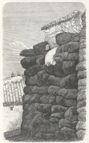
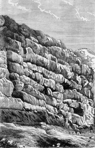
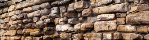
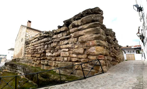
It was Manuel de Góngora, during his journey through the province of Jaén around 1860, who discovered this magnificent wall, stating for the first time that it was of Iberian construction. This Professor of Universal History and Inspector of Antiquities made a spectacular discovery: he was the first to identify the Iberian peoples of the Upper Guadalquivir. More recent studies have identified this type of cyclopean structure with towers and fortified enclosures dating from between the 2nd and 1st centuries BC. In these later stages of Iberian culture, the Romans had already reached the lands of the Guadalquivir, imposing new models of land occupation in which these great defensive structures appear to correspond to strategic sites that delimit and control territories, roads, water sources and even farmland. The cyclopean wall of Ibros, today integrated into the townscape, has survived to the present day as an important architectural element of Iberian culture. Its huge stones, originally joined without mortar, teach us much about those people: their fears, technological advances, struggles and wars, conquests, social transformations… It is located in the northern part of the historic centre, in the district known as "el señorío". Its location makes strategic sense, as it defended the most vulnerable area, closest to the riverbed. It is one of the most celebrated prehistoric monuments in the province of Jaén. A large structure, originally formed by a quadrangular enclosure surrounding the perimeter of the settlement, of which today only a corner measuring 12 to 13 metres long survives. Its enormous ashlar blocks are fitted together without mortar and measure 3.60 metres in length by 1.70 metres in width. We hear nothing more of the town until Christian times, when it was taken in 1157. It later fell once again into Arab hands, until it was definitively conquered by Ferdinand III the Saint. During the reign of Philip IV, the town's defence consisted of a small castle and a wall in which the Ibero-Roman cyclopean wall was reused. The old castle of Ibros must have gradually fallen into disuse, like the rest of the region's fortresses, since after the fall of Granada in 1492 there was no immediate external threat, and advances in artillery made such fortifications unnecessary.
Breve descripción
The Cyclopes were mythological beings with only one eye, members of a race of giants — strong, hot-tempered and prone to sudden emotions. Mythology tells us they were great builders and craftsmen, and this is why, during the Middle Ages, walls made of large worked blocks — like this one in Ibros — began to be discovered and came to be called "cyclopean structures", leading to the conclusion that only the Cyclopes possessed the skill and strength needed to build them.
Telecomunicaciones
Teléfono
Visita exterior, no precisa reservar para su visita.

*Consejos para la visita

Se aconseja comenzar la visita desde la Plaza del Ayuntamiento, dirigiéndonos hacia la calle Gradas llegaremos a la calle del Pilar donde se localiza la muralla.
Sitio web
www.ayunibros.es
Ubicación
Código Postal
23450
Latitud
38.02357
Longitud
-3.50342
Dirección
C/ Pilar, 1
Municipio
Ubicación en el mapa
POINT (-3.50342 38.02357)
Tipos de punto de interés
Imágenes carrusel
imagen
Image
murralla.png
Imagen principal
Desactivado
imagen
Image
muralla_ciclopeda_5.jpg
Imagen principal
Desactivado
imagen
Image
muralla_ciclopeda_4.jpg
Imagen principal
Desactivado
Imágenes cabecera
imagen
Image
Ibros_cab%20%281%29.jpg
Imagen principal
Activado
Horario
Abierto 24 horas
Microsite al que pertenece
Loading map
Preparing points of interest and routes...

Restaurante Tropezón

Submitted by brandcode_deweloper on
Id
6771659
Redes sociales
Facebook
https://www.facebook.com/Restaurante-Tropezon-171697546354700/?ref=page_internal
Descripción
Descripción larga
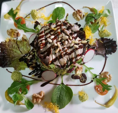
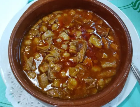
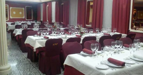
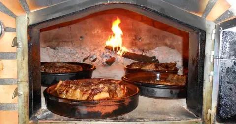
Restaurante Tropezón is a traditional-cuisine restaurant that, alongside its outstanding quality, offers very good value for money. Excellent raw ingredients guarantee the quality of Restaurante Tropezón, where you'll find good meat, fish and seafood. It also offers a home-delivery menu, featuring starters, fish, meat and roasts to enjoy. Its spacious premises also make it the perfect place for celebrations and events.
Información de contacto
Sitio web
https://www.jaenparaisointerior.es/es/restaurante-tropezon-villacarrillo
Teléfono de contacto
953377032
Ubicación
Código Postal
37.93926
Latitud
-3.73042
Longitud
23630
Dirección
Plaza de la Constitucion, 8
Municipio
Ubicación en el mapa
POINT (-3.730355 37.939302)
Tipo de restaurante
Imágenes
imagen
Image
15288546_550446815146436_8582017086427663448_o.jpg
Imagen principal
Activado
imagen
Image
120751785_1476720375852404_1835087933561251692_o%20%281%29.jpg
Imagen principal
Desactivado
imagen
Image
121200881_1481906548667120_6480809203470358403_n.jpg
Imagen principal
Desactivado
Tipo de cocina
Microsite al que pertenece
Loading map
Preparing points of interest and routes...

Restaurante-Asador El Recreo

Submitted by brandcode_deweloper on
Id
2182115
Descripción
Descripción larga
This blend of traditional, artisan Andalusian cuisine with touches of creative, avant-garde cooking creates the perfect mix to delight and surprise even the most demanding, gourmet palates. Thanks to the outstanding quality of the ingredients, their skill at the stove, and the warm, family-style treatment of guests, they ensure that when you sit down at their table, you'll remember the excellence of good cooking and the quality of their dishes with gratitude. Restaurante Asador "El Recreo" was founded by Miguel Ramírez Navarro in 1934. His sons, Pedro and Manolo Ramírez, carried on the hospitality business, and today it is the grandchildren and great-grandchildren who continue this saga of restaurateurs. Today, this third and fourth generation have given the establishment the dynamic, innovative touch that characterises it today.
Información de contacto
Sitio web
www.restauranteasadorelrecreo.es
Teléfono de contacto
953377072
Correo electrónico
contacto@restauranteasadorelrecreo.es
Ubicación
Código Postal
23630
Latitud
37.94008
Longitud
-3.72933
Dirección
Plaza de la Constitución, 53
Municipio
Ubicación en el mapa
POINT (-3.72933 37.94008)
Tipo de restaurante
Imágenes
imagen
Image
6.jpg
Imagen principal
Activado
imagen
Image
7.jpg
Imagen principal
Desactivado
imagen
Image
7%20%281%29.jpg
Imagen principal
Desactivado
imagen
Image
6%20%281%29.jpg
Imagen principal
Desactivado
Capacidad
80
Número de tenedores
1
Tipo de cocina
Horario
• Monday: 11: 00-1: 30 • Tuesday: 11: 00-1: 30 • Wednesday: 11: 00-1: 30 • Thursday: 11: 00-1: 30 • Friday: 11: 00-1: 30 • Saturday: 11: 00-2: 30 • Sunday: 11: 00-2: 30
Microsite al que pertenece
Loading map
Preparing points of interest and routes...

Araúz de Robles

Submitted by brandcode_deweloper on
EMP-0004
Descripción larga
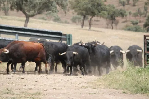
The Araúz de Robles is located in the heart of Sierra Morena, within the Sierra de Andújar Natural Park. A privileged environment for the breeding of the bravo bull between oak and cork. The visit allows you to know the livestock and its facilities, enjoy a tentadero, share the day to day of the bravo bull with experiences such as crossing the bulls through the Rumblar River in canoe. All with traditional and flamenco cuisine linked to the tauromaquia.
Teléfono
695 497 007
Sitio web
https://arauzderobles.com/
Correo electrónico
jesusperez@artetur.es
Latitud
38.183755
Longitud
-2.86924
Dirección
Dehesa El Burguillo
Distrito
Municipio
Ubicación en el mapa
POINT (-2.86924 38.183755)
Curiosidades
Event facilities: parties, capeas, weddings, baptizes, communions, company events, living room bullfighting classes, goodbyes, etc. Good accessibility from the N-IV Highway.
Desactivado
Loading map
Preparing points of interest and routes...

El Añadío

Submitted by brandcode_deweloper on
6870559
Facebook
https://www.facebook.com/Amigos-de-El-A%C3%B1adio-161845803872243/
Twitter
https://twitter.com/elanadio_sc?lang=es
Instagram
https://www.instagram.com/elanadio/?hl=es
Descripción larga

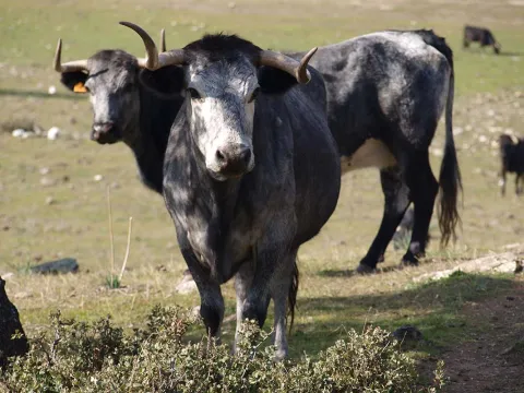
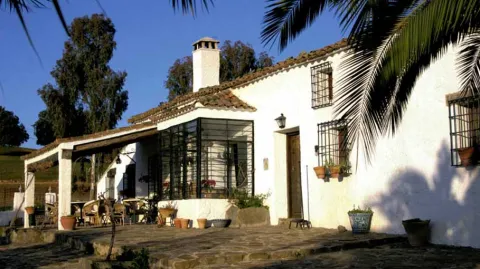
A dehesa of more than 350 Ha. where, since the mid-19th century, successive generations of the same family, have dedicated themselves to their great passion, the breeding of the bravo bull.

Teléfono
953 066 031
Sitio web
https://elanadio.es/
Correo electrónico
gerencia@elanadio.es
Latitud
38.250240
Longitud
-2.86921
Dirección
Dehesa El Añadío. Carretera A-301 La Carolina-Úbeda, Km. 11,9
Distrito
Municipio
Ubicación en el mapa
POINT (-2.86921 38.25024)
Curiosidades

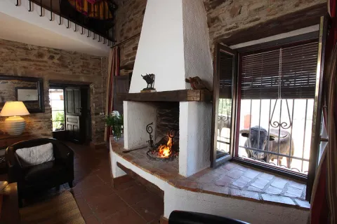
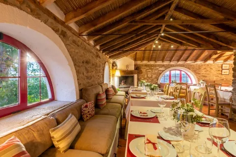
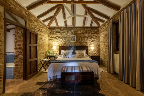
It is a breeding of ligia that invites the tourist to contemplate and engage in their work: to feed and review the cattle, to cling calves, to lock up cattle, to separate, to participate in horseshoes, to witness tentaderos, even to learn to torar, both in the living room and in practical way. It has top-class rural accommodation, swimming pool and restaurant for accommodation and early external reservations.

imagen
Image
Vista%20aerea.jpg
Imagen principal
Activado
imagen
Image
el-anadio-2.jpg
Imagen principal
Desactivado
imagen
Image
El%20A%2B%C2%A6ad%2B%C2%A1o%20Vistas%20.jpg
Imagen principal
Desactivado
imagen
Image
vilches-jaen-casa-habitaciones-galeria-14.jpg
Imagen principal
Desactivado
imagen
Image
El%20A%2B%C2%A6ad%2B%C2%A1o%20Comedor.jpg
Imagen principal
Desactivado
imagen
Image
El%20A%2B%C2%A6ad%2B%C2%A1o%20Dormitorio.jpg
Imagen principal
Desactivado
imagen
Image
El%20A%2B%C2%A6ad%2B%C2%A1o%20Salon%20de%20los%20toros.jpg
Imagen principal
Desactivado
Desactivado
Loading map
Preparing points of interest and routes...
Finca Puertolaca

Submitted by brandcode_deweloper on
991394
Facebook
https://www.facebook.com/condedevillafuente
Instagram
https://www.instagram.com/explore/tags/puertolaca/
Descripción larga

Puertolaca is a dehesa of oak and alcornoques where the cattle don Sancho Dávila, Conde de Villafuente Bermeja, is pasta dedicated to the breeding and selection of bravas and one of the most signposts of Andalusia.

Teléfono
600 424 560 / 670 010 166
Sitio web
http://www.torospuertolaca.com/
Correo electrónico
rocio@torospuertolaca.com
Latitud
38.299910
Longitud
-2.86841
Dirección
Carretera A-312 Linares a Orcera. Santisteban del Puerto
Distrito
Ubicación en el mapa
POINT (-2.86841 38.29991)
Curiosidades

It offers "A day of field and bulls," dedicated to contemplating the fences of cows and their newborn calves and the fences of bulls and bullfighting, and to participating in the field works. There is a walk through the dehesa under the explanations of the mayoral and the farmer and in the tentadero a bullfighter makes the demonstration of a factory. Living room capacity for 180 people.

imagen
Image
finca.jpg
Imagen principal
Activado
imagen
Image
puertolaca-1.jpg
Imagen principal
Desactivado
imagen
Image
Foto%204.jpg
Imagen principal
Desactivado
imagen
Image
Foto%202.jpg
Imagen principal
Desactivado
imagen
Image
Toros%20en%20Puerta%20Laca.jpg
Imagen principal
Desactivado
Desactivado
Loading map
Preparing points of interest and routes...