Saltar al contenido principal
icon-intereses-cultura-del-toro

Ganadería El Cotillo

Submitted by brandcode_deweloper on
9171276
Facebook
https://www.facebook.com/FincaelCotillo/
Instagram
https://www.instagram.com/complejo_el_cotillo/
Descripción larga

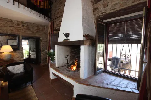
Recently created tourist complex that offers, in the middle of the dehesa and located next to the La Garza golf course, rural accommodation with all the details and amenities surrounded by a unique landscape linked to the Industrial Mineral Heritage.

Teléfono
620 171 644
Sitio web
https://www.ganaderiaelcotillo.es/
Correo electrónico
info@ganaderiaelcotillo.es
Latitud
38.229796
Longitud
-2.86835
Dirección
Camino Valdeinfierno, s/n
Distrito
Municipio
Ubicación en el mapa
POINT (-2.86835 38.229796)
Curiosidades

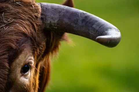
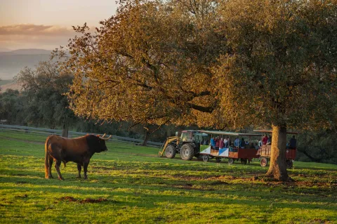
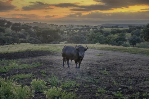
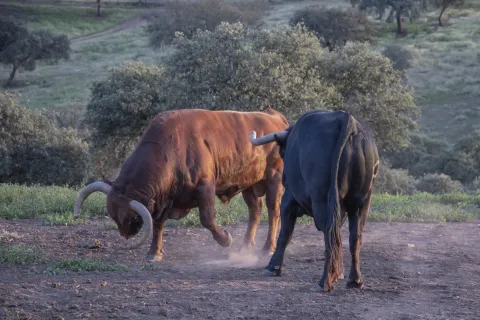
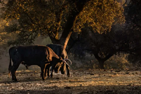
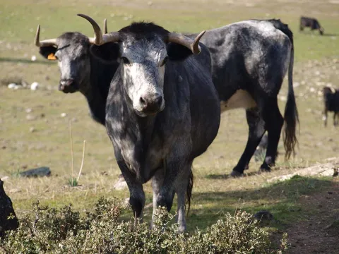
In our dehesa pasture the braves of the Hnos Collado Ruiz and El Cotillo irons.
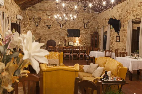
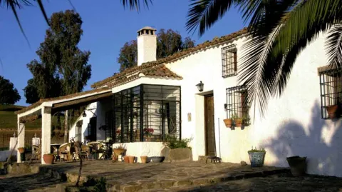
The facilities of El Cotillo are the result of the rehabilitation of the 18th century buildings that made up the house of management, offices and plan room of the chief engineers who exploited the mines of lead, silver and perlite of Linares, La Carolina and El Centenillo.
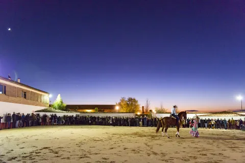
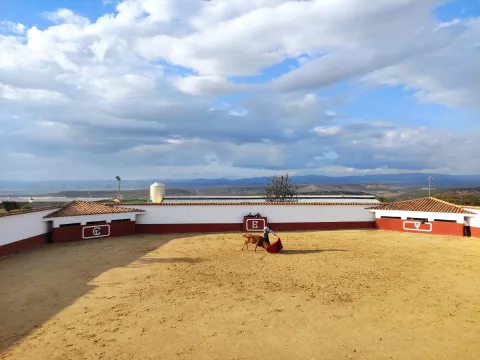
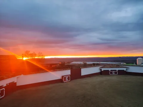
La Finca has a rural accommodation, scheduled visits to the livestock (for individuals and groups) and horse routes. It carries out activities linked to the culture of the bull of ligia, such as the tentaderos, capeas, horseshoes, living room toreo, etc. It is also conditioned and has spaces for the celebration of all kinds of events.
Its environment ensures total disconnection during the stay and allows nature lovers to enjoy it to the maximum both within and around the estate. In Finca El Cotillo we offer a wide variety of activities:

Guided tours to livestock:

They consist of a 4 × 4 tour or vehicles adapted for groups from which you can visit the different fences, vaults and training areas of the bulls, as well as the facilities for their management such as corrals, manga for veterinary use, embarkation and tients for the selection of caste and bravura.

You will also have the possibility, if you wish, of getting directly involved in the field tasks that are performed daily by the mayoral.

In addition, you will enjoy a tour of the rooms of the estate, the result of a great work of restoration and of great historical content, since these were the dependencies of what was the main mining core of the province and from where the extraction of minerals such as silver, lead or perlite was managed since the mid-18th century.

The guided tours have a duration of approximately two and a half hours, and can be carried out individually or by groups, with special rates for people staying on the estate.

Guided tours for groups:

They are focused for groups of 21 minimum people and include, in addition to the guided tour, breakfast and / or a meal on the farm, based on our best traditional cuisine made from home-made and with products of the farm.

Horseback routes:

Always accompanied by an experienced rider, you can enjoy the natural environment and landscape beauty that the dehesa offers, as well as the animals and plants that live in it.

Duration: 2 hour approx.

-Tentage:

This is one of the most important tasks of livestock, as it is the test of selection of caste and bravura to decide cows and breeding stallions. It is always carried out with professional bullfighters.

Horsemen:

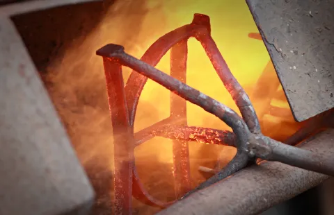
This activity consists of identifying each of the animals, marking by fire: the sign of livestock, iron, garrison and number.

Capeas:

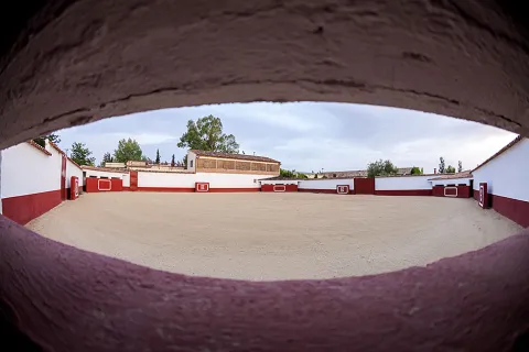
The capeia is an outdoor activity in which fans venture to have fun, body to body, with a wafer. In our tientos square you can enjoy the art of bullfighting, for groups and practical fans, always under the supervision of a taurino professional, who will give them the necessary indications at every moment.

Lounge Toreo:

Ideal for any person who loves the art of the bullfighting. It does not require any equipment or previous experience and is provided by a professional in our tientas square, using a "carreton" to simulate the braid of the bravo bull along with capote and crutch.
imagen
Image
1651574874176.jpg
Imagen principal
Activado
imagen
Image
_DSC4203.jpg
Imagen principal
Desactivado
imagen
Image
_ANT2868.jpg
Imagen principal
Desactivado
imagen
Image
Finca%20El%20Cotillo%20restaurante.jpg
Imagen principal
Desactivado
imagen
Image
galeria_comun_10.jpg
Imagen principal
Desactivado
imagen
Image
_ANT1110.jpg
Imagen principal
Desactivado
imagen
Image
portada.jpg
Imagen principal
Desactivado
imagen
Image
DSE_2407.jpg
Imagen principal
Desactivado
imagen
Image
DSE_2570.jpg
Imagen principal
Desactivado
imagen
Image
_ANT1133.jpg
Imagen principal
Desactivado
imagen
Image
IMG_5123.JPG
Imagen principal
Desactivado
imagen
Image
IMG_20220227_173305.jpg
Imagen principal
Desactivado
Desactivado
Loading map
Preparing points of interest and routes...

Toros de Orellana Perdiz

Submitted by brandcode_deweloper on
EMP-0005
Facebook
https://www.facebook.com/Toros-de-Orellana-Perdiz-111333277691790
Instagram
https://www.instagram.com/torosdeorellanaperdiz/
Descripción larga
Located on foot of the motorway of Andalusia (A-4 km 265), the tourist and leisure complex Orellana Perdiz is an ideal window to know the world of the Bravo bull from within. He invites to head along with the cattle of the "Toros de Orellana Perdiz," in the farms El Melocotón (Santa Elena), El Castillo (La Carolina) and San Agustín (Carboneros).
Teléfono
953 660 600 / 680 197 086
Sitio web
https://www.orellanaperdiz.es/ganaderia/18-2/
Correo electrónico
info@orellanaperdiz.es
Latitud
38.274248
Longitud
-2.86637
Dirección
Autovía de Andalucía A-4 Sur, Km. 265
Distrito
Municipio
Ubicación en el mapa
POINT (-2.86637 38.274248)
Curiosidades
It organizes tients and capeas for groups. It has two restaurants and hotel accommodation of three and two stars. "History and bulls in Sierra Morena" package (2 days with accommodation): guided tours to various farms and tourist points. Tour Orellana: guided tour to the Castillo de las Navas de Tolosa, to ruins of old mines of lead and silver, and possibility to champion next to the reses.
Desactivado
Loading map
Preparing points of interest and routes...

La Iruela

Submitted by brandcode_deweloper on
Id
918750
Descripción
Descripción larga

Next to the castle you will find the ruins of the Church of Sto. Silos Sunday. The legend tells that it was built on the place where the Arabs held captive Christians in prison and there was Santo Domingo doing his job. In the building there are traces of the disciples of Vandelvira. It's a must-see for any lover of history.

The Iruela was part of Cazorla until 1370, when Archbishop D. Gome Manrique gave it independence, power and shield. His political and territorial position has allowed him to preserve an important heritage: the Conistory House - a proud building in the Mudejar style of Toledan - and the Church of the Immaculate Conception are part of this legacy.

The population has a core worth visiting. The streets are steep and narrow, with crouched houses and flowers on the balconies. In the center there is a beautiful fountain from which several roads arise to surround the village. From here you can go up to Temple Street on a beautiful stone road accompanied by fig trees and cypresses.

We suggest:

  • About five minutes from La Iruela you will find Burunchel. Come to know the Hermitage of San Julián and the temple of the Holy Spirit among other attractions of this pedany.
  • On August 27, during the summer parties of the village you will see a curious pyrotechnic show, in which the castle is also the protagonist.
Breve descripción

The road that goes up to the saw from Cazorla borders this small, but amazing population. Its best known profile is due to the castle, a legendary fortress that became owned by the Templars and dominates the Guadalquivir Valley. The need to defend itself has given rise to this fortification which, because of its most abrupt aspect, is inexortable. But the Iruela is more attractive.

Ubicación
Latitud
37.920351
Longitud
-2.994140
Municipio
Ubicación en el mapa
POINT (-2.99414 37.920351)
Tipos de punto de interés
Imágenes carrusel
imagen
Image
iruela.jpeg
Imagen principal
Desactivado
Imágenes cabecera
imagen
Image
La-Iruela-Jaen-nuevo-municipio-turistico-de-Andalucia-foto-de-Junta.jpg
Imagen principal
Activado
Loading map
Preparing points of interest and routes...
Marcas de calidad

El Añadío

Submitted by brandcode_deweloper on
EMP-0003
Facebook
https://www.facebook.com/Amigos-de-El-A%C3%B1adio-161845803872243/
Twitter
https://twitter.com/elanadio_sc?lang=es
Instagram
https://www.instagram.com/elanadio/?hl=es
Descripción larga
Dehesa over 350 ha. where, since the mid-19th century, successive generations of the same family have dedicated themselves to their great passion: the raising of the bravo bull. He invites the tourist to contemplate and get involved in his work: to feed and review the cattle, to clamp up calves, to lock up cattle, to separate, to participate in horseshoes, to witness tentaderos and even to learn to roast in a living room or in a practical way.
Teléfono
953 066 031
Sitio web
https://elanadio.es/
Correo electrónico
gerencia@elanadio.es
Latitud
38.210765
Longitud
-2.86922
Dirección
Dehesa El Añadío. Carretera A-301 La Carolina-Úbeda, Km. 11,9
Distrito
Municipio
Ubicación en el mapa
POINT (-2.86922 38.210765)
Curiosidades
It has top-class rural accommodation, swimming pool and restaurant for accommodation and external reservations in advance.
imagen
Image
Vista%20aerea.jpg
Imagen principal
Activado
imagen
Image
P1050553.JPG
Imagen principal
Desactivado
Desactivado
Loading map
Preparing points of interest and routes...

Finca Puertolaca

Submitted by brandcode_deweloper on
EMP-0002
Facebook
https://www.facebook.com/condedevillafuente
Instagram
https://www.instagram.com/explore/tags/puertolaca/
Descripción larga
Puertolaca is a dehesa of oak and alcornoques where the cattle don Sancho Dávila, Conde de Villafuente Bermeja, is pasta dedicated to the breeding and selection of bravas and one of the most signposts of Andalusia.
Teléfono
600 424 560 / 670 010 166
Sitio web
http://www.torospuertolaca.com/
Correo electrónico
rocio@torospuertolaca.com
Latitud
38.248435
Longitud
-2.86842
Dirección
Carretera A-312 Linares a Orcera. Santisteban del Puerto
Distrito
Ubicación en el mapa
POINT (-2.86842 38.248435)
Curiosidades
It offers "A day of field and bulls": visit to the fences of cows with newborn calves and to the fences of bulls and bullfighting bulls, participation in field works, walk through the dehesa explained by the mayoral and the farmer, and show a factory by a bullfighter in the tentadero. Living room capacity: 180 people.
imagen
Image
finca.jpg
Imagen principal
Activado
imagen
Image
el-anadio-2.jpg
Imagen principal
Desactivado
imagen
Image
vilches-jaen-casa-habitaciones-galeria-14.jpg
Imagen principal
Desactivado
Desactivado
Loading map
Preparing points of interest and routes...

Río Guazalamanco

Submitted by brandcode_deweloper on
Id
913911
Descripción larga

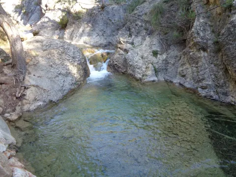
Once the asphalt ramp is over, the most painful stretch of the road, we reach an excellent lookout that allows us to enjoy a good view of the reservoir and the Valentine Barrio. A little later the track runs parallel to the river. When it wanders the way, without crossing, we follow the shore to the corners full of charm that we will meet. Later we will be forced to leave the shore to access a lane. We continue upstream, until we reach the Dike Cascade, very easy to distinguish because in its crown it has stone walls. A little lower, hidden in the bush, a beautiful leap of water is hidden that we must not miss.

Overcoming the Cascade of the Dique, part of a path that, at first, crosses the channel twice and takes us to the head of the river. Leaving the bottom of the ravine for a long time, and then returning to it, when the road ends on a forest track, we reach the bottom of the Cerrada de Navas, where the Guazalanco offers one of its most beautiful pictures.

However, to get to this point from above and to make the way down the stream, you can make an interesting route from the Nature Hall and Botanical Garden of El Hornico: Route of Guazalamanco on the Prays of Arredondo. This circular itinerary is signposted and has 13.2 (circular) length. If two vehicles are available and leaving one on the Cuesta del Cement, we reduce the route to 8.8 km and, in addition, we avoid the most flat and monotonous part of the route, the Dehesa del Rincón.

The most direct access to the Guazalamanco River is by the Dehesa del Rincón. From Pozo Alcón you have to take the A-326, up the Avenida de la Bolera, direction to Castril. By passing the campsite de la Bolera and the Km. 7, we take a detour that comes to our left and that borders the Forest House of la Bolera (it indicates to the Hornico). On an unasphalted road, always following the main road, 6,7 km from its start a fork to the left, in a slope, is left, which is asphalted (Cuesta del Cement). Although with an apron we can reach the Pasada de Guazalamanco, by a forest track parallel to the channel, the most recommended option is to leave the vehicle at the foot of the hill and take a small walk to the Cascade del Dique (round and round 2.5 km), and enjoy the many corners that this beautiful and wild mountain stream offers us.

Breve descripción

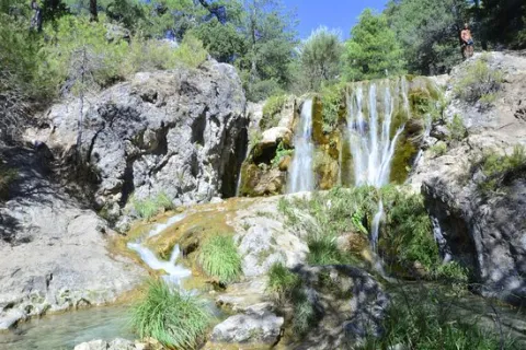
Guazalamanco is a mountain channel of permanent and turbulent waters, loaded with oxygen and gelid glass. Each of its corners invites us to recreate our senses, to remain still, in silence, as if we wanted to merge with nature and return to our origins. If you forget the camera in the car, when you discover the stream you will return to your steps to restart the road, now with the machine ready.

Latitud
38.1704
Longitud
-2.7002
Municipio
Ubicación en el mapa
POINT (-2.7002 38.1704)
imagen
Image
cascada-del-guazalamanco.jpg
Imagen principal
Activado
imagen
Image
guazalmanco.jpg
Imagen principal
Desactivado

Nature

icon-intereses-naturaleza

Friends

icon-intereses-amigos

Adventure

icon-intereses-aventura

Culture

icon-intereses-cultura

Culture of the Bull

icon-intereses-cultura-del-toro

Sport

icon-intereses-deporte

Eco-friendly

icon-intereses-eco-friendly

For couples

icon-intereses-en-pareja

Family

icon-intereses-familia

Gastronomy

icon-intereses-gastronomia

Municipality

icon-intereses-municipio

Low-cost tourism

icon-intereses-turismo-low-cost

Solo travel

icon-intereses-viajar-solo
Baja
Río Guazalamanco
Activado

Pine Tree Galapán

Submitted by brandcode_deweloper on
Id
913492
Descripción larga

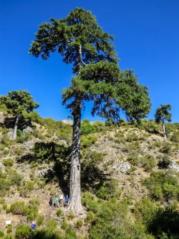
Because until you're with him you're not aware of his proportions. Embrace and surround it is impossible if 4 or 5 people do not join, as its perimeter reaches 5.40 meters. For its dimensions it is part of the Project "Trees: Legends vivables," a beautiful work of cataloging unique trees of the Iberian Peninsula.

This wonderful pine tree has survived the intense forest activity that developed on these lands for several centuries. Many of his companions, who are no longer present, were part of the ships that were built for the Spanish Navy between the 16th and 18th centuries. It was the time when the Serra de Segura saw was the Maritime Province. But the Galapan is still with us to show you its splendor.

We suggest...

  • Enjoy a good time sitting next to the Pino Galapán, under his cup, watching the water spread through the stream of the Juan Fría and appreciating this natural monument, which for centuries has been the inspiration of legends, stories, writings and traditions.
  • Since you have come to that you can continue on the forest track until you look at the fields of Hernán Perea, another of the natural treasures of the Park. You won't regret it.

From Santiago de la Espada you have to follow the road A-317 towards La Matea, and through this town continue to the village of Don Domingo. Once there you have to take a forest track in perfect condition, marked for hiking as GR 144. This track is directed towards Rambla Seca and the fields of Hernán Perea. As you pass a bridge you will find a first crossing where, on the right, the route to the Pino Galapán is indicated. 2.6 km from this crossing you will find it in the right margin of the road.

Breve descripción

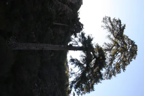
You have before you a magnificent example of larix pine, which here is called the Salgareño pine (Pinus nigra salzmanii), a living treasure of this territory that with its more than 400 years of age and 39 m of height is listed as one of the giants of the Spanish forests. It is the most emblematic tree in the Segura saw, and although it does not seem much to you from the forest track, you have to go down the path and get to its base to understand what is special.

Latitud
38.111768
Longitud
-2.551516
Ubicación en el mapa
POINT (-2.551516 38.111768)
imagen
Image
Pinogalapan450-x-600.jpg
Imagen principal
Activado
imagen
Image
Pino%20Galap%C3%A1n.jpg
Imagen principal
Desactivado

Friends

icon-intereses-amigos

Adventure

icon-intereses-aventura

Culture

icon-intereses-cultura

Culture of the Bull

icon-intereses-cultura-del-toro

Sport

icon-intereses-deporte

Eco-friendly

icon-intereses-eco-friendly

For couples

icon-intereses-en-pareja

Family

icon-intereses-familia

Gastronomy

icon-intereses-gastronomia

Municipality

icon-intereses-municipio

Nature

icon-intereses-naturaleza

Low-cost tourism

icon-intereses-turismo-low-cost

Solo travel

icon-intereses-viajar-solo
Pino Galapán
Desactivado
Coordenadas / Huso 30S
30S x = 539316 and = 4218311
Tramo de asfalto o cemento
 
Tramo de pista o camino forestal
 
Tramo de vía pecuaria
 
Tramo de senda
 

Routes de Olivo

Submitted by brandcode_deweloper on
Id
7435987
Descripción larga

Discover Jaén and olive oil doing oleoturism

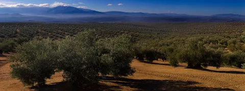
The province of Jaén, with its more than 60 million olive trees, is the largest producer of olive oil worldwide, the culture and traditions surrounding its cultivation, its fully humanized "olive sea" landscape throughout the centuries, the production of olive oil in its almazaras, the traditional and mechanized collection of olive oil, the visit to the Museum of the Olive Culture of the Hacienda la Laguna, emblematic cortijos and the enjoyment of its rich gastronomy irrigated with the "liquid gold," are some of the activities that Ritas del Olivo Interior offers for our Paradise.
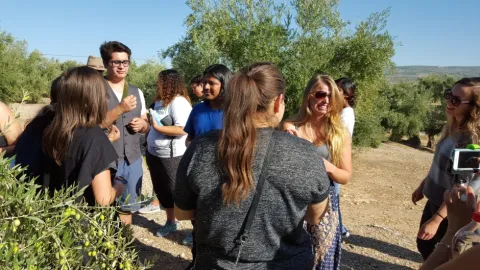
Our company, specialized in activities around the Olive and Olive Oil, has been offering for a decade Oleoturism experiences, for all ages and for groups and individuals, making one of our main signs of identity known.

We perform any kind of experience to the letter, either for individuals in small groups with our own vip van and a very personalized professional guide service or for incentive groups, congresses, major or school with bus transfer and with unique and unrepeatable activities that you will never forget.

Let the people who love their fields and "feel the land of the olive land" be taken for us, discover our millennial culture.

Breve descripción

A new option to know the world of Extra Virgin Olive Oil with custom routes.

Latitud
37.991831
Longitud
-3.472649
Municipio
Ubicación en el mapa
POINT (-3.472649 37.991831)
imagen
Image
1sliderppal.jpg
Imagen principal
Activado
imagen
Image
79e08f32fa8a036f84441baab7b7a7ff_3_XL.jpg
Imagen principal
Desactivado
imagen
Image
79e08f32fa8a036f84441baab7b7a7ff_2_XL.jpg
Imagen principal
Desactivado

Nature

icon-intereses-naturaleza

Friends

icon-intereses-amigos

Adventure

icon-intereses-aventura

Culture

icon-intereses-cultura

Culture of the Bull

icon-intereses-cultura-del-toro

Sport

icon-intereses-deporte

Eco-friendly

icon-intereses-eco-friendly

For couples

icon-intereses-en-pareja

Family

icon-intereses-familia

Gastronomy

icon-intereses-gastronomia

Municipality

icon-intereses-municipio

Business

icon-intereses-negocios

Seniors

icon-intereses-senior

Low-cost tourism

icon-intereses-turismo-low-cost

Solo travel

icon-intereses-viajar-solo
Rutas de Olivo
All year round
Desactivado
Coordenadas / Huso 30S
30S x = 458498 and = 4205014

La Espinareda

Submitted by brandcode_deweloper on
Id
660041
Descripción larga

The ruins of the castle are impressive because of its elevated situation and the remains of houses and rooms made in tapial that are around it. From above you can observe much of the valley and see, right in front, the castle of Segura and a little below the Arab towers of Santa Catalina and Orcera. We suggest that you walk through the forest track that links this village with that of El Tobazo, by forest track with very little level marked for hiking like GR-146.

Breve descripción

It is one of the most charming villages for its location, very close to the remains of the small castle of Espinareda, of which it is named. narrow streets, white walls and small roofs extended on the hillside. A shaded ravine makes it a lookout over the rest of the valley.

Latitud
38.301671
Longitud
-2.735648
Distrito
Ubicación en el mapa
POINT (-2.735648 38.301671)
imagen
Image
aldeaespiraneda.png
Imagen principal
Activado
imagen
Image
Segura_de_la_Sierra_PM_091670_E.jpg
Imagen principal
Desactivado

Nature

icon-intereses-naturaleza

Friends

icon-intereses-amigos

Adventure

icon-intereses-aventura

Culture

icon-intereses-cultura

Culture of the Bull

icon-intereses-cultura-del-toro

Sport

icon-intereses-deporte

Eco-friendly

icon-intereses-eco-friendly

For couples

icon-intereses-en-pareja

Family

icon-intereses-familia

Gastronomy

icon-intereses-gastronomia

Municipality

icon-intereses-municipio

Low-cost tourism

icon-intereses-turismo-low-cost

Solo travel

icon-intereses-viajar-solo
La Espinareda
Activado
Coordenadas / Huso 30S
30S x = 523114 and = 4239320
Tramo de asfalto o cemento
 
Tramo de pista o camino forestal
 
Tramo de vía pecuaria
 
Tramo de senda
 

Huelga Utrera

Submitted by brandcode_deweloper on
Id
659543
Descripción larga

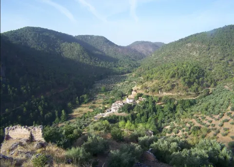
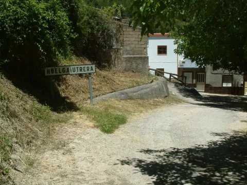
Ancient gardens turned into meadows when they are left without use, fruit, ferns, pine, oak, are present throughout the village. The houses are located around a square where we find silence only broken by the sound of the water of the fountain. Unpossible alleyways and windows of another time live together with rehabilitated houses and old laundry houses no longer used.

In the Utrera Strike there is a small path that goes towards the Water Cave that is worth the spectacular cave and the landscape surrounding the village.

Breve descripción

Utrera strike is surprised by its vegetation and the feeling of meeting us in forests of other latitudes. The water of the Segura River passes just below the village, leaving an impressive riverside with lush vegetation.

Latitud
38.167394
Longitud
-2.609647
Ubicación en el mapa
POINT (-2.609647 38.167394)
imagen
Image
huelgaUtrera%20%281%29.jpeg
Imagen principal
Activado
imagen
Image
huelga.jpg
Imagen principal
Desactivado

Nature

icon-intereses-naturaleza

Friends

icon-intereses-amigos

Adventure

icon-intereses-aventura

Culture

icon-intereses-cultura

Culture of the Bull

icon-intereses-cultura-del-toro

Sport

icon-intereses-deporte

Eco-friendly

icon-intereses-eco-friendly

For couples

icon-intereses-en-pareja

Family

icon-intereses-familia

Gastronomy

icon-intereses-gastronomia

Municipality

icon-intereses-municipio

Low-cost tourism

icon-intereses-turismo-low-cost

Solo travel

icon-intereses-viajar-solo
Huelga Utrera
Desactivado
Coordenadas / Huso 30S
30S x = 534194 and = 4224460