Saltar al contenido principal

Bike Route Source of Guadalquivir

Submitted by brandcode_deweloper on
Id
2851444
Descripción larga

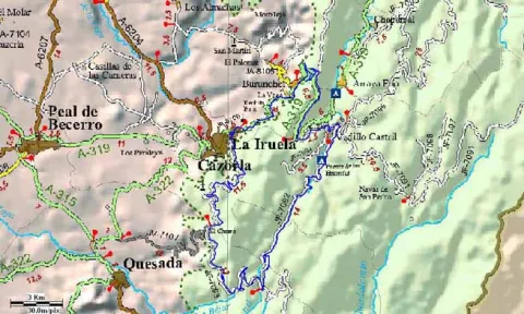
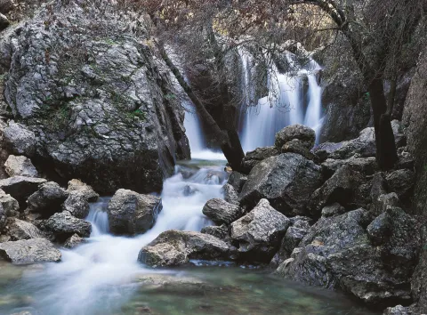
4 km. from the exit, right next to the waterfall of the Escaleruela, we enter a wide land track that we will travel for 31 km, having various points of interest such as the views of the Castle of the Five Esquinas, or the monastery of Montesión, Sierra Magina and Quesada.

In the 12 km and after passing through the Forest House of the Chorro, we reach the paredones of the Chorro where we can see with a little luck the majestic flight of the leonado vulture in a magnificent existing vultures.

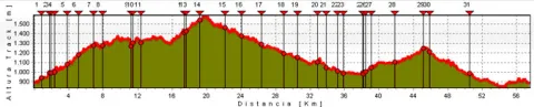
After and on the continuous rise and following the track we travel, the signs to the birth of the Guadalquivir, we will pass through Collado Zamora, a true natural balcony and Puerto Lorente the maximum height of our route where we can admire one of the longest complaints of the entire Park. From there, we will begin a long descent that will take us to the Cañada de las Fuentes and the Birth of Guadalquivir.

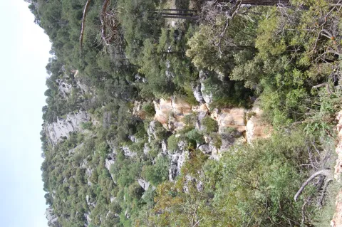
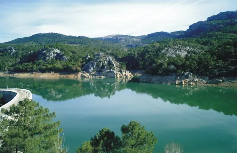
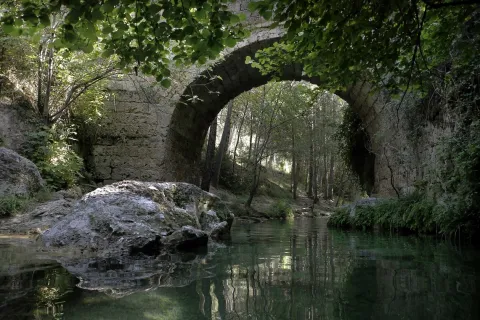
From the birth, and continuing downstream, we will go through very unique places from the landscape, botanical and geological point of view, special mention requires the "Pino Pepe," an exceptional example of larice pine on track, which suffered several years ago the attack of a visitor lacking in ethics who baptized it at the point of knife, as well as the botanical and geological formations around the Yellow Arroyo, the majesty of the Cortijo del Calerón or the Bridge of Herrerias (k35 from the route), according to the legend built in one night. Right there we'll leave the stretch of land to enter the asphalt road, the JF-7092. In just 3 km. of circular parallel to the river along its right bank and leaving behind the campsite Puente de las Herreerías and the village of Vadillo-Castril, we arrive to a new bridge over the Guadalquivir. There we find the small dam of the Cerrada de Utrero, there is a signposted path of circular layout that well deserves a brief letter on our route.

Then and continuing on the road JF-7091 we are heading towards the Empalme del Valle, crossing with the road A-319 that we will continue direction to Cazorla ascending through the Port of the Palomas, with its two viewpoints, and once crowned the same, sinuous descent to Burunchel and later bordering the Natural Park and at a less steep descent we will reach our starting point in La Iruela.

Breve descripción

This circular tour is one of the most characteristic that takes place in the Natural Park Sierras de Cazorla, Segura and Las Villas, which can be done both by bicycle and by private 4x4 vehicle or with the services of guided tour in 4x4. Our route begins in the town of Iruela, a historical set, but by being circular it can be undertaken from any point of its journey, returning to the end of the place of departure. In a first stretch the asphalt track has extraordinary views of the village of Cazorla, with several panoramic viewpoints from where to admire its historic town.
Latitud
37.951336
Longitud
-2.946139
Municipio
Ubicación en el mapa
POINT (-2.946139 37.951336)
imagen
Image
Fuentes%20del%20R%C3%Ado%20Guadalquivir%20%28Jose%20Antonio%20Sanguinetti%29.jpg
Imagen principal
Activado
imagen
Image
Puente%20de%20las%20Herreras.jpg
Imagen principal
Desactivado
imagen
Image
Nacimiento%20del%20Guadalquivir%20%28Jose%20Luis%20Castillo%29.jpg
Imagen principal
Desactivado
imagen
Image
cascada-cerca-nacimiento-guadalquivir-jpg
Imagen principal
Desactivado

Family

icon-intereses-familia

Friends

icon-intereses-amigos

Nature

icon-intereses-naturaleza

Adventure

icon-intereses-aventura

Solo travel

icon-intereses-viajar-solo

Culture

icon-intereses-cultura

Gastronomy

icon-intereses-gastronomia

Sport

icon-intereses-deporte

Municipality

icon-intereses-municipio

Low-cost tourism

icon-intereses-turismo-low-cost

Eco-friendly

icon-intereses-eco-friendly

For couples

icon-intereses-en-pareja
985 m.
Image
0971d27b-ca7d-866e-c0da-7f13472d93ed?t=1589473749752
CIRCULAR NACIMIENTO DEL GUADALQUIVIR
58,19 km
2616m
2616m
In Bicycle, Horse, on foot
All year round
Desactivado
Image
74e06b87-cd2f-56d4-c8ff-265340212765?t=1589473843441

Cañada de las Fuentes - Puente de las Herrerías - Linarejos - Empalme del Valle

The Iruela

889 m.

The Iruela

889 m.
Coordenadas / Huso 30S
30S x = 504732 and = 4200417
Tramo de asfalto o cemento
46.73%
Tramo de pista o camino forestal
53.27%
Tramo de vía pecuaria
0
Tramo de senda
0

Route Gil Cobo - Fuente Colorá

Submitted by brandcode_deweloper on
Id
2813220
Descripción larga

The path begins in the recreational area and camp of Gil-Cobos by the right margin of the stream of the Aguascebas, up the secondary forest track that exists there in a southeast direction. At 800 m from the beginning we find one of the most beautiful areas of this tour, the Cerrada de San Ginés, a vertical setting of rocky lanterns formed by the Lobo's Locks on the left, and the Escalera's boat on the right, which is surrounded by deciduous forests, pinars, and riparian and rupic communities.

At the end of it, where the stream is divided into two, the track is also divided and we will have to turn right according to the direction of the march, to continue a steep rise in its first meters; after a sharp curve we find a source of work with some stone tables, it is Fountain Colorá, at 2.1 km. From the beginning. 600 meters later we find on our left a shop, it is Majalserbal, which is raised on the beautiful and agribusiness boat Ignacio. The other boat, which falls from the ink to the beginning of the Cerrada de San Ginés, has the name "Lancha del Sordo."

After walking 4.4 km. We got to a collar. We are at the top of the Stairboat. The Poyo of the Robles is what is also called all this land. Large panorama of the lome of Ubeda with several well-visible villages and the massif of Sierra Magina. We are close to 1,600 m of altitude and vegetation is characteristic of the high mountain of the Park, piornal and other small-scale, arbustive and thorny plants, as well as herring, larice pines and some oaks.

This area will be the highest of our journey, as from here we begin to descend. The track tracks several curves with firm formed of loose stones and quite bumpy until it enters the flat lands of Jabalhora. A unique karctic landscape that will accompany us until the end of our journey. We found several streams on its highest side, such as Arroyo del Raso de la Escalera and Arroyo de la Fuente del Tejo, and in the km. 6.7 and also a jungle with water called the Fuentecilla of the Vultures.

Later, in the km. 8.2, we left a track to the left, which is directed to other cortijadas in the Avellano Canyon or Jabalhora cortijos also called. We will continue to the left to find in the km. 8.8 The cords of the Berraza, where there is a source. From this moment on the firm becomes more difficult and begins to turn right to leave Peña Corba to our left.

At 11.3 km. We got to the Pardal Cortijos. It is recommended to climb to the peak on foot, as with its 1.578 m., it offers a wide view of the area. The return will be on the same way out.

Breve descripción

If you access from Chilluévar and about 8 km away. after passing the reservoir of the Aguascebas, in the km. 28, there is a secondary forest track or road that leaves to the right of the road, just where it crosses the Arroyo de las Aguascebas de Gil Cobo, beginning of the route.

Latitud
38.032722
Longitud
-2.904077
Municipio
Ubicación en el mapa
POINT (-2.904077 38.032722)
imagen
Image
_MG_3292.JPG
Imagen principal
Activado
imagen
Image
PANTANO2.jpg
Imagen principal
Desactivado
imagen
Image
Sierra%20de%20las%20Villas.%20Vva.%20del%20Arzobispo%20%28Ja%C3%A9n%29.JPG
Imagen principal
Desactivado

Nature

icon-intereses-naturaleza

Friends

icon-intereses-amigos

Adventure

icon-intereses-aventura

Culture

icon-intereses-cultura

Sport

icon-intereses-deporte

Eco-friendly

icon-intereses-eco-friendly

For couples

icon-intereses-en-pareja

Family

icon-intereses-familia

Gastronomy

icon-intereses-gastronomia

Municipality

icon-intereses-municipio

Low-cost tourism

icon-intereses-turismo-low-cost

Solo travel

icon-intereses-viajar-solo
1,474 m.
Campamento de Gil Cobo a Cortijos del Pardal
11,3 km (solo ida)
476m
279m
All year round
Desactivado
Image
3698f04f-cd07-22ba-8591-6d952821430c?t=1589388090540

We can also access the beginning from the oil puddle.

1.178 m.

Itinerary: GIL COBO - SAN GIN CERRADA - SCALERA LANCH - JABALCABEL CLANES - PARDAL CORTIJO

1.178 m.
Coordenadas / Huso 30S
30S x = 508418 and = 4209450
Tramo de asfalto o cemento
0
Tramo de pista o camino forestal
0.01
Tramo de vía pecuaria
0
Tramo de senda
0

Route Natural del Puerto de Navatrillo

Submitted by brandcode_deweloper on
Id
2591156
Descripción larga

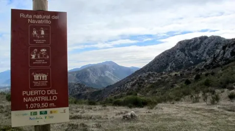
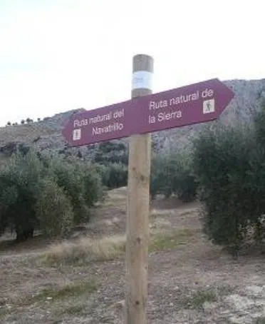
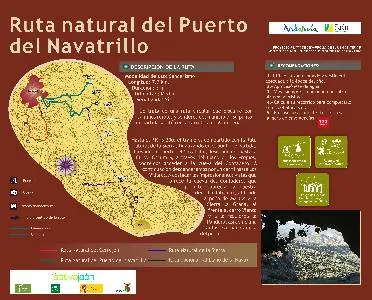
It is a circular route that runs along rural roads and trails of the municipality. Its starting point is on the Valdepeñas road, on the access lane to La Urbanización La Carrasquilla (Los Torcales lane). To the point of kilometric 3,300, the stretch is shared with the Natural Route of the Sierra, ending at the starting point. Arriving at the port of the Navatrillo, we go down to the Dark Cave and, through the Llano de los Propios, we can access the cave of the Contadero. Then we'll go down a lane to Los Villares. To highlight the impressive views of the Cave of the Contadero, which allow to appreciate to our right Jabalcuz, to the background the rock of Castro and the Sierra la Grana, to the front of the Mount Wind and to the left the Pandera, as well as a fantastic panoramic of the village.

Breve descripción

It is a circular route that runs along rural roads and trails of the municipality.

Latitud
37.7601
Longitud
-3.5003
Distrito
Municipio
Ubicación en el mapa
POINT (-3.5003 37.7601)
imagen
Image
3413300Master.jpg
Imagen principal
Activado
imagen
Image
Ruta%20Natural%20del%20Puerto%20de%20Navatrillo.jpg
Imagen principal
Desactivado
3 h

Nature

icon-intereses-naturaleza

Friends

icon-intereses-amigos

Adventure

icon-intereses-aventura

Culture

icon-intereses-cultura

Sport

icon-intereses-deporte

Eco-friendly

icon-intereses-eco-friendly

For couples

icon-intereses-en-pareja

Family

icon-intereses-familia

Gastronomy

icon-intereses-gastronomia

Municipality

icon-intereses-municipio

Low-cost tourism

icon-intereses-turismo-low-cost

Solo travel

icon-intereses-viajar-solo
Medium
Image
b212551f-6a80-444a-b4a8-aa9f9726c98e?t=1589203992521
Ruta Natural del Puerto de Navatrillo
7,7 km
All year round
Desactivado

- Use comfortable shoes and dress suitable for the time of year.
- Hold on to water.
- Always go with another or other hikers.
- Calculate your route to complete before sunset.
- In case of an accident, call the emergency number 112.

Valdepeñas road.

Tramo de asfalto o cemento
 
Tramo de pista o camino forestal
 
Tramo de vía pecuaria
 
Tramo de senda
 

Route Natural del Cerrejón

Submitted by brandcode_deweloper on
Id
2585128
Descripción larga

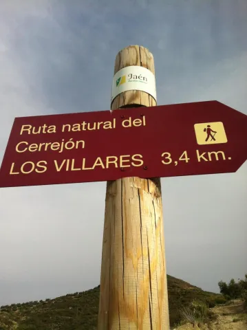
It is a circular route that runs in its entirety on rural roads and has as its starting point the path of access to the municipal building, in the city centre, ending in the Mirador del Molino del Rey, also in Los Villares. The first 500 m., looking behind our back, we can see a beautiful panorama of Los Villares, the Canjorro, as well as the Peña de Castro. Continuing the ascent, we will leave the municipal landfill and the Pedregoso River to our right. From the Casería de la Venta we descend, through a partially paved road, to the area of Los Molinos, by the river Frio. On the left bank of the river, we will pass through a fountain located just on foot, about 500 meters before the end of the itinerary. The route of the Cerrejon ends in the parking lot, which is located next to the Mill of the King.

Latitud
37.7902
Longitud
-3.4604
Distrito
Municipio
Ubicación en el mapa
POINT (-3.4604 37.7902)
imagen
Image
Ruta%20Natural%20del%20Cerrej%C3%B3n%20%281%29.jpg
Imagen principal
Activado
imagen
Image
turismoActivo1.jpg
Imagen principal
Desactivado
1 h 30 min

Nature

icon-intereses-naturaleza

Friends

icon-intereses-amigos

Adventure

icon-intereses-aventura

Culture

icon-intereses-cultura

Sport

icon-intereses-deporte

Eco-friendly

icon-intereses-eco-friendly

For couples

icon-intereses-en-pareja

Family

icon-intereses-familia

Gastronomy

icon-intereses-gastronomia

Municipality

icon-intereses-municipio

Low-cost tourism

icon-intereses-turismo-low-cost

Solo travel

icon-intereses-viajar-solo
Baja
Image
74e9f9e5-b35d-33eb-a75a-0bc9d83133f5?t=1589202824829
Ruta Natural del Cerrejón
3,7 km
All year round
Desactivado

- Use comfortable shoes and dress suitable for the time of year.
- Always go with another or other hikers.
- Calculate your route to complete before sunset.
- In case of an accident, call the emergency number 112.