Saltar al contenido principal

Trail de la Muralla PR-A126

Submitted by brandcode_deweloper on
Id
6489019
Descripción larga

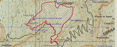
Without leaving the path, at the front and below we find the path of the Fuente la Zarza, the forest opens and leaves room for the olive tree. Without going down to the lane, to the left, on the hillside, a narrow path diagonally ascends towards the right flank of the pine near the olive grove. Here begins a progressive, and pleasant promotion. This path connects with an access lane to an olive grove. At this point and without separating from the pine tree we go up to the left, for a short and steep stretch that softens and leads us first on a path and then on a track to the Neveral Hospital.

Due to the constant works in the vicinity of the Hospital and the lack of continuity of the original route of the path that previously surrounded the center through the back area, it is easier to continue straight by the asphalt, so we enter the hospital compound Dr. Sagaz, El Neveral and we cross it to its exit. At the entrance already on the road and to avoid moving on it, to the right, we take advantage of the trails of the recreational area of the Neveral that will take us away from the road traffic. We take a narrow road to the left, on a basketball field and cross the forest track, (common section with the PR-A127: Pinares del Neveral) the road marked, continues close to the vaguada, and the cross later to connect with the road again, about 50 meters from the Caño Quebrado Center. Caño Quebrado is the only source we find throughout the course. (End of common section with the PR-A127 Neveral Pines).

In Caño Quebrado they connect the road to Jaén, the road of the Castle of Santa Catalina and Parador Nacional, with the road to the Neveral Hospital, where we have passed before. In front of the Caño Quebrado Fountain. Just to the left of the road that goes up to the Castle of Santa Catalina and the Parador. Take a lane that descends next to some old chalet, below and to the right continue on a very good road that opens way between the pines and that will return us back to the crossing that is next to the Wall, which we cross again, this time in the opposite direction, to return to the beginning of the Path.

Breve descripción

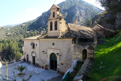
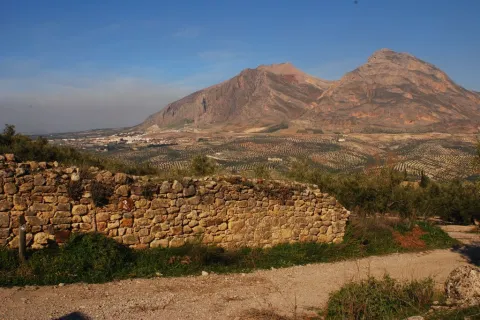
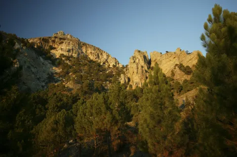
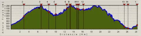
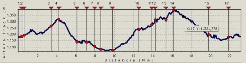
This circular path, has its beginning in the city centre of Jaén, specifically begins on the bypass road, opposite No. 126. In front of this point a road in good condition, next to an electric transformer ascends on the north side of the hill of the Castle of Santa Catalina. The track with a strong slope, then turns right and softens, rushing through the castle wall. Once we cross the wall, we find an olive tree and the road forks. At this point we will return to the descent, as from here it begins circular section of the path. We take the right road, right through the olive line. From this flat section, you can see the San Vicente de Paul (below), the Magdalena Quarter, and the San Juan Quarter on the right. As we reach the pine tree, we continue on a path descending a few meters and then slightly ascending, opening the way between the pine trees. At about 150 m there is a crossing that we must continue on the right. Later on it passes through a (open) gate of one fenced, the path crosses this fencing, and it leaves it coming out later by a similar gate. Both cancels are generally open.

Latitud
37.768825
Longitud
-3.795409
Ubicación en el mapa
POINT (-3.795409 37.768825)
imagen
Image
sendero%20de%20la%20muralla1.jpg
Imagen principal
Activado
imagen
Image
sendero%20de%20la%20muralla.jpg
Imagen principal
Desactivado
2 h 30 min

Nature

icon-intereses-naturaleza

Friends

icon-intereses-amigos

Adventure

icon-intereses-aventura

Culture

icon-intereses-cultura

Sport

icon-intereses-deporte

Eco-friendly

icon-intereses-eco-friendly

For couples

icon-intereses-en-pareja

Family

icon-intereses-familia

Gastronomy

icon-intereses-gastronomia

Municipality

icon-intereses-municipio

Low-cost tourism

icon-intereses-turismo-low-cost

Solo travel

icon-intereses-viajar-solo
Medium
645 m
Muralla PR-A126
5,95 km
195m
195m
On foot
All year round
Desactivado

Good conservation status, but signs have disappeared in some areas.
Coordenadas / Huso 30S
UTM coordinates: x = 429946 and = 4180464
Tramo de asfalto o cemento
8.4%
Tramo de pista o camino forestal
47.9%
Tramo de vía pecuaria
0
Tramo de senda
43.7%

GR-247 Bosques del Sur

Submitted by brandcode_deweloper on
Id
6480311
Breve descripción

The GR247is the largest hiking route in the largest natural space in Spain. The GR247 Forest of the South path offers you 478 km marked, along 21 main stages and 11 derivations to places of interest. The GR also has 3 variants, composed of two sections each, that will help you subdivide the layout, and make a version adapted to your interests and time available. You decide how to do it! Its tour will take you to the births of the Guadalquivir and Segura rivers, it will enter you by the mosaic of landscapes of this mountain: high mountain peaks, castles, forests, rivers and waterfalls, traditional roads, altiplanicies, villages and villages still inhabited, historical sets, olive groves and orchards. A great way to discover the flight of the broken bones, the cleanest waters, the conversation with the transhuman pastors, the way to live in the mountain villages..., a collection of experiences and the authenticity of the most extensive saws of Andalusia, await you on the verge of this road. Most of the stages start and end in places with basic services - sources, villages or villages, campsites and other accommodation, camping areas or near carts. Other sections have only emergency shelters, without services, built to provide these areas of the GR. It well plans your journey because some stages go through very remote places, without telephone coverage, often subject to high mountain conditions that can leave you isolated (snow, wind and low-zero temperatures in winter, or lack of water and permanent insolation in summer), so you must be informed of the conditions before you start the route; in addition to having enough of your breath. You decide where to start the road, how many steps you will make on this visit to the park, how to divide the walk or, if you prefer, dedicate all your holidays to the full tour. Never leave the route, always follow the rules of use of the GR and the shelters as well as the instructions of the natural park staff. It respects all the rules of protected space as you walk the path and use its equipment. Landscapes full of memory await the steps and the complicit look of the walker, in one of the most interesting natural spaces in southern Europe.

Latitud
38.1547
Longitud
-2.5612
Distrito
Municipio
Ubicación en el mapa
POINT (-2.5612 38.1547)
imagen
Image
image_162532.jpeg
Imagen principal
Activado

Nature

icon-intereses-naturaleza

Friends

icon-intereses-amigos
Image
GR-247 Bosques del Sur
478 km
Desactivado

Recommendedalways long pants (even in summer), boots or non-slip shoes, hat or cap, drinking water and some kind of food and clothing adaptable to variable weather. It is also advisable to carry protection cream for the sun and air, to be provided with a mobile phone and to carry a small medicine with disinfectant, tirite, gauze, some bandage, anti-inflammatory and against bites. In rainy days or where there are sources or rivers it is also recommended to wear a complete mute of clothes.
You can't forget the photo camera!

Hiking Route La Presilla

Submitted by brandcode_deweloper on
Id
5727646
Descripción larga

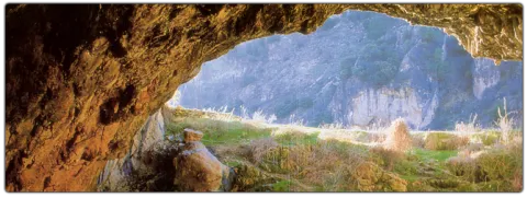
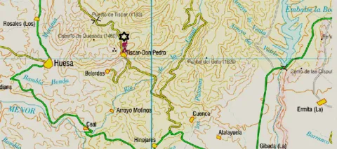
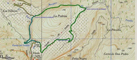
Next to the impressive Tiscar Sanctuary by the Vadillo River, where the beautiful Cueva del Agua opens and where the mountains offer a beautiful port, at Km 12.5 of the A-315, passing the Vadillo Restaurant towards Quesada, we find a sharp curve to the right. Before passing it, a lane with an ascending slope to the right is the beginning of the path.
It is a way of servitude from which different accesses to olive plots come. We must always take the main path by dismissing other secondary ones. The olive tree is dominated by almonds, an unproductive olive tree because of the altitude at which we are, but it was once the only way for the inhabitants of these mountains. At 900 m from the beginning, we reach a crossing that we must take to the right, leaving the Vadillo Vereda, which continues ascending but more in a straight line on our left.
The road runs between two rocky massizos: to the right a rocky cut and to the left La Pedriza, whose top is at 1179 m of altitude. Different paths can be taken, although if it runs through the main, we will end up in a flat area with some gardens.
2.6 km from the beginning we reach a road crossing, where we will have to turn left to continue to surround La Pedriza. We are in the Barrio de la Presilla and from now on we will go down it. At the front and following the rising stream, we can travel the Maquis Road, which commemorates the transit of men who fought in armed resistance against the Franco dictatorship in the 1940s.
At the base of the slices are paint and light. The lane floor slips if wet so it is not recommended to use car in this case. The best time to make the path is autumn and winter for the greatest presence of birds.
4 km from the start, we reach the asphalt road of the port of Tiscar, there we will have to turn left to reach the start point in just over 1 km.

Breve descripción

Next to the impressive Tiscar Sanctuary by the Vadillo River, where the beautiful Cueva del Agua opens and where the mountains offer a beautiful port, at Km 12.5 of the A-315, passing the Vadillo Restaurant towards Quesada, we find a sharp curve to the right. Before passing it, a lane with an ascending slope to the right is the beginning of the path.

Latitud
37.781485
Longitud
-3.021872
Municipio
Ubicación en el mapa
POINT (-3.021872 37.781485)
imagen
Image
656_img.png
Imagen principal
Activado
imagen
Image
shutterstock_1060474277.jpg
Imagen principal
Desactivado
1 h 50 min

Nature

icon-intereses-naturaleza

Friends

icon-intereses-amigos

Adventure

icon-intereses-aventura

Culture

icon-intereses-cultura

Sport

icon-intereses-deporte

Eco-friendly

icon-intereses-eco-friendly

For couples

icon-intereses-en-pareja

Family

icon-intereses-familia

Gastronomy

icon-intereses-gastronomia

Municipality

icon-intereses-municipio

Low-cost tourism

icon-intereses-turismo-low-cost

Solo travel

icon-intereses-viajar-solo
Medium
987
Image
ff7caf80-f2f4-ad07-e154-4763e2234224?t=1607024821041
Document
Image
3cb09274-ff1b-b4cf-52a0-ba294f50c7a4?t=1607024807235
LA PRESILLA
5,13 km
236m
245m
1
1
1
2
Horse, on foot and bike
All year round
Desactivado
Image
38e988e5-42f7-4cd9-344c-0f44af3fafa1?t=1607024815462

Tiscar Sanctuary

Path of the Tiscar Water Cave, near the beginning

The tour is marked by beacons with directional arrows.

12 km from Quesada, at the A-6206 and before arriving at the Tiscar Sanctuary, after a closed curk to the left, it starts a track of land to the left in ascension

922

Same point

922
Coordenadas / Huso 30S
30S x = 498074 and = 4181571
Tramo de asfalto o cemento
23.98%
Tramo de pista o camino forestal
17.54%
Tramo de vía pecuaria
0
Tramo de senda
58.48%

Hiking Route Guazalamanco

Submitted by brandcode_deweloper on
Id
5726517
Descripción larga


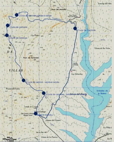
We started the route in El Hornico. We left the car in the parking lot of the Botanical Garden and went to the old Forest House, now a nature classroom, hostel and rural house. Before we reach the first building, on our right we find the starting sign and, behind it, an old cavalry path that ascends through the skirt of the mountain. A wooden beacon, with red band, indicates the km 0 of the route. We will find other wood indications on the itinerary, which belong to other routes, but we will only obey those with a red ring at the top.
At about 950 metres from the starting point, we cross the Sabina Bridge, over the Arroyo de la Venta, which in this section is usually leaked down under the bed edges. A few meters away we reached a forest track and turned left. We follow it until we reach km 2 of our tour, where we will be very attentive because at about 50 meters we take a path (without indicators) that begins to our right. From here we are expected 2.3 km of ascent, in the hardest part of the journey. In the middle of the repulse the path forges. The right-hand option shows old vehicle tracks. Although the two variants take us to the same place, we will choose the one on the left, a softer track. When the slope is crowned, we reach the Collado de los Hercas, a crossing of roads where two jalones indicate the route to follow (the exit further north). We can enjoy a good panorama if we deviate about 300 meters along the road that comes out to our right (it is a jorro, that is, a wooden way of drawing); then we will return to this point and follow the indicators.
About five minutes away we find the ruins of the Forest House of the Prados de Arredondo. By passing the building, the dividing path; we continue on the right, as the beacon tells us. Half a kilometre later we reached the Guazalamanco stream, just where the Cerrada de Navas ends. In this place, if we deviate along the way up, we reach a delicious corner, ideal for a pleasant break. After the refreshment, we continue on the forest track, which we find as we cross the current and, at the height of km 6 of our itinerary, we leave it to follow, on the right, a path that communicates with a path that descends down the hillside. At 800 meters we find the creek again, which we wade twice before we reach the Cascade del Dique. From here we run through the forest track that descends at the same time as the channel, until it is separated from it. 200 meters later we will view the reservoir of the Bolera.
If we have chosen the reduced version (1), down the asphalt slope we will find the first vehicle, with which we can return to El Hornico, where the other one awaits us. If not, we follow the road of land, flat in almost all its way, through the Dehesa del Rincón, until we reach our starting point, 4 Km later.
(1) Reduced option: If it is a group and at least two vehicles are available, one will leave it in the Hornico and the others at 4.1 km following the main ground road, until it reaches a fork, where the left deviation is at cost and asphalt. Logically the Hornico car will have been used to bring the driver or drivers to the starting point. With this option we will save the 4 km most monotonous and dangerous (by the movement of vehicles) of the route.

Breve descripción

We started the route in El Hornico. We left the car in the parking lot of the Botanical Garden and went to the old Forest House, now a nature classroom, hostel and rural house. Before we reach the first building, on our right we find the starting sign and, behind it, an old cavalry path that ascends through the skirt of the mountain. A wooden beacon, with red band, indicates the km 0 of the route. We will find other wood indications on the itinerary, which belong to other routes, but we will only obey those with a red ring at the top.

Latitud
37.804829
Longitud
-2.904941
Municipio
Ubicación en el mapa
POINT (-2.904941 37.804829)
imagen
Image
657_img.png
Imagen principal
Activado
imagen
Image
shutterstock_1060474277.jpg
Imagen principal
Desactivado
5 h 45 min

Nature

icon-intereses-naturaleza

Friends

icon-intereses-amigos

Adventure

icon-intereses-aventura

Culture

icon-intereses-cultura

Sport

icon-intereses-deporte

Eco-friendly

icon-intereses-eco-friendly

For couples

icon-intereses-en-pareja

Family

icon-intereses-familia

Gastronomy

icon-intereses-gastronomia

Municipality

icon-intereses-municipio

Low-cost tourism

icon-intereses-turismo-low-cost

Solo travel

icon-intereses-viajar-solo
Medium
1015
Document
Image
d84fb74f-5399-f2ac-50ba-9dcb6ef13f40?t=1607095645832
Image
518b3045-dfd0-a46c-3753-7bac2931cd70?t=1607095659036
GUAZALAMANCO POR LOS PRADOS DE ARREDONDO
12,2 km
1069m
1310m
1
2
1
3
On foot
All year round
Desactivado
Image
348f8bd0-d32d-dafa-174f-9ad64f73e9bf?t=1607095652283

Packaging of the Bolera and recreational area of the Hoyo de los Pinos or the Bolera

The route is marked with direct arrows and with kilometric posts.

The Botanical Garden of the Hornico is 9 Km from Pozo Alcón and 17 Km from Hinojares. From Pozo Alcón you have to take the A-326, up the Avenida de la Bolera, direction to Castril. By passing the campsite de la Bolera, passing the Km. 7, we take a detour that comes out to our left and that borders the Forest House of la Bolera (the indication to El Hornico is signposted). On an unasphalted road, 2 km later, we take another turn to the left, after passing a bridge, which leads us to the parking lot of the Garden a few meters later. Next to the first building of the nature classroom, is the route's start sign.

1025

Same point

1025
Coordenadas / Huso 30S
30S x = 508368 and = 4184165
Tramo de asfalto o cemento
0.82%
Tramo de pista o camino forestal
47.95%
Tramo de vía pecuaria
0
Tramo de senda
51.23%

Hiking Route circular Ermita de la Hoz

Submitted by brandcode_deweloper on
Id
5726100
Descripción larga

440 m from the Cave of the Peinero, we find a forest track to the right and in a downhill that runs through pine trees, oaks and madrognals splashed with ferns. Back is the Swarm Stone (1360 m) that belongs to La Albard.
400 m from the start we find a barrier, which cuts the passage to motor vehicles. On your side we can go right through. A few olive trees, mixed with pine trees, show the difficulties of the cultivation of this woody species that is carried out in the area, gaining ground to the forest. Now that agricultural methods are based on high production, it is the forest that gradually gains the ground to the less productive olive groves, in the face of low productivity abandonment.
Later on we find on our right a fenced olive tree next to an irrigation water register; from here we can see a wide panorama of the place where we are, to the south the boat of the Tosero, the peak of Caballo Torraso (1726 m) and the horse of the Albarda, to the east the ravine of Arroyo María, the Poyo de las Andaragasques and the peaks of Las Culebras, Las Grajas and la Veleta. To the north-east, the Rasca del Guijarrón with its surveillance site at the summit, on the other side of the Guadalquivir valley. In this section we find several secondary tracks of entry to olive groves, which we must despise always continuing on the main track.
About 2.4 km from the beginning we arrived at the Houses of the Hermitage of the Hoz, small still inhabited cordijada, of which we must say had a hermitage that gave it name, but today it is completely disappeared. Before we reach them we have left to our left some orchards and fruit. Our route continues not to get into the corrijada, between the first and the second entry to it.
The houses are left to our right to turn left on a track that continues between olive groves, which secondary to the one that has brought us to the houses and is ascending. There are several worse-state olive slopes to it, we will always continue for the main.
After a small roll and a flat, there is a fork to the left about 2.8 km from the start, we follow the front, the track starts to turn left overlooking the Stone of the Be and Loma of the Be, gradually approaching the Arroyo of the Fountain of the Topaero. Later, we arrive at another fork at 3.4 km from the beginning, we will have to go to the front in curve to the left, leaving to our right a stream and the Cortijo of the Straits of the Hoz. In this place there is a water-sink under a oak and numerous fruit.
Later on and after making the route two very pronounced curves, first to the left and then to the right and continuing on the rise, we left to the left of the track the Casa Cuadros, which is surrounded by centenary oak. We are 3.8 km from the beginning. By passing the cortijo there is a fork of roads, we will follow that of the right in an ascending way and do zigzag on the side of the Umbria del Aguilar. We will go through a very lush left curve of vegetation through which a small stream passes and above we will turn, 4.1 km, into a road that comes from the right, to which we join, to continue to the left. This will take us to the asphalt track on which we started the route.
Once on the road, 4.8 km away, we have two options. If we go to the right we can reach, in a little more than 2 km, the Topadero Mirador, with exceptional views, and if we go to the left we return to the starting point in 1.4 km.

Breve descripción

440 m from the Cave of the Peinero, we find a forest track to the right and in a downhill that runs through pinars, oaks and madrognals splashed with ferns. Back is the Swarm Stone (1360 m) that belongs to La Albard.

Latitud
38.173966
Longitud
-2.849114
Ubicación en el mapa
POINT (-2.849114 38.173966)
imagen
Image
671_img.png
Imagen principal
Activado
imagen
Image
shutterstock_1060474277.jpg
Imagen principal
Desactivado
2 h 15 min. Extensión Mirador del Topaero (ida y vuelta): 1 h 15 min

Nature

icon-intereses-naturaleza

Friends

icon-intereses-amigos

Adventure

icon-intereses-aventura

Culture

icon-intereses-cultura

Sport

icon-intereses-deporte

Eco-friendly

icon-intereses-eco-friendly

For couples

icon-intereses-en-pareja

Family

icon-intereses-familia

Gastronomy

icon-intereses-gastronomia

Municipality

icon-intereses-municipio

Low-cost tourism

icon-intereses-turismo-low-cost

Solo travel

icon-intereses-viajar-solo
Medium
994
Image
23c314c1-f51b-8993-c341-b0f9f53dc326?t=1607093266172
Image
3fcf9588-62ff-fee2-b116-0073a71b129f?t=1607093272560
CIRCULAR ERMITA DE LA HOZ
6,2 km al mirador del Topaero / 4,2 km (ida y vuelta)
380m
393m
1
1
1
2
Horse, on foot and bike
All year round
Desactivado
Image
b2b18a9f-d00a-03ac-e534-c31823670321?t=1607093152220

ZAC The Cerezos

In the JH-7155 which is accessed from Mogón or from the oil puddle, in the km. 52.7, where a lane to our right goes down, if we enter from the Agustines Bridge or Oil Charco.

920

Same point

920
Coordenadas / Huso 30S
30S x = 513216 and = 4225128
Tramo de asfalto o cemento
 
Tramo de pista o camino forestal
 
Tramo de vía pecuaria
 
Tramo de senda
 

Hiking Route circular Aguascebas

Submitted by brandcode_deweloper on
Id
5726047
Descripción larga

By accessing from Mogón by the JH-7155, just before crossing the waterfront dam and in the vicinity of the reservoir village we find a forest track to the right in good condition, which is where our tour goes. There is a descriptive panel of the Tranco del Acebo site, which is where the Chorro Gil waterfall is located, to which we will access with this path.
Initially we will visit pine forests with large grasslands, in continuous rise for 1.3 km, leaving on the way several restored cortijos. Once a hill has passed, where there are great clear left, we begin to come down to the Chorro Gil waterfall. In the middle of the descent we hear and see the cascade of Chorro Gil, and when we reach 1.78 km of route we can take a small path to the right that brings us to it, 5 minutes from the track, to then return to this point and continue the path. The Chorrogil Cascade is one of the most spectacular of the park, approaching 100 m of altitude and gives this area a very characteristic microclimate of more northern places, hence the name of the site, Tranco del Acebo.

We continue our route back on the rise until we pass again through another hill 2.5 km from the beginning and again another descent to the Vega del Aguascebas de la Fuente del Tejo. This river runs next to a magnificent gallery forest and large meadows. We must cross the same, 3.3 km from the beginning, by a path following the forest track or by a passing of concrete blocks painted in white. This is the Paso del Manguillo. Again this itinerary begins to rise until it reaches 4.15 km to a road crossing, close to a cortijo that is left to our right, we will continue to the left and almost all our journey will be in descent.

In the km 5.1 we find again another track crossing to the left, we continue to face after having zigzagueado on several occasions. A few ten minutes to the asphalt road JH-7155 we will now have to follow left to reach the beautiful reservoir of Aguascebas. Its dam, on which we will have to pass, is located on the spectacular closure of the Aguascebas Chico. A few meters away, we found the town of the reservoir where the beginning of this itinerary was located.

Breve descripción

By accessing from Mogón by the JH-7155, just before crossing the waterfront dam and in the vicinity of the reservoir village we find a forest track to the right in good condition, which is where our tour goes. There is a descriptive panel of the Tranco del Acebo site, which is where the Chorro Gil waterfall is located, to which we will access with this path.

Latitud
38.045694
Longitud
-2.950503
Municipio
Ubicación en el mapa
POINT (-2.950503 38.045694)
imagen
Image
Ruta%20de%20senderismo%20circular%20Aguascebas.jpg
Imagen principal
Activado
imagen
Image
Ruta%20de%20senderismo%20circular%20Aguascebas1.jpg
Imagen principal
Desactivado
2 h 8 min

Nature

icon-intereses-naturaleza

Friends

icon-intereses-amigos

Adventure

icon-intereses-aventura

Culture

icon-intereses-cultura

Sport

icon-intereses-deporte

Eco-friendly

icon-intereses-eco-friendly

For couples

icon-intereses-en-pareja

Family

icon-intereses-familia

Gastronomy

icon-intereses-gastronomia

Municipality

icon-intereses-municipio

Low-cost tourism

icon-intereses-turismo-low-cost

Solo travel

icon-intereses-viajar-solo
Medium
1015 m
Document
Document
CIRCULAR AGUASCEBAS
221m
234m
1
1
1
2
Horse, on foot and bike
All year round
Desactivado
Image
265a289a-2ef1-6655-bd5d-267d50416a71?t=1607029553302

In the JH-7155 which is accessed from Mogón or from the Oil Charco in the km 18.5, next to the town of Confederación in the reservoir of Aguascebas.

1047 m

Same point

1047 m
Coordenadas / Huso 30S
30S x = 504343 and = 4210886

Hiking Route Cerrada del Utrero and Cascada de Linarejos

Submitted by brandcode_deweloper on
Id
5725805
Breve descripción

The site known as Cerrada del Utroo-Linarejos is an amazing natural work sculpted by the Guadalquivir in the limestone that surrounds it. The path is on foot, and it will allow you to appreciate the sharp rocks and objades created by water over hundreds of thousands of years. It is a charming walk where the labiérnago, the cornicabra, and the willow accompany you to one of the most photographed places in the Park: the "horse tail" or Cascada de Linarejos.

The Guadalquivir made this canyon narrow and deep, leaving some streams - like that of Linarej- hanging on the heights. When this stream is at the throat it forms the spectacular Cascade of Linarejos, which after standing in some pozas joins the Guadalquivir to descend to the valley.

The path is 1.6 km and on its circular route it surrounds the "Peñón del Lanchón" to return to the road in a pleasant walk of about 45 minutes.

In the final part of the road - just before returning to the asphalt - you reach a pine-resinero or black forest (Pinus pinaster) that was used to obtain the resin with which the water used to be made. In these trees you will see the furrows that the resineros opened to allow the exit of this sap.

We suggest:

  • Observe the numerous rupicular birds that nest on the rocky wall in front of our path, as we pass the waterfall of Linarejos. You will see small species, such as the victor, the lone rocher or the white lavender, sharing space with much larger ones like the leonate vulture.
  • Get to know the small town of Vadillo-Castril, where the old Rife sawmill was and today it is the home of two agencies of great importance for the Natural Park: the School of Forest Capataces and the Forest Defense Center.

LOCATION

In Cazorla take the Sierra road (A-319) until the crossing known as the Empalme del Valle. Turn right on the JF-7092 road and just before passing the bridge over the Guadalquivir River (4 km from the Empalme) begins the Cerrada del Utrero path.

Latitud
37.9052
Longitud
-2.9551
Ubicación en el mapa
POINT (-2.9551 37.9052)
imagen
Image
676_img.png
Imagen principal
Activado
imagen
Image
575_image_4.jpg
Imagen principal
Desactivado
imagen
Image
575_image_5.jpg
Imagen principal
Desactivado

Nature

icon-intereses-naturaleza

Friends

icon-intereses-amigos

Adventure

icon-intereses-aventura

Culture

icon-intereses-cultura

Sport

icon-intereses-deporte

Eco-friendly

icon-intereses-eco-friendly

For couples

icon-intereses-en-pareja

Family

icon-intereses-familia

Gastronomy

icon-intereses-gastronomia

Municipality

icon-intereses-municipio

Low-cost tourism

icon-intereses-turismo-low-cost

Solo travel

icon-intereses-viajar-solo
Ruta de senderismo Cerrada del Utrero y Cascada de Linarejos
All year round
Desactivado
Tramo de asfalto o cemento
 
Tramo de pista o camino forestal
 
Tramo de vía pecuaria
 
Tramo de senda
 

Trail las Viñas

Submitted by brandcode_deweloper on
Id
4981725
Descripción larga

It begins in the recreational area of Cuadros, parallel to the Aldelfal de Cuadros trail, which allows us to enjoy beautiful views of the adelfal and its pink flowers in spring and summer. Little by little we will go up and get to know the main water births of Bedmar (Los Sistillos), always accompanied by the extraordinary views of this unique site.

In our ascent we will find the cornicabra abundantly. This plant acquires tones from yellow to red in the autumn, the best time to appreciate the beauty of these formations.

We will go up to privileged locations from which we will see wide panoramic views of the Sierra Magina Natural Park. A varied vegetation will be offered at our pace, both natural and cultivated. And we will also be able to know something about the history and heritage of these mountains.

If we turn a little bit, we can visit the view-conditioning at the Torreón de Cuadros. This watchtower looks at the steep valley of the Cuadros River and a beautiful landscape of gardens and crops. The contrast of this landscape well deserves that little effort as it deviates.

Breve descripción

This is a circular path of making it difficult to average, in which we will find a great diversity of very interesting elements.

Latitud
37.8244
Longitud
-3.3956
Distrito
Municipio
Ubicación en el mapa
POINT (-3.3956 37.8244)
imagen
Image
724_SS_04.jpg
Imagen principal
Activado
imagen
Image
sendero%20las%20vi%C3%B1as.jpg
Imagen principal
Desactivado
imagen
Image
724_SS_06.jpg
Imagen principal
Desactivado
imagen
Image
724_SS_05.jpg
Imagen principal
Desactivado
3 h

Nature

icon-intereses-naturaleza

Friends

icon-intereses-amigos

Adventure

icon-intereses-aventura

Culture

icon-intereses-cultura

Sport

icon-intereses-deporte

Eco-friendly

icon-intereses-eco-friendly

For couples

icon-intereses-en-pareja

Family

icon-intereses-familia

Gastronomy

icon-intereses-gastronomia

Municipality

icon-intereses-municipio

Low-cost tourism

icon-intereses-turismo-low-cost

Solo travel

icon-intereses-viajar-solo
Medium
Document
Sendero las Viñas
8,7 km
On foot
All year round
Desactivado

Recreative area of squares

  • In front of COVID19, keep the safety distance and carry a mask, avoid agglomerations and contact with surfaces, wash your hands frequently, use hydroalcoholic gel and consult the available digital materials. Take care of your health and others.
  • It works to prevent fires. Do not throw cigarettes or any other object that produces combustion.
  • By consuming local products and having companies in the area you will contribute to rural development.
  • He lives with the local people and other users. It respects private property and property.
  • Unwind in a sustainable way: public transport, bike, walk, shared vehicle...
  • Noise is another form of pollution. In silence you will enjoy your experience more.
  • It facilitates the use of people with special needs.
  • The trash doesn't come back alone. Take her with you to the nearest container. Reduce, reuse, recycle.
  • Don't leave a mark on your way through nature.
  • It practices a responsible and committed tourism with the environment. Be a real ecotourist!
  • Respect the facilities at your disposal. We all pay for your maintenance.
  • Check the weather forecast before starting your activity.
  • Avoid going out alone. If you do, it communicates tour and time of return to other people.
  • Extreme caution under adverse conditions and with the occasional presence of animals or motor vehicles.
  • Please provide prior information on the possible existence of cynegetic activity.
  • It has water, sun protection, proper clothes and shoes.
  • It carries a mobile with enough battery in case of emergency (112), but remember that there is not always coverage.
  • Don't even bother animals. You would negatively alter his behavior.
  • For your safety and the safety of the environment, don't get out of the signposted road or take shortcuts.
  • Remember that the capture of animals, light fire, fish and collect plants or minerals is prohibited.
  • If you bring a dog, take him with his strap and make sure he doesn't bother other animals or people.
  • Your safety is our concern, but it's your responsibility.

Thank you for your cooperation!

From the village of Bedmar we will take the road leading to the Sanctuary of the Virgin of Cuadros, just before crossing the bridge over the river we will deviate on the left track until we reach the recreational area Adelfal de Cuadros, the starting point of this path.

To end the path we will pass by the beautiful hermitage of the Virgin of Cuadros, and next to the impressive Cueva del Agua, ideal to visit in summer and refresh, if we want to walk within the river and discover three caves through which the river runs forming spectacular formations as a result of the water's spread over time. In this case, it is recommended to wear shoes and clothes for water.

Bike Route Siles - El Portichuelo - El Seminario - La Canalica - Siles

Submitted by brandcode_deweloper on
Id
2851934
Descripción larga

We will continue the main track in continuous rise. As you pass the indication to the Mirador de La Rayuela, which is essential to visit, there is a very pronounced curve to the left and there appears a track in slight descent to the front, which is the one we take. We continue in a well-deserved decline that will allow us to regain strength, and we contemplate unbeatable views of Siles and its surroundings, the olive grove in the lower area and the pine forests at medium and high altitudes. This area is very suitable for the observation of marine fossils, of ammonites above all, who lived at sea millions of years ago.

Just as we pass through a small water channelling shed that is at the foot of the track, we have a great view of the Anchorian and Calarejo ravine. Finally, we will cross a stream with permanent water and find a small building on our left that corresponds to a water survey that took place several years ago. From here on there is a profound change in the forest, as we went into a pinar of slender and high lard pine trees very rich in grass and much cooler than we had gone across the hill. We started going up again.

After 2 km. from the rise, we get to some cords that are left to our right. In the Cortijo Palerillas, we recommend a deviation before we return to our route: take the track that starts to the left, in a more sharp and counterman rise, to follow it to its end in 2 km. approximately. If we go to our right, at the base of the rocky cuts that rise upon us we will find several millennia of tejo. It is the most important weave of the Natural Park Sierras de Cazorla, Segura and Las Villas. Then we will return to the Cortijo Pancalillas, to continue the journey along the track. At 700 m we left to the left the great building of the Free Time Residence of Siles, known as The Seminary, and finally we reached asphalt road.

When we get to the road we turn right to go back down slightly until 1 km. down to a crossing where we have to turn left to get back on track and back up. Right at this point we find a magnificent source. We go to the Canalica Fountain Camping, to which we will have to deviate following the entry signs, but before passing through the access door, we will have to continue on a track that opens to the front. This will take us with a soft rise by places of great beauty, such as the Stone of the Hole and the Cerro Bucentaina, which we will surround, to view the valley of the Morles River, and already on a much more sharp and pleasant descent, we will reach the Peña del Olivar. It is a unique place suitable for the bathroom with a recreational area and a botanical collection. From there and by road we are headed for Siles. A few meters after exceeding the campsite Rio Los Molinos we will turn to our right, in the absence of 1 km. to reach Siles, thus avoiding more asphalted stretch and entering the town by land track.

Breve descripción

The circular tour begins in the town of Siles. We are headed for a forest track towards the hill of the Portichuelo, from which we have an unbeatable view of the village and the Vega de Castrobayona, before the nearby Albaceteña mountains and which shows the difficult agricultural life of the former inhabitants of the area. The Portichuelo is also the starting point of several signposted trails of small route.

Latitud
38.377909
Longitud
-2.579232
Distrito
Municipio
Ubicación en el mapa
POINT (-2.579232 38.377909)
imagen
Image
IMG_4539.jpg
Imagen principal
Activado
imagen
Image
Siles%20-%20El%20Portichuelo%20-%20El%20Seminario%20-%20La%20Canalica%202.jpg
Imagen principal
Desactivado
imagen
Image
Puntal%20Nieve%20invierno%20%282%29.jpg
Imagen principal
Desactivado
imagen
Image
Pico%20Navalperal%20y%20Las%20Acebeas.jpg
Imagen principal
Desactivado

Nature

icon-intereses-naturaleza

Friends

icon-intereses-amigos

Adventure

icon-intereses-aventura

Culture

icon-intereses-cultura

Sport

icon-intereses-deporte

Eco-friendly

icon-intereses-eco-friendly

For couples

icon-intereses-en-pareja

Family

icon-intereses-familia

Gastronomy

icon-intereses-gastronomia

Municipality

icon-intereses-municipio

Low-cost tourism

icon-intereses-turismo-low-cost

Solo travel

icon-intereses-viajar-solo
761 m.
CIRCULAR SILES - EL SEMINARIO - PEÑA DEL OLIVAR
28,6 km
1342m
1336m
In Bicycle, Horse, on foot
All year round
Desactivado
Image
582fc3e8-4a35-123b-e253-afabe37578ee?t=1589476117495

Peña del Olivar

Siles

821 m.

RECORRID: SILES - THE PORTICHUEL - BARRANCO OF THE ANCHURICAS - THE SEMINARY - SOURCE OF THE CANALIC - OLIVAR PEÑA - SILS

821 m.
Coordenadas / Huso 30S
30S x = 536752 and = 4247830
Tramo de asfalto o cemento
12.24%
Tramo de pista o camino forestal
87.76%
Tramo de vía pecuaria
0
Tramo de senda
0

Bike Route Río Madera - Valle de Los Anchos

Submitted by brandcode_deweloper on
Id
2851677
Descripción larga

1.7 km. We left the asphalt road, to turn left by forest track and between larium pinears, going down slightly to the stream and from there gradually going back to the Arroyo de los Asperones and leaving to the right the Cortijos del Jaral, until we reach the Collado de los Asperones where a small farm of the Segureña sheep is located.

From there, and in a dizzy descent next to the Arroyo de Romaguillo, we go down to the cortijos of the same name where we go back to the asphalt road. Once in this we turned right to continue downstream through the valley of Rio Madera, leaving corijadas on both sides of it that show the most ancestral way of life of these mountains, where the locals won small plots next to the houses to have small gardens of self-supply. We'll go down the road 3.7 km. until you reach the small village of Venta de Rampees, just as you cross a bridge on it opens to our left a narrow asphalt track that is marked as Los Anchos.

The track of the Anchos, in a smooth and continuous rise, runs first through the right margin of the valley, leaving to the left cornered as the Hoya del Azor, and once we cross to the left side we will find on our left the Cortijos de Majada Oscura where an ethnographic museum is located that well deserves a careful visit.

The larix forests splattered with some trees of caduca, chopos and fruit leaves spatter these sites next to rocky walls especially on the right side of the valley. Continuing our climb through it, we reach the two most important villages of it, it is the village of the Anchos and Pradomaguillo, places that deserve a small break to walk between its alleys.

At the entrance of Pradomaguillo we must turn left following the signs of GR 147, but it is worth getting off the bike and looking at 150 m., past Pradomaguillo, to see from the track that continues to walk this valley, in a true natural viewpoint, the Valley of the Anchos in all its splendor.

Just 400 m later, already on the GR-147, we found a small hill on our left without trees. We must go up to the same, for we will see great panoramic views of the valley and of the Calar that rise before us with its limestone walls. Then we continue our ground track to coronate at a few 300-400 m. along the Pradopurco Collado and once crowned simply follow the most transited track, in a sinuous but soft descent. We will see with the slender larity pine trees some small acebo bosquet and above all large pastures under the trees. To our right the Arroyo de las Tres Aguas and a vertical mole of limestone that is the Calar de Peñarrubia; just as we are in front of the Calar, below the stream we find ruins on a clear that belong to an ancient flour mill. A few 200-300 m. we will leave the GR-147 to the right to continue the track on which we were moving to the front. Soon this track descends and we cross the stream of the Three Waters, which only a few meters from the river Madera. Once we crossed the stream, we found a ruse, collaring and descent to wade the Wood River.

Cruzado Río Madera, we are in a very fresh and lush area, here is the area of Aparpada Controlada de la Morringa with its recreational area, it is worth moving 100 m. to the right to contemplate the remnants of the river and the facilities of the area.

We arrive again on the asphalt road, which we will have to follow to the right, to continue to climb up the valley of Rio Madera. At 1.2 km. We got to our starting point.

Breve descripción

The tour begins at the intersection of the village of Rio Madera, at the intersection of the JF-7,038 road with the JF-7,039, initially we go towards the village, by asphalt road, leaving to our right the mountain host and the small hermitage of the village and, just a few meters and to the left, the old laundry and the corrijada of Rocanas.

Latitud
38.240876
Longitud
-2.613059
Distrito
Municipio
Ubicación en el mapa
POINT (-2.613059 38.240876)
imagen
Image
R%C3%Ado%20Madera.jpg
Imagen principal
Activado
imagen
Image
Alma%20Serrana%201.JPG
Imagen principal
Desactivado

Family

icon-intereses-familia

Friends

icon-intereses-amigos

Nature

icon-intereses-naturaleza

Adventure

icon-intereses-aventura

Solo travel

icon-intereses-viajar-solo

Culture

icon-intereses-cultura

Gastronomy

icon-intereses-gastronomia

Sport

icon-intereses-deporte

Municipality

icon-intereses-municipio

Low-cost tourism

icon-intereses-turismo-low-cost

Eco-friendly

icon-intereses-eco-friendly

For couples

icon-intereses-en-pareja
1,176 m.
CIRCULAR RÍO MADERA VALLE DE LOS ANCHOS
23,29 km
788m
810m
In Bicycle, Horse, on foot
All year round
Desactivado
Image
fe6694c5-9e10-6264-7570-b3f67786aa8b?t=1589474581587

La Morringa

River Wood Cross on JF-7.038 with JF-7.039

1.178 m.

River Wood Cross in the JF-7038 with the JF-7039

1.178 m.
Coordenadas / Huso 30S
30S x = 533861 and = 4232612
Tramo de asfalto o cemento
0.19%
Tramo de pista o camino forestal
0.71%
Tramo de vía pecuaria
0
Tramo de senda
0