Saltar al contenido principal

Los Miradores

Submitted by brandcode_deweloper on
Id
856876
Descripción larga

The look at La Morra de Los Canalizos (km 31) has tables to eat. A little further we found the crosses to Hornos el Viejo and La Plantera. It is highly advisable to turn around this last village, with its scattered population and large oaks, and even down to the Tranco reservoir, to take a relaxing walk along its margin.

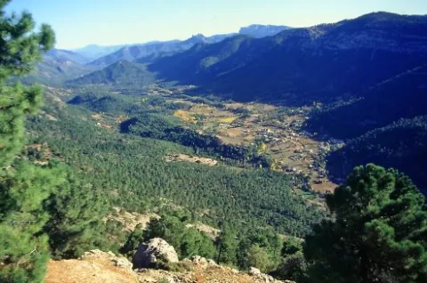
In the impressive Mirabuenos lookout (km 35) the views change quite a lot: from the humanized landscape of the previous lookout, with extensive olive areas and numerous cortijos and villages, we go to the vast panoramic high mountain, where the large forests dominate.

The view of Las Huelguecillas (km 36), which has tables to eat, is on an extensive promontory, and thanks to its situation as a small "peninsula" aerial we enjoy a very wide panoramic in all directions.

The Pradillos lookout (km) is the last and has a special charm for being at 1,340 m of altitude. This section of the A-317 ends when it stops climbing. You'll find a crossing and you'll have two options. If you keep going, you'll go to Pontoons and the birth of the Segura. You will find a livestock landscape, with very clear views. If you choose to turn left, you will enter a more forest landscape. You can complete your route in a circular way by returning to the Hornos de Segura on the roads of La Suma and la Garganta (A-317a).

Breve descripción

This route runs the first 20 km that has the road A-317 from Hornos to Pontones and Santiago de la Espada. This is a very panoramic section whose seven viewpoints make it an authentic landscape route. All are equipped with parking, banks, stationery and wooden fences. Some also have tables to eat. The viewpoints have attractive ceramic panels, which serve to interpret the landscape and to know some aspects of the natural and cultural heritage of the environment.

Latitud
37.9202
Longitud
-2.9801
Distrito
Municipio
Ubicación en el mapa
POINT (-2.9801 37.9202)
imagen
Image
la-historia.png
Imagen principal
Activado

Nature

icon-intereses-naturaleza

Friends

icon-intereses-amigos

Adventure

icon-intereses-aventura

Culture

icon-intereses-cultura

Sport

icon-intereses-deporte

Eco-friendly

icon-intereses-eco-friendly

For couples

icon-intereses-en-pareja

Family

icon-intereses-familia

Gastronomy

icon-intereses-gastronomia

Municipality

icon-intereses-municipio

Low-cost tourism

icon-intereses-turismo-low-cost

Solo travel

icon-intereses-viajar-solo
Los Miradores
Desactivado

We suggest...

  • The village of Los Goldines (km 40), depopulated and half-run, is testimony to the sad abandonment to which its inhabitants were forced when the National Caza Cote was created in 1960. Its ruins are an open book about the recent history of the Serrans.
  • The village of La Parrilla (km 41) remains populated. Since the rest of the villages were very isolated until the construction of this road in 2006.
  • Do not stop visiting the villages of La Ballestera and Montalvo, the latter in a superb location. They deserve a quiet walk because they keep the authenticity of traditional mountain villages. To enjoy the landscape more, we recommend you walk up to Montalvo, although you can go perfectly by car.

Cerrada del Utrero - Torre del Vinagre

Submitted by brandcode_deweloper on
Id
856851
Descripción larga

Among the options we propose to you:

Km 0. Caraway. The best way to enjoy Cazorla is to get lost in the streets of the old town and to discover some of its wonders, but on this occasion we propose some forced visits: the Plaza de Santa María, the Castle of the Yedra and some churches such as that of the Carmen or San Francisco of Renaissance style.

Km 1.5. The Iruela.Here we propose to stop you again, leave the car by the road and walk up one of the steep streets that lead to the castle that was owned by the Templars. From above you will have a beautiful view of the Guadalquivir depression. Next to the castle you can also visit the Church of Santo Domingo - and know the details of its foundation and history. Back in the car you will enjoy slimmed streets full of flowers that cheer the view.

Km 12. Air Pass lookout.We go up the road that leads us to the Natural Park and to say goodbye to the countryside, nothing better than to stop at this Mirador and enjoy its views. From here we change villages, castles and olive trees to valleys, rivers and mountains.

Km 13. Viewer of the Port of the Doves (1200 m).The landscape changes dramatically. You will find a great panoramic view of the Alto Valle del Guadalquivir, surrounded by beautiful mountains, including the Poyos de la Mesa on the right, unmistakable by its steep cliffs. It is also a good point to observe rapacious birds such as the royal eagle or the leonate vulture.

Km 16. Valley splash.In fact, the Valley Empalme is not a stop but a crossroads. We can turn left and descend to Cold Arroyo, but at this point we will follow the right-hand option following the JF-7092 road that leads us to the Utrero Clock.

Km 19.5. Closed from the Utrel. 3.5 Km from the Empalme del Valle you can reach a bridge over the Guadalquivir River. At this point we have to leave the car. Here begins a circular route of approximately 45 minutes that we will walk. It is a charming walk next to a Guadalquivir that is going to fit in and that later receives the surprise from the air of the stream of Linarejos. Impossible.

Km 23. Valley splash.Back to the road crossing we now continue on the right, following the A-319 road towards Cold Arroyo.

Km 30. Cold Arroyo.At this point in the road we can visit the Ethnographic Museum of Arts and Customs of the Natural Park. Cold Arroyo is also a good place to take something or make some unexpected purchase.

Km 33. Tejina Recreative Area.A stop on the way to rest, relax and eat outdoors if that's your choice.

Km 40. Vinagre Tower.This is certainly a strategic place within the Park because of it some of the routes that will take you to places as famous as the Cerrada de Elias or the Laguna de Valdeazores. At this point there are also a number of facilities that allow you to know the Park. You will find information about this extraordinary enclave in the area "Passeos por el Valle."

Breve descripción

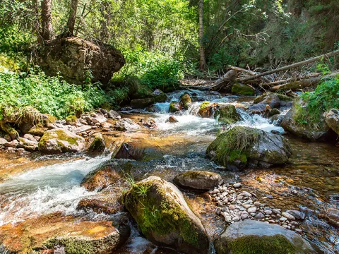
History and nature by the Guadalquivir River are the proposals for this route full of contrasts that leads us to some of the most significant points of the Natural Park of the saws of Cazorla, Segura and the Villas.

The great protagonist is, of course, the Guadalquivir River, which we will see docile in the olive and narrow and noisy countryside in the high parts of the valley where he has been in charge of modeling the magnificent landscapes we will see. You can appreciate the contrast between people full of history and culture, who live together with a natural environment that is invariable and full of life: you will find wild animals, forests that cover the whole landscape, high mountains and water everywhere.

Latitud
37.9053
Longitud
-2.9552
Distrito
Ubicación en el mapa
POINT (-2.9552 37.9053)
imagen
Image
agua-sierra%20%281%29.png
Imagen principal
Activado
imagen
Image
5%20%284%29.jpg
Imagen principal
Desactivado
imagen
Image
6%20%283%29.jpg
Imagen principal
Desactivado
imagen
Image
Natu225.jpg
Imagen principal
Desactivado

Nature

icon-intereses-naturaleza

Friends

icon-intereses-amigos

Adventure

icon-intereses-aventura

Culture

icon-intereses-cultura

Sport

icon-intereses-deporte

Eco-friendly

icon-intereses-eco-friendly

For couples

icon-intereses-en-pareja

Family

icon-intereses-familia

Gastronomy

icon-intereses-gastronomia

Municipality

icon-intereses-municipio

Low-cost tourism

icon-intereses-turismo-low-cost

Solo travel

icon-intereses-viajar-solo
Cerrada del Utrero - Torre del Vinagre
Desactivado
Tramo de asfalto o cemento
 
Tramo de pista o camino forestal
 
Tramo de vía pecuaria
 
Tramo de senda
 

Route Ornitológica Sierra de Cazorla

Submitted by brandcode_deweloper on
Id
6216167
Descripción larga

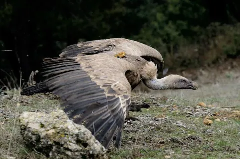
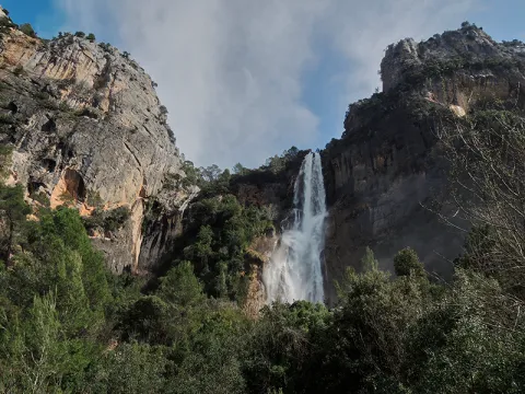
From here, with a little patience and luck, we can take advantage of the nearby feeding station for scavenging birds to enjoy the majestic flight of the griffon vulture, the most numerous of our large birds of prey. It may delight us by gliding just a few metres above the treetops of the surrounding pine forest. Other birds of prey can also be observed from here, including common buzzards and booted eagles.

From here, we continue along the same road until reaching Empalme del Valle, the point where this route connects with the main route when starting from the village of Arroyo Frío. We then turn right towards Vadillo-Castril. At this former timber settlement on the banks of the Guadalquivir River, we can make a second stop. Either by walking along the riverbanks through the village or by spending a little more time completing the circular Cerrada del Utrero trail on foot, which is also of ornithological interest, we can observe a wide variety of riverside bird species. These include the white-throated dipper, a reliable indicator of good water quality; the grey wagtail, moving among the rocks emerging from the water; Cetti’s warblers; and, in spring, the colourful golden oriole, among others.

Continuing onwards, after crossing the Iron Bridge beside the Cerrada del Utrero trail, we reach a fork where we turn left and climb towards Las Navas. We leave behind the Lanchales de Linarejos, a beautiful karst landscape where, with a little patience, it is possible to observe the agile Iberian ibex. By remaining quiet and carefully examining the trunks of the surrounding trees, we may also see several small but beautiful woodland bird species, such as Eurasian nuthatches, short-toed treecreepers, coal tits and long-tailed tits. We continue to the Los Collados forest house, where the unpaved forest track begins. This track takes us along the Cuesta del Bazar to Nava del Espino.

A little further uphill, on our right, we find the first viewpoint overlooking Los Poyos de la Mesa. Griffon vultures are frequently seen flying here, and with luck we may also observe golden eagles, booted eagles and short-toed snake eagles. The latter are present during spring and summer, after returning to these mountains from their wintering grounds in Africa.

We continue climbing through beautiful forests of maritime pine, holm oak and a number of old Portuguese oaks. The undergrowth consists of rosemary, marjoram, turpentine trees and rockroses. As we ascend the Cuesta del Bazar, the maritime pines gradually give way to majestic European black pines. We are now in the Oro-Mediterranean vegetation zone, where these slender pine trees grow alongside centuries-old Portuguese oaks, hawthorns, barberries and prickly cushion plants.

We have reached the beginning of Nava del Espino, a beautiful high plateau covered with dense European black pine forests and high-mountain grasslands. It is surrounded by striking peaks such as Cabeza del Tejo and Cerro de Pedro Cerrillo, where fallow deer can often be seen running swiftly across the landscape, grazing or resting beneath the shade of a pine tree.

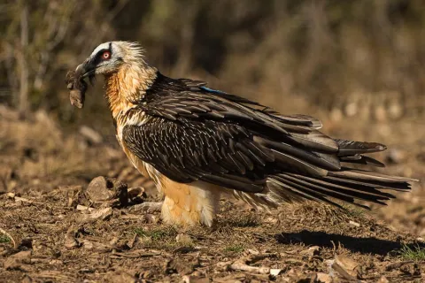
We continue along the forest track, passing the Fuente de la Garganta recreational area, until reaching La Esperilla, where the second viewpoint dedicated to Félix Rodríguez de la Fuente is located. This viewpoint overlooks Nava de San Pedro and Torcales del Lobo. It is well worth spending some time here and using binoculars to scan this magnificent landscape in search of a great spotted woodpecker, green woodpecker or carrion crow hidden among the scrub or the interwoven branches of the replanted poplar groves. Looking towards the sky, it is not unusual to see the silhouette of a golden eagle, peregrine falcon, griffon vulture, raven or one of the bearded vultures released as part of the species reintroduction programme. The Bearded Vulture Captive Breeding Centre is now located beside the former Nava de San Pedro Game Park. This ambitious project is producing successful results, as this threatened species has once again returned to the skies above these mountains.

We continue along the route and, after passing through the cutting, reach a viewpoint overlooking Vado de las Carretas. On days with good visibility, it is possible to see as far as Sierra Nevada National Park. A little further uphill, beside the former farmsteads of Poyo Manquillo, a short path on our left leads to the third viewpoint. It overlooks a beautiful holm oak woodland growing over limestone slabs, as well as the impressive cliffs of Torcales del Lobo and, further away, Cerro de las Cabañas, Puerto Pinillo and Torcal de Linares.

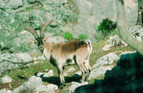
We return to our vehicle and, after travelling approximately two kilometres, reach the fourth viewpoint in the area known as Estrecho de los Perales. Here, beautiful and unusual geological formations surround the crystal-clear waters of the Valdetrillos Stream. Agile mouflons and male Iberian ibex can often be seen climbing the vertical rock walls, while golden eagles, griffon vultures and booted eagles may be observed flying majestically overhead. Flocks of unusual birds with crossed bills may also be seen. These are crossbills, remarkably adapted to feeding in pine forests and using their distinctive bills to extract seeds from pine cones. Another small bird that may be observed here is the citril finch.

We continue along the forest track, passing the former Fuente Acero forest house. One kilometre further on, we reach beautiful and impressive limestone cliffs, dominated by the peaks of Loma del Caballo de Acero, Alto de la Cabrilla and Navalasno. These were the last places where the bearded vulture nested before disappearing from the area in 1986–1987.

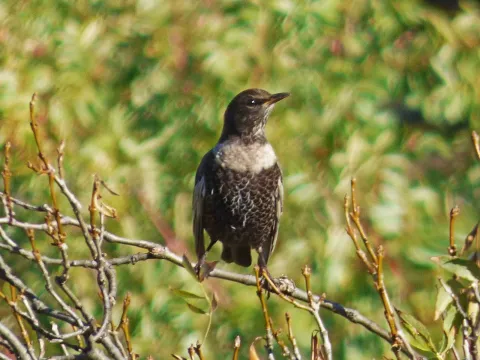
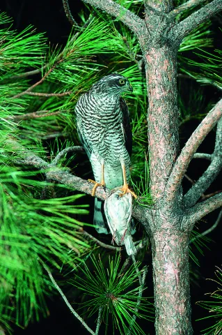
Continuing along the forest track and passing Collado de Fuente Bermejo, we arrive at Collado de la Zarca. On our left stands an impressive European black pine more than 300 years old. From here, there are beautiful panoramic views over the Guadalentín Ravine and the Natural Park’s great limestone formations, including Navalasno, Poyos de la Carilarga and La Cabrilla. At the end of the route, we reach the area known as Ramblaseca, the gateway to the renowned Campos de Hernán Perea. This high plateau has sparse vegetation because of the harsh environmental conditions and, above all, the pressure of livestock grazing. An endless variety of small birds can be seen in these open uplands, taking advantage of livestock drinking troughs as sources of water. These include chaffinches, crossbills, mistle thrushes, common rock thrushes and ring ouzels, with the latter two being more frequent in winter. Northern goshawks and Eurasian sparrowhawks may also be seen waiting for an opportunity to catch one of the birds that lowers its guard while drinking.

All that remains is to return along the same route to the Puente de las Herrerías junction. Here, we can either return along the same route used on the outward journey or take the road leading to the source of the Guadalquivir River and then continue to El Chorro. There, we can enjoy views of a griffon vulture colony situated on vertical cliffs of imposing beauty. Griffon vultures, red-billed choughs and crag martins can be observed, as well as Egyptian vultures and Alpine swifts during the breeding season. Please note that this alternative route considerably increases both the duration and distance of the journey, so it is advisable to complete it on a separate day.

Breve descripción

It begins in Cazorla, a village of a unique beauty catalogued as an artistic historical ensemble that is also the head of the Sierra de Cazorla region. We take direction to the Natural Park on the A-319 road, through the village of La Iruela and Burunchel, just before entering its limits, we continue on the winding mountain road, ascending to reach the Port of the Palomas and the Paso del Aire, at this point we can take advantage to make the first stop contemplating the difference of landscape between the slope facing the Guadalquivir Valley and the direction to the agricultural countryside covered by the olive mantle that covers these lands.

Latitud
37.91334
Longitud
-3.002196
Municipio
Ubicación en el mapa
POINT (-3.002196 37.91334)
imagen
Image
sierra-cazorla%20%282%29.png
Imagen principal
Activado
imagen
Image
quebrantahuesos-espana-3.jpg
Imagen principal
Desactivado
imagen
Image
buitres.jpg
Imagen principal
Desactivado
imagen
Image
33621933485_2b6a232942_b.jpg
Imagen principal
Desactivado
imagen
Image
Sierra-Cazorla.jpg
Imagen principal
Desactivado
imagen
Image
P1450025.JPG
Imagen principal
Desactivado
imagen
Image
Natu035.jpg
Imagen principal
Desactivado
imagen
Image
Natu206.jpg
Imagen principal
Desactivado

Nature

icon-intereses-naturaleza

Friends

icon-intereses-amigos

Adventure

icon-intereses-aventura

Culture

icon-intereses-cultura

Sport

icon-intereses-deporte

Eco-friendly

icon-intereses-eco-friendly

For couples

icon-intereses-en-pareja

Family

icon-intereses-familia

Gastronomy

icon-intereses-gastronomia

Municipality

icon-intereses-municipio

Low-cost tourism

icon-intereses-turismo-low-cost

Solo travel

icon-intereses-viajar-solo
Baja
Ruta Ornitológica Sierra de Cazorla
All year round
Desactivado
Coordenadas / Huso 30S
30S x = 499807 and = 4196200

Piedra del Agujero

Submitted by brandcode_deweloper on
Id
5930013
Breve descripción

It is located between Navalperal and Cerro Bucentaina near the Camping de la Canalica.
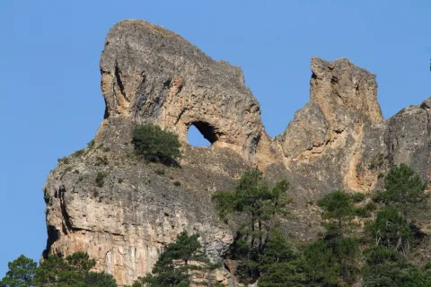
Also known as Horadada Stone, the Hole Stone marks a geomorphological milestone in the landscape.
It is part of a north-south mountain alignment, whose main reliefs are Navalperal and Bucentaina. The "Hole Stone" is a magnificent example of uniform relief in dolomies. These are dolomies with subhorizontal stratification with several caves that cross the peak, and with a very well developed "dentado" relief.
Access is only possible on foot, but the environment can be visited on the route "Circular Peña del Olivar" from the Sierra de Segura Road Network.

Latitud
38.388735
Longitud
-2.589807
Distrito
Municipio
Ubicación en el mapa
POINT (-2.589807 38.388735)
imagen
Image
1%20%281%29.jpg
Imagen principal
Activado
imagen
Image
Piedra%20del%20Agujero.jpg
Imagen principal
Desactivado

Nature

icon-intereses-naturaleza
Piedra del Agujero
Desactivado
Coordenadas / Huso 30S
30S x = 535823 and = 4249027
Tramo de asfalto o cemento
 
Tramo de pista o camino forestal
 
Tramo de vía pecuaria
 
Tramo de senda
 

Senderismo el Pocico

Submitted by brandcode_deweloper on
Id
5714152
Descripción larga

It begins in the Plaza de España de Jódar, where we can enjoy the facade of the facade of the Church of the Assumption (16th century). We continue on the c / General Noriega to Jódar Castle. We went up the c / Plaza del Castillo to the Hall of Nature Felix R. de la Fuente. From there, through the peri-urban park we access the Mirador de Traschina.

Behind us is the starting point of our "Los Pocicos" path, outside the city centre. We can get information on the information panel. We will follow an old well-defined horseshoe path leaving the town behind. We will gradually go up to a small hill where there was the Hermitage of San Cristobal, which gives name to this hill. We divised an ancient olive tree still in operation called "Primera Pocico." It has an old mine and a small water spring. We'll look back for a nice view.

We will follow a small stretch of lane about 100 m and we will take the path to the left again. After moving through almonds, we will pass through a short stretch of olive trees until we connect back to the lane at the end of the climb.

From here on the ground changes. We can observe the "Second Pocco" at the front, between olive lands and some isolated carrasco pines. Our goal is the rock formations we have in the West direction. When we reach the lane curve, we will take the second path that ascends between olive trees. We will continue straight on the path that leads us to the "Second Pocco" hill. From here we will have wonderful views of the Cazorla Natural Park, Segura and Las Villas and the Guadalquivir Valley.

At this point we surround the limestone formations to come down by the so-called Turrilla Hace. This is an ancient land of rain cultivation. The coat of the rock has an old cattle abrevadero, and on this one we must admire a curious rocky pinnacle: Peña Pescezo. We will go down among the almonds to continue our path. At 100 meters down we will take a lane with a certain slope that we will climb to turn left and continue our route.

During the return we will have another perspective of the town of Jódar as we walk between arbustive and herbaceous vegetation. The mountain is dominated by spartum: raw material of great importance to Jódar in the past.

Breve descripción

This hiking route has a linear part and a circular final section. It has a total distance of 7 km.

Latitud
37.844513
Longitud
-3.354832
Distrito
Municipio
Ubicación en el mapa
POINT (-3.354832 37.844513)
imagen
Image
10.jpg
Imagen principal
Activado
imagen
Image
turismoActivo1.jpg
Imagen principal
Desactivado

Nature

icon-intereses-naturaleza

Friends

icon-intereses-amigos

Adventure

icon-intereses-aventura

Culture

icon-intereses-cultura

Sport

icon-intereses-deporte

Eco-friendly

icon-intereses-eco-friendly

For couples

icon-intereses-en-pareja

Family

icon-intereses-familia

Gastronomy

icon-intereses-gastronomia

Municipality

icon-intereses-municipio

Low-cost tourism

icon-intereses-turismo-low-cost

Solo travel

icon-intereses-viajar-solo
Senderismo el Pocico
Desactivado
Coordenadas / Huso 30S
30S x = 468781 and = 4188623

Route cicloturista de Andújar a Baños de la Encina

Submitted by brandcode_deweloper on
Id
2641192
Descripción larga

We left Andujar in the direction of the Peñallana vineyards through the Ctra. J-501. In the km. About 14,400, after passing the Los Pinos Restaurant, we take a road that comes out to the right; we go into it we will get to Los Escoriales, leave to our left a dish of bulls or tentadero and, at about 100 m., we will get a track to the right that we will take; here we can observe an interesting darkness occupied preferably by alcornocals, at some points as a mature or climate community on a sediment-type substrate. When we begin to descend, we will leave to our right the Cerro del Moro, an elevation that maintains a well-developed shroud, we will pass through the house of the Gorgojil and the Nava de Andújar, dehesa ganadera and place of transit that allows to observe the typical topographic relief of Sierra Morena and the crops of the geological domain of Guadalquivir, coming to the reservoir of the Rumblar, a sheet of water perfectly attached to the steep relief and, from here, to Baños de la Encina, one of the four municipalities that make up the Natural Park of Sierra de Andújar, the whole of the city of the town of the city of the city of the city of the city of the city of the city of the town of the city of the city of the city of the town of the city of the city of the town of the city of the city of the town of the city of the city of the city of the city of the town of the town of the town of the town of the town of the town of the town of the town of the town of the town of the town of the town of the town of the town of the town of

Breve descripción

Unbeatable views of the local castle. First Km by road and soft profile.

Stage without any complication.

Latitud
38.17381
Longitud
-3.844715
Distrito
Municipio
Ubicación en el mapa
POINT (-3.844715 38.17381)
imagen
Image
16811388.jpg
Imagen principal
Activado
imagen
Image
Ruta%20cicloturista%20de%20And%C3%BAjar%20a%20Ba%C3%B1os%20de%20la%20Encina.jpg
Imagen principal
Desactivado

Nature

icon-intereses-naturaleza

Friends

icon-intereses-amigos

Adventure

icon-intereses-aventura

Culture

icon-intereses-cultura

Sport

icon-intereses-deporte

Eco-friendly

icon-intereses-eco-friendly

For couples

icon-intereses-en-pareja

Family

icon-intereses-familia

Gastronomy

icon-intereses-gastronomia

Municipality

icon-intereses-municipio

Low-cost tourism

icon-intereses-turismo-low-cost

Solo travel

icon-intereses-viajar-solo
Ruta cicloturista de Andújar a Baños de la Encina
In Bicycle, Horse, on foot
All year round
Desactivado
Coordenadas / Huso 30S
30S x = 426011 and = 4225437
Tramo de asfalto o cemento
 
Tramo de pista o camino forestal
 
Tramo de vía pecuaria
 
Tramo de senda
 

Montaña del Castillo and Pinares del Nevaral

Submitted by brandcode_deweloper on
Id
2615395
Descripción larga

One of these routes starts right above the Almond Quarter, at the junction of the Circumvalation Road with the rise to the Castillo-Parador de Turismo. Towards the south side of the hill of the Castle of Santa Catalina, next to the road of ascending to the Castilla-Hospital El Neveral, a narrow path rises between almonds under the vertical walls that serve as foundations to the walls of the castle. The itinerary presented here has the possibility of being extended with other surrounding areas.

We will pass to a water tank and then we will enter the pine until we leave to a crossing of the road right next to the Caño Quebrado fountain. From the back of the forest house in this Source continues a path parallel to the road. We followed her until we crossed the track next to the El Neveral Recreative Zone. We continue on the path that goes up between the pine and the olive grove, overlooking the Hospital of El Neveral, and pass by another water tank, until we reach a clear area of trees from where we will see a closed curve a crossing and continue to glide and leave the crossing to the right and another to the left. We will connect with a track that, after, a small climb that places us at more than 1000 meters of height, just below the Cerro de los Morteros, descends to the previous recreational area, culminating the circular stretch of this path and then continuing on the road already travelled to the fountain of Caño Quebrado, at the crossing with access to the Castle.

Right next to this crossing, in front of the Fountain is taken a descending lane to the north side and to the city of Jaén, which immediately becomes a path from which we will enjoy beautiful views of the city through the pines. We had a small olive tree and crossed the wall of Almohad origin (11th century). In this area, in the direction of the decks of the Cross of the Castle, through the wall through the door there, there are some scarves that have traditionally been the school of the Jiennese climbers. By a final stretch of the downhill track we will go to the Circumvalation Road, already in the Magdalena district, again in the city of Jaén.

Breve descripción

Recently, hiking routes (PR-A 126 and 127) have been identified in the immediate mountains to the city of Jaén, in particular in the Periurban Park of the Neveral and Castle of Santa Catalina, which is mostly made up of a magnificent forest of Pinus halepensis and rocky areas. This tour is sometimes used by athletes from the capital, for hiking, all-terrain bike, trial bike, mountain race and climbing. This is an area of environmental value that offers resources for the practice of different activities.

Latitud
37.6002
Longitud
-3.8401
Distrito
Municipio
Ubicación en el mapa
POINT (-3.8401 37.6002)
imagen
Image
2498238.jpg
Imagen principal
Activado
imagen
Image
Monta%C3%B1a%20del%20Castillo%20y%20Pinares%20del%20Nevaral.jpeg
Imagen principal
Desactivado

Nature

icon-intereses-naturaleza

Friends

icon-intereses-amigos

Adventure

icon-intereses-aventura

Culture

icon-intereses-cultura

Sport

icon-intereses-deporte

Eco-friendly

icon-intereses-eco-friendly

For couples

icon-intereses-en-pareja

Family

icon-intereses-familia

Gastronomy

icon-intereses-gastronomia

Municipality

icon-intereses-municipio

Low-cost tourism

icon-intereses-turismo-low-cost

Solo travel

icon-intereses-viajar-solo
Montaña del Castillo y Pinares del Nevaral
Activado

Circular.
Length: 6 Km.
Difficulty: Low / medium.

Tramo de asfalto o cemento
 
Tramo de pista o camino forestal
 
Tramo de vía pecuaria
 
Tramo de senda
 

GR-48

Submitted by brandcode_deweloper on
Id
2575177
Descripción larga

The entire route has been divided into 28 linear stages and one circular alternative route in the province of Seville. All of them can be comfortably completed during a single day of hiking. Each stage begins and ends either in one of the municipalities through which the trail passes or in places where food and overnight accommodation are available, such as the Sanctuary of the Virgen de la Cabeza in the Sierra de Andújar.

In the province of Jaén, the GR 48 is divided into five stages. Some of these are among the longest in the whole of Sierra Morena and, without detracting from the routes through the other three provinces, they are among the most highly appreciated by hikers because of their exceptional beauty.

The Jaén section of the GR 48 is characterised by its varied landscapes. Along the route, the typical wooded pastureland of Sierra Morena, where livestock graze, alternates with the steep slopes of the Sierra de Andújar and the foothills of Despeñaperros. Here, gorges, ravines and medium-altitude mountains create an evocative landscape reminiscent of high-mountain regions.

The Sierra Morena trail in Jaén is divided into five stages, taking us from Marmolejo to the centre of Santa Elena. Along the way, the route passes close to important landmarks such as the Sanctuary of the Virgen de la Cabeza, the outstanding historical heritage of Baños de la Encina and the former mining pasturelands around La Carolina. The journey crosses constantly changing landscapes in which Mediterranean woodland blends with more rugged natural surroundings, creating spectacular scenery whose colours vary throughout the year and are at their finest in autumn and spring.

However, this route offers much more than scenery. The absence of major towns in the heart of the mountains has allowed the area to remain exceptionally well preserved, making it relatively easy to observe birds and mammals at almost any point along the GR 48.

The great biodiversity of this territory provides an opportunity to observe unique species of both fauna and flora. The Sierra de Andújar is one of the last remaining strongholds of the Iberian lynx, as well as being home to other protected species such as the cinereous vulture and the golden eagle. As this area is one of the most important hunting regions in Spain, sightings of large mammals such as red deer, fallow deer and wild boar are very frequent and almost commonplace. Extensive cattle-grazing estates with herds of fighting bulls are another attraction, becoming more common as the trail continues towards the north-east of the province, particularly along the central section between the Sierra de Andújar Natural Park and the Despeñaperros Natural Park.

In addition to the species already mentioned, those interested in herpetology will find a significant amphibian population along the Jaén section of the GR 48. This includes species found exclusively on the Iberian Peninsula, such as the Iberian painted frog, the Iberian newt and the Iberian midwife toad.

The vegetation encountered along the route consists mainly of typical Mediterranean woodland and scrub, dominated by holm oak forests with rockroses, mastic trees and wild olive trees. These are complemented by examples of the conifer plantations established in the mid-20th century, particularly the pine forests around the Sierra de Andújar and near Santa Elena in Despeñaperros. Along the streams and rivers crossed by the GR 48, hikers can also appreciate riverside woodland, such as that found along Los Santos Stream during the first stage, the Jándula River during the second and the Campana River during the final stage.

When walking the GR 48, it should be remembered that the stages cover long distances and are best completed over full days. Food and supplies are available at the beginning and end of each stage. Nevertheless, particularly on the longer stages, it is advisable to carry plenty of water, as Sierra Morena is typically dry and there are few springs where hikers can quench their thirst. The time of year should also be considered carefully, as summers in Sierra Morena are extremely hot, with very high temperatures during the summer months. Anyone wishing to complete the trail during July or August should therefore plan their schedule carefully and alternate periods of walking with adequate rest.

In addition to the sensory pleasure of walking along this trail, each stage leads to fascinating places that reveal the rich heritage left in the province by different civilisations. Throughout the route, there are numerous reasons to make short detours and explore the past: archaeological sites and prehistoric cave paintings provide a connection with ancient history; the magnificent medieval heritage of Baños de la Encina and the nearby battlefield of the Battle of Las Navas de Tolosa in Santa Elena recall the Middle Ages; while the elegant urban layouts of the New Settlements of Sierra Morena and the surrounding mining remains provide evidence of the province’s more recent history.

Breve descripción

The GR 48 Path of Sierra Morena is the long-distance route that allows you to cross this mountain range from west to east. They are 590 Km of signposted itinerary and conditioning that begin their journey in the Portuguese town of Barrancos, on the border of Andalusia with Portugal, and from there it leads us to a tour of the provinces of Huelva, Sevilla, Córdoba and Jaén, ending in the municipality of Santa Elena, opening the door to the Natural Park of Despeñaparos.

Latitud
38.052907
Longitud
-4.238353
Distrito
Municipio
Ubicación en el mapa
POINT (-4.238353 38.052907)
imagen
Image
image_161430%20%281%29.jpeg
Imagen principal
Activado
imagen
Image
santuario-2-jpg
Imagen principal
Desactivado
imagen
Image
pag33-despenaperros-032-png
Imagen principal
Desactivado
imagen
Image
_mg_5140-jpg
Imagen principal
Desactivado
imagen
Image
_mg_2137-jpg
Imagen principal
Desactivado
imagen
Image
pag21-despenaperros-ciervos-png
Imagen principal
Desactivado

Friends

icon-intereses-amigos

Nature

icon-intereses-naturaleza

Solo travel

icon-intereses-viajar-solo

Gastronomy

icon-intereses-gastronomia

For couples

icon-intereses-en-pareja

Family

icon-intereses-familia

Adventure

icon-intereses-aventura

Culture

icon-intereses-cultura

Sport

icon-intereses-deporte

Municipality

icon-intereses-municipio

Low-cost tourism

icon-intereses-turismo-low-cost

Eco-friendly

icon-intereses-eco-friendly
GR-48
Spring and autumn
Activado
Coordenadas / Huso 30S
30S x = 391352 and = 4212409

Trail de la Mina de Mimbre

Submitted by brandcode_deweloper on
Id
2149819
Descripción larga

This place is known as Christ of the Valley. 20 meters to the left, on the other side of the road is an old house in ruins with rocks piled to its side by tapping and hiding an old road that descends to the well El Calvary, surrounded by vegetation and where it impresses its support of cabria and fireplace. We must continue on a narrow road that leads to the Mina del Mimbre, where we will be particularly careful not to get out of the way by the various sinking of the ground that can be appreciated.

We follow the route without leaving the main track, with a south direction, until we reach a crossing near two large houses in ruins, where we leave the track.

This mine is one of the oldest in the district and had an important production already in the 17th century. Later, it is connected to the Mimbre Coast and the La Garza path, PR-A 262. We will have to overcome this common stretch to a closed curve before the slope is over, where the PR-A 262 is separated to the right and heading to the Arrayanes Mineral Laundry. We follow the route without leaving the main track, with a south direction, until we reach a crossing near two large houses in ruins, where we leave the track to follow the road leading to the well San Vicente, the deepest of the district, where the double masonry goat stands out. The Via Verde, a point very close to the San Luis Fundition, is later crossed. Without changing course we continue on a wide track across the track, which we will not leave at any time until we return to the Hermitage of Linarejos.

Breve descripción

Circular path that begins in the Hermitage of Linarejos and continues along the way of the old railway Linares- Los Salidos that, among olive trees, leads to the San Luis Foundry. After exceeding the Fundition the road is abandoned and to the right you have to take a dirty lane that has as reference, 50? m., a house in ruins with three eucalyptus. After a curve to the left the lane is occupied by an olive grove, but it does not prevent the passage; then you have to follow to the right until you reach the green track that links the La Cruz Foundry with the well 4 and Linares.

Latitud
37.8104
Longitud
-3.4803
Distrito
Municipio
Ubicación en el mapa
POINT (-3.4803 37.8104)
imagen
Image
filxn_La_Tortilla.jpg
Imagen principal
Activado

Family

icon-intereses-familia

Friends

icon-intereses-amigos

Nature

icon-intereses-naturaleza

Adventure

icon-intereses-aventura

Solo travel

icon-intereses-viajar-solo

Culture

icon-intereses-cultura

Gastronomy

icon-intereses-gastronomia

Sport

icon-intereses-deporte

Municipality

icon-intereses-municipio

Low-cost tourism

icon-intereses-turismo-low-cost

Eco-friendly

icon-intereses-eco-friendly

For couples

icon-intereses-en-pareja
Sendero de la Mina de Mimbre
On foot
All year round
Activado

Route: Cambil-Mata Bejid-Centro Visitantes Natural Park-Huelma-Arbuniel-Cambil

Submitted by brandcode_deweloper on
Id
7395615
Descripción larga

In the first section we go through three points of interest: the corrijada of Mata Bejid, set of regional-style constructions, the Centre of Visitors of the Natural Park and the bosquet with meringeros area of the Sanctuary of the Fuensanta. In addition in this first part of the route we will find conveniently marked the beginning of the most interesting trails of the massif: Torres Ports and Ascension to the Magic Pico. To the Ctra. A-324 will circulate for 17 km to Huelma. We advise to stop at the Mata Bejid Visitors Center, which in addition to an interesting presentation on the environmental and cultural values of the Natural Park and an audiovisual, has a small shop and meringero area adapted for people with reduced mobility. The Visitors' Centre is open from Thursday to Sunday (check time per season).

You will continue to Huelma, where you can visit two Renaissance monuments that perfectly explain the grandiosity of this population, of these mountains in the 16th century: the Church of the Immaculate Conception, the work of Andrés de Vandelvira, and the castle that watches the people from above.

The second section of the route runs on horseback in the provinces of Granada and Jaén. From Huelma we'll take the Ctra. JA-4204 for four kms. We'll continue for 4 km. More for the Ctra. GR-3100. These are the landscapes of the mountain cereal, increasingly reduced in extension due to its low profitability, but that in times not so far away were the sustenance of the families of the area. The feeling that is perceived in the contemplation of these moors is of remoteness, of isolation, a rural world that is extinguishing.

Attention because you have to turn right on the Ctra. JA-3205, by which you will go down a steep slope towards Arbuniel. To this point you take 35 kms. since you left Cambil. Arbuniel is known for its water spring that feeds the irrigations of the area, through a system of waterfalls that remains active, and that passes through this small population belonging to the municipality of Cambil. The spring is surrounded by a little park, a magnificent place to rest.

From Arbuniel, and in only 8 km. from a road that passes through olive landscapes, we will reach Cambil by the Ctra. JA-3204. Cambil has sufficient restoration services. Do not stop walking through its urban town and be surprised with some Baroque facades, such as the Hospital (18th century).

Breve descripción

A route to know endangered landscapes, this route crosses some of the most interesting forest masses of Sierra Magina, but also the mountain cerealist landscapes that remain hidden in this corner of Andalusia. It is a circular route that begins and ends in Cambil, so it can be done in both ways.

Latitud
37.6681
Longitud
-3.5742
Distrito
Municipio
Ubicación en el mapa
POINT (-3.5742 37.6681)
imagen
Image
Castillo_de_Alhabar01.jpg
Imagen principal
Desactivado
imagen
Image
cambil%20%281%29.jpg
Imagen principal
Desactivado
1 h (sin incluir paradas)

Nature

icon-intereses-naturaleza

Culture

icon-intereses-cultura
Medium
Ruta: Cambil-Mata Bejid-Centro Visitantes Parque Natural-Huelma-Arbuniel-Cambil
44 km
All year round
Desactivado

Start in Cambil direction Huelma.

It ends in Cambil.