Montaña del Castillo and Pinares del Nevaral


Description
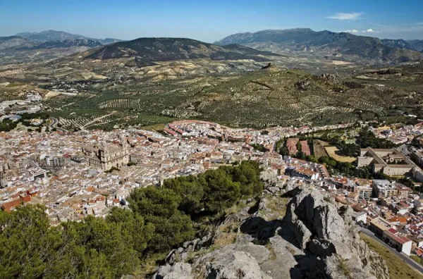
Recently, hiking routes (PR-A 126 and 127) have been identified in the immediate mountains to the city of Jaén, in particular in the Periurban Park of the Neveral and Castle of Santa Catalina, which is mostly made up of a magnificent forest of Pinus halepensis and rocky areas. This tour is sometimes used by athletes from the capital, for hiking, all-terrain bike, trial bike, mountain race and climbing. This is an area of environmental value that offers resources for the practice of different activities.
Datos de la ruta
ROUTE NAME
Montaña del Castillo y Pinares del Nevaral
TRAIL TYPE
Circular
DIFFICULTY
--
TOTAL DISTANCE (IN KILOMETERS) --
-
Stretch of asphalt or concrete:
-
Section of track, forest road, or dry watercourse:
-
Trail section:
-
Sections of livestock trails:
HUSO 30S
ESTIMATED TRAVEL TIME
ROAD SURFACE TYPE
Trail
--
--
DIFFICULTY. RATING ACCORDING TO THE MIDE METHOD
--
MEANS
Severity of the natural environment
--
ITINERARY
Route guidance
--
DISPLACEMENT
Difficulty moving about
--
EFFORT
Amount of effort required
ACCESSIBILITY TYPE
TIME OF YEAR
SIGNALING
Sí
MORE INFORMATION
TUNNELS
STEEL VIADUCTS
METAL WALKWAYS
WATER POINTS
PONTOONS
GUARD BOOTHS AND BARRIERS
SWITCHMAN'S CABINS
CYCLABILITY
RECREATIONAL OR SPORTS AREAS NEAR THE TRAIL
AID STATIONS
LINKS TO OTHER TRAILS
SHELTERS
RECOMMENDATIONS
OTHER INFORMATION OF INTEREST (ARCHITECTURAL OR HISTORICAL-CULTURAL, GEOLOGICAL-ECOLOGICAL)
Circular.
Length: 6 Km.
Difficulty: Low / medium.
Technical Description
One of these routes starts right above the Almond Quarter, at the junction of the Circumvalation Road with the rise to the Castillo-Parador de Turismo. Towards the south side of the hill of the Castle of Santa Catalina, next to the road of ascending to the Castilla-Hospital El Neveral, a narrow path rises between almonds under the vertical walls that serve as foundations to the walls of the castle. The itinerary presented here has the possibility of being extended with other surrounding areas.
We will pass to a water tank and then we will enter the pine until we leave to a crossing of the road right next to the Caño Quebrado fountain. From the back of the forest house in this Source continues a path parallel to the road. We followed her until we crossed the track next to the El Neveral Recreative Zone. We continue on the path that goes up between the pine and the olive grove, overlooking the Hospital of El Neveral, and pass by another water tank, until we reach a clear area of trees from where we will see a closed curve a crossing and continue to glide and leave the crossing to the right and another to the left. We will connect with a track that, after, a small climb that places us at more than 1000 meters of height, just below the Cerro de los Morteros, descends to the previous recreational area, culminating the circular stretch of this path and then continuing on the road already travelled to the fountain of Caño Quebrado, at the crossing with access to the Castle.
Right next to this crossing, in front of the Fountain is taken a descending lane to the north side and to the city of Jaén, which immediately becomes a path from which we will enjoy beautiful views of the city through the pines. We had a small olive tree and crossed the wall of Almohad origin (11th century). In this area, in the direction of the decks of the Cross of the Castle, through the wall through the door there, there are some scarves that have traditionally been the school of the Jiennese climbers. By a final stretch of the downhill track we will go to the Circumvalation Road, already in the Magdalena district, again in the city of Jaén.
We recommend