Saltar al contenido principal

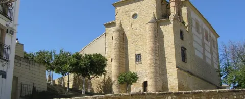
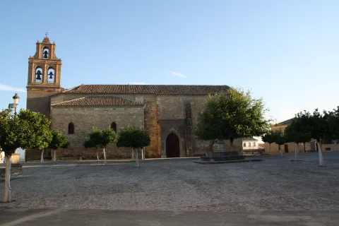
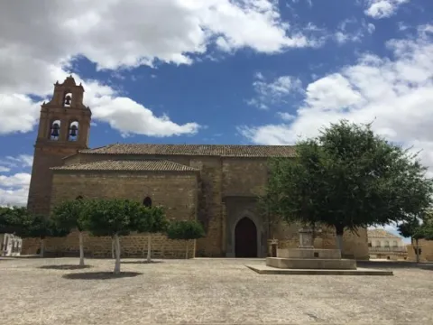
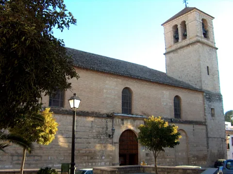
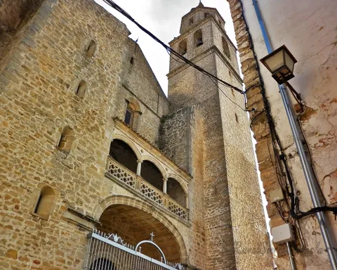
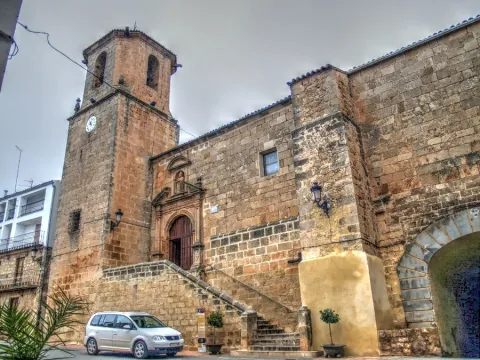
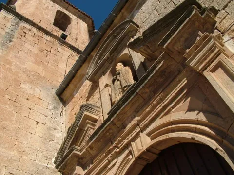
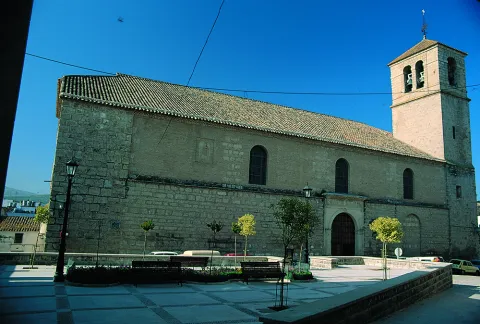
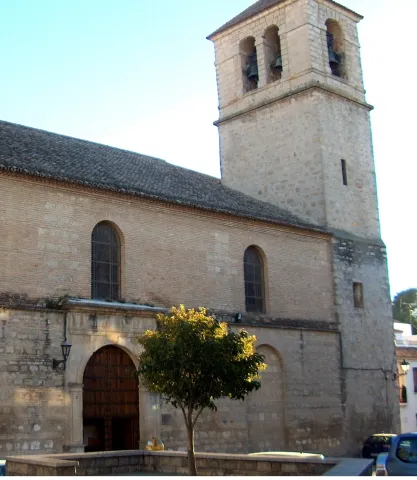
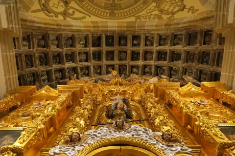
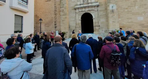
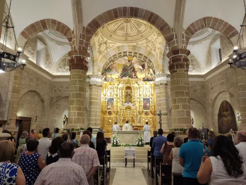
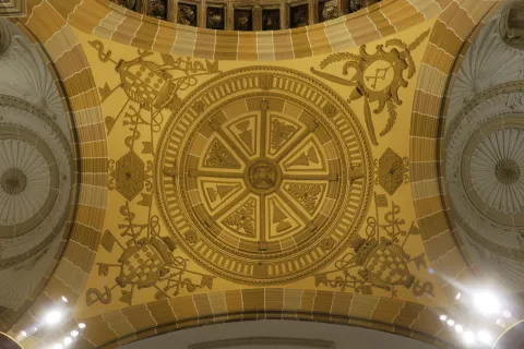
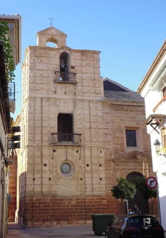
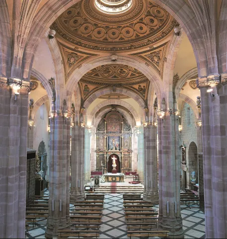
Church of Santa María la Mayor

Submitted by brandcode_deweloper on
Id
5867824
Descripción
Breve descripción
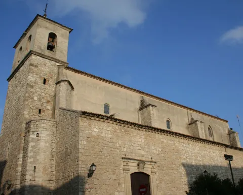
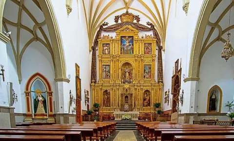
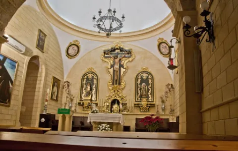
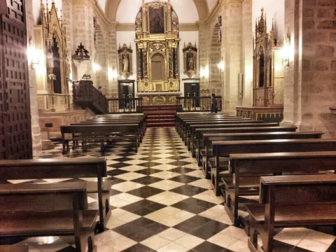
The Iglesia de Santa Marina de Andújar, one of the oldest and most representative temples in the city, is presented as a setting of great heritage value for the celebration of cultural events, institutional presentations or unique events. Its sober and elegant architecture creates a solemn and evocative atmosphere that adds a unique character to any gathering. Capacity: Old Church Room: 125 Location: Andujar Available services: Television, sound table, recording, projector and public address system
Ubicación
Código Postal
23740
Latitud
38.037410
Longitud
-4.055990
Dirección
Plaza Sta. María, s/n
Distrito
Municipio
Ubicación en el mapa
POINT (-4.05599 38.03741)
Tipos de punto de interés
Imágenes carrusel
imagen
Image
Iglesia%20de%20Santa%20Mar%C3%ADa%20Andujar2.jpg
Imagen principal
Desactivado
Imágenes cabecera
imagen
Image
INTERIOR_IGLESIA_DE_SANTA_MARIA.jpg
Imagen principal
Activado
Horario
Winter: Tuesday to Sunday 11:30 - 13:30 and 17:30 - 20:00. Summer: Tuesday to Sunday 11:30 - 13:30 and 18:00 - 21:30.
Loading map
Preparing points of interest and routes...
Church of Santa María del Collado

Submitted by brandcode_deweloper on
Id
4763780
Descripción
Descripción larga

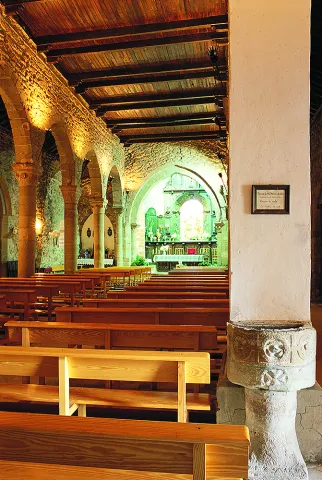
In the 13th century, during the reign of Fernando III (1217-1252) or that of his son Alfonso X (12122-1284), the columns were used to make a fully Romanesque church of three ships and head of three semicircular apses.

The portico is also of Romanesque trace, although in it you can see the point of the outer arches, characteristic this from the time of transition to the Gothic period. The columns inside the temple are cylindrical and base by imitating the old attic with the circular molding and he painted it square. The capitals are primordial and have a wide variety of motifs, from geometric figures and vegetable ornaments of leaves, rosetons and fruits, to animal figures such as lions, bulls, fish, goats and human figures.

The arches are pointed and the roof presents in the part corresponding to the cruise, a large vault of stone edge and in that of the ships a wooden craft. At the entrance of the presbytery there are two half columns with capitel with saw tooth ornaments, which support a large opival arc.

By the 16th century the church's enclosure was extended on the old trail, surely for greater needs of worship. The 16th century also brought together the artistic altarpiece of the Altar Mayor, which serves as an armour to the shrimp of the Virgin.

Another point to be highlighted is the chorus gate and silery both of a silver style. The gate of this, is adorned by a series of columns where there are carved various ornamental motifs, such as human and animal heads as well as fruit clusters.

The capital of these columns is Ionian. At the top door of the entrance door to the choir there is a large shield with the weapons of Don Francisco Delgado, which was preached in Jaén from 1566 to 1576. The chorus's silery is kept in good condition and all its chairs over half a shell and separated by columnites, where there are carved the same themes of the columns of the gate and as in this and on the central chair, are the weapons of the Bishop of Jaén indicated above.

The bottom of the seats is also finely worked, presenting geometric motifs. On both sides of the choir there are so many other chapels that have the wooden gate following that of the choir and with the same ornamental sizes.

Breve descripción

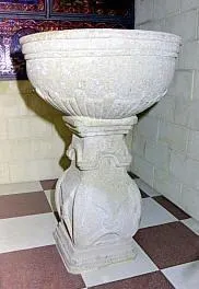
It was originally a visionary temple, as can be seen in the medallions that adorn the back of the temple and some that are preserved in the apse. Also visigoda epoch belongs a pile of holy water.

Ubicación
Latitud
38.248231
Longitud
-3.208180
Dirección
C/ Sta. María, 11
Distrito
Ubicación en el mapa
POINT (-3.20818 38.248231)
Tipos de punto de interés
Imágenes carrusel
imagen
Image
Mon273%20%281%29.jpg
Imagen principal
Desactivado
imagen
Image
Mon274%20%281%29.jpg
Imagen principal
Desactivado
imagen
Image
Mon275%20%281%29.jpg
Imagen principal
Desactivado
Imágenes cabecera
imagen
Image
6.jpg
Imagen principal
Activado
Microsite al que pertenece
Loading map
Preparing points of interest and routes...
Church of Santa María del Collado

Submitted by brandcode_deweloper on
Id
913898
Descripción
Descripción larga

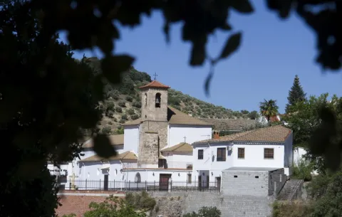
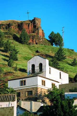
It is through the visit of October 9, 1525 that we know that the parish church of Santa María del Collado is being made again, at the head of the factory, the bartender Maese Rodrigo. Through the description made by the visitors in the visit to the temple on January 19, 1537 it seems that the temple was finished.

On this occasion with the visitors, the master singers Francisco de Luna and Andrés de Vandelvira travelled to Segura de la Sierra, without a doubt to inspect what was built by Maese Domingo, which apparently presented certain problems; Luna and Vandelvira made a statement "(...) for the security repair of the yglesia desta villa e de la nesçaña that çerca dello has and what in it they contenydo make haber in the yglesia that they do from here two years first that they verge (...)."

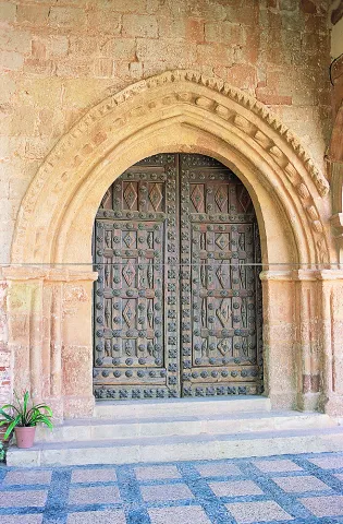
The documentation silences the detailed content of this statement and, therefore, we do not know the level of intervention of both teachers, but they had to give orders to solve the defects of the Gothic factory built by Maese Rodrigo, but also to end, among other works, the tower chapitel, the chorus stairs or the vaulted chapel of baptism. However, the most clearly vandelvirian piece preserved in the temple is its main cover, covered by a large arcosolio with a half-canyon vault of Spanish-manchega tradition; it was ordered to work by the visitors in 1554, although the order was not carried out until the end of the century.

Vandelvira died in 1575 and, therefore, was not able to take care of it, but in any case the piece responds to a clear compositional scheme developed by it in the covers of the churches of San Miguel de Jaén, San Juan Evangelista de Mancha Real, or that of San Nicolás in Ubeda, but with a greater constructive and ornamental dryness not without classical correction; it is formed by the consabid arch of half-point on impostes with jambos and threaded, which is flanqué by two pairs of columns of compound and transphizon the same, with the two-and-a-a-a-a-a-a-a-a-a-a-a-a-a-a-a-a-a-a-a-a-a-a-a-a-two-a-a-a-a-a-a-a-a-a-a-a-two-a-a-a-a-a-a-a-a-a-a-a-a-a-a-a-a-a-a-a-a-a-

The data provided and the consequences that can be derived from them suggest a direct intervention by Andrés de Vandelvira in the church of Segura de la Sierra and a fluid relationship with the sanctiaguists responsible for his factory. This relationship was initiated thanks to his father-in-law Francisco de Luna, a singing teacher whose professional activity from the beginning was closely linked to the Order of Santiago on Spanish-manchegas lands.

Breve descripción

Monument of the Historical-Artistic Set. Declared 05 / 07 / 1962 The practical visits by the visitors of the Order of Santiago to the populations dependent on the Encomienda de Segura de la Sierra, provide us with numerous data on the situation of their parish factories, some of them built on a new floor, others with important works of consolidation, expansion or reform.

Telecomunicaciones
Sitio web
www.seguradelasierra.es/patrimonio/iglesia-de-santa-maria-del-collado.html
Teléfono de contacto
953 480 280
Correo electrónico
administracion@seguradelasierra.es
Ubicación
Código Postal
23379
Latitud
38.298300
Longitud
-2.652100
Dirección
Plaza de los Jesuitas, 1
Distrito
Ubicación en el mapa
POINT (-2.6521 38.2983)
Tipos de punto de interés
Imágenes carrusel
imagen
Image
ntra_sra_collado.jpg
Imagen principal
Desactivado
imagen
Image
segura-de-la-sierra-iglesia-1-jpg
Imagen principal
Desactivado
Imágenes cabecera
imagen
Image
Iglesia%20de%20Santa%20Mar%C3%ADa%20del%20Collado%201.jpg
Imagen principal
Activado
Microsite al que pertenece
Loading map
Preparing points of interest and routes...
Church of Santa María del Alcázar

Submitted by brandcode_deweloper on
Id
5619802
Descripción
Breve descripción
It is an Elizabethan style temple (16th century), with a single nave and transept with short arms. Located on a sacred place since ancient times (Roman, Visigoth and Muslim remains), it was built on the remains of the primitive Arab mosque. Since 1843, the church has guarded the images of the town's patron saints: San Bonoso y San Maximiano, along with that of Santa María del Alcázar, who was also the patron saint of the city. The temple is built as a church with a military or fortress appearance, surrounded by buttresses. In 1936, the Church was burned and suffered serious damage: doors, chapels... (a fact that the author captures in the work The Templar Tombstone). The current appearance of the Church is due to the reforms it underwent after this destruction. The Iglesia de Santa María has been guarding the images of the Patrons of the San Bonoso y San Maximiano town since 1843 to protect them since the confiscation of Mendizábal. (…) (…) They crossed the esplanade of the orange trees and headed to the Santa María church. The side doorway, with a beautiful Gothic arch, reproduced the original lost when the fire of 1936, which completely destroyed the temple, leaving only four walls. Fortunately, the Bafomet from the old photographs still persisted on the main façade (…)
Ubicación
Código Postal
23760
Latitud
37.935360
Longitud
-4.054290
Dirección
Plaza Sta. María, s/n
Distrito
Municipio
Ubicación en el mapa
POINT (-4.05429 37.93536)
Tipos de punto de interés
Imágenes carrusel
imagen
Image
Mon291.jpg
Imagen principal
Desactivado
imagen
Image
250px-Arjonasantamaria05.jpg
Imagen principal
Desactivado
imagen
Image
Iglesia%20de%20Santa%20Mar%C3%ADa%20del%20Alc%C3%A1zar2.jpg
Imagen principal
Desactivado
imagen
Image
Iglesia%20de%20Santa%20Mar%C3%ADa%20del%20Alc%C3%A1zar.jpg
Imagen principal
Desactivado
Imágenes cabecera
imagen
Image
iglesia-de-santa-maria.jpg
Imagen principal
Activado
Microsite al que pertenece
Loading map
Preparing points of interest and routes...
Church of Santa María

Submitted by brandcode_deweloper on
Id
4884621
Descripción
Descripción larga

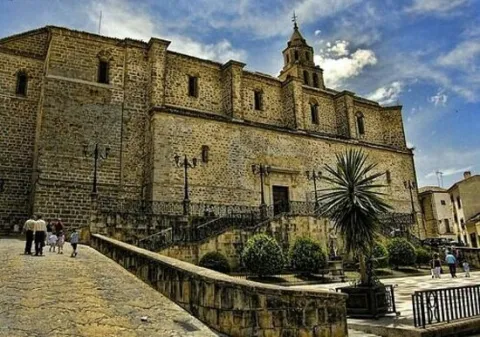
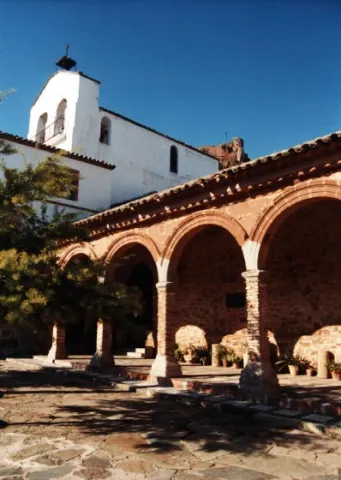
Outside, the temple offers a staggered volume due to the different heights of the ships, the facades counterstrengths and the presence of the torre-bell tower. The main facade stands out from the whole by the body of the tower attached to the wall and by the cover, made up of a conopial arch with archivoltas and columns with the capitals of pitchers.

On the northern façade the cover of the 18th century is opened, formed by a half-point arch framed by pilassas, while on the side, work of 1529, the door is located from the old palace of Villalta or Casa de la Torre.

Breve descripción

The Church was built by the Order of Calatrava during the first quarter of the 16th century and extended in the 18th century. It combines the Gothic and late baroque architectural styles. The church occupies part of the site of the ancient Islamic fortress, whose materials were reused for construction. The building stands out for its volume and verticality of the tower. The 18th century additions focused on the construction of a new ship with the chapel and the shrimp of the Virgin of the Dolores.

Telecomunicaciones
Sitio web
www.tosiria.com
Teléfono de contacto
953 571 754
Ubicación
Código Postal
23650
Latitud
37.767660
Longitud
-3.957810
Dirección
Plaza Sta. María, 0
Distrito
Municipio
Ubicación en el mapa
POINT (-3.95781 37.76766)
Tipos de punto de interés
Imágenes carrusel
imagen
Image
iglesia%20de%20santa%20maria%20torredonjimeno2.JPG
Imagen principal
Desactivado
imagen
Image
iglesia-santa-maria-2.jpg
Imagen principal
Desactivado
Imágenes cabecera
imagen
Image
iglesia%20de%20santa%20maria%20torredonjimeno.jpg
Imagen principal
Activado
Microsite al que pertenece
Loading map
Preparing points of interest and routes...
Church of Santa Lucía

Submitted by brandcode_deweloper on
Id
3848324
Descripción
Descripción larga

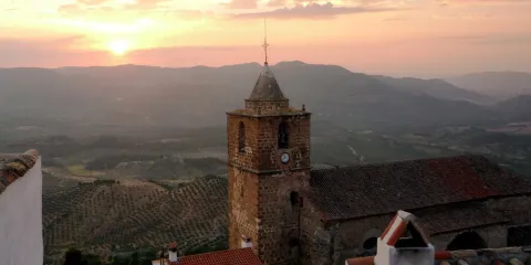
In the century of the great reforms (XVIII), the friar church became the help of the parish of Santa María la Mayor, of Alcalá la Real (1778). New works were made in charge of Master Jacinto Pérez, which consisted of lengthening the ship and building a major chapel that was not there.

Church of Saint Lucia - 124; Views
In the second half of the 19th century, the church was dedicated to the Virgin of the Dolores and the dimensions of the building were not enough for the number of neighbors. It had an altarpiece composed of several paintings and chaired by an image of the size of the Dolorosa, attributed to José de Mora. There were only three altars on the ship. From this time it was the wooden door with claverie, dated 1852.

At the end of the 20th century and by the hand of the parish priest Alberto Jaime Martínez Pulido, the reform was carried out which we can see today, maintaining the ancient elements, but with a view to the new millennium. From this stage is the magnificent craftsman that was made in Atarfe (Granada) in the workshop of 'The Three Juans'.

Among the oldest elements still stands the tower-bell tower, with three bells bearing the sound names of Our Lady of the Dolores, San Rafael and Virgen de las Mercedes.

Breve descripción

It owes its origin, like so many other churches, to a hermitage. In 1550, Pedro de Valencia built at his expense this, on a site that he acquired from Bartolomé Fernández de Montemolín and cost the image of Saint Lucia. The master, Manuel García del Álamo, built the altarpiece of the Rosary, which is now missing. In 1778, shortly before he was erected in parish, he brought the baptismal pile of the Alcalaine church of the Mota. Three years later, devotion to Our Lady of the Dolores was consolidated.

Telecomunicaciones
Sitio web
www.frailes.es/iglesia-de-santa-lucia-frailes
Teléfono de contacto
953 593 028
Ubicación
Código Postal
23690
Latitud
37.485130
Longitud
-3.837780
Dirección
C/ de la Caridad, 1
Distrito
Municipio
Ubicación en el mapa
POINT (-3.83778 37.48513)
Tipos de punto de interés
Imágenes carrusel
imagen
Image
Iglesia%20de%20Santa%20Luc%C3%ADa.jpg
Imagen principal
Desactivado
imagen
Image
Iglesia%20de%20Santa%20Luc%C3%ADa3.jpg
Imagen principal
Desactivado
imagen
Image
Iglesia%20de%20Santa%20Luc%C3%ADa4.jpg
Imagen principal
Desactivado
imagen
Image
Iglesia%20de%20Santa%20Luc%C3%ADa2.jpg
Imagen principal
Desactivado
Imágenes cabecera
imagen
Image
iglesia-santa-lucia-frailes-geydes-2.jpg
Imagen principal
Activado
Microsite al que pertenece
Loading map
Preparing points of interest and routes...
Church of Santa Isabel de los Ángeles

Submitted by brandcode_deweloper on
Id
4635783
Descripción
Descripción larga

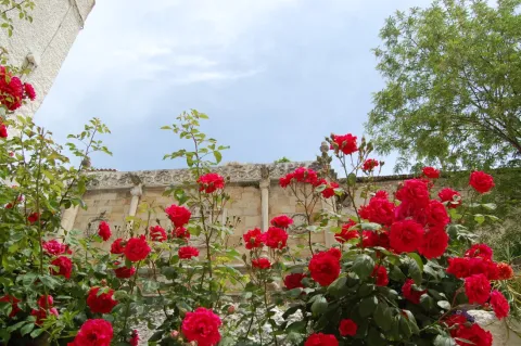
Its construction seems to start around 1576, and so the details and style place it in the late 16th and early 17th century. The plant is one ship (living room) with a high choir at the end and the vaults on the deck are half-canyon. The breasts of this dome have frescoes attributed to the village of Escudero de la Torre. The golden altarpiece has an 18th-century salomonic columns. The facade is made of stone with irregular armchairs with a simple three-body slate that rises at the northwest angle of it. The cover, attributed to the architect Juan de Aranda and Salazar (Master Major of the Cathedral of Jaén and continuator of Vandelvira), reigns an elegant classicism with a hornacino in which is found the stone image of Santa Isabel, the church holder. In this church, on August 25, 1812, the solemn act of swearing of the new Constitution of Cadiz, "La Pepa," was held.

Breve descripción

In the steep "Cuesta de las Monjas," Ramón y Cajal street, Villacarillo is located the church of Santa Isabel de los Angeles. The building attached to the temple was a closing convent until 1737, a public prison during the French occupation and, from 1884, a hospital to which the services of the former San Lorenzo Hospital were transferred. Today it houses several municipal units.

Telecomunicaciones
Sitio web
www.villacarrillo.es/fotografias-iglesia-santa-isabel-de-los-angeles/
Teléfono de contacto
953 440 000
Ubicación
Código Postal
23300
Latitud
38.114090
Longitud
-3.088570
Dirección
C/ Ramón y Cajal
Municipio
Ubicación en el mapa
POINT (-3.08857 38.11409)
Tipos de punto de interés
Imágenes carrusel
imagen
Image
Iglesia%20de%20Santa%20Isabel%20de%20los%20%C3%81ngeles.jpg
Imagen principal
Desactivado
imagen
Image
Iglesia%20de%20Santa%20Isabel%20de%20los%20%C3%81ngeles2.jpg
Imagen principal
Desactivado
Imágenes cabecera
imagen
Image
villacarrillo-20.jpg
Imagen principal
Activado
Horario
Jul, ago and sept: Wednesday 11: 00 - 13: 00.
Loading map
Preparing points of interest and routes...
Church of San Pedro Chiclana de Segura

Submitted by brandcode_deweloper on
Id
4437596
Descripción
Descripción larga

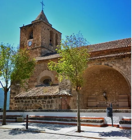
Between the two hills the square was established, which would henceforth be the religious and political centre of the people. There, between the end of the 16th century and the first third of the 17th century, the parish church of San Pedro was erected in an explanade located in a peñasco, on the site of an ancient medieval temple. Its only plant is rectangular with four hornadine chapels and flat tester presbytery. As an autonomous ornament of the architectural one can describe the pile of holy, Renaissance, carved stone water; the image in size of the Virgin, from the 18th century; and, something later, the oil of St. Peter.

The outer vision of the parishioners is impressive: magnificent silvery, counter-strong, and steps to access the southern cover, which has a half-point bow flanked by the curved pilasters, a ball-split fronton, a hornaine in the eardrum and another, this time curved fronton, to host the image of the holy headline. The most prominent element may be the tower, raised on the side of the epistle, of square floor and two bodies, the bass with two windows, vault and arch and covered down, and, separated by a cornice, the second body, with canyon vault and snail staircase and, to the outside, half-point vanos for bells and corners with flanked flyers; a cornose with three gargoes with anthropomorphic figures is the whole.

Breve descripción

The population core that formed around the peñasco, bordering the castle, gradually expanded at the feet of the nearby hill, that of the Atalaya.

Telecomunicaciones
Sitio web
www.chiclanadesegura.es
Teléfono de contacto
953 466 300
Correo electrónico
chiclana@promojaen.es
Ubicación
Código Postal
23264
Latitud
38.312480
Longitud
-3.042520
Dirección
C/ Concha Albacete, s/n
Distrito
Municipio
Ubicación en el mapa
POINT (-3.04252 38.31248)
Tipos de punto de interés
Imágenes carrusel
imagen
Image
glesia%20de%20San%20Pedro%20Chiclana2.jpg
Imagen principal
Desactivado
Imágenes cabecera
imagen
Image
Iglesia%20de%20San%20Pedro%20Chiclana%20de%20Segura%20foto2.jpg
Imagen principal
Activado
Microsite al que pertenece
Loading map
Preparing points of interest and routes...
Church of San Pedro Apóstol

Submitted by brandcode_deweloper on
Id
4884849
Descripción
Breve descripción

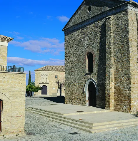
In Renaissance style, designed by Francisco del Castillo "El Mozo" and built in 1592. It is divided into three ships by sober columns of Tuscan order that support a Mudejar artisan: that of the right dedicated to the Virgin of the Angustias, that of the left is occupied by the Christ of Love and at the bottom the Chapel of the Virgin of Carmen. On the presbyterium is the fourth-sphere vault, on pechines, covered with frescoes of the Celestial Glory. The altarpiece, from the first third of the 17th century, originates from a convent of Valladolid. It also highlights the large number of pictorial works of Easter.

Telecomunicaciones
Sitio web
http://www.parroquiasanpedroapostol.wordpress.com/
Teléfono de contacto
953 344 224
Correo electrónico
webparroquiasanpedro@gmail.com
Ubicación
Código Postal
23650
Latitud
37.765080
Longitud
-3.959090
Dirección
Plaza San Pedro, 1
Distrito
Municipio
Ubicación en el mapa
POINT (-3.95909 37.76508)
Tipos de punto de interés
Imágenes carrusel
imagen
Image
Mon219.jpg
Imagen principal
Desactivado
Imágenes cabecera
imagen
Image
San-pedro-apostol%20%281%29.jpg
Imagen principal
Activado
Microsite al que pertenece
Loading map
Preparing points of interest and routes...
Church of San Pedro Apóstol

Submitted by brandcode_deweloper on
Id
4619062
Descripción
Descripción larga

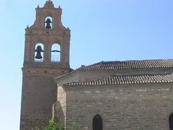
The building, with marked influences of Vandelvira, Francisco del Castillo "El Viejo," and Alonso Barba, despite the reforms it has undergone over the centuries, retains the taste of the late 16th century.

Breve descripción

The Church of San Pedro, an architectural jewel of the Renaissance, is located in the centre of the old town, and together with the Tower and the Casa Palacio, they make up the most emblematic and significant constructions of the city.

Telecomunicaciones
Sitio web
https://mengibarturismo.com/
Teléfono de contacto
677 222 285
Correo electrónico
turismo@aytomengibar.com
Ubicación
Código Postal
23620
Latitud
37.967900
Longitud
-3.808700
Dirección
Plaza de la Constitución, 1
Distrito
Municipio
Ubicación en el mapa
POINT (-3.8087 37.9679)
Tipos de punto de interés
Imágenes carrusel
imagen
Image
mengibar-restauracion-de-la-cupula-1140-03.jpg
Imagen principal
Desactivado
imagen
Image
Mengibar%204%20%281%29.jpg
Imagen principal
Desactivado
imagen
Image
223516263_3604595952977317_5352155631937089749_n.jpg
Imagen principal
Desactivado
Imágenes cabecera
imagen
Image
mengibar-restauracion-de-la-cupula-1140-02.jpg
Imagen principal
Activado
Microsite al que pertenece
Loading map
Preparing points of interest and routes...