Saltar al contenido principal

Hiking Route Senda de Pescadores

Submitted by brandcode_deweloper on
Id
5727942
Descripción larga


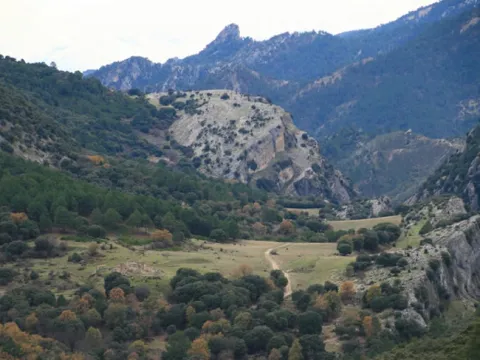
The Guadalanimín River is made up of small streams that come down from the Cabilla saw at the height of the Majal de la Carrasca, receives the Arroyo de los Arenales and already with a permanent channel flows through the bottom of a deep ravine in a south direction. It receives in the Vado de las Carretas to the stream of San Pedro, of intermittent waters, and in the Cerrada de la Canaliega to the stream of the Tornillos de Gualay. Always in the south direction and at the bottom of a deep ravine receives the streams of the Acebadillas and the Cold stream, at the height of the closed of the same name and flows into the Guadiana Menor river, at the height of the Negratin reservoir, between the municipalities of Cuevas del Campo and Zújar. Its channel serves as a divisive between the saw of the Cabrilla and that of the well
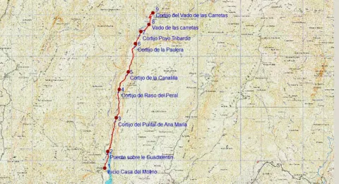
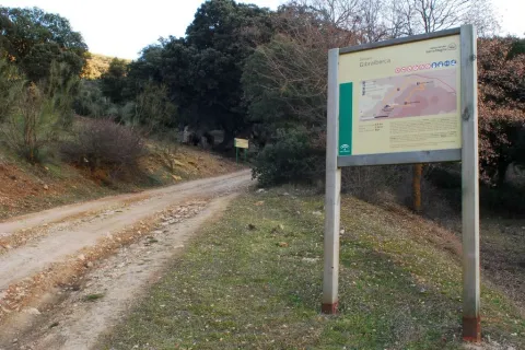
The tour begins on the track that runs through the reservoir of the Bolera by its left margin in the forest house of the Molinillo, which can be reached by ground track in any type of vehicle.

200 meters from the start signal, there is a fork, which we will take to the right, walking the tail of the Bolera reservoir.
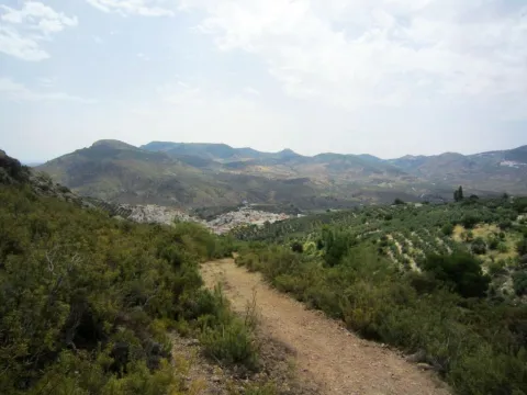
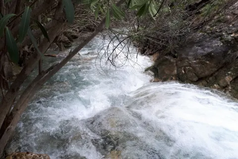
At 900 m we reach a bridge that crosses the Guadaltiín River, with crystal clear and pure waters, in a place of unique beauty that is the Cerrada de la Herradura. From here, and already on the right bank of the valley, a rise of approximately 3 km begins that will take us to the Cortijo del Raso del Peral. The rise is continued, just 200 m from passing the bridge are left the Cortijos de los Tontos, leaving also the edge of a cut on the Guadalanimin that well deserves to be seen, with several clings and closed. Later on we left to our left the cortijo of the Puntal de Ana María. The Cañada del Mesto, which we can travel through and which is used by flocks of sheep and goats in their annual journeys in search of fresh pastures, runs through this section.
As the Cortijo del Raso del Peral passes, the track begins a slight descent through numerous ruinous cortijadas and others in very good condition such as the Canalilla 5 km, the Paulera 6.5 km and Poyo Tribaldos 7.2 km from the beginning.
Finally the track reaches the river, in the area known as Vado de las Carretas, a pleasant and paradoxical place that well deserves a stop. The river will have to be watered, if we want to reach the cortijos of the Vado de las Carretas, to do so by crossing it we will have to follow the front and despise the track that goes to the right following the channel. These cortijos, still inhabited, are only 1,000 m from where we are.

Breve descripción

The Guadalanimín River is made up of small streams that come down from the Cabilla saw at the height of the Majal de la Carrasca, receives the Arroyo de los Arenales and already with a permanent channel flows through the bottom of a deep ravine in a south direction. It receives in the Vado de las Carretas to the stream of San Pedro, of intermittent waters, and in the Cerrada de la Canaliega to the stream of the Tornillos de Gualay. Always in the south direction and at the bottom of a deep ravine receives the streams of the Acebadillas and the Cold stream, at the height of the closed of the same name and flows into the Guadiana Menor river, at the height of the Negratin reservoir, between the municipalities of Cuevas del Campo and Zújar.
Latitud
37.876404
Longitud
-2.877082
Municipio
Ubicación en el mapa
POINT (-2.877082 37.876404)
imagen
Image
658_img.png
Imagen principal
Activado
imagen
Image
shutterstock_1060474277.jpg
Imagen principal
Desactivado
5 h 20 min (ida y vuelta)

Nature

icon-intereses-naturaleza

Friends

icon-intereses-amigos

Adventure

icon-intereses-aventura

Culture

icon-intereses-cultura

Sport

icon-intereses-deporte

Eco-friendly

icon-intereses-eco-friendly

For couples

icon-intereses-en-pareja

Family

icon-intereses-familia

Gastronomy

icon-intereses-gastronomia

Municipality

icon-intereses-municipio

Low-cost tourism

icon-intereses-turismo-low-cost

Solo travel

icon-intereses-viajar-solo
Medium
1164
Image
1dbd612a-b301-2f7c-6099-b1496d217079?t=1607022009228
Image
329bed14-b7c1-1544-5bc9-8b07893b576e?t=1607022019451
SENDA DE PESCADORES
9 km (solo ida)
386m
235m
2
1
1
3
Horse, on foot and bike
All year round
Desactivado
Image
f8cc619e-be85-15bc-f798-92ce55adb865?t=1607022131867

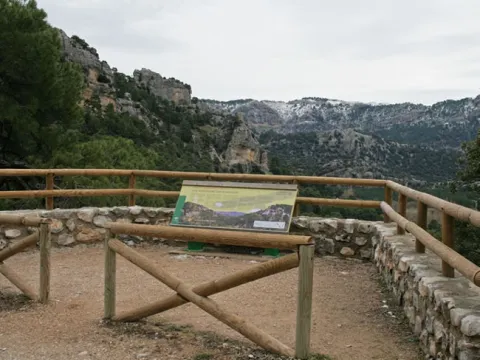
Point of revival or rest next to the Cortijo del Saso del Peral

The Vado de las Carretas is a link point with another very well-known path, which is circular and that runs through the upper part of the Barrio del Gualatentín, Fuente Steel, the Strait of Perales and the Trench.

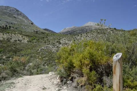
The tour is marked by beacons with directional arrows.
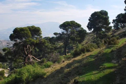
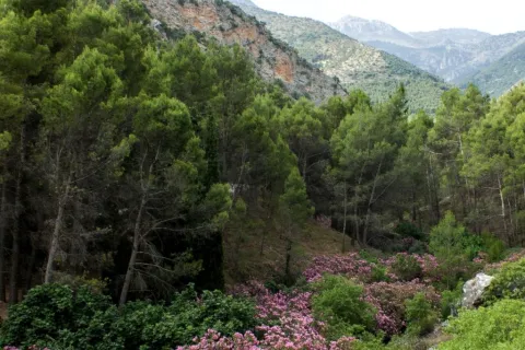
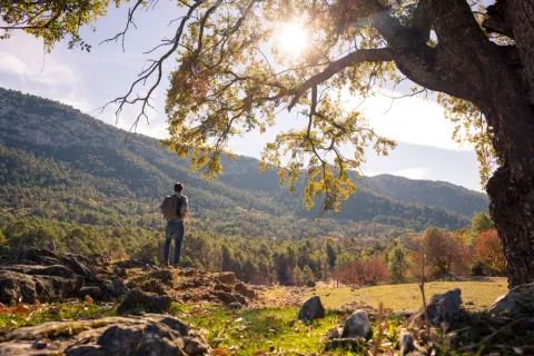
It has great botanical wealth with spectacular examples of larix pine and centenary complaints.., abundant presence of large rapacious birds (leonate vulture, real eagle, real owl...)
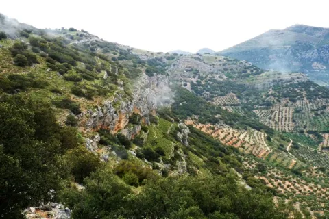
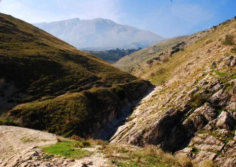
Deep-ravine geomorphological formation (Guadalanimin and Cerrada de la Canaliega) between the Cortijo de la Paulera and the Cortijo de Poyo Tribaldos.

At the Casa del Molino, located later on the Hornico in the Bolera reservoir. It is accessed from Pozo Alcón by the A-326 taking a track that is in the km 7.9 to the left, that you have to travel 14 km to the Casa del Molino.

1015

Cortijo Vado de las Carretas
1164
Coordenadas / Huso 30S
30S x = 510810 and = 4192109
Tramo de asfalto o cemento
0
Tramo de pista o camino forestal
0.01
Tramo de vía pecuaria
0
Tramo de senda
0

Trail Veredón-Mojón Blanco

Submitted by brandcode_deweloper on
Id
4982563
Descripción larga

The path from the Veredón to Mojón Blanco runs along the Pecuaria route Colada Fuente de la Teja, in Pegalajar. It allows us to climb to the peak in which the municipal terms of Pegalajar, Mancha Real and Torres are joined, and from which are seen spectacular views of the Bercho umbria, one of the most steep and wild areas of the municipal term Pegalajar. We can also enjoy amazing views of the Sierra de Jaén.

It is a relatively short path that we can complete with a visit to the beautiful village of Pegalajar and its famous pond, which in the years of abundant rains appears as a huge pond within the urban centre.

This path can be linked to those who come from the Royal Mancha, as well as other pecuary ways, or even, to the Pico Almadén.

Breve descripción

The path from the Veredón to Mojón Blanco runs along the Pecuaria route Colada Fuente de la Teja, in Pegalajar. It allows us to climb to the peak in which the municipal terms of Pegalajar, Mancha Real and Torres are joined, and from which are seen spectacular views of the Bercho umbria, one of the most steep and wild areas of the municipal term Pegalajar. We can also enjoy amazing views of the Sierra de Jaén.

It is a relatively short path that we can complete with a visit to the beautiful village of Pegalajar and its famous pond, which in the years of abundant rains appears as a huge pond within the urban centre.

This path can be linked to those who come from the Royal Mancha, as well as other pecuary ways, or even, to the Pico Almadén.

Latitud
37.7861
Longitud
-3.6286
Distrito
Municipio
Ubicación en el mapa
POINT (-3.6286 37.7861)
imagen
Image
1561_SS_05.jpg
Imagen principal
Activado
imagen
Image
Sendero%20Vered%C3%B3n-Moj%C3%B3n%20Blanco.jpg
Imagen principal
Desactivado
imagen
Image
1561_SS_04.jpg
Imagen principal
Desactivado
imagen
Image
1561_SS_02.jpg
Imagen principal
Desactivado
1 h 30 min

Nature

icon-intereses-naturaleza

Friends

icon-intereses-amigos

Adventure

icon-intereses-aventura

Culture

icon-intereses-cultura

Sport

icon-intereses-deporte

Eco-friendly

icon-intereses-eco-friendly

For couples

icon-intereses-en-pareja

Family

icon-intereses-familia

Gastronomy

icon-intereses-gastronomia

Municipality

icon-intereses-municipio

Low-cost tourism

icon-intereses-turismo-low-cost

Solo travel

icon-intereses-viajar-solo
Medium
Sendero Veredón-Mojón Blanco
2,9 km
On foot
All year round
Desactivado
  • In front of COVID19, keep the safety distance and carry a mask, avoid agglomerations and contact with surfaces, wash your hands frequently, use hydroalcoholic gel and consult the available digital materials. Take care of your health and others.
  • It works to prevent fires. Do not throw cigarettes or any other object that produces combustion.
  • By consuming local products and having companies in the area you will contribute to rural development.
  • He lives with the local people and other users. It respects private property and property.
  • Unwind in a sustainable way: public transport, bike, walk, shared vehicle...
  • Noise is another form of pollution. In silence you will enjoy your experience more.
  • It facilitates the use of people with special needs.
  • The trash doesn't come back alone. Take her with you to the nearest container. Reduce, reuse, recycle.
  • Don't leave a mark on your way through nature.
  • It practices a responsible and committed tourism with the environment. Be a real ecotourist!
  • Respect the facilities at your disposal. We all pay for your maintenance.
  • Check the weather forecast before starting your activity.
  • Avoid going out alone. If you do, it communicates tour and time of return to other people.
  • Extreme caution under adverse conditions and with the occasional presence of animals or motor vehicles.
  • Please provide prior information on the possible existence of cynegetic activity.
  • It has water, sun protection, proper clothes and shoes.
  • It carries a mobile with enough battery in case of emergency (112), but remember that there is not always coverage.
  • Don't even bother animals. You would negatively alter his behavior.
  • For your safety and the safety of the environment, don't get out of the signposted road or take shortcuts.
  • Remember that the capture of animals, light fire, fish and collect plants or minerals is prohibited.
  • If you bring a dog, take him with his strap and make sure he doesn't bother other animals or people.
  • Your safety is our concern, but it's your responsibility.

Thank you for your cooperation!

From the city centre of Pegalajar itself, go along the Vereda Real Ubeda-Granada, along the track leading to Mount Bercho. The path begins about 5 km from the village.

Tramo de asfalto o cemento
 
Tramo de pista o camino forestal
 
Tramo de vía pecuaria
 
Tramo de senda
 

Trail Ascent to Hoando de la Laguna

Submitted by brandcode_deweloper on
Id
4982394
Descripción larga

We begin our itinerary on the way to Los Orchertos, between olive groves and orchards irrigated by the waters of the Garganton River that are transported through the existing waterfalls. Then we link with the pecuaria track, which ascends between aulagas and rosemary by this path used for transhumanism. In our tour we will see the Torre del Lucero, a relatively well-preserved atalaya, which during the Reconquest (XIII-XV) was part of the defensive system of the kingdom of Granada.

From the Collado del Lucero we see the castles of Bélmez and Solera and we enter into an encore mixed with some maple. We walk through a Kárstico modeling landscape, a limestone that culminates with a dolina known as the Hoyo de la Laguna, the largest of this protected space.

From the end of the path you can link with the signposted path Caño del Aguadero, with beginning in the recreational area Cuadros.

Breve descripción

This beautiful path has its beginning next to the park of the Birth, located in the urban town of Bélmez de la Moraleda, entering into the heart of the Sierra Magina Natural Park by the Cordel de la Laguna. In this area we can see the agricultural, livestock and forestry uses of the area, various defensive constructions and the Arctic modeling of Sierra Magina.

Latitud
38.1104
Longitud
-2.5903
Distrito
Ubicación en el mapa
POINT (-2.5903 38.1104)
imagen
Image
1552_SS_05.jpg
Imagen principal
Activado
imagen
Image
Sendero%20Subida%20al%20Hoyo%20de%20la%20Laguna2.jpg
Imagen principal
Desactivado
imagen
Image
1552_SS_04.jpg
Imagen principal
Desactivado
imagen
Image
1552_SS_01.jpg
Imagen principal
Desactivado
2 h 30 min

Nature

icon-intereses-naturaleza

Friends

icon-intereses-amigos

Adventure

icon-intereses-aventura

Culture

icon-intereses-cultura

Sport

icon-intereses-deporte

Eco-friendly

icon-intereses-eco-friendly

For couples

icon-intereses-en-pareja

Family

icon-intereses-familia

Gastronomy

icon-intereses-gastronomia

Municipality

icon-intereses-municipio

Low-cost tourism

icon-intereses-turismo-low-cost

Solo travel

icon-intereses-viajar-solo
Medium
Sendero Subida al Hoyo de la Laguna
5,5 km
On foot
All year round
Desactivado
  • In front of COVID19, keep the safety distance and carry a mask, avoid agglomerations and contact with surfaces, wash your hands frequently, use hydroalcoholic gel and consult the available digital materials. Take care of your health and others.
  • It works to prevent fires. Do not throw cigarettes or any other object that produces combustion.
  • By consuming local products and having companies in the area you will contribute to rural development.
  • He lives with the local people and other users. It respects private property and property.
  • Unwind in a sustainable way: public transport, bike, walk, shared vehicle...
  • Noise is another form of pollution. In silence you will enjoy your experience more.
  • It facilitates the use of people with special needs.
  • The trash doesn't come back alone. Take her with you to the nearest container. Reduce, reuse, recycle.
  • Don't leave a mark on your way through nature.
  • It practices a responsible and committed tourism with the environment. Be a real ecotourist!
  • Respect the facilities at your disposal. We all pay for your maintenance.
  • Check the weather forecast before starting your activity.
  • Avoid going out alone. If you do, it communicates tour and time of return to other people.
  • Extreme caution under adverse conditions and with the occasional presence of animals or motor vehicles.
  • Please provide prior information on the possible existence of cynegetic activity.
  • It has water, sun protection, proper clothes and shoes.
  • It carries a mobile with enough battery in case of emergency (112), but remember that there is not always coverage.
  • Don't even bother animals. You would negatively alter his behavior.
  • For your safety and the safety of the environment, don't get out of the signposted road or take shortcuts.
  • Remember that the capture of animals, light fire, fish and collect plants or minerals is prohibited.
  • If you bring a dog, take him with his strap and make sure he doesn't bother other animals or people.
  • Your safety is our concern, but it's your responsibility.

Thank you for your cooperation!

From the A-401 take the region road JA-4201 or the region JA-4202 to reach the municipality Bélmez de la Moraleda. The path begins in the urban core itself, at the end of Sierra Magina Avenue.

Trail Pine Forest of Cánava

Submitted by brandcode_deweloper on
Id
4982102
Descripción larga

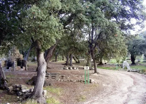
We began our path in the hermitage of the Virgin of Cánava, near a beautiful square with a magnificent fountain of several years, and with a thick grove around.

Breve descripción

The singularity of this corner of Sierra Magina is undeniable: a forest anchored in the past that for years has remained unchanged. A rise to a pine forest that has been preserved in a state very close to the natural one and which, therefore, retains an unusual beauty intact.

This pine was declared a Pinar Natural Monument of Canavas by the Junta de Andalucía on November 23, 2001. It belongs to the municipal term of Jimena, and is one of the few centenary forests of carrasco pine that remain in Andalusia, with specimens up to 250 years. It borders the edge of the limestone mountain massif and the countryside of the Jaén olive groves. On the way we will access unforgettable landscape panorama and we will be able to observe a wide variety of flora and fauna associated with the different areas to be crossed.

Latitud
37.8244
Longitud
-3.3956
Distrito
Municipio
Ubicación en el mapa
POINT (-3.3956 37.8244)
imagen
Image
1116_SS_02.jpg
Imagen principal
Activado
imagen
Image
Pinar_de_c%C3%A1nava.jpg
Imagen principal
Desactivado
imagen
Image
1116_SS_10.jpg
Imagen principal
Desactivado
imagen
Image
1116_SS_07.jpg
Imagen principal
Desactivado
1 h

Nature

icon-intereses-naturaleza

Friends

icon-intereses-amigos

Adventure

icon-intereses-aventura

Culture

icon-intereses-cultura

Sport

icon-intereses-deporte

Eco-friendly

icon-intereses-eco-friendly

For couples

icon-intereses-en-pareja

Family

icon-intereses-familia

Gastronomy

icon-intereses-gastronomia

Municipality

icon-intereses-municipio

Low-cost tourism

icon-intereses-turismo-low-cost

Solo travel

icon-intereses-viajar-solo
Baja - Media
Sendero Pinar de Cánava
1,7 km
On foot
All year round
Desactivado
  • In front of COVID19, keep the safety distance and carry a mask, avoid agglomerations and contact with surfaces, wash your hands frequently, use hydroalcoholic gel and consult the available digital materials. Take care of your health and others.
  • It works to prevent fires. Do not throw cigarettes or any other object that produces combustion.
  • By consuming local products and having companies in the area you will contribute to rural development.
  • He lives with the local people and other users. It respects private property and property.
  • Unwind in a sustainable way: public transport, bike, walk, shared vehicle...
  • Noise is another form of pollution. In silence you will enjoy your experience more.
  • It facilitates the use of people with special needs.
  • The trash doesn't come back alone. Take her with you to the nearest container. Reduce, reuse, recycle.
  • Don't leave a mark on your way through nature.
  • It practices a responsible and committed tourism with the environment. Be a real ecotourist!
  • Respect the facilities at your disposal. We all pay for your maintenance.
  • Check the weather forecast before starting your activity.
  • Avoid going out alone. If you do, it communicates tour and time of return to other people.
  • Extreme caution under adverse conditions and with the occasional presence of animals or motor vehicles.
  • Please provide prior information on the possible existence of cynegetic activity.
  • It has water, sun protection, proper clothes and shoes.
  • It carries a mobile with enough battery in case of emergency (112), but remember that there is not always coverage.
  • Don't even bother animals. You would negatively alter his behavior.
  • For your safety and the safety of the environment, don't get out of the signposted road or take shortcuts.
  • Remember that the capture of animals, light fire, fish and collect plants or minerals is prohibited.
  • If you bring a dog, take him with his strap and make sure he doesn't bother other animals or people.
  • Your safety is our concern, but it's your responsibility.

Thank you for your cooperation!

As a surprise and a complement to this path, we can go a little more than 100 meters and reach the Caracoles, an ancient and magical village of quarries that worked the round mill stone, in which we will find some of its unique buildings in dry stone.

Up to Jimena for the A-320 (Real- Bedmar Mancha) connects with the A-316 (Estepa-Ubeda) and the A-401 (Ubeda-Moreda). From there go to the upper part of the village to the hermitage of the Virgin of Canava, where you will find the beginning of the path.

Tramo de asfalto o cemento
 
Tramo de pista o camino forestal
 
Tramo de vía pecuaria
 
Tramo de senda
 

Trail la Cave of Graja

Submitted by brandcode_deweloper on
Id
4981374
Breve descripción

Due to the limestone materials and the action of the water, in the Sierra Magina Natural Park there are oysters. The abundance of hunting and the wild fruits convinced our ancestors of the Neolithic, the first inhabitants of the Guadalquivir, to make it a place of residence. This is a test of the cave, actually a coat, that we visit with this path. National Historical Monument since 1924, and Good of Cultural Interest, in it we can see representations of rites and pastoralism.

Latitud
37.8244
Longitud
-3.3956
Distrito
Municipio
Ubicación en el mapa
POINT (-3.3956 37.8244)
imagen
Image
1%20%282%29.jpg
Imagen principal
Activado
imagen
Image
Sendero%20la%20Cueva%20de%20la%20Graja.jpg
Imagen principal
Desactivado
imagen
Image
721_SS_04.jpg
Imagen principal
Desactivado
imagen
Image
721_SS_03.jpg
Imagen principal
Desactivado
30 min

Nature

icon-intereses-naturaleza

Friends

icon-intereses-amigos

Adventure

icon-intereses-aventura

Culture

icon-intereses-cultura

Sport

icon-intereses-deporte

Eco-friendly

icon-intereses-eco-friendly

For couples

icon-intereses-en-pareja

Family

icon-intereses-familia

Gastronomy

icon-intereses-gastronomia

Municipality

icon-intereses-municipio

Low-cost tourism

icon-intereses-turismo-low-cost

Solo travel

icon-intereses-viajar-solo
Medium
Sendero la Cueva de la Graja
0,6 km
On foot
All year round
Desactivado
  • In front of COVID19, keep the safety distance and carry a mask, avoid agglomerations and contact with surfaces, wash your hands frequently, use hydroalcoholic gel and consult the available digital materials. Take care of your health and others.
  • It works to prevent fires. Do not throw cigarettes or any other object that produces combustion.
  • By consuming local products and having companies in the area you will contribute to rural development.
  • He lives with the local people and other users. It respects private property and property.
  • Unwind in a sustainable way: public transport, bike, walk, shared vehicle...
  • Noise is another form of pollution. In silence you will enjoy your experience more.
  • It facilitates the use of people with special needs.
  • The trash doesn't come back alone. Take her with you to the nearest container. Reduce, reuse, recycle.
  • Don't leave a mark on your way through nature.
  • It practices a responsible and committed tourism with the environment. Be a real ecotourist!
  • Respect the facilities at your disposal. We all pay for your maintenance.
  • Check the weather forecast before starting your activity.
  • Avoid going out alone. If you do, it communicates tour and time of return to other people.
  • Extreme caution under adverse conditions and with the occasional presence of animals or motor vehicles.
  • Please provide prior information on the possible existence of cynegetic activity.
  • It has water, sun protection, proper clothes and shoes.
  • It carries a mobile with enough battery in case of emergency (112), but remember that there is not always coverage.
  • Don't even bother animals. You would negatively alter his behavior.
  • For your safety and the safety of the environment, don't get out of the signposted road or take shortcuts.
  • Remember that the capture of animals, light fire, fish and collect plants or minerals is prohibited.
  • If you bring a dog, take him with his strap and make sure he doesn't bother other animals or people.
  • Your safety is our concern, but it's your responsibility.

Thank you for your cooperation!

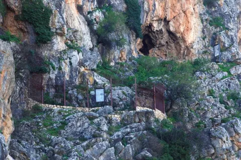
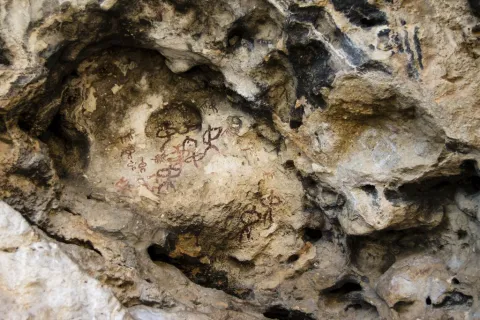
The paintings present different tonalities, which can go from chestnut to more or less dark red. These colors were obtained by means of mineral pigments, iron oxide and ferruginous clays, mixed with animal fat. The schematic painting is of difficult and complex interpretation, and is mainly linked to the social structure of the groups in the area and the tasks they performed: collection, hunting and grazing.

The paintings we see inside are quite abstract, with relatively thick strokes. Possibly made with their own fingers, or with a rite crushed like a rustic brush. Several representations appear: zoomorphic and anthropomorphic figures. Some of the human figures are accompanied by ornaments such as feathers, horns, weapons or other objects. The figure of an occulate, with tentacles and surrounded by human figures with arms in hand, is most powerful. Other representative paintings are those of two figures together and of an individual who seems to feed an animal.

To be able to visit these paintings it is necessary to order the key in the City Council of Jimena or in the Hermitage of the Virgin of Canava, next to its beautiful square with a magnificent fountain of several years, and with a thick grove around, located shortly before the beginning of the path.

Even Jimena for the A-320 (Real-Bedmar Mancha) connects with the A-316 (Estepa-Ubeda) and the A-401 (Ubeda-Moreda). From there to the upper part of the village and 100 m from the entrance of the municipal pool, you will find the beginning of the path.

Tramo de asfalto o cemento
 
Tramo de pista o camino forestal
 
Tramo de vía pecuaria
 
Tramo de senda
 

Trail Gibralberca

Submitted by brandcode_deweloper on
Id
4981199
Breve descripción

It is a path of medium length, whose journey is interesting to pass from the southern to the northern slopes in a short space of time, which allows us to contemplate the change of existing vegetation. There are many botanical species that we can observe and which are typical of the Mediterranean forest. We will find coals of considerable bearing, centenary complaints, repopulation pines such as the carrasco or the resinero, maples, skirmishes, cornicabra, majuelos, tojos, omillos...

Starting from the peaceful recreational area of Gibralbca, where we will find centenary oaks, we take a path that will take us to a point from which we can contemplate the crest of Magina by its southern face with several peaks of the saw that exceed 2,000 meters in height, such as those of Almadén, Pico Magina and Ponce and the different floors of the vegetation depending on the altitude. On the way down we will reach the Umbria of Cano and on that piece of the path it is not difficult to observe specimens of real eagle.

Latitud
37.6681
Longitud
-3.5742
Distrito
Municipio
Ubicación en el mapa
POINT (-3.5742 37.6681)
imagen
Image
722_SS_05.jpg
Imagen principal
Activado
imagen
Image
Sendero%20Gibralberca.jpg
Imagen principal
Desactivado
imagen
Image
Sendero%20Gibralberca2.jpg
Imagen principal
Desactivado
imagen
Image
722_SS_01%20%281%29.jpg
Imagen principal
Desactivado
imagen
Image
722_SS_06.jpg
Imagen principal
Desactivado
2 h

Nature

icon-intereses-naturaleza

Friends

icon-intereses-amigos

Adventure

icon-intereses-aventura

Culture

icon-intereses-cultura

Sport

icon-intereses-deporte

Eco-friendly

icon-intereses-eco-friendly

For couples

icon-intereses-en-pareja

Family

icon-intereses-familia

Gastronomy

icon-intereses-gastronomia

Municipality

icon-intereses-municipio

Low-cost tourism

icon-intereses-turismo-low-cost

Solo travel

icon-intereses-viajar-solo
Baja - Media
Sendero Gibralberca
5,7 km
On foot
All year round
Desactivado
  • In front of COVID19, keep the safety distance and carry a mask, avoid agglomerations and contact with surfaces, wash your hands frequently, use hydroalcoholic gel and consult the available digital materials. Take care of your health and others.
  • It works to prevent fires. Do not throw cigarettes or any other object that produces combustion.
  • By consuming local products and having companies in the area you will contribute to rural development.
  • He lives with the local people and other users. It respects private property and property.
  • Unwind in a sustainable way: public transport, bike, walk, shared vehicle...
  • Noise is another form of pollution. In silence you will enjoy your experience more.
  • It facilitates the use of people with special needs.
  • The trash doesn't come back alone. Take her with you to the nearest container. Reduce, reuse, recycle.
  • Don't leave a mark on your way through nature.
  • It practices a responsible and committed tourism with the environment. Be a real ecotourist!
  • Respect the facilities at your disposal. We all pay for your maintenance.
  • Check the weather forecast before starting your activity.
  • Avoid going out alone. If you do, it communicates tour and time of return to other people.
  • Extreme caution under adverse conditions and with the occasional presence of animals or motor vehicles.
  • Please provide prior information on the possible existence of cynegetic activity.
  • It has water, sun protection, proper clothes and shoes.
  • It carries a mobile with enough battery in case of emergency (112), but remember that there is not always coverage.
  • Don't even bother animals. You would negatively alter his behavior.
  • For your safety and the safety of the environment, don't get out of the signposted road or take shortcuts.
  • Remember that the capture of animals, light fire, fish and collect plants or minerals is prohibited.
  • If you bring a dog, take him with his strap and make sure he doesn't bother other animals or people.
  • Your safety is our concern, but it's your responsibility.

Thank you for your cooperation!

It has access from the A-324 (Cambil-Huelma) road, located among the towns of Huelma at 9.1 km. and Cambil, at 10.2 km. From here a road leads to the recreational area of Gibralbca.

Trail Fuenmaandor

Submitted by brandcode_deweloper on
Id
4979890
Breve descripción

This is a particularly beautiful path in the flowering season of the cherry tree, where we can enjoy this unique spectacle of nature with a walk, or just reaching its starting point in the Fuenmayor recreational area.

Latitud
37.7917
Longitud
-3.5447
Distrito
Municipio
Ubicación en el mapa
POINT (-3.5447 37.7917)
imagen
Image
723_SS_03.jpg
Imagen principal
Activado
imagen
Image
Sendero%20Fuenmayor.jpg
Imagen principal
Desactivado
imagen
Image
Sendero%20Fuenmayor2.jpg
Imagen principal
Desactivado
imagen
Image
723_SS_05.jpg
Imagen principal
Desactivado
2 h 20 min

Nature

icon-intereses-naturaleza

Friends

icon-intereses-amigos

Adventure

icon-intereses-aventura

Culture

icon-intereses-cultura

Sport

icon-intereses-deporte

Eco-friendly

icon-intereses-eco-friendly

For couples

icon-intereses-en-pareja

Family

icon-intereses-familia

Gastronomy

icon-intereses-gastronomia

Municipality

icon-intereses-municipio

Low-cost tourism

icon-intereses-turismo-low-cost

Solo travel

icon-intereses-viajar-solo
Medium
Sendero Fuenmayor
6,4 km
On foot
All year round
Desactivado

Also in winter this path can be an adventure and allow us to enjoy the snow with the whole family, or be a starting point for lovers of the high mountain.
In summer, it is one of the coolest areas of the natural park, and we can enjoy our picnic in the refreshing Fuenmayor.

  • In front of COVID19, keep the safety distance and carry a mask, avoid agglomerations and contact with surfaces, wash your hands frequently, use hydroalcoholic gel and consult the available digital materials. Take care of your health and others.
  • It works to prevent fires. Do not throw cigarettes or any other object that produces combustion.
  • By consuming local products and having companies in the area you will contribute to rural development.
  • He lives with the local people and other users. It respects private property and property.
  • Unwind in a sustainable way: public transport, bike, walk, shared vehicle...
  • Noise is another form of pollution. In silence you will enjoy your experience more.
  • It facilitates the use of people with special needs.
  • The trash doesn't come back alone. Take her with you to the nearest container. Reduce, reuse, recycle.
  • Don't leave a mark on your way through nature.
  • It practices a responsible and committed tourism with the environment. Be a real ecotourist!
  • Respect the facilities at your disposal. We all pay for your maintenance.
  • Check the weather forecast before starting your activity.
  • Avoid going out alone. If you do, it communicates tour and time of return to other people.
  • Extreme caution under adverse conditions and with the occasional presence of animals or motor vehicles.
  • Please provide prior information on the possible existence of cynegetic activity.
  • It has water, sun protection, proper clothes and shoes.
  • It carries a mobile with enough battery in case of emergency (112), but remember that there is not always coverage.
  • Don't even bother animals. You would negatively alter his behavior.
  • For your safety and the safety of the environment, don't get out of the signposted road or take shortcuts.
  • Remember that the capture of animals, light fire, fish and collect plants or minerals is prohibited.
  • If you bring a dog, take him with his strap and make sure he doesn't bother other animals or people.
  • Your safety is our concern, but it's your responsibility.

Thank you for your cooperation!

The beginning of this path is located in the recreational area of Fuenmayor, which is accessed by the road that is part of the end of the promenade of San Isidoro, in the town of Torres. You have to travel 7 Km from the village to the equipment.

Starting from the Fuenmayor recreational area, we started a rising road that a mile later leads us to the Zurreon waterfall. Later on, this path offers us a beautiful panoramic view of Torres and the landscape of crops that unfolds around this town and ends up introducing us on a narrow road surrounded by cherry, cakis and olive trees.

From this path we can easily link with the end of the path Subida Puerto de la Mata, from which we will enjoy beautiful views of the magnificent dehesa of Mata Bejid, completely different from those that accompanied us.

Tramo de asfalto o cemento
 
Tramo de pista o camino forestal
 
Tramo de vía pecuaria
 
Tramo de senda
 

Trail Castle of Albanchez

Submitted by brandcode_deweloper on
Id
4979788
Breve descripción

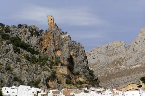
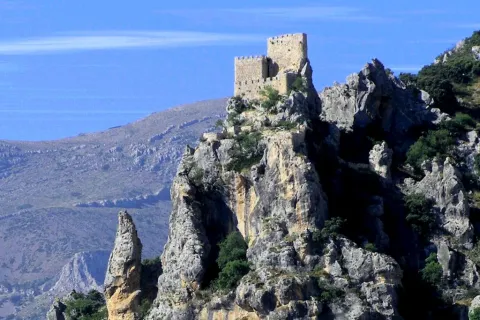
Jaén is the province of most castles per square kilometre in all of Europe, which is explained by its strategic value. The region of Magina was an important border between the kingdoms of Castile and Granada, which led its conquerors throughout history to lift fortifications that would allow the surveillance and defense. That's the case with Albánchez Castle. Of Christian origin but raised on Arab remains, it served to master the steps of Almadén and Magina.

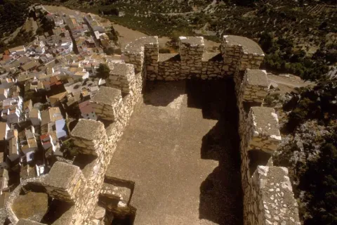
The interest of this short, but intense path is historical and landscape. In addition, once we go up to the viewpoint of the castle of Albanchez de Magina, we will find impressive and extensive views of the territory and its varied landscapes. If we stand among their almenas and let our imagination fly, we can evoke how these lands could be in the time of skirmishes between the Christian and Muslim kingdoms during the Middle Ages; from here, the sentinels, it would be cold or hot, they watched any movement of enemy troops.

Latitud
37.8244
Longitud
-3.3956
Distrito
Ubicación en el mapa
POINT (-3.3956 37.8244)
imagen
Image
3.jpg
Imagen principal
Activado
imagen
Image
Sendero%20Castillo%20de%20Albanchez.jpg
Imagen principal
Desactivado
imagen
Image
728_SS_02.jpg
Imagen principal
Desactivado
imagen
Image
728_SS_05.jpg
Imagen principal
Desactivado
20 min

Nature

icon-intereses-naturaleza

Friends

icon-intereses-amigos

Adventure

icon-intereses-aventura

Culture

icon-intereses-cultura

Sport

icon-intereses-deporte

Eco-friendly

icon-intereses-eco-friendly

For couples

icon-intereses-en-pareja

Family

icon-intereses-familia

Gastronomy

icon-intereses-gastronomia

Municipality

icon-intereses-municipio

Low-cost tourism

icon-intereses-turismo-low-cost

Solo travel

icon-intereses-viajar-solo
Medium
Sendero Castillo de Albanchez
0,2 km
On foot
All year round
Desactivado
  • In front of COVID19, keep the safety distance and carry a mask, avoid agglomerations and contact with surfaces, wash your hands frequently, use hydroalcoholic gel and consult the available digital materials. Take care of your health and others.
  • It works to prevent fires. Do not throw cigarettes or any other object that produces combustion.
  • By consuming local products and having companies in the area you will contribute to rural development.
  • He lives with the local people and other users. It respects private property and property.
  • Unwind in a sustainable way: public transport, bike, walk, shared vehicle...
  • Noise is another form of pollution. In silence you will enjoy your experience more.
  • It facilitates the use of people with special needs.
  • The trash doesn't come back alone. Take her with you to the nearest container. Reduce, reuse, recycle.
  • Don't leave a mark on your way through nature.
  • It practices a responsible and committed tourism with the environment. Be a real ecotourist!
  • Respect the facilities at your disposal. We all pay for your maintenance.
  • Check the weather forecast before starting your activity.
  • Avoid going out alone. If you do, it communicates tour and time of return to other people.
  • Extreme caution under adverse conditions and with the occasional presence of animals or motor vehicles.
  • Please provide prior information on the possible existence of cynegetic activity.
  • It has water, sun protection, proper clothes and shoes.
  • It carries a mobile with enough battery in case of emergency (112), but remember that there is not always coverage.
  • Don't even bother animals. You would negatively alter his behavior.
  • For your safety and the safety of the environment, don't get out of the signposted road or take shortcuts.
  • Remember that the capture of animals, light fire, fish and collect plants or minerals is prohibited.
  • If you bring a dog, take him with his strap and make sure he doesn't bother other animals or people.
  • Your safety is our concern, but it's your responsibility.

Thank you for your cooperation!

Up to Albanchez de Magina by the A-320 (Real-Bedmar Mancha) taking the JA-3105 or JA-1107. From there go to the City Hall Square from where the start point of the path is marked, next to the last houses of the town.

Trail Adelfal de Cuadros

Submitted by brandcode_deweloper on
Id
4979539
Breve descripción

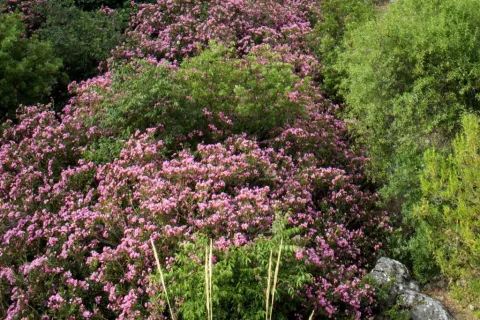
The natural adelfal of the Cuadros River is probably one of the largest in size and importance of the Iberian Peninsula. This plant has a beautiful flowering in spring and summer that colors the beautiful valley of the river Cuadros in pink, intertwined between cutting and vertical folds, with a rich geological diversity. The adelfas, plants that do not resist the frost, are located in the lower parts of the Sierra Magina Natural Park and in areas where there are nearby watercourses. Wept willows, fig trees, and other species of the banks are jalonar the path.

Located in the incomparable area of Cuadros near the town of Bedmar, this path offers the visitor a short but unforgettable tour. It will enter a river that cherishes one of the most important natural masses of thinning on the peninsula. During its passage, we will be able to observe the exuberance of the alderfal formations that develop exceptional tree ports. The sound of water will accompany us during our journey by relaxing our senses, and by surprise us in summer with a fresh and spectacular getaway.

Along the path and intermittently it is possible to have as a reference the tower of Cuadros, a milestone that recalls the past of these lands as the border of the kingdom of Granada.

Next to the path, next to the hermitage of the venerated Virgin of Cuadros we find the Cave of Water, a magical place for the summer, if we want to walk within the river and discover three caves by which the river runs forming spectacular formations as a result of the spread of the water over time.

It also links this path with the path of the Viñas, which brings us closer to the view of Torreón de Cuadros with unbeatable views over this unique valley.

Latitud
37.8244
Longitud
-3.3956
Distrito
Municipio
Ubicación en el mapa
POINT (-3.3956 37.8244)
imagen
Image
1.jpg
Imagen principal
Activado
imagen
Image
Sendero%20Adelfal%20de%20Cuadros.JPG
Imagen principal
Desactivado
imagen
Image
727_SS_05.jpg
Imagen principal
Desactivado
imagen
Image
727_SS_03.jpg
Imagen principal
Desactivado
imagen
Image
727_SS_04.jpg
Imagen principal
Desactivado
20 min

Nature

icon-intereses-naturaleza

Friends

icon-intereses-amigos

Adventure

icon-intereses-aventura

Culture

icon-intereses-cultura

Sport

icon-intereses-deporte

Eco-friendly

icon-intereses-eco-friendly

For couples

icon-intereses-en-pareja

Family

icon-intereses-familia

Gastronomy

icon-intereses-gastronomia

Municipality

icon-intereses-municipio

Low-cost tourism

icon-intereses-turismo-low-cost

Solo travel

icon-intereses-viajar-solo
Baja
Sendero Adelfal de Cuadros
0,4 km
On foot
All year round
Desactivado
  • In front of COVID19, keep the safety distance and carry a mask, avoid agglomerations and contact with surfaces, wash your hands frequently, use hydroalcoholic gel and consult the available digital materials. Take care of your health and others.
  • It works to prevent fires. Do not throw cigarettes or any other object that produces combustion.
  • By consuming local products and having companies in the area you will contribute to rural development.
  • He lives with the local people and other users. It respects private property and property.
  • Unwind in a sustainable way: public transport, bike, walk, shared vehicle...
  • Noise is another form of pollution. In silence you will enjoy your experience more.
  • It facilitates the use of people with special needs.
  • The trash doesn't come back alone. Take her with you to the nearest container. Reduce, reuse, recycle.
  • Don't leave a mark on your way through nature.
  • It practices a responsible and committed tourism with the environment. Be a real ecotourist!
  • Respect the facilities at your disposal. We all pay for your maintenance.
  • Check the weather forecast before starting your activity.
  • Avoid going out alone. If you do, it communicates tour and time of return to other people.
  • Extreme caution under adverse conditions and with the occasional presence of animals or motor vehicles.
  • Please provide prior information on the possible existence of cynegetic activity.
  • It has water, sun protection, proper clothes and shoes.
  • It carries a mobile with enough battery in case of emergency (112), but remember that there is not always coverage.
  • Don't even bother animals. You would negatively alter his behavior.
  • For your safety and the safety of the environment, don't get out of the signposted road or take shortcuts.
  • Remember that the capture of animals, light fire, fish and collect plants or minerals is prohibited.
  • If you bring a dog, take him with his strap and make sure he doesn't bother other animals or people.
  • Your safety is our concern, but it's your responsibility.

Thank you for your cooperation!

From the village of Bedmar we will take the road leading to the Sanctuary of the Virgin of Cuadros, just before crossing the bridge over the river we will deviate on the left track until we reach the recreational area Adelfal de Cuadros, the starting point of this path.

Tramo de asfalto o cemento
 
Tramo de pista o camino forestal
 
Tramo de vía pecuaria
 
Tramo de senda
 

ALTERNATIVE GR 247.3 STAGE 2: Forestrand House Refuge El Sacejo - Forestrand House Refuge Fuente Acero

Submitted by brandcode_deweloper on
Id
2593240
Breve descripción

This stage begins in a Refugio located next to one of the most well-known areas of the Park, the Parador de Cazorla, from whose surroundings you enjoy good views over the forests of the south. From there it descends to the narrow and lush valley of a newborn Guadalquivir, on which it crosses in the emblematic area of the Puente de Las Herrerias, important crossroads of roads that also has various infrastructures for the rest and enjoyment of the walker, such as a campsite, a recreational area and a kiosco- bar.

It then separates from the Guadalquivir Valley to reach one of the most popular forest tracks in the Park: the old Castril Road, now known as the Pista de las Navas. Always walking through pineapples with plenty of oak and plenty of oaks (complaints), our route is pulled by various viewpoints with interpretative panels.

One of them is the Mirador de Los Poyos de La Mesa, in front of this great calar whose roundabout figure presides over much of our journey. Another, also memorable, is that of the Strait of the Perals, on a spectacular throat flanked by rock formations of capricious forms. At some points, as in the area of La Trinchera, we will see at our feet the Guadaltiín Valley, one of the most beautiful and graceful of the Park.

The ships, to which their name owes the track that runs the second half of the Stage, are flat and fertile land in the middle altitudes of the mountain, which have historically been deforsted and exploited by man as agricultural land. They are quite rare, but the few that there are introduce a wonderful factor of landscape diversity, with their fields, fruit, orchards and choperas, all surrounded by forests and mountains.

In this stage we will find two, that of Espino, already practically abandoned, and that of San Pedro, much more extensive and that retains all its appeal.

The abundance of fauna is another of the great attractions of this stage. Deers, wowls, muflons, boars and mountain goats are easily seen, sometimes at a short distance. This was not in vain another of the favorite areas of the naturalist Felix Rodríguez de la Fuente to record impressive sequences of his documentary series "Man and Earth."

Today, it is precisely in the Navy of San Pedro where is the Quebrantacobos Breeding Center, a fundamental place for the conservation of the Iberian fauna. Thanks to its work, the vast territories that this stage is going through are again overflown by the broken bones, whose flight is sometimes crossed in the sky with that of the lion vultures and royal and perdiera eagles.

Latitud
37.8554
Longitud
-3.0602
Municipio
Ubicación en el mapa
POINT (-3.0602 37.8554)
imagen
Image
1.jpg
Imagen principal
Activado
imagen
Image
2.jpg
Imagen principal
Desactivado
imagen
Image
3.jpg
Imagen principal
Desactivado
imagen
Image
4.jpg
Imagen principal
Desactivado
imagen
Image
5.jpg
Imagen principal
Desactivado
imagen
Image
6.jpg
Imagen principal
Desactivado
imagen
Image
7.jpg
Imagen principal
Desactivado
imagen
Image
8.jpg
Imagen principal
Desactivado
imagen
Image
9.jpg
Imagen principal
Desactivado
imagen
Image
10.jpg
Imagen principal
Desactivado
imagen
Image
11.jpg
Imagen principal
Desactivado
imagen
Image
12.jpg
Imagen principal
Desactivado
imagen
Image
13.jpg
Imagen principal
Desactivado
7 h 14 min

Nature

icon-intereses-naturaleza

Friends

icon-intereses-amigos

Adventure

icon-intereses-aventura

Culture

icon-intereses-cultura

Sport

icon-intereses-deporte

Eco-friendly

icon-intereses-eco-friendly

For couples

icon-intereses-en-pareja

Family

icon-intereses-familia

Gastronomy

icon-intereses-gastronomia

Municipality

icon-intereses-municipio

Low-cost tourism

icon-intereses-turismo-low-cost

Solo travel

icon-intereses-viajar-solo
Alta
Refugio CF El Sacejo - Refugio CF Fuente Acero
23,59 km
478m
1057m
909m
2
1
2
4
On foot
All year round
Activado
There are no special difficulties.
El Sacejo, Puente de las Herrerías, fuente de La Garganta, Nava de San Pedro, Refugio Casa Forestal Fuente Econo.

On the path: Bridge of the Herries
Near the path: Cazorla, La Iruela, Cold Arroyo

In the beginning: Refugio Casa Forestal del Sacejo. In the final: Refugio Casa Forestal Fuente del Steel

Input and re-introduced animals

This stage runs through areas belonging to the Andaluza de Huna de Cazorla and Segura Reserve, managed by the Junta de Andalucía and whose first name was Coto Nacional de Huna de Cazorla-Segura. The Coto was created in 1960 and occupies 67000 hectares, almost a third of the Natural Park.

Its creation was the result of a policy to promote greater hunting, so a series of introductions and reintroductions of various species of large wild ungulates were previously made.

In 1952, 37 deer, 7 boars and 10 corzos were reintroduced, all of which were extinct in these saws. The first two are today very abundant, while the third failed. They also brought 5 muflons, a species that had never been present in the area, but which was adapted without any problems. Later, in 1956, 25 gems were introduced, which just as the muflons expanded rapidly despite not being indigenous.

Finally, in 1960, attempts were made to introduce the rebuttal, which is not indigenous, with the release of 4 copies, which died shortly. In fact, the rebuttal had been part of the fauna of the area, but in the Neolithic, when the climate was quite cold and humid than the present one.

Today, fortunately, capricious introductions of non-indigenous species are no longer carried out, which can cause serious ecological imbalances. Thus, the abundance of wos and muflons, together with important populations of other great ungulates and an important livestock cabin, and in the absence of the wolf, which was the species that previously regulated the herbivores populations, has resulted in unmeasured pressure on many species of flora, some of them endemic and in danger of extinction.

Refuge CF El Sacejo

Refuge CF Fuente Steel

Coordenadas / Huso 30S
According to Projection UTM Datum ETRS89
Tramo de asfalto o cemento
0
Tramo de pista o camino forestal
87.62%
Tramo de vía pecuaria
0
Tramo de senda
12.38%

Route card

Km 0

Refugio Casa Forestal El Sacejo

Esta Etapa comienza en la Casa Forestal El Sacejo, situada junto al Parador de Cazorla. La ruta comienza pasando por detrás del mismo, entre cipreses, y tomando una pista forestal cerrada al paso de vehículos que baja al encuentro del Arroyo de los Cierzos. A nuestra izquierda y al frente tenemos amplias vistas hacia el tramo de cabecera del Valle del Guadalquivir y elevaciones como la Loma de la Mesa y el Calar de Juana.
Caminamos entre pinos laricios con encinas y enebros y, tras pasar un par de arroyos, dejamos a la izquierda las ruinas de un cortijo. Bajo el pinar comienzan a aparecer quejigos, cornicabras y algunos arces y según bajamos hacia el Arroyo de los Cierzos, la vegetación se hace más exuberante, con higueras y nogales silvestres, hiedra, arces de buen tamaño y hasta algún tejo. Recorridos 2 kilómetros llegamos al citado arroyo y caminamos junto a él, y un poco más adelante cruzamos otro pequeño afluente del mismo.
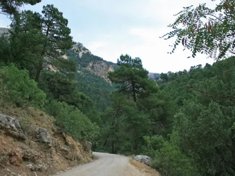
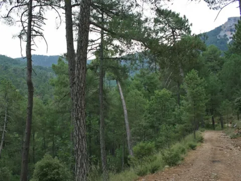
Si lleva mucha agua, puede ser necesario ayudarse colocando algunas piedras para pasar. En este punto hay señales del Sendero PR-A 314, así como otra que indica hacia la derecha la subida al Puerto del Gilillo en tres horas por ruta sin señalizar.

El Arroyo de los Cierzos, siempre a nuestra izquierda, se encaja entre rocas en su último tramo, apareciendo el boj en su ribera. Pasamos junto a una pequeña represa y enseguida aparece al fondo el Valle del Guadalquivir.

Km 2,9

Valle del Guadalquivir

Tras pasar una valla de cierre del paso a vehículos, nuestra pista desemboca en otra más ancha y con mejor firme. Hemos llegado al Valle del Guadalquivir, más amplio que el que hemos recorrido hasta ahora. Si tomáramos a mano derecha llegaríamos al Nacimiento de este río, pero nuestra ruta gira a la izquierda pasando por un puente sobre el Arroyo de los Cierzos, muy cerca del punto donde este vierte sus aguas al Guadalquivir y en una zona de gran belleza paisajística.

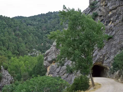
A los pocos metros pasamos por un túnel excavado en la roca, y en kilómetro 4,1, en una curva a la izquierda en el paraje de La Caracolilla, se abren grandes vistas: hacia el este, los Poyos de La Mesa y el Castellón del Calerón, y hacia el norte, a lo lejos, la Sierra de Las Villas, mientras desde abajo, por nuestra derecha, asciende el rumor de las aguas del recién nacido Guadalquivir.

En el kilómetro 4,8 hay una valla para vehículos, correspondiente a la Reserva Andaluza de Caza de Cazorla-Segura, que se cierra entre las 21 las 9 horas, aunque el paso a pie es siempre libre. Más adelante, en el kilómetro 5,1, dejamos a la derecha la gran Casa del Calerón, caminando por pinar de pino negral con abundancia de quejigos, encinas y cornicabras.

Km 6,4

Puente de Las Herrerías

Este punto es muy estratégico por varios motivos. Encontramos un Área Recreativa con mesas, fuente y quiosco-bar, y muy cerca, un camping, además de una pequeña carretera (JF-7092) que nos llevaría hasta el Empalme del Valle, conectando con las poblaciones de Arroyo Frío y Burunchel. Hay también un importante cruce de caminos señalizados, ya que el Sendero Bosques del Sur se cruza con el GR 7, por el que podríamos ir a Cazorla o a Coto Ríos.

También, por la margen derecha del Guadalquivir, podemos ir en sentido contrario al que traemos hacia el Nacimiento de este río, por la Derivación 11 del Sendero Bosques del Sur que pasa por el paraje del Pino de las Tres Cruces.

Otro sendero de 1,3 kilómetros, señalizado por la Consejería de Medio Ambiente, nos permitiría llegar al emblemático paraje de la Fuente del Oso, no lejos del Parador de Cazorla por carretera (JF-7094), lo que nos permitiría articular una ruta circular con el tramo del Sendero Bosques del Sur que hemos recorrido hasta ahora.

El paraje es fresco y umbrío, con abundante vegetación de ribera, y el Puente de Las Herrerías sobre el Guadalquivir es sencillo pero muy bello, con su arco de medio punto construido con piedra de toba. Cuenta la tradición que una noche llegó aquí la reina Isabel la Católica con su séquito procedente de Quesada en dirección a Baza, ciudad del Reino de Granada que deseaba conquistar.

Ante la dificultad de vadear el río, que venía crecido por las lluvias otoñales, la leyenda afirma que sus caballeros construyeron o remozaron el puente en una sola noche para que la reina pudiera continuar sin demora su viaje. El nuestro, más pacífico y sosegado, utiliza el mismo puente y abandona a los pocos metros la carretera que va hacia el citado Empalme del Valle, tomando un ancho camino que sale a la derecha.

El paisaje cambia, ya que nos separamos del Guadalquivir para internarnos en ascenso por un hermoso bosque de pino laricio siguiendo en principio el Arroyo de La Mesa, que queda a nuestra izquierda. Pronto, hacia la derecha, veremos alzarse los imponentes paredones de Los Poyos de La Mesa por su cara norte, la más abrupta y vertical. En el kilómetro 7,9 cruzamos un arroyo y descartamos un camino que sale a la izquierda, y 400 metros después, en una bifurcación, abandonamos el camino para tomar un jorro (vía de saca de madera) por la derecha.

En el kilómetro 9,4 tomamos una pista forestal a la izquierda y poco después pasamos una valla de cierre del paso a vehículos, llegando a la denominada pista de Las Navas. Durante este último tramo pasamos muy cerca del llamado Pino Abuelo, un centenario pino laricio que se secó hace ya muchos años, pero que aún sigue en pie, destacando por su gran tamaño entre los de su entorno.

Km 10,6

Pista de Las Navas

Llegamos a esta pista forestal que es todo un clásico en los recorridos más conocidos del Parque Natural por el atractivo de los parajes que recorre. Hacia la izquierda la pista pasa enseguida a estar asfaltada y nos llevaría hacia el Empalme del Valle pasando junto a lugares tan emblemáticos como el Área Recreativa de Linarejos, la Cerrada del Utrero (recorrida por un corto y fantástico sendero) y Vadillo Castril.

Nuestra ruta, sin embargo, gira a la derecha. Durante un tramo está señalizada con franjas blancas rojas y amarillas por coincidir con el PR-A 315.

Unos 300 metros más adelante llegamos al impresionante Mirador de los Poyos de la Mesa, orientado hacia el sur y dotado de un panel interpretativo que nos ayudará a identificar los hitos más significativos del grandioso paisaje que contemplamos. Entre ellos destaca una vez más la meseta de Los Poyos de La Mesa, de 1635 metros de altitud, con sus arriscados paredones. Ante nuestra vista se extienden grandes pinares, así como encinares y bosques mixtos.

Son territorios de gran riqueza faunística, muy queridos por la cabra montés y el ciervo, así como por rapaces como el buitre leonado y las águilas real, calzada y culebrera, de ahí que en estos parajes el inolvidable Félix Rodríguez de la Fuente grabara algunos de sus mejores documentales de la serie televisiva El Hombre y La Tierra.

Nuestra pista asciende suavemente por un precioso bosque, al principio con mezcla de pinos negrales y laricios, y dominando ya estos últimos según ganamos altitud. Hay mucha encina y buenos robles (quejigos). De cuando en cuando se abren excelentes vistas a un lado y otro de la pista. En el kilómetro 14 sale a la izquierda una pista cerrada al tránsito de vehículos que sube hacia el Cerrillo del Piornal. Nuestra pista llanea antes de llegar a la Nava del Espino.

Km 14,5

Nava del Espino

En este punto, a la derecha, se abre un bello y despejado llano donde se sitúa la Casa Forestal de la Nava del Espino, ya en ruinas. Pinares y praderías componen un armónico paisaje donde se puede ver a los gamos acudir a alimentarse a última hora de la tarde. Junto a la Casa parte un camino hacia Los Poyos de la Mesa, de 7 kilómetros de longitud y un ascenso acumulado de 225 metros.

Si decidimos recorrerlo, una vez arriba tendremos unas extraordinarias vistas sobre el Valle del Guadalquivir y la zona de Vadillo Castril.

En el kilómetro 14,8 sale a la izquierda una pista cortada a vehículos por la que se puede acceder, entre otros lugares, al Raso del Madrigal, desde donde se disfruta de espléndidas vistas. Nuestra ruta continúa en suave descenso, teniendo a nuestra izquierda el Arroyo de la Garganta y la bella estampa del monte Cabeza del Tejo.

Km 15,6

Fuente de la Garganta

Esta fuente de tres caños está situada en el arroyo del mismo nombre, en un paraje fresco y relajante con mesas para comer. Más allá podemos disfrutar de otro espléndido mirador con un panel interpretativo dedicado a la reintroducción del quebrantahuesos en el Parque Natural.

Km 17,2

Nava de San Pedro

Nuestra Etapa llega a la Nava de San Pedro, uno de los lugares con más acusada personalidad del Parque Natural. El paisaje, hasta ahora dominado por el bosque, se abre de pronto ante nuestros ojos, humanizándose, pues las navas son terrenos muy fértiles que se sitúan a cierta altitud y que han sido deforestados y aprovechados por el hombre desde tiempos inmemoriales como pastos frescos o como terrenos agrícolas.

A los pies del viejo cortijo de la Nava, convertido ahora en un pequeño bar-restaurante, se extiende una vista extraordinariamente armónica y relajante donde se combinan las huertas y tierras de labor, los frutales dispersos, los álamos –amarillos en otoño- y las altas montañas cubiertas de bosques y coronadas por abruptos riscales.

Además, este paraje alberga el Centro de Cría de Quebrantahuesos, un lugar emblemático para la conservación de la fauna ibérica que puede ser visitado entre mediados de mayo y finales de septiembre –es decir, fuera de la época de cría – previa cita con la Fundación Gypaetus.

En el kilómetro 17,9 arranca a la izquierda el sendero de Valdetrillo, señalizado por la Consejería de Medio Ambiente, de 6,3 kilómetros de longitud, que discurre junto a los Arroyos de Valdecuevas y Valdetrillo y cuenta con un espectacular mirador hacia el Estrecho de los Perales. Siguiendo por nuestra ruta, la pista comienza a ascender de nuevo y dejamos a la derecha un pinar de repoblación.

En el kilómetro 18,7, en el paraje de La Trinchera, podremos disfrutar hacia nuestra derecha de una de las vistas más celebradas del Parque Natural: las que corresponden al Valle del Guadalentín, hendido por el famoso Barranco del mismo nombre, un extraordinario paisaje que se cierra con las cumbres de Sierra Nevada y por el que discurra la Etapa 14 del Sendero Bosques del Sur.

Unos 200 metros más adelante sale a la derecha la Senda Ornitológica Circular Barranco del Guadalentín, en cuyo inicio hay un panel interpretativo. Esta ruta, en cuyo recorrido emplearíamos unas cinco horas, coincide en su tramo junto al Guadalentín con parte de la citada Etapa 14.

Nuestra pista continúa ascendiendo entre rasos y encinares, en medio de un paisaje de gran dulzura y armonía, pasando en el kilómetro 21 una barrera que cierra el paso a vehículos entre las 21 y las 9 h.

Km 21,3

Estrecho de los Perales


Un mirador con un panel interpretativo nos facilita la contemplación del Estrecho de los Perales, una espectacular garganta flanqueada por irregulares formaciones rocosas. En la zona es frecuente avistar animales tan señeros como la cabra montés y el águila real, lo cual es bien expresivo de su gran riqueza ecológica.

De hecho, veremos pequeños carteles a nuestra izquierda que marcan el límite del Área de Reserva de Navahondona-Guadahornillos, una amplia zona donde las actividades humanas están fuertemente restringidas para conservar sus extraordinarios valores naturales.

Km 23,6

Refugio Casa Forestal de Fuente Acero

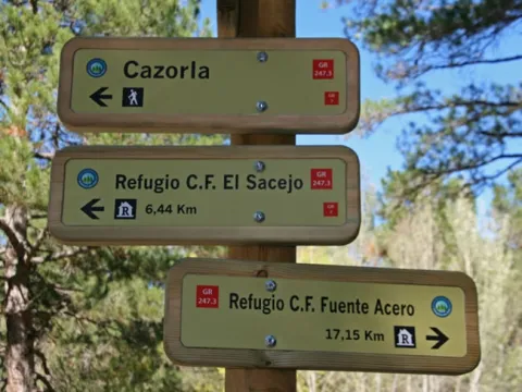
Nuestra larga Etapa llega a su término en la antigua Casa Forestal de Fuente Acero, ya en desuso, pero que en sus buenos tiempos fue un punto de referencia esencial en toda esta zona, y donde se ha habilitado uno de los refugios del Sendero Bosques del Sur. Es un lugar hermosísimo en el que destaca el viejo y gigantesco pino laricio o salgareño situado en medio del raso que hay frente a la Casa Forestal.

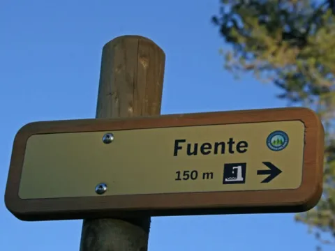
Hay una fuente señalizada a 150 metros. Fuente Acero es, además, uno de los puntos estratégicos del Sendero Bosques del Sur, por ser punto de llegada o salida de las Etapas 14 y 15, además de la que se acaba de describir.