Saltar al contenido principal
icon-intereses-senior

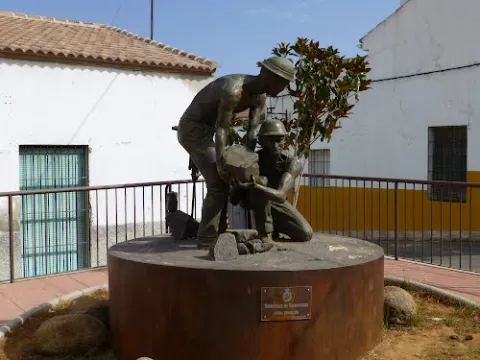
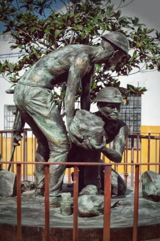
Monument to los mineros

Submitted by brandcode_deweloper on
Id
4485591
Descripción
Descripción larga

This work by Javier Ruiz Abel is a tribute to those granadino and almerian miners who in the late 19th and early 20th century came to work in the mines of the Linares - La Carolina district, of which in our municipal term we have some unique examples.

Telecomunicaciones
Sitio web
www.guarroman.es/ciudad/conoce-la-ciudad/edificios-y-monumentos/
Ubicación
Código Postal
23210
Latitud
38.181480
Longitud
-3.687920
Distrito
Municipio
Ubicación en el mapa
POINT (-3.68792 38.18148)
Tipos de punto de interés
Imágenes carrusel
imagen
Image
wmonumento%20mineros.jpg
Imagen principal
Desactivado
Imágenes cabecera
imagen
Image
Monumento%20a%20los%20mineros.jpg
Imagen principal
Activado
Loading map
Preparing points of interest and routes...
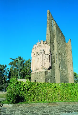
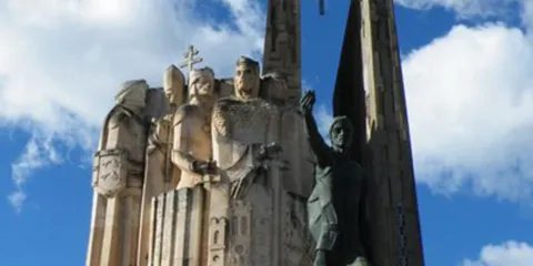
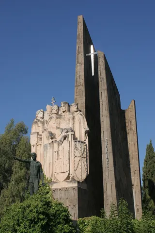
Monument to la Batalla de las Navas de Tolosa.

Submitted by brandcode_deweloper on
Id
4383810
Descripción
Breve descripción

The Monument to the Battle is a memorial to the great battles in the province of Jaén, the Battle of the Navas de Tolosa and the Battle of Bailén. It is located in the provincial capital, in the centre of the Plaza de las Batallas, on the Paseo de la Estación, in front of the Parque de la Concordia and the Government Subdelegation.

Telecomunicaciones
Sitio web
www.redjaen.es
Teléfono de contacto
953 660 255
Correo electrónico
info@lacarolina.es
Ubicación
Código Postal
23200
Latitud
38.277920
Longitud
-3.606620
Dirección
C/ Alemania, 2
Distrito
Municipio
Ubicación en el mapa
POINT (-3.60662 38.27792)
Tipos de punto de interés
Imágenes carrusel
imagen
Image
Mon073.jpg
Imagen principal
Desactivado
imagen
Image
monumento-batalla-navas-de-tolosa4jpg__940x620_q83_1284x642_q75_middle.jpg
Imagen principal
Desactivado
Imágenes cabecera
imagen
Image
navasdetolosamonument.jpg
Imagen principal
Activado
Loading map
Preparing points of interest and routes...
Monument to Jorge Manrique

Submitted by brandcode_deweloper on
Id
657289
Descripción
Descripción larga

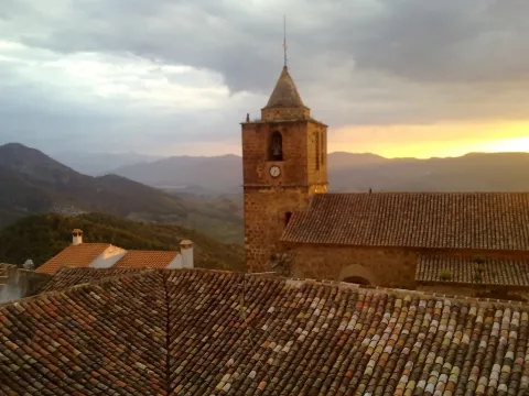
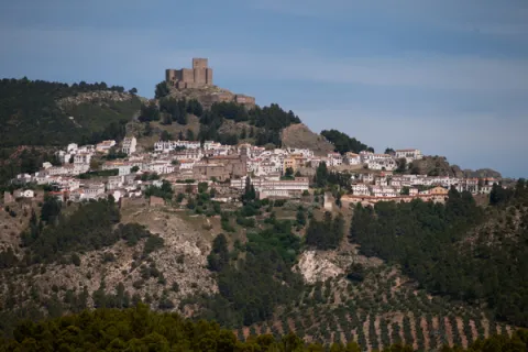
These lines correspond to the Treaty of the Mountain, studied by the Duke of Almazan, a document that some researchers attribute to Jorge Manrique. To talk about the 15th century in the Sierra de Segura is to talk about the Manrique family and the border period. A situation in which attacks and responses by Christians and Muslims were frequent. This danger and the border situation can only be seen by entering Segura de la Sierra: remains of walls, towers, entrance doors and on top of the hill, the watchful castle.

The Visits Books of the Order of Santiago described in the late 15th century the castle of Segura de la Sierra as a military compound with weapons to face a siege or, if necessary, to organize a village to attack the enemy. We cannot forget that in 1434 Rodrigo Manrique organized a village to conquer Huécar in the Altiplano granadino.

In Segura de la Sierra, taking advantage of this privileged position and under the security offered by its walls is where Jorge Manrique was raised under the care of his mother, Mrs. Mencía de Figueroa, in the house that still today is preserved five hundred years later.

Breve descripción

A candle on an oak table, a tintero with a pen and a half-write piece of paper. A figure draws attention to the rest of the room dedicated to the Manrique family on the second floor of the tower of tribute in the castle of Segura. Jorge Manrique is a character closely linked to Segura de la Sierra. If we were to imagine the poet in front of the paper, we might think that the text might start like this: "remind me to be very noble, Mr. Brother, having once said, in they are closer to mockery, you will see if you wanted me to write something about the work of the Montaria."

Ubicación
Latitud
38.298857
Longitud
-2.651877
Distrito
Ubicación en el mapa
POINT (-2.651877 38.298857)
Tipos de punto de interés
Imágenes carrusel
imagen
Image
6%20%283%29.jpg
Imagen principal
Desactivado
imagen
Image
10633135523_4ee3bea4f5_b.jpg
Imagen principal
Desactivado
imagen
Image
Segura_de_la_Sierra_PM_091668_E.jpg
Imagen principal
Desactivado
Loading map
Preparing points of interest and routes...
Marcas de calidad

Monument to Félix Rodríguez de la Fuente

Submitted by brandcode_deweloper on
Id
8108303
Descripción
Descripción larga

Built in 1980

Breve descripción
Source dedicated to the memory of Félix Rodríguez de la Fuente, a lover of nature. It has a tile plate where the honorado and the year of construction are named.
Telecomunicaciones
Teléfono de contacto
953 566 001
Ubicación
Código Postal
23658
Latitud
37.746690
Longitud
-3.906610
Dirección
Camino de la Sierra, 1
Distrito
Municipio
Ubicación en el mapa
POINT (-3.90661 37.74669)
Tipos de punto de interés
Imágenes carrusel
imagen
Image
Monumento%20a%20F%C3%A9lix%20Rodr%C3%ADguez%20de%20la%20Fuente3.jpg
Imagen principal
Desactivado
Imágenes cabecera
imagen
Image
Monumento%20a%20F%C3%A9lix%20Rodr%C3%ADguez%20de%20la%20Fuente.jpg
Imagen principal
Activado
Loading map
Preparing points of interest and routes...

Mount Cuarto de Ardal

Submitted by brandcode_deweloper on
Id
8095030
Descripción
Descripción larga

At 1440 m high is the MONTE ARDAL, which can be accessed by the road that reaches San Bartolomé, to the crossing that is moving to the left. It is a classroom of nature located in a forest shelter, with views of the village, the surrounding mountains,... in addition to the shelter, there is also a recreation area, adapted don barbecues, tables, and covered by a porch.

Breve descripción

Northof the term, there is a mountain, theArdal Room, in which the oaks, together with the retama, predominate, the albar thorn, wild rosals, juniper, ivy and madreselva. An ideal ground for the cicnetic species of major hunting (boar, deer, corzo...), and also of pastures, especially for the cattle of ligia.

Telecomunicaciones
Correo electrónico
ayuntamiento@genave.es
Ubicación
Código Postal
23392
Latitud
38.429970
Longitud
-2.733050
Distrito
Municipio
Ubicación en el mapa
POINT (-2.73305 38.42997)
Imágenes carrusel
imagen
Image
Cuarto%20de%20Ardal%2C2.JPG
Imagen principal
Desactivado
Imágenes cabecera
imagen
Image
Cuarto%20de%20Ardal%2C%20%281%29.jpg
Imagen principal
Activado
Loading map
Preparing points of interest and routes...
Alto de Santa Ana Mill-Museum

Submitted by brandcode_deweloper on
Id
2343682
Descripción
Descripción larga

It was the first, and therefore oldest, to operate in Valdepeñas. It began to ground the day on August 15, 1540 and had two milling stones. Its owner, Juanín LeClerque, called it the Upper Mill of Santa Ana and also built a second mill, called the Bajo of Santa Ana, which also had two stones. Both mills were the only ones in Valdepeñas until the 18th century.

In 1787, the batan, used until then to cast wool, was transformed into a mill, and was built in the area of El Ejido de San Sebastián by Catherine González de Medina.

It is currently dedicated to the museum and divided into three sections: Portal, dedicated to the historical part; Molino, dedicated to the mill, its parts and operation; and Hoorno, which hosts a small sample of objects and techniques specific to the popular arts and customs of Valdepeñas and its region.

Breve descripción

3-storey Arab-origin hydraulic flour mill. The construction is in bankruptcy, adapting to the skirt of a hillside. In its interior are presented useful and tools of the 19th century.

Telecomunicaciones
Teléfono de contacto
953 310 044 / 953 310 111
Correo electrónico
serafinpulido@msn.com
Ubicación
Código Postal
23150
Latitud
37.590170
Longitud
-3.823590
Dirección
Molino de Santa Ana, 29
Distrito
Ubicación en el mapa
POINT (-3.82359 37.59017)
Tipos de punto de interés
Imágenes carrusel
imagen
Image
Valdepe%C3%B1as%20de%20Ja%C3%A9n%20027.jpg
Imagen principal
Desactivado
imagen
Image
Valdepe%C3%B1as%20de%20Ja%C3%A9n%20028.jpg
Imagen principal
Desactivado
Imágenes cabecera
imagen
Image
Valdepe%C3%B1as%20de%20Ja%C3%A9n%20031.jpg
Imagen principal
Activado
Horario
Concerted visits. Weekends: 10: 00 - 14: 00 and 17: 00 - 20: 00.
Microsite al que pertenece
Loading map
Preparing points of interest and routes...
Flour Mill and Frondosa Naturaleza Interpretation Centre

Submitted by brandcode_deweloper on
Id
2343514
Descripción
Breve descripción

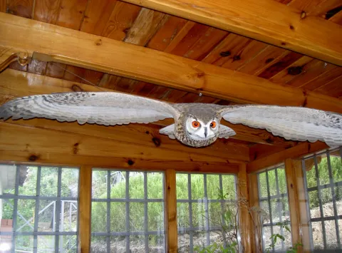
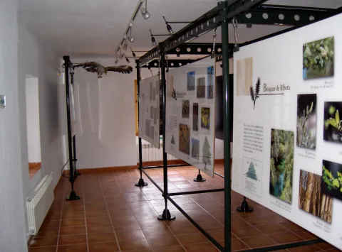
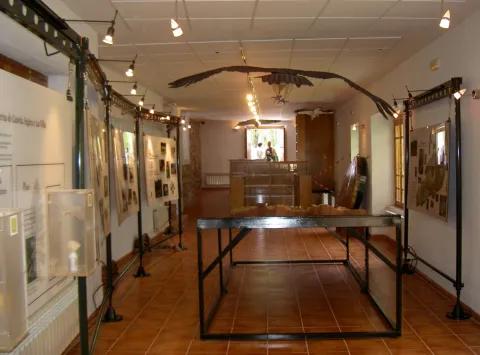
Frondosa Nature contains, among other elements, audiovisual, olfactory panels, images and sounds of the flora and fauna of this protected natural space, bird reproductions and a model of the Natural Park of Cazorla, Segura and the Villas.

Telecomunicaciones
Sitio web
www.almagaia.eu
Teléfono de contacto
953 721 330
Correo electrónico
info@almagaia.es
Ubicación
Nombre
La Casa de la Luz.
Código Postal
23470
Latitud
37.905224
Longitud
-2.998526
Dirección
Camino del Ángel, 7-9
Municipio
Ubicación en el mapa
POINT (-2.998526 37.905224)
Tipos de punto de interés
Imágenes carrusel
imagen
Image
PICT5925.jpg
Imagen principal
Desactivado
imagen
Image
PICT5929.jpg
Imagen principal
Desactivado
imagen
Image
PICT5927.jpg
Imagen principal
Desactivado
imagen
Image
PICT5926.jpg
Imagen principal
Desactivado
Imágenes cabecera
imagen
Image
PICT5936.jpg
Imagen principal
Activado
Horario
10: 30 - 13: 30 and 16: 00 - 19: 00.
Loading map
Preparing points of interest and routes...

Flour Mill el Gato

Submitted by brandcode_deweloper on
Id
8107962
Descripción
Descripción larga

Dated between 1950 / 1959. Electric flour mill with elevators and threads that carry wheat and flour from one machine to another. It has atrojes for the storage of wheat, atroje for the damp, alfanje, milling stay and machine stay. The chunks are built in tapial and spun, the function being to store the grain. The alfanje, built in brick and wood, is where you will find the set of milling stones. Inside is the gear that moves the stone. The stay of the milling is where the process of milling the grain is carried out. The machine stay is the second floor where you will find the trickle, the clean and the fender.

Breve descripción

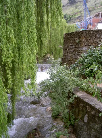
Located in the Hutar or Hutar Birth. It's the next mill to the Trinity Mill. He took advantage of the strength of the Hutar Arroyo water. The mill is within a newly built building. The waterfall remains with its blinded arches that brought water to the mill. In the surroundings are its mill stones

Telecomunicaciones
Sitio web
www.huesa.es
Correo electrónico
ayuntamiento@carboneros.es
Ubicación
Código Postal
23487
Latitud
37.764260
Longitud
-3.077970
Municipio
Ubicación en el mapa
POINT (-3.07797 37.76426)
Imágenes carrusel
imagen
Image
p1330838.jpg
Imagen principal
Desactivado
Imágenes cabecera
imagen
Image
p1330739-copia.jpg
Imagen principal
Activado
Loading map
Preparing points of interest and routes...

Mill of the Cubo

Submitted by brandcode_deweloper on
Id
4884561
Descripción
Breve descripción

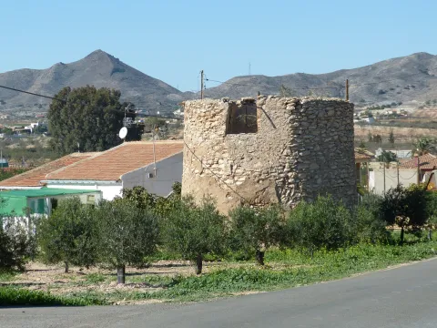
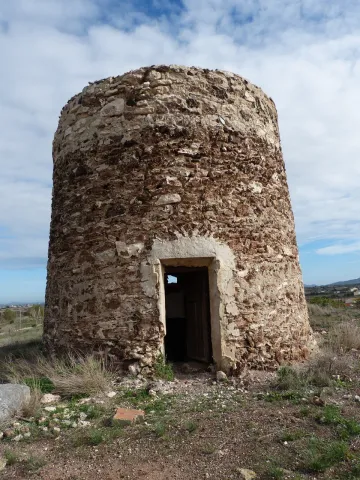
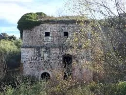
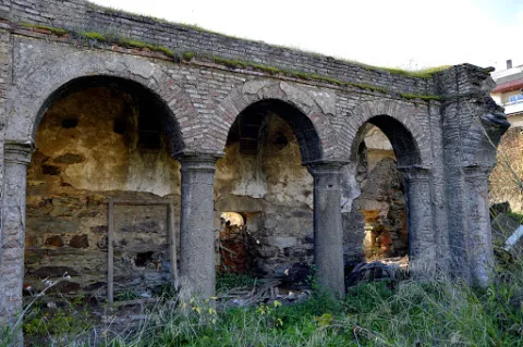
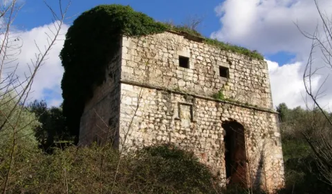
It is a fortified flour mill that takes the name of the stream of the cube, is built by the Order of Calatrava in 1437. It is the largest and best preserved fortified mill built by the South Peninsular Military Orders. In this place, down to the river of the Cube, we find an area of high ecological and landscape value.

Telecomunicaciones
Sitio web
www.tosiria.com
Teléfono de contacto
622 626 159
Ubicación
Código Postal
23650
Latitud
37.743900
Longitud
-3.940700
Distrito
Municipio
Ubicación en el mapa
POINT (-3.9407 37.7439)
Tipos de punto de interés
Imágenes carrusel
imagen
Image
molino%20del%20cubo.jpg
Imagen principal
Desactivado
imagen
Image
molino%20del%20cubo%202.jpg
Imagen principal
Desactivado
Imágenes cabecera
imagen
Image
molino.jpg
Imagen principal
Activado
Loading map
Preparing points of interest and routes...
Lower Mill or Vicarage Mill

Submitted by brandcode_deweloper on
Id
4707246
Descripción
Descripción larga

It consists of one wheel and two milling stones, the first to mould wheat and the second for other grain types; the network of acequias and canals that fed it is kept in use but only for the irrigation of the annexed gardens.

Breve descripción

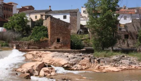
This flour mill is located on the right bank of the Guadalimar, upstream of the core of Puente de Génave, being the most interesting from the architectural and historical point of view. It appears to be mentioned in Philip II's Relations in which it is said that it is "a particular flour mill in which all the neighbors of Génave grind" and that they went here due to the absence of streams with sufficient flows for the construction of a mill in that locality; from this circumstance derives the name of "Génave mill" with which it is also known.

Telecomunicaciones
Sitio web
www.puentedegenave.es/el-municipio/patrimonio-historico.html
Correo electrónico
pgenave@puentedegenave.es
Ubicación
Código Postal
23350
Latitud
38.354562
Longitud
-2.803199
Distrito
Municipio
Ubicación en el mapa
POINT (-2.803199 38.354562)
Tipos de punto de interés
Imágenes carrusel
imagen
Image
111430.jpg
Imagen principal
Desactivado
Imágenes cabecera
imagen
Image
Almazara_de_la_Vicarxa.jpg
Imagen principal
Activado
Loading map
Preparing points of interest and routes...