Saltar al contenido principal
icon-intereses-senior

Canena Small Mill

Submitted by brandcode_deweloper on
Id
8001060
Descripción
Descripción larga

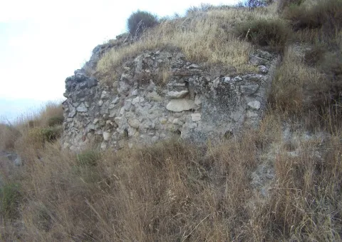
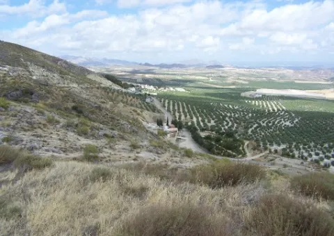
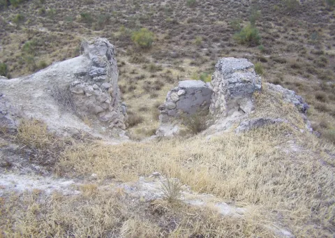
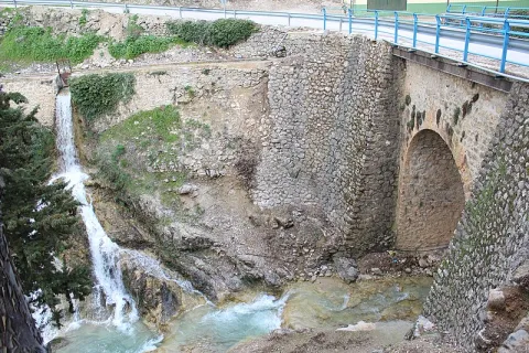
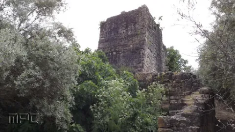
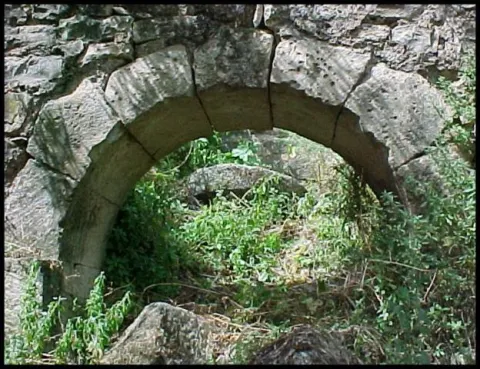
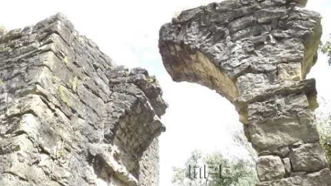
The mill is a hydraulic construction of at least Roman times that served for the grinding of cereal. The initial remains could be dated in the Roman era, but then much improved in the 16th century when it was bought by Francisco de los Cobos. The existing remains allow to contemplate several arches of the aqueduct, the water storage tank and hydraulic drive.

Breve descripción

The architectural and urban elements of interest of Canena are the aqueduct and mill of El Molinillo, located next to the stream of the Yedra.

Telecomunicaciones
Sitio web
https://canena.es/
Correo electrónico
canena@canena.es
Ubicación
Código Postal
23420
Latitud
38.047680
Longitud
-3.482890
Dirección
Carretera 322 Km. 135
Municipio
Ubicación en el mapa
POINT (-3.48289 38.04768)
Tipos de punto de interés
Imágenes carrusel
imagen
Image
molinillo%20canena.jpg
Imagen principal
Desactivado
imagen
Image
molinillo%20canena3.jpg
Imagen principal
Desactivado
Imágenes cabecera
imagen
Image
molinillo%20canena2.jpg
Imagen principal
Activado
Loading map
Preparing points of interest and routes...
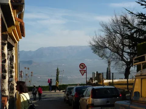
Viewpoint Paseo de Antonio Machado

Submitted by brandcode_deweloper on
Id
7500350
Descripción
Breve descripción

Known as La Muralla, this perimeter street to the city of Baeza offers beautiful views over the olive grove, the Guadalquivir valley and the natural park of Sierra Magina.

Ubicación
Código Postal
23440
Latitud
37.992360
Longitud
-3.469560
Municipio
Ubicación en el mapa
POINT (-3.46956 37.99236)
Tipos de punto de interés
Imágenes carrusel
imagen
Image
Baeza_Paseo_Antonio_Machado_010.jpg
Imagen principal
Desactivado
Microsite al que pertenece
Loading map
Preparing points of interest and routes...
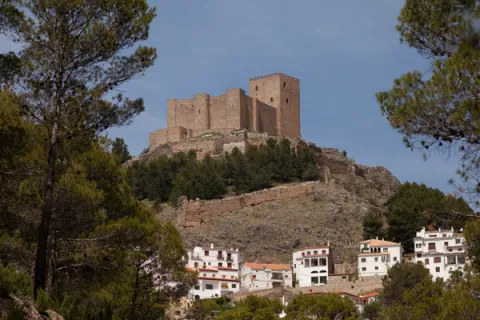
Viewpoint Castle of Segura de la Sierra

Submitted by brandcode_deweloper on
Id
7480918
Descripción
Breve descripción

One of the treasures of the Sierras de Cazorla, Segura and Las Villas natural park, lifts the visitor over the mountains and shows on one side the mountain olive groves and on the other the most extensive forests of the Iberian Peninsula.

Ubicación
Código Postal
23379
Latitud
38.299210
Longitud
-2.649790
Dirección
C/ Castillo, s/n
Distrito
Ubicación en el mapa
POINT (-2.64979 38.29921)
Tipos de punto de interés
Imágenes carrusel
imagen
Image
Segura_de_la_Sierra_PM_091677_E.jpg
Imagen principal
Desactivado
imagen
Image
Segura_de_la_Sierra_PM_091756_E.jpg
Imagen principal
Desactivado
Imágenes cabecera
imagen
Image
Segura_de_la_Sierra_PM_091670_E.jpg
Imagen principal
Activado
Microsite al que pertenece
Loading map
Preparing points of interest and routes...
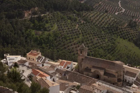
Viewpoint Castle of Santa Catalina

Submitted by brandcode_deweloper on
Id
7477305
Descripción
Breve descripción

A walk outside the Parador offers an aerial view over the olive groves of the countryside, between Jaén and Sierra Morena.

Ubicación
Código Postal
23003
Latitud
37.767780
Longitud
-3.799800
Dirección
Cerro, C/ Sta. Catalina, s/n
Distrito
Municipio
Ubicación en el mapa
POINT (-3.7998 37.76778)
Tipos de punto de interés
Imágenes carrusel
imagen
Image
image_104368.jpeg
Imagen principal
Desactivado
imagen
Image
image_217365.jpeg
Imagen principal
Desactivado
Microsite al que pertenece
Loading map
Preparing points of interest and routes...
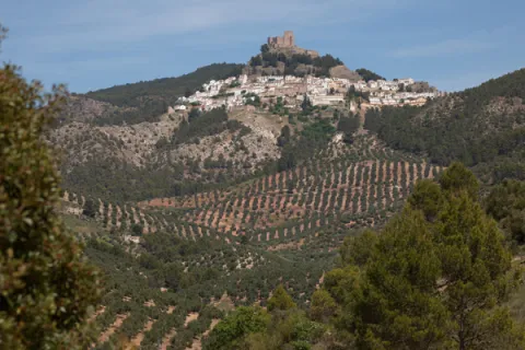
Viewpoint Castle of la Peña de Martos

Submitted by brandcode_deweloper on
Id
7474476
Descripción
Breve descripción

An excursion from the city centre of Martos will lead you to the ruin of the mystery-filled castle. It is a great lookout over the longest olive groves in the province.

Ubicación
Código Postal
23600
Latitud
37.718020
Longitud
-3.960870
Distrito
Municipio
Ubicación en el mapa
POINT (-3.96087 37.71802)
Tipos de punto de interés
Imágenes carrusel
imagen
Image
castillo-martos.jpg
Imagen principal
Desactivado
Imágenes cabecera
imagen
Image
castillo-pena.jpg
Imagen principal
Activado
Microsite al que pertenece
Loading map
Preparing points of interest and routes...
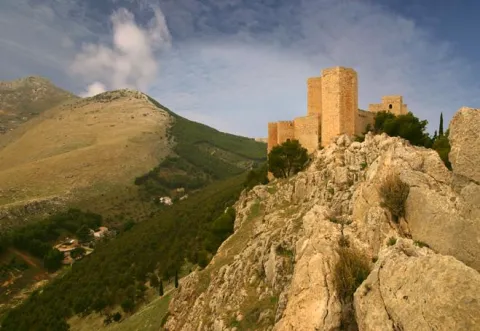
Viewpoint Castle of Baños de la Encina

Submitted by brandcode_deweloper on
Id
7473108
Descripción
Breve descripción

One of the oldest castles in Europe, a film scene, magnificent Almohad military construction, allows us an extensive view of the olive grove near Sierra Morena.

Ubicación
Nombre
Cerro del Cueto
Código Postal
23711
Latitud
38.170310
Longitud
-3.775320
Dirección
Plaza de Santa María, 1
Distrito
Ubicación en el mapa
POINT (-3.77532 38.17031)
Tipos de punto de interés
Imágenes carrusel
imagen
Image
mirador.jpg
Imagen principal
Desactivado
Imágenes cabecera
imagen
Image
banos-encina.jpg
Imagen principal
Activado
Loading map
Preparing points of interest and routes...
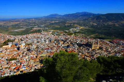
Viewpoint Casco Histórico de Iznatoraf

Submitted by brandcode_deweloper on
Id
7504663
Descripción
Breve descripción

One of the highest towns in Andalusia, this urban town is located at 1000 meters of altitude, as a watchhouse over tens of kilometers of olive trees in all directions. The view of the Sierra de Las Villas is spectacular.

Ubicación
Código Postal
23338
Latitud
38.157390
Longitud
-3.033010
Municipio
Ubicación en el mapa
POINT (-3.03301 38.15739)
Tipos de punto de interés
Imágenes carrusel
imagen
Image
image_148449.jpeg
Imagen principal
Desactivado
imagen
Image
image_148455.jpeg
Imagen principal
Desactivado
Imágenes cabecera
imagen
Image
image_165313.jpeg
Imagen principal
Activado
Loading map
Preparing points of interest and routes...
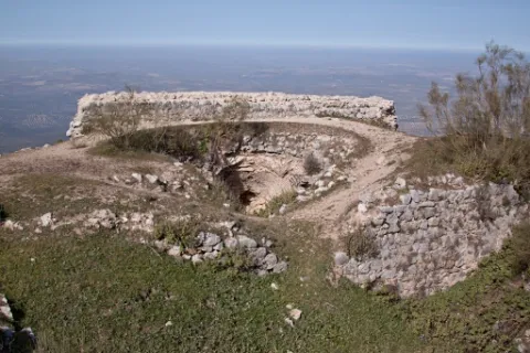
Old Wash House

Submitted by brandcode_deweloper on
Id
4520112
Descripción
Breve descripción

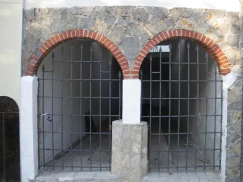
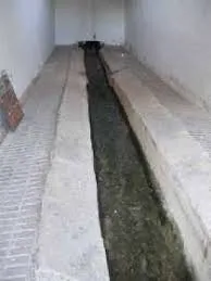
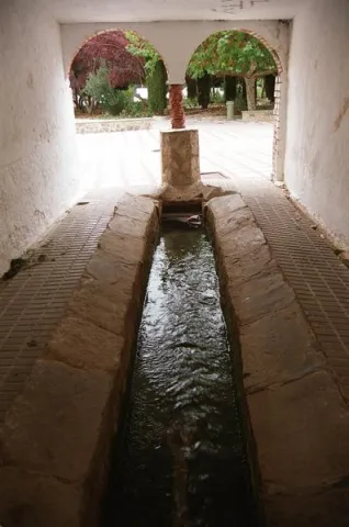
A few meters from the Fuente de la Negra is another public building related to water, the laundry, whose origin dates back to the 17th century, with architectural elements characteristic of the popular baroque such as the access panels arches or the small central salomonic column that is based on a pillar. Its use, markedly social, has been maintained until almost today. Incidentally, it is an elongated rectangular ship (10 x 2.5 meters), of argamase and lime, with a central channel, covered by a skylight, which constitutes the proper laundry.

Telecomunicaciones
Sitio web
www.fuensantademartos.es
Teléfono de contacto
953 565 000
Ubicación
Código Postal
23610
Latitud
37.647140
Longitud
-3.905260
Distrito
Ubicación en el mapa
POINT (-3.90526 37.64714)
Tipos de punto de interés
Imágenes carrusel
imagen
Image
lavadero%202.jpg
Imagen principal
Desactivado
imagen
Image
lavadero.jpg
Imagen principal
Desactivado
Imágenes cabecera
imagen
Image
Monumentos6Lavadero.jpg
Imagen principal
Activado
Loading map
Preparing points of interest and routes...
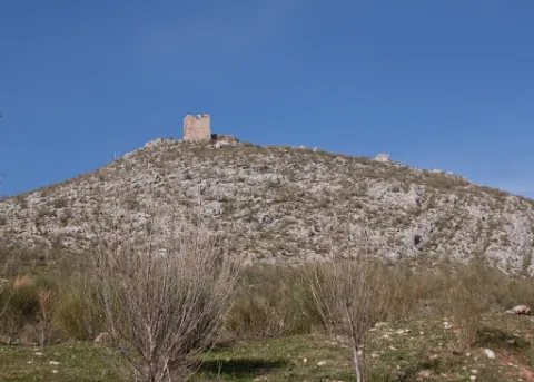
The Moors' Tiles

Submitted by brandcode_deweloper on
Id
8211317
Descripción
Descripción larga

It is possibly the Muslim castle referred to in the 1243 delimitation between the episcopal headquarters of Baeza and the Archbishop of Toledo. Known as Ullurauam. In a territory between the Jandulilla River and the Guadiana Minor River, which would be identified as Larva. It is located near the current population of Larva, on a well-ridden hill, with a polygonal plant and two enclosures. Its construction is of tapial alternating with masonry. It keeps its perimeter walled and several towers. Then, because of the border situation and the demographic vacuum, this castle would run the same destination as that of Cabra, abandoned in a neutral area. Roman remains have also been found as a tegola.

Breve descripción

Since the 13th century Larva was integrated into the Spanish-Nazi border, playing an important role in the villages of the minor Guadiana, in 1243 there were conflicts in the delimitations between the episcopal headquarters of Baeza and the archbishopric of Toledo.

Telecomunicaciones
Correo electrónico
ayuntamiento@larva.es
Ubicación
Código Postal
23591
Latitud
37.760080
Longitud
-3.202320
Distrito
Municipio
Ubicación en el mapa
POINT (-3.20232 37.76008)
Imágenes carrusel
imagen
Image
Tejar%20de%20los%20Moros2.jpg
Imagen principal
Desactivado
imagen
Image
El%20Tejar%20de%20los%20moros.jpg
Imagen principal
Desactivado
Imágenes cabecera
imagen
Image
Tejar%20de%20los%20Moros3.jpg
Imagen principal
Activado
Microsite al que pertenece
Loading map
Preparing points of interest and routes...
La Puente

Submitted by brandcode_deweloper on
Id
912688
Descripción
Descripción larga

Cobos not only had territorial jurisdiction over these populations, but also exercised strong control over all of them of their Councils and their inhabitants.

In Torres, apart from certain actions to preserve the medieval castle, the Council planned various works throughout the 16th century, such as the capitular houses, the posite, the reform of the parish temple and a bridge, absolutely necessary to unite the town with the site of the Fuenmayor, where the mills of the secretary Cobos were located, by which the neighbors were required to pass. In the population, the only one who had a privilege to build mills was Cobos and his wife, Maria de Mendoza. Their control assured them of a safe income, so it was absolutely necessary to keep the bridge in good condition.

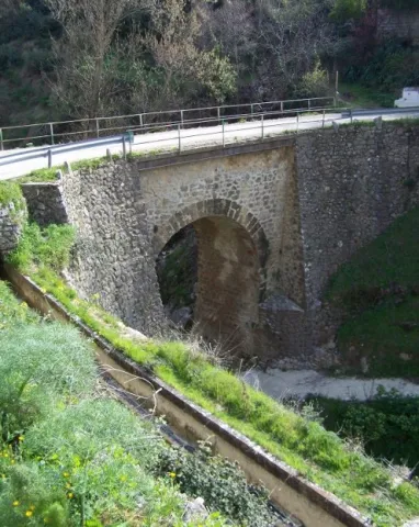
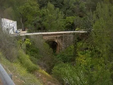
Dead Cobos, Mrs. Maria de Mendoza, through his butler Bartolomé Ximénez, ordered the Council to make a new bridge, as the old man was destroyed by a heavy storm. The project was carried out by Andrés de Vandelvira, an architect at the service of the family of Cobos. According to María José Sánchez Lozano the works began in 1561, and the following year the Council agreed that all that was left to rise from it should be done according to the trace of Andrés de Vandelvira: "(...) I saw what is left to be made of the work of the bridge that is to be done in the river of the said villa for the passage of the mills of the bread of his lordship (...) command that everything that is left to be made of the bridge be done by the trace that has given Andrés de Vandelvira (...). The bridge, which is currently preserved, although removed, is made of stone and has a single half-point eye rather high, as the ravine on which it rises is very deep in this area.

Vandelvira draws a bridge without great pretensions, without decorative attachments, in which security and permanence in time must take precedence over other aspects. Vandelvira will be an experienced bridge builder, sometimes simple as this one of Torres, others of great architectural and engineering monumental, such as those raised on the channels of the Guadalmena, Guadalimar (Ariza) and Guadalquivir (Mazuecos) rivers.

Breve descripción

In 1539 the Secretary of Charles V, the ubetense Don Francisco de los Cobos, acquired the villas of Canena and Torres, which were alienated by the Crown to the Military Orders of Santiago and Calatrava. With this double purchase he rounded Cobos his heritage; years earlier, in 1537 he also made it with the villa of Sabiote, head of his large lordship, completed with the acquisition of Jimena and Recena by his wife Maria de Mendoza.

Telecomunicaciones
Sitio web
www.torresturismo.es
Teléfono de contacto
953 363 011
Correo electrónico
info@torresturismo.es
Ubicación
Código Postal
23540
Latitud
37.786140
Longitud
-3.509730
Distrito
Municipio
Ubicación en el mapa
POINT (-3.50973 37.78614)
Tipos de punto de interés
Imágenes carrusel
imagen
Image
La%20Puente%202.jpg
Imagen principal
Desactivado
imagen
Image
La%20Puente.jpg
Imagen principal
Desactivado
Imágenes cabecera
imagen
Image
800px-La_Puente%2C_Torres_24J_02.jpg
Imagen principal
Activado
Microsite al que pertenece
Loading map
Preparing points of interest and routes...