Saltar al contenido principal
icon-intereses-senior

La Fuente del Vergao

Submitted by brandcode_deweloper on
Id
4742245
Descripción
Breve descripción

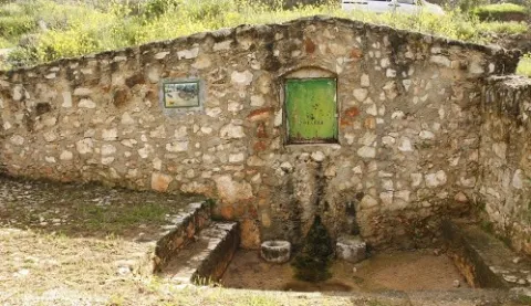
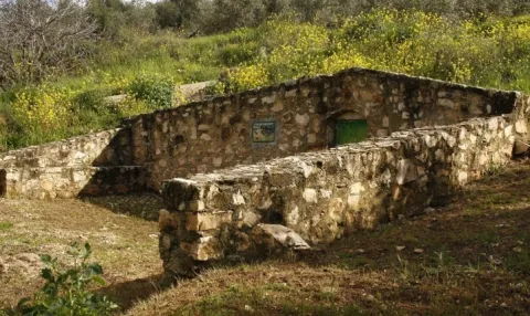
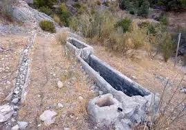
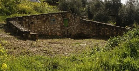
The source of El Vergao is a public source whose existence has been known at least since 1752. It is a source of alcoba that was in use until 1966, when the municipality was provided with the drinking water network. It is located next to the road of El Vergao.

Ubicación
Latitud
38.183511
Longitud
-3.313678
Distrito
Municipio
Ubicación en el mapa
POINT (-3.313678 38.183511)
Tipos de punto de interés
Imágenes carrusel
imagen
Image
unnamed.jpg
Imagen principal
Desactivado
imagen
Image
La%20Fuente%20del%20Vergao.jpg
Imagen principal
Desactivado
Imágenes cabecera
imagen
Image
7.jpg
Imagen principal
Activado
Loading map
Preparing points of interest and routes...

La Hermitage of Santa María Magdalena

Submitted by brandcode_deweloper on
Id
4619189
Descripción
Descripción larga

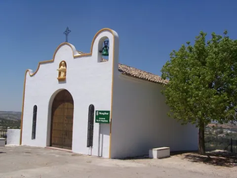
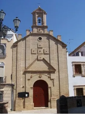
It features a simple half-point arch cover with two small side voids imitating saetas. On the top we find a hornadine with the image of Mary Magdalena and on a side a small body of swordsman.

Breve descripción

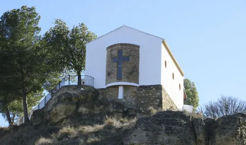
On July 14, 1990, the new hermitage of Santa María Magdalena was opened and blessed; it is located on the hill of Maquiz, where the old one was and which is quoted in the 16th century.

Telecomunicaciones
Sitio web
https://mengibarturismo.com/
Teléfono de contacto
677 222 285
Correo electrónico
turismo@aytomengibar.com
Ubicación
Código Postal
23620
Latitud
37.968050
Longitud
-3.808780
Dirección
Carretera A-6000 a Villargordo, desvío por el camino de Los Chorrillos
Distrito
Municipio
Ubicación en el mapa
POINT (-3.80878 37.96805)
Tipos de punto de interés
Imágenes carrusel
imagen
Image
La%20Ermita%20de%20Santa%20Mar%C3%ADa%20Magdalena.jpg
Imagen principal
Desactivado
Imágenes cabecera
imagen
Image
ermita-de-la-malena-mengibar.jpg
Imagen principal
Activado
Microsite al que pertenece
Loading map
Preparing points of interest and routes...

La Hermitage of Jesús

Submitted by brandcode_deweloper on
Id
4969981
Descripción
Breve descripción

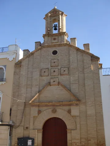
Built in the17th century, retains the cover of its only floor with canyon vault with lunetes. The 18th century facade stands out for its monocrous simplicity of the brick, the ascending verticality of lines and the articulation of spaces. From its interior to highlight theJesus' shrimpwith paintings of this century in the vault.

Telecomunicaciones
Sitio web
www.arjonilla.es/el-municipio/patrimonio-historico.html
Correo electrónico
alcaldia@ayuntamientodearjonilla.es
Ubicación
Código Postal
23750
Latitud
37.974440
Longitud
-4.107590
Dirección
Plaza de la Encarnación, s/n
Distrito
Municipio
Ubicación en el mapa
POINT (-4.10759 37.97444)
Tipos de punto de interés
Imágenes carrusel
imagen
Image
Ermita%20de%20Jes%C3%BAs%20en%20arjonilla.jpg
Imagen principal
Desactivado
Imágenes cabecera
imagen
Image
ermita%20%281%29.jpg
Imagen principal
Activado
Microsite al que pertenece
Loading map
Preparing points of interest and routes...

La Cerradilla

Submitted by brandcode_deweloper on
Id
8094084
Descripción
Descripción larga

Location: To the north-east of the city centre, very close to it and at the limits of the Natural Park of Cazorla, Segura and Las Villas.

Distance: 3 km.

Medium: On foot.

Access route: By a road that leaves directly from the city centre towards Los Rinnes.

Breve descripción

To the north-east of the city centre, very close to it and at the limits of the Natural Park of Cazorla, Segura and Las Villas, beautiful natural enclave that stands out for the presence of a natural water source, as well as the remains of an Arab castle.

Telecomunicaciones
Sitio web
www.huesa.es/el-municipio/patrimonio-natural.html
Correo electrónico
huesa@promojaen.es
Ubicación
Código Postal
23487
Latitud
37.764200
Longitud
-3.077910
Municipio
Ubicación en el mapa
POINT (-3.07791 37.7642)
Tipos de punto de interés
Imágenes carrusel
imagen
Image
Rinc%C3%B3n%20Alto%20.%20La%20Cerradilla.%20%281%29.jpg
Imagen principal
Desactivado
Loading map
Preparing points of interest and routes...

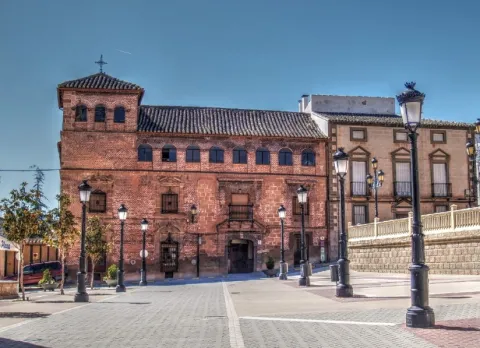
The Big House

Submitted by brandcode_deweloper on
Id
4571299
Descripción
Descripción larga

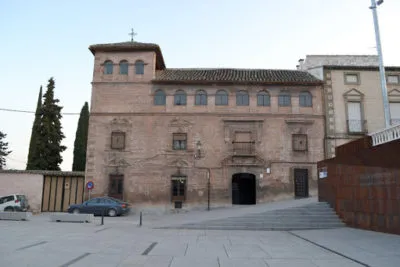
It is actually a wide rectangle, divided into three floors in height and with an airful turret-view on the east side - or left side. Very common typology in Granada, especially in the neighborhoods of San Jerónimo, San Matías and la Magdalena. Although, unlike here, it does not present a porticated and blasphemed courtyard in its centralizer, which leads us to think that it would not in its origin be a foundation of a family - more or less aristocratic - for its particular residence, so we suspect it would have another purpose.

The same similarity with the granadine is also given from a constructive point of view. Thus, if brick is used for the wall walls, for the structural elements, jambas, dintels and frontons, the quarry is used - in this case the asperon so abundant in the place - and the latter are the elements that define it from the stylistic point of view.

As a result, we are facing an interesting example of a typical house of the full baroque - the second half of the XVII-, where there is still a very strong presence of the elements of Mudejar tradition, the façade being very well resolved, because of its interior only highlights the dome on the pechines that originally topped the staircase.

On the first floor, whose cover of the apainelated arch does not appear by focusing the set, its beautiful intellized windows, crowned by beautiful curved and broken fronts, stand out. In the second, the most noble, the rhythms are changed, as they are small intellized windows with the same type of front, except that located on the door which is a large balcony framed by a beautiful alfice, also being in both bodies of a high quality the grate. Finally, a large, flying cornice separates them from the last with a proliferation of semicircular windows.

A number of hypotheses have been set aside on the promoters of its construction. At some times we thought it might be the great plateau that the first Marquis de la Rambla ordered to raise in the town, from which we even have several works payments. However, by some documents it seems to be deduced that it was built by the albaceas and employers of the foundation created by Mother Martha of Jesus - the so-called Almagro House - from the place - to also use it as a table to house travellers and carriages, which with their income would help to cover the expenses of the Hospital of Mercy.

Breve descripción

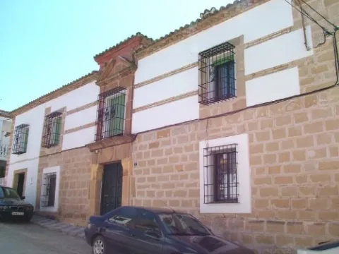
The so-called Casa Grande is located flanking the southern side of the Plaza de Bajo - a popular name -, wide public space, which works and performs functions that a larger square of any Spanish village.

Telecomunicaciones
Sitio web
www.cabradelsantocristo.org/monumentos/la-casa-grande/
Teléfono de contacto
953 397 002
Correo electrónico
info@aytocabradelsantocristo.com
Ubicación
Latitud
37.704510
Longitud
-3.285770
Distrito
Ubicación en el mapa
POINT (-3.28577 37.70451)
Tipos de punto de interés
Imágenes carrusel
imagen
Image
casa-grande-cabradelsantocristo-400x267.jpg
Imagen principal
Desactivado
Imágenes cabecera
imagen
Image
11.jpg
Imagen principal
Activado
Microsite al que pertenece
Loading map
Preparing points of interest and routes...

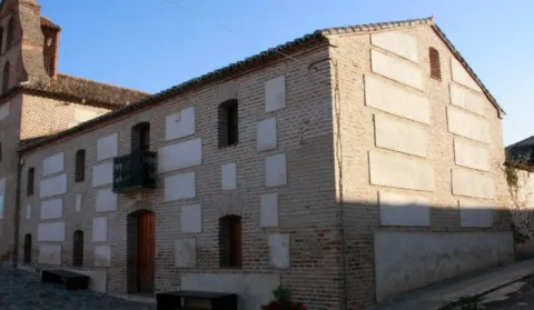
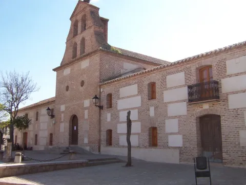
The Priest's House

Submitted by brandcode_deweloper on
Id
6547993
Descripción
Breve descripción

Located on the side of the church, the house of the priest is currently in the process of restoration after a time of abandonment.

Telecomunicaciones
Sitio web
www.aldeaquemada.com
Teléfono de contacto
680 104 199
Correo electrónico
turismo.aldeaquemada@gmail.com
Ubicación
Código Postal
23215
Latitud
38.412170
Longitud
-3.371710
Dirección
C/ Miguel Hernández, 4
Distrito
Municipio
Ubicación en el mapa
POINT (-3.37171 38.41217)
Tipos de punto de interés
Imágenes carrusel
imagen
Image
1.jpg
Imagen principal
Desactivado
Imágenes cabecera
imagen
Image
3.jpg
Imagen principal
Activado
Loading map
Preparing points of interest and routes...

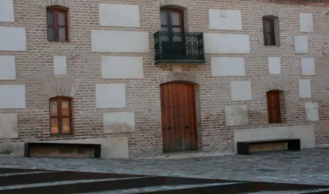
The Civil Commander's House

Submitted by brandcode_deweloper on
Id
6549854
Descripción
Breve descripción

In the church, this house has had several functions, some of which are the City Council and currently the home of the retired. For many years it was used as a poultry of braves during the holidays.

Telecomunicaciones
Sitio web
www.aldeaquemada.com
Teléfono de contacto
680 104 199
Correo electrónico
turismo.aldeaquemada@gmail.com
Ubicación
Código Postal
23215
Latitud
38.411930
Longitud
-3.371660
Dirección
C/ Miguel Hernández, 4
Distrito
Municipio
Ubicación en el mapa
POINT (-3.37166 38.41193)
Tipos de punto de interés
Imágenes carrusel
imagen
Image
1001176.jpg
Imagen principal
Desactivado
Imágenes cabecera
imagen
Image
Aldeaquemada%20-%20Iglesia%20%281%29.jpg
Imagen principal
Activado
Loading map
Preparing points of interest and routes...

The Carrillera House

Submitted by brandcode_deweloper on
Id
4444747
Descripción
Descripción larga

It is the oldest and largest house in the town, sent to build in the year 1,760. It was used as a house of the Carrillera and the posio, where food was stored to distribute to the people in the years of scarcity and drought.

It was also believed that the inquisition was established there because his shield was on the facade, but after successive studies the researchers concluded that the Court of the Inquisition was in another house and that only one member of it lived there. This house, other ancient people and the Church, are united by underground tunnels that come out of its wells and lead to the outskirts of the village.

Breve descripción

It is the oldest and largest house in the town, sent to build in the year 1,760. Known as Casa de la Carrillera or Casa Grande of the 17th century. It was used as a home of the Carrillera and the posio, where food was stored to distribute to the village in the years of scarcity and drought.

Telecomunicaciones
Sitio web
www.cazalilla.es/el-municipio/patrimonio-historico.html
Teléfono de contacto
953 537 131
Correo electrónico
castalla@cazalilla.es
Ubicación
Código Postal
23628
Latitud
37.984340
Longitud
-3.881640
Dirección
C/ Donantes de Sangre, 12
Distrito
Municipio
Ubicación en el mapa
POINT (-3.88164 37.98434)
Tipos de punto de interés
Imágenes cabecera
imagen
Image
casa-carrilera.jpg
Imagen principal
Activado
Loading map
Preparing points of interest and routes...

Church-Sanctuary of the Christ of Mercy

Submitted by brandcode_deweloper on
Id
5713458
Descripción
Descripción larga

It was built on the primitive Mosque, documented by the Arab geographer Al-Himyari, which mentions that it was "three ships supported by marble columns."

His primitive advocation was that of Santa Maria, not knowing what the primitive building was, only that the Altar Mayor was oriented to the west and its main door to the north, next to the so-called "Source of the Place." The first documentary data on the works of the present temple dates back to 1547, bringing the stone from the quarry of Bedmar. In 1569 the Sunday Master of Uriarte worked on it. From 1582 to 1589 the work was carried out by Juan Vizcaino. In 1591, the Gaspar and Francisco de Aranda brothers were mentioned as builders and singers, building the central ship with their six side chapels with cassette vaults, so to the use of Vandelvira, who was the supervisor of the works of the temples of the Diocese. The whole set is of Renaissance-purist style.

In 1613 the construction of the Tower began, according to the trace of Juan de Aranda Salazar in a baroque style. Three shields belonging to the Bishops are carved in stone: Sancho Dávila, Cardinal Moscoso and Fernando Andrade, in the work of the Masters Francisco de Zamora, Alonso Galan, Andrés and Diego Guerrero, being completed in 1661 by Euphrassio López de Rojas, a shield of Sancho Dávila is found inside. One of its four bells is 1794.

In 1729 he repaired the header or Major Chapel by Juan de Consuegra. From 1771 to 1780 is built the current cruise, Capilla Mayor and dome of the Evangelists in neoclassical style with details of the rocky in the dome that was built by Pedro Fernández, Manuel and Juan Armenteros. In 1799, the pulpits and graderies were placed and the construction of the Main Fachada in neoclassical style was started by Manuel Caballero, who finished it, along with the choir in 1801. According to some historians, the façade is one of the best in the province because of its irous proportions. In 1864 the Capels of Expiration and Baptism were built. In 1877 the construction work of the Chapel of San José, directed by the architect Pedro Pascual Samaniego, with elegant orange half, was completed and decorated with interesting frescoes from 1915. From 1989 to 1992 the temple suffered a profound restoration by adding elements that further enhance its interior as several altarpieces in Macael marble and stone, the magnificent Reja and silery of the Chapel of San José, lighting, etc.

Breve descripción

In its interior there are valuable works of art such as the Altardo Mayor of Neorenacentalist style of the Sevillian Carlos Bravo Nogales, also author of his imagination. Images like Jesus Yacente by Sebastian Santos Rojas, considered one of the best imagers of the 20th century. In general it stands out all its Imagineria de Semana Santa de famado imagineros, as well as the Retables of San José and Ntra. Mrs. Dolores. The Church retains interesting paintings from the 16th, 17th and 18th centuries, Images from the 16th to the 18th and some pieces of silver goldsmiths from the 16th to the 19th, highlighting the Procedural Custody of 1669 and the embroidery of some ornaments. The Church is Good of Cultural Interest, and according to UNESCO it is heritage to be preserved. The Church retains a PARROQUIAL MUSEO with interesting pieces of goldsmiths since the 16th century and embroidery, with terres from the 17th and 18th century.

Telecomunicaciones
Sitio web
www.misericordiajodar.org/historia/articulo04.html
Correo electrónico
secretaria@misericordiajodar.org
Ubicación
Código Postal
23500
Latitud
37.844820
Longitud
-3.352820
Dirección
C/ Juan Martín, 1
Distrito
Municipio
Ubicación en el mapa
POINT (-3.35282 37.84482)
Tipos de punto de interés
Imágenes carrusel
imagen
Image
1.jpg
Imagen principal
Desactivado
Imágenes cabecera
imagen
Image
3.jpg
Imagen principal
Activado
Microsite al que pertenece
Loading map
Preparing points of interest and routes...

Parish Church of Santo Domingo

Submitted by brandcode_deweloper on
Id
912171
Descripción
Descripción larga

Little one was to be the early church for the Council to take the agreement of enlargement and to extend it, as stated in the Act of Cabildo of 11 November 1545: "Attend to the neçania that woes that the church and temple is enlarged and enlarged as the people who come to the dibines oficiços to the church do not take within it (...)." These works were not to solve the problems, and by 1564 the Council decided to build a new temple according to the traces of Andrés de Vandelvira, master of the factory of the Cathedral of Jaén and also director of the parish factories of the Diocese. The agreement is reflected in the Act of Cabildo of 6 January 1564: "Let another yglesia be built and fagged again that is wider and better, because the one that is now very narrow and partly working (...) will be built the new church where the best paresçiere to be made healthier (...) and will be traced by Andres de Vandelvira, master of works of this bishopric (...)."

Neither outside nor inside are structures kept in plain sight that remind us of the Vandelvirian architecture, in large part by the above-mentioned radical interventions practiced in the temple, which continued to preserve its primitive location. A more detailed analysis of its factory and an inspection of hidden areas provide us with certain architectural elements that can support the partition of Vandelvira in the works, case the remains of the run-in conserved between the deck or roof and the current vaults. It is to be thought that because of its unique disposition, exposed to the seasons and winds, that church suffered a serious setback in its original architecture, which, after strong restorations or modifications, was covert or integrated into which we currently contemplate.

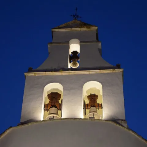
In any case, certain works were completed in the temple in 1587: tower staircase, general enlucido, repairs on the roof. At the end of the 17th century, according to Professor Galera Andreu, Master Francisco Landeras made a modest swordsman, which is not the one currently preserved, because this is the result of the works of the 19th century. In 1837, according to the report of Juan Tuñón, master of public works of Baeza, it was necessary to strengthen the silery on the west side, to fix the corner on the midday side and to do the whole roof. Years later, specifically on January 26, 1860, Antonio López, a master of works at the Cathedral of Baeza, made another report, in which there is a need for a number of damage to the walls, soleras of the chorus ship, straps of the armor of the roof, roof of the sacristy; as far as the bell tower is concerned, he says: "The bell tower is necessary to do it again from its plant (...) by the construction of that bell tower that will have six and a half rods of width and nine and fourth of high (...) its cost is eleven thousand and two hundred reais."

The conditions are also inserted: that the bulk of the walls of the bell tower will be of rod and half a fourth in frame, and its brick and mixture factory. By 1866, the architect José María Cuenca, states that the building was in very poor condition, although some works had already been done. In 1876 there was a record of new payments for works (including the general encalado of the temple, the fees for the direction of the architect Vicente Serrano Salaberri, etc.), which amounted to 26,000 reais.

All these works, plus the necessary and continuous general maintenance, have determined their current configuration: a living room church with three ships, with vaults down the central and half canyon the sides. Special mention should be made of the arcosolinos of the 17th century that flank the presbytery, with simple classical altars crowned with the blasphons of the Sánchez Barrionuevo.

OTHER ARTISTICAL MANIFESTIONS

In the side chapels of the cruise, the shields of the Sánchez Barrionuevo (S. XVII) are kept on the plaster. The paintings of the disciplinant procession of the Christ of Veracruz are interesting. The most valuable piece is its mudejar baptismal pile, made of green glazed ceramic with a gothic inscription between sogued moulds, which is closely related to that of the church of Bartolomé de Jaén. The baptismal pile (1750), decorated with a threaded serpent, is interesting.

Also preservedan oil on canvaswith the iconography ofEcce Homoof the 17th century: a sitting Christ that responds to the baroque aesthetics of the dark, another 18th century oil of the Divine Pastor of popular theme and great chromatic contrast and of the 20th century, a wooden size of a Crucified, with careful anatomical study.

Breve descripción

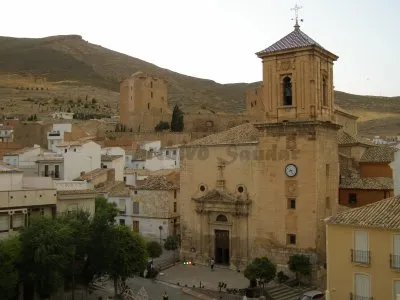
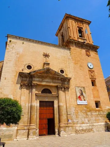
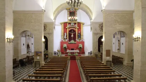
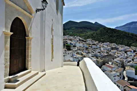
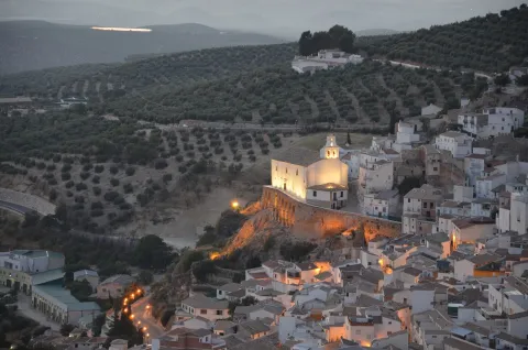
Monument included in the Artistic Historical Set. Incoated on 09 / 07 / 82. The parish church of Santo Domingo, located at the end of the city centre, is built on a strong architecture made up of eight arches that serve as a counter to its foundation on the side facing a wide valley, which is ironfully dominating. In the end, with its factory completely skewed, it shows us an image of an eminently popular temple, other than the formulas of cultured architecture. The interior, however, presents sufficient elements to consider its architecture within the 16th and 17th centuries, although certainly very much intervened by various causes and circumstances during the 18th and 19th centuries. A Mª. J. Sánchez Lozano we owe some data about his constructive process.

Telecomunicaciones
Sitio web
www.aytorres.es/el-municipio/patrimonio-historico.html
Teléfono de contacto
953 363 026
Correo electrónico
parroquiatorresjaen@gmail.com
Ubicación
Código Postal
23540
Latitud
37.786400
Longitud
-3.511030
Dirección
C/ Jesús Castillo Solís, 9
Distrito
Municipio
Ubicación en el mapa
POINT (-3.51103 37.7864)
Tipos de punto de interés
Imágenes carrusel
imagen
Image
igles-1140x640.jpg
Imagen principal
Desactivado
imagen
Image
Iglesia%20Parroquial%20de%20Santo%20Domingo2.jpg
Imagen principal
Desactivado
imagen
Image
iglesia-parroquial-2%20%281%29.jpg
Imagen principal
Desactivado
imagen
Image
iglesia-parroquial.jpg
Imagen principal
Activado
Imágenes cabecera
imagen
Image
iglesia-parroquial.jpg
Imagen principal
Activado
Modelo 3D
Loading map
Preparing points of interest and routes...