Saltar al contenido principal
icon-intereses-senior

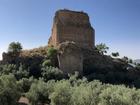
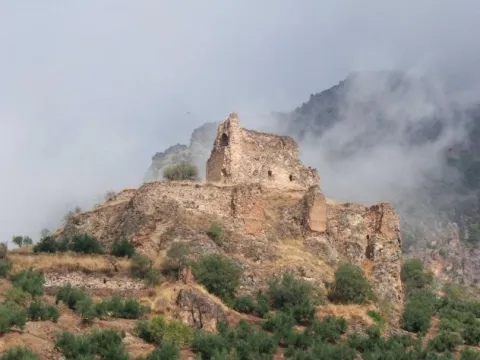
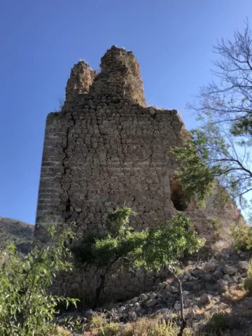
Castle of Bélmez de la Moraleda

Submitted by brandcode_deweloper on
Id
5857694
Descripción
Breve descripción

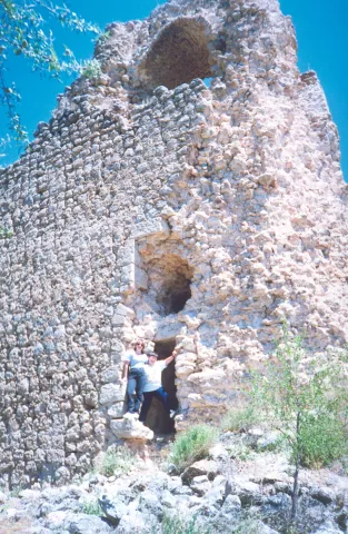
The castle of the Moraleda was built by the Muslims, and conquered by the Christians, for the first time, between 1243 and 1246, but it was not definitely until 1448, going into the Lordship of Jódar years later. It belonged to the Council of Baeza and the Order of Calatrava. From 1501 the lands of Bélmez belonged to the city of Granada in payment of certain debts that the Kings had with it, reserving the house of the castle to the lord of Jódar. The foundation as a villa dates from 1524, when land for rent was given to some local farmers. It belonged to the jurisdiction of Granada until, following the provincial organization of Javier de Burgos in 1833, it was included in the new province of Jaén.

Ubicación
Latitud
37.749540
Longitud
-3.383630
Dirección
C/ Patrocinio de Biedma, 9
Distrito
Ubicación en el mapa
POINT (-3.38363 37.74954)
Tipos de punto de interés
Imágenes carrusel
imagen
Image
castillo%20belmez.jpg
Imagen principal
Desactivado
imagen
Image
Castillo-de-Belmez-de-la-Moraleda_.jpg
Imagen principal
Desactivado
imagen
Image
Castillo-de-Belmez-de-la-Moraleda_01.jpg
Imagen principal
Desactivado
Imágenes cabecera
imagen
Image
Castillo-de-Belmez-de-la-Moraleda_02.jpg
Imagen principal
Activado
Microsite al que pertenece
Loading map
Preparing points of interest and routes...
Castle of Arenas

Submitted by brandcode_deweloper on
Id
4555180
Descripción
Descripción larga

Alfonso X won the castle through Peace signed with King Muhammad II year 1281. In 1462, after Henry IV's treguas, he granted to the great Moors the Constable Mr Lucas de Iranzo, with 600 men of horse and 2000 pawns attacked the castle of Camillo de Arenas on 20 April 1462. The fight was very intense and of five doors the castle had, two were burned by Christians. However, it was not achieved.

The Constable sent 30 gentlemen from Jaén to prepare an ambush to the Garrison of the Sand Camp. They were served as a spy by a renegade Moor who was a nephew of the Sand Camp Warden. The ambush was unsuccessful and after a slight skirmish the Christians returned to Jaén. In 1463, the Constable sent 40 pawns in command of Juan Navarrete, against the castle of Campillo. Christians make two prisoners for whom it was known that the garrison made up 33 Moors.

The Constable Iranzo sends 30 soldiers to try to take over Campillo, which was not done because... "they failed to be in good care." In 1471, the king of Granada, when he heard of a Christian project of attack on Campillo, sent his defenders "sufficient recuperation and people." In the letter of the Constable Iranzo to the then Pope Sixto IV, about the hasty situation of Jaén before the push of the Moors is cited as of great danger to Christians to the castle of Camillo de Arenas. Other news about our castle is given by the following chronists:
Argote de Molina in his "Nobleza de Andalucía" (1588), cites as Alcaide del Castillo de Campillo de Arenas to D. Francisco Fonseca.

Ximena Jury in his "ecclesiastical Anales" (1654), qualifies the castle of Campillo as "A strong castle on the Gate of Arenas." Espinalt in "Atlante española" (1787), says the following about the castle of Camillo de Arenas: "To the west of this villa half a leagues away, there remains a strong castle somewhat ruined, of immemorial time, as well as the Gate of Arenas held by two high peñascos that form it; it has twenty poles of latitude and through the river Valdearanzo and there is tradition that half chain that there is in the prison of this village one that put two Saracens in that door to prevent the entry of Christians of the kingdom of Jaén."

Campillo was conquered to the Moors by Mr Pedro Coello, Knight of the Vanda. His body was buried in the St. Louis of the Knights, the missing Royal Convent of San Francisco de Jaén. His epitaph said, "Here lies Pedro Coello, Knight of the Vanda, who won the Moors the castle of Arenas at their expense and died in an entrance with them, during the reign of the Catholic Kings in 1486.

Breve descripción

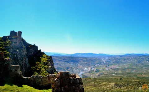
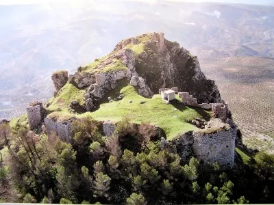
The Arenas Castle was built over the 14th century, preserving structures from the 9th to the 11th century. It sits on the Cerro del Castillo de Puerta Arenas, in the Sierra de Alta Coloma, between Granada and Jaén. The Camillo River Portillo is the only practical step to cross this saw.

Telecomunicaciones
Sitio web
www.campillodearenas.es
Correo electrónico
contacto@jaenescondido.es
Ubicación
Código Postal
23130
Latitud
37.592560
Longitud
-3.622090
Dirección
Campillo de Arenas
Distrito
Municipio
Ubicación en el mapa
POINT (-3.62209 37.59256)
Tipos de punto de interés
Imágenes carrusel
imagen
Image
Castillo-de-Puerta-Arenas-Campillo-de-Arenas-scaled%20%281%29.jpeg
Imagen principal
Desactivado
imagen
Image
Castillo%20de%20Arenas%202.jpg
Imagen principal
Desactivado
Imágenes cabecera
imagen
Image
Castillo%20de%20Arenas%20%281%29.jpg
Imagen principal
Activado
Microsite al que pertenece
Loading map
Preparing points of interest and routes...
Castle of Albanchez de Mágina

Submitted by brandcode_deweloper on
Id
1735110
Descripción
Descripción larga

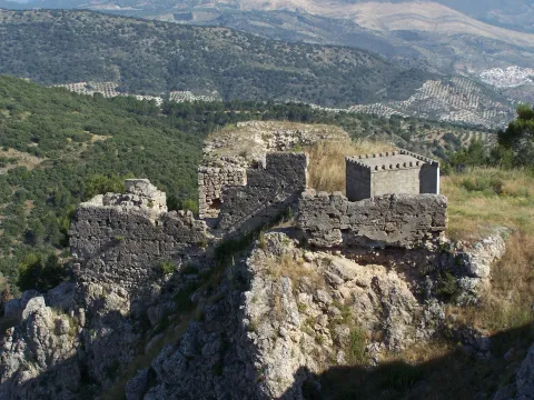
The castle was linked to the Order of Santiago, which created the command of Bedmar and Albanchez. What is preserved from it is its alcazarejo, built with masonry, which consists of two small, impressive nuclei because of its exterior appearance and the closing of the rock on which it sits, but with little internal capacity to house troops and beings. The highest core is a narrow rectangular platform that enables a small interior space. The entrance opens to the terrace of a rectangular floor turret that housed two cameras: one top, covered with a half-barrel vault, now melted, and one lower, a aljibe, with slightly pointed vault and remains of the stucco that covered it. The castle also had a small courtyard of triangular weapons with almond parapet and saetera windows, a square terrace with albarrana to defend over the cliff, protective walls, today practically destroyed, and rounded corners outside as it was a calatravo castle. It was declared Good of Cultural Interest in 1985.

Breve descripción

The castle of Albanchez de Mágina dominates and presides the village, which is located on the first ridge of the Sierra de los Castillejos. Despite its small dimensions and its inner narrows, its arriseach position makes it extremely difficult to access. Of presumably Christian origin, its construction was made with argamasa and it had to rise late, in the Middle Ages, in the early 14th century, as an alternative to another Muslim castle from which there are only remains, built with tapial in the lower and closer to the people.

Telecomunicaciones
Sitio web
www.albanchezdemagina.es
Teléfono de contacto
953 347 009
Correo electrónico
ayuntamiento@albanchezdemagina.es
Ubicación
Código Postal
23538
Latitud
37.790250
Longitud
-3.468000
Dirección
Av. de Hutar, 2
Distrito
Ubicación en el mapa
POINT (-3.468 37.79025)
Tipos de punto de interés
Imágenes carrusel
imagen
Image
Mon312.jpg
Imagen principal
Desactivado
imagen
Image
castillo%20de%20albanchez%20de%20magina.jpg
Imagen principal
Desactivado
imagen
Image
castillo%20de%20albanchez%20de%20magina%202.jpg
Imagen principal
Desactivado
Imágenes cabecera
imagen
Image
728_SS_01.jpg
Imagen principal
Activado
Horario
24 h.
Microsite al que pertenece
Loading map
Preparing points of interest and routes...
Castle Chiclana de Segura

Submitted by brandcode_deweloper on
Id
4480424
Descripción
Descripción larga

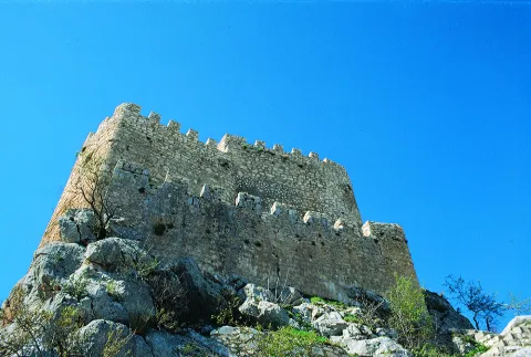
On top of this, the ruins of the castle, dominators and solitarians, are required to refer to the intensity of its first historical avatars, but also to the urban configuration of the municipality. Located at the highest point in the environment, it was a privileged place of surveillance for centuries. From that castle, dialectic synthesis of the Muslim and the Christian after being conquered by Fernando III, there remain evotions to the solidity of its already melted walls, to its snail staircase with false door, canes, bookstore and even a winery to keep the most generous caldos manchegos.

The ruins of this castle were declared in 1985 Good of Cultural Interest.

Telecomunicaciones
Sitio web
www.chiclanadesegura.es
Correo electrónico
chiclana@promojaen.es
Ubicación
Código Postal
23264
Latitud
38.310810
Longitud
-3.044480
Distrito
Municipio
Ubicación en el mapa
POINT (-3.04448 38.31081)
Tipos de punto de interés
Imágenes carrusel
imagen
Image
image_187172.jpeg
Imagen principal
Desactivado
Imágenes cabecera
imagen
Image
Mon265.jpg
Imagen principal
Activado
Loading map
Preparing points of interest and routes...
Castle Árabe de Rus

Submitted by brandcode_deweloper on
Id
4554738
Descripción
Breve descripción

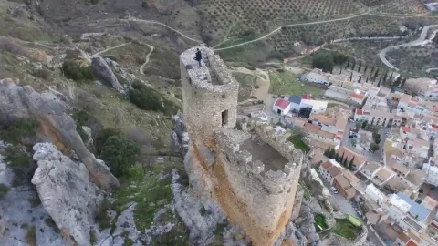
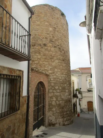
The urban origins of Rus are linked to an old castle from which a cylindrical turret of 12 meters of perimeter, in masonry, in the second half of the 13th century, is preserved. Until a few years ago, another was held on Triana Street.

Telecomunicaciones
Sitio web
www.rus.es
Teléfono de contacto
953 770 002
Correo electrónico
web@rus.es
Ubicación
Código Postal
23430
Latitud
38.046810
Longitud
-3.461350
Dirección
C/ Triana, 5
Municipio
Ubicación en el mapa
POINT (-3.46135 38.04681)
Tipos de punto de interés
Imágenes carrusel
imagen
Image
Castillo%20de%20Rus%202.jpg
Imagen principal
Desactivado
Imágenes cabecera
imagen
Image
Castillo%20%C3%81rabe%20de%20Rus.jpg
Imagen principal
Activado
Loading map
Preparing points of interest and routes...
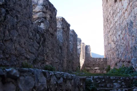
Town Centre of Villarrodrigo

Submitted by brandcode_deweloper on
Id
7970600
Descripción
Descripción larga

A ceramic panel, made by Palenciano in 1983, of a certain kitsch formalism, is shown in the square of the village to the popular taste, where the patron, the Virgin of Albanchez with the child Jesus, crowned by angels, is represented as well as a panoramic view of the parish church.

Breve descripción

In this small municipality are also of interest the characteristic elements of its vernacular architecture, prodigal in the use of tapial and flattened masonry, as well as of forged iron bars, decorated with rosets, lis flowers and fins on the front.

Telecomunicaciones
Sitio web
http://www.villarrodrigo.es/el-municipio/patrimonio-historico.html
Teléfono de contacto
953 484 126
Ubicación
Código Postal
23393
Latitud
38.487200
Longitud
-2.636120
Dirección
C/ Sta. Ana, 3
Distrito
Municipio
Ubicación en el mapa
POINT (-2.63612 38.4872)
Tipos de punto de interés
Imágenes cabecera
imagen
Image
cascourbano.jpg
Imagen principal
Activado
Loading map
Preparing points of interest and routes...
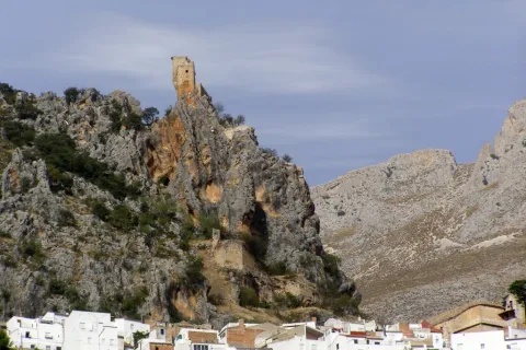
Town Centre of Orcera

Submitted by brandcode_deweloper on
Id
4672158
Descripción
Breve descripción

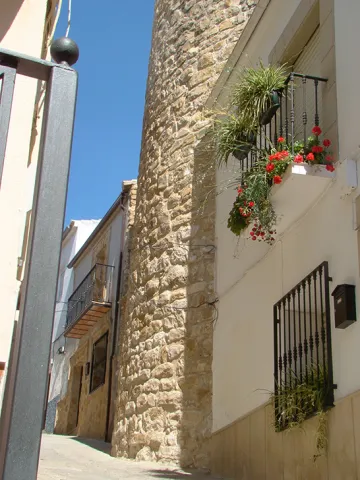
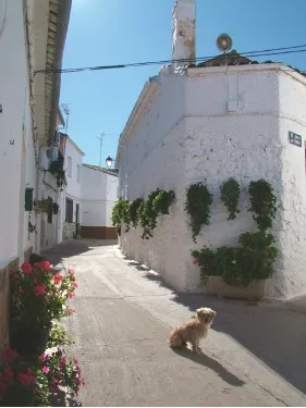
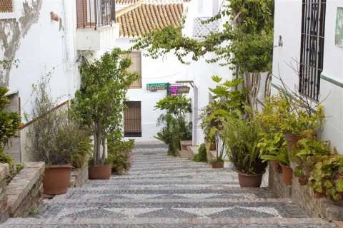
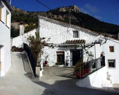
In an urban reticulation that is faithful to its origins, in the skirt of Mount Peñalta, on an abrupt topography, through narrow and irregular alleys, adarves and improvised squares, houses of clear serrana and vernacular identity, of ripada and slimmed masonry, capricious volumes, empty asymmetric, low height, original chimneys and Arab tiles are raised. It is the medieval neighborhood, which resists the avatars of the centuries.

Telecomunicaciones
Sitio web
www.orcera.es
Ubicación
Código Postal
23370
Latitud
38.317760
Longitud
-2.659330
Distrito
Municipio
Ubicación en el mapa
POINT (-2.65933 38.31776)
Tipos de punto de interés
Imágenes carrusel
imagen
Image
2283_Fill_800_800.jpg
Imagen principal
Desactivado
Imágenes cabecera
imagen
Image
Monumentos4Arquitecturapopular.jpg
Imagen principal
Activado
Loading map
Preparing points of interest and routes...
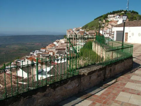
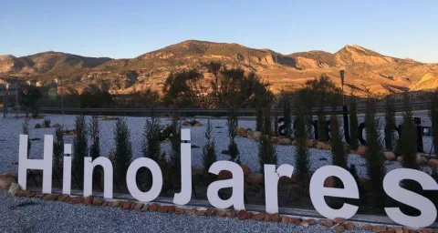
Town Centre of Hinojares

Submitted by brandcode_deweloper on
Id
8090596
Descripción
Descripción larga

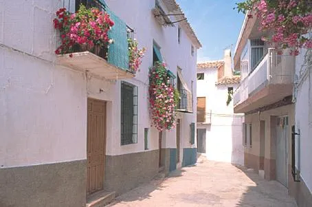
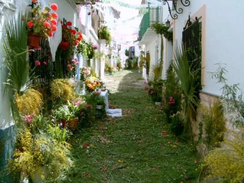
It is a small set of traditional houses that are whitened and covered in two waters by Arab tiles, with small verticalized holes to alleviate the rigors of winter, adapted to the simple habits of its inhabitants, dedicated to hunting, pastures and agriculture; and, in more peripheral positions, houses with a floor structure, with a maximum of four heights and roofed to four waters. The buildings are stacked and morphologically split like the chips of a game of domino, almost lost in an open landscape of wide horizons, differentiating ravines and green spaces, only on the next contour to the municipality.

Breve descripción

Urbanistically, this municipality has not been formed as a result of previous planning; it does not have a rational and hierarchical structure; it does not show regularity in the layout of its streets or an orderly design in the distribution of housing and services.

Telecomunicaciones
Sitio web
www.hinojares.es/el-municipio/patrimonio-historico.html
Correo electrónico
hinojares@promojaen.es
Ubicación
Código Postal
23486
Latitud
37.715500
Longitud
-2.999240
Municipio
Ubicación en el mapa
POINT (-2.99924 37.7155)
Imágenes carrusel
imagen
Image
hinojares2%20%281%29.jpg
Imagen principal
Desactivado
imagen
Image
hinojares5.jpeg
Imagen principal
Desactivado
Imágenes cabecera
imagen
Image
hinojares.jpg
Imagen principal
Activado
Loading map
Preparing points of interest and routes...
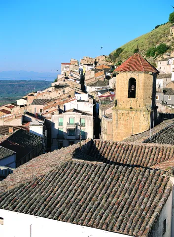
Town Centre Chiclana de Segura

Submitted by brandcode_deweloper on
Id
4479488
Descripción
Descripción larga

Located at a high height, embedded in a rock, around a rock, at the entrance to the Sierra de Segura, Chiclana is spread through the streets of the mountains, capricious corners and improvised squares, with the smell of the carnations and geraniums of its balconies and windows. It is accessed through a surprising tunnel that introduces us directly into the aura of its medieval mystery. This beautiful town, despite the historical avatars so negative to its heritage - such as the destructive retaliation of the Napoleonic troops, the fratricidal raging of the carlists, or the virulence of the hurricane that destroyed the church tower - retains the original Hispanic-Muslim structure of its urbanism, the medieval typology of its homes, and an unexpected architectural surprise, the buildings excavated in the stone, trogloditic wisdom that makes it possible to have houses with a uniform temperature throughout the year.

Ubicación
Código Postal
23264
Latitud
38.310770
Longitud
-3.044500
Distrito
Municipio
Ubicación en el mapa
POINT (-3.0445 38.31077)
Tipos de punto de interés
Imágenes carrusel
imagen
Image
Casco%20urbano%20Chiclana%20de%20Segura%202.jpg
Imagen principal
Desactivado
Imágenes cabecera
imagen
Image
Casco%20urbano%20Chiclana%20de%20segura.jpg
Imagen principal
Activado
Loading map
Preparing points of interest and routes...
Waterfall Bridge Nevada

Submitted by brandcode_deweloper on
Id
8088114
Descripción
Descripción larga

Like the other municipalities of the region, it is located between the mountain and the Guadalquivir valley. Its fundamental economy is the olive tree, although it has an incipient tourist development

Breve descripción

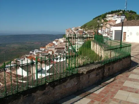
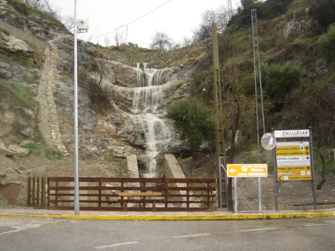
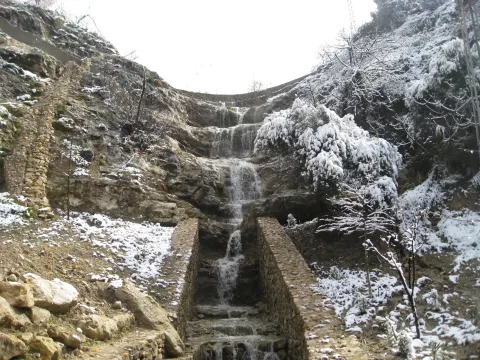
Chilluevar is a municipality in the province of Jaén, in Andalusia, Spain. It belongs to the Sierra de Cazorla region. This town is located at 738 meters of altitude and is located in one of the least known parts of the Natural Park, the Sierra de las Villas.

Telecomunicaciones
Sitio web
www.promojaen.es/pit/fmt.asp?i=&m=28&op=1
Teléfono de contacto
953 717 300
Ubicación
Código Postal
23477
Latitud
38.001440
Longitud
-3.031300
Municipio
Ubicación en el mapa
POINT (-3.0313 38.00144)
Imágenes carrusel
imagen
Image
cascada%20Chillu%C3%A9var2%20%281%29.jpg
Imagen principal
Desactivado
Imágenes cabecera
imagen
Image
cascada%20Chillu%C3%A9var%20%281%29.jpg
Imagen principal
Activado
Loading map
Preparing points of interest and routes...