Saltar al contenido principal
icon-intereses-familia

Castle of Burgalimar

Submitted by brandcode_deweloper on
Id
320772
Descripción
Descripción larga

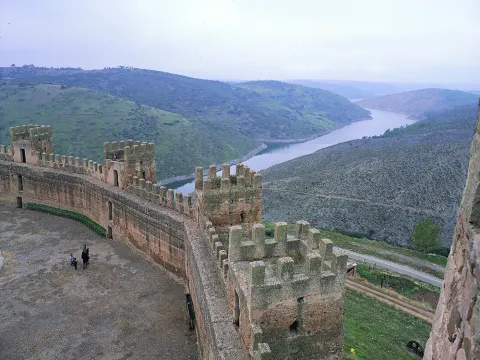
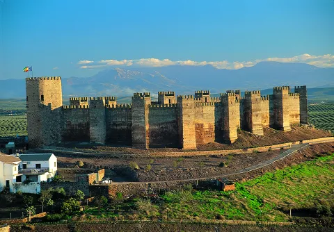
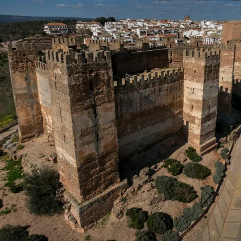
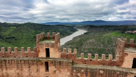
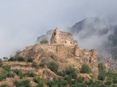
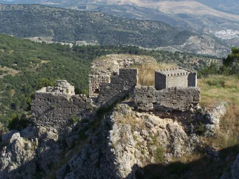
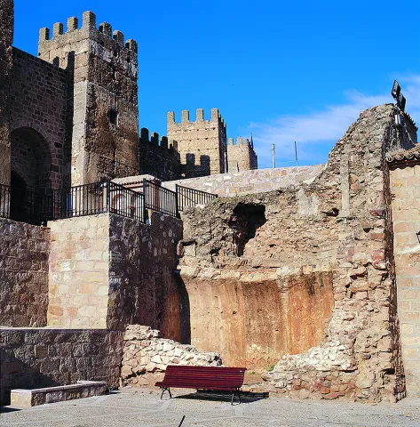
El castillo de Baños de la Encina, tradicionalmente ha sido considerado una obra califal a partir de la confusión generada por una lápida fundacional que le fue atribuida erróneamente, constatándose que la misma estuvo emplazada en la muralla de Talavera de la Reina, siendo todos los epígrafes que se han registrado en la localidad de carácter funerario. La fortaleza ocupa la zona de mayor altitud del Cerro del Cueto, mientras que la población de Baños de la Encina se extiende por sus vertientes norte y este, junto a uno de los afluentes más caudalosos e importantes del río Guadalquivir, el Rumblar.

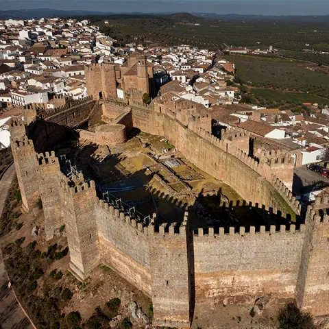
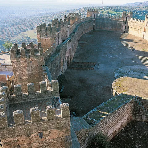
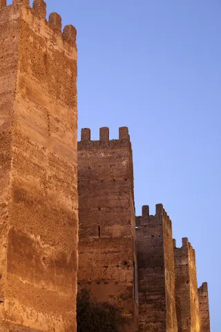
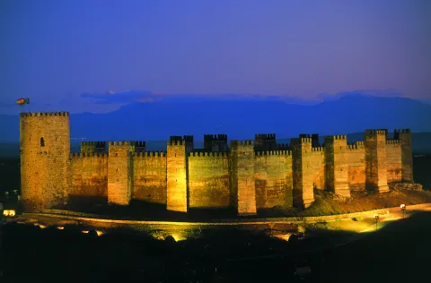
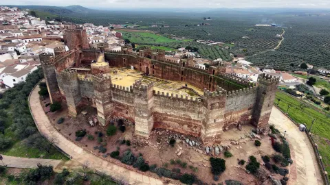
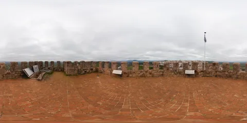
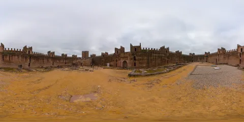
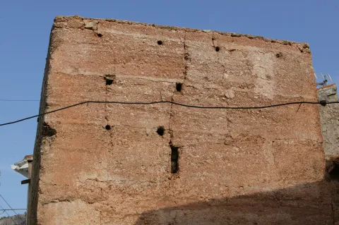
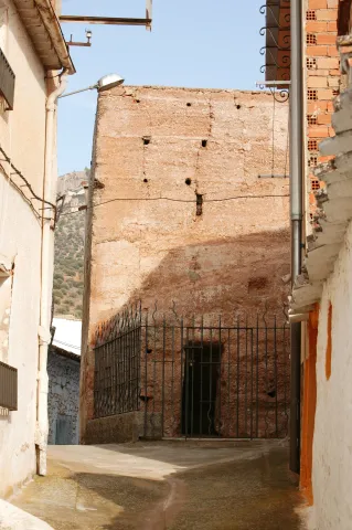
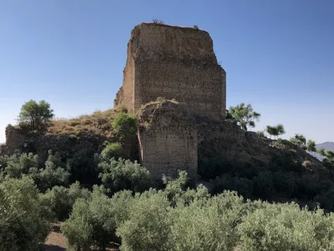
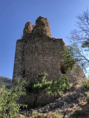
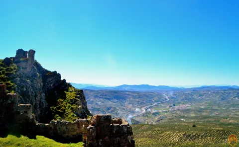
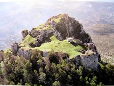
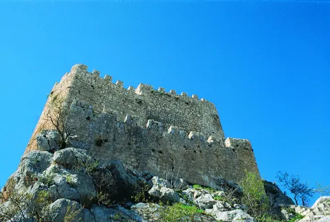
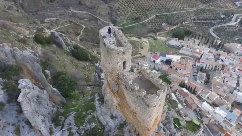
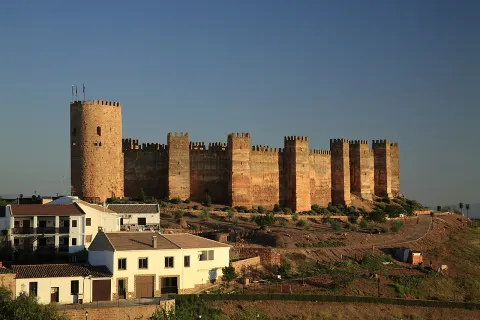
Se trata de un monumental recinto defensivo, conformado por paños de muralla jalonados por quince torres cuadradas de tapial de argamasa (Tabiyya), revestido con cal que reproduce la técnica del “falso despiece”, entre las que destaca la torre norte por sus dimensiones. El recinto se adapta perfectamente a la orografía del terreno, conformando una fortaleza amurallada con forma elíptica, estratégicamente posicionada, ya que controla Sierra Morena por el norte y toda la campiña jiennense, por el sur. 

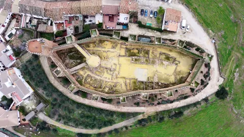
En el espacio interior se disponen diferentes estancias, en su mayoría de planta cuadrada, a ambos lados del recinto, existiendo en la zona central, la más elevada del cerro, un aljibe de planta rectangular, dividido en dos salas por un muro medianero, cubiertas por bóvedas de cañón.

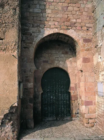
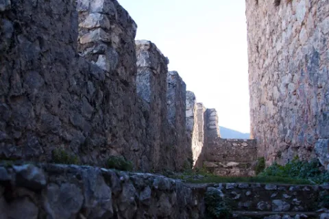
La entrada al recinto se realizaba en recodo, utilizando un estrecho pasillo que se formaría entre la muralla y las diferentes estancias, para alcanzar la parte sur del recinto o incluso el acceso al aljibe. De la misma forma, hacia el norte, las dependencias de la fortaleza estarían separadas o distribuidas siguiendo otro vial, en esta ocasión empedrado, que llegaría hasta la torre más septentrional del recinto. Estas dos calles, que circulan de sur a norte, dividen y ordenan la mitad septentrional del castillo en tres alargados espacios, a la vez que daban acceso a las torres, en cuyo interior se disponen pequeñas estancias superpuestas. Ambas calles se cortan con la reforma cristiana y la construcción del alcazarejo, pero se conservan algunos restos en este nuevo espacio cristiano.

Enfrentada con la entrada principal, en la zona occidental del lienzo de muralla, se emplaza la Pontanilla, puerta delimitada por dos muros, posteriormente reformados, con el mismo sistema defensivo que la entrada principal, con un pasillo estrecho y quebrado.

Tras la conquista por Fernando III de Castilla en 1225 se produce un reordenamiento interno del castillo y de su sistema defensivo. 

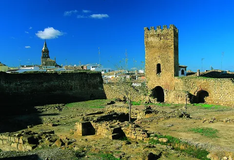
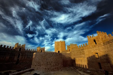
Se construye en la zona norte el Alcazarejo, con un torreón circular y dos murallas de sillarejos que se adosan a los lienzos musulmanes del castillo. Así se obtiene un espacio romboidal, que se convierte en el último reducto defensivo y protege la Torre del Homenaje, que sustituye a la original torre islámica. De mayores dimensiones y edificada en mampostería, se accedería a ella por los adarves laterales. En el interior del recinto externo se han documentado otras dependencias castellanas, como un espacio de almacén y bodega en el rincón este y estructuras posiblemente destinadas a horno para pan y lagar.

La utilización del Castillo como cementerio hasta 1928, afectó gravemente a los restos arqueológicos, pudiéndose observar en la actualidad las improntas de los nichos en algunos lienzos de la muralla oeste.

La riqueza minera y su ubicación estratégica atrajeron pobladores desde época prehistórica al Cerro del Cueto. La primera ocupación de importancia registrada, ligada al auge de la minería del cobre y después del bronce data del II milenio a.n.e., coincidiendo temporalmente con el poblado de Peñalosa. Son asentamientos con las similares características, que se deben considerar de la misma estructura político-económico-social. 

La ocupación iberorromana parece concentrarse en la zona más alta del cerro, donde se han documentado varias fases de ocupación casi ininterrumpidas que se extienden desde el ibérico pleno hasta época romana tardía. 

Tras la conquista musulmana de la Península Ibérica, la población se instalaría en las faldas del recinto defensivo. En la zona más elevada debió existir un bastión militar que reutilizaría los muros y lienzos preexistentes.

Tradicionalmente se ha considerado que el castillo de Baños de la Encina fue edificado durante el reinado de al-Hakam II en la segunda mitad del siglo X, a partir de la atribución errónea de una lápida epigráfica depositada en el Museo Arqueológico Nacional, sin embargo, las últimas investigaciones han puesto de manifiesto la edificación de este conjunto defensivo en un periodo anterior a los acontecimientos bélicos que culminaron con la Batalla de las Navas de Tolosa (1212), para servir de baluarte defensivo junto a los castillos de Castro Ferral, Las Navas de Tolosa o Vilches, ante el avance de las tropas cristianas, guiadas por sus monarcas, entre los que destacarían Alfonso VII y Alfonso VIII.

Tras su conquista en 1225 por Fernando III, pasó a formar parte de un amplio territorio concejil bajo la jurisdicción de la ciudad de Baeza, siendo objeto de significativas remodelaciones internas concentradas en la parte más septentrional de la fortaleza.

A lo largo de los siglos XVI y XVII, la población va realzando su poder económico y social con la construcción de grandes edificios señoriales de familias de un cierto rango social, provenientes sobre todo de Baeza y Linares, que se irán estableciéndose a ambos lados de la vía principal. La posibilidad de que la villa estuviese delimitada por una cerca muraria, con una función más fiscal que defensiva, está avalada por algunos vestigios aún perceptibles en el núcleo urbano. En época de Felipe IV, en 1626, Baños adquiere la independencia jurisdiccional, desgajándose del gran Concejo de Baeza.

El castillo parece mantener su carácter militar hasta el siglo XVII, a partir del cual sufrirá un proceso de deterioro y abandono que se prolongará con toda probabilidad hasta el siglo XIX, cuando se comenzará a utilizar el patio de armas como cementerio municipal hasta bien entrado el siglo XX.
 

Breve descripción

In the Cerro del Cueto, a rocky elevation of 430 m above sea level, the imposing castle of Baños de la Encina, a defensive enclosure built in the 12th century and reformed after the Christian conquest, is now erected. Its strategic position allowed it to control Sierra Morena in the north and the entire Jiennense countryside in the south. It is made up of an alcázar and an outer enclosure jalonado by fourteen square towers made of argamase tapial and a tower of Tribute in irregular masonry. In its interior, archaeological interventions have shown, in its most southern sector, an occupation since prehistoric to Roman times. At present, remains of a Bronze Age village or a step that could belong to a large Roman cult building are preserved.
The mining wealth of this region and its strategic location on the communication routes between Andalusia and the Plateau, have led to the settlement of different populations at its top, highlighting an important settlement of the Bronze Age, coetany of Peñalosa. Several almost uninterrupted phases of occupation have also been documented, ranging from the full Iberian to late Roman times. In the Middle Ages, in the face of the advancement of Christian armies, a network of fortifications is created in the surroundings of Sierra Morena, of which will form part the castle of Baños, built in the 12th century by the Almohades and reinforced by the Castilians after its conquest in 1225. The population boom throughout the 16th and 17th centuries has been reflected in the numerous nobility buildings that the town retains.
Telecomunicaciones
Teléfono
<p>José María Rodríguez Valle</p>
Sitio web
www.laencinaturismo.com
Teléfono de contacto
953 613 338 / 626 818 446
Correo electrónico
info@laencinaturismo.com
Ubicación
Nombre
Cerro del Cueto
Código Postal
23711
Latitud
38.170310
Longitud
-3.775320
Dirección
Plaza de Santa María, 1
Distrito
Ubicación en el mapa
POINT (-3.77532 38.17031)
Tipos de punto de interés
Imágenes carrusel
imagen
Image
Mon290.jpg
Imagen principal
Desactivado
imagen
Image
_MG_1884%20%281%29.jpg
Imagen principal
Desactivado
imagen
Image
Castillo de Burgalimar
Imagen principal
Desactivado
imagen
Image
Castillo de Burgalimar
Imagen principal
Desactivado
imagen
Image
Castillo de Burgalimar
Imagen principal
Desactivado
imagen
Image
Castillo de Burgalimar
Imagen principal
Desactivado
imagen
Image
Castillo de Burgalimar
Imagen principal
Desactivado
imagen
Image
Castillo de Burgalimar
Imagen principal
Desactivado
imagen
Image
Castillo de Burgalimar
Imagen principal
Desactivado
imagen
Image
Castillo de Burgalimar
Imagen principal
Desactivado
imagen
Image
Castillo de Burgalimar
Imagen principal
Desactivado
imagen
Image
Castillo de Burgalimar
Imagen principal
Desactivado
imagen
Image
Castillo de Burgalimar
Imagen principal
Desactivado
Imágenes cabecera
imagen
Image
cyb_banosdelaencina_castillo_01
Imagen principal
Desactivado
imagen
Image
cyb_banosdelaencina_castillo_02
Imagen principal
Desactivado
imagen
Image
cyb_banosdelaencina_castillo_04
Imagen principal
Desactivado
Horario
All year round except 25 Dec, 1 and 6 Jan: Monday to Friday 11: 00 - 14: 00. 16 sept - 15 Jun: 16: 00 - 18: 00. 16 Jun - 15 sept: 19: 00 - 21: 00. Guided tours every 45 minutes. More info: www.laencinaturismo.com / 626 818 446.
Experiencia 360
Image
cyb_banosdelaencina_360_torre
Image
cyb_banosdelaencina_patiodearmas360
Loading map
Preparing points of interest and routes...

Castle of Bujaraiza

Submitted by brandcode_deweloper on
Id
918389
Descripción
Descripción larga

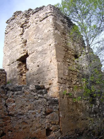
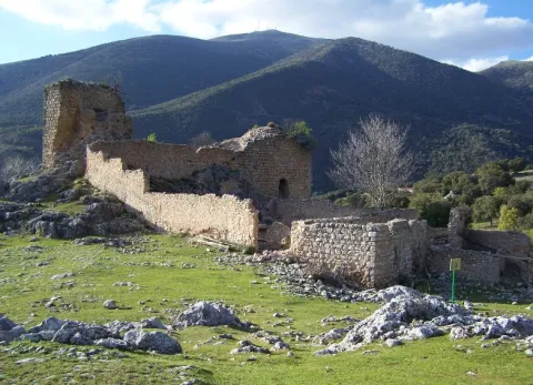
They highlight the remains of the tower of tribute located in the courtyard of arms. It is worth taking advantage of the low levels of the reservoir to walk to the castle from the above-mentioned viewpoint.

Breve descripción

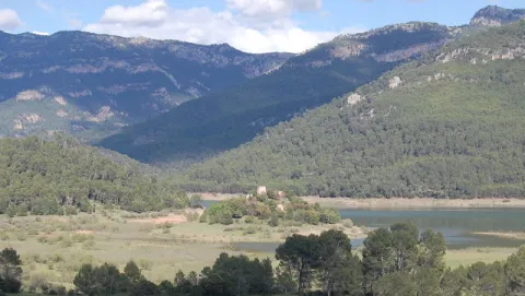
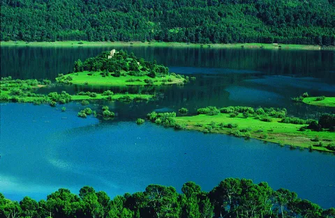
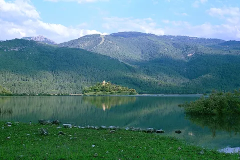
Small Arab fortress built on a hill that today becomes an island when the level of the reservoir rises, which gives it a special charm despite its deteriorating appearance. It can be seen from the viewpoint of Félix Rodríguez de la Fuente, in the km 60.5.

Ubicación
Latitud
37.912893
Longitud
-3.003887
Municipio
Ubicación en el mapa
POINT (-3.003887 37.912893)
Tipos de punto de interés
Imágenes carrusel
imagen
Image
1%20%282%29.jpg
Imagen principal
Desactivado
imagen
Image
2%20%283%29.jpg
Imagen principal
Desactivado
imagen
Image
Natu067.jpg
Imagen principal
Desactivado
imagen
Image
Natu074.jpg
Imagen principal
Desactivado
Imágenes cabecera
imagen
Image
experiencia-bujaraiza.jpg
Imagen principal
Activado
Loading map
Preparing points of interest and routes...

Castle of Bujalamé

Submitted by brandcode_deweloper on
Id
5709512
Descripción
Breve descripción

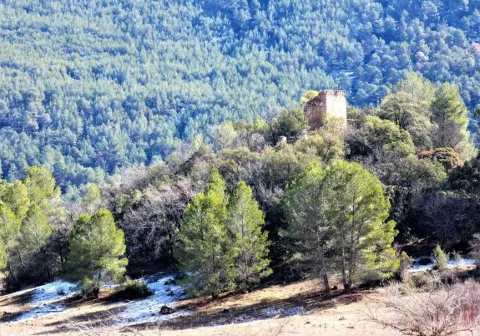
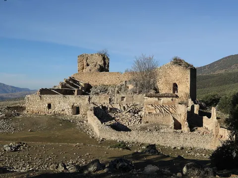
It belongs to the Almohad period, so it dates from the last third of the 11th century and the first half of the XII. During the Middle Ages the municipality performed strategic functions of interest, as the Guadalimar was fundamental on the Levante route. The Muslims valued the importance of the castle, along with the dam and the adjacent bridge, for the control of this path. However, the castle deteriorated and its stones were used by its neighbours for new constructions. Thus, only the remains of an old turret of the outer defensive belt, of a square floor and made of tapial, are preserved from the medieval fortress. He served as a prison for years and there was a church inside.
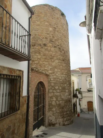
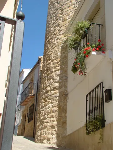
Telecomunicaciones
Sitio web
www.lapuertadesegura.jaenescondido.es/castillo-de-bujalame.html
Correo electrónico
lapuerta@promojaen.es
Ubicación
Código Postal
23360
Latitud
38.349170
Longitud
-2.737380
Dirección
C/ Castillo, 11
Distrito
Ubicación en el mapa
POINT (-2.73738 38.34917)
Tipos de punto de interés
Imágenes carrusel
imagen
Image
torreon-jpg
Imagen principal
Desactivado
Imágenes cabecera
imagen
Image
torreon-del-viejo-castillo-jpg
Imagen principal
Activado
Loading map
Preparing points of interest and routes...

Castle of Bélmez de la Moraleda

Submitted by brandcode_deweloper on
Id
5857694
Descripción
Breve descripción

The castle of the Moraleda was built by the Muslims, and conquered by the Christians, for the first time, between 1243 and 1246, but it was not definitely until 1448, going into the Lordship of Jódar years later. It belonged to the Council of Baeza and the Order of Calatrava. From 1501 the lands of Bélmez belonged to the city of Granada in payment of certain debts that the Kings had with it, reserving the house of the castle to the lord of Jódar. The foundation as a villa dates from 1524, when land for rent was given to some local farmers. It belonged to the jurisdiction of Granada until, following the provincial organization of Javier de Burgos in 1833, it was included in the new province of Jaén.

Ubicación
Latitud
37.749540
Longitud
-3.383630
Dirección
C/ Patrocinio de Biedma, 9
Distrito
Ubicación en el mapa
POINT (-3.38363 37.74954)
Tipos de punto de interés
Imágenes carrusel
imagen
Image
castillo%20belmez.jpg
Imagen principal
Desactivado
imagen
Image
Castillo-de-Belmez-de-la-Moraleda_.jpg
Imagen principal
Desactivado
imagen
Image
Castillo-de-Belmez-de-la-Moraleda_01.jpg
Imagen principal
Desactivado
Imágenes cabecera
imagen
Image
Castillo-de-Belmez-de-la-Moraleda_02.jpg
Imagen principal
Activado
Microsite al que pertenece
Loading map
Preparing points of interest and routes...

Castle of Arenas

Submitted by brandcode_deweloper on
Id
4555180
Descripción
Descripción larga

Alfonso X won the castle through Peace signed with King Muhammad II year 1281. In 1462, after Henry IV's treguas, he granted to the great Moors the Constable Mr Lucas de Iranzo, with 600 men of horse and 2000 pawns attacked the castle of Camillo de Arenas on 20 April 1462. The fight was very intense and of five doors the castle had, two were burned by Christians. However, it was not achieved.

The Constable sent 30 gentlemen from Jaén to prepare an ambush to the Garrison of the Sand Camp. They were served as a spy by a renegade Moor who was a nephew of the Sand Camp Warden. The ambush was unsuccessful and after a slight skirmish the Christians returned to Jaén. In 1463, the Constable sent 40 pawns in command of Juan Navarrete, against the castle of Campillo. Christians make two prisoners for whom it was known that the garrison made up 33 Moors.

The Constable Iranzo sends 30 soldiers to try to take over Campillo, which was not done because... "they failed to be in good care." In 1471, the king of Granada, when he heard of a Christian project of attack on Campillo, sent his defenders "sufficient recuperation and people." In the letter of the Constable Iranzo to the then Pope Sixto IV, about the hasty situation of Jaén before the push of the Moors is cited as of great danger to Christians to the castle of Camillo de Arenas. Other news about our castle is given by the following chronists:
Argote de Molina in his "Nobleza de Andalucía" (1588), cites as Alcaide del Castillo de Campillo de Arenas to D. Francisco Fonseca.

Ximena Jury in his "ecclesiastical Anales" (1654), qualifies the castle of Campillo as "A strong castle on the Gate of Arenas." Espinalt in "Atlante española" (1787), says the following about the castle of Camillo de Arenas: "To the west of this villa half a leagues away, there remains a strong castle somewhat ruined, of immemorial time, as well as the Gate of Arenas held by two high peñascos that form it; it has twenty poles of latitude and through the river Valdearanzo and there is tradition that half chain that there is in the prison of this village one that put two Saracens in that door to prevent the entry of Christians of the kingdom of Jaén."

Campillo was conquered to the Moors by Mr Pedro Coello, Knight of the Vanda. His body was buried in the St. Louis of the Knights, the missing Royal Convent of San Francisco de Jaén. His epitaph said, "Here lies Pedro Coello, Knight of the Vanda, who won the Moors the castle of Arenas at their expense and died in an entrance with them, during the reign of the Catholic Kings in 1486.

Breve descripción

The Arenas Castle was built over the 14th century, preserving structures from the 9th to the 11th century. It sits on the Cerro del Castillo de Puerta Arenas, in the Sierra de Alta Coloma, between Granada and Jaén. The Camillo River Portillo is the only practical step to cross this saw.

Telecomunicaciones
Sitio web
www.campillodearenas.es
Correo electrónico
contacto@jaenescondido.es
Ubicación
Código Postal
23130
Latitud
37.592560
Longitud
-3.622090
Dirección
Campillo de Arenas
Distrito
Municipio
Ubicación en el mapa
POINT (-3.62209 37.59256)
Tipos de punto de interés
Imágenes carrusel
imagen
Image
Castillo-de-Puerta-Arenas-Campillo-de-Arenas-scaled%20%281%29.jpeg
Imagen principal
Desactivado
imagen
Image
Castillo%20de%20Arenas%202.jpg
Imagen principal
Desactivado
Imágenes cabecera
imagen
Image
Castillo%20de%20Arenas%20%281%29.jpg
Imagen principal
Activado
Microsite al que pertenece
Loading map
Preparing points of interest and routes...

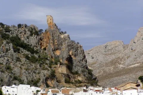
Castle of Albanchez de Mágina

Submitted by brandcode_deweloper on
Id
1735110
Descripción
Descripción larga

The castle was linked to the Order of Santiago, which created the command of Bedmar and Albanchez. What is preserved from it is its alcazarejo, built with masonry, which consists of two small, impressive nuclei because of its exterior appearance and the closing of the rock on which it sits, but with little internal capacity to house troops and beings. The highest core is a narrow rectangular platform that enables a small interior space. The entrance opens to the terrace of a rectangular floor turret that housed two cameras: one top, covered with a half-barrel vault, now melted, and one lower, a aljibe, with slightly pointed vault and remains of the stucco that covered it. The castle also had a small courtyard of triangular weapons with almond parapet and saetera windows, a square terrace with albarrana to defend over the cliff, protective walls, today practically destroyed, and rounded corners outside as it was a calatravo castle. It was declared Good of Cultural Interest in 1985.

Breve descripción

The castle of Albanchez de Mágina dominates and presides the village, which is located on the first ridge of the Sierra de los Castillejos. Despite its small dimensions and its inner narrows, its arriseach position makes it extremely difficult to access. Of presumably Christian origin, its construction was made with argamasa and it had to rise late, in the Middle Ages, in the early 14th century, as an alternative to another Muslim castle from which there are only remains, built with tapial in the lower and closer to the people.

Telecomunicaciones
Sitio web
www.albanchezdemagina.es
Teléfono de contacto
953 347 009
Correo electrónico
ayuntamiento@albanchezdemagina.es
Ubicación
Código Postal
23538
Latitud
37.790250
Longitud
-3.468000
Dirección
Av. de Hutar, 2
Distrito
Ubicación en el mapa
POINT (-3.468 37.79025)
Tipos de punto de interés
Imágenes carrusel
imagen
Image
Mon312.jpg
Imagen principal
Desactivado
imagen
Image
castillo%20de%20albanchez%20de%20magina.jpg
Imagen principal
Desactivado
imagen
Image
castillo%20de%20albanchez%20de%20magina%202.jpg
Imagen principal
Desactivado
Imágenes cabecera
imagen
Image
728_SS_01.jpg
Imagen principal
Activado
Horario
24 h.
Microsite al que pertenece
Loading map
Preparing points of interest and routes...

Castle Chiclana de Segura

Submitted by brandcode_deweloper on
Id
4480424
Descripción
Descripción larga

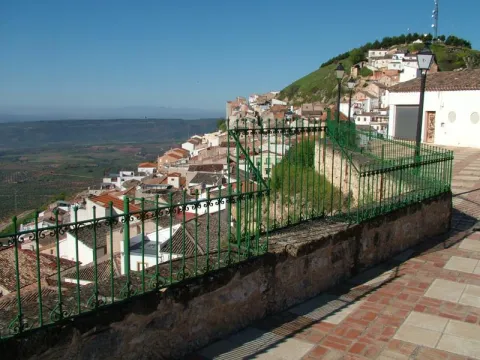
On top of this, the ruins of the castle, dominators and solitarians, are required to refer to the intensity of its first historical avatars, but also to the urban configuration of the municipality. Located at the highest point in the environment, it was a privileged place of surveillance for centuries. From that castle, dialectic synthesis of the Muslim and the Christian after being conquered by Fernando III, there remain evotions to the solidity of its already melted walls, to its snail staircase with false door, canes, bookstore and even a winery to keep the most generous caldos manchegos.

The ruins of this castle were declared in 1985 Good of Cultural Interest.

Telecomunicaciones
Sitio web
www.chiclanadesegura.es
Correo electrónico
chiclana@promojaen.es
Ubicación
Código Postal
23264
Latitud
38.310810
Longitud
-3.044480
Distrito
Municipio
Ubicación en el mapa
POINT (-3.04448 38.31081)
Tipos de punto de interés
Imágenes carrusel
imagen
Image
image_187172.jpeg
Imagen principal
Desactivado
Imágenes cabecera
imagen
Image
Mon265.jpg
Imagen principal
Activado
Loading map
Preparing points of interest and routes...

Castle Árabe de Rus

Submitted by brandcode_deweloper on
Id
4554738
Descripción
Breve descripción

The urban origins of Rus are linked to an old castle from which a cylindrical turret of 12 meters of perimeter, in masonry, in the second half of the 13th century, is preserved. Until a few years ago, another was held on Triana Street.

Telecomunicaciones
Sitio web
www.rus.es
Teléfono de contacto
953 770 002
Correo electrónico
web@rus.es
Ubicación
Código Postal
23430
Latitud
38.046810
Longitud
-3.461350
Dirección
C/ Triana, 5
Municipio
Ubicación en el mapa
POINT (-3.46135 38.04681)
Tipos de punto de interés
Imágenes carrusel
imagen
Image
Castillo%20de%20Rus%202.jpg
Imagen principal
Desactivado
Imágenes cabecera
imagen
Image
Castillo%20%C3%81rabe%20de%20Rus.jpg
Imagen principal
Activado
Loading map
Preparing points of interest and routes...

Castillejo de Mata Bejid (Torres Pass)

Submitted by brandcode_deweloper on
Id
5844957
Descripción
Breve descripción

It is a passage between mountains, some above 2,000 m., which offers a spectacular landscape: the southern side of the Natural Park of Sierra Magina, with mountains more than 2,000 meters of altitude (Almadén, 2,036 m., Ponce, 2,006 m and Cerro Cárceles, 2,061 m.), dehesas in height of complaints, flocks of sheep... The Castlejo de Mata Bejid is a beautiful place that housed a garrison that was watching this passage at the border in the Middle Ages. The first half of the 20th century saw a number of families of settlers cultivating the dehesas along the way. This castle was donated to the city of Jaén by the Catholic Kings in 1494, in reward for the services provided in the conquest of Cambil and Alhabar. Access is made from the A-324 road from Cambil to Huelma.

Ubicación
Latitud
37.704930
Longitud
-3.510540
Distrito
Municipio
Ubicación en el mapa
POINT (-3.51054 37.70493)
Tipos de punto de interés
Imágenes carrusel
imagen
Image
Castillejo%20de%20Mata%20Bejid%20%28Puerto%20de%20Torres%29.jpg
Imagen principal
Desactivado
Imágenes cabecera
imagen
Image
Castillo_Matabejid.JPG
Imagen principal
Activado
Microsite al que pertenece
Loading map
Preparing points of interest and routes...

Town Centre of Villarrodrigo

Submitted by brandcode_deweloper on
Id
7970600
Descripción
Descripción larga

A ceramic panel, made by Palenciano in 1983, of a certain kitsch formalism, is shown in the square of the village to the popular taste, where the patron, the Virgin of Albanchez with the child Jesus, crowned by angels, is represented as well as a panoramic view of the parish church.

Breve descripción

In this small municipality are also of interest the characteristic elements of its vernacular architecture, prodigal in the use of tapial and flattened masonry, as well as of forged iron bars, decorated with rosets, lis flowers and fins on the front.

Telecomunicaciones
Sitio web
http://www.villarrodrigo.es/el-municipio/patrimonio-historico.html
Teléfono de contacto
953 484 126
Ubicación
Código Postal
23393
Latitud
38.487200
Longitud
-2.636120
Dirección
C/ Sta. Ana, 3
Distrito
Municipio
Ubicación en el mapa
POINT (-2.63612 38.4872)
Tipos de punto de interés
Imágenes cabecera
imagen
Image
cascourbano.jpg
Imagen principal
Activado
Loading map
Preparing points of interest and routes...