Saltar al contenido principal
icon-intereses-amigos

Castillejo de Mata Bejid (Torres Pass)

Submitted by brandcode_deweloper on
Id
5844957
Descripción
Breve descripción

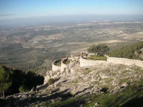
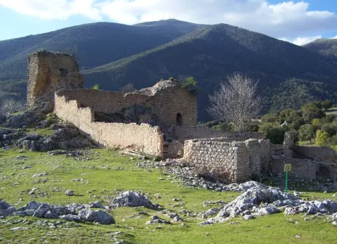
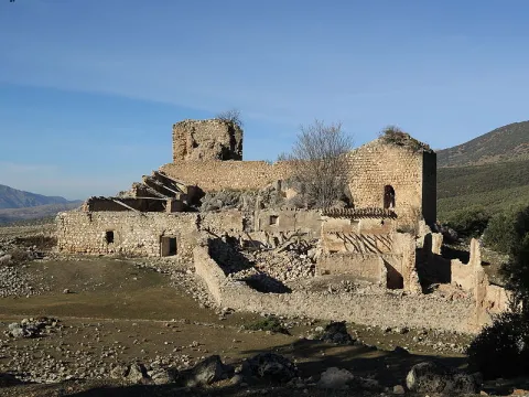
It is a passage between mountains, some above 2,000 m., which offers a spectacular landscape: the southern side of the Natural Park of Sierra Magina, with mountains more than 2,000 meters of altitude (Almadén, 2,036 m., Ponce, 2,006 m and Cerro Cárceles, 2,061 m.), dehesas in height of complaints, flocks of sheep... The Castlejo de Mata Bejid is a beautiful place that housed a garrison that was watching this passage at the border in the Middle Ages. The first half of the 20th century saw a number of families of settlers cultivating the dehesas along the way. This castle was donated to the city of Jaén by the Catholic Kings in 1494, in reward for the services provided in the conquest of Cambil and Alhabar. Access is made from the A-324 road from Cambil to Huelma.

Ubicación
Latitud
37.704930
Longitud
-3.510540
Distrito
Municipio
Ubicación en el mapa
POINT (-3.51054 37.70493)
Tipos de punto de interés
Imágenes carrusel
imagen
Image
Castillejo%20de%20Mata%20Bejid%20%28Puerto%20de%20Torres%29.jpg
Imagen principal
Desactivado
Imágenes cabecera
imagen
Image
Castillo_Matabejid.JPG
Imagen principal
Activado
Microsite al que pertenece
Loading map
Preparing points of interest and routes...

Town Centre of Villarrodrigo

Submitted by brandcode_deweloper on
Id
7970600
Descripción
Descripción larga

A ceramic panel, made by Palenciano in 1983, of a certain kitsch formalism, is shown in the square of the village to the popular taste, where the patron, the Virgin of Albanchez with the child Jesus, crowned by angels, is represented as well as a panoramic view of the parish church.

Breve descripción

In this small municipality are also of interest the characteristic elements of its vernacular architecture, prodigal in the use of tapial and flattened masonry, as well as of forged iron bars, decorated with rosets, lis flowers and fins on the front.

Telecomunicaciones
Sitio web
http://www.villarrodrigo.es/el-municipio/patrimonio-historico.html
Teléfono de contacto
953 484 126
Ubicación
Código Postal
23393
Latitud
38.487200
Longitud
-2.636120
Dirección
C/ Sta. Ana, 3
Distrito
Municipio
Ubicación en el mapa
POINT (-2.63612 38.4872)
Tipos de punto de interés
Imágenes cabecera
imagen
Image
cascourbano.jpg
Imagen principal
Activado
Loading map
Preparing points of interest and routes...
Town Centre of Orcera

Submitted by brandcode_deweloper on
Id
4672158
Descripción
Breve descripción

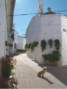
In an urban reticulation that is faithful to its origins, in the skirt of Mount Peñalta, on an abrupt topography, through narrow and irregular alleys, adarves and improvised squares, houses of clear serrana and vernacular identity, of ripada and slimmed masonry, capricious volumes, empty asymmetric, low height, original chimneys and Arab tiles are raised. It is the medieval neighborhood, which resists the avatars of the centuries.

Telecomunicaciones
Sitio web
www.orcera.es
Ubicación
Código Postal
23370
Latitud
38.317760
Longitud
-2.659330
Distrito
Municipio
Ubicación en el mapa
POINT (-2.65933 38.31776)
Tipos de punto de interés
Imágenes carrusel
imagen
Image
2283_Fill_800_800.jpg
Imagen principal
Desactivado
Imágenes cabecera
imagen
Image
Monumentos4Arquitecturapopular.jpg
Imagen principal
Activado
Loading map
Preparing points of interest and routes...
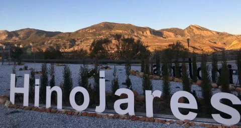
Town Centre of Hinojares

Submitted by brandcode_deweloper on
Id
8090596
Descripción
Descripción larga

It is a small set of traditional houses that are whitened and covered in two waters by Arab tiles, with small verticalized holes to alleviate the rigors of winter, adapted to the simple habits of its inhabitants, dedicated to hunting, pastures and agriculture; and, in more peripheral positions, houses with a floor structure, with a maximum of four heights and roofed to four waters. The buildings are stacked and morphologically split like the chips of a game of domino, almost lost in an open landscape of wide horizons, differentiating ravines and green spaces, only on the next contour to the municipality.

Breve descripción

Urbanistically, this municipality has not been formed as a result of previous planning; it does not have a rational and hierarchical structure; it does not show regularity in the layout of its streets or an orderly design in the distribution of housing and services.

Telecomunicaciones
Sitio web
www.hinojares.es/el-municipio/patrimonio-historico.html
Correo electrónico
hinojares@promojaen.es
Ubicación
Código Postal
23486
Latitud
37.715500
Longitud
-2.999240
Municipio
Ubicación en el mapa
POINT (-2.99924 37.7155)
Imágenes carrusel
imagen
Image
hinojares2%20%281%29.jpg
Imagen principal
Desactivado
imagen
Image
hinojares5.jpeg
Imagen principal
Desactivado
Imágenes cabecera
imagen
Image
hinojares.jpg
Imagen principal
Activado
Loading map
Preparing points of interest and routes...
Town Centre Chiclana de Segura

Submitted by brandcode_deweloper on
Id
4479488
Descripción
Descripción larga

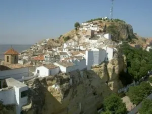
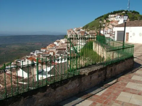
Located at a high height, embedded in a rock, around a rock, at the entrance to the Sierra de Segura, Chiclana is spread through the streets of the mountains, capricious corners and improvised squares, with the smell of the carnations and geraniums of its balconies and windows. It is accessed through a surprising tunnel that introduces us directly into the aura of its medieval mystery. This beautiful town, despite the historical avatars so negative to its heritage - such as the destructive retaliation of the Napoleonic troops, the fratricidal raging of the carlists, or the virulence of the hurricane that destroyed the church tower - retains the original Hispanic-Muslim structure of its urbanism, the medieval typology of its homes, and an unexpected architectural surprise, the buildings excavated in the stone, trogloditic wisdom that makes it possible to have houses with a uniform temperature throughout the year.

Ubicación
Código Postal
23264
Latitud
38.310770
Longitud
-3.044500
Distrito
Municipio
Ubicación en el mapa
POINT (-3.0445 38.31077)
Tipos de punto de interés
Imágenes carrusel
imagen
Image
Casco%20urbano%20Chiclana%20de%20Segura%202.jpg
Imagen principal
Desactivado
Imágenes cabecera
imagen
Image
Casco%20urbano%20Chiclana%20de%20segura.jpg
Imagen principal
Activado
Loading map
Preparing points of interest and routes...
Waterfall Bridge Nevada

Submitted by brandcode_deweloper on
Id
8088114
Descripción
Descripción larga

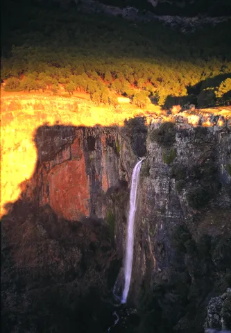
Like the other municipalities of the region, it is located between the mountain and the Guadalquivir valley. Its fundamental economy is the olive tree, although it has an incipient tourist development

Breve descripción

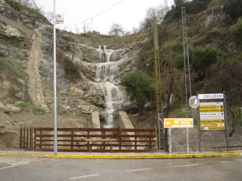
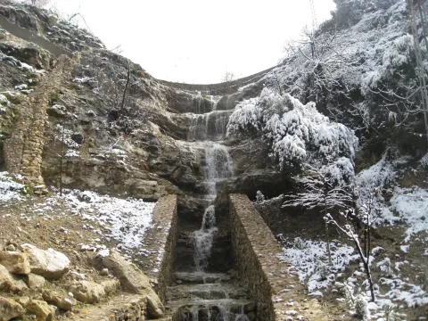
Chilluevar is a municipality in the province of Jaén, in Andalusia, Spain. It belongs to the Sierra de Cazorla region. This town is located at 738 meters of altitude and is located in one of the least known parts of the Natural Park, the Sierra de las Villas.

Telecomunicaciones
Sitio web
www.promojaen.es/pit/fmt.asp?i=&m=28&op=1
Teléfono de contacto
953 717 300
Ubicación
Código Postal
23477
Latitud
38.001440
Longitud
-3.031300
Municipio
Ubicación en el mapa
POINT (-3.0313 38.00144)
Imágenes carrusel
imagen
Image
cascada%20Chillu%C3%A9var2%20%281%29.jpg
Imagen principal
Desactivado
Imágenes cabecera
imagen
Image
cascada%20Chillu%C3%A9var%20%281%29.jpg
Imagen principal
Activado
Loading map
Preparing points of interest and routes...
Waterfall la Escaruela

Submitted by brandcode_deweloper on
Id
912020
Descripción
Descripción larga

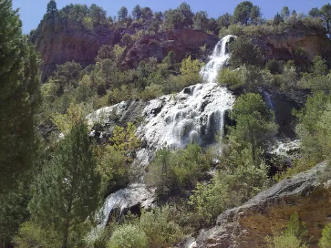
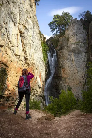
The waterfall is located next to the Falcones (1448 m), mountain always visible from any street of Cazorla, and a natural stone wall "Los Castellones" (1,820 m), elevation as a fortress from where it is named. To appreciate the water leaps it will be necessary to climb up a narrow path that runs next to the slope of the stream where you will be accompanied by the cornicabra (Pistacia terebinthus), a very abundant species on this path. By moving along the path you will appreciate the impressive fall of water as soon as the limestone walls serve as slides.

We suggest:

  • Next to the bridge from where the waterfall is seen, a right-hand road leads us to the control of Riogazas. It is a pleasant walk in which you will find a fountain called "The River" and another beautiful waterfall, that of the Magdalena. From here goes down a road to Cazorla.

In the Iruela you have to reach the square of the City Hall from where the road ascends towards the hotel Riogazas. 5 km from the Iruela and after two lookouts with meringeros there is a bridge. To the left we can see the Cascade of the Escaleruela.

Breve descripción

When you look at the waterfall you discover a stream covered in vegetation that barely lets the water see. Your look continues to ascend among limestone walls to discover how a stream with numerous water leaps is unraveling, only visible in periods of abundant rain and ice. Although we are very close to the localities of Cazorla and the Iruela wild nature begins to manifest in this spectacular leap of water, premonition of what we will find later.

Ubicación
Latitud
37.912893
Longitud
-3.003887
Municipio
Ubicación en el mapa
POINT (-3.003887 37.912893)
Tipos de punto de interés
Imágenes carrusel
imagen
Image
escaruela.jpg
Imagen principal
Desactivado
Imágenes cabecera
imagen
Image
unnamed%20%283%29.jpg
Imagen principal
Activado
Loading map
Preparing points of interest and routes...
Waterfall El Saltador

Submitted by brandcode_deweloper on
Id
5929475
Descripción
Descripción larga

Information and Observations

  • We will have to leave the vehicle at the entrance of the lane because there is a barrier to avoid the passage of vehicles.
  • The property through which the lane passes is private so it is not allowed to enter the lane with vehicle.
Breve descripción

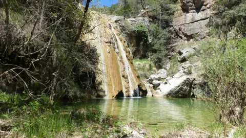
The Saltador is a natural waterfall in the Arroyo del Tejuelo; this stream receives the waters of the Arroyo de Andrés and the Sierra del Agua, then joins the Arroyo de la Fuente del Tejo and forms the flow of the Tu River.

Ubicación
Latitud
38.388680
Longitud
-2.581360
Distrito
Municipio
Ubicación en el mapa
POINT (-2.58136 38.38868)
Imágenes carrusel
imagen
Image
Natu150.jpg
Imagen principal
Desactivado
Imágenes cabecera
imagen
Image
5.jpg
Imagen principal
Activado
Loading map
Preparing points of interest and routes...
Waterfall of Chorro Gil

Submitted by brandcode_deweloper on
Id
878082
Descripción
Descripción larga

The upper part of the Borosa River, has a scalated profile for the development of pozas and waterfalls in which travertine terraces are formed with spectacular botroidal calcite morphologies that were precipitated during the most humid and warm periods of the Quaternary.

Although travertine appear throughout the river, the highest concentration is located in the sector between the organ jump and the electric power plant. Its formation is due to the precipitation of calcite caused by the tear-up of the river waters produced by the turbulent regime of the water leaps in the areas with the greatest slope. This precipitation occurs in areas of dense vegetation receding elements of plants and producing subvertical sheets known as cascade facies.

Breve descripción

Travertines and cascade of Chorro Gil

Ubicación
Latitud
37.912893
Longitud
-3.003887
Dirección
Cascada de Chorro Gil
Municipio
Ubicación en el mapa
POINT (-3.003887 37.912893)
Tipos de punto de interés
Imágenes carrusel
imagen
Image
salto-de-los-organos-jpg
Imagen principal
Desactivado
Imágenes cabecera
imagen
Image
Natu069%20%281%29.jpg
Imagen principal
Activado
Loading map
Preparing points of interest and routes...
Casas-cueva de Pegalajar

Submitted by brandcode_deweloper on
Id
5848815
Descripción
Breve descripción

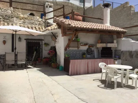
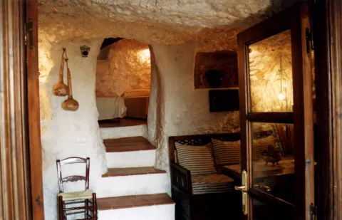
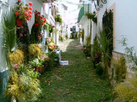
Set of troglodite houses rehabilitated as second residences and holiday tourist houses. They now make up a picturesque neighborhood, on horseback between the Serrezuela and the city centre. Very memorable.

Ubicación
Latitud
37.740061
Longitud
-3.645026
Distrito
Municipio
Ubicación en el mapa
POINT (-3.645026 37.740061)
Tipos de punto de interés
Imágenes carrusel
imagen
Image
01387888.jpg
Imagen principal
Desactivado
imagen
Image
68.jpg
Imagen principal
Desactivado
Imágenes cabecera
imagen
Image
cuevapelagar%20%281%29.jpg
Imagen principal
Activado
Microsite al que pertenece
Loading map
Preparing points of interest and routes...