Saltar al contenido principal
icon-intereses-amigos

Bike Route Mirabuenos - Los Centenares

Submitted by brandcode_deweloper on
Id
2851244
Descripción larga

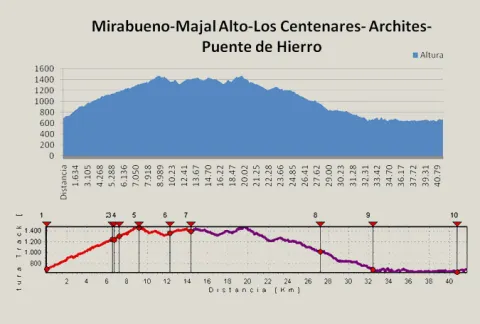
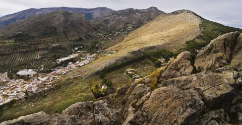
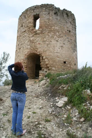
We can refresh at the Fountain del Roble, which gives name to the initial area, and arrive at the crossing of the road to the Archites, in the km. 6.7, we'll have to turn right at first to do a round-trip. Then, when we return, we will continue our route on the left. The linear section has great attractions, as it is an old vulture feeder located in the km. 7.2, or the Majal Alto watch house with stunning views of the whole of the Banderillas and the Guadalquivir Valley (km. 9.1). Once crowned Majal Alto and after a brief descent we will continue to ascend to the village of Las Canalejas and then to Los Centenares, two of the populations that were uninhabited with the creation of the National Cazorla and Segura Coto in the year 1,960.

From the Centenars we start the return on the same way out until we reach the km. 4.6, where we took the track of the Archites, another of the cords inhabited in its day, where they also took advantage of the nearest land to grow all kinds of cereals, and which have now become mostly forest land.

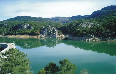
Finally continuing the track in continuous descent we reach the edge of the Embalse del Tranco, just opposite the Island of Cabeza de la Viña, in the area known as the Iron Bridge. We turn there to the left to line the reservoir. We will leave to our right the ruins of the castle of Bujaraiza and the plain of the same name, well known as the stage of the berrea, the fighting that takes place every year in September among the great deer males in their time of zeal. Finally we arrive at the Mirabueno view over the Guadalquivir River and just 300 m. to the starting place.

Breve descripción

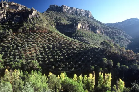
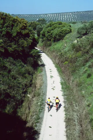
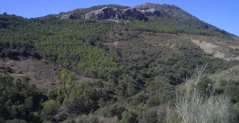
The tour begins on the road to the Cuesta de Mirabueno, on the Llanos de Arance track, and has a linear round and round section and a circular. The route starts at 4.6 km. on the A-319 road, right on a closed track left on our right. This track, in continuous rise, enters us by the three types of pine trees that exist in the Park (carrasco, black and laricio pines) as we gain altitude, but we must highlight the magnificent forest of burning that we go through at half climb.

Latitud
38.0803
Longitud
-2.6201
Distrito
Municipio
Ubicación en el mapa
POINT (-2.6201 38.0803)
imagen
Image
_MG_0793.JPG
Imagen principal
Activado
imagen
Image
Ruta%20en%20bici%20Mirabuenos%20-%20Los%20Centenares.jpg
Imagen principal
Desactivado
imagen
Image
Ruta%20en%20bici%20Mirabuenos%20-%20Los%20Centenares2.jpeg
Imagen principal
Desactivado

Nature

icon-intereses-naturaleza

Friends

icon-intereses-amigos

Adventure

icon-intereses-aventura

Culture

icon-intereses-cultura

Sport

icon-intereses-deporte

Eco-friendly

icon-intereses-eco-friendly

For couples

icon-intereses-en-pareja

Family

icon-intereses-familia

Gastronomy

icon-intereses-gastronomia

Municipality

icon-intereses-municipio

Low-cost tourism

icon-intereses-turismo-low-cost

Solo travel

icon-intereses-viajar-solo
638 m.
CAMINO DE MIRABUENO A LOS CENTENARES
42,1 km
1938m
1941m
In Bicycle, Horse, on foot
All year round
Desactivado
Image
5256dc0f-573d-f9f4-529f-9cda9ae7e6c8?t=1589472588230

Plains of arance.

From the road A-319 we will take the detour to Llanos de Arance and continue the entrance track to the Camping la JF-7099. Our route will begin on the second track we find to the right.

681 m.

The village of Los Centenares

1.171 m.
Coordenadas / Huso 30S
30S = 516047 and = 4214438
Tramo de asfalto o cemento
0
Tramo de pista o camino forestal
0.01
Tramo de vía pecuaria
0
Tramo de senda
0

Circular Route Campos de Hernán Pelea

Submitted by brandcode_deweloper on
Id
2819129
Descripción larga

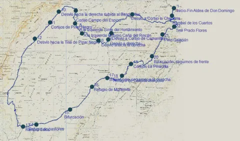
We must take the track that begins next to the Forest House of Don Domingo, in the direction of the Rambla, 1.5 km. We got to it. It is a stream that occasionally carries water, but that shows great avalanches in times of growth, before crossing it, we will have to take to the right a track that goes parallel to this stream. It is a breeding area par excellence, so along the route we will find flocks of Segureña sheep, tornajos (abrevaderos) for water and large pastures splattered with larice pines in some areas, black retama in others and graceful.

In the km. 5.5 We find a fork, to the right the track leads to the Chaparra Cortijos, we follow to the front. Later, in the km. 7.5 We find another right-hand detour, this one to access the Camarillas Cortijos, and we also follow the front.

At 8.4 km. We get to another crossing and here we have to turn right and at 600 m we will find again another crossing that we will have to follow right. Before the same we will also have left a secondary track to the right.

In the km. 11.5 We left to our left another track to access the herdsmen 'shelter of the Rincón Canyon. Our track is going up little by little, and almost 500 meters later we must leave it, to continue for a less busy that goes left. Right at this point and just 200 m to our left, there is a very striking dolina, as it has almost perfect funnel shape. Soon we passed through a hill and began a sharp descent towards a large plains that make up the Campo del Espino. In front we see the Banners peak and right in front of a forest mass that corresponds to the Pinar Negro estate, which we will travel from this moment on. In the km. 13 We left to our left the Cortijo del Campo del Espino, moving at this moment to the right, to border the forest mentioned above and to turn to the left, later to the Banderillas. We left to our right a peeled hill of trees that is the Majal de la Carrasca.

15.2 km. We left to the right a secondary track that we could access to the top of the Banderillas, we followed to the front and a few 1.3 km. We left to the right the Black Pinar Cortijos, which have a pebble. The tour at this time and for several km more runs through the base of the Banderillas that remains to our right and to our left infinity of dolinas, with rocks, pine and large pastures.

In the km. 18 We find a fork that we will have to follow to the right, the left track goes to the black Pinar Tina and we could also go through it to the Black Pinar Sima, a vertical oquity of several hundred meters of galleries.

From this moment on, we will go through the area known as the Charcones, very rich in fauna, and closed to the traffic of motor vehicles, so the observation of fauna is very common. We are coming down, but soon the track begins to rise to the steep crests of the Risco and the Halt of Hell, to return to Ramblaseca.

When we get to Rambla Seca we will take a little more than 28 km. Here we will find a herdsman's shelter and a water-filled work-room. To continue our route we must turn left and continue the main track. To the right is the old control of Rambla Seca.

From here it is difficult to get lost, as long as we maintain our criterion of following the most busy track, in the km. 31.5 we'll leave a new forest track to the left, and in km. 35 the Refuge of Monterilla. 1.7 km. On the same side again, we left another track to the left and soon arrived at the Cañada Mercosa Refuge.

At the height of the km. 39, the landscape begins to change, with some larity pines appearing and soon, 500 m away, we left the Pinadilla Cortijos to the left. Later on in the km. 42 We shall leave to the right the track that goes towards the fourth of the Pinar. We continue to the front on the right side of the Arroyo del Juan Fría. Very soon, on our left, we began to see some examples of larice of extraordinary dimensions. On the other side of the stream, in the km. 44.2, is the Pino Galapán, the highest of the larices of the entire Park.

Then we must follow our track, which begins a small climb, on a small hill we leave the Tina Prado Flores to the left and in the km. 47 We arrived again at the Rambla de los Cuartos, which we saw at the beginning. Now we will cross it, to return along the same path that we initially traveled to the village of Don Domingo.

Breve descripción

The tour takes place on the large kartic platform of the Campos de Hernán Pelea, altiplanicie located between 1,600 to 1,700 m of altitude, and is the largest reserve of underground water in the entire Natural Park Sierras de Cazorla, Segura and Las Villas. It is a circular route that begins in the village of Don Domingo, which can be reached by asphalt road, from the core of Santiago de la Sword.

Latitud
38.01781
Longitud
-2.652742
Distrito
Municipio
Ubicación en el mapa
POINT (-2.652742 38.01781)
imagen
Image
IMG_1218%20copia.jpg
Imagen principal
Activado
imagen
Image
Campos-Hern%C3%A1n-Perea.jpg
Imagen principal
Desactivado
imagen
Image
Campos-Hern%C3%A1n-Perea2.jpg
Imagen principal
Desactivado

Nature

icon-intereses-naturaleza

Friends

icon-intereses-amigos

Adventure

icon-intereses-aventura

Culture

icon-intereses-cultura

Sport

icon-intereses-deporte

Eco-friendly

icon-intereses-eco-friendly

For couples

icon-intereses-en-pareja

Family

icon-intereses-familia

Gastronomy

icon-intereses-gastronomia

Municipality

icon-intereses-municipio

Low-cost tourism

icon-intereses-turismo-low-cost

Solo travel

icon-intereses-viajar-solo
1,574 m.
Image
2e51fc1f-48d2-c7a4-5341-bfd8e4df99c9?t=1589390356114
CIRCULAR CAMPOS DE HERNÁN PELEA
48,22 km
852m
836m
All year round
Desactivado
Image
412bc72d-44fe-fef2-95e7-c6dd431279e2?t=1589390318542

Village of Don Domingo

_

1.544 m.

Village of Don Domingo

1.544 m.
Coordenadas / Huso 30S
30S x = 530481 and = 4207848
Tramo de asfalto o cemento
0.01
Tramo de pista o camino forestal
0
Tramo de vía pecuaria
0
Tramo de senda
0

Route Gil Cobo - Fuente Colorá

Submitted by brandcode_deweloper on
Id
2813220
Descripción larga

The path begins in the recreational area and camp of Gil-Cobos by the right margin of the stream of the Aguascebas, up the secondary forest track that exists there in a southeast direction. At 800 m from the beginning we find one of the most beautiful areas of this tour, the Cerrada de San Ginés, a vertical setting of rocky lanterns formed by the Lobo's Locks on the left, and the Escalera's boat on the right, which is surrounded by deciduous forests, pinars, and riparian and rupic communities.

At the end of it, where the stream is divided into two, the track is also divided and we will have to turn right according to the direction of the march, to continue a steep rise in its first meters; after a sharp curve we find a source of work with some stone tables, it is Fountain Colorá, at 2.1 km. From the beginning. 600 meters later we find on our left a shop, it is Majalserbal, which is raised on the beautiful and agribusiness boat Ignacio. The other boat, which falls from the ink to the beginning of the Cerrada de San Ginés, has the name "Lancha del Sordo."

After walking 4.4 km. We got to a collar. We are at the top of the Stairboat. The Poyo of the Robles is what is also called all this land. Large panorama of the lome of Ubeda with several well-visible villages and the massif of Sierra Magina. We are close to 1,600 m of altitude and vegetation is characteristic of the high mountain of the Park, piornal and other small-scale, arbustive and thorny plants, as well as herring, larice pines and some oaks.

This area will be the highest of our journey, as from here we begin to descend. The track tracks several curves with firm formed of loose stones and quite bumpy until it enters the flat lands of Jabalhora. A unique karctic landscape that will accompany us until the end of our journey. We found several streams on its highest side, such as Arroyo del Raso de la Escalera and Arroyo de la Fuente del Tejo, and in the km. 6.7 and also a jungle with water called the Fuentecilla of the Vultures.

Later, in the km. 8.2, we left a track to the left, which is directed to other cortijadas in the Avellano Canyon or Jabalhora cortijos also called. We will continue to the left to find in the km. 8.8 The cords of the Berraza, where there is a source. From this moment on the firm becomes more difficult and begins to turn right to leave Peña Corba to our left.

At 11.3 km. We got to the Pardal Cortijos. It is recommended to climb to the peak on foot, as with its 1.578 m., it offers a wide view of the area. The return will be on the same way out.

Breve descripción

If you access from Chilluévar and about 8 km away. after passing the reservoir of the Aguascebas, in the km. 28, there is a secondary forest track or road that leaves to the right of the road, just where it crosses the Arroyo de las Aguascebas de Gil Cobo, beginning of the route.

Latitud
38.032722
Longitud
-2.904077
Municipio
Ubicación en el mapa
POINT (-2.904077 38.032722)
imagen
Image
_MG_3292.JPG
Imagen principal
Activado
imagen
Image
PANTANO2.jpg
Imagen principal
Desactivado
imagen
Image
Sierra%20de%20las%20Villas.%20Vva.%20del%20Arzobispo%20%28Ja%C3%A9n%29.JPG
Imagen principal
Desactivado

Nature

icon-intereses-naturaleza

Friends

icon-intereses-amigos

Adventure

icon-intereses-aventura

Culture

icon-intereses-cultura

Sport

icon-intereses-deporte

Eco-friendly

icon-intereses-eco-friendly

For couples

icon-intereses-en-pareja

Family

icon-intereses-familia

Gastronomy

icon-intereses-gastronomia

Municipality

icon-intereses-municipio

Low-cost tourism

icon-intereses-turismo-low-cost

Solo travel

icon-intereses-viajar-solo
1,474 m.
Campamento de Gil Cobo a Cortijos del Pardal
11,3 km (solo ida)
476m
279m
All year round
Desactivado
Image
3698f04f-cd07-22ba-8591-6d952821430c?t=1589388090540

We can also access the beginning from the oil puddle.

1.178 m.

Itinerary: GIL COBO - SAN GIN CERRADA - SCALERA LANCH - JABALCABEL CLANES - PARDAL CORTIJO

1.178 m.
Coordenadas / Huso 30S
30S x = 508418 and = 4209450
Tramo de asfalto o cemento
0
Tramo de pista o camino forestal
0.01
Tramo de vía pecuaria
0
Tramo de senda
0

Route de la Ascensión al Pico Jabalcuz

Submitted by brandcode_deweloper on
Id
2683115
Descripción larga

The route of this ascension begins at the Torredelcampo Station (km. 11,800 of the Via Verde del Oil), located at 620 meters altitude, and ascends to the summit of Mount Jabalcuz, at 1,614 meters. Its summit is a magnificent view of the landscape of the interior of Andalusia, from which you can perfectly observe the encounter of the Betic Cordilleras with the Depression of the Guadalquivir. From the urban centre, on an asphalt slope we go to Cerro Miguelico (km. 2,400), a promontory that hosts an interesting Iberian site (necropolis excavated in the rock), well known for being the place where the Hermitage of Santa Ana is located. In this place there is a road area, with a water supply. Continuing on the same road we passed by the bosquet of La Bañizuela, and later by an active quarry. In the km. 4,900 found the remains of another abandoned quarry. A kilometer later we arrived to a stone house surrounded by a bosquet of walnuts, which we will border on the right road. In the next detours we will always follow the front, along the main lane.

At point Kilometric 7,600, in a clear area, we find a road crossing, where we will always continue along the main lane (we will despise a right and two left). After this crossing we have in front of us a valley and the Devil's crest: the ascent begins in the mountain area. At the km point 9,600 we find the barrier that only limits the passage to motor vehicles. The pinar accompanies us to the Puerto del Aire (1.030 m.), at the point of 12 200 km from where for the first time we enjoy the landscapes of the eastern part of the province of Jaén (at the bottom of Sierra Magina Natural Park).

We only have to finish the promotion until the end of the lane (km. 16,400). A sidewalk, less than 100 meters, leads us to the summit, where the fire surveillance house is located as a perfect lookout. From this place the view in any direction is all an experience. From this summit you can see much of the province of Jaén, to its limits with Córdoba and Granada. We are on the edge of the high Andalusian mountain: be careful with the hydration and the coat!. To the north is the entire countryside (the route of the Green Way of Oil is almost entirely observed) and the Guadalquivir Valley, to Sierra Morena. To the south, with clear days, the Sierra Nevada summit line will be observed, including the highest summit of the Iberian Peninsula, the Mulhacén, with 3,481 m. To the east the horizon extends from the peaks of the Natural Park Sierras de Cazorla, Segura and the Villas to the roof of the province the Pico Magina (2,197 m.), in the natural park of the same name. The western panorama is reserved for the Sierra de la Grana and the Cordobese countryside. At this summit, the municipal terms of Jaén, Torredelcampo and the Villares converge, which are seen in the sight of birds during the ascent and from the summit.

The return can be made on the same way up, to Torredelfield, or to Jaén in the Air Port (down to the east) by a lane of similar characteristics. After 4,400 km. We find another barrier. 3,600 km more take us to the road C-3.221, which is accessed by the service road of the residential area of the old resort of Jabalcuz, is the one that leads us to Jaén. In front of this crossing is a rural accommodation with restaurant ("La Casa de Piedra"). From this point we pedaled 4,500 km. more to the city of Jaén. Either of the two descending routes is a reward for the effort made.

Breve descripción

The road offers magnificent panoramic views of the landscape of the province of Jaén, through an interesting tour of the countryside to the Betic mountains, with an average slope of not more than 6%, although in some sections the slope is much greater.

Latitud
37.6801
Longitud
-3.7803
Distrito
Municipio
Ubicación en el mapa
POINT (-3.7803 37.6801)
imagen
Image
miguelrklopezmoralesgmailcom5jpg%202.jpg
Imagen principal
Activado
imagen
Image
1511_MI_01.jpg
Imagen principal
Desactivado
imagen
Image
fromerohDSC1731jpg.jpg
Imagen principal
Desactivado

Nature

icon-intereses-naturaleza

Friends

icon-intereses-amigos

Adventure

icon-intereses-aventura

Culture

icon-intereses-cultura

Sport

icon-intereses-deporte

Eco-friendly

icon-intereses-eco-friendly

For couples

icon-intereses-en-pareja

Family

icon-intereses-familia

Gastronomy

icon-intereses-gastronomia

Municipality

icon-intereses-municipio

Low-cost tourism

icon-intereses-turismo-low-cost

Solo travel

icon-intereses-viajar-solo
Alta
Ruta de la Ascensión al Pico Jabalcuz
32,8 km (ida y vuelta) / 32,9 km (opción Jaén)
All year round
Desactivado

Given the character of continuous ascent, it is recommended to make successive stops and to hydrate properly. For the stay at the summit and for the descent, it is essential to have a coat. In winter it is no wonder that the final stretch is snowed or beaten by strong winds. In the decrease it is recommended to maintain a moderate speed. In the spring and summer periods, the promotion is advised in the first hour of the morning. Another alternative, when the road is well known, is to make the evening rise and contemplate one of the best starry skies you can imagine. It is recommended to start the tour in the km. 11,800 of the Via Verde, in the old station of Torredelfield.

Tramo de asfalto o cemento
 
Tramo de pista o camino forestal
 
Tramo de vía pecuaria
 
Tramo de senda
 

Route del Aceite (Segunda jornada: de Las Casillas a Alcalá la Real)

Submitted by brandcode_deweloper on
Id
2681103
Descripción larga

The first part of the day runs along the road from the Vado del Fresno to the Achillos saw. The route leaves the asphalt track before the hill, past the kilometer pillar 16 (km. 9.3). The lantern of earth is attached to a pecuary path, the laundry of Fountain Mateo to Martos. Many crosses and bifurcations come to pass, but none of them offer any doubt as they are marked. At first, constant ups and downs occur, but soon the definitive descent to the Carrizal Sales begins. It is then passed next to the bathroom cortijo (km. 13,9), famous for the sulfurated waters that were flushing there. Later on a mountain known as Encina Hermosa is surrounded, where remains of an important Ibero-Roman enclosure remain.

Shortly before reaching the Vega, the lane that approaches one of the watchtowers that adorn the area is left to the right. Just before the bridge over the San Juan River the itinerary turns left and, along several kilometres, it walks the Vega of the river, along with the route of the Caliphate del Legado Andalusí. At the foot of Castillo de Locubín, the route is diverted (km. 23.1) to continue along the right bank of the river. After a short stretch by road, he takes the direction of El Nacimiento, where a handful of water-nurturing developments all over the valley. After the recreational area, the road fits between the chimallions of the Guadalcoton, and after repeated wadeos the climb to Charilla is undertaken.

Once the city centre has its strength, the route is moved to the left by a lane (km. 34) that borders the slopes of the Loma de San Marcos, ending at the doors of Alcalá la Real. During the two centuries of the Christian siege of the Nazi kingdom, these border lands served as a platform for harassment and skirmishes. Strongholds were raised in the villages, and in their strategic hills a whole chain of watchtowers or simple watchtowers that, as a way of advancing, were watching the enemy's movements. Along the wide-range of the San Juan River, up to 4 towers are counted; although some miraculously whole, they all retain the quiet serenity of those who have seen centuries of history. Anyone who is encouraged to approach his feet will have the opportunity to loot the same horizons, now covered with olive trees.

Latitud
37.4614
Longitud
-3.9222
Distrito
Municipio
Ubicación en el mapa
POINT (-3.9222 37.4614)
imagen
Image
082.jpg
Imagen principal
Activado
imagen
Image
La%20Mota%20Reformada.jpg
Imagen principal
Desactivado
imagen
Image
132.jpg
Imagen principal
Desactivado
imagen
Image
082%20%281%29.jpg
Imagen principal
Desactivado
2 h 30 min

Nature

icon-intereses-naturaleza

Friends

icon-intereses-amigos

Adventure

icon-intereses-aventura

Culture

icon-intereses-cultura

Sport

icon-intereses-deporte

Eco-friendly

icon-intereses-eco-friendly

For couples

icon-intereses-en-pareja

Family

icon-intereses-familia

Gastronomy

icon-intereses-gastronomia

Municipality

icon-intereses-municipio

Low-cost tourism

icon-intereses-turismo-low-cost

Solo travel

icon-intereses-viajar-solo
Alta
Ruta del Aceite (Segunda jornada: de Las Casillas a Alcalá la Real)
38 km
805m
805m
All year round
Desactivado

The stage, although a little long, is very varied. It has an asphalt ascension, followed by a descent and then comes a practically flat stretch that ends in a strong rise. In times of rain certain difficulties may arise by having to wade the Guadalcoton stream four times.

Route del Aceite (Primera jornada)

Submitted by brandcode_deweloper on
Id
2679156
Descripción larga

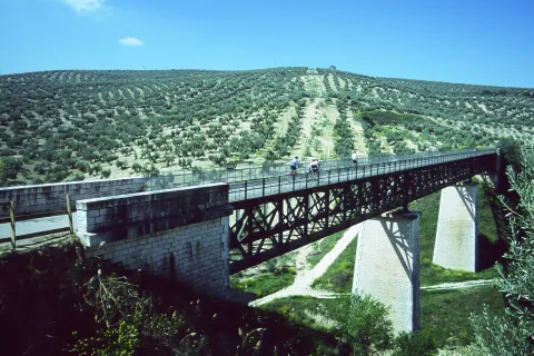
The avenue of Los Olivares then leads to the outskirts of the city, crosses the new circumvalation and follows from the front by an asphalt lane. In the next few miles it will be rolled through the vast olive countryside surrounding Martos. The route, always marked, does not give rise to any doubt. After leaving two other paved lanes on the left and crossing the tracks of the old oil rail, a crossing is reached (km. 5.3). Straight is beginning to descend to the Salado stream, and the impressive metal structure of the old oil train viaduct that saves the first ravine is seen. The route will do it a little later in a fenced way, after having crossed a stretch along the margins of the stream. There is no choice but to face a very steep slope, which is softened just by recrossing the railway platform.

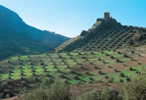
In the next fork is thrown on the left to link, shortly after, with the road to Las Casillas (km. 8.7). For a little more than a kilometer it is circulated through the region that barely supports traffic. In the middle of a hill a dirt lane is taken to the right (km. 10), which after a short rewind descends in the direction of a quarry and immediately to the same foot of the castle Víboras, located on a sharp rocky promontory. To the left the lane leads to the Casillas bordering what in the future will be a reservoir. A wave of soft hills subject to strict olive geometry surrounds Martos. Beyond, these same loins are raised, the ravines are deepened and then the landscape is haunted.

The mountains of the Caracolera, of moderate opulence, and Achillos, of more sharp appearance, truncate the horizon to almost 1,500 meters. The obstinate olive trees roar their tops, while at their feet the oil route runs. The road first savors the sweetness of the jiennese countryside, then it is adventure through the ravine of the Salado and finally stops at the bitter serrano orographic wall.

Breve descripción

The route from Martos, the Plaza de la Cruz del Lloro is a good reference to leave the town without difficulties

Latitud
37.6204
Longitud
-3.9202
Distrito
Municipio
Ubicación en el mapa
POINT (-3.9202 37.6204)
imagen
Image
VIBORAS.jpg
Imagen principal
Activado
imagen
Image
Viaducto%20sobre%20Arroyo%20Salado%20%28Martos%29%20%281%29.jpg
Imagen principal
Desactivado
imagen
Image
Estaci%C3%B3n%20de%20Martos.jpg
Imagen principal
Desactivado
2 h 30 min

Nature

icon-intereses-naturaleza

Friends

icon-intereses-amigos

Adventure

icon-intereses-aventura

Culture

icon-intereses-cultura

Sport

icon-intereses-deporte

Eco-friendly

icon-intereses-eco-friendly

For couples

icon-intereses-en-pareja

Family

icon-intereses-familia

Gastronomy

icon-intereses-gastronomia

Municipality

icon-intereses-municipio

Low-cost tourism

icon-intereses-turismo-low-cost

Solo travel

icon-intereses-viajar-solo
Baja
Ruta del Aceite (Primera jornada)
14 km
280m
280m
All year round
Desactivado

This first stage has no difficulty. We just have to save strength for the ramps at the end. The vado of the Salado stream is reinforced with cement. Any time of the year is good for starting the route, the feast of the olive that is held in Martos on December 8 can be a good pretext.

Tramo de asfalto o cemento
 
Tramo de pista o camino forestal
 
Tramo de vía pecuaria
 
Tramo de senda
 

Route de los Puentes

Submitted by brandcode_deweloper on
Id
2679115
Descripción larga

At the entrance of Las Casillas is the post that indicates the beginning of the route. Following Francisco Molina Malonado Street, you can reach the Constitution Square. There, a street descends to the left and soon becomes a dirt lane that goes directly down to the Vega of the Víboras River. After having rolled about 400 meters per asphalt, you have to deviate (km. 2.2) and take on the right a track that starts next to a villa.

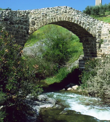
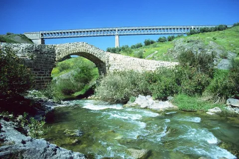
Later on, the path of the dam is left, also to the right. Soon after, the ruins of the Víboras castle are seen on the opposite side. After 3 kilometers, it flows into the former national (km. 10.7). Through its asphalt is the pedanía of the Venta Pantalones, the river Víboras is once again crossed and it begins to rise until it finds the dirt lane (km. 12.4) that links with the layout of the old Oil Train. The route is now headed for the site known as El Pontón, where you can admire a spectacular modernist viaduct that rises a few meters from a Roman stone bridge. The same way of the train goes back and there is a ruined foothold (km. 18,9). At this point you have to leave the railway platform to take a cash track, the street of the Carriles. First it crosses the old national and within 2 kilometers it flows into the district of Las Casillas. At a half-climb there is the detour (km. 23.6) that leads to a quarry and to the foot of the Víboras castle. There it continues along the left lane that with some strong repo ends at the entrance of the village.

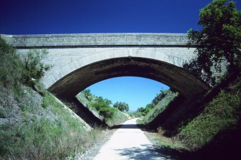
The Jaén-Campo Real railway line saw the last train pass in 1984. After twelve years of abandonment the administration today wants to turn this forgotten iron road into a true green corridor, suitable for ecotourism. Along its 121 km the road passes through places of unique beauty, such as El Pontón, where through a bold viaduct it saves the skulls of the Víboras river. A few meters away, a raging Roman bridge puts a delicate counterpoint in the form of decimononic engineering.

Latitud
37.9402
Longitud
-2.9601
Ubicación en el mapa
POINT (-2.9601 37.9402)
imagen
Image
11370019%20%281%29.png
Imagen principal
Activado
imagen
Image
11370014.jpg
Imagen principal
Desactivado
imagen
Image
11370013.jpg
Imagen principal
Desactivado
imagen
Image
Viaducto%20de%20hierro%20sobre%20el%20r%C3%ADo%20V%C3%ADboras%20%281%29.jpg
Imagen principal
Desactivado
2 h 30 min

Nature

icon-intereses-naturaleza

Friends

icon-intereses-amigos

Adventure

icon-intereses-aventura

Culture

icon-intereses-cultura

Sport

icon-intereses-deporte

Eco-friendly

icon-intereses-eco-friendly

For couples

icon-intereses-en-pareja

Family

icon-intereses-familia

Gastronomy

icon-intereses-gastronomia

Municipality

icon-intereses-municipio

Low-cost tourism

icon-intereses-turismo-low-cost

Solo travel

icon-intereses-viajar-solo
Baja
Ruta de los Puentes
28 km
335m
335m
All year round
Desactivado

Route without difficulty. Only a few forces will have to be saved for the reels of the end. It can be done at any time of the year, in summer the central hours of the day will be avoided. Water should be provided in Las Casillas.

Route de los Miradores

Submitted by brandcode_deweloper on
Id
2677116
Descripción larga

The tour starts from the road crossing to Las Casillas and Villar Bajo with the road to the Amuña Fountain. Located a mile from the city centre. By the asphalt of the region, which is used to supporting little traffic, the rise of the Achillos saw begins. As you gain height, the panorama unfolds. Behind the back is Alcaudete with his imposing fortress and the monotonous olive countryside is seen in front. Before coronating the neckline and at the end of a metal fence, the road is left to the right (km. 6.7) by a forest road parallel to the fenced. At this point there is a drinking water source located in a ravine.

It is raised through a pine to a high and crossroads (km. 7.7). The bicycles continue in a slight descent to surround the Achillos saw. The magnificent views that will accompany during this stretch begin to unfold: the mountains of La Pandera and the Alta Coloma, to the south La Parapanda, are seen not unnoticed and, as a backdrop to these mountainous horizons, the white summits of Sierra Nevada. Below, the pine forest gives way to the olive tree that will already be constant to the end. Two lanes are left to the right, although the latter can be used as a shortcut. The route continues ahead and soon after it reaches a crossing (km. 11.8).

On the right hand side it saves a ravine and immediately after it starts to rise and then reaches the Vizcalmon mold. In this place the final down to Alcaudete is started, which is already seen between the edges of the olive trees. A traffic-free region, a forest track between pine trees and a rural road allow you to explore the contours of this sharp saw manly and enjoy your best prospects. From the beginning, the first views are revealed: a poniente is stretched the countryside to the hateful profile the cordobese subbetic. On the opposite side the landscape is collided between the pines and it is possible to recognize each of the picachos of the South Sierra: from the naked hills of the Alto de la Pandera to the docile top of La Martina, passing through the distant and repulsive Sierra Nevada. Already down, a little collar gives the keys to the last panoramic over Alcaudete.

Latitud
37.9201
Longitud
-2.9803
Distrito
Municipio
Ubicación en el mapa
POINT (-2.9803 37.9201)
imagen
Image
Sierra%20Ahillos%20bis%20%281%29.jpg
Imagen principal
Activado
imagen
Image
Vista%20General%20del%20Municipio.JPG
Imagen principal
Desactivado
imagen
Image
Sierra%20Ahillos%20nevada.jpg
Imagen principal
Desactivado

Family

icon-intereses-familia

Friends

icon-intereses-amigos

Nature

icon-intereses-naturaleza

Adventure

icon-intereses-aventura

Solo travel

icon-intereses-viajar-solo

Culture

icon-intereses-cultura

Gastronomy

icon-intereses-gastronomia

Sport

icon-intereses-deporte

Municipality

icon-intereses-municipio

Low-cost tourism

icon-intereses-turismo-low-cost

Eco-friendly

icon-intereses-eco-friendly

For couples

icon-intereses-en-pareja
Baja
Ruta de los Miradores
15 km
350m
350m
All year round
Desactivado

The tour is easy, short and without complications. It has a long asphalt rise that hardens on the forest road and ends with a smooth, tiled down with short reels. Any time of year is good, but the clean winter skies are more than advisable to enjoy the beautiful panoramic. Do not forget to supply yourself with water in the Amuña fountain.

Tramo de asfalto o cemento
 
Tramo de pista o camino forestal
 
Tramo de vía pecuaria
 
Tramo de senda
 

Route de las Lagunas

Submitted by brandcode_deweloper on
Id
2673250
Descripción larga

From the road A-316 to Córdoba you take the region to the old station of Alcaudete, which soon after is abandoned (km 2,3) by a lane of land to the right. Just after coronating an altozane (km 3.2), a fork appears. To the right you start to descend with strong slopes and then lead to a crossing (km 4.8). The route then turns left and, past a ruined cortijo, links with the platform of the old Oil Train (km. 5.4). Its unmistakable layout, indifferent to the vicissitudes of the land, raises no doubt. Trinches and taludes occur before reaching the old Alcaudete station. A little later, the recently built autonomous road cuts the railway platform. It must be passed with caution to link with the tracks, which are now heading for the encounter of the Honda Lagoon. In winter the reserve gives shelter to a large number of aquatic birds.

The route continues along the road, however, next to a raft (10.8) it moves to the right and soon reaches the cortijo del Chinche, from where the second lagoon is already seen. Although it is smaller in size than the previous one, it also has anatides; the best way to observe them is from a lane that leaves to the left, past the cortijo. If you take the one on the right, soon after there is another crossing (km. 13.4) where from the front you will go to a road and immediately to the autonomous one.

To return to Alcaudete the best thing is to choose the region that goes up from the same station. The Honda and Chinche lagoons arise as by magic in the middle of the jiennese countryside. They are part of the Spanish Natural Wetlands Network; in 1989 they were declared Natural Reserves. They are seasonal lagoons, that is, in summer they dry and the autumn rains feed it, remaining flooded in winter and part of spring. The surrounding vegetation gives shelter to numerous aquatic birds; the royal anades, the elusive water cock or the common focal, which is recognized for its frequent immersions, usually visit it. Occasionally there comes the rare evil or even some small flock of flamingos that use it as a resting place for their migration trips.

Latitud
38.0204
Longitud
-2.7902
Distrito
Municipio
Ubicación en el mapa
POINT (-2.7902 38.0204)
imagen
Image
Imagen%20033%20%281%29.jpg
Imagen principal
Activado
imagen
Image
P1000967.JPG
Imagen principal
Desactivado
imagen
Image
P1000961.JPG
Imagen principal
Desactivado
2 h 30 min

Nature

icon-intereses-naturaleza

Friends

icon-intereses-amigos

Adventure

icon-intereses-aventura

Culture

icon-intereses-cultura

Sport

icon-intereses-deporte

Eco-friendly

icon-intereses-eco-friendly

For couples

icon-intereses-en-pareja

Family

icon-intereses-familia

Gastronomy

icon-intereses-gastronomia

Municipality

icon-intereses-municipio

Low-cost tourism

icon-intereses-turismo-low-cost

Solo travel

icon-intereses-viajar-solo
Baja
Ruta de las Lagunas
21 km
200m
200m
Winter
Desactivado

The tour is suitable for all. They do not overcome large levels and the roads are in good condition; the only difficulty lies in the first down, something tilted and with grooves. The best time to visit the gaps is in winter; the railway platform itself is a strategic observation point. A lot of patience, a little silence and good prismatics are all you need to enjoy this place.

Route de las Alturas

Submitted by brandcode_deweloper on
Id
2673211
Descripción larga

Departing from Valdepeñas in the direction of Jaén starts (km 2), shortly after the gas station, an asphalt lane that rises with strong reels in its final stretch, to the port of the Coberteras (km 7.5). The explanade separates the challenging hills from the La Pandera saw from the Ventilquer summits. The asphalt ends at this point. The route now follows a gravel road that is slowly losing height by the blemish of the Ventilator covered with a dense tree vegetation. In the port Pitillos (km. 3.6) and just to strangle a barrier that prevents the passage to the motor vehicles, a long rise between lush pinears begins to the right.

As you gain height, the panoramas are being deployed, first on the quiet waters of the Quebrajano reservoir, and immediately as you change your side on the ravine of the river that feeds you and the deep cuts of the Alcabuces saw. After a mold of wires, the lane that descends to the Navalayegua ravine is left to the left, where an unusual tidal bosquet is located. The most difficult sections of the route that will almost certainly force you to stand on the ground by both the slope and the stones, end up coronating another hill. Very close, there is a semi-abandoned cortijo surrounded by beautiful and long specimens of oak. It only remains to overcome the last rise that will culminate in the port of Navalayegua (km. 21.9).

On the hill the descent begins through the ravine of the Vadillo stream, which dies in the same town. The Ventilquer saw is a strong calcareous massif, on its arrogant slopes an almost wild vegetation survives extraordinarily pure. The oaks and complaints dominate the arboreal stratum and the accompanying shrubs sometimes become very dense. On its southern side, semi-hidden in the narrow of a ravine, there is a community of old tides, true relic of the past. The purely serrana route draws the essence of these rough landscapes.

Latitud
37.8001
Longitud
-3.4503
Distrito
Ubicación en el mapa
POINT (-3.4503 37.8001)
imagen
Image
Rutas%20de%20las%20alturas.jpg
Imagen principal
Activado
imagen
Image
ganado%20ovino%20de%20la%20Sierra%20de%20Ventisqueros.jpg
Imagen principal
Desactivado
imagen
Image
Ca%C3%B1%C3%B3n%20de%20Pitillos%201.jpg
Imagen principal
Desactivado
imagen
Image
Rutas%20de%20las%20alturas.jpg
Imagen principal
Desactivado
4 h

Family

icon-intereses-familia

Friends

icon-intereses-amigos

Nature

icon-intereses-naturaleza

Adventure

icon-intereses-aventura

Solo travel

icon-intereses-viajar-solo

Culture

icon-intereses-cultura

Gastronomy

icon-intereses-gastronomia

Sport

icon-intereses-deporte

Municipality

icon-intereses-municipio

Low-cost tourism

icon-intereses-turismo-low-cost

Eco-friendly

icon-intereses-eco-friendly

For couples

icon-intereses-en-pareja
Alta
Ruta de las Alturas
30 km
835m
835m
All year round
Desactivado

Although the route is mainly on good roads, a good physical form is required to deal with the four hills. The less prepared must take it very slowly and take the rest to enjoy the landscape. The possibility of going down to the ravine of the Tejos adds difficulty and degrade to the journey, each one will decide according to their strength. It is important to reclose the cancels once they are open to pass through; their mission is to control the passage of the cattle.

Tramo de asfalto o cemento
 
Tramo de pista o camino forestal
 
Tramo de vía pecuaria
 
Tramo de senda