Saltar al contenido principal
icon-intereses-amigos

Route de la Sierra (De Valdepeñas de Jaén a Frailes)

Submitted by brandcode_deweloper on
Id
2673115
Descripción larga

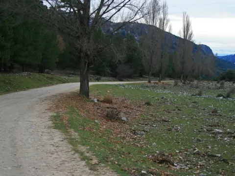
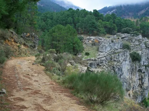
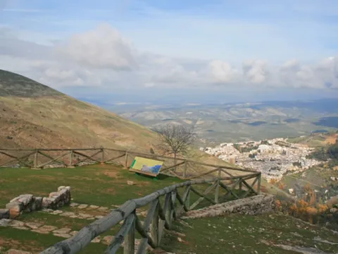
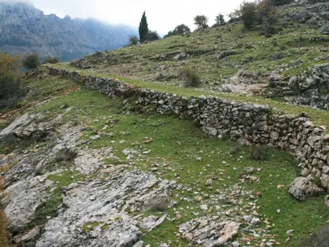
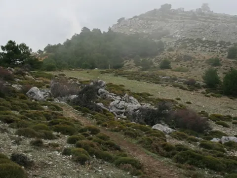
Next to the football field of Valdepeñas de Jaén, located in the upper part of the village, it starts the land lane leading to Frailes. Just after you started pedaling, you face the first rise of the day that will not give up until after a cortijo. At the beginning of the downhill, just at the vertex of a curve (km. 4.4), you have to leave the lane and take the one that continues from the front. Soon the fencing that delimits the estate Solana Los Morales appears. The porch remains open during the day and as indicated by the panels you cannot leave the way throughout the journey.

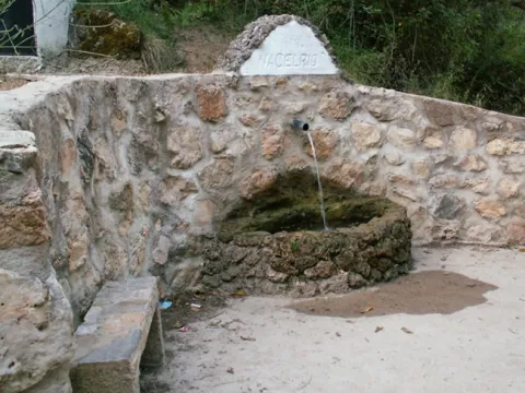
After reassembling a loin it gets out of the hunting ground. The route continues to face two crosses and to the left in a fork. Finally it flows into a vast cerealist plain known as the Llanos of the Angel. At this point it takes to the left the road of Fries, and a kilometer later (km. 11.4) opts for the asphalt lane on the right that goes up in zigzag. From the hill it descends to the legendary Hoya de Charilla. The lane now surrounds the saw of the Shoulder and adapts to its marinated orography. Then a rosary of ups - some short but with very steep ramps - begins that end in false hills, until the arrival in Charilla. The route enters the village on Prado Street. In the square (km. 22.7) it turns left and leaves it on Fountain Street. The first lane goes down, then clings to a stream and immediately reaches a crossing (km. 26.1). You have to turn left. After 5 kilometers of constant ups and downs, Frailes is seen.

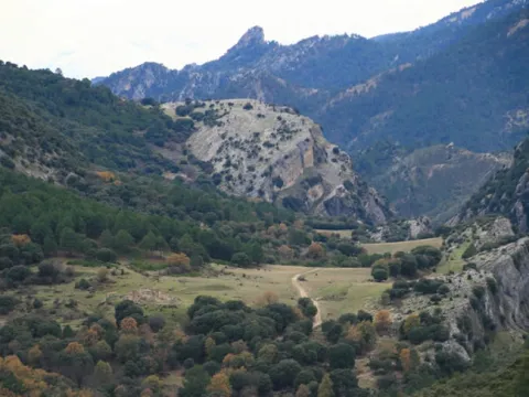
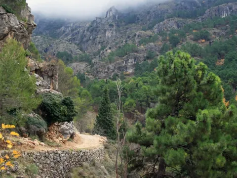
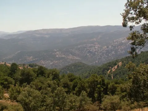
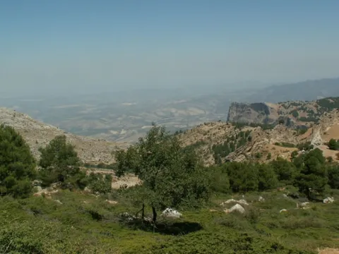
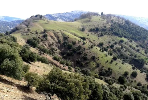
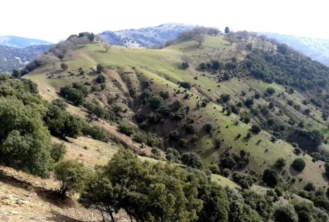
The difficult orography of the Sierra Sur is to go into a little-known mountain area, away from the great circuits, but of extraordinary beauty and great natural value. Its sinuous valleys, strong hills and warm holes seduce. Also in this silent serrania, the solages arrove unique legends such as that of the Serena of the Fountain of the Sotillo and give life to a popular religiosity halfway between mysticism and magic, that of the saints and healers. A magic saw in every way.

Breve descripción

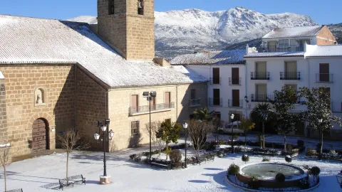
The Valdepeñas-Fráiles stage, belonging to the Path of Great Tour of the Sierra Sur de Jaén, begins its tour in the Park of Chorrillo. After a short stretch of urban soil, we arrived at one of the natural exits of the village on the way to Fries.
Latitud
37.7796
Longitud
-3.7849
Distrito
Ubicación en el mapa
POINT (-3.7849 37.7796)
imagen
Image
Plaza%20nevada%20-%20copia.jpg
Imagen principal
Activado
imagen
Image
Ruta%20de%20la%20Sierra%20%28De%20Valdepe%C3%B1as%20de%20Ja%C3%A9n%20a%20Frailes%29.jpg
Imagen principal
Desactivado
imagen
Image
Ruta%20de%20la%20Sierra%20%28De%20Valdepe%C3%B1as%20de%20Ja%C3%A9n%20a%20Frailes%293.jpg
Imagen principal
Desactivado
4 h

Nature

icon-intereses-naturaleza

Friends

icon-intereses-amigos

Adventure

icon-intereses-aventura

Culture

icon-intereses-cultura

Sport

icon-intereses-deporte

Eco-friendly

icon-intereses-eco-friendly

For couples

icon-intereses-en-pareja

Family

icon-intereses-familia

Gastronomy

icon-intereses-gastronomia

Municipality

icon-intereses-municipio

Low-cost tourism

icon-intereses-turismo-low-cost

Solo travel

icon-intereses-viajar-solo
Alta
Ruta de la Sierra (De Valdepeñas de Jaén a Frailes)
31 km
915m
915m
All year round
Desactivado

Although there is no technical difficulty, a minimum physical form is required to overcome some hard slopes. Any time of the year is good, in September you can attend the ritual of the deer's berrhea. It is not allowed to leave the way through the estate. In the km. 9.6 is passed very close to a hive, you will have to be careful.
Route de la Sierra (De Frailes a Valdepeñas de Jaén)

Submitted by brandcode_deweloper on
Id
2669103
Descripción larga

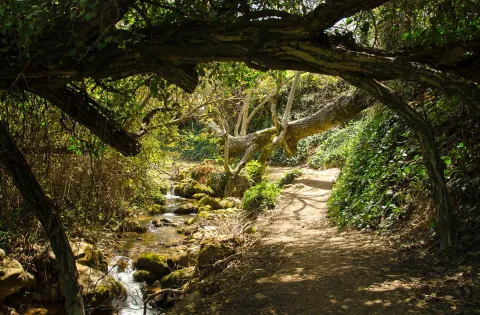
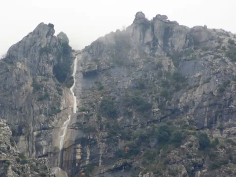
The route goes through Fries on the bottom. Once outside the city centre a fork appears (km. 1.9). Both roads lead to Valdepeñas de Jaén, but will be chosen by the one on the right. The first meters pass through the river's Vega. Immediately the sodomy pedal ends and must face the first rise, with some rather steep ramps. Once left behind the cortijos of Los Rosales, the first collar is reached (km 5.5). At this point you must continue to face them and ignore them two ways on the right, to descend without loss to a wading stream.

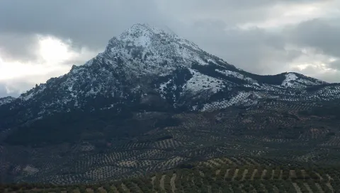
The tour again gains height to the cortijos of Cerezo Gordo. Immediately and after a short fall, the next rise begins which, despite being long, does not present the previous hard slopes. At the beginning of the slope (km. 11.2) the zigzagueante lane leading to Noalejo is left to the right. The asphalt ends next to a ruined cortijo. Soon after you reach the Pinatero port (km. 13.2), located at the foot of the Los Nevazos peak, the tip of the Trigo saw.

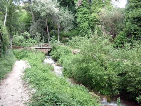
The route continues straight along the widest road and, as it is losing height, discovers the beautiful valley where the cortijo de La Fresnedilla is located. After having stranded the fourth hill, it descends to the hole of the Carboneros, locked between impressive flashes. Its meadows and creek invite a break before the last climb. They must save almost 200 meters, but once they have been overcome, it awaits a rapid descent that ends in Valdepeñas de Jaén.

The tormented orography of the South Sierra has stopped the widespread invasion of agriculture and within it there are hardly any population nuclei beyond some lonely agonic cortijos. In contrast, the natural environment has managed to remain in an almost wild state. In fact, the Mediterranean forest and bush cover 30% of the surface and grazing is still the essential activity. A secular way of life is located in the depths of the saw and it runs its most remote corners on an accidental journey to the encounter of areas still unknown.

Latitud
37.7796
Longitud
-3.7849
Distrito
Municipio
Ubicación en el mapa
POINT (-3.7849 37.7796)
imagen
Image
chorreras-1.jpg
Imagen principal
Activado
imagen
Image
Ruta%20de%20la%20Sierra%20%28De%20Valdepe%C3%B1as%20de%20Ja%C3%A9n%20a%20Frailes%29%20%281%29.jpg
Imagen principal
Desactivado
imagen
Image
DSC07086%20%281%29.jpg
Imagen principal
Desactivado
2 h

Nature

icon-intereses-naturaleza

Friends

icon-intereses-amigos

Adventure

icon-intereses-aventura

Culture

icon-intereses-cultura

Sport

icon-intereses-deporte

Eco-friendly

icon-intereses-eco-friendly

For couples

icon-intereses-en-pareja

Family

icon-intereses-familia

Gastronomy

icon-intereses-gastronomia

Municipality

icon-intereses-municipio

Low-cost tourism

icon-intereses-turismo-low-cost

Solo travel

icon-intereses-viajar-solo
Baja
Ruta de la Sierra (De Frailes a Valdepeñas de Jaén)
15 km
350m
350m
All year round
Desactivado

The difficulty of the route lies more than anything in the four necklaces that behave as true "break-legs," although half of the route runs by asphalt. Any time is good for visiting these places, in summer you will have to leave early to avoid pedaling in the hours of greatest insolation. The water is not missing.

Tramo de asfalto o cemento
 
Tramo de pista o camino forestal
 
Tramo de vía pecuaria
 
Tramo de senda
 

Route de la Ermita

Submitted by brandcode_deweloper on
Id
2665104
Descripción larga

In Fuensanta de Martos is taken the Castillo de Locubín road. First the height of the Bermejo Port is crowned, and immediately it descends to the Regüelo stream and the cords of the same name. After a series of slides, the route was moved on the left (km. 9.7) after a small almazara. The dirt lane descends into a ravine, crosses it and begins to remount a slope.

When you reach a crossing (km. 11.7), you should continue to climb right. In the next one, turn right again. The rise ends in a flare where another cortijo is located. From there the lane will remain almost half-hillside, offering beautiful perspectives on the river Grande. After leaving aside an era that serves as a lookout, it begins to lose height. The back lane is immediately left to the right and finally it is connected on an asphalt road (km. 16.1). There he goes on the left in the direction of the Hermitage of the Christ of the Chircal, which well deserves a visit.

Then you must go back to the river (km. 18.2) by a lane that goes down to the site known as the Junta de los Rios, in the confluence of the river with the Arroyo de los Cortesos. It is worth getting off the bike and walking the closed one, or getting close by the sidewalk that starts next to the old light factory, to the waterfall that hides the stream. The lane is bound to the river, jelated by a lush vegetation that provides freshness to its riverside. In 4 kilometers, it flows into the road of Fuensanta de Martos, which is taken to the right.

In the Alta Coloma saw are born countless rivers and streams. The largest of them is the Great River that downstream changes its name to the most virulent Vipers. Its impetuous waters have carved a beautiful river canyon where waterfalls are chained, closed, fast, leaps and pods that invite you to explore these beautiful and intimate areas. At the freshness of the riverside lies a lush gallery forest, alamos, milling, willows and mimberas, with discipline the channel.
In the spring, their welcoming fronts give shade to the rosemary who come to pay tribute to the Chircal Christ, in the hermitage of the same name.
Latitud
37.7502
Longitud
-3.5204
Distrito
Ubicación en el mapa
POINT (-3.5204 37.7502)
imagen
Image
Ermita-Chircales-2.jpg
Imagen principal
Activado
imagen
Image
Ruta%20de%20la%20Ermita.jpg
Imagen principal
Desactivado
imagen
Image
panel%20se%C3%B1alizaci%C3%B3n%20ruta%20Chircales.jpg
Imagen principal
Desactivado
4 h

Nature

icon-intereses-naturaleza

Friends

icon-intereses-amigos

Adventure

icon-intereses-aventura

Culture

icon-intereses-cultura

Sport

icon-intereses-deporte

Eco-friendly

icon-intereses-eco-friendly

For couples

icon-intereses-en-pareja

Family

icon-intereses-familia

Gastronomy

icon-intereses-gastronomia

Municipality

icon-intereses-municipio

Low-cost tourism

icon-intereses-turismo-low-cost

Solo travel

icon-intereses-viajar-solo
Medium
Ruta de la Ermita
33 km
510m
510m
Spring and autumn
Desactivado

The best time to enjoy the route is spring and autumn, when the riverside forests offer their most colorful image; in summer it is better to avoid pedaling in the central hours of the day. On the first Sunday of May is celebrated the Romeria of the Christ of the Chircal and from 1 to 5 September its major feast. All the lanes used are perfectly transitory by bicycle, only a few short reels can tighten the gear.

Ascent to Pandera

Submitted by brandcode_deweloper on
Id
2649168
Descripción larga

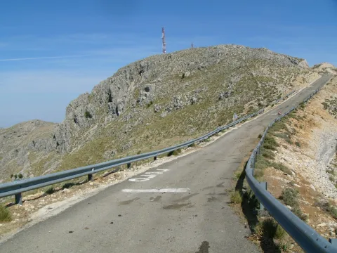
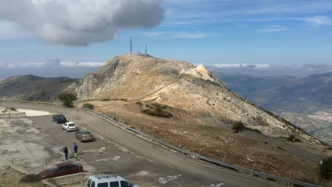
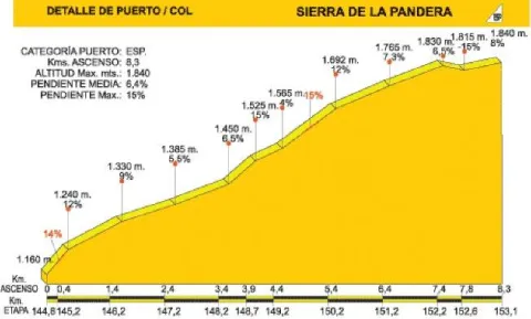
The road that leads to La Pandera, which is accessed from the road A-6.050 Jaén-Valdepeñas de Jaén-Castillo de Locubín, through a detour to the left located at the point of 24,500, is an asphalt and narrow itinerary built to access the military facilities at its top. In recent years it has become a forced quote from La Vuelta Ciclista to Spain, being considered as one of the mountain queen stages. For the first 3 km. We are accompanied by the typical landscape of the Mediterranean forest, with plenty of shrubs splashed by oak trees.

When you reach a quarry, the first important ramps appear, with slopes about 15% changing the vegetation as the altitude rises: lavender, thyme, aulagas, thorn, rosemary, cardo... The road, even in the dark, is becoming more and more difficult and offers the cycloturist the first landscape panorama. The environment is gradually becoming more arid, but the visual basin is greatly expanded and the views of Los Villares, Valdepeñas de Jaén or the capital itself, surrounded by olive fields, are impressive.

Breve descripción

The area has abundant snow wells, used until the 20th century, of which snow was extracted that would then be transformed into ice, to be used for medical purposes and as a water revival.

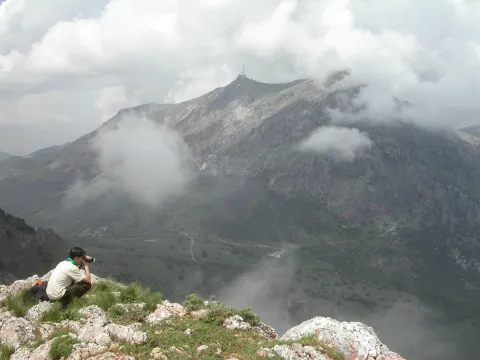
The Alto de La Pandera is a great lookout for the entire Jiennense province and other areas. Thus, in clear sky conditions, it is possible to see Sierra Nevada and the Sierra de Alhama (Granada), the Cordobese subbetic saw, the Ronda serrania and the Málaga Mountains, the Alpujarra almerienne and even Gibraltar.

Latitud
37.6203
Longitud
-3.7601
Distrito
Ubicación en el mapa
POINT (-3.7601 37.6203)
imagen
Image
Subida%20a%20la%20Pandera%202.jpg
Imagen principal
Activado
imagen
Image
P1030436.JPG
Imagen principal
Desactivado
imagen
Image
pandera2010.jpg
Imagen principal
Desactivado
7 h 8 min

Nature

icon-intereses-naturaleza

Friends

icon-intereses-amigos

Adventure

icon-intereses-aventura

Culture

icon-intereses-cultura

Sport

icon-intereses-deporte

Eco-friendly

icon-intereses-eco-friendly

For couples

icon-intereses-en-pareja

Family

icon-intereses-familia

Gastronomy

icon-intereses-gastronomia

Municipality

icon-intereses-municipio

Low-cost tourism

icon-intereses-turismo-low-cost

Solo travel

icon-intereses-viajar-solo
Alta
Image
69feca5b-9e6c-2510-25be-3fa0d3e57662?t=1607089019405
Subida a la Pandera
8,3 km
1217m
1217m
On foot
All year round
Desactivado
Image
11ac37f5-591c-1aaf-9b80-18a2e3be9cb9?t=1589225712911

The access road to Alto de La Pandera is closed to the traffic of vehicles so it is necessary to request the key of the cancel in the City of Valdepeñas de Jaén (Tel. 953 310 111) or Los Villares (Tel. 953 320 005).

The tour ends on the top of the Pandera, just in the place where the quartering is located, which, taking advantage of its strategic position, was the seat of a military detachment specialized in communications.

1.872 m.
Tramo de asfalto o cemento
 
Tramo de pista o camino forestal
 
Tramo de vía pecuaria
 
Tramo de senda
 

Route de la Sierra de los Ahillos

Submitted by brandcode_deweloper on
Id
2597124
Descripción larga

This alternative route connects the Alcaudete station (point 48,250 of the Green Way of Oil) to that of Vado Jaén (point 36,950 of the track). The tour begins at the old Alcaudete Station (km. 0). From here we're headed for Alcaudete. In the center of the city center we took the signposted detour to the location of the Amuña Fountain. At kilometer 6.4 we arrive at the crossing of Fuente Amuña, where we will continue in the direction of the Casillas de Martos. The road is raised by a curved route that for several kilometres offers good views of the countryside. At the kilometer 11.6 of tour we see a typical mountain cortijo located on a nava or depression inside the saw.

On the right side according to the direction of the march is the Pico Achillos (1.453 m.) that retains a lush slope of Mediterranean vegetation, and that gives name to this saw. Through paths you can ascend to this summit. At the kilometer 13.4 we reach the port, and the road begins the descent (at the crossing choose the right option). After five kilometres of quiet descent, you pass through a village that conserves a unitary school, witness to almost extinct rural ways of life. The kilometer 22 of route reaches the tail of the reservoir of the Víboras River (at this point there is a full rental rural house "La Morata").

After 2 kilometres, the wall of the dam serves as an entrance to the village of the Casillas de Martos. At the kilometer 25.4 we turned in the roundabout towards Martos and Alcaudete. This road leads us directly to the Green Way of Oil, and after 30.6 kilometers of pedal we arrived at the former Vado Jaén Station.

Breve descripción

The Sierra de Achillos is a small mountain formation integrated in the Sierra Sur de Jaén. This is an interesting example of an interior Mediterranean mountain, with a natural forest landscape and olive crops, splattered with cords and isolated villages.

Latitud
37.5953
Longitud
-4.0864
Distrito
Municipio
Ubicación en el mapa
POINT (-4.0864 37.5953)
imagen
Image
Sierra%20Ahillos%20nevada%20-%20copia.jpg
Imagen principal
Activado
imagen
Image
Sierra%20Ahillos%20bis.JPG
Imagen principal
Desactivado
imagen
Image
Sierra%20Ahillos%20nevada%20%281%29.jpg
Imagen principal
Desactivado
4 h 53 min

Nature

icon-intereses-naturaleza

Friends

icon-intereses-amigos
Medium
Ruta de la Sierra de los Ahillos
30,6 km
927m
927m
All year round
Desactivado

It is recommended to start the route at the Old Alcaudete Station, as in this sense the miles of ascent are less.

To access the starting point, in Alcaudete you take the road to Las Casillas, pedanía de Martos. Before coronating the neckline, and on a fence, the vehicle can be parked. At this point there is a drinking water source located in a ravine.

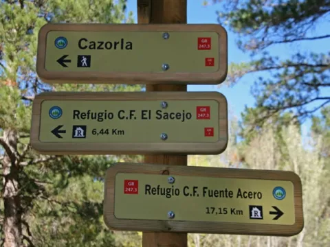
ALTERNATIVE GR 247.3 STAGE 2: Forestrand House Refuge El Sacejo - Forestrand House Refuge Fuente Acero

Submitted by brandcode_deweloper on
Id
2593240
Breve descripción

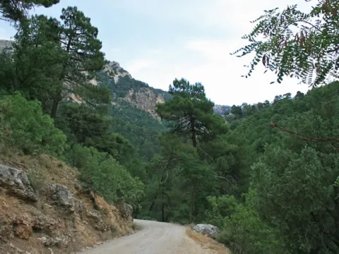
This stage begins in a Refugio located next to one of the most well-known areas of the Park, the Parador de Cazorla, from whose surroundings you enjoy good views over the forests of the south. From there it descends to the narrow and lush valley of a newborn Guadalquivir, on which it crosses in the emblematic area of the Puente de Las Herrerias, important crossroads of roads that also has various infrastructures for the rest and enjoyment of the walker, such as a campsite, a recreational area and a kiosco- bar.

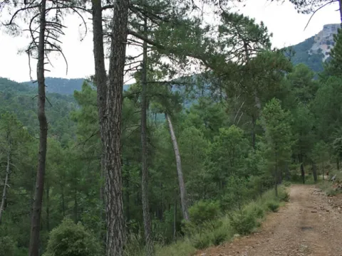
It then separates from the Guadalquivir Valley to reach one of the most popular forest tracks in the Park: the old Castril Road, now known as the Pista de las Navas. Always walking through pineapples with plenty of oak and plenty of oaks (complaints), our route is pulled by various viewpoints with interpretative panels.

One of them is the Mirador de Los Poyos de La Mesa, in front of this great calar whose roundabout figure presides over much of our journey. Another, also memorable, is that of the Strait of the Perals, on a spectacular throat flanked by rock formations of capricious forms. At some points, as in the area of La Trinchera, we will see at our feet the Guadaltiín Valley, one of the most beautiful and graceful of the Park.

The ships, to which their name owes the track that runs the second half of the Stage, are flat and fertile land in the middle altitudes of the mountain, which have historically been deforsted and exploited by man as agricultural land. They are quite rare, but the few that there are introduce a wonderful factor of landscape diversity, with their fields, fruit, orchards and choperas, all surrounded by forests and mountains.

In this stage we will find two, that of Espino, already practically abandoned, and that of San Pedro, much more extensive and that retains all its appeal.

The abundance of fauna is another of the great attractions of this stage. Deers, wowls, muflons, boars and mountain goats are easily seen, sometimes at a short distance. This was not in vain another of the favorite areas of the naturalist Felix Rodríguez de la Fuente to record impressive sequences of his documentary series "Man and Earth."

Today, it is precisely in the Navy of San Pedro where is the Quebrantacobos Breeding Center, a fundamental place for the conservation of the Iberian fauna. Thanks to its work, the vast territories that this stage is going through are again overflown by the broken bones, whose flight is sometimes crossed in the sky with that of the lion vultures and royal and perdiera eagles.

Latitud
37.8554
Longitud
-3.0602
Municipio
Ubicación en el mapa
POINT (-3.0602 37.8554)
imagen
Image
1.jpg
Imagen principal
Activado
imagen
Image
2.jpg
Imagen principal
Desactivado
imagen
Image
3.jpg
Imagen principal
Desactivado
imagen
Image
4.jpg
Imagen principal
Desactivado
imagen
Image
5.jpg
Imagen principal
Desactivado
imagen
Image
6.jpg
Imagen principal
Desactivado
imagen
Image
7.jpg
Imagen principal
Desactivado
imagen
Image
8.jpg
Imagen principal
Desactivado
imagen
Image
9.jpg
Imagen principal
Desactivado
imagen
Image
10.jpg
Imagen principal
Desactivado
imagen
Image
11.jpg
Imagen principal
Desactivado
imagen
Image
12.jpg
Imagen principal
Desactivado
imagen
Image
13.jpg
Imagen principal
Desactivado
7 h 14 min

Nature

icon-intereses-naturaleza

Friends

icon-intereses-amigos

Adventure

icon-intereses-aventura

Culture

icon-intereses-cultura

Sport

icon-intereses-deporte

Eco-friendly

icon-intereses-eco-friendly

For couples

icon-intereses-en-pareja

Family

icon-intereses-familia

Gastronomy

icon-intereses-gastronomia

Municipality

icon-intereses-municipio

Low-cost tourism

icon-intereses-turismo-low-cost

Solo travel

icon-intereses-viajar-solo
Alta
Refugio CF El Sacejo - Refugio CF Fuente Acero
23,59 km
478m
1057m
909m
2
1
2
4
On foot
All year round
Activado
There are no special difficulties.
El Sacejo, Puente de las Herrerías, fuente de La Garganta, Nava de San Pedro, Refugio Casa Forestal Fuente Econo.

On the path: Bridge of the Herries
Near the path: Cazorla, La Iruela, Cold Arroyo

In the beginning: Refugio Casa Forestal del Sacejo. In the final: Refugio Casa Forestal Fuente del Steel

Input and re-introduced animals

This stage runs through areas belonging to the Andaluza de Huna de Cazorla and Segura Reserve, managed by the Junta de Andalucía and whose first name was Coto Nacional de Huna de Cazorla-Segura. The Coto was created in 1960 and occupies 67000 hectares, almost a third of the Natural Park.

Its creation was the result of a policy to promote greater hunting, so a series of introductions and reintroductions of various species of large wild ungulates were previously made.

In 1952, 37 deer, 7 boars and 10 corzos were reintroduced, all of which were extinct in these saws. The first two are today very abundant, while the third failed. They also brought 5 muflons, a species that had never been present in the area, but which was adapted without any problems. Later, in 1956, 25 gems were introduced, which just as the muflons expanded rapidly despite not being indigenous.

Finally, in 1960, attempts were made to introduce the rebuttal, which is not indigenous, with the release of 4 copies, which died shortly. In fact, the rebuttal had been part of the fauna of the area, but in the Neolithic, when the climate was quite cold and humid than the present one.

Today, fortunately, capricious introductions of non-indigenous species are no longer carried out, which can cause serious ecological imbalances. Thus, the abundance of wos and muflons, together with important populations of other great ungulates and an important livestock cabin, and in the absence of the wolf, which was the species that previously regulated the herbivores populations, has resulted in unmeasured pressure on many species of flora, some of them endemic and in danger of extinction.

Refuge CF El Sacejo

Refuge CF Fuente Steel

Coordenadas / Huso 30S
According to Projection UTM Datum ETRS89
Tramo de asfalto o cemento
0
Tramo de pista o camino forestal
87.62%
Tramo de vía pecuaria
0
Tramo de senda
12.38%

Route card

Km 0

Refugio Casa Forestal El Sacejo

Esta Etapa comienza en la Casa Forestal El Sacejo, situada junto al Parador de Cazorla. La ruta comienza pasando por detrás del mismo, entre cipreses, y tomando una pista forestal cerrada al paso de vehículos que baja al encuentro del Arroyo de los Cierzos. A nuestra izquierda y al frente tenemos amplias vistas hacia el tramo de cabecera del Valle del Guadalquivir y elevaciones como la Loma de la Mesa y el Calar de Juana.

Caminamos entre pinos laricios con encinas y enebros y, tras pasar un par de arroyos, dejamos a la izquierda las ruinas de un cortijo. Bajo el pinar comienzan a aparecer quejigos, cornicabras y algunos arces y según bajamos hacia el Arroyo de los Cierzos, la vegetación se hace más exuberante, con higueras y nogales silvestres, hiedra, arces de buen tamaño y hasta algún tejo. Recorridos 2 kilómetros llegamos al citado arroyo y caminamos junto a él, y un poco más adelante cruzamos otro pequeño afluente del mismo.

Si lleva mucha agua, puede ser necesario ayudarse colocando algunas piedras para pasar. En este punto hay señales del Sendero PR-A 314, así como otra que indica hacia la derecha la subida al Puerto del Gilillo en tres horas por ruta sin señalizar.

El Arroyo de los Cierzos, siempre a nuestra izquierda, se encaja entre rocas en su último tramo, apareciendo el boj en su ribera. Pasamos junto a una pequeña represa y enseguida aparece al fondo el Valle del Guadalquivir.

Km 2,9

Valle del Guadalquivir

Tras pasar una valla de cierre del paso a vehículos, nuestra pista desemboca en otra más ancha y con mejor firme. Hemos llegado al Valle del Guadalquivir, más amplio que el que hemos recorrido hasta ahora. Si tomáramos a mano derecha llegaríamos al Nacimiento de este río, pero nuestra ruta gira a la izquierda pasando por un puente sobre el Arroyo de los Cierzos, muy cerca del punto donde este vierte sus aguas al Guadalquivir y en una zona de gran belleza paisajística.

A los pocos metros pasamos por un túnel excavado en la roca, y en kilómetro 4,1, en una curva a la izquierda en el paraje de La Caracolilla, se abren grandes vistas: hacia el este, los Poyos de La Mesa y el Castellón del Calerón, y hacia el norte, a lo lejos, la Sierra de Las Villas, mientras desde abajo, por nuestra derecha, asciende el rumor de las aguas del recién nacido Guadalquivir.

En el kilómetro 4,8 hay una valla para vehículos, correspondiente a la Reserva Andaluza de Caza de Cazorla-Segura, que se cierra entre las 21 las 9 horas, aunque el paso a pie es siempre libre. Más adelante, en el kilómetro 5,1, dejamos a la derecha la gran Casa del Calerón, caminando por pinar de pino negral con abundancia de quejigos, encinas y cornicabras.

Km 6,4

Puente de Las Herrerías

Este punto es muy estratégico por varios motivos. Encontramos un Área Recreativa con mesas, fuente y quiosco-bar, y muy cerca, un camping, además de una pequeña carretera (JF-7092) que nos llevaría hasta el Empalme del Valle, conectando con las poblaciones de Arroyo Frío y Burunchel. Hay también un importante cruce de caminos señalizados, ya que el Sendero Bosques del Sur se cruza con el GR 7, por el que podríamos ir a Cazorla o a Coto Ríos.

También, por la margen derecha del Guadalquivir, podemos ir en sentido contrario al que traemos hacia el Nacimiento de este río, por la Derivación 11 del Sendero Bosques del Sur que pasa por el paraje del Pino de las Tres Cruces.

Otro sendero de 1,3 kilómetros, señalizado por la Consejería de Medio Ambiente, nos permitiría llegar al emblemático paraje de la Fuente del Oso, no lejos del Parador de Cazorla por carretera (JF-7094), lo que nos permitiría articular una ruta circular con el tramo del Sendero Bosques del Sur que hemos recorrido hasta ahora.

El paraje es fresco y umbrío, con abundante vegetación de ribera, y el Puente de Las Herrerías sobre el Guadalquivir es sencillo pero muy bello, con su arco de medio punto construido con piedra de toba. Cuenta la tradición que una noche llegó aquí la reina Isabel la Católica con su séquito procedente de Quesada en dirección a Baza, ciudad del Reino de Granada que deseaba conquistar.

Ante la dificultad de vadear el río, que venía crecido por las lluvias otoñales, la leyenda afirma que sus caballeros construyeron o remozaron el puente en una sola noche para que la reina pudiera continuar sin demora su viaje. El nuestro, más pacífico y sosegado, utiliza el mismo puente y abandona a los pocos metros la carretera que va hacia el citado Empalme del Valle, tomando un ancho camino que sale a la derecha.

El paisaje cambia, ya que nos separamos del Guadalquivir para internarnos en ascenso por un hermoso bosque de pino laricio siguiendo en principio el Arroyo de La Mesa, que queda a nuestra izquierda. Pronto, hacia la derecha, veremos alzarse los imponentes paredones de Los Poyos de La Mesa por su cara norte, la más abrupta y vertical. En el kilómetro 7,9 cruzamos un arroyo y descartamos un camino que sale a la izquierda, y 400 metros después, en una bifurcación, abandonamos el camino para tomar un jorro (vía de saca de madera) por la derecha.

En el kilómetro 9,4 tomamos una pista forestal a la izquierda y poco después pasamos una valla de cierre del paso a vehículos, llegando a la denominada pista de Las Navas. Durante este último tramo pasamos muy cerca del llamado Pino Abuelo, un centenario pino laricio que se secó hace ya muchos años, pero que aún sigue en pie, destacando por su gran tamaño entre los de su entorno.

Km 10,6

Pista de Las Navas

Llegamos a esta pista forestal que es todo un clásico en los recorridos más conocidos del Parque Natural por el atractivo de los parajes que recorre. Hacia la izquierda la pista pasa enseguida a estar asfaltada y nos llevaría hacia el Empalme del Valle pasando junto a lugares tan emblemáticos como el Área Recreativa de Linarejos, la Cerrada del Utrero (recorrida por un corto y fantástico sendero) y Vadillo Castril.

Nuestra ruta, sin embargo, gira a la derecha. Durante un tramo está señalizada con franjas blancas rojas y amarillas por coincidir con el PR-A 315.

Unos 300 metros más adelante llegamos al impresionante Mirador de los Poyos de la Mesa, orientado hacia el sur y dotado de un panel interpretativo que nos ayudará a identificar los hitos más significativos del grandioso paisaje que contemplamos. Entre ellos destaca una vez más la meseta de Los Poyos de La Mesa, de 1635 metros de altitud, con sus arriscados paredones. Ante nuestra vista se extienden grandes pinares, así como encinares y bosques mixtos.

Son territorios de gran riqueza faunística, muy queridos por la cabra montés y el ciervo, así como por rapaces como el buitre leonado y las águilas real, calzada y culebrera, de ahí que en estos parajes el inolvidable Félix Rodríguez de la Fuente grabara algunos de sus mejores documentales de la serie televisiva El Hombre y La Tierra.

Nuestra pista asciende suavemente por un precioso bosque, al principio con mezcla de pinos negrales y laricios, y dominando ya estos últimos según ganamos altitud. Hay mucha encina y buenos robles (quejigos). De cuando en cuando se abren excelentes vistas a un lado y otro de la pista. En el kilómetro 14 sale a la izquierda una pista cerrada al tránsito de vehículos que sube hacia el Cerrillo del Piornal. Nuestra pista llanea antes de llegar a la Nava del Espino.

Km 14,5

Nava del Espino

En este punto, a la derecha, se abre un bello y despejado llano donde se sitúa la Casa Forestal de la Nava del Espino, ya en ruinas. Pinares y praderías componen un armónico paisaje donde se puede ver a los gamos acudir a alimentarse a última hora de la tarde. Junto a la Casa parte un camino hacia Los Poyos de la Mesa, de 7 kilómetros de longitud y un ascenso acumulado de 225 metros.

Si decidimos recorrerlo, una vez arriba tendremos unas extraordinarias vistas sobre el Valle del Guadalquivir y la zona de Vadillo Castril.

En el kilómetro 14,8 sale a la izquierda una pista cortada a vehículos por la que se puede acceder, entre otros lugares, al Raso del Madrigal, desde donde se disfruta de espléndidas vistas. Nuestra ruta continúa en suave descenso, teniendo a nuestra izquierda el Arroyo de la Garganta y la bella estampa del monte Cabeza del Tejo.

Km 15,6

Fuente de la Garganta

Esta fuente de tres caños está situada en el arroyo del mismo nombre, en un paraje fresco y relajante con mesas para comer. Más allá podemos disfrutar de otro espléndido mirador con un panel interpretativo dedicado a la reintroducción del quebrantahuesos en el Parque Natural.

Km 17,2

Nava de San Pedro

Nuestra Etapa llega a la Nava de San Pedro, uno de los lugares con más acusada personalidad del Parque Natural. El paisaje, hasta ahora dominado por el bosque, se abre de pronto ante nuestros ojos, humanizándose, pues las navas son terrenos muy fértiles que se sitúan a cierta altitud y que han sido deforestados y aprovechados por el hombre desde tiempos inmemoriales como pastos frescos o como terrenos agrícolas.

A los pies del viejo cortijo de la Nava, convertido ahora en un pequeño bar-restaurante, se extiende una vista extraordinariamente armónica y relajante donde se combinan las huertas y tierras de labor, los frutales dispersos, los álamos –amarillos en otoño- y las altas montañas cubiertas de bosques y coronadas por abruptos riscales.

Además, este paraje alberga el Centro de Cría de Quebrantahuesos, un lugar emblemático para la conservación de la fauna ibérica que puede ser visitado entre mediados de mayo y finales de septiembre –es decir, fuera de la época de cría – previa cita con la Fundación Gypaetus.

En el kilómetro 17,9 arranca a la izquierda el sendero de Valdetrillo, señalizado por la Consejería de Medio Ambiente, de 6,3 kilómetros de longitud, que discurre junto a los Arroyos de Valdecuevas y Valdetrillo y cuenta con un espectacular mirador hacia el Estrecho de los Perales. Siguiendo por nuestra ruta, la pista comienza a ascender de nuevo y dejamos a la derecha un pinar de repoblación.

En el kilómetro 18,7, en el paraje de La Trinchera, podremos disfrutar hacia nuestra derecha de una de las vistas más celebradas del Parque Natural: las que corresponden al Valle del Guadalentín, hendido por el famoso Barranco del mismo nombre, un extraordinario paisaje que se cierra con las cumbres de Sierra Nevada y por el que discurra la Etapa 14 del Sendero Bosques del Sur.

Unos 200 metros más adelante sale a la derecha la Senda Ornitológica Circular Barranco del Guadalentín, en cuyo inicio hay un panel interpretativo. Esta ruta, en cuyo recorrido emplearíamos unas cinco horas, coincide en su tramo junto al Guadalentín con parte de la citada Etapa 14.

Nuestra pista continúa ascendiendo entre rasos y encinares, en medio de un paisaje de gran dulzura y armonía, pasando en el kilómetro 21 una barrera que cierra el paso a vehículos entre las 21 y las 9 h.

Km 21,3

Estrecho de los Perales


Un mirador con un panel interpretativo nos facilita la contemplación del Estrecho de los Perales, una espectacular garganta flanqueada por irregulares formaciones rocosas. En la zona es frecuente avistar animales tan señeros como la cabra montés y el águila real, lo cual es bien expresivo de su gran riqueza ecológica.

De hecho, veremos pequeños carteles a nuestra izquierda que marcan el límite del Área de Reserva de Navahondona-Guadahornillos, una amplia zona donde las actividades humanas están fuertemente restringidas para conservar sus extraordinarios valores naturales.

Km 23,6

Refugio Casa Forestal de Fuente Acero

Nuestra larga Etapa llega a su término en la antigua Casa Forestal de Fuente Acero, ya en desuso, pero que en sus buenos tiempos fue un punto de referencia esencial en toda esta zona, y donde se ha habilitado uno de los refugios del Sendero Bosques del Sur. Es un lugar hermosísimo en el que destaca el viejo y gigantesco pino laricio o salgareño situado en medio del raso que hay frente a la Casa Forestal.

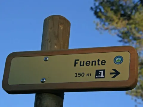
Hay una fuente señalizada a 150 metros. Fuente Acero es, además, uno de los puntos estratégicos del Sendero Bosques del Sur, por ser punto de llegada o salida de las Etapas 14 y 15, además de la que se acaba de describir.

ALTERNATIVE GR 247.3 STAGE 1: Cazorla - Forestrand House Refuge del Sacejo

Submitted by brandcode_deweloper on
Id
2591314
Breve descripción

This stage links the town of Cazorla with the Refugio de El Sacejo, next to the Parador de Cazorla. It therefore runs between the southwestern outer edge of the Natural Park and the slopes that fall to the Guadalquivir Valley, the axis of the southern area of the Park.

Its tour has many attractions, starting with the very village of Cazorla, the most visited of the Park, and the road that part of the population dating back to the lush valley of the Cerezuelo, closed by a rocky wall by which the Cascade of La Escaleruela is cleared when the precipitation has been sufficient.

From the Mirador de Riogazas we can see exceptional panoramic views of Cazorla and the surrounding mountains, with the great olive countryside at the bottom. Later on, the road we will go is no longer a simple means to enjoy the landscape and becomes the main protagonist of the route. Width, with good firm and built in the traditional way, with its hormone and dry stone underpants, is a type of road that we can only find in this area of the Natural Park, as we also see in other stages of GR 247.

For its quality, for the effort and expertise that it needed at the time, and for the impressive places they travel, these roads are part of the best of the Park's heritage.

Even the Collado del Gilillo will enjoy great views towards the lowlands covered with olive groves, and once overtaken, the route changes from the side to the mountains that flank the enclosed Valle del Guadalquivir, in a clear contrast between agricultural and forest landscapes. If in the above-mentioned necklaces we choose to turn briefly and climb to the top of the same name, we will enjoy one of the most exciting landscape shows in the Natural Park, with views that range from the north of the Sierra de Segura to Sierra Nevada.

The wealth of the entire area is great. It is easy to see vultures and frequent to see real eagles. And, of course, at any time, we can be surprised by the mountain goat, the deer, the gamo and the muflon.

Latitud
37.9143
Longitud
-3.0072
Municipio
Ubicación en el mapa
POINT (-3.0072 37.9143)
imagen
Image
1.jpg
Imagen principal
Activado
imagen
Image
2.jpg
Imagen principal
Desactivado
imagen
Image
3.jpg
Imagen principal
Desactivado
imagen
Image
5.jpg
Imagen principal
Desactivado
imagen
Image
4.jpg
Imagen principal
Desactivado
imagen
Image
6.jpg
Imagen principal
Desactivado
imagen
Image
7.jpg
Imagen principal
Desactivado
imagen
Image
8.jpg
Imagen principal
Desactivado
imagen
Image
9.jpg
Imagen principal
Desactivado
imagen
Image
10.jpg
Imagen principal
Desactivado
imagen
Image
11.jpg
Imagen principal
Desactivado
imagen
Image
12.jpg
Imagen principal
Desactivado
imagen
Image
13.jpg
Imagen principal
Desactivado
imagen
Image
14.jpg
Imagen principal
Desactivado
imagen
Image
15.jpg
Imagen principal
Desactivado
imagen
Image
16.jpg
Imagen principal
Desactivado
imagen
Image
17.jpg
Imagen principal
Desactivado
imagen
Image
18.jpg
Imagen principal
Desactivado
imagen
Image
19.jpg
Imagen principal
Desactivado
imagen
Image
20.jpg
Imagen principal
Desactivado
imagen
Image
21.jpg
Imagen principal
Desactivado
5 h 22 min

Nature

icon-intereses-naturaleza

Friends

icon-intereses-amigos

Adventure

icon-intereses-aventura

Culture

icon-intereses-cultura

Sport

icon-intereses-deporte

Eco-friendly

icon-intereses-eco-friendly

For couples

icon-intereses-en-pareja

Family

icon-intereses-familia

Gastronomy

icon-intereses-gastronomia

Municipality

icon-intereses-municipio

Low-cost tourism

icon-intereses-turismo-low-cost

Solo travel

icon-intereses-viajar-solo
Baja
Cazorla - Refugio Casa Forestal del Sacejo
15,04 km
927m
993m
425m
2
1
2
3
On foot
All year round
Activado
Most of the stage runs along the way. Short sections with strong slope at the exit of Cazorla. From Riogazas to about two kilometres before the end of the stage, there are points and short sections with stony soil, steps and very narrow path.
Cazorla, Nacelrio, La Malena, fuenteo-abrevadero in Cerro Cagairón, Refugio Casa Forestal del Sacejo.

On the path: Cazorla
Near the path: La Iruela

In the beginning: there is no. In the final: Refugio Casa Forestal del Sacejo

The golden era of forest roads

The splendid roads that we will walk in this stage (which are not modern forest tracks, but not old ways of riverboats), make us wonder about their origin. Here is the answer of Alfredo Benavente Navarro, one of the best connoisseurs of the Natural Park.

The oldest roads of these Sierras are medieval and served to cross it, like the one that goes from Cazorla to Castril. On this was the path that crosses Giillo, the Port of Juan de Baco and Puerto Pinillo, but most of the roads we see in the Sierra de Cazorla are from the last decade of the 19th century and the first three of the 20th century.

The original proposal of this network of roads was produced in 1883 by the Jaén Forest District in order to communicate the forest houses planned for the forest exploitation of the Serras de Cazorla and Segura. These works began around 1900, when the construction of these houses is addressed, in order to facilitate the communication and monitoring of the forest works, at a time when the woods were taken out of the mountain through rivers, jorros (sac roads) and road roads, many of which are currently under the asphalt of the roads or have been widened to become forest tracks.

The technical direction of these roads was executed by the shift engineer in the corresponding brigade. Thus, in the mountains of Navahondona, Guadalhornillos, Vertientes del Guadalquivir, Torre del Vinagre, Hortizuela, Poyo Segura, etc., the network of roads was executed by Enrique Mackay, one of the most illustrious and competent mountain engineers of the time at the national level.

In the Sierra de Segura, however, few new roads were made at that time, because there was already a network of paths between cortijos and villages, on which the new forest tracks were adapted. Therefore, most of the roads for the forest exploitation of these saws were created between 1900 and 1936. After the Civil War few more were made, except in the National Cazorla-Segura Hunting Cote (1960) and a few to communicate new forest houses.

Caraway

Refugio Casa Forestal del Sacejo

Coordenadas / Huso 30S
According to Projection UTM Datum ETRS89
Tramo de asfalto o cemento
0
Tramo de pista o camino forestal
24.6%
Tramo de vía pecuaria
0
Tramo de senda
75.4%

Route card

Km 0

Cazorla

La ruta parte de Cazorla, junto al Río Cerezuelo –también llamado de Cazorla-, muy cerca de la Plaza de Santa María y en el camino que sube al Castillo de La Yedra. Este río y su entorno han sido restaurados hace pocos años y dispone de un agradable sendero para disfrutarlo. Nuestra ruta gira a la izquierda a los pocos metros de su inicio, pasando a la orilla derecha del río.

La fuerte pendiente hace que enseguida ganemos altitud, siempre en un ambiente muy frondoso, entre casas, huertas y chalés, enlazando diversos caminos con distintos tipos de firme cuyos cruces están bien señalizados con marcas de cuatro colores, ya que en este primer tramo nuestro GR coincide con otros Sendero de Pequeño Recorrido y un Sendero Local.

Si miramos hacia atrás veremos una bella estampa del pueblo de Cazorla coronado por su castillo, y al fondo, la campiña olivarera y Sierra Mágina. El camino que recorremos es el que tradicionalmente han usado los cazorleños para subir a la sierra andando o a lomos de sus caballerías.

El valle que tenemos a nuestra derecha merece ser contemplado con detenimiento por su frondosidad. También podemos ver, en la vertiente contraria a la que estamos recorriendo, las ruinas del Castillo de las Cinco Esquinas, o de Salvatierra, que así se llama el cerro que corona. Se trata de una fortificación de finales del siglo XII, cuya torre tiene una curiosa planta en forma de pentágono irregular. Pasaremos al lado de la humilde Ermita de San Sebastián, al parecer de finales del siglo XV, que queda a nuestra izquierda.

De tanto en tanto veremos en el fondo del valle los pequeños saltos que hace el río, cuyas aguas movieran en su día las piedras del Molino de Tíscar. Mientras, durante algunos trechos, el paisaje no puede ser más ameno, con huertos, bancales, higueras, caquis, chopos, algunos olivos, y al fondo, la muralla de poderosos farallones de la cuerda del Sinclinal, por los que se despeña la larga cola de caballo de la Cascada de La Escaleruela, cuya visibilidad depende de la época del año y las precipitaciones caídas.

La armonía entre hombre y naturaleza en estos parajes se expresa también en sus sonidos: el balido de las ovejas, el agua del río, las campanas de Cazorla y el canto de los pajarillos, que son tan abundantes y variados como los recursos que aquí encuentran.

Km 2,2

Fuente de Nacelrío

Unos 100 metros después de haber cruzado el río por un puente llegamos a la fuente de Nacelrío, donde hay un cruce que debemos tomar a la derecha. A la izquierda iríamos a la ermita de la Virgen de la Cabeza en una hora. Por este santuario pasa la Etapa 10 del GR 247, a un kilómetro de su final, lo que conviene tener en cuenta si queremos hacer recorridos alternativos.

A partir de aquí nos internamos en los territorios de los bosques y los roquedos, comenzando por un ancho camino en medio de un pinar de pino carrasco.

Tras cruzar el Arroyo de La Malena en el kilómetro 2,7 encontraremos una nueva fuente y una pequeña área recreativa con una buena chopera y un precioso mirador hacia Cazorla.

Unos metros más adelante (casi un kilómetro después de la fuente de Nacelrío) llegamos al fantástico Mirador de Riogazas, un gran balcón desde el que vemos todos los parajes que hemos recorrido hasta este momento, identificados en un panel interpretativo nos ayudará a conocer mejor el paisaje que estamos disfrutando, donde la Peña de los Halcones a la derecha y la Loma del Castillo a la izquierda forman una gran uve en cuyo pie está el pueblo de Cazorla.

Km 3,6

Caseta del Control de Riogazas

Llegamos a la antigua Caseta del Control de Riogazas, que antiguamente era un punto de inspección de los vehículos que transportaban la abundante madera que siempre han producido estos montes. Encontramos una ancha pista forestal que hacia la derecha se dirige a la Casa Forestal del Chorro y el Collado Zamora. Si la siguiéramos, enlazaríamos al cabo de 3 kilómetros con la Etapa 11 del Sendero Bosques del Sur a la altura del kilómetro 5,2.

Nosotros la cruzamos para continuar de frente por una senda que enseguida se ensancha convirtiéndose en un buen camino con piedras a los lados. 300 metros más adelante cruzamos de nuevo la misma pista y seguimos por nuestra senda al frente. Pronto comprobamos la importancia que tuvo este camino tradicional por su anchura y por los calzos y hormas de piedra seca que tiene. Pasamos por una zona repoblada con cipreses y a la izquierda veremos una vez más la Cascada de la Escaleruela.

En el kilómetro 4,4 encontramos otro cruce con la pista forestal antes citada, que tomamos a la derecha, para abandonarla a los pocos metros por la senda que sale a la izquierda y que arranca con un escalonamiento. Tras pasar junto a una fuente-abrevadero el camino se interna en un pinar de pino negral, más denso que los que nos han acompañado hasta ahora. La mayor humedad hace que aparezcan los musgos y la hiedra, así como algunos pinos laricios, arces, majuelos y guillomos o durillos blancos (Amelanchier ovalis).

La senda, que asciende por las laderas del Cerro de Cagahierro, es muy panorámica en algunos tramos.

En el kilómetro 6,2 pasamos por una zona encharcadiza donde hay que seguir la ruta fijándose en las piedras que marcan el camino.

Km 6,3

Collado de Cagahierro

Llegamos al collado de Cagahierro. A la derecha parte un camino por el que enlazaríamos en tan solo un kilómetro con la Etapa 11, en el tramo comprendido entre el monasterio de Montesión y el famoso paraje de El Chorro. Nuestra ruta continúa al frente, en ascenso sostenido, pasando por un pinar de laricios de repoblación.

A partir del kilómetro 6,7 el pinar es sustituido por el encinar, pero según subimos, el terreno está pronto cada vez más pelado, con piornos, espinos arlos (Berberis hispánica) y algunos guillomos.La ausencia de arbolado permite disfrutar de extraordinarias vistas hacia la campiña jiennense. Este portentoso tramo por la Lancha del Gilillo, hasta el Collado del mismo nombre, es sin duda uno de los de mayor personalidad de todo el Sendero Bosques del Sur.

El camino es ancho y bien construido, con sus hormas de piedra seca. A la derecha está flanqueado por grandes cantiles, farallones y rocas desprendidas, mientras a la izquierda la vista se pierde hasta lejanos horizontes, viéndose en primer plano pueblos como Quesada y Peal de Becerro.

En el kilómetro 7,4 pasamos un pequeño collado tras el que aparece al frente el Gilillo, muy pelado y rocoso, mientras a la derecha, abajo, veremos los cortados de El Chorro.

Nuestro extraordinario camino sigue serpenteando, sin estar ya pegado a los farallones y con un relieve más suave. Aparecen manchas de enebro rastrero, perfectamente adaptado a los vientos, las nieves y los suelos pobres, y nos sorprenden algunos ejemplares de mostajo (Sorbus aria), arbolillo relativamente frecuente en el norte de España pero bastante escaso en el Parque Natural.

Km 8,3

Collado de Gilillo

Este punto es un hito importante de la Etapa porque cambiamos de vertiente y la dirección del sendero deja de ser hacia el sureste para dirigirse hacia el noreste, abriéndose impresionantes vistas hacia las montañas que flanquean la vertiente derecha del Valle del Guadalquivir, como el Calar de Juana y la Loma de La Mesa.

Es muy recomendable desviarse de la ruta para subir a la cumbre del Gilillo, que está a solo 500 metros, y que con sus 1848 m de altitud, nos brinda unas increíbles panorámicas en todas las direcciones. Por el este vemos Sierra Mágina, coronada por el pico del mismo nombre, que es el más alto de la provincia de Jaén (2164 metros), extendiéndose las vistas hasta más allá de la Loma de Úbeda, en la campiña.

Más hacia el sur, en días claros podemos ver alzarse a lo lejos las blancas cumbres de Sierra Nevada. Las vistas meridionales, ya sobre las montañas del Parque, están coronadas por el pico Cabañas e incluyen el Nacimiento del Guadalquivir. Hacia el este vemos la profunda hendidura del Valle de este río y las montañas que lo flanquean por el lado opuesto, como el Calar de Juana y los Poyos de La Mesa.

Y finalmente, hacia el norte, los interminables telones montañosos de las Sierras de Las Villas y Segura, donde destacan el Banderillas, El Yelmo y los calares del Espino y Navalperal.

De vuelta a nuestra ruta, abandonamos el ancho camino por el que hemos caminado para tomar una pequeña senda que sale a la izquierda, junto a las ruinas de una antigua caseta de vigilancia. Reaparece el arbolado, al principio con pequeños pinos laricios, y en seguida vemos un pequeño y precioso quejigar. A la derecha continuamos teniendo grandiosas vistas hacia el Valle del Guadalquivir.

700 metros más adelante llegamos a un nuevo collado con una agradable pradera donde giramos de nuevo a la izquierda, dejando de tener vistas hacia el Valle. La senda, muy estrecha al principio, pasa por un pinar y llega a una amplia hondonada que rodea por la derecha. El paisaje aquí es muy llamativo, estando dominado por una alfombra de piornos y enebros rastreros, así como rocas con perfiles dentados y formas muy caprichosas.

Tras un corto ascenso alcanzamos otro pequeño collado (kilómetro 9,8) en el que volvemos a ver el Valle del Guadalquivir, discurriendo nuestra estrecha senda entre piornos y por suelo bastante rocoso.

Km 10,15

Collado

La ruta, siempre por la Loma de Los Castellones, llega a otro collado en el que nace, a la derecha, un agreste y estrecho barranco formado por un arroyo tributario del Arroyo Cerezo, afluente a su vez del Guadalquivir. Las vistas son espectaculares, teniendo al este el Valle del Guadalquivir.

Nuestra estrecha senda continúa por suelo rocoso, en él no pueden crecer otros árboles que algunos pinos laricios pequeños y retorcidos, pero en el que aparece la sabina rastrera y, más adelante, el boj y el enebro rastrero. En el kilómetro 11,3 la ruta gira a la derecha cambiando de vertiente, descendiendo en zigzag por pinar, que ahora es más denso y que deja entrever en algunos tramos el Valle del Guadalquivir.

Los pinos van siendo más grandes según bajamos, aunque tienen muy poco sotobosque, porque bajo ellos solo crece el enebro rastrero.

En el kilómetro 11,6 pasamos por un raso muy agradable en forma de suave hoya, que puede llegar a encharcarse en el centro y en cuyo margen derecho hay una alineación de rocas que parecen hincadas en el suelo. Salimos de la hoya por la derecha, fijándonos en la baliza correspondiente, y tomamos de nuevo un camino ancho y con buen firme. Tras llanear durante un trecho, descendemos otra vez por pinar en el que aparecen espinos arlos, laureolas, rosales y guillomos, con vistas intermitentes hacia el Valle del Guadalquivir.

Km 12,2

Puerto del Tejo

En este collado, con hermosísimas vistas hacia ambos lados, nuestro camino llega a una importante y nítida bifurcación. La de la izquierda nos llevaría hacia la ermita de la Virgen de la Cabeza, rodeando el Cerro de la Laguna por su vertiente sur. Si vamos sobrados de tiempo, se recomienda recorrer uno o dos kilómetros y volver al Puerto del Tejo, solo por el placer de disfrutar de las vistas impresionantes sobre el agreste barranco que recorre, así como del propio camino, amplio y bien construido a la manera tradicional.

Nuestra ruta, en la citada bifurcación, continúa por la derecha, por pinar de pino negral con enebros, sabinas y encinas. Poco a poco se va ensanchando hasta convertirse en una pista forestal en la que aparecen algunos robles (quejigos). En el kilómetro 13,8 hay una bifurcación en la que debemos tomar a la derecha. En el último tramo nuestra pista desciende con bastante pendiente.

Km 15

Refugio Casa Forestal del Sacejo

Nuestra Etapa finaliza en esta antigua Casa Forestal, en la que se ha habilitado un refugio. Está situada a pocos metros del Parador de Cazorla, establecimiento que fue pionero en el desarrollo turístico de la Sierra de Cazorla. Hay una fuente.

Route Natural del Puerto de Navatrillo

Submitted by brandcode_deweloper on
Id
2591156
Descripción larga

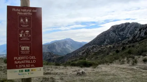
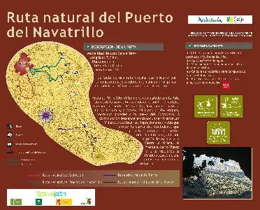
It is a circular route that runs along rural roads and trails of the municipality. Its starting point is on the Valdepeñas road, on the access lane to La Urbanización La Carrasquilla (Los Torcales lane). To the point of kilometric 3,300, the stretch is shared with the Natural Route of the Sierra, ending at the starting point. Arriving at the port of the Navatrillo, we go down to the Dark Cave and, through the Llano de los Propios, we can access the cave of the Contadero. Then we'll go down a lane to Los Villares. To highlight the impressive views of the Cave of the Contadero, which allow to appreciate to our right Jabalcuz, to the background the rock of Castro and the Sierra la Grana, to the front of the Mount Wind and to the left the Pandera, as well as a fantastic panoramic of the village.

Breve descripción

It is a circular route that runs along rural roads and trails of the municipality.

Latitud
37.7601
Longitud
-3.5003
Distrito
Municipio
Ubicación en el mapa
POINT (-3.5003 37.7601)
imagen
Image
3413300Master.jpg
Imagen principal
Activado
imagen
Image
Ruta%20Natural%20del%20Puerto%20de%20Navatrillo.jpg
Imagen principal
Desactivado
3 h

Nature

icon-intereses-naturaleza

Friends

icon-intereses-amigos

Adventure

icon-intereses-aventura

Culture

icon-intereses-cultura

Sport

icon-intereses-deporte

Eco-friendly

icon-intereses-eco-friendly

For couples

icon-intereses-en-pareja

Family

icon-intereses-familia

Gastronomy

icon-intereses-gastronomia

Municipality

icon-intereses-municipio

Low-cost tourism

icon-intereses-turismo-low-cost

Solo travel

icon-intereses-viajar-solo
Medium
Image
b212551f-6a80-444a-b4a8-aa9f9726c98e?t=1589203992521
Ruta Natural del Puerto de Navatrillo
7,7 km
All year round
Desactivado

- Use comfortable shoes and dress suitable for the time of year.
- Hold on to water.
- Always go with another or other hikers.
- Calculate your route to complete before sunset.
- In case of an accident, call the emergency number 112.

Valdepeñas road.

Tramo de asfalto o cemento
 
Tramo de pista o camino forestal
 
Tramo de vía pecuaria
 
Tramo de senda
 

Route Natural del Cerrejón

Submitted by brandcode_deweloper on
Id
2585128
Descripción larga

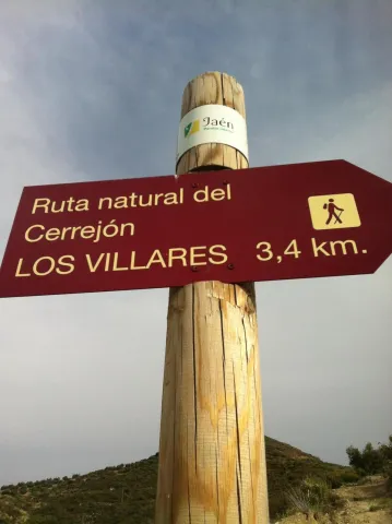
It is a circular route that runs in its entirety on rural roads and has as its starting point the path of access to the municipal building, in the city centre, ending in the Mirador del Molino del Rey, also in Los Villares. The first 500 m., looking behind our back, we can see a beautiful panorama of Los Villares, the Canjorro, as well as the Peña de Castro. Continuing the ascent, we will leave the municipal landfill and the Pedregoso River to our right. From the Casería de la Venta we descend, through a partially paved road, to the area of Los Molinos, by the river Frio. On the left bank of the river, we will pass through a fountain located just on foot, about 500 meters before the end of the itinerary. The route of the Cerrejon ends in the parking lot, which is located next to the Mill of the King.

Latitud
37.7902
Longitud
-3.4604
Distrito
Municipio
Ubicación en el mapa
POINT (-3.4604 37.7902)
imagen
Image
Ruta%20Natural%20del%20Cerrej%C3%B3n%20%281%29.jpg
Imagen principal
Activado
imagen
Image
turismoActivo1.jpg
Imagen principal
Desactivado
1 h 30 min

Nature

icon-intereses-naturaleza

Friends

icon-intereses-amigos

Adventure

icon-intereses-aventura

Culture

icon-intereses-cultura

Sport

icon-intereses-deporte

Eco-friendly

icon-intereses-eco-friendly

For couples

icon-intereses-en-pareja

Family

icon-intereses-familia

Gastronomy

icon-intereses-gastronomia

Municipality

icon-intereses-municipio

Low-cost tourism

icon-intereses-turismo-low-cost

Solo travel

icon-intereses-viajar-solo
Baja
Image
74e9f9e5-b35d-33eb-a75a-0bc9d83133f5?t=1589202824829
Ruta Natural del Cerrejón
3,7 km
All year round
Desactivado

- Use comfortable shoes and dress suitable for the time of year.
- Always go with another or other hikers.
- Calculate your route to complete before sunset.
- In case of an accident, call the emergency number 112.

Route Natural de La Sierra

Submitted by brandcode_deweloper on
Id
2579303
Descripción larga

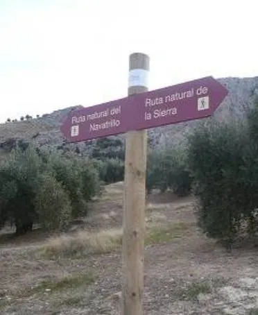
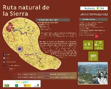
The Natural Route of the Sierra runs along rural roads and trails of the municipality. Its starting point is on the road of Valdepeñas A-6.060, on the road of access to La Urbanización La Carrasquilla (lane of Los Torcales), ending on the same road at the height of Rio Frio. After leaving the Port of Navatrillo, to the left, we will ascend to the Llano de Gamonaz, passing through the rock of Beltran, which is left to our left. When we reach the ravine called the Neveros, we will be diverted along the road that leads to the Port of Hoya from Otiñar. From the Port of the Hoya we begin the descent by a lane that connects with the exit of the Pancorbo retreat, in the vicinity of the Cold River.

Breve descripción

In much of its journey, the Natural Way of La Sierra runs along two rivers: the Guadalporcún and the Guadalete. Both in perfect conservation, have a common denominator with the rivers of the southern Iberian Peninsula: their name, which begins with guadal.

Latitud
37.7803
Longitud
-3.4801
Distrito
Municipio
Ubicación en el mapa
POINT (-3.4801 37.7803)
imagen
Image
rutas-sierra-andujar.jpg
Imagen principal
Activado
imagen
Image
Ruta%20Natural%20de%20La%20Sierra.jpg
Imagen principal
Desactivado
4 h

Nature

icon-intereses-naturaleza

Friends

icon-intereses-amigos

Adventure

icon-intereses-aventura

Culture

icon-intereses-cultura

Sport

icon-intereses-deporte

Eco-friendly

icon-intereses-eco-friendly

For couples

icon-intereses-en-pareja

Family

icon-intereses-familia

Gastronomy

icon-intereses-gastronomia

Municipality

icon-intereses-municipio

Low-cost tourism

icon-intereses-turismo-low-cost

Solo travel

icon-intereses-viajar-solo
Alta
Image
577003b6-0362-77b8-767f-b7df4c1d272d?t=1589201888703
Ruta Natural de La Sierra
9 km
420m
710m
1
1
1
4
All year round
Desactivado
29

- Use comfortable shoes and dress suitable for the time of year.
- Hold on to water.
- Always go with another or other hikers.
- Calculate your route to complete before sunset.
- In case of an accident, call the emergency number 112.

Tramo de asfalto o cemento
 
Tramo de pista o camino forestal
 
Tramo de vía pecuaria
 
Tramo de senda