Saltar al contenido principal
icon-intereses-naturaleza

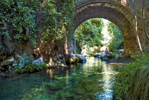
Bridge of las Herrerías

Submitted by brandcode_deweloper on
Id
881939
Descripción
Descripción larga

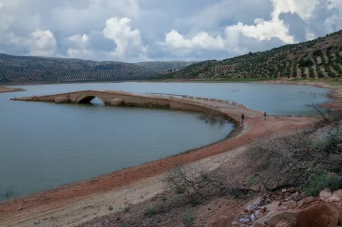
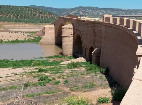
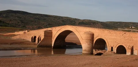
They have in the area that in the 15th century, when Isabel La Católica was traveling to the conquest of Granada from Córdoba, it reached this point where Guadalquivir was so grown that it did not allow its passage. In one night, according to the book, his gentlemen raised this robust bridge that allowed him to reach Baza and Guadix.

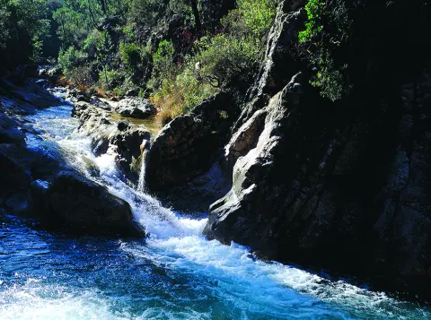
The place is beautiful by itself: the bridge is surrounded by fig trees and wild rosals. And in the paths around it you can observe boj, strawberries and hazelnuts.

On the right side is joined the Maillar stream - with another beautiful stone bridge - which makes in rainy years the place an authentic vergel and a very busy bathing area.

We suggest:

  • Make walking some (or all) part of the road that leads to the birth of the Guadalquivir. They are about 11 km across the Navahondona- Guadahornillos Reserve Area, the most protected area of the Natural Park.

In Cazorla take the Sierra road (A-319) until the crossing known as the Empalme del Valle, 17 km. Turn right on the JF-7092 road and after passing the bridge over the Guadalquivir River (4 km from the Empalme) follow the right track (JF-7091) that after two kilometres reaches the Bridge.

Breve descripción

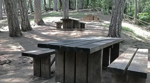
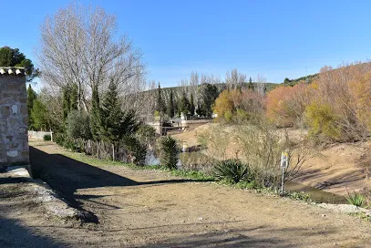
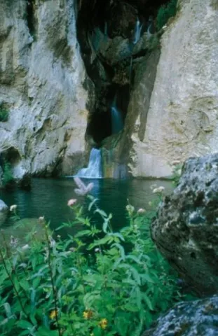
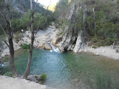
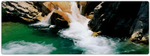
The Herrera Bridge and its surroundings are one of the best known places in the Alto Guadalquivir. It is a great place to start some of the most interesting routes of the Sierra de Cazorla, and the enranche that involves its recreational area will allow you to rest, refresh and enjoy a Guadalquivir river, which at this point already contains a considerable flow. The bridge, built on porous limestone armchairs - here called toba - is perfectly integrated into the landscape.

Ubicación
Latitud
37.900980
Longitud
-2.938540
Dirección
JF-7092
Distrito
Ubicación en el mapa
POINT (-2.93854 37.90098)
Tipos de punto de interés
Imágenes carrusel
imagen
Imagen
Puente%20de%20las%20Herrer%C3%ADas%202.jpg
Imagen principal
Desactivado
imagen
Imagen
Puente%20de%20las%20Herrer%C3%ADas.jpg
Imagen principal
Desactivado
imagen
Imagen
Puente%20de%20las%20Herrer%C3%ADas%20merendero.jpg
Imagen principal
Desactivado
Imágenes cabecera
imagen
Imagen
puente-herreras.jpg
Imagen principal
Activado
Loading map
Preparing points of interest and routes...

Bridge of la Cerrada

Submitted by brandcode_deweloper on
Id
4892938
Descripción
Breve descripción

It is a basin regulatory reservoir, belonging to the Guadalquivir River, where you can enjoy the typical landscape of the wetland (especially carrizos), as well as the abundant aquatic fauna that forms the ecosystem: avetoro, large tick, squid, real duck, spoon duck, common focha...

Ubicación
Código Postal
23320
Latitud
37.958410
Longitud
-3.188940
Municipio
Ubicación en el mapa
POINT (-3.18894 37.95841)
Imágenes carrusel
imagen
Imagen
puentecerrada%20%281%29.jpg
Imagen principal
Desactivado
Imágenes cabecera
imagen
Imagen
puente%20%281%29.jpg
Imagen principal
Activado
Microsite al que pertenece
Loading map
Preparing points of interest and routes...

Ariza Bridge

Submitted by brandcode_deweloper on
Id
6773653
Descripción
Descripción larga
That of Ariza, extended over the bed of the Guadalimar River, of which important documentation made known by V.M. Ruiz Fuentes, was built at the initiative of the Úbeda Council to improve the communication of Andalusia with Levante and La Mancha through the Condado region. In September 1562, a royal provision authorized the drafting of the conditions of work as well as its public auction. Vandelvira is in charge of drawing up the plans and conditions for the construction of the bridge. Once the work was put up for auction, it was finally finished on October 4, 1563 by the Ubetan master stonemason Antón Sánchez. The works were visited by Vandelvira on numerous occasions. In the one carried out in September 1571, the side arches were going to be closed and the first ring of the central one was practically closed. In August 1575, with Vandelvira already dead, Antón Sánchez acknowledges having received, to date, the sum of 1,875,875 maravedís, while indicating that the work was practically finished. Finally, in 1582 Pedro de Alcalá Monte, Senior Master of the Huéscar church, appraised the work, now completely finished, leaving the Council of Úbeda in debt to Antón Sánchez for 17,859 ducats. Built in sandstone carved in ashlar, it is a rare example of a Renaissance bridge, of the type known as “on the back of a donkey”, as its passage is not flat but formed by a very pronounced double ramp, with the apex over the keystone of the central arch. It is composed of five semicircular arches with different spans, perfectly outlined thanks to a molding that links them all, the central one being large and with a span of about 32.7 m.; the total length reached almost 100 m. and the maximum height 17 m. The layout of the bridge was modified in the 19th century by rectifying the grades, and thus eliminating the steep slope of the original ramps. In the middle of the 20th century, two long slopes covered with masonry were added, made when considering the current layout of the road with two curves leading in and out of the bridge, in contrast to the original straight road. The beauty and uniqueness of its proportions, the grandeur of its central arch which, like the rest, starts from the platform of the plinth, its excellent stonework and its authorship, perfectly documented as the work of Andrés de Vandelvira, make this bridge one of the most important examples within its genre in the Spanish artistic panorama of the 16th century, although not exempt from a certain previous resentment due to the pointed image of its layout generated by the pronounced ramps, drastically truncated in the reform reviewed. of the 19th century. As an emblem of the city that led to its construction, its shield is not preserved, if it ever had one, but a beautiful relief representing its patron, San Miguel Arcángel.
Breve descripción
Declared Monument 02/04/1993. The Ariza bridge, 17 km away from the city of Úbeda, is undoubtedly the most beautiful and important engineering work of Andrés de Vandelvira. As a bridge builder, Vandelvira gained experience alongside his father-in-law Francisco de Luna, the master stonemason responsible for the grandiose San Pablo bridge in the city of Cuenca, begun in 1520 and replaced in 1895 by the current one. Vandelvira, while carrying out his work in the cathedral of Cuenca, intervened in this bridge, creating plans in 1560 for the carving of the arches. His is also the demolished bridge over the Guadalmena (studied by E. Herrera and J. Zapata), located on the limits of the current municipalities of Siles (Jaén) and Montiel (Ciudad Real), for which in 1555 Vandelvira presented the first traces and in 1565 the second.

Ubicación
Nombre
Embalse de Giribaile
Código Postal
23400
Latitud
38.112550
Longitud
-3.365920
Municipio
Ubicación en el mapa
POINT (-3.36592 38.11255)
Tipos de punto de interés
Imágenes carrusel
imagen
Imagen
_VSC7843.jpg
Imagen principal
Desactivado
imagen
Imagen
Puente%20Ariza%2C%202.jpg
Imagen principal
Desactivado
Imágenes cabecera
imagen
Imagen
Puente-Ariza-1200x580.jpg
Imagen principal
Activado
Microsite al que pertenece
Loading map
Preparing points of interest and routes...

Dam of Mengíbar

Submitted by brandcode_deweloper on
Id
4619362
Descripción
Descripción larga

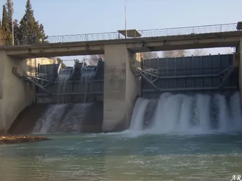
The Mengibar Dam was an important civil work in its time, as it was among the first hydraulic power plants to be built in Spain with mobile doors. Until then, the dams were fixed and, if they exceeded their capacity, overflowed. However, in the case of Mengibar, in anticipation of possible floods, Mengemor engineers designed to install mobile doors that allow the water to be depacked in a controlled way to the river. Built from load walls, with natural stone masonry, lacquered and assembled by concrete mortar. The holes form a half-point arc with material of similar characteristics. Covered with flat ceramic tile, mounted on metal fences. It is in good conservation and is currently used to generate electrical power and inject it into the network.

Breve descripción

Located on the Guadalquivir River and inaugurated on 30 November 1916 by King Don Alfonso XIII, the project was the work of architect Antonio Palacios Ramilo and built by the company Mengemor.

Telecomunicaciones
Sitio web
www.mengibarturismo.com
Teléfono de contacto
677 222 285
Correo electrónico
turismo@aytomengibar.com
Ubicación
Código Postal
23620
Latitud
37.987049
Longitud
-3.792523
Dirección
Carretera de la Presa
Distrito
Municipio
Ubicación en el mapa
POINT (-3.792523 37.987049)
Imágenes cabecera
imagen
Imagen
main_image_97200.jpeg
Imagen principal
Activado
Microsite al que pertenece
Loading map
Preparing points of interest and routes...

Poyos de La Mesa

Submitted by brandcode_deweloper on
Id
913611
Descripción
Descripción larga

Although it is possible to reach the Poyos de la Mesa from different places, we propose to do it from the track it leads to the Nava del Espino. From this point comes a path marked as PR-A 315 that in an hour and a half leads you to the top of this mountain.

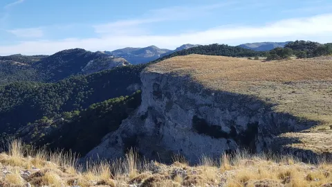
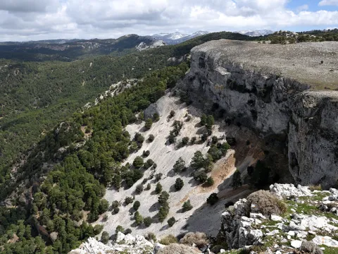
Once at the summit you will discover a wavy landscape of limestone eroded by the passage of time and covered with green meadows and larive pines. It is a formidable place to see the great herbivores of the Park that pasture to pleasure the juicy grass of these heights. It was also one of Felix Rodríguez de la Fuente's favorite places to shoot some of his famous wild scenes.

Now you have to enjoy the landscape around you and identify the many peaks you can see: The Banderillas, the Cabañas, the Empanadas rope, or the Pico Giillo are some of the most emblematic mountains of the Natural Park.

In these saws, it is known as "poyos" to the high plateaus surrounded by cliffs cut to peak, like huge teeth. The Poyos de la Mesa is one of the most spectacular. From its edges you can see a good panorama of the head of the Guadalquivir and if you look at the slices or poyos that name this mountain.

We suggest:

  • Once located in the Poyos you should not leave the opportunity to approach the area of the Marchante Prairie, by the bank of the Gualay Tornillo stream.

In Cazorla take the Sierra road (A-319) until the crossing known as the Empalme del Valle. Turn right on the JF-7092 road and after passing the bridge over the Guadalquivir River (4 km from the Empalme) follow the left track (JF-7091). Continue this track to the Nava del Espino in km 21 of the road signs, where you will find a milestone that points to the rise to the Poyos.

Breve descripción

Going up the way of the Navas demands our attention in a powerful way a huge mountain surrounded by cliffs that fall on the pine forests surrounding it. They're the Poyos of the Bureau. Something mysterious makes us stop our way to observe it. It is distinguished from the other hills by their peculiar forms that invite you to meet her...

Ubicación
Latitud
37.772886
Longitud
-3.788329
Ubicación en el mapa
POINT (-3.788329 37.772886)
Tipos de punto de interés
Imágenes carrusel
imagen
Imagen
poyos.jpg
Imagen principal
Desactivado
Imágenes cabecera
imagen
Imagen
poyos-mesa.png
Imagen principal
Activado
Loading map
Preparing points of interest and routes...

Labradores Granary

Submitted by brandcode_deweloper on
Id
4485126
Descripción
Descripción larga

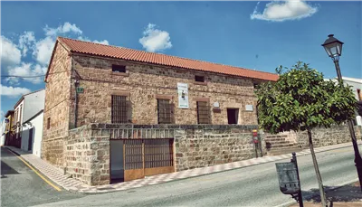
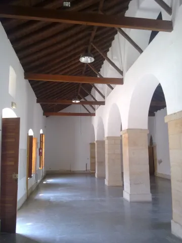
Its construction ended in 1789 and retains the colonial typology of these buildings intended to store the grain and seed, control and regulate its production, as well as its redistribution.

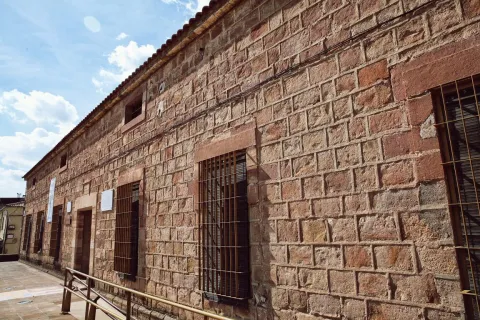
Rectangular plant with factory of thick walls covered with sandstone silery and resistant interior arches. It originally consisted of a single plant, but then a second was built.

The Pósito de laboradores has been used as a warehouse, civil guard headquarters, dusty during the War of Independence and children's school.

Telecomunicaciones
Sitio web
www.guarroman.es/ciudad/conoce-la-ciudad/edificios-y-monumentos/
Teléfono de contacto
953 615 004 / 953 615 306
Ubicación
Código Postal
23210
Latitud
38.182850
Longitud
-3.687570
Distrito
Municipio
Ubicación en el mapa
POINT (-3.68757 38.18285)
Tipos de punto de interés
Imágenes carrusel
imagen
Imagen
posito%20labradores.jpg
Imagen principal
Desactivado
Imágenes cabecera
imagen
Imagen
Posito%20de%20Labradores.jpg
Imagen principal
Activado
Loading map
Preparing points of interest and routes...

Granary de Carboneros

Submitted by brandcode_deweloper on
Id
4399242
Descripción
Descripción larga

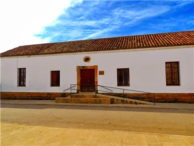
The plant is in the form of "U" and has only one height. The main ship is divided lengthwise by a half-point archer on square pillars, an archer that runs parallel to the main plane, and on it is another series of half-point arches. It has recently been rehabilitated as a library and cultural center.

Breve descripción

Located in front of the church, it is a work in slimmed masonry also from the last third of the 18th century. It has a predominantly horizontal structure, with an intellized door that marks the symmetry, which is accessed through double stairs, flanked by two rectangular windows.

Telecomunicaciones
Sitio web
www.carboneros.es
Correo electrónico
ayuntamiento@carboneros.es
Ubicación
Código Postal
23211
Latitud
38.229310
Longitud
-3.631480
Dirección
C/ Constitución, 38
Distrito
Municipio
Ubicación en el mapa
POINT (-3.63148 38.22931)
Tipos de punto de interés
Imágenes carrusel
imagen
Imagen
posito%20carboneros.jpg
Imagen principal
Desactivado
Imágenes cabecera
imagen
Imagen
27082013738.jpg
Imagen principal
Activado
Loading map
Preparing points of interest and routes...

Granary (actual ayuntamiento)

Submitted by brandcode_deweloper on
Id
913332
Descripción
Descripción larga

In 1572, the cantero Pedro Venetian and the mason Luís de Vilches committed themselves to building the posio, in accordance with the conditions and traces dictated by Andrés de Vandelvira. The building, of a rectangular floor, defines the confluence of the streets Corredera and San Antón with the square of the Constitution. It rises in the planned enranche in the 16th century, outside the medieval compound, essentially formed by the castle and the Renaissance church raised at the foot of it, in which, although perhaps not directly, Andrés de Vandelvira was able to intervene.

The ground floor, with a stone factory seen, is most likely the best preserved part, as the high ones (originally compartmentalized in trickery and built in brick and masonry) were later adapted for other local administrative functions. The singularity of this building is in the division drawn by Vandelvira on the ground floor, made up of five small rectangular ships covered with parallel half-barrel vaults, popularly called the "positillos," built in silery, which communicate directly with the outside based on half-point voids, being the largest central than the other ones.

Typically Vandelvira acuña a model, developed in such a way in the Pósito de Baeza, in which the knowledge of the stereotomy or cutting of the stone requires a great perfection due to the need for the isolation of wetlands to preserve the genre stored in the best conditions. Several heraldic shields are preserved in the building and, as a reminder of the recovery of the advance of Cazorla (in which the villa of La Iruela was included) by the Archbishopric of Toledo, in the early 17th century was placed by the command of Archbishop Don Bernardo de Rojas and Sandoval in the capitular room an allusive inscription to perpetuate this important event. A lot of effort and money cost Toledo's mitre to be made again with her old territory, which was taken from her in 1545 by Don Francisco de los Cobos, Secretary of the Emperor Charles V.

Breve descripción

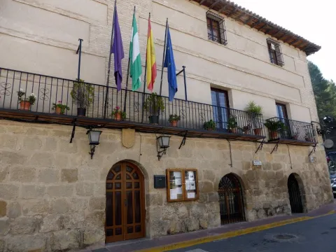
Monument of the Historical-Artistic Set. Incoation 01 / 04 / 85. The professional activity of Andrés de Vandelvira revolved not only around religious or private architecture, but was also hired by the Councils to intervene in various municipal works: sources, bridges, foundings or grain stores, municipalities, etc. In the villa of La Iruela, the Pósito, the current headquarters of the City Council, has arrived today, from which the contract has been retained, published by V. M. Ruiz Fuentes.

Ubicación
Código Postal
23476
Latitud
37.920510
Longitud
-2.993990
Dirección
Plaza del Ayuntamiento
Municipio
Ubicación en el mapa
POINT (-2.99399 37.92051)
Tipos de punto de interés
Imágenes cabecera
imagen
Imagen
p%C3%B3sito%20-%20ayuntamiento.jpg
Imagen principal
Activado
Loading map
Preparing points of interest and routes...

River Folds of Borosa

Submitted by brandcode_deweloper on
Id
877125
Descripción
Descripción larga

The route of the Borosa River, between the Piscifactory and the Cerrada de Elias, allows to observe a varied set of folds. The structure of the Sierra del Pozo, in which the Borosa River is located, is characterized by the presence of folds and NNE-SSW direction failures. The general geological structure of this Sierra is controlled by two large synchlinals: the birth of the Guadalquivir River and the Cabañas River.

In the four initial kilometers of the itinerary that part of the Piscifactory, folds associated with those of a regional character are observed, the size of which ranges from 1 meter to several tens of meters. These are developed in Cretaceous materials of Urgonian facies and their orientation determines the course of neighboring streams, with the concordant relief of the Arroyo de las Trout valley controlled by a spectacular sinchinal. As an example of anti-linear, the best fold is found in the Los Caracolillo Bridge.

Source: Inventory of Georresources of Andalusia. Environmental Council. Junta de Andalusia.

Breve descripción

Plizas del Río Borosa

Ubicación
Latitud
38.298857
Longitud
-2.651877
Distrito
Ubicación en el mapa
POINT (-2.651877 38.298857)
Tipos de punto de interés
Imágenes carrusel
imagen
Imagen
1%20%285%29.jpg
Imagen principal
Desactivado
imagen
Imagen
2%20%284%29.jpg
Imagen principal
Desactivado
imagen
Imagen
Natu249.jpg
Imagen principal
Desactivado
Imágenes cabecera
imagen
Imagen
558_img.png
Imagen principal
Activado
Loading map
Preparing points of interest and routes...

Small Square of the Armas

Submitted by brandcode_deweloper on
Id
6550232
Descripción
Descripción larga

Located between La Mella and Jabalcuz, Mount Almodóvar is famous for its crest, visible almost from any point in the city of Jaén. With 992 meters in height, this hill does not stand out for its altitude, but it does stand out for hosting very close places for the Jiennans, such as the Fuente de la Peña or the Plazoleta de las Armas. The Plazoleta de las Armas is a small plain surrounded by almonds, majolets and pines that offers beautiful views of the city. Place of play, walk and "bulls" of several generations of jiennenses, this square - which is accessed from the district of the Gloriet - remains a special place worth visiting.

Breve descripción

From almost any point in the city of Jaén are visible the spectacular crest of Cerro Almodóvar. Located between La Mella and Jabalcuz, the Almodóvar is 992 meters high and houses places much loved by the Jiennenses, such as the Fuente de la Peña or the protagonist of this report. The Plazoleta de las Armas is a small plain surrounded by almonds, pines and majolets where several generations of jiennenses have grown between games. Located just above the Glorieta district, it is worth taking a walk through and looking at the wonderful views it offers.

Ubicación
Latitud
37.757478
Longitud
-3.800935
Distrito
Municipio
Ubicación en el mapa
POINT (-3.800935 37.757478)
Tipos de punto de interés
Imágenes cabecera
imagen
Imagen
_G8Y2454.jpg
Imagen principal
Activado
Microsite al que pertenece
Loading map
Preparing points of interest and routes...