Saltar al contenido principal
icon-intereses-naturaleza

El Moralejo Farmhouse

Submitted by brandcode_deweloper on
Id
2853367
Descripción
Descripción larga

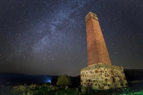
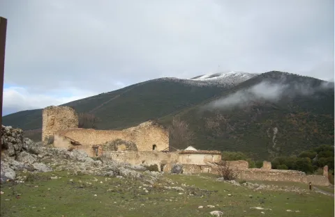
To arrive there is only to follow the signs to the Natural Monument of the Quejigo del Master from Valdepeñas de Jaén, just 1 '5 km from a lane that descends to the right, continuing just over 2 km we arrive to an old ruined cortijo in the middle of a wide explanade.

The horizon is wide, although it is true that the mountains cut the celestial vault a little. We are facing a top-class place for those most demanding fans.
This observation point is located more than 1,100 meters in height and in the bottom of the valley with outstanding conditions of seeing and darkness.

Breve descripción

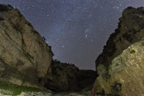
We are at one of the best points in the entire Starlight Reserve in the South Sierra de Jaén. Note: the use of 4x4 vehicle is necessary to access this point, however it is worth it because it is reached at the bottom of a large valley surrounded by lomas and mountains that hide the few remains of light pollution. From this point on the darkness and purity of heaven is exquisite.

Telecomunicaciones
Sitio web
www.andalucia.org/es/valdepenas-de-jaen-turismo-cultural-cortijo-del-moralejo
Ubicación
Latitud
37.591089
Longitud
-3.808862
Distrito
Ubicación en el mapa
POINT (-3.808862 37.591089)
Tipos de punto de interés
Imágenes carrusel
imagen
Image
shutterstock_313430609.jpg
Imagen principal
Desactivado
Imágenes cabecera
imagen
Image
image_197209.jpeg
Imagen principal
Activado
Loading map
Preparing points of interest and routes...

María Luisa Farmhouse

Submitted by brandcode_deweloper on
Id
2853502
Descripción
Descripción larga

The point we propose in the old rear explanade of the old cortijo of Maria Luisa, right on the border between the provinces of Córdoba and Jaén, in the municipal term of Martos. It is easily accessed from the marteña pedanía of Monte Lopez-Alvarez in the direction of Albendín, a few meters from the province limit a detour to the left in the direction of Alcaudete. At this point is already visible the large line of cereal with the old cortijo preceded by a row of trees that is just the way of access.

In the back we find a large place to leave the vehicles and set up to enjoy the night show.

Breve descripción

A nearby place for the inhabitants of the surrounding populations, easily accessible and wide to go on summer nights to enjoy the rain of stars. It is a place of wide horizon, very dark in the cenit and free of light pollution in much of the horizon. Only the light of Martos pollutes the horizons E and NE.

Telecomunicaciones
Sitio web
www.martos.es
Teléfono de contacto
953 210 000
Ubicación
Código Postal
23600
Latitud
37.723220
Longitud
-3.970320
Distrito
Municipio
Ubicación en el mapa
POINT (-3.97032 37.72322)
Tipos de punto de interés
Imágenes carrusel
imagen
Image
JJG_4951.jpg
Imagen principal
Desactivado
Imágenes cabecera
imagen
Image
Imagen principal
Activado
Loading map
Preparing points of interest and routes...

Mata Bejid Farmhouse

Submitted by brandcode_deweloper on
Id
5857145
Descripción
Breve descripción

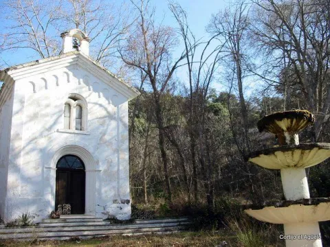
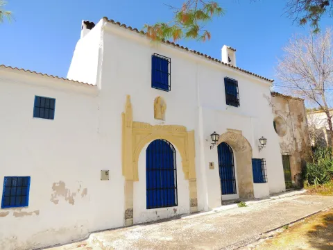
In this private estate the spirit of the belle époque with rural dyes is still revived. It is a private property with an interesting chapel, gardens, house of the gentlemen and even a regional style garage.

Ubicación
Latitud
37.676846
Longitud
-3.564921
Distrito
Municipio
Ubicación en el mapa
POINT (-3.564921 37.676846)
Tipos de punto de interés
Imágenes carrusel
imagen
Image
Ermita_Begid.jpg
Imagen principal
Desactivado
Imágenes cabecera
imagen
Image
Cortijada%20Mata%20Bejid.png
Imagen principal
Activado
Microsite al que pertenece
Loading map
Preparing points of interest and routes...

El Chorro Cliffs

Submitted by brandcode_deweloper on
Id
912498
Descripción
Descripción larga

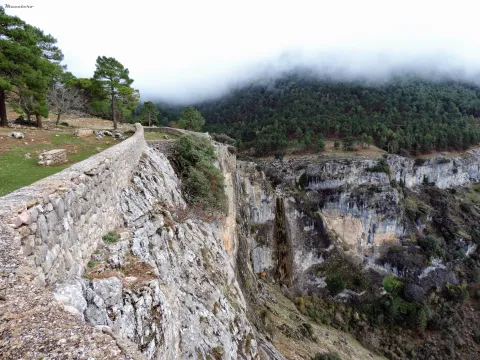
Two are the points from which you get a good view of the Chorro:

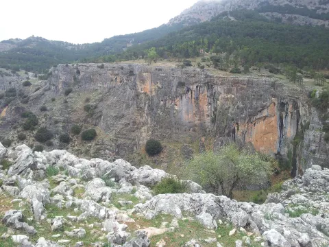
  • In front of the forest house comes a path that takes you to a lookout with a stone wall from which to serene observe the show that opens before your eyes. The white spots that are seen on the walls of this mole accuse the presence of vultures' nests, for they are only the stained of their excrements by being dragged through the waters.
  • Following the track that has brought us to the Chorro and a few meters away you have to go down a path that comes to the right to the very abyss through a cast of sharp stones. You're on top of an impressive rosejo of vertical walls. With great caution you can look and get over the heights, views and flight of the many birds that live or go by in their constant search for food.

We suggest...

  • Take binoculars to see the caves where the birds nest.
  • Make use of the wooden observatory from where you will pass unnoticed for the birds that will fly and pose around you without complexes. At the entrance there is an information panel with the most common birds in the area. A good time to learn to identify them.

In the Iruela, from the City Hall square, the road rises towards the Riogazas hotel. It is known as the Chorro road. 12 km from the Iruela is the Chorro forest house on the left bank of the forest track.

Breve descripción

This abrupt glow, located just a few meters from the road, is an ideal place to observe carrion birds such as the leonate vulture or the aloche. The impressive cut of limestone forms deep cracks used by numerous birds to nesting. The royal vicar, the common cernicalo and even the pilgrim hawk are constantly flying over the ravine of the Chorro stream, which is strolling in a 70-meter waterfall and which welcomes the melting waters of the Giillo.

Ubicación
Latitud
37.920351
Longitud
-2.994140
Municipio
Ubicación en el mapa
POINT (-2.99414 37.920351)
Tipos de punto de interés
Imágenes carrusel
imagen
Image
cortados.jpg
Imagen principal
Desactivado
imagen
Image
576_img.png
Imagen principal
Desactivado
Imágenes cabecera
imagen
Image
El%20Chorro%20078.JPG
Imagen principal
Activado
Loading map
Preparing points of interest and routes...

Cornicabrales

Submitted by brandcode_deweloper on
Id
920498
Descripción
Descripción larga

Once we get to Central, we're already in the middle of the cornicabral. A mile earlier, from the Nidillo Strike, we will be accompanied by the cornicabra to our right on a very stony and pending slope. At the end of the route, in front of the bridge that crosses the Borosa River to access the central one, on the hillside that extends to our left after crossing the bridge, we will observe large trees, which look like oak trees, but if you look at us it will surprise us that they are large cornicabra. In the fall we are presented with a multitude of warm colors ranging from orange to dark red.

The cornicabral that we see is associated with little vegetation in its lowland, this is because the presence of cattle (wild or domestic ungulates) benefits the cornicabra, its outbreaks and spills of seed are very toxic and not appetizing to the cattle, so it is not easy to see other species accompanying the cornicabral, and more in areas frequented by the cattle. However, they are usually seen in oak (Quercus ilex ballota), arces de Montpelier (Acer mosnpessulanum), agracejos (Phillyrea latifolia), sabinas (Juniperus phoenicea), lentisco (Pistacia lenticus), rosemos (Rosmarinus officinalis), torvizcos (Daphne gnidium), esamujos (Rosa ssp.) and among herbaceas we highlight the peony or rose of mountain (Paeonia broteroi), as well as in the gradivos (Rachos), as in the gradivázos, as in the gradivánas in the gracos (Rachos, as in the gradius, as in the gradivás, as in the gradivázos, as in the gracos (Rachos), as in the gradius, as in the gradivávás, as in the gradius in the gracas in the gracos, as in the (Poa bulbosa, Agrostis ssp., Cynosurus echinatus, Aegilops geniculata, Arrhenatherum elatinus, etc.).

The name of the cornicabra is due to the protuberances in the form of goat horn so characteristic in leaves and stems, which are gills produced by the bite of an insect, which uses them as food for its larvae.

We suggest:

  • The cornicabral are present in others in many mountains and more or less stony slopes of the Park, as in this type of environment it is where the cornicabra (Pistacia terebinthus) finds its habitat. Extensive cornicabral can be seen on the slopes of the Zumeta River, near the Ticiano Sale, in the gutters of Peña Corba (Las Villas), on the slopes of the Yelmo Chico, in the Cerrada del Utrero, etc.

Route of the Borosa, from the place known as La Central. To reach the cornicabral we must remount the Borosa River along the track that passes to its vera, and that ends up in a hydroelectric power plant. We take it on the farm of Borosa, a well-known place. We have 8 km ahead of us, but they don't have much slope and can be done easily, and we go all the way through the Borosa River, which is one of the most spectacular and popular routes of the Park.

Breve descripción

Pilate boat, Borosa River

This cornicabral is extended by the Pilate Boat, at the head of the Borosa River, where there are the largest copies of those in the Park.

When enjoying plant formations, preference is often given to those that are starring in trees, but in these saws many are dominated by shrubs. This is the case with the cornicabral, of great ecological and landscape importance, especially in the autumn, when they become almost red.

Ubicación
Latitud
38.252679
Longitud
-2.890872
Distrito
Municipio
Ubicación en el mapa
POINT (-2.890872 38.252679)
Imágenes carrusel
imagen
Image
Natu154.jpg
Imagen principal
Desactivado
Loading map
Preparing points of interest and routes...

Convent of Santa Ana

Submitted by brandcode_deweloper on
Id
4639785
Descripción
Breve descripción

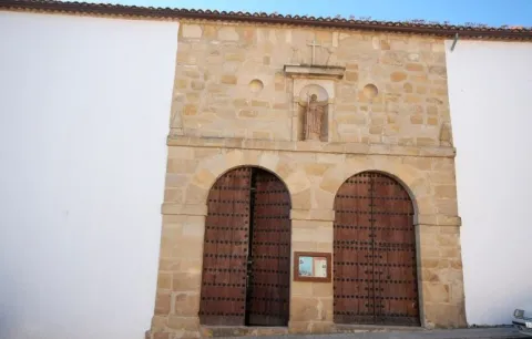
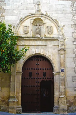
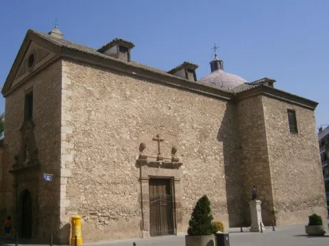
The Santa Ana Sunday convent was built in 1540 at the request of Fray Domingo de Baltanás, Dominican, theologian and writer. The cover of the church is made of silery stone, with a hornacina where the figure of the Santo Domingo de Guzmán, founder of the Dominican order, is represented. The interior of the church is made up of a single ship. In the convent, a magnificent 16th century cloister, with fourteen columns that support part of the dependencies, is removed. Around the courtyard is the refectory with a remarkable mural of 1584.

Telecomunicaciones
Sitio web
www.villanuevadelarzobispo.es
Ubicación
Código Postal
23330
Latitud
38.168820
Longitud
-3.012450
Dirección
C/ Santa Ana, 21
Ubicación en el mapa
POINT (-3.01245 38.16882)
Tipos de punto de interés
Imágenes carrusel
imagen
Image
Convento%20de%20Santa%20Ana%2C%20Villanueva%20del%20Arzobispo%202.jpeg
Imagen principal
Desactivado
imagen
Image
Convento%20de%20Santa%20Ana%2C%20Villanueva%20del%20Arzobispo.jpeg
Imagen principal
Desactivado
Imágenes cabecera
imagen
Image
Villanueva_del_Arzobispo_-_Convento_de_Santa_Ana%20%281%29.jpg
Imagen principal
Activado
Loading map
Preparing points of interest and routes...

Convent of Nuestra Señora de la Piedad

Submitted by brandcode_deweloper on
Id
4884756
Descripción
Breve descripción

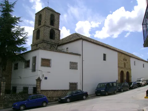
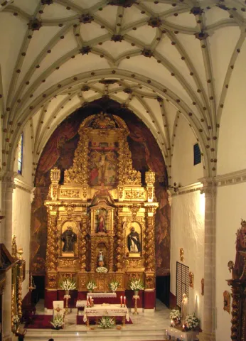
Founded by Don Jerónimo de Padilla and Pacheco around the year 1540, belonging to theOrder of Santiagoand with a triple function:house a convent of Dominican nuns, be a family pantheon for the founders and serve as a school for home maidens. The church presentsone shipdivided into three sections, with side chapels embedded in the wall. It hasdouble choruson the feet and on the side of the presbytery. The altarpiece is baroque from 1728. The ship is divided into three sections with star Gothic vaults and separated by half-point arches, columns and capitals. The profusion of santiaguine shells and the general composition of late and Renaissance Gothic elements are a decorative element. In the interior of the convent you can highlight the double floor cloister, you cannot visit it as a closing convent.

Telecomunicaciones
Teléfono de contacto
953 571 749
Ubicación
Código Postal
23650
Latitud
37.765410
Longitud
-3.956930
Dirección
C/ Monjas Altas, 28
Distrito
Municipio
Ubicación en el mapa
POINT (-3.95693 37.76541)
Tipos de punto de interés
Imágenes carrusel
imagen
Image
convento%20nuestra%20se%C3%B1ora%20de%20la%20piedad%202.jpg
Imagen principal
Desactivado
imagen
Image
convento%20nuestra%20se%C3%B1ora%20de%20la%20piedad.jpg
Imagen principal
Desactivado
Imágenes cabecera
imagen
Image
web11domi.jpg
Imagen principal
Activado
Loading map
Preparing points of interest and routes...

Convent of los Carmelitas Descalzos de Mancha Real

Submitted by brandcode_deweloper on
Id
5387160
Descripción
Breve descripción

It was founded by San Juan de la Cruz when it was in Baeza on 12 October 1586, putting it under the patronage of the Immaculate Conception, as we can see in the commemorative plaque of the façade. It is accessed through a cover with a half-point arch flanked by pilasters. The set is removed by a cornice that supports four pinacles.

Telecomunicaciones
Sitio web
www.manchareal.es
Teléfono de contacto
953 350 157
Ubicación
Código Postal
23002
Latitud
37.763360
Longitud
-3.791910
Dirección
C/ Carrera de Jesús, 0
Distrito
Municipio
Ubicación en el mapa
POINT (-3.79191 37.76336)
Tipos de punto de interés
Imágenes carrusel
imagen
Image
conventodelascarmelitasdescalzas.jpg
Imagen principal
Desactivado
Imágenes cabecera
imagen
Image
convento%20%281%29.jpg
Imagen principal
Activado
Horario
Wednesday to Sunday: 10: 30 - 14: 00. Late by season (see web).
Microsite al que pertenece
Loading map
Preparing points of interest and routes...

Convent of Cazalla

Submitted by brandcode_deweloper on
Id
4406075
Descripción
Descripción larga

This convent is very linked to Our Lady of Hope, as we can see below. Often, when we hear about Our Lady of Hope, we automatically associate her with Seville and her Holy Week. However, one thing that many people are not aware of is that its origin is located in the province of Jaén, specifically in the region of Sierra Magina, according to some studies and the finding of a document, image of the left, of great importance on this subject. With the transcription that is presented we intend to see how in the toponymy of the convent of Cazalla a reference to the Virgin Macarena appears, in the year 1749, coinciding with the epoch of the highest splendor of the Order of the Basilios, as well as the Cadastre of the Marquis of the Ensenada. This report, which refers to a guide to the transport of cattle, is the only document found in the municipal archive, so far, where it is confirmed something that supports previous studies, such as that published by Rafael Ortega and Sagrista, "The Monastery of Our Lady of Hope, in the cazalla, belonging to the order of San Basilio Magno," where the origin of such a Marian advocation, the famous Virgin Esperanza Macarena of Seville, is determined in these places. What seems to be fully observed is that the diffuse center of the Basil monks in Andalusia comes from the region of Sierra Mágina, in particular Mata-Begid and the said Cazalla Convent, as Vicente Oya shows, to see the website www.camorl.iesata.es, or the book by Hilario Arenas González "La Macarena de Sevilla."
With this small review, we are only trying to make known an interesting line of research that we are now in the process of developing.

Breve descripción

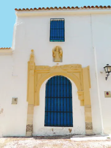
Since the 15th century there was a monastery of agustines in the place of Cazalla, which in 1578 became of the order of S. Basilio Magno. From that convent, it reached its highest splendor in the 18th century, reaching to have 13 monks, 3 leagues, 8 servants to own more than 200 flocks of cultivation (approximately 130 Hectareas) as known to the remains currently existing, only one cover remains, with a half-point bow blinded that gave access to the temple and, above it, the statue of S. Basilio Great, on a stacked hornadine up to half. It is a cast size of small proportions, which only lets see the head of the holy headline, with a luenga beard and a mitre. The size has been recently restored.

Telecomunicaciones
Sitio web
www.carcheles.es/el-municipio/patrimonio-historico.html
Correo electrónico
Webmaster@carcheles.es
Ubicación
Código Postal
23192
Latitud
37.634520
Longitud
-3.640970
Distrito
Municipio
Ubicación en el mapa
POINT (-3.64097 37.63452)
Tipos de punto de interés
Imágenes carrusel
imagen
Image
convento%20%282%29.jpg
Imagen principal
Desactivado
Imágenes cabecera
imagen
Image
Convento%20de%20Cazalla%20%281%29.jpg
Imagen principal
Activado
Microsite al que pertenece
Loading map
Preparing points of interest and routes...

Control Checkpoint of La Cabrera

Submitted by brandcode_deweloper on
Id
2854602
Descripción
Descripción larga

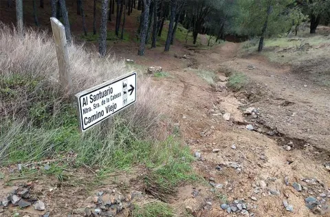
The access road runs through a relatively easy forest track; this track is taken from the same town of Marmolejo, after crossing the bridge over the Guadalquivir River at the height of the spa.

Right on the north bank of the river a right turn is taken towards the Aliseda, follow those signs and this way for 12.5 km until you reach the closed control door. There you can leave the vehicle and put things on the other side by entering the pedestrian door.

This point is especially suitable for those fans with telescopes and their own means in search of an outstanding sky and with light-taking to connect their equipment.

Breve descripción

Another privileged place is La Cabrera Control, in Marmolejo. The great advantage of this enclave is that it currently has an electric current that can be taken directly from an external plug that is located on the wall of the guard's surveillance shed.

Telecomunicaciones
Sitio web
www.andalucia.org/es/marmolejo-turismo-cultural-control-de-la-cabrera
Ubicación
Latitud
38.044893
Longitud
-4.170983
Distrito
Municipio
Ubicación en el mapa
POINT (-4.170983 38.044893)
Tipos de punto de interés
Imágenes carrusel
imagen
Image
Sendero%20Control%20de%20la%20Cabrera-Santuario%20Virgen%20de%20la%20Cabeza2.jpg
Imagen principal
Desactivado
Imágenes cabecera
imagen
Image
JJG_1117%20%281%29.jpg
Imagen principal
Activado
Microsite al que pertenece
Loading map
Preparing points of interest and routes...