Saltar al contenido principal
icon-intereses-aventura

Town Centre Chiclana de Segura

Submitted by brandcode_deweloper on
Id
4479488
Descripción
Descripción larga

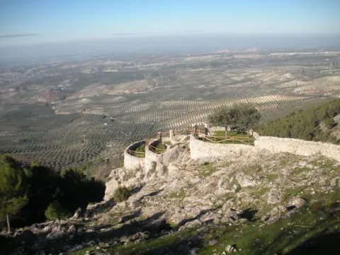
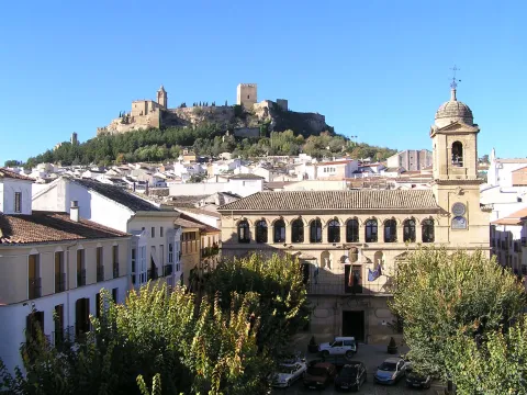
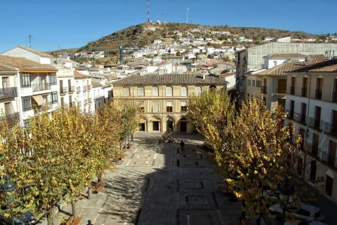
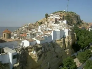
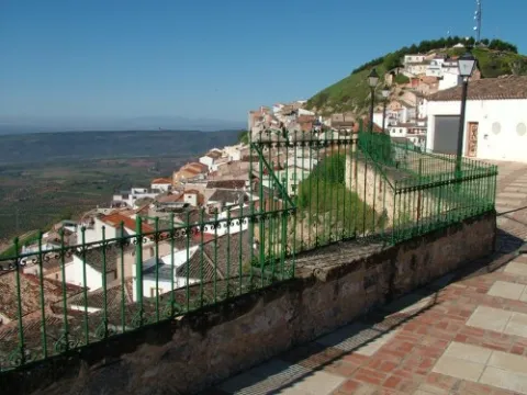
Located at a high height, embedded in a rock, around a rock, at the entrance to the Sierra de Segura, Chiclana is spread through the streets of the mountains, capricious corners and improvised squares, with the smell of the carnations and geraniums of its balconies and windows. It is accessed through a surprising tunnel that introduces us directly into the aura of its medieval mystery. This beautiful town, despite the historical avatars so negative to its heritage - such as the destructive retaliation of the Napoleonic troops, the fratricidal raging of the carlists, or the virulence of the hurricane that destroyed the church tower - retains the original Hispanic-Muslim structure of its urbanism, the medieval typology of its homes, and an unexpected architectural surprise, the buildings excavated in the stone, trogloditic wisdom that makes it possible to have houses with a uniform temperature throughout the year.
Ubicación
Código Postal
23264
Latitud
38.310770
Longitud
-3.044500
Distrito
Municipio
Ubicación en el mapa
POINT (-3.0445 38.31077)
Tipos de punto de interés
Imágenes carrusel
imagen
Image
Casco%20urbano%20Chiclana%20de%20Segura%202.jpg
Imagen principal
Desactivado
Imágenes cabecera
imagen
Image
Casco%20urbano%20Chiclana%20de%20segura.jpg
Imagen principal
Activado
Loading map
Preparing points of interest and routes...

Waterfall Bridge Nevada

Submitted by brandcode_deweloper on
Id
8088114
Descripción
Descripción larga

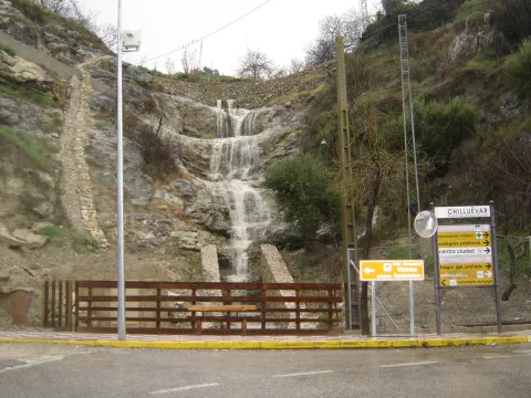
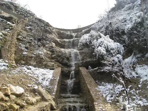
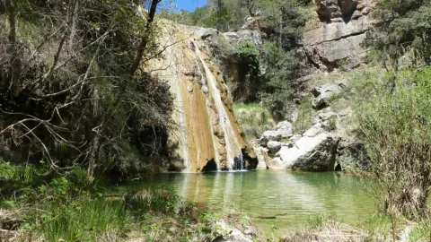
Like the other municipalities of the region, it is located between the mountain and the Guadalquivir valley. Its fundamental economy is the olive tree, although it has an incipient tourist development

Breve descripción

Chilluevar is a municipality in the province of Jaén, in Andalusia, Spain. It belongs to the Sierra de Cazorla region. This town is located at 738 meters of altitude and is located in one of the least known parts of the Natural Park, the Sierra de las Villas.

Telecomunicaciones
Sitio web
www.promojaen.es/pit/fmt.asp?i=&m=28&op=1
Teléfono de contacto
953 717 300
Ubicación
Código Postal
23477
Latitud
38.001440
Longitud
-3.031300
Municipio
Ubicación en el mapa
POINT (-3.0313 38.00144)
Imágenes carrusel
imagen
Image
cascada%20Chillu%C3%A9var2%20%281%29.jpg
Imagen principal
Desactivado
Imágenes cabecera
imagen
Image
cascada%20Chillu%C3%A9var%20%281%29.jpg
Imagen principal
Activado
Loading map
Preparing points of interest and routes...

Waterfall la Escaruela

Submitted by brandcode_deweloper on
Id
912020
Descripción
Descripción larga

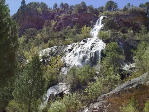
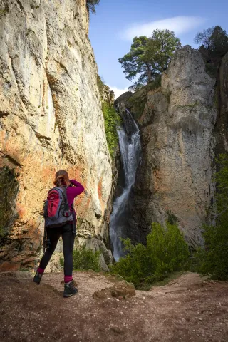
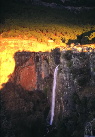
The waterfall is located next to the Falcones (1448 m), mountain always visible from any street of Cazorla, and a natural stone wall "Los Castellones" (1,820 m), elevation as a fortress from where it is named. To appreciate the water leaps it will be necessary to climb up a narrow path that runs next to the slope of the stream where you will be accompanied by the cornicabra (Pistacia terebinthus), a very abundant species on this path. By moving along the path you will appreciate the impressive fall of water as soon as the limestone walls serve as slides.

We suggest:

  • Next to the bridge from where the waterfall is seen, a right-hand road leads us to the control of Riogazas. It is a pleasant walk in which you will find a fountain called "The River" and another beautiful waterfall, that of the Magdalena. From here goes down a road to Cazorla.

In the Iruela you have to reach the square of the City Hall from where the road ascends towards the hotel Riogazas. 5 km from the Iruela and after two lookouts with meringeros there is a bridge. To the left we can see the Cascade of the Escaleruela.

Breve descripción

When you look at the waterfall you discover a stream covered in vegetation that barely lets the water see. Your look continues to ascend among limestone walls to discover how a stream with numerous water leaps is unraveling, only visible in periods of abundant rain and ice. Although we are very close to the localities of Cazorla and the Iruela wild nature begins to manifest in this spectacular leap of water, premonition of what we will find later.

Ubicación
Latitud
37.912893
Longitud
-3.003887
Municipio
Ubicación en el mapa
POINT (-3.003887 37.912893)
Tipos de punto de interés
Imágenes carrusel
imagen
Image
escaruela.jpg
Imagen principal
Desactivado
Imágenes cabecera
imagen
Image
unnamed%20%283%29.jpg
Imagen principal
Activado
Loading map
Preparing points of interest and routes...

Waterfall El Saltador

Submitted by brandcode_deweloper on
Id
5929475
Descripción
Descripción larga

Information and Observations

  • We will have to leave the vehicle at the entrance of the lane because there is a barrier to avoid the passage of vehicles.
  • The property through which the lane passes is private so it is not allowed to enter the lane with vehicle.
Breve descripción

The Saltador is a natural waterfall in the Arroyo del Tejuelo; this stream receives the waters of the Arroyo de Andrés and the Sierra del Agua, then joins the Arroyo de la Fuente del Tejo and forms the flow of the Tu River.

Ubicación
Latitud
38.388680
Longitud
-2.581360
Distrito
Municipio
Ubicación en el mapa
POINT (-2.58136 38.38868)
Imágenes carrusel
imagen
Image
Natu150.jpg
Imagen principal
Desactivado
Imágenes cabecera
imagen
Image
5.jpg
Imagen principal
Activado
Loading map
Preparing points of interest and routes...

Waterfall of Chorro Gil

Submitted by brandcode_deweloper on
Id
878082
Descripción
Descripción larga

The upper part of the Borosa River, has a scalated profile for the development of pozas and waterfalls in which travertine terraces are formed with spectacular botroidal calcite morphologies that were precipitated during the most humid and warm periods of the Quaternary.

Although travertine appear throughout the river, the highest concentration is located in the sector between the organ jump and the electric power plant. Its formation is due to the precipitation of calcite caused by the tear-up of the river waters produced by the turbulent regime of the water leaps in the areas with the greatest slope. This precipitation occurs in areas of dense vegetation receding elements of plants and producing subvertical sheets known as cascade facies.

Breve descripción

Travertines and cascade of Chorro Gil

Ubicación
Latitud
37.912893
Longitud
-3.003887
Dirección
Cascada de Chorro Gil
Municipio
Ubicación en el mapa
POINT (-3.003887 37.912893)
Tipos de punto de interés
Imágenes carrusel
imagen
Image
salto-de-los-organos-jpg
Imagen principal
Desactivado
Imágenes cabecera
imagen
Image
Natu069%20%281%29.jpg
Imagen principal
Activado
Loading map
Preparing points of interest and routes...

Casas-cueva de Pegalajar

Submitted by brandcode_deweloper on
Id
5848815
Descripción
Breve descripción

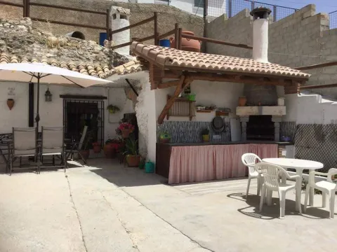
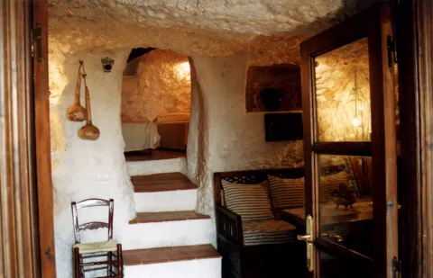
Set of troglodite houses rehabilitated as second residences and holiday tourist houses. They now make up a picturesque neighborhood, on horseback between the Serrezuela and the city centre. Very memorable.

Ubicación
Latitud
37.740061
Longitud
-3.645026
Distrito
Municipio
Ubicación en el mapa
POINT (-3.645026 37.740061)
Tipos de punto de interés
Imágenes carrusel
imagen
Image
01387888.jpg
Imagen principal
Desactivado
imagen
Image
68.jpg
Imagen principal
Desactivado
Imágenes cabecera
imagen
Image
cuevapelagar%20%281%29.jpg
Imagen principal
Activado
Microsite al que pertenece
Loading map
Preparing points of interest and routes...

Casas de Enfrente and Town Hall Square

Submitted by brandcode_deweloper on
Id
2275535
Descripción
Descripción larga

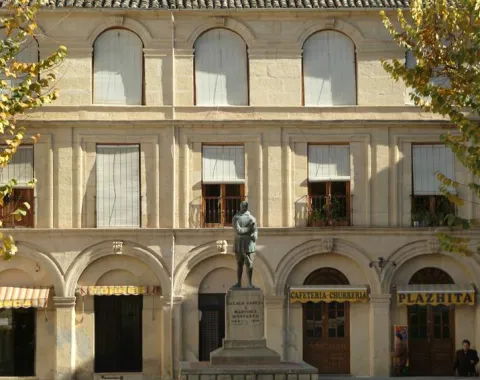
The Houses of Front were conceived as a strip, that is, as a public building of commercial services, although today it is in private hands. The façade has a horizontal structure of three bodies: the first - formed by a gallery of seven arches on pilars - follows the typical structure of the stand, present in a large number of Spanish public squares.

The main floor shows its holes with balconies and shields at the extremes, while the discharge is transformed into a gallery with half-point arches, larger than those of the City Hall.

Breve descripción

The square has a rectangular floor and on the eastern side there is a monument to the illustrious city of Juan Martínez Montañés, the work of Jacinto Higueras.

Telecomunicaciones
Sitio web
www.alcalalareal.es
Teléfono de contacto
953 580 000
Ubicación
Código Postal
23680
Latitud
37.463780
Longitud
-3.924330
Dirección
Plaza Arcipreste de Hita
Distrito
Municipio
Ubicación en el mapa
POINT (-3.92433 37.46378)
Tipos de punto de interés
Imágenes carrusel
imagen
Image
casas%20de%20enfrente%2002.jpeg
Imagen principal
Desactivado
imagen
Image
ayuntamiento-panoramica.jpg
Imagen principal
Desactivado
Imágenes cabecera
imagen
Image
casas%20de%20enfrente%2001.jpeg
Imagen principal
Activado
Horario
Monday to Friday: 08: 00 - 15: 00.
Loading map
Preparing points of interest and routes...

Casa-palacio de los Niños de Don Gome

Submitted by brandcode_deweloper on
Id
1914212
Descripción
Descripción larga

The house was part of the majority created in 1571 by Doña María Baltodano, wife of Don Gome de Cárdenas. It will be Elvira Cárdenas Baltodano and her husband Don Luis Valdivia Figueroa, gentleman of Santiago, who begin the construction of the said house.

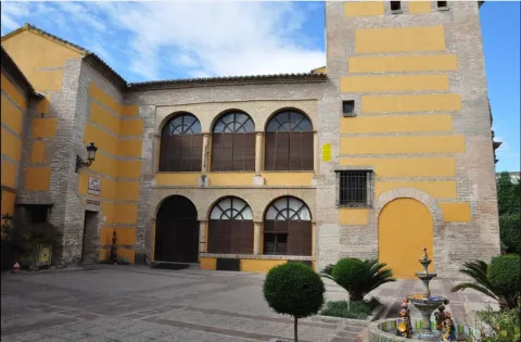
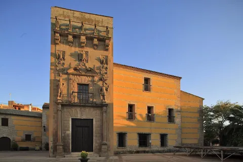
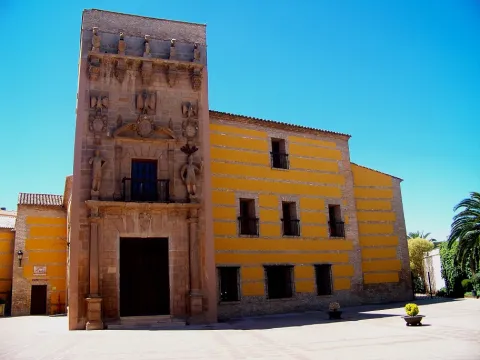
Two elements of very different use make up the house of the Children of Don Gome: the house of the inhabitants and the cavalry. On the façade of the house, built in a plane more advanced than that of the cavalry, stands out its porta-tower, built unlike the other elements of the set in sandstone. Portada- tower that was built in the second third of the 17th century by Don Gome de Valdivia, Cárdenas and Guzmán and Doña Mayor Nicuesa and that is formally framed in the Baroque style.

The façade, retranqued with respect to Maestra Street, is preceded by a spacious square, which was public until 1848, year which was annexed to the house and closed with a wall lined with door and half-point vanos.

The pillow cover is almost unnoticed by the exuberant decoration, two Indian-accent, repetitive heraldic, and a highlighted cornice, as more prominent elements. Inside are preserved the cavalry with part of the fish, a porticated courtyard and the winery.

The building currently has a cultural use, in it is located the Archaeological Museum Professor Sotomayor, is the seat of the courses of the University of Autumn of the University of Jaén and the corporation performs the plenums in the hall of the Caballeros

Breve descripción

A solariega house from the late 16th and early 17th century, belonging to the Cardenas- Valdivia lineage. It is located on Maestra Street, near the arch of the Virgin Mary, missing in 1778.

Telecomunicaciones
Sitio web
https://www.turismodeandujar.com/palacio-don-gome
Teléfono de contacto
953 500 603
Ubicación
Código Postal
23740
Latitud
38.036130
Longitud
-4.052050
Dirección
C/ Maestra, s/n
Distrito
Municipio
Ubicación en el mapa
POINT (-4.05205 38.03613)
Tipos de punto de interés
Imágenes carrusel
imagen
Image
Anotaci%C3%B3n%202020-04-16%20073945.jpg
Imagen principal
Desactivado
imagen
Image
ni%C3%B1os%20de%20don%20gome.jpg
Imagen principal
Desactivado
imagen
Image
Anotaci%C3%B3n%202020-04-16%20074107.jpg
Imagen principal
Desactivado
imagen
Image
Anotaci%C3%B3n%202020-04-16%20074030.jpg
Imagen principal
Desactivado
imagen
Image
IMG_1572.jpg
Imagen principal
Desactivado
Imágenes cabecera
imagen
Image
Ni%C3%B1os%20de%20Don%20Gome.jpg
Imagen principal
Activado
Horario
Winter: Tuesday to Friday 10: 30 - 13: 30 and 16: 30 - 18: 30, Saturday and Sunday 12: 15 - 14: 00, except holidays. Summer: Tuesday to Friday 09: 00 - 14: 00, Saturday and holiday 11: 00 - 14: 00.
Microsite al que pertenece
Loading map
Preparing points of interest and routes...

Tercia House

Submitted by brandcode_deweloper on
Id
4868987
Descripción
Breve descripción

Built in the 15th century between the two towers with which the fortress had. It was the house where the tithe collectors settled. Here lived the master of Santiago, Don Rodrigo Manrique, father of Jorge Manrique, whom the poet cried to in "Coplas to the death of my father."

Telecomunicaciones
Sitio web
www.siles.es/historia-y-patrimonio-de-siles/
Ubicación
Código Postal
23380
Latitud
38.386420
Longitud
-2.581550
Dirección
Av. de San Roque, s/n
Distrito
Municipio
Ubicación en el mapa
POINT (-2.58155 38.38642)
Tipos de punto de interés
Imágenes carrusel
imagen
Image
1.jpg
Imagen principal
Desactivado
Imágenes cabecera
imagen
Image
image_content_12765402_20170521112419.jpg
Imagen principal
Activado
Loading map
Preparing points of interest and routes...

Palace-House

Submitted by brandcode_deweloper on
Id
4619296
Descripción
Descripción larga

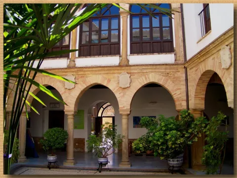
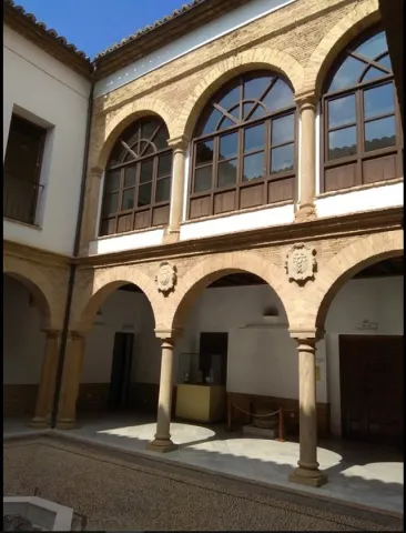
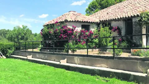
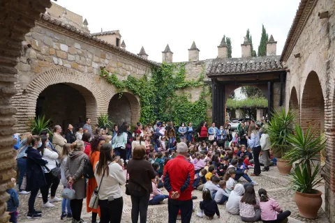
The arch of the cover of access to the porticated courtyard of the House of Palacio has two nobility shields, the one on the left corresponds to the Ponce de León, while the right belongs to the Condes de Garciez, for the fourth count was Lord of Mengibar. This main front is crowned with contemporary stone almenillas. After the arch, a beautiful courtyard is raised, composed of three half-point arches, a bit of brick, which rest on pillars. On the north front the main entrance of the house is raised with a simple cover with armchairs in the jambas and a lintel with cross in the center and the date of 1,663.

In 1808 Casa Palacio became a key space in the context of the Mengibar Action. The house served as accommodation for the troops led by General Reding. In the current dining room, we can see how the weight of the weaponry damaged the structure of the building and large wooden beams are preserved as points.

The house was acquired in the late 19th century by the family of the Girl. The members of this family gave the building the architectural and decorative aspect it has today. In the first decade of the 2000's, it became a hotel. Years later, the City of Mengibar would buy the property.

Breve descripción

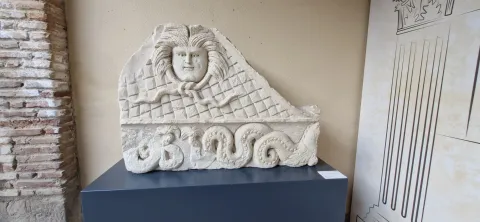
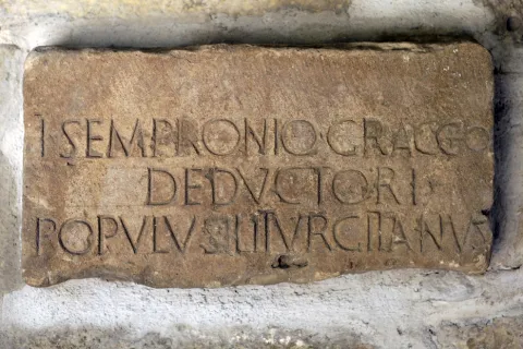
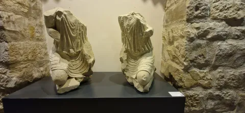
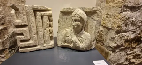
The Palace House is located in the Plaza de la Constitución, adjacent to the Tower. It is accessed by a fenced and embellished courtyard with two unique lions. This access is created in the 20th century. A second courtyard is opened after this access, in its galleries are currently displayed various archaeological pieces from Machiz, as a sample of the Iliturgi Collection, an excellent set of more than half a hundred archaeological elements of the ancient Roman city of Iliturgi (located in Cerro Machiz, Mengibar), dating from the 1st century BC to the IV-V centuries AD During the 20th century, these pieces were accumulated by the family of La Chica and are currently located in the Mengibar Palace. Although its provenance is unknown, the majority are attached to funerary spaces, important are those that are associated with urban public spaces, such as the forum of the Roman city, whose location we know precisely and it is still pending research.

Telecomunicaciones
Sitio web
www.mengibarturismo.com/
Teléfono de contacto
953 370 025 / 677 222 285
Correo electrónico
turismo@aytomengibar.com
Ubicación
Código Postal
23620
Latitud
37.968420
Longitud
-3.809350
Dirección
Plaza de la Constitución, 8
Distrito
Municipio
Ubicación en el mapa
POINT (-3.80935 37.96842)
Tipos de punto de interés
Imágenes carrusel
imagen
Image
fotografias_casa-palacio-jpg
Imagen principal
Desactivado
imagen
Image
fotograf-as_casa-palacio-1-jpg
Imagen principal
Desactivado
imagen
Image
fotograf-as_casa-palacio-2-jpg
Imagen principal
Desactivado
imagen
Image
fotagrias_coleccion-iliturgi-1-jpg
Imagen principal
Desactivado
imagen
Image
fotagrias_coleccion-iliturgi-2-jpg
Imagen principal
Desactivado
imagen
Image
fotagrias_coleccion-iliturgi-3-jpg
Imagen principal
Desactivado
imagen
Image
fotagrias_coleccion-iliturgi-4-jpg
Imagen principal
Desactivado
Imágenes cabecera
imagen
Image
fotograf-as_casa-palacio-jpg
Imagen principal
Activado
Loading map
Preparing points of interest and routes...