Saltar al contenido principal

Stage Jaén - Martos

Submitted by brandcode_deweloper on
Id
13069818
Breve descripción

This stage marks the beginning of the Mozarabic Way of St James, starting in the city of Jaén, passing through the municipalities of Torredelcampo and Jamilena, and ending in Martos.

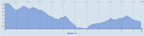
This stage of the Mozarabic Way of St James, which runs from Jaén to Martos, covers approximately 20 kilometres. Classified as moderately difficult, it provides an accessible challenge that allows pilgrims to enjoy an experience combining the urban surroundings of Jaén with the natural landscape of the Sierra Sur de Jaén.

START OF THE ROUTE IN JAÉN

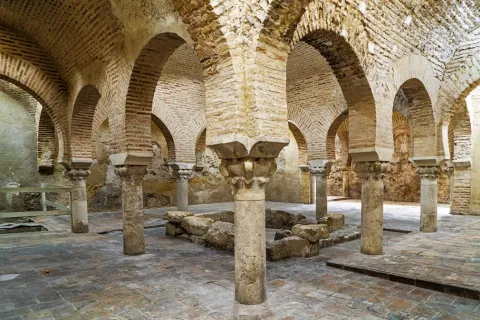
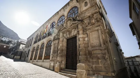
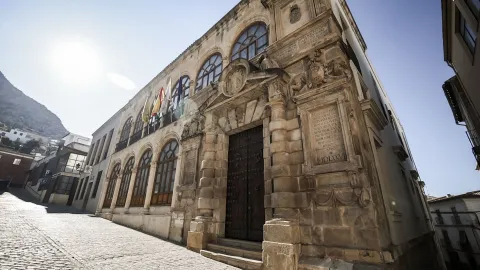
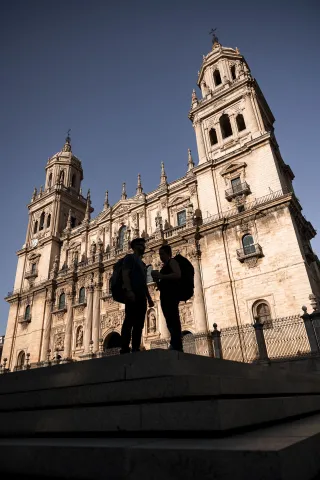
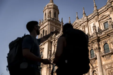
The stage begins in Plaza de Santa María, dominated by the Cathedral, which houses one of Christianity’s most important relics: the “Holy Face”. Following the yellow arrows, we enter Calle Maestra and continue through historic neighbourhoods where the legacy of Arab, Jewish and Christian cultures still survives. The route takes us past the Arco de San Lorenzo, Plazoleta de Santiago, the Church of San Juan, Villardompardo Palace, which contains important 10th-century Arab Baths, the Convent of Santo Domingo and the Church of La Magdalena, with its secluded courtyard. Pilgrim information centres can be found at the Jaén Tourist Office, the Province of Jaén Tourism Development Centre and Villardompardo Palace–Arab Baths.

From here, we continue along the Córdoba road, following our route towards the town of Torredelcampo.

TRANSITION TO THE COUNTRYSIDE

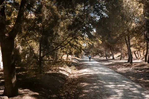
On leaving Jaén, the route heads towards the Córdoba road. Pilgrims follow the old road to Torredelcampo, gradually ascending through residential areas until the last buildings of Jaén are left behind. Once outside the urban area, the route enters the Sierra Sur, where the landscape changes to a more natural and rural setting.

The route includes descents through several stream valleys, marking the beginning of a steeper section. Pilgrims follow paths leading towards Casa del Vicario and the Sierra de Jabalcuz before climbing towards a motorway fence. Continuing onwards, the route reaches a junction with the Megatín road. After descending for approximately one kilometre, it begins to climb again, leading pilgrims towards Torredelcampo.

ARRIVAL AND EXPLORATION OF TORREDELCAMPO

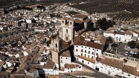
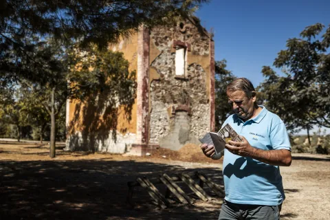
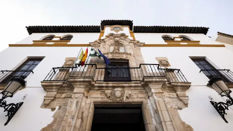
As the route approaches Torredelcampo, it enters along Calle Andalucía. You will pass through this welcoming town until reaching the Church of San Bartolomé and the Town Hall, which serves as a Pilgrim Information Point. The route then continues towards the old Santa Ana road, reached after a short but steep climb. The origins of the present-day municipality are closely linked to the ancient Iberian inhabitants of Cerro Miguelico. During the 1st and 2nd centuries AD, part of the population moved to the location now occupied by Torredelcampo. Later, following the conflicts at the end of the Emirate period, the inhabitants of the area were forced to gather in a single settlement. Near the chapel dedicated to the town’s patron saint is Llano de Santa Ana, a recreational area with water and shade where you can enjoy a well-deserved rest. The area also contains part of the town’s historical heritage, including the remains of a Visigothic necropolis and an ancient Iberian oppidum.

DEPARTURE FROM TORREDELCAMPO

Having entered the town along Avenida de Andalucía, the starting point for this section is Plaza del Ayuntamiento, where the Pilgrim Assistance Office is located. Before leaving the municipality, we recommend visiting its three famous towers: Torre de la Muña, Torre Olvidada and Torre de la Aldehuela, clear examples of the large number of fortifications found throughout the province of Jaén.

Starting from the Church of San Bartolomé, located in Plaza del Ayuntamiento itself, we follow the signs for the Mozarabic Way. These take us through the streets and towards the outskirts of the town, leaving behind its welcoming squares and small buildings typical of the area. As we cross the centre of Torredelcampo and leave the urban area, we begin an ascent along a cobbled track towards the Chapel of Santa Ana, the patron saint of Torredelcampo.

ARRIVAL IN JAMILENA

The route continues along a section of road towards Jamilena, with a short detour leading to a small wayside shrine where Nuestro Padre Jesús Nazareno, the town’s patron saint, is venerated. The route enters the centre of Jamilena through its narrow streets, lined with white houses typical of Andalusian architecture. Jamilena is known for its peaceful atmosphere and the hospitality of its residents, making this small town a welcoming stop for pilgrims.

DEPARTURE FROM JAMILENA

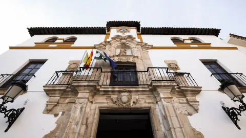
This section begins in the peaceful town of Jamilena, the municipality with the smallest administrative area in the entire province. It is known not only for its extensive olive groves, but also for another product that drives its economy: garlic. Some of its most characteristic landmarks include Plaza del Ayuntamiento and the Parish Church of Nuestra Señora de la Natividad.

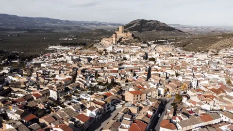
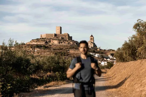
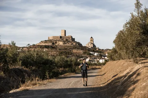
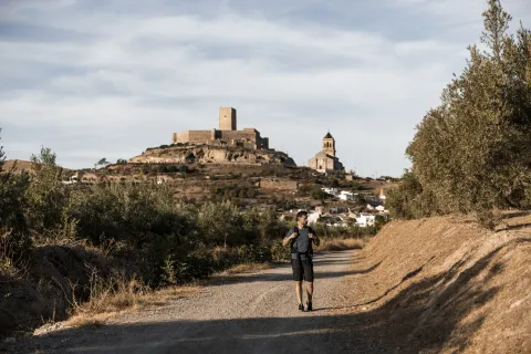
As we leave the urban area, the Peña de Martos appears on the horizon, dominating the landscape and accompanying us for almost the entire journey towards Martos. This section offers a perfect combination of nature and panoramic views over the vast olive groves that are so characteristic of the province.

The route towards Martos follows a historic path that connects the two municipalities and has been used for centuries. Although most of the route is relatively gentle, it includes several moderate climbs, particularly when approaching the town. However, the effort is rewarded by the views, the fresh air and the sense of tranquillity offered by the surroundings.

ARRIVAL IN MARTOS

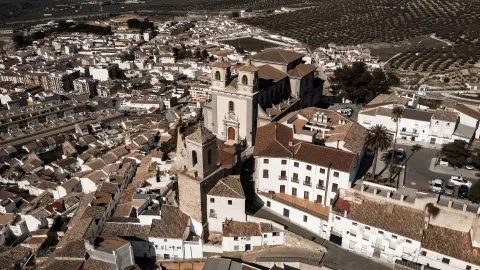
The first landmark on arriving in Martos is the Chapel of Santa Lucía, an emblematic site marking the entrance to the town. From here, we begin an ascent towards the historic centre, passing the Parish Church of San Amador and Santa Ana, dedicated to the town’s Mozarabic patron saint. On reaching the old quarter, we encounter its rich heritage.

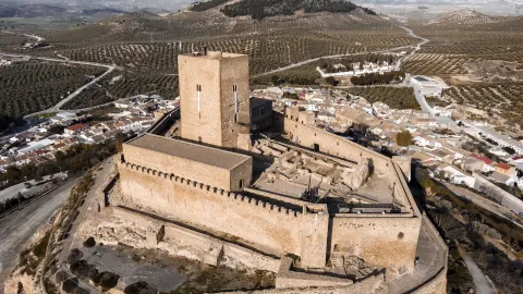
Among the places of interest that should not be missed in Martos are the former prison and council building, which is now used as the Town Hall and Pilgrim Information Point, the castles of La Peña and La Villa, and the Roman Bridge. The town also preserves part of its historic defensive walls.

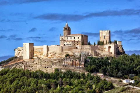
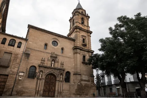
Its most emblematic religious buildings include the Royal Parish Church of Santa Marta, the Sanctuary of María Santísima de la Villa and the Monastery of the Holy Trinity. The chapels of San Bartolomé and Santa Lucía are also well worth visiting.

For a well-deserved rest after completing the stage, the Convent of the Trinitarian Sisters offers welcoming accommodation for pilgrims in the heart of the town.

CONCLUSION OF THE ROUTE

The stage from Jaén to Martos offers an experience that balances the urban environment with the natural landscape of the Sierra Sur de Jaén. Its moderate level of difficulty makes it an accessible option, providing an opportunity to experience the beauty and history of the region. Throughout this stage, pilgrims not only enjoy a rewarding route but also have the opportunity to connect with the cultural heritage and tranquillity of this part of the Mozarabic Way of St James.
ACCESS THE OFFICIAL WEBSITE

Latitud
37.7796
Longitud
-3.7849
Distrito
Municipio
Ubicación en el mapa
POINT (-3.7849 37.7796)
imagen
Image
jaen-web-01-jpg
Imagen principal
Activado
imagen
Image
imagen-principal-camino-mozarabe-1-jpg
Imagen principal
Desactivado
imagen
Image
banos-arabes-jpg
Imagen principal
Desactivado
imagen
Image
jaen-web-67-jpg
Imagen principal
Desactivado
imagen
Image
jaen-web-69-jpg
Imagen principal
Desactivado
imagen
Image
martos-web-12-1-jpg
Imagen principal
Desactivado
imagen
Image
martos-web-38-jpg
Imagen principal
Desactivado

Nature

icon-intereses-naturaleza

Adventure

icon-intereses-aventura
Moderada
Etapa Jaén - Martos
20,69 km
700m
500m
Desactivado
Image
perfiljaenmartos-png

Jaén

Martos
Stage Martos - Alcaudete

Submitted by brandcode_deweloper on
Id
13069554
Breve descripción

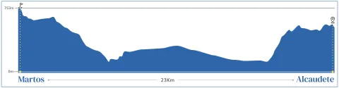
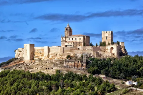
The stretch between Martos and Alcaudete is a 23 km stage with a moderate level. This is an ideal way for those looking for an immersion into the rural and historical landscape of Jaén, as we will find one of the best preserved medieval bridges in the province or enter the mythical Via Verde del Oil.

_

We leave from Martos, across the city on Avenida de los Olivares. We left the "old" Martos behind and headed towards its newest area, until we reached a roundabout that marks the beginning of our road to Alcaudete. Once the roundabout has been saved, we move on to the right-hand side, taking the Belda Friar Road.

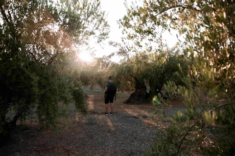
This stretch enters us into the extensive olive tree that characterizes the region, considered the largest in the world. During the tour, two "pinets" serve as a reference, announcing the cortijo that gives name to this road. We left the cortijo to our left and continued to reach a tree, where we will meet the Green Way of Oil. Without deviating from this route, we continue straight, moving forward among large trees.

When we reach a crossing, we turn left to wade the Salty Arroyo. Here we begin a slight rise, in which two paths are presented: we take the one on the right to finally join the Green Way of Oil.

_

The Green Way of Oil accompanies us for several kilometers, allowing us to enjoy meringers where pilgrims can rest. We passed under the old N-321 road, and continued to reach an old railway building, at which time we must turn left to leave the green road.

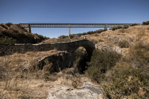
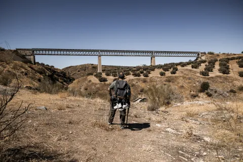
From here on, the road becomes a peculiar way, leading us to a cortijo and later to the impressive "Ponton del Río Víboras," a medieval bridge that served as a link of union in an old royal canyon. This is one of the best preserved medieval bridges in the province and a perfect place to stop, enjoy the landscape and lunch surrounded by nature.

_

After crossing the bridge, we started a rise of about 4 kilometers that will take us to Alcaudete. This stretch requires a moderate effort, but is rewarded with the impressive views of the environment and the satisfaction of approaching our destination. After the rise, we are expected a smooth down of almost 3 km that will allow us to reach the town.

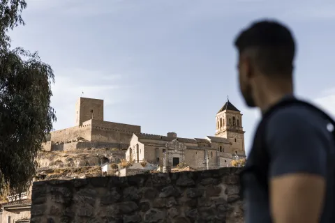
As we enter Alcaudete, we seek the signage of the Way that leads us to the City Hall Square, information point to the pilgrim. Among its most prominent points of interest are the Calatravo Castle, the Church of St. Peter and the Sanctuary of the Virgin of the Fuensanta. The city offers a rich historical heritage and a quiet environment for pilgrims.

CONCLUSION OF THE RECORRID

The arrival in Alcaudete is the link of union with the other way of the Mozarto road that comes from Granada and that will take us to Córdoba. This municipality not only offers us an important tour of historical and natural heritage, but we will be able to find rest in the city's pilgrims' hostel or just take a break in Fuente Amuña before continuing our journey.

ACCESS TO OFFICIAL PAGE

Latitud
37.7206
Longitud
-3.9726
Distrito
Municipio
Ubicación en el mapa
POINT (-3.9726 37.7206)
imagen
Image
imagen-principal-martos-alcaudete-jpg
Imagen principal
Activado
imagen
Image
martos-alcaudete-1-jpg
Imagen principal
Desactivado
imagen
Image
martos-alcaudete-2-jpg
Imagen principal
Desactivado
imagen
Image
martos-alcaudete-3-jpg
Imagen principal
Desactivado
imagen
Image
martos-web-12-jpg
Imagen principal
Desactivado
imagen
Image
martos-web-38-jpg
Imagen principal
Desactivado
imagen
Image
alcaudete-web-39-jpg
Imagen principal
Desactivado

Nature

icon-intereses-naturaleza

Adventure

icon-intereses-aventura
Moderada
Etapa Martos - Alcaudete
25 km
400m
400m
Desactivado
Image
perfil_topografico_martos_alcaudete-jpg

Martos

Get lost.

Tramo de asfalto o cemento
 
Tramo de pista o camino forestal
 
Tramo de vía pecuaria
 
Tramo de senda
 

Stage Alcaudete - Baena

Submitted by brandcode_deweloper on
Id
13069337
Breve descripción

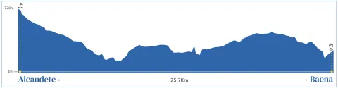
The stretch of the Mozarto Road between Alcaudete and Baena is a 25.4-kilometre journey between centuries-old olive groves before leaving the province of Jaén to reach Córdoba. With a moderate level of + 350 m and -250 m, this stage represents an accessible and attractive challenge for pilgrims, as they travel a mix of rural roads, streams and secondary roads.

The stage begins at the Plaza 28 de Feb. next to the City of Alcaudete. Another option is to start at the roundabout near the hospital, continuing on the N-432 towards Córdoba. Following the Jacobea signs, the tour will take us to the Zaide Source, an important point of reference.

From this fountain we will have beautiful views of the Castle of Alcaudete, located in its historic centre of medieval origin. We recommend that you visit it before leaving this municipality and enjoy its important architectural heritage, in which apart from the Castillo-Palacio de Alcaudete, you can find the Church of Santa María la Mayor, the Church of the Incarnation or of Carmen, the Church of San Pedro, the Convent and Church of Santa Clara and the Cemetery and Chapel of Santa Catalina among others.

Right after the Zaide Fountain we will find the starting point of the old road to Baena.

_ AND ARROYOS

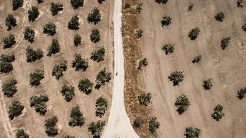
Crossing an impressive centenary olive tree with large olive trees, the pilgrims will advance through this agricultural landscape to meet a small stream, usually with little flow. After crossing the stream, a cortijo will be left to the right and, shortly thereafter, a second stream will mark the beginning of a gradual ascent that will lead to the national road.

Once the N-432 has been reached, you should walk with caution through the left arm. At a crossroads with good visibility, we move to the right bow, at which time we will have crossed the Salado and San Juan rivers. From this point on, the union of both rivers is called the Guadajoz River. The road continues on a narrow path that will take us to an agricultural ship and, following the course between olive groves, will reach the Laguna del Salobral, a natural reserve that offers a visual rest in the meantime olive trees. Then the road will cross the route of the old railway known as "Train of Oil," a vestige of the industrial past of the area.

The descent to a stream leads to a secondary road, which the pilgrims will leave when they reach a cordial. Here, you take a path to the left that continues to soften among the olive groves. About 1 km from this detour, a house known as "El Barranco" will be on the right. The tour continues to cross another road to continue to face a track that crosses olive fields and leads up to an almazara, an unequivocal sign of the importance of the oil industry in this region.

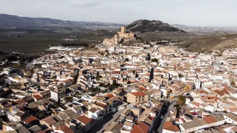
After passing on the route of the N-432, the route enters Baena by the olive cooperative "Our Lady of Guadalupe." As pilgrims approach the urban core, they will notice the contrast between the rural environment and agricultural activity. Baena, known for its olive oil and historical heritage, offers several points of interest for pilgrims before continuing their journey to Córdoba.

CONCLUSION OF THE RECORRID

The stage between Alcaudete and Baena is a journey that combines the natural beauty of olive fields with the historical heritage of the region. At this stage, our tour of the Mozarto Road in the province of Jaén ends, continuing our tour of Córdoba until we reach Santiago de Compostela.

Latitud
37.5953
Longitud
-4.0864
Distrito
Municipio
Ubicación en el mapa
POINT (-4.0864 37.5953)
imagen
Image
imagen-principal-alcaudete-baena-jpg
Imagen principal
Activado
imagen
Image
alcaudete-baena-1-re-jpg
Imagen principal
Desactivado
imagen
Image
alcaudete-baena-2-re-jpg
Imagen principal
Desactivado
imagen
Image
alcaudete-baena-3-jpg
Imagen principal
Desactivado
imagen
Image
alcaudete-web-41-jpg
Imagen principal
Desactivado
imagen
Image
alcaudete-web-21-jpg
Imagen principal
Desactivado
imagen
Image
alcaudete-web-39-jpg
Imagen principal
Desactivado

Nature

icon-intereses-naturaleza

Adventure

icon-intereses-aventura
Moderada
Etapa Alcaudete - Baena
25 km
600m
300m
Desactivado
Image
perfil_topografico_alcaudete-baena-jpg

Get lost.

Baena

Stage Moclín - Alcalá la Real

Submitted by brandcode_deweloper on
Id
13069129
Breve descripción

At this stage is the continuation of the Mozário Road of Granada, so that we will leave the granadine lands and enter the province of Jaén, with its landscape of endless extensions of olive trees. We will finish the day in Alcalá la Real, capital of the Sierra Sur region, located under a great fortress worth visiting.

On the street Real and the street Estas we will leave Moclin, passing by the Center of Commercial Interpretation, we go down about 700 m and we arrive at the Fuente de Malalto. At this point we left the asphalt and continued on a dirt lane leading to the road. We will turn left, extreme the caution during the 2 km tour before linking with the N-432, take a short path behind a house and cross the N-432 with caution.

When we cross, we take the royal canyon "Cordel de la Gallina." We ascend 400 m to the "Coto de los Pedernales." We're still on a lane until we get to a milestone. We must continue among the olive trees but the closest to a barranquera left to us, reaching a new lane we will follow to the left, and after a rise we will link with a particular road by accessing the cortijo "Cañada Alta."

We will continue to the right, we will return to the N-432, next to the San Antonio Oil Cooperative, we will continue to the left argon for 1 km, (HAY THAT I BE PRUDENT IN THIS KILOMETRO OF ARCEN), to turn left on a road that leads to Cequia, then to Pilillas and then to Ermita Nueva, we leave the village descending and straight, crossing the Palanaches stream, we continue on the Paseo de los Almondrales arriving to the N-432.

We get to some ships, it's the place to cross the N-432 with extreme care, once in the other arson we get diverted on a road to the right. Then when we reach a fork we will choose to the left, we will cross an old cortijo and at the next new fork we will also choose to the left, the lane will take us to cross a tunnel under a road, just after leaving the tunnel a lane to the right for bicycles and walkers will take us to a new crossing where a milestone points to the left. By going up the lane and across some vineyards we will arrive after passing a roundabout to the entrance on a path to the city. We will leave the bus station to the left and a long avenue will leave us in the park, city center.

ACCESS TO OFFICIAL PAGE

Latitud
37.3356
Longitud
-3.7739
Distrito
Municipio
Ubicación en el mapa
POINT (-3.7739 37.3356)
imagen
Image
mochilacamino-jpg
Imagen principal
Activado
imagen
Image
camino-olivos-jpg
Imagen principal
Desactivado
imagen
Image
alcala-la-real-web-19-jpg
Imagen principal
Desactivado
imagen
Image
alcala-la-real-poblacion-5-1-jpg
Imagen principal
Desactivado

Nature

icon-intereses-naturaleza

Adventure

icon-intereses-aventura
Moderada
Etapa Moclín - Alcalá la Real
22,47 km
1000m
755m
Desactivado
Image
perfilmoclinalcala-png

Moclin

Alcalá la Real

Tramo de asfalto o cemento
 
Tramo de pista o camino forestal
 
Tramo de vía pecuaria
 
Tramo de senda
 

Stage Alcalá la Real - Alcaudete

Submitted by brandcode_deweloper on
Id
13068933
Breve descripción

A pleasant stage, with a wavy profile but with no large slopes, which runs mostly on land roads between olive groves. In the equator of the same is Ventes del Carrizal, only intermediate town that has some service. We will end the day in the historic village of Alcaudete, which, as usual in these border lands, grew around the walls of its medieval castle, whose silhouette dominates the landscape.

It is part of the Plaza Pablo de Rojas de Alcalá la Real, we pass through Palacio Abacial (Point of Information to the pilgrim), continuing through the race of the Mercedes, to the street Tejuela. We leave the City of Mota on the street Camino Nuevo to link with the "Cordel de Córdoba a Guadix." At 1.5 km we find a small medieval bridge that crosses a stream and follows the old road, by which after 3 km we will reach the village of Puertollano.

We continue the "Vereda de Granada" parallel to the right of the N-432. We follow that path almost 4 km., we will find an underground passage, on a stream with pinets to cross it in times of rain, which allows us to cross the road to its left and follow the path until we reach Sales del Carrizal to which we enter by crossing a light. The Social Services Centre is an information point. We go down La Fuente Street and go down to the San Juan River, cross the bridge and turn immediately to the left, to follow the "Cañada Real de Fuente Amuña."

We continue in front of Alcaudete, we enter through Fountain Amuña. We go down the asphalt street about 600 m., we turn left and we reach the Sanctuary of La Fuensanta, we go down the park and we go left, on the roundabout we ascend right through the Avd. of Andalusia, to the City Hall Square.

In the town of Alcaudete there is a pilgrimage hostel on the Camino de Santa Catalina, where you can stay and take a well-deserved break to enjoy this wonderful municipality, with a wide variety of leisure and cultural services.

ACCESS TO OFFICIAL PAGE

Latitud
37.4614
Longitud
-3.9222
Distrito
Municipio
Ubicación en el mapa
POINT (-3.9222 37.4614)
imagen
Image
alcala-la-real-poblacion-5-jpg-1
Imagen principal
Activado
imagen
Image
alcaudete-baena-3-jpg
Imagen principal
Desactivado
imagen
Image
alcala-la-real-web-14-jpg
Imagen principal
Desactivado
imagen
Image
alcala-la-real-web-19-jpg
Imagen principal
Desactivado
imagen
Image
alcaudete-web-41-jpg
Imagen principal
Desactivado
imagen
Image
alcaudete-web-21-jpg
Imagen principal
Desactivado
imagen
Image
camino-olivos-jpg
Imagen principal
Desactivado

Nature

icon-intereses-naturaleza

Adventure

icon-intereses-aventura
Moderada
Etapa Alcalá la Real - Alcaudete
23,3 km
900m
500m
Desactivado
Image
perfilalcalaalcaudete-png

Alcalá la Real

Get lost.