Saltar al contenido principal
icon-intereses-gastronomia

Forestrand Track el Puntal de la Raanduela

Submitted by brandcode_deweloper on
Id
5729092
Descripción larga

Home marked "El Puntal Free Flight Zone" in the upper part of Siles, next to the Old Age Residence.

Breve descripción

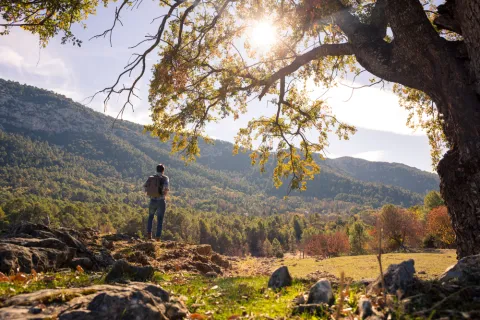
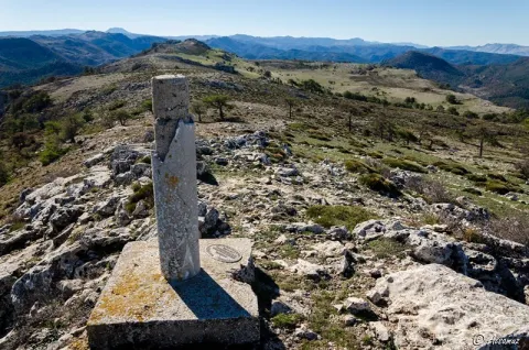
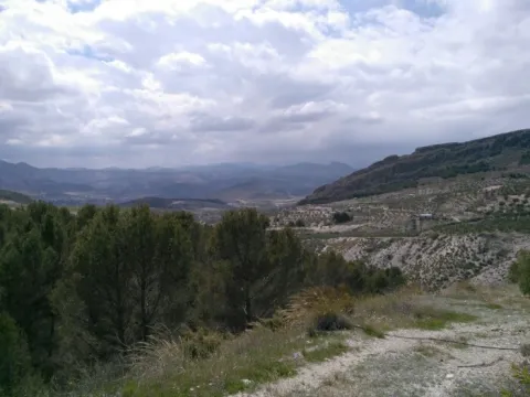
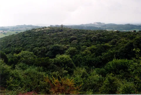
This track, usually in good condition, allows access to the Puntal, a promontory at just over 1,500 m above Siles. There is a fire surveillance shed and a free flight take-off, from which large panoramic views are dominated. On the way we can look at two viewpoints and take some walks to some of the most beautiful places in the northern part of the Natural Park. The route runs between carrasco, black and laricio pine pines.

Just less than 2 km from the beginning you can reach the Portichuelo, where is the first lookout and arrows of two signposted paths. In the km 5.8 we find the indication to the view of La Rayuela, with extraordinary views. It's 5 minutes walk from the track.

Back to the main route, in km 10.8 we will find a new indication to the right towards El Puntal. This is a track that usually
Latitud
37.9504
Longitud
-2.9002
Distrito
Municipio
Ubicación en el mapa
POINT (-2.9002 37.9504)
imagen
Image
el-encinar-de-penas-negras.jpg
Imagen principal
Activado
imagen
Image
shutterstock_1678062892.jpg
Imagen principal
Desactivado

Nature

icon-intereses-naturaleza

Friends

icon-intereses-amigos

Adventure

icon-intereses-aventura

Culture

icon-intereses-cultura

Sport

icon-intereses-deporte

Eco-friendly

icon-intereses-eco-friendly

For couples

icon-intereses-en-pareja

Family

icon-intereses-familia

Gastronomy

icon-intereses-gastronomia

Municipality

icon-intereses-municipio

Low-cost tourism

icon-intereses-turismo-low-cost

Solo travel

icon-intereses-viajar-solo
Pista Forestal el Puntal de la Rayuela
Desactivado

Take a walk along the track that goes right a few meters before the path of the lookout of La Rayuela. It is a wide and very panoramic road that has no loss. After 6.5 km, it ends in the Free Time Residence of Siles.

Walk 3 km to La Laguna de Siles, one of the few in the Natural Park. Although it may be dry, the place is very beautiful, as it is a wide meadow surrounded by thick oak trees near the Calar del Mundo. The road, which is not signposted, leaves to the left in a closed curve to the right in the km 8.2. Just follow him without taking any detour.

Instead of going up to the Puntal, leaving the car at the crossing of the km 10.8 we find the indication to the view of La Rayuela, with extraordinary views. And continue walking along the main track, which from that point has worse firm. You will be surprised, in the first few miles, by an impressive forest of oak, splashed with abundant maples and moans. Beyond that, the landscape opens in panoramic vases to the site of Pozo Romero, in the confines of the Calar del Mundo.

Tramo de asfalto o cemento
 
Tramo de pista o camino forestal
 
Tramo de vía pecuaria
 
Tramo de senda
 

Forestrand Track hacia Prado de Juan Ruiz

Submitted by brandcode_deweloper on
Id
5728669
Breve descripción

It is a very long forest track that ends in the village of La Donal, in the province of Albacete. The firm is usually in good condition, although some sections may not be recommended for cars. We suggest you go to the village of Prado de Juan Ruiz, 13.5 km from the beginning. The good views and the passage through some of the areas with the most botanical relevance of the Natural Park are guaranteed.

From the beginning of the tour we can see the abundance of complaints and albar thorns mixed with the larix pine, as well as some twins. At 4 km, we find the beginning of the extraordinary signposted path that goes up to the Calar del Espino, in the area of maximum protection declared Reserve Area for its botanical interest.

At 5 '5 km we will be on the Collado del Ventano, a stretch in which there are excellent views and in which are very abundant the granadino maples, spectacular in autumn. At 6' 9 km, a forest track on the right also allows us to climb on foot to the Calar del Espino and go to the magnificent Collado de Góntar, where you can go down to the Segura valley.

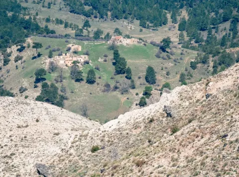
Following the main route, we immediately reach the cozy foothills of the Fuente del Tejo, and 10 km from the beginning, we pass through the Cortijo de Morillas. Three and a half kilometres further is the village of Prado de Juan Ruiz, already in ruins and without any signs. It is a place lost from whose old age, at the foot of the track, there is the contradictory feeling of guessing what the hard life on the mountain must have been and of enjoying the greatness of the landscape.

If we continued, we would find at the end of 7 km the small right turn to the village of Collado de la Fuente, and then, between the hillsides covered with closed cobblestones, the shocking parade of Los Huecos de Bañares. Already in the province of Albacete, you can go to Las Juntas Miller to close an extraordinary circuit along the Segura and Madera valleys.

Latitud
38.0702
Longitud
-2.6801
Distrito
Ubicación en el mapa
POINT (-2.6801 38.0702)
imagen
Image
14020_tihp03b7ew2kv5xg.jpg
Imagen principal
Activado
imagen
Image
2.jpg
Imagen principal
Desactivado

Family

icon-intereses-familia

Friends

icon-intereses-amigos

Nature

icon-intereses-naturaleza

Adventure

icon-intereses-aventura

Solo travel

icon-intereses-viajar-solo

Culture

icon-intereses-cultura

Gastronomy

icon-intereses-gastronomia

Sport

icon-intereses-deporte

Municipality

icon-intereses-municipio

Low-cost tourism

icon-intereses-turismo-low-cost

Eco-friendly

icon-intereses-eco-friendly

For couples

icon-intereses-en-pareja
Pista Forestal hacia Prado de Juan Ruiz
Desactivado

Located at the junction of the JF-7016 road, which comes from Segura de la Sierra, and the JF-7012 road, which comes from Siles, we take direction towards Rio Madera and Santiago de la Sword. The track, wide and very visible, starts at 0.4 km to the left.

Forestrand Track de Navazalto

Submitted by brandcode_deweloper on
Id
5728423
Descripción larga

To get to the beginning of the track we follow the JH-7155 (Transversal de Las Villas) road, which starts in Mogón, until the km 22, after about 700 m from the site of La Fresnedilla. At that point, to our left, several ways are left. The first to the site of the Arroyo del Torno, place of an old nursery located in the wonderful channel of this stream. The second detour is the track that leads us, after 2.6 km, to the top of Navazalto (1379 m).

Breve descripción

From the top of the Navazalto you will see huge parades of high rocky walls, which cause abrupt and steep ravines, by which spectacular water leaps occur. The panorama is splendid. To the west, the great depression of the Guadalquivir valley, between the green tapestry of the olive trees, is lost on the horizon, as are the villages of the La Loma and Magina. From north to south you can see a complete view of the indomic saw of the Villas, and below, the blue of the reservoir of Aguascebas.

In this place it is easy to observe the flight the leonate vultures, coming out of their nests that are below us. It is also not difficult to see several groups of mountain goats followed by their young.

This route can be done on foot, on a bike or with a 4x4 vehicle. The forest track leading to Navazalto is narrow and sinuous. On the plain, where the track begins, we can see a small fountain with its tornachs, a watershed where the cattle satisfy their thirst. It runs on a soft rocky side with wooded sketches of juniper, savannah, wild rosals and oaks. Later on there are majestic black pine trees that accompany us to the summit, where the pastures are alternated with young pine populations.

Latitud
38.0903
Longitud
-2.6504
Municipio
Ubicación en el mapa
POINT (-2.6504 38.0903)
imagen
Image
665_img.png
Imagen principal
Activado
imagen
Image
shutterstock_1060474277.jpg
Imagen principal
Desactivado
imagen
Image
Ruta%20Aguascebas%20108.JPG
Imagen principal
Desactivado

Nature

icon-intereses-naturaleza

Friends

icon-intereses-amigos

Adventure

icon-intereses-aventura

Culture

icon-intereses-cultura

Sport

icon-intereses-deporte

Eco-friendly

icon-intereses-eco-friendly

For couples

icon-intereses-en-pareja

Family

icon-intereses-familia

Gastronomy

icon-intereses-gastronomia

Municipality

icon-intereses-municipio

Low-cost tourism

icon-intereses-turismo-low-cost

Solo travel

icon-intereses-viajar-solo
Baja
Pista Forestal de Navazalto
Desactivado
Tramo de asfalto o cemento
 
Tramo de pista o camino forestal
 
Tramo de vía pecuaria
 
Tramo de senda
 

Forestrand Track Naval Caballo - El Robledo

Submitted by brandcode_deweloper on
Id
5728237
Breve descripción

This forest track is 20 kilometres long and is down from the Navalhora site, in the middle of a large larix pine forest, to the village of El Robledo, near New Cortijos. We recommend walking through its first miles from Navalhora, enjoying magnificent views towards the villages of Los Royos and Moralejos, as well as the thick oak trees that develop under the pine.

At 3.7 km, a wide road to the left allows us to link back to the road.

If we approach the track from the opposite point, at the Robledo, at 700 m we will reach the lookout of the same name and at the end of 2.5 km to a flowery fountain, then gain splendid views towards the Tranco reservoir.

The track does not have excessive levels, so it is very suitable for mountain bike. We do not recommend driving because you can find sections with the firm in bad condition.

Latitud
38.0401
Longitud
-2.7202
Distrito
Ubicación en el mapa
POINT (-2.7202 38.0401)
imagen
Image
494_img.png
Imagen principal
Activado
imagen
Image
shutterstock_1060474277.jpg
Imagen principal
Desactivado

Family

icon-intereses-familia

Friends

icon-intereses-amigos

Nature

icon-intereses-naturaleza

Adventure

icon-intereses-aventura

Solo travel

icon-intereses-viajar-solo

Culture

icon-intereses-cultura

Gastronomy

icon-intereses-gastronomia

Sport

icon-intereses-deporte

Municipality

icon-intereses-municipio

Low-cost tourism

icon-intereses-turismo-low-cost

Eco-friendly

icon-intereses-eco-friendly

For couples

icon-intereses-en-pareja
Pista Forestal Naval Caballo - El Robledo
Desactivado

Forestrand Track mirador de Juan León

Submitted by brandcode_deweloper on
Id
5728071
Descripción larga

From the town of Pontones we left for the A-317 towards Santiago de la Espada. Immediately, we take to the right an asphalt road that ends at the birth of the Segura River. There begins a forest track marked as GR 144. About 2.5 km away we take a fork to the right corresponding to GR 7. From here, without leaving the road, we will reach an open area where the lookout is indicated within 10 minutes. From birth to the lookout there is a 1? h and 30 minutes walking.

Breve descripción

On this natural balcony made up of almond rocks located at 1700 m of altitude, you can enjoy a spectacular panoramic view. Before you the Sierra de las Villas to the west, to the south of Cazorla and to the east of Segura, all with its most representative peaks. If you look out with caution you will be impressed by the view of the Barranco del Lobo, next to which the abandoned village of Los Centenares is located. From the viewpoint you can still see the ages that their inhabitants used to feed the grain.

The forest track that leads you to the viewpoint of Juan León can be done by car, although it is worth taking a walk. In progressive ascension you will enjoy a pleasant landscape that is being transformed as you advance. You will find areas with imposing isolated pine trees, thick forests and noble shrubs with protected species, increasingly difficult to find. If it is spring you will be seduced by the great flowers of peony, of a striking fuchsia color.

At other times the landscape is opened, leaving to see rocky and piornal ones that tell us that we are many meters high. Along the climb you will see some dyes and tornips, buildings intended for the shelter and feeding of the cattle. Walking these paths and watching the landscape you will discover the life of these lands.

Already on the balcony you must be attentive, because at any time it can appear before your eyes some rapace with its majestic flight, perhaps pursued by the crows in their struggle for the territory.

Latitud
38.0004
Longitud
-2.7503
Distrito
Municipio
Ubicación en el mapa
POINT (-2.7503 38.0004)
imagen
Image
6942435Master.jpg
Imagen principal
Activado
imagen
Image
shutterstock_1060474277.jpg
Imagen principal
Desactivado

Nature

icon-intereses-naturaleza

Friends

icon-intereses-amigos

Adventure

icon-intereses-aventura

Culture

icon-intereses-cultura

Sport

icon-intereses-deporte

Eco-friendly

icon-intereses-eco-friendly

For couples

icon-intereses-en-pareja

Family

icon-intereses-familia

Gastronomy

icon-intereses-gastronomia

Municipality

icon-intereses-municipio

Low-cost tourism

icon-intereses-turismo-low-cost

Solo travel

icon-intereses-viajar-solo
Pista Forestal mirador de Juan León
Desactivado

Continue to the left by the rope of the viewpoints of which the one of Juan León is the beginning. After 1 km along a path you will reach the top of this mountain chain, which will allow you to see part of the Tranco reservoir and also, if the day is clear and clear, the mountains of Granada and Alcaraz.

Tramo de asfalto o cemento
 
Tramo de pista o camino forestal
 
Tramo de vía pecuaria
 
Tramo de senda
 

Forestrand Track de Despiernacaballos

Submitted by brandcode_deweloper on
Id
5727977
Descripción larga

On our way out of Pontones we are heading for Santiago de la Sword for the A-317. About 10 - 11 km is located on the right the Tina de la Cañá, a small construction to keep cattle, and just across the road begins this forest track that goes from the heights of Pontones and Santiago de la Espada to the Toba.

Breve descripción

This track is very panoramic and links two nearby but contrasted areas: the heights of Pontones and the Segura valley. The descent on the track allows you to enjoy beautiful views of the Segura River and the mountains and risks that accompany you before giving yourself to the reservoir of Las Anchuricas. It can be done by car or walking, but it is ideal for making it by mountain bike.

The start is practically flat, and continues like this to the Collado Los Ruejos, where it begins another way to the right that is interesting, but it is not our route. So far the vegetation is mainly arbustive, with some repopulation pinars. The track then slowly descends until it is almost parallel to the Cañada Hermosa stream, and thus reaches the hill of Desevernacaballos, the huge limestone wall that gives name to the track.

From this point you will cross a dense black pine forest, while the road takes advantage of the level curves so that the slope is not too uncomfortable. Along this descent you will see the impressive mountains surrounding the Segura River: the Cerro del Garmonal and the Pichon del Tesoro on our right, the Calar del Pino in front of you, on the other side of the river.

The 11 km of track will allow you to appreciate the great contrast between the two areas: the high part that is unearthed and without just slope, while in the Segura valley, near La Toba, you will find a lot of trees and streams that nurture the orchards and fruits of the village.

Latitud
37.9602
Longitud
-2.9401
Distrito
Municipio
Ubicación en el mapa
POINT (-2.9401 37.9602)
imagen
Image
8040409Master%20%282%29.jpg
Imagen principal
Activado
imagen
Image
shutterstock_1060474277.jpg
Imagen principal
Desactivado
imagen
Image
Pista%20Forestal%20de%20Despiernacaballos%20%281%29.png
Imagen principal
Desactivado

Nature

icon-intereses-naturaleza

Friends

icon-intereses-amigos

Adventure

icon-intereses-aventura

Culture

icon-intereses-cultura

Sport

icon-intereses-deporte

Eco-friendly

icon-intereses-eco-friendly

For couples

icon-intereses-en-pareja

Family

icon-intereses-familia

Gastronomy

icon-intereses-gastronomia

Municipality

icon-intereses-municipio

Low-cost tourism

icon-intereses-turismo-low-cost

Solo travel

icon-intereses-viajar-solo
Pista Forestal de Despiernacaballos
Desactivado

It is required to visit the fountain of La Toba, a permanent spring that brings 150 litres per second to the Segura River, and is located in a curious cave of frozen water.

As you cross the denser vegetation area, it is worth stopping to discover maples, complaints or oaks in the wet areas. You'll always be able to cross with some deer or horse goat.

Hiking Route Senda de Pescadores

Submitted by brandcode_deweloper on
Id
5727942
Descripción larga


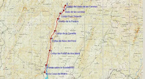
The Guadalanimín River is made up of small streams that come down from the Cabilla saw at the height of the Majal de la Carrasca, receives the Arroyo de los Arenales and already with a permanent channel flows through the bottom of a deep ravine in a south direction. It receives in the Vado de las Carretas to the stream of San Pedro, of intermittent waters, and in the Cerrada de la Canaliega to the stream of the Tornillos de Gualay. Always in the south direction and at the bottom of a deep ravine receives the streams of the Acebadillas and the Cold stream, at the height of the closed of the same name and flows into the Guadiana Menor river, at the height of the Negratin reservoir, between the municipalities of Cuevas del Campo and Zújar. Its channel serves as a divisive between the saw of the Cabrilla and that of the well
The tour begins on the track that runs through the reservoir of the Bolera by its left margin in the forest house of the Molinillo, which can be reached by ground track in any type of vehicle.

200 meters from the start signal, there is a fork, which we will take to the right, walking the tail of the Bolera reservoir.
At 900 m we reach a bridge that crosses the Guadaltiín River, with crystal clear and pure waters, in a place of unique beauty that is the Cerrada de la Herradura. From here, and already on the right bank of the valley, a rise of approximately 3 km begins that will take us to the Cortijo del Raso del Peral. The rise is continued, just 200 m from passing the bridge are left the Cortijos de los Tontos, leaving also the edge of a cut on the Guadalanimin that well deserves to be seen, with several clings and closed. Later on we left to our left the cortijo of the Puntal de Ana María. The Cañada del Mesto, which we can travel through and which is used by flocks of sheep and goats in their annual journeys in search of fresh pastures, runs through this section.
As the Cortijo del Raso del Peral passes, the track begins a slight descent through numerous ruinous cortijadas and others in very good condition such as the Canalilla 5 km, the Paulera 6.5 km and Poyo Tribaldos 7.2 km from the beginning.
Finally the track reaches the river, in the area known as Vado de las Carretas, a pleasant and paradoxical place that well deserves a stop. The river will have to be watered, if we want to reach the cortijos of the Vado de las Carretas, to do so by crossing it we will have to follow the front and despise the track that goes to the right following the channel. These cortijos, still inhabited, are only 1,000 m from where we are.

Breve descripción

The Guadalanimín River is made up of small streams that come down from the Cabilla saw at the height of the Majal de la Carrasca, receives the Arroyo de los Arenales and already with a permanent channel flows through the bottom of a deep ravine in a south direction. It receives in the Vado de las Carretas to the stream of San Pedro, of intermittent waters, and in the Cerrada de la Canaliega to the stream of the Tornillos de Gualay. Always in the south direction and at the bottom of a deep ravine receives the streams of the Acebadillas and the Cold stream, at the height of the closed of the same name and flows into the Guadiana Menor river, at the height of the Negratin reservoir, between the municipalities of Cuevas del Campo and Zújar.

Latitud
37.876404
Longitud
-2.877082
Municipio
Ubicación en el mapa
POINT (-2.877082 37.876404)
imagen
Image
658_img.png
Imagen principal
Activado
imagen
Image
shutterstock_1060474277.jpg
Imagen principal
Desactivado
5 h 20 min (ida y vuelta)

Nature

icon-intereses-naturaleza

Friends

icon-intereses-amigos

Adventure

icon-intereses-aventura

Culture

icon-intereses-cultura

Sport

icon-intereses-deporte

Eco-friendly

icon-intereses-eco-friendly

For couples

icon-intereses-en-pareja

Family

icon-intereses-familia

Gastronomy

icon-intereses-gastronomia

Municipality

icon-intereses-municipio

Low-cost tourism

icon-intereses-turismo-low-cost

Solo travel

icon-intereses-viajar-solo
Medium
1164
Image
1dbd612a-b301-2f7c-6099-b1496d217079?t=1607022009228
Image
329bed14-b7c1-1544-5bc9-8b07893b576e?t=1607022019451
SENDA DE PESCADORES
9 km (solo ida)
386m
235m
2
1
1
3
Horse, on foot and bike
All year round
Desactivado
Image
f8cc619e-be85-15bc-f798-92ce55adb865?t=1607022131867

Point of revival or rest next to the Cortijo del Saso del Peral

The Vado de las Carretas is a link point with another very well-known path, which is circular and that runs through the upper part of the Barrio del Gualatentín, Fuente Steel, the Strait of Perales and the Trench.

The tour is marked by beacons with directional arrows.
It has great botanical wealth with spectacular examples of larix pine and centenary complaints.., abundant presence of large rapacious birds (leonate vulture, real eagle, real owl...)
Deep-ravine geomorphological formation (Guadalanimin and Cerrada de la Canaliega) between the Cortijo de la Paulera and the Cortijo de Poyo Tribaldos.

At the Casa del Molino, located later on the Hornico in the Bolera reservoir. It is accessed from Pozo Alcón by the A-326 taking a track that is in the km 7.9 to the left, that you have to travel 14 km to the Casa del Molino.

1015

Cortijo Vado de las Carretas

1164
Coordenadas / Huso 30S
30S x = 510810 and = 4192109
Tramo de asfalto o cemento
0
Tramo de pista o camino forestal
0.01
Tramo de vía pecuaria
0
Tramo de senda
0

Hiking Route Río Borosa

Submitted by brandcode_deweloper on
Id
5727693
Descripción larga


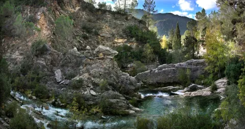
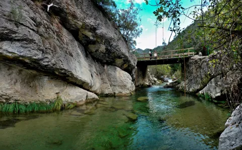
This hiking route is, of course, the most popular route in the Natural Park, which also implies the possibility of a certain massification at a short time. The set formed by the fast waters of the Borosa, the rocks in which the channel is fit and the closed riverside vegetation, is one of the most spectacular river scenarios in southern Spain.

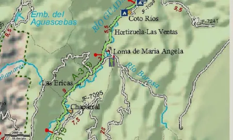
To start the route we go to the Visitors' Reception Centre of the Torre del Vinagre, in the Carrier A-319, and we take a detour to the River Borosa River River River River River River. The path begins right from the farm next door.

At first, the tour goes through a closed forest track to the traffic of private vehicles that always goes parallel to the river's path, being one of the most pleasant walks that can be made in the Natural Park, especially in its initial section.

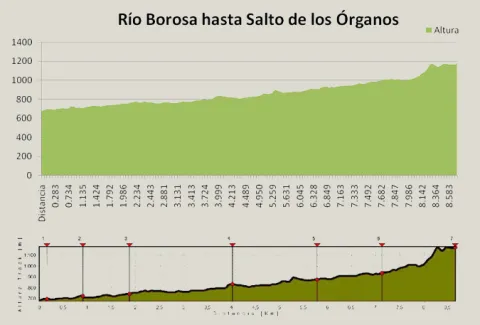
At first it coincides with the route of GR 7, up to the bridge of the Snails where we leave this Grand Tour, to continue parallel to the Borosa River. In the km 3.3 we left the track on which we went to the left to continue by the river, along the path and through the Cerrada de Elias, a rocky cling of the channel, full of clear and cold waters. Later on we go back to the track we were initially going through, to continue upstream on either side of the river until we reach the Hydroelectric Central of the Organs where the track ends.

Here begins a sinuous path with much more slope next to a much more tight, rocky and abrupt channel, full of spectacular water jumps. And it ends the tour in the organ jump, without a doubt one of the most spectacular waterfalls in the entire park. It is said that its name is due to the noise that, in past times, they did when the logs that were taken from these mountains fell through these water jumps.

Most of the tour runs along the edge of one of the Park Reserve Areas, an area with the highest level of protection due to the ecological values it houses. The Borosa River, along its 10 km, is one of the most cuddly tributaries of Guadalquivir within the Park. It is born at the base of the large underground aquifer that forms the altiplanicie of the fields of Hernán Perea, hence its annual flow and regularity. It is important to highlight in its channel several Cerradas that make up a spectacular landscape, continuous water jumps and pozas and a very good state of conservation of the channel, maintaining crystal clear and cold waters, with abundant fauna and lush riverside vegetation. This tour also offers us a true lesson in geology, with striking, sincere and anti-linear folds that are easily observed.

Breve descripción

This hiking route is, of course, the most popular route in the Natural Park, which also implies the possibility of a certain massification at a short time. The set formed by the fast waters of the Borosa, the rocks in which the channel is fit and the closed riverside vegetation, is one of the most spectacular river scenarios in southern Spain.

Latitud
37.969693
Longitud
-2.818145
Distrito
Municipio
Ubicación en el mapa
POINT (-2.818145 37.969693)
imagen
Image
Rio%20Borosa%201.jpg
Imagen principal
Desactivado
imagen
Image
Rio%20Borosa%202.jpg
Imagen principal
Desactivado
2 h 10 min

Nature

icon-intereses-naturaleza

Friends

icon-intereses-amigos

Adventure

icon-intereses-aventura

Culture

icon-intereses-cultura

Sport

icon-intereses-deporte

Eco-friendly

icon-intereses-eco-friendly

For couples

icon-intereses-en-pareja

Family

icon-intereses-familia

Gastronomy

icon-intereses-gastronomia

Municipality

icon-intereses-municipio

Low-cost tourism

icon-intereses-turismo-low-cost

Solo travel

icon-intereses-viajar-solo
Medium
1175
Document
Image
2ec036ff-ad31-ddd2-4b7f-81e7f2ac7e60?t=1607087625599
Document
Image
99f458a1-40f7-f2ca-ce5e-e777b5a80749?t=1607086468943
RÍO BOROSA A SALTO DE LOS ÓRGANOS
8,92 km
619m
143m
3
1
2
2
In Bicycle, Horse, on foot
All year round
Desactivado
Image
e57eeca2-fdbd-8aef-bbab-3a9084d4b61f?t=1607087616696

Badén and Los Rodeos Bridge

In its initial route that coincides with the GR 7 that separates from our route on the Bridge of the Snails, the path can be continued towards the Embalse of Aguas Negras and Laguna de Valdeazores crossing the tunnels, from the Jump of the Organs.

Access to the village of Loma de Mariangela, from the Interpretation Centre of the Vinagre Tower in the A 319, at the height of the farm and the River Borosa River River River River River River.

681 m

Leap from the bodies

1171 m
Coordenadas / Huso 30S
30S x = 515973 and = 4202468
Tramo de asfalto o cemento
0
Tramo de pista o camino forestal
71.75%
Tramo de vía pecuaria
0
Tramo de senda
28.28%

Hiking Route La Presilla

Submitted by brandcode_deweloper on
Id
5727646
Descripción larga

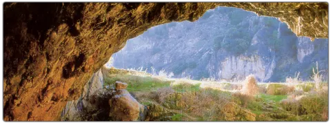
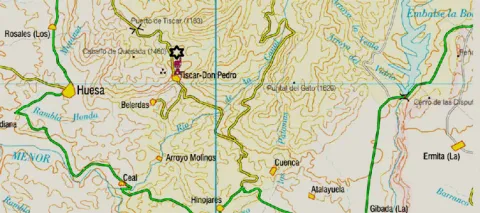
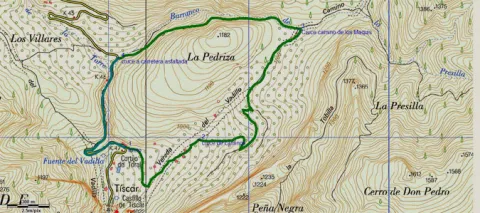
Next to the impressive Tiscar Sanctuary by the Vadillo River, where the beautiful Cueva del Agua opens and where the mountains offer a beautiful port, at Km 12.5 of the A-315, passing the Vadillo Restaurant towards Quesada, we find a sharp curve to the right. Before passing it, a lane with an ascending slope to the right is the beginning of the path.
It is a way of servitude from which different accesses to olive plots come. We must always take the main path by dismissing other secondary ones. The olive tree is dominated by almonds, an unproductive olive tree because of the altitude at which we are, but it was once the only way for the inhabitants of these mountains. At 900 m from the beginning, we reach a crossing that we must take to the right, leaving the Vadillo Vereda, which continues ascending but more in a straight line on our left.
The road runs between two rocky massizos: to the right a rocky cut and to the left La Pedriza, whose top is at 1179 m of altitude. Different paths can be taken, although if it runs through the main, we will end up in a flat area with some gardens.
2.6 km from the beginning we reach a road crossing, where we will have to turn left to continue to surround La Pedriza. We are in the Barrio de la Presilla and from now on we will go down it. At the front and following the rising stream, we can travel the Maquis Road, which commemorates the transit of men who fought in armed resistance against the Franco dictatorship in the 1940s.
At the base of the slices are paint and light. The lane floor slips if wet so it is not recommended to use car in this case. The best time to make the path is autumn and winter for the greatest presence of birds.
4 km from the start, we reach the asphalt road of the port of Tiscar, there we will have to turn left to reach the start point in just over 1 km.

Breve descripción

Next to the impressive Tiscar Sanctuary by the Vadillo River, where the beautiful Cueva del Agua opens and where the mountains offer a beautiful port, at Km 12.5 of the A-315, passing the Vadillo Restaurant towards Quesada, we find a sharp curve to the right. Before passing it, a lane with an ascending slope to the right is the beginning of the path.

Latitud
37.781485
Longitud
-3.021872
Municipio
Ubicación en el mapa
POINT (-3.021872 37.781485)
imagen
Image
656_img.png
Imagen principal
Activado
imagen
Image
shutterstock_1060474277.jpg
Imagen principal
Desactivado
1 h 50 min

Nature

icon-intereses-naturaleza

Friends

icon-intereses-amigos

Adventure

icon-intereses-aventura

Culture

icon-intereses-cultura

Sport

icon-intereses-deporte

Eco-friendly

icon-intereses-eco-friendly

For couples

icon-intereses-en-pareja

Family

icon-intereses-familia

Gastronomy

icon-intereses-gastronomia

Municipality

icon-intereses-municipio

Low-cost tourism

icon-intereses-turismo-low-cost

Solo travel

icon-intereses-viajar-solo
Medium
987
Image
ff7caf80-f2f4-ad07-e154-4763e2234224?t=1607024821041
Document
Image
3cb09274-ff1b-b4cf-52a0-ba294f50c7a4?t=1607024807235
LA PRESILLA
5,13 km
236m
245m
1
1
1
2
Horse, on foot and bike
All year round
Desactivado
Image
38e988e5-42f7-4cd9-344c-0f44af3fafa1?t=1607024815462

Tiscar Sanctuary

Path of the Tiscar Water Cave, near the beginning

The tour is marked by beacons with directional arrows.

12 km from Quesada, at the A-6206 and before arriving at the Tiscar Sanctuary, after a closed curk to the left, it starts a track of land to the left in ascension

922

Same point

922
Coordenadas / Huso 30S
30S x = 498074 and = 4181571
Tramo de asfalto o cemento
23.98%
Tramo de pista o camino forestal
17.54%
Tramo de vía pecuaria
0
Tramo de senda
58.48%

Hiking Route Poandos de La Mesa

Submitted by brandcode_deweloper on
Id
5727175
Descripción larga


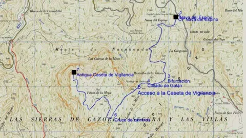
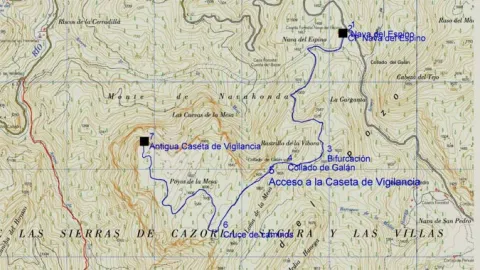
The ships are very fertile lands that are located at a certain height that have been exploited by man since time immemorial as fresh pastures or as agricultural grounds; in the first of them we find in the asphalt Track first and after land JF-7091, the Nava del Espino, is the beginning of this path, right next to the ruins of the forest house of the same name.

The route always by narrow track of land, closed to the traffic of private vehicles, runs through spectacular laricio forest with large pastures, and is gradually ascending along the slopes of Los Poyos de la Mesa. It is very common to observe the great herbivores of the park on this route, and to find up to the four species that exist along it.

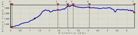
After walking 2.4 km we find a fork that we will have to follow to the right and gently continue the ascent.

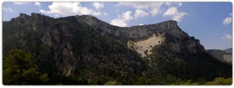
In the km 3 after the Galan Collado the views to the right begin to be spectacular, for practically without realizing we are incarnate in one of the most classic calares we can find, we are really on the edge of a table. Here the limestone that we have just below acts as a great sponge that collects water in periods of abundance, to gradually release it several hundred meters below and months later. It is worth deviating from our route in km 3.3 to the left to climb to the moon fire surveillance shed that remains in the rocky crest that we have parallel and this is in use in the months of maximum risk.

Just a few meters later we find ourselves immersed in a high platform, full of dolins and minions with large forest clear very rich in fresh grass. It is an ideal place for wildlife observation. We will continue the track through which we travel without leaving it until we reach the km 4.1, there we find a track to the front that quickly begins to descend, we must despise it and continue on the one that turns to the right, continuing on the calar. Finally we will reach the edge of a cut rocky where the old surveillance house of the Poyos is located, a true natural viewpoint of the Guadalquivir valley.

Breve descripción

The ships are very fertile lands that are located at a certain height that have been exploited by man since time immemorial as fresh pastures or as agricultural grounds; in the first of them we find in the asphalt Track first and after land JF-7091, the Nava del Espino, is the beginning of this path, right next to the ruins of the forest house of the same name. The route always by narrow track of land, closed to the traffic of private vehicles, runs through spectacular laricio forest with large pastures, and is gradually ascending along the slopes of Los Poyos de la Mesa.

Latitud
37.896406
Longitud
-2.9216
Municipio
Ubicación en el mapa
POINT (-2.9216 37.896406)
imagen
Image
588_img.png
Imagen principal
Activado
imagen
Image
shutterstock_1060474277.jpg
Imagen principal
Desactivado
3 h 12 min

Nature

icon-intereses-naturaleza

Friends

icon-intereses-amigos

Adventure

icon-intereses-aventura

Culture

icon-intereses-cultura

Sport

icon-intereses-deporte

Eco-friendly

icon-intereses-eco-friendly

For couples

icon-intereses-en-pareja

Family

icon-intereses-familia

Gastronomy

icon-intereses-gastronomia

Municipality

icon-intereses-municipio

Low-cost tourism

icon-intereses-turismo-low-cost

Solo travel

icon-intereses-viajar-solo
Medium
1563
Image
60dade7b-9622-92be-dca7-1600c0c6e5fe?t=1607086462783
Image
99f458a1-40f7-f2ca-ce5e-e777b5a80749?t=1607086468943
POYOS DE LA MESA
6,43 km (solo ida)
225m
103m
2
1
1
3
In Bicycle, Horse, on foot
All year round
Desactivado
Image
792246db-fbed-0845-c94d-f9d77f09b0c9?t=1607086334333

La Garganta recreational area

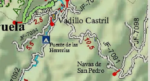
From the town of Cazorla and the Iruela or from the dam of the Tranco by the A- 319 you have to reach the Empalme del Valle located on the ascent to the port of the Doves from Arroyo Frio. There we take the JF 7091, leaving to the right the detour to the Parador, the detour to the village of the Vadillo-Castril and the detour to the birth of the Guadalquivir. We continue this asphalt road that then becomes a forest track towards the Navas and the path starts on the Espino Navy right on the Ruins of the Espino CF Nava that we find on our right.

1426 m

Former Bureau Poo Monitoring Hat

1628 m
Coordenadas / Huso 30S
30S x = 506893 and = 4194324
Tramo de asfalto o cemento
0
Tramo de pista o camino forestal
0.01
Tramo de vía pecuaria
0
Tramo de senda
0