Saltar al contenido principal
icon-intereses-deporte

La Cerradilla

Submitted by brandcode_deweloper on
Id
8094084
Descripción
Descripción larga

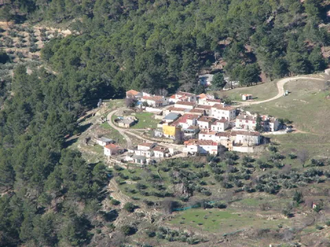
Location: To the north-east of the city centre, very close to it and at the limits of the Natural Park of Cazorla, Segura and Las Villas.

Distance: 3 km.

Medium: On foot.

Access route: By a road that leaves directly from the city centre towards Los Rinnes.

Breve descripción

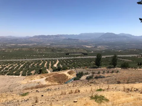
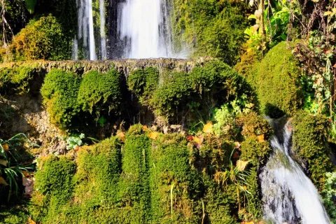
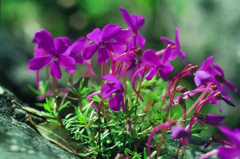
To the north-east of the city centre, very close to it and at the limits of the Natural Park of Cazorla, Segura and Las Villas, beautiful natural enclave that stands out for the presence of a natural water source, as well as the remains of an Arab castle.

Telecomunicaciones
Sitio web
www.huesa.es/el-municipio/patrimonio-natural.html
Correo electrónico
huesa@promojaen.es
Ubicación
Código Postal
23487
Latitud
37.764200
Longitud
-3.077910
Municipio
Ubicación en el mapa
POINT (-3.07791 37.7642)
Tipos de punto de interés
Imágenes carrusel
imagen
Image
Rinc%C3%B3n%20Alto%20.%20La%20Cerradilla.%20%281%29.jpg
Imagen principal
Desactivado
Loading map
Preparing points of interest and routes...

The Chaplaincy

Submitted by brandcode_deweloper on
Id
659644
Descripción
Descripción larga

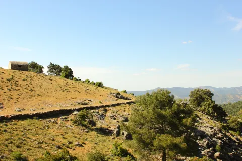
A small hermitage, which at the time made the school, brings to our head memories of past times. Its position allows it to have a privileged view over the nearby mountains, which you can know more in depth if you do the circular path of the Yelmo Chico, the PR-A 150 that part of the Capellania.

Breve descripción

Jars, rosemary and pines accompany the road leading to the Capellania. Small gardens between the pine trees and some olive trees lead to the area where the village is located. It has an immense central meadow with several roads that lead to the different houses.

Ubicación
Latitud
37.913575
Longitud
-3.011814
Municipio
Ubicación en el mapa
POINT (-3.011814 37.913575)
Tipos de punto de interés
Imágenes carrusel
imagen
Image
6%20%281%29.jpg
Imagen principal
Desactivado
imagen
Image
b4b8d505ab9cd1db1bf562f9e4900a0b40f1d770.jpeg
Imagen principal
Desactivado
Imágenes cabecera
imagen
Image
Cazorla_%2814277828194%29.jpg
Imagen principal
Activado
Loading map
Preparing points of interest and routes...
Marcas de calidad

La Ballestera y Montalvo

Submitted by brandcode_deweloper on
Id
659617
Descripción
Descripción larga

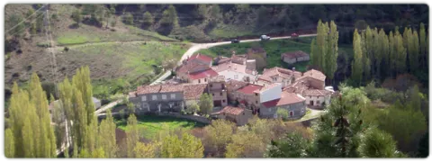
The crossbow is made up of two cores of houses separated by an old laundry room that awaits the arrival of people in laundry clothes. During the winter it has only four neighbors. It surprises the cleaning of the village and the freshness of the water that runs next to it. If you close your eyes you can discover that the silence is broken only by the rooster singing, the cat's maullido or the water running.

Next to the Ballestera we find Montalvo with a completely different landscape. It dominates an elevation that is accessed by a road that zigzaguea to the village and offers us impressive views over the valley. You can see narrow streets, narrow walls, houses recovered from ruin, all surrounded by privileged views of the valley.

Breve descripción

A very narrow road surrounded by trees leads us to the Ballestera. You will pass through a bread oven and an old haystack, witnesses from another time, from the self-sufficient past of this village. The gardens are intermingled with the pines and some olive trees, the result of the need to get oil before.

Ubicación
Latitud
38.148202
Longitud
-2.693707
Ubicación en el mapa
POINT (-2.693707 38.148202)
Tipos de punto de interés
Imágenes carrusel
imagen
Image
596_img.png
Imagen principal
Desactivado
imagen
Image
IMG_7633.JPG
Imagen principal
Desactivado
Imágenes cabecera
imagen
Image
ballesteraMontalvo%20%281%29.jpg
Imagen principal
Activado
Loading map
Preparing points of interest and routes...
Marcas de calidad

The Stone Wall

Submitted by brandcode_deweloper on
Id
4971000
Descripción
Breve descripción

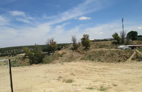
This is an old mud quarry next to the city centre. It has an artificial water lagoon very interesting for its ecological function.

Ubicación
Código Postal
23750
Latitud
37.973500
Longitud
-4.106650
Distrito
Municipio
Ubicación en el mapa
POINT (-4.10665 37.9735)
Tipos de punto de interés
Imágenes carrusel
imagen
Image
albarrada.png
Imagen principal
Desactivado
Imágenes cabecera
imagen
Image
Olivar.jpg
Imagen principal
Activado
Microsite al que pertenece
Loading map
Preparing points of interest and routes...

Karst of Pinar Negro

Submitted by brandcode_deweloper on
Id
876621
Descripción
Descripción larga

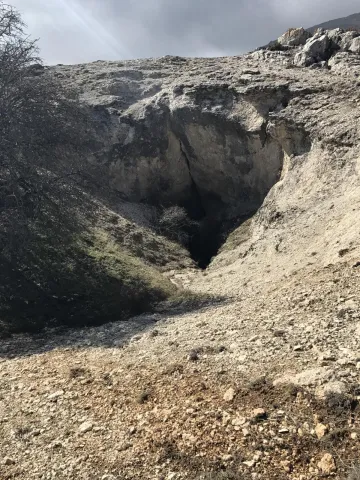
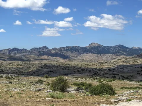
In the eastern part of the Sierra de Segura there is a spectacular karmic landscape, characterized by the presence of an exokarst of exceptional beauty with an immense field of dolins and uvalas, splashed with sims, of different scale. This karmic relief is controlled litologically and structurally, and conditioned by a high mountain climate, with level periods that accentuate the dissolution in karmic cavities. In this area, a carbonated altiplanicie that includes from the fields of Hernán Perea to those of the Black Pinar, stands out a series of simas, within dolinas and uvalas, among which stand out the one of the Campo del Espino, the one of the Hunzón, the one of the Cortijo, and mainly the very one of the Black Pinar.

The morphology of these cavities, with frequent balance chimneys, uses and some subhorizontal galleries, with clear structural control, reflects the importance of dissolution in the geomorphological evolution of them, with few examples of tectonic simas such. The most important of its development is that of the Black Pinar which is the sink of a large dolina of 105 x 130 m. In the area around the mouth a small channel runs through which a water course temporarily circulates that penetrates the cavity as a ponor. It has a large mouth (8 x 2 m.) that communicates with a large initial well of 10 x 16 m that descends to 104 m., where a second well of 40 m is started; reaching the bottom of the main track of the sima. Fifteen meters above the second well is the side track of smaller dimensions, but it reaches more depth, reaching more than 100 m.

Source: Inventory of Georresources of Andalusia. Environmental Council. Junta de Andalusia.

Breve descripción

Karst of Black Pinar

Ubicación
Latitud
38.298857
Longitud
-2.651877
Distrito
Ubicación en el mapa
POINT (-2.651877 38.298857)
Tipos de punto de interés
Imágenes carrusel
imagen
Image
10379407Master.jpg
Imagen principal
Desactivado
Imágenes cabecera
imagen
Image
800px-Campos_de_Hern%C3%A1n_Perea_24J_01.jpg
Imagen principal
Activado
Loading map
Preparing points of interest and routes...

Confluence of Miller

Submitted by brandcode_deweloper on
Id
913153
Descripción
Descripción larga

Here was born in the 1950s a village with the same name: Miller's Boards. This core was created to house the personnel employed in the construction of Miller's hydraulic power plant. To supply water to this plant the reservoirs of the Anchuricas (Segura River) and the Old River (Zumeta River) were built. The water jumps are 185 and 195 meters high respectively.

A magnificent view of Las Juntas is from the place known as the Loma del Paerón. To get to this point we recommend you make the route "Loma del Paerón" which is identified as PR-A 108. From here a natural lookout is opened before you to contemplate the valleys of the Zumeta and Segura rivers, and the union of both.

In front of the Loma are the Cañás de la Muela, where there is a large colony of leonado vulture, as well as the Iberian village of the Peñón de los Almendros, the village of Góntar... You're in a magical area worth discovering.

We suggest...

  • If you get to Miller's Boards after you have made a good route, where you have known villages like Miller, the Coke's Calar or the Eguijones' Cave, you certainly need to get a good dip (only in summer, of course...).
  • To know and remember the history of the following pineers who, until the 1950s of the 20th century, carried wood through the rivers, helped with hooks and shooting beasts.
  • There is a great book for hiking in the area: Valleys of the Segura River and Zumeta. It describes with precision and deep knowledge a series of routes that you will certainly love.

It is reached through the road JF-7038 from the town of Santiago de la Espada after 22 km. From Segura de la Sierra we can also reach the road in the direction of Rio Madera - La Toba - Miller's Boards. This way the distance is 54 km. and a time of about 1 hour.

Breve descripción

With this suggestive name we know the union of two important rivers of the Sierra de Segura: the Zumeta and the Segura. Together they say goodbye to Jaén - this peaceful and beautiful parachute - to enter the province of Albacete. From the bridge it is easy to imagine the ancient "pineros" preparing the logs that arrived from the two rivers and that would take them, after a fabulous journey, to the Mediterranean, with no tool other than a double-pointed hazelnut stick hook.

Ubicación
Latitud
38.298857
Longitud
-2.651877
Distrito
Ubicación en el mapa
POINT (-2.651877 38.298857)
Tipos de punto de interés
Imágenes carrusel
imagen
Image
19250548_143367852884610_5379292057515744177_o.jpg
Imagen principal
Desactivado
imagen
Image
17%20Las%20Juntas%20de%20Miller.jpg
Imagen principal
Desactivado
imagen
Image
6%20Juntas%20de%20Miller.JPG
Imagen principal
Desactivado
Imágenes cabecera
imagen
Image
43310356724_616217becc_b.jpg
Imagen principal
Activado
Loading map
Preparing points of interest and routes...

Torre del Vinagre Botanical Garden

Submitted by brandcode_deweloper on
Id
920758
Descripción
Descripción larga

In the Garden are the different plant formations that, depending on the height and humidity, we can find naturally in the Park, such as the high mountain, the larix pineapples, the deciduous bosquets or the riverside forests. There is a space dedicated to the exclusive species of the Park (endemisms), such as the Cazorla violet.

We suggest...

  • Any season is good for visiting the Garden, but in autumn the deciduous trees are dressed in yellow and in spring you can see the flowers of some endemic plants.
  • Attention should be paid to the activities organized by the Garden, such as photography workshops, medicinal plants or plant dyes. There are also activities for children. They are free and have a remarkable quality. You can call or subscribe to your mailing list.
  • Torre del Vinagre is one of the most strategic places in the Park, which has two Visitors' Centres and the beginning of the emblematic route of the Borosa. It can be worth using a whole day.
Breve descripción

This large Botanical Garden has a wide and careful selection of plants from the Natural Park, from small herbaceas to large trees. It is a perfect place to observe and learn to distinguish them or simply to take a pleasant walk between lush vegetation. Your visit will help you understand that the extraordinary botanical wealth of these saws is one of the main reasons for them to be declared as Protected Space. The entrance is free.

    Ubicación
    Latitud
    38.014000
    Longitud
    -2.872970
    Ubicación en el mapa
    POINT (-2.87297 38.014)
    Tipos de punto de interés
    Imágenes carrusel
    imagen
    Image
    jardin2.jpg
    Imagen principal
    Desactivado
    imagen
    Image
    24vinagre_ribera.jpg
    Imagen principal
    Desactivado
    imagen
    Image
    646_JB_01.jpg
    Imagen principal
    Desactivado
    imagen
    Image
    Natu210%20%281%29.jpg
    Imagen principal
    Desactivado
    Imágenes cabecera
    imagen
    Image
    506_img.png
    Imagen principal
    Activado
    Loading map
    Preparing points of interest and routes...

    Botanical Garden el Hornico

    Submitted by brandcode_deweloper on
    Id
    920700
    Descripción
    Descripción larga

    The Arroyo del Vidrio divides the Garden into two, and passing through a wooden bridge with eastern air, we reach a natural area where we can know the plants integrated into their natural habitat, some of them in danger of extinction. This part has a circular path around the channel, where, in addition to vegetables, more than forty species of birds can be observed, as well as squirrels and amphibians. This ravine is the ideal framework to begin to contemplate in situ the particular contrast of the area, from a lookout located at the highest part of the tour.

    The slope of the right margin, in umbria, is occupied by a pineapple pineapple (Pinus nigra ssp. salzmanii). In front, in the dolomitic herring where the parking is located, the black pine (Pinus pinaster) is the only tree able to overcome the presence of magnesium on the ground. Next, in the rocky carasol, the carrasco pine (Pinus halepensis), the most characteristic Mediterranean pinacea of arid areas, dwells on very permeable substrates, where drought becomes extreme. The fact that the three native pine species of this Natural Park naturally coexist in such a small space, deletes the special ecological characteristics of this area.

    We suggest...

    • The Botanical Garden of El Hornico, marked as the Collection of Autotonous Plants in the public-use organization chart of the Natural Park, is currently managed by the municipality of Pozo Alcón and is only open to the public in times of maximum tourist influx. For an organized and scheduled visit it is best to contact the municipal tourist information point (Tfno. 953 739 005)
    • Next to the botanist is the El Hornico Nature Hall, which develops environmental education activities within the garden and in its nearby environment. It is an ideal place to organize school and group activities.

    The Botanical Garden of the Hornico is 9 km from Pozo Alcón and 17 km from Hinojares. From Pozo Alcón you have to take the A-326, up the Avenida de la Bolera, direction to Castril. By passing the campsite de la Bolera and the km 7, we take a detour that comes to our left and that borders the Forest House of la Bolera (it is marked as an entrance to El Hornico). On an unasphalt road, 2 km later, we take another turn to the left, after passing a bridge, which leads us to the park of the Garden a few meters later.

    Breve descripción

    The diversity and contrast in the landscape, essential characteristics of the southern end of the Natural Park, are manifested, above all, in the composition and structure of the plant formations that cover the territory. With a short and pleasant walk through the Botanical Garden of El Hornico we will know the forest ecosystems present in the protected natural space and the plants that make up them, from the subdesert dungeons of the Guadiana Menor, to the piornal and pine trees of the high mountain of the mountain, passing through the different forests present along the length and width of its surface. In these facilities, reaching the summits from the basal area, it only costs effort and a few minutes.

    Ubicación
    Latitud
    37.774490
    Longitud
    -2.923710
    Municipio
    Ubicación en el mapa
    POINT (-2.92371 37.77449)
    Imágenes carrusel
    imagen
    Image
    jardin-botanico-el-hornico.jpg
    Imagen principal
    Desactivado
    imagen
    Image
    jardin-botanico-el-hornico%20%282%29.jpg
    Imagen principal
    Desactivado
    Imágenes cabecera
    imagen
    Image
    jardin-botanico-el-hornico.png
    Imagen principal
    Activado
    Loading map
    Preparing points of interest and routes...

    Church-Sanctuary of the Christ of Mercy

    Submitted by brandcode_deweloper on
    Id
    5713458
    Descripción
    Descripción larga

    It was built on the primitive Mosque, documented by the Arab geographer Al-Himyari, which mentions that it was "three ships supported by marble columns."

    His primitive advocation was that of Santa Maria, not knowing what the primitive building was, only that the Altar Mayor was oriented to the west and its main door to the north, next to the so-called "Source of the Place." The first documentary data on the works of the present temple dates back to 1547, bringing the stone from the quarry of Bedmar. In 1569 the Sunday Master of Uriarte worked on it. From 1582 to 1589 the work was carried out by Juan Vizcaino. In 1591, the Gaspar and Francisco de Aranda brothers were mentioned as builders and singers, building the central ship with their six side chapels with cassette vaults, so to the use of Vandelvira, who was the supervisor of the works of the temples of the Diocese. The whole set is of Renaissance-purist style.

    In 1613 the construction of the Tower began, according to the trace of Juan de Aranda Salazar in a baroque style. Three shields belonging to the Bishops are carved in stone: Sancho Dávila, Cardinal Moscoso and Fernando Andrade, in the work of the Masters Francisco de Zamora, Alonso Galan, Andrés and Diego Guerrero, being completed in 1661 by Euphrassio López de Rojas, a shield of Sancho Dávila is found inside. One of its four bells is 1794.

    In 1729 he repaired the header or Major Chapel by Juan de Consuegra. From 1771 to 1780 is built the current cruise, Capilla Mayor and dome of the Evangelists in neoclassical style with details of the rocky in the dome that was built by Pedro Fernández, Manuel and Juan Armenteros. In 1799, the pulpits and graderies were placed and the construction of the Main Fachada in neoclassical style was started by Manuel Caballero, who finished it, along with the choir in 1801. According to some historians, the façade is one of the best in the province because of its irous proportions. In 1864 the Capels of Expiration and Baptism were built. In 1877 the construction work of the Chapel of San José, directed by the architect Pedro Pascual Samaniego, with elegant orange half, was completed and decorated with interesting frescoes from 1915. From 1989 to 1992 the temple suffered a profound restoration by adding elements that further enhance its interior as several altarpieces in Macael marble and stone, the magnificent Reja and silery of the Chapel of San José, lighting, etc.

    Breve descripción

    In its interior there are valuable works of art such as the Altardo Mayor of Neorenacentalist style of the Sevillian Carlos Bravo Nogales, also author of his imagination. Images like Jesus Yacente by Sebastian Santos Rojas, considered one of the best imagers of the 20th century. In general it stands out all its Imagineria de Semana Santa de famado imagineros, as well as the Retables of San José and Ntra. Mrs. Dolores. The Church retains interesting paintings from the 16th, 17th and 18th centuries, Images from the 16th to the 18th and some pieces of silver goldsmiths from the 16th to the 19th, highlighting the Procedural Custody of 1669 and the embroidery of some ornaments. The Church is Good of Cultural Interest, and according to UNESCO it is heritage to be preserved. The Church retains a PARROQUIAL MUSEO with interesting pieces of goldsmiths since the 16th century and embroidery, with terres from the 17th and 18th century.

    Telecomunicaciones
    Sitio web
    www.misericordiajodar.org/historia/articulo04.html
    Correo electrónico
    secretaria@misericordiajodar.org
    Ubicación
    Código Postal
    23500
    Latitud
    37.844820
    Longitud
    -3.352820
    Dirección
    C/ Juan Martín, 1
    Distrito
    Municipio
    Ubicación en el mapa
    POINT (-3.35282 37.84482)
    Tipos de punto de interés
    Imágenes carrusel
    imagen
    Image
    1.jpg
    Imagen principal
    Desactivado
    Imágenes cabecera
    imagen
    Image
    3.jpg
    Imagen principal
    Activado
    Microsite al que pertenece
    Loading map
    Preparing points of interest and routes...

    Parish Church of Santo Domingo

    Submitted by brandcode_deweloper on
    Id
    912171
    Descripción
    Descripción larga

    Little one was to be the early church for the Council to take the agreement of enlargement and to extend it, as stated in the Act of Cabildo of 11 November 1545: "Attend to the neçania that woes that the church and temple is enlarged and enlarged as the people who come to the dibines oficiços to the church do not take within it (...)." These works were not to solve the problems, and by 1564 the Council decided to build a new temple according to the traces of Andrés de Vandelvira, master of the factory of the Cathedral of Jaén and also director of the parish factories of the Diocese. The agreement is reflected in the Act of Cabildo of 6 January 1564: "Let another yglesia be built and fagged again that is wider and better, because the one that is now very narrow and partly working (...) will be built the new church where the best paresçiere to be made healthier (...) and will be traced by Andres de Vandelvira, master of works of this bishopric (...)."

    Neither outside nor inside are structures kept in plain sight that remind us of the Vandelvirian architecture, in large part by the above-mentioned radical interventions practiced in the temple, which continued to preserve its primitive location. A more detailed analysis of its factory and an inspection of hidden areas provide us with certain architectural elements that can support the partition of Vandelvira in the works, case the remains of the run-in conserved between the deck or roof and the current vaults. It is to be thought that because of its unique disposition, exposed to the seasons and winds, that church suffered a serious setback in its original architecture, which, after strong restorations or modifications, was covert or integrated into which we currently contemplate.

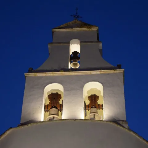
    In any case, certain works were completed in the temple in 1587: tower staircase, general enlucido, repairs on the roof. At the end of the 17th century, according to Professor Galera Andreu, Master Francisco Landeras made a modest swordsman, which is not the one currently preserved, because this is the result of the works of the 19th century. In 1837, according to the report of Juan Tuñón, master of public works of Baeza, it was necessary to strengthen the silery on the west side, to fix the corner on the midday side and to do the whole roof. Years later, specifically on January 26, 1860, Antonio López, a master of works at the Cathedral of Baeza, made another report, in which there is a need for a number of damage to the walls, soleras of the chorus ship, straps of the armor of the roof, roof of the sacristy; as far as the bell tower is concerned, he says: "The bell tower is necessary to do it again from its plant (...) by the construction of that bell tower that will have six and a half rods of width and nine and fourth of high (...) its cost is eleven thousand and two hundred reais."

    The conditions are also inserted: that the bulk of the walls of the bell tower will be of rod and half a fourth in frame, and its brick and mixture factory. By 1866, the architect José María Cuenca, states that the building was in very poor condition, although some works had already been done. In 1876 there was a record of new payments for works (including the general encalado of the temple, the fees for the direction of the architect Vicente Serrano Salaberri, etc.), which amounted to 26,000 reais.

    All these works, plus the necessary and continuous general maintenance, have determined their current configuration: a living room church with three ships, with vaults down the central and half canyon the sides. Special mention should be made of the arcosolinos of the 17th century that flank the presbytery, with simple classical altars crowned with the blasphons of the Sánchez Barrionuevo.

    OTHER ARTISTICAL MANIFESTIONS

    In the side chapels of the cruise, the shields of the Sánchez Barrionuevo (S. XVII) are kept on the plaster. The paintings of the disciplinant procession of the Christ of Veracruz are interesting. The most valuable piece is its mudejar baptismal pile, made of green glazed ceramic with a gothic inscription between sogued moulds, which is closely related to that of the church of Bartolomé de Jaén. The baptismal pile (1750), decorated with a threaded serpent, is interesting.

    Also preservedan oil on canvaswith the iconography ofEcce Homoof the 17th century: a sitting Christ that responds to the baroque aesthetics of the dark, another 18th century oil of the Divine Pastor of popular theme and great chromatic contrast and of the 20th century, a wooden size of a Crucified, with careful anatomical study.

    Breve descripción

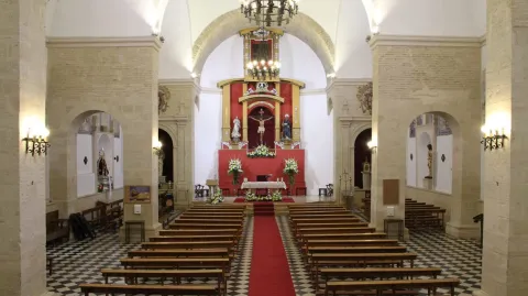
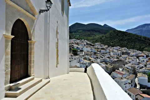
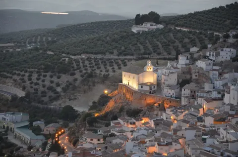
    Monument included in the Artistic Historical Set. Incoated on 09 / 07 / 82. The parish church of Santo Domingo, located at the end of the city centre, is built on a strong architecture made up of eight arches that serve as a counter to its foundation on the side facing a wide valley, which is ironfully dominating. In the end, with its factory completely skewed, it shows us an image of an eminently popular temple, other than the formulas of cultured architecture. The interior, however, presents sufficient elements to consider its architecture within the 16th and 17th centuries, although certainly very much intervened by various causes and circumstances during the 18th and 19th centuries. A Mª. J. Sánchez Lozano we owe some data about his constructive process.

    Telecomunicaciones
    Sitio web
    www.aytorres.es/el-municipio/patrimonio-historico.html
    Teléfono de contacto
    953 363 026
    Correo electrónico
    parroquiatorresjaen@gmail.com
    Ubicación
    Código Postal
    23540
    Latitud
    37.786400
    Longitud
    -3.511030
    Dirección
    C/ Jesús Castillo Solís, 9
    Distrito
    Municipio
    Ubicación en el mapa
    POINT (-3.51103 37.7864)
    Tipos de punto de interés
    Imágenes carrusel
    imagen
    Image
    igles-1140x640.jpg
    Imagen principal
    Desactivado
    imagen
    Image
    Iglesia%20Parroquial%20de%20Santo%20Domingo2.jpg
    Imagen principal
    Desactivado
    imagen
    Image
    iglesia-parroquial-2%20%281%29.jpg
    Imagen principal
    Desactivado
    imagen
    Image
    iglesia-parroquial.jpg
    Imagen principal
    Activado
    Imágenes cabecera
    imagen
    Image
    iglesia-parroquial.jpg
    Imagen principal
    Activado
    Modelo 3D
    Loading map
    Preparing points of interest and routes...