Saltar al contenido principal
icon-intereses-deporte

CIRCUIT 5. ENJOY WITH ALL 5 SENSES IN THE SIERRA DE LAS VILLAS

Submitted by brandcode_deweloper on
Id
13494183
Descripción larga

Day 1.

Arrived at the accommodation.

Day 2.

Adventure in Las Villas, enjoy a natural gymkhana with Rural House and Active Tourism and Leisure Center Villanatura.
Duration of experience: 3 hours.
Price: 35 €/ person

Day 3.

Escape room: The mystery of Catalina with ASINRE International Association of Resins.
Duration of experience: between 1 hour and half and 2 hours.
Price: From 15 €/ person.

Day 4.

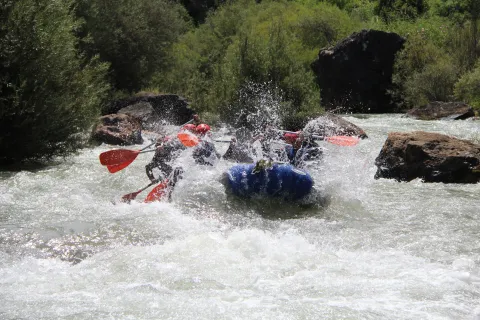
Rafting Natura: more than a descent a real adventure with Rafting Las Villas.
Duration of experience: 3 and a half hours.
Price: adults: €45 per person and children (7-12 years): €35 per person.

(*) Accommodation options in the Sierra de La Loma and Las Villas available on the circuit: Rural House and Active Tourism Center Villanatura, Hotel Torres I and Hotel La Moraleda- Complex Las Delicias.

(* *) Prices may be subject to change.

GEOLOCALIZATION

Breve descripción

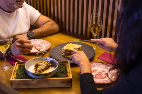
This circuit offers us a complete sensory experience, designed to connect body, mind and nature. Through a series of activities, you can feel the excitement of an outdoor room escape or the rafting adrenaline.

This circuit fuses outdoor activities, culture and well-being, offering an integral way to enjoy nature and local life, all in harmony with the environment, adding an adventure dose.

Latitud
38.3202
Longitud
-2.6804
Ubicación en el mapa
POINT (-2.6804 38.3202)
imagen
Image
mapas-lasvillas-2-png
Imagen principal
Activado
imagen
Image
_mg_8598-2-jpg
Imagen principal
Desactivado
imagen
Image
dsc08498-1-jpg
Imagen principal
Desactivado
imagen
Image
img_8463-1-jpg
Imagen principal
Desactivado

Family

icon-intereses-familia

Friends

icon-intereses-amigos

Nature

icon-intereses-naturaleza

Groups

icon-intereses-grupos

Adventure

icon-intereses-aventura

Culture

icon-intereses-cultura

Sport

icon-intereses-deporte

For couples

icon-intereses-en-pareja
CIRCUITO 5. DISFRUTA CON LOS 5 SENTIDOS EN LA SIERRA DE LAS VILLAS
All year round
Desactivado
Tramo de asfalto o cemento
 
Tramo de pista o camino forestal
 
Tramo de vía pecuaria
 
Tramo de senda
 

CIRCUIT 3. DISCOVER TRADITIONAL CRAFTS IN SIERRA DE CAZORLA

Submitted by brandcode_deweloper on
Id
13492327
Descripción larga

Day 1.

Arrived at the accommodation.

Day 2.

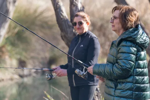
Live a stay with fishing experience in Casa Josefa.
Duration of experience: minimum stay 2 nights.
Price: From 470 €.

Day 3.

Cook Andalusian flavors with international touches in the Macurina Restaurant.
Duration of experience: 3 hours.
Price: 70 €/ person.


Day 4.

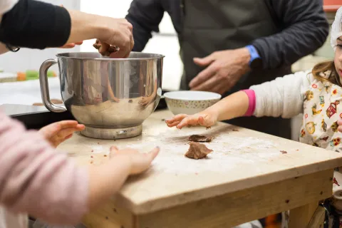
Workshop on making cookies in Sinmas.
Duration of experience: 2 hours.
Price: 20 €/ person.

(*) Accommodation options in the Sierra de Cazorla available on the circuit: Hotel & Spa Sierra de Cazorla, La Rosita Rural Accommodation, Hotel Al-Ándalus, Hotel Restaurante El Curro, Hotel Spa Rural Coto del Valle, Hotel Rural Los Nogales.

(*) Prices may be subject to change.

GEOLOCALIZATION

Breve descripción

This circuit invites travelers to immerse themselves in the valuable cultural and natural heritage of our rural traditions, offering unique experiences that connect with the trades that have shaped our history. In the Sierra de Cazorla, the gastronomy will be your guide, knowing traditional fishing, handmade pastries or the cuisine with high quality indigenous products.

This circuit not only highlights the value of these trades, but promotes a form of sustainable tourism, promoting respect for the environment and the preservation of local culture.

Latitud
37.9143
Longitud
-3.0072
Municipio
Ubicación en el mapa
POINT (-3.0072 37.9143)
imagen
Image
mapas-cazorla-1-png
Imagen principal
Activado
imagen
Image
dsc09868-jpg
Imagen principal
Desactivado
imagen
Image
_mg_3731-1-jpg
Imagen principal
Desactivado
imagen
Image
_mg_5121-1-jpg
Imagen principal
Desactivado

Seniors

icon-intereses-senior

Family

icon-intereses-familia

Friends

icon-intereses-amigos

Groups

icon-intereses-grupos

Gastronomy

icon-intereses-gastronomia

Sport

icon-intereses-deporte

Eco-friendly

icon-intereses-eco-friendly

For couples

icon-intereses-en-pareja
CIRCUITO 3. CONOCE LOS OFICIOS TRADICIONALES EN SIERRA DE CAZORLA
Desactivado
Tramo de asfalto o cemento
 
Tramo de pista o camino forestal
 
Tramo de vía pecuaria
 
Tramo de senda
 

Enjoy a stay at Cortijo de Ramón between "Roots and Candles"

Submitted by brandcode_deweloper on
Id
13471072
Descripción larga
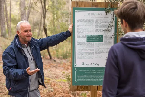
Enjoy a different experience in the Cortijo de Ramón, where history and nature intertwine in a welcoming environment. This two-night stay with accommodation and breakfast will allow you to disconnect and immerse yourself in the charm of the rural world, starting every day with a delicious healthy breakfast, made with fresh and local products. During your visit, you will be able to travel "Roots and Candles," a route that reminds us that the history of the peoples is kept alive through those who tell it. Inspired by the time the region was a Maritime Province (1733-1836), we have designed a tour of more than a kilometre with 30 information panels that narrate the great Spanish Maritime Epopeya. Through these stories, you will know the exploits of great navigators and explorers, as well as the importance of Andalusian scenarios in these historical events. In addition, some of these panels have been written by renowned authors of historical novel, whose works are available in our shop. A perfect opportunity to take a piece of history with you. Live the past, discover new stories and connect with the essence of the rural world in the Cortijo de Ramón.
Latitud
38.25994
Longitud
-2.746338
Distrito
Municipio
Ubicación en el mapa
POINT (-2.746338 38.25994)
imagen
Image
_mg_6408-jpg
Imagen principal
Activado

Sport

icon-intereses-deporte
Disfruta de una estancia en el Cortijo de Ramón entre “Raíces y Velas”
All year round
Desactivado
Coordenadas / Huso 30S
30S x = 522192 and = 4234687
Tramo de asfalto o cemento
 
Tramo de pista o camino forestal
 
Tramo de vía pecuaria
 
Tramo de senda
 

CIRCUIT 10. EXPLORING THE SIERRA DE LAS VILLAS-NATURALEZA Y AVENTURA

Submitted by brandcode_deweloper on
Id
13413607
Descripción larga

Day 1.

Arrived at the accommodation.

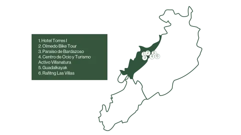
Defeat the liquid gold of Jaén from the hand of the Hotel Torres I.

Duration of experience: Minimum stay of 1 night.

Price: 125 €/ adult.

Day 2.

Discover the Sierra de Las Villas by bike or by taking a route.

Option A.

Explore the Natural Park of the saws of Cazorla, Segura and Las Villas by bicycle with Olmedo Bike Tour.

Duration of experience: 6 to 7 hours.

Price: 50 €/ group.

Option B.

Taste and adventure: Route and tasting gourmet in Paradise of Bardazoso.

Duration of experience: 5 hours.

Price: 50 €/ person.

Option C.

Change of accommodation.

Rural House and Active Tourism and Leisure Center Villanatura. Enjoy a day in a mountain olive grove.

Duration of experience: 5 hours.

Minimum stay of 1 night.

Price: 50 €/ person.

Day 3.

Adventure activities.

Option A.

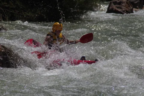
Rafting by the Guadalquivir River with Guadalkayak.

Duration of experience: 1 hour.

Price: adult 40 €/ person and children (under 14 years): 30 €/ person.

Option B.

Kayak waters by the Guadalquivir River with Guadalkayak.

Duration of experience: 3 hours.

Price: 50 €/ person.

Day 4

Initiation to the Via Ferrata El Rayo with Rafting Las Villas.

Duration of experience: 2 and a half hours.

Price: 35 €/ person.

(*) Prices may be subject to change.

GEOLOCALIZATION

Breve descripción

A circuit designed for those who want to immerse themselves in the natural and cultural beauty of the Sierra de Las Villas. Various experiences of oleoturism are offered, where travelers will discover the process of making extra virgin olive oil, a real local treasure. On many occasions you can combine it with the rich gastronomy of the area, which offers local and quality products, highlighting its authentic flavors.

For nature and sport lovers, you can make bike routes or explore the river by practicing kayak or rafting, ideal for enjoying the landscapes of the saw from different perspectives.

A circuit that combines culture, sport and the pleasure of gastronomy, allowing to discover the Sierra de Las Villas in a unique and sustainable way.


Latitud
38.3203
Longitud
-2.6801
Ubicación en el mapa
POINT (-2.6801 38.3203)
imagen
Image
mapas-las-villas-4-1-png
Imagen principal
Activado
imagen
Image
fotos-guadalkayak-1-jpg
Imagen principal
Desactivado
imagen
Image
dsc08567-1-jpg
Imagen principal
Desactivado
imagen
Image
_mg_6928-1-jpg
Imagen principal
Desactivado

Friends

icon-intereses-amigos

Nature

icon-intereses-naturaleza

Solo travel

icon-intereses-viajar-solo

Gastronomy

icon-intereses-gastronomia

For couples

icon-intereses-en-pareja

Family

icon-intereses-familia

Adventure

icon-intereses-aventura

Culture

icon-intereses-cultura

Sport

icon-intereses-deporte

Municipality

icon-intereses-municipio

Low-cost tourism

icon-intereses-turismo-low-cost

Eco-friendly

icon-intereses-eco-friendly
CIRCUITO 10. EXPLORANDO LA SIERRA DE LAS VILLAS-NATURALEZA Y AVENTURA
Desactivado

The Guadalentín Route, path of the carreros and recoveros

Submitted by brandcode_deweloper on
Id
10489763
Descripción larga

The mountain house where the main action is developed mixed route (car-hiking / BTT-car).


The central section, where the main action of the film was recorded, is restricted to the road traffic, only accessible for Senderists and cyclists btt. In this case, the track tour of this section is facilitated, knowing that it can be connected to the initial and final sections by car. If applicable, at the end, transfer is required up to Carawayor the return to the point of origin.

This route is linked to the southern area of the natural park and constitutes the traditional transit area, of carriage of goods by car from the altiplano of Granada to the Sierra de Segura and Albacete, in the direction of the Campos de Hernán Perea and to the deepest area of the Sierra de Segura (Santiago de la Sword, Segura River Valley, Pontons, Zumeta Valley...).

It is the traditional marketing area, and of walking and horseshoe trips through these mountains, between the neighbouring regions of the Spanish Levante, the head of the Guadalquivir Valley, the Granada Altiplano and Sierra Nevada. In fact the last maquis resisted in this area until 1956, when the last game of guerrillas who walked through these solages since the end of the Civil War was finished.

These roads were splashed with cortijos, fountains, resiegos, and pegeras, which almost worked with rest stations and avtuallation of the travelers who moved in blood through these places for centuries. On these roads there is a lot of memory and a lot of tangible and intangible heritage that fills these landscapes with meanings and that tell us the lives of those who walked and lived there.

Fishermen's area, clean rivers, orchards and mountain fruit, wood use, isolated life in corjadas, forest nurseries, pineapple sequeros, hunting and legends such as those of the bad woman or the Pine de la Posá, always linked to traditional mountain rural communities.

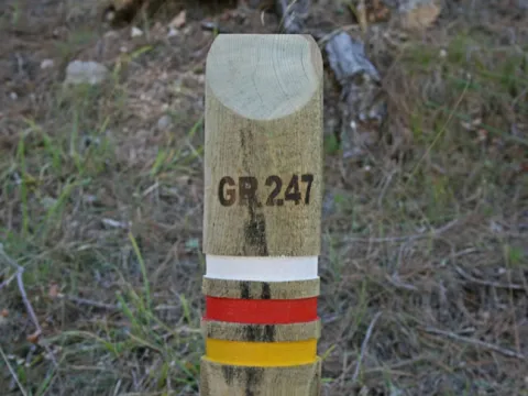
Much of the tour, from the area of the San Pedro Navy, the entire section of hiking/btt and even El Hornico, coincides with the GR247 Southern forests, steps 13 and 14 and alternative 3.

Breve descripción

Municipal terms of Cazorla and Pozo Alcón. Natural park Sierras de Cazorla, Segura y las Villas, Jaén.

Latitud
38.2804
Longitud
-2.6502
Municipio
Ubicación en el mapa
POINT (-2.6502 38.2804)
imagen
Image
ruta-1.png
Imagen principal
Activado
imagen
Image
La%20Hija%2010.jpg
Imagen principal
Desactivado
imagen
Image
La%20Hija%2011.jpg
Imagen principal
Desactivado
imagen
Image
La%20Hija%2012.jpg
Imagen principal
Desactivado
imagen
Image
La%20Hija_frames_41.jpg
Imagen principal
Desactivado

Sport

icon-intereses-deporte
La ruta del Guadalentín, camino de carreros y recoveros
All year round
Desactivado

1. Viewpoints and forest landscapes of the Sierras de Cazorla, Segura and Las Villas Natural Park. A general tour of its forest legacy.

Submitted by brandcode_deweloper on
Id
13767729
Descripción larga

The tour begins at the edge of the city centre of Jaén, next to the municipal sports complex Las Fuentezuelas. The first 2 km, used by hiking and cycling, have several rest areas. From here on, we will cross, on a service road, the north-west circumvalation of Jaén to resume the trail to the town of Torredelcamp. After passing through a new alternative road that saves the A-316 motorway, we arrive at the Torredelcampo station (km. 11,100) located in this urban nucleus.

After two tunnels (the first lit 333 meters long), two viaducts and the rest area of the Quebradas, we will reach the nearby town of Torredonjimeno. From Torredonjimeno Station (Km. 1,600) we will continue in the direction of Martos, for which we will have to cross two long metal walkways that allow the crossing with the road A-316. La Via Verde crosses the city centre of Martos and offers the possibility to make interesting visits to the city.

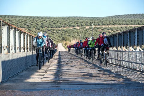
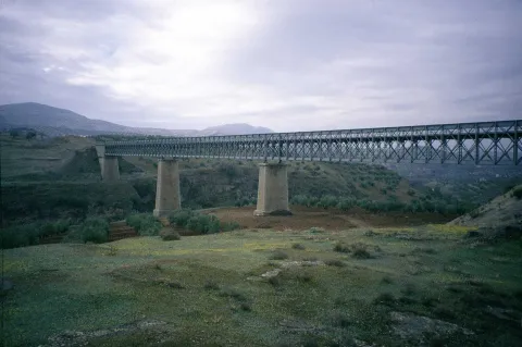
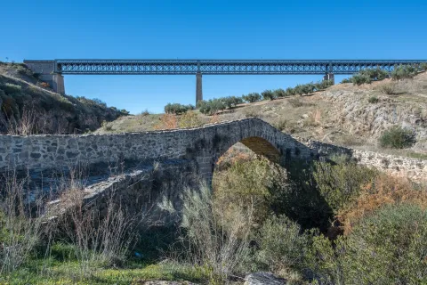
We left Martos, in a southwestern direction, towards the border with the province of Córdoba. New intersections with the national road are resolved by installing a lower step and a new gateway. In Km. 33, coinciding with the proximity of the Salado stream, the landscape changes and becomes more abrupt and serrano, already in the foothills of the Sierra Sur massif. The railway crosses rivers and streams in the middle of impressive ravines, through metal viaducts with lengths between 70 m and 224 m. These complex engineering works, which were designed by the French Alessandre and Delapierre, date back to the end of the 19th century, magnificent examples of oblonted architecture, and which constitute extraordinary views on the rural landscapes of the province of Jaén.

The rest area of the isolated station of Vado-Jaén is located at km 37. The old railway platform continues its course in the direction of the Alcaudete Station, passing the impressive viaduct on the Víboras River (224 m long and 80 m high), the remains of an abandoned balast quarry, called La Muela, and some sections of lush Mediterranean vegetation in which they stand out oak, retama and majajelos, as well as old almonds.

Leaving the Alcaudete station behind, at 48,400 km, we will reach a crossing with the A-316 road, saved by a high gateway.

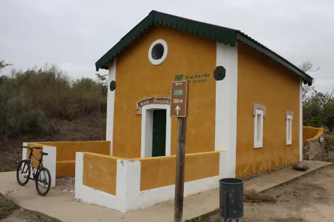
After passing through the building for the railway houses, the Green Way of Oil connects with the Biking Routes of Sierra Sur de Jaén (signposted), which enter the cycloturist in the heart of the massif of the same name, and runs right next to the Laguna Honda Natural Reserve (Km. 50,500); at this point you can see the abundant and rich avifauna that dwells in this 65 Has. wetland of extension: evil, real anade, squid or small zampullin.

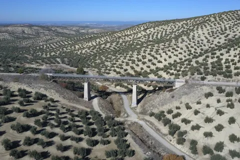
On the right bank of the Green Way, a road leads to another natural space protected from the environment: the Natural Reserve of Laguna del Chinche, of 6.5 Has. of extension and with an interesting perilagunar vegetation. The last miles pass through a very eroded site where deep ravines are frequent, in whose slopes the thyme and the spartum occupy a land, not suitable for the olive tree, which sometimes offer excellent panoramic views of the Vadomojón reservoir. The jiennese part of the Green Way of Oil concludes on the great iron bridge over the Guadaljoz River, right in the tail of the reservoir, 199 m long.

From this point the green track connects with that of the Cordobese Subbetic.

Latitud
38.2167
Longitud
-2.7228
Distrito
Municipio
Ubicación en el mapa
POINT (-2.7228 38.2167)
imagen
Image
foto-4_rncc_2540-jpg
Imagen principal
Activado
imagen
Image
perfil-aceite-fusion-1-jpg
Imagen principal
Activado
imagen
Image
vva-jpg
Imagen principal
Desactivado
imagen
Image
patricia-aybar-en-via-verde-jpg
Imagen principal
Desactivado
imagen
Image
vva-1-jpg
Imagen principal
Desactivado
imagen
Image
vva-2-jpg
Imagen principal
Desactivado
imagen
Image
vva-3-jpg
Imagen principal
Desactivado
imagen
Image
vva-4-jpg
Imagen principal
Desactivado
imagen
Image
vva-5-jpg
Imagen principal
Desactivado
imagen
Image
vva-6-jpg
Imagen principal
Desactivado
imagen
Image
74422248_140452477303677_4407740479924338688_o-jpg
Imagen principal
Desactivado
imagen
Image
vva-7-jpg
Imagen principal
Desactivado
imagen
Image
vva-8-jpg
Imagen principal
Desactivado
imagen
Image
aceite08-jpg
Imagen principal
Desactivado
imagen
Image
aceite10-jpg
Imagen principal
Desactivado
imagen
Image
aceite13-jpg
Imagen principal
Desactivado
imagen
Image
rcc_2082-1-jpg
Imagen principal
Desactivado
imagen
Image
cantera-de-la-muela-1-jpg-1
Imagen principal
Desactivado
7 h 30 min

Friends

icon-intereses-amigos

Nature

icon-intereses-naturaleza

Solo travel

icon-intereses-viajar-solo

Gastronomy

icon-intereses-gastronomia

For couples

icon-intereses-en-pareja

Family

icon-intereses-familia

Adventure

icon-intereses-aventura

Culture

icon-intereses-cultura

Sport

icon-intereses-deporte

Municipality

icon-intereses-municipio

Low-cost tourism

icon-intereses-turismo-low-cost

Eco-friendly

icon-intereses-eco-friendly
Baja
Document
Image
fc880c76-e19a-7c1e-4cfb-785b4441a694?t=1604415740731
1. Miradores y paisajes forestales del Parque Natural Sierras de Cazorla, Segura y las Villas. Un recorrido general por su legado forestal.
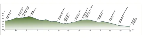
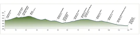
115 km
892m
All year round
Desactivado
Image
perfil-aceite-fusion-1-jpg

6, from Jaén (The Fuentezuelas' polysports complex) and from each of the five stations.

Users: cyclists, walkers and wheelchair people.

Regardless of the way you decide to travel this route, it is recommended to use comfortable clothes and footwear and adapted to the time of the year. Although it is not convenient to do so in the middle of summer due to the heat. You must not forget to wear enough water and, if you go on a bike, it is always recommended to wear a helmet.

For more information visit:http: / / www.viasverdes.com

Cultural heritage: Monumental set of Jaén. The medieval castle of Alcaudete. Medieval Bridge of the Vipers. Archaeological route of the Torreones. Urban assemblies of Luque, Zuheros, Doña Mencía, Cabra and Lucena. Cueva de los Murcielagos en Zuheros.
Ramal a Baena: Urban complex of Luque and Baena, archaeological park of Torreparedones, the Historical and Archaeological Museum of Baena, church of the ancient Convent of the Agustinos Descalzo in Luque.

The starting point is located in the village of Vadillo-Castril. The latter is followed by the A-319 road that links the towns of Peal de Becerro and Hornos de Segura. We must take the detour located at the kilometer 31.7 and continue for 5 km by the JF-7091 until the entrance detour to Vadillo-Castril and the Training and Forest Experiment Centre.

The route has been broken down in stages, assuming that it will be of interest to cycloturists, although it could be carried out by car as it travels on roads open to traffic.

  1. Km 115 - Sequero de Siles.

Coordinates 38.39197, -2,58255

Siles is a village of 2200 inhabitants located on the north end of the Natural Park. There is an old artificial pineapple sequero, which has been musealized and transformed into the current Centre for Interpretation and Reception of Visitors of the Sierra de Segura. It is located in the street Carretera de Hellín no. 21, and has several exhibition spaces that report on the natural values of the Sierra de Segura, the history of the human population in the territory, the serrano trades and, in an outstanding way, on the sequero itself, from which the original machinery is preserved.

Tramo de asfalto o cemento
97.39%
Tramo de pista o camino forestal
2.61%
Tramo de vía pecuaria
0
Tramo de senda
0

1. Viewpoints and forest landscapes of the Sierras de Cazorla, Segura and Las Villas Natural Park. A general tour of its forest legacy.

Submitted by brandcode_deweloper on
Id
13767377
Breve descripción

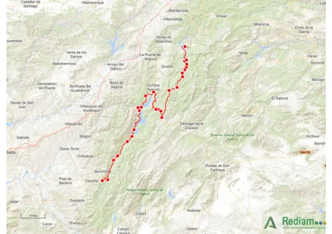
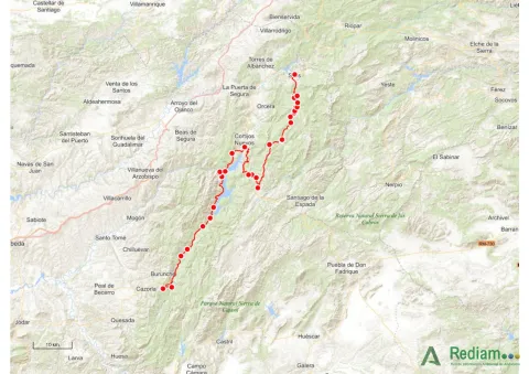
This stage is part of Mount Navahondona, one of the areas of the Natural Park with the highest concentration of elements of the forest legacy, mainly because here the mountain engineer don Enrique Mackay worked during the first quarter of the 20th century. After descending through the Guadalquivir valley, following the route of the woods, it reaches the reservoir of the Tranco, where we can see a very unique artifact.

Latitud
37.91676
Longitud
-2.95436
Municipio
Ubicación en el mapa
POINT (-2.95436 37.91676)
imagen
Image
01-1-jpg
Imagen principal
Activado
imagen
Image
mapa_01-jpg
Imagen principal
Activado
7 h 30 min

Sport

icon-intereses-deporte
Image
mapa_01-1-jpg
1. Miradores y paisajes forestales del Parque Natural Sierras de Cazorla, Segura y las Villas. Un recorrido general por su legado forestal.
115 km
892m
Desactivado
Image
mapa_01-jpg

The route runs within a natural protected space rich in flora and fauna, which can be damaged by incivious and unenvironmentally friendly behaviour. The regulations of the Natural Park prohibit both the collection of plants and the capture of animals. You can't light fire either. Along the course, there are different accommodation and restoration options.

Elements of the Forest Legacy Catalogue to be visited: Sheet number 1, 6, 9, 12.17, 32 and 44.

The starting point is located in the village of Vadillo-Castril. The latter is followed by the A-319 road that links the towns of Peal de Becerro and Hornos de Segura. We must take the detour located at the kilometer 31.7 and continue for 5 km by the JF-7091 until the entrance detour to Vadillo-Castril and the Training and Forest Experiment Centre.

The route has been broken down in stages, assuming that it will be of interest to cycloturists, although it could be carried out by car as it travels on roads open to traffic.

Coordenadas / Huso 30S
37.91676, -2.95436
Tramo de asfalto o cemento
97.39%
Tramo de pista o camino forestal
2.61%
Tramo de vía pecuaria
0
Tramo de senda
0

Route Viaje al Tiempo de los Íberos

Submitted by brandcode_deweloper on
Id
9356905
Breve descripción

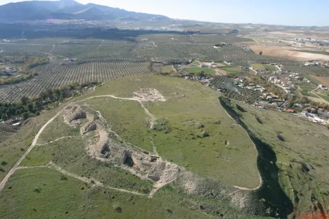
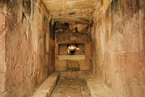
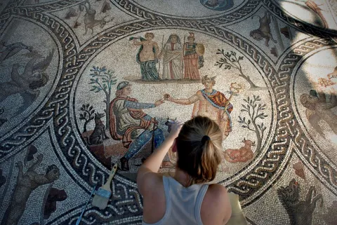
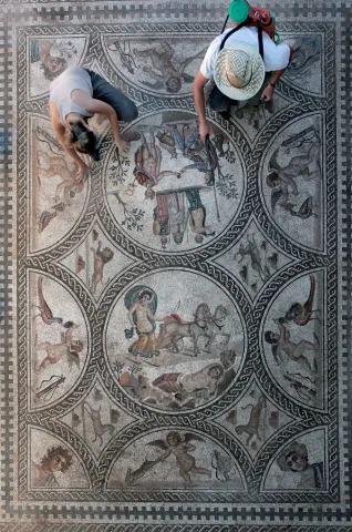
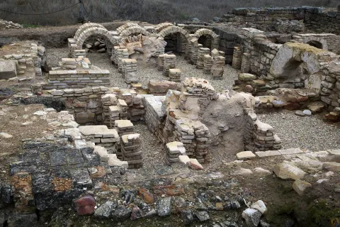
The archaeological heritage that left the culture of the Iberos in Jaén is unique in the world, both for its uniqueness and for its variety. The development of this culture between the 6th century BC and the 1st century BC, has left in the province more than 545 invented sites, among which are the most important
fortified cities of Catulo and Puente Tablas, funeral chambers such as Toya, and ethnic shrines such as the Cave of the Dolls or the Lobera.

The archaeological heritage that left the culture of the Iberos in Jaén is unique in the world, both for its uniqueness and for its variety.

The great journey we propose to the time of the Iberos is a great project of the Diputación de Jaén coordinated with the various municipalities, and is currently in full development. The visitor can contemplate one of the largest sculptural assemblies of the Ibera Statuary in stone: that of Cerillo Blanco de Porcra and that of the Heroic Sanctuary of the Pajarillo of Huelma, exposed at the Provincial Museum of Jaén. In the Archaeological Museum of Linares we can visit the history of Catulo, one of the most important cities of ancient times, and in the Museum of Castellar an impressive collection of Iberian exvotes is presented. All this together with the new projects that are currently being implemented and have new
museum spaces and the value of archaeological sites such as the White Crow in Porcilla.

Journey to the time of the Iberians

Municipio
imagen
Image
Guerrero%20%C3%ADbero%20%281%29%20%281%29.jpg
Imagen principal
Activado
imagen
Image
puente%20tablas%20a%C3%A9rea%20%281%29.jpg
Imagen principal
Desactivado
imagen
Image
C%C3%A1mara%20de%20Toya.%20Peal%20de%20Becerro.%20Viaje%20al%20Tiempo%20de%20los%20%C3%8Dberos.jpg
Imagen principal
Desactivado
imagen
Image
Limpieza%20mosaico%20de%20los%20Amores%204%20%281%29.jpg
Imagen principal
Desactivado
imagen
Image
Limpieza%20mosaico%20de%20los%20Amores%205%20%281%29.jpg
Imagen principal
Desactivado
imagen
Image
c%C3%A1stulo.jpeg
Imagen principal
Desactivado
imagen
Image
IMG_2037%20giribaile%20%281%29.jpg
Imagen principal
Desactivado

Seniors

icon-intereses-senior

Friends

icon-intereses-amigos

Culture of the Bull

icon-intereses-cultura-del-toro

Nature

icon-intereses-naturaleza

Solo travel

icon-intereses-viajar-solo

Gastronomy

icon-intereses-gastronomia

For couples

icon-intereses-en-pareja

Business

icon-intereses-negocios

Family

icon-intereses-familia

Culture

icon-intereses-cultura

Adventure

icon-intereses-aventura

Sport

icon-intereses-deporte

Low-cost tourism

icon-intereses-turismo-low-cost

Eco-friendly

icon-intereses-eco-friendly
All year round
Desactivado

Route del río Cerezuelo

Submitted by brandcode_deweloper on
Id
9271092
Descripción larga

Shortly after the fifth bridge, it is recommended to continue to the left, where it is already incorporated into a wider road, right next to a rural house called "Nace el Río." If you go ahead, there are two ways to return, or on a road to the left that goes down to the same point of departure, or you can follow the right by a road called "Paseo del Solar," which when you reach the village allows you to go down to the Plaza de Santa María again.

The first option would be about an hour, the second option would be half an hour more, but it is worth the beautiful views we have from the viewpoints. Both routes are very simple so they are perfect for those trails who want to go for a walk or families with children. But they are also ideal to discover the most beautiful corners of the area without making an intense effort, being able to enjoy the road to the maximum.

Breve descripción

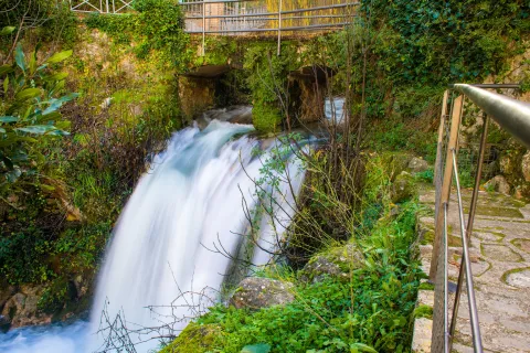
In the direction of the Castle of the Yedra we run into a small square where to the right it is moving towards the Castle, and to the left it is already marked the beginning of this circular route, which will enter into a space closed by large chopos that, in combination with the crystal waters of the river forming pozas, will make our journey an unparalleled environment to enjoy nature. Using the various wooden bridges, you can cross the river to continue this magnificent expedition.

Latitud
37.9143
Longitud
-3.0072
Municipio
Ubicación en el mapa
POINT (-3.0072 37.9143)
imagen
Image
Cascada%20r%C3%ADo%20Cerezuelo.jpg
Imagen principal
Activado
imagen
Image
Ruta%20r%C3%ADo%20Cerezuelo.jpg
Imagen principal
Desactivado
1 h

Nature

icon-intereses-naturaleza

Friends

icon-intereses-amigos

Adventure

icon-intereses-aventura

Sport

icon-intereses-deporte

Eco-friendly

icon-intereses-eco-friendly

For couples

icon-intereses-en-pareja

Family

icon-intereses-familia

Municipality

icon-intereses-municipio

Low-cost tourism

icon-intereses-turismo-low-cost

Solo travel

icon-intereses-viajar-solo
Baja
Ruta del río Cerezuelo
2,4 km
All year round
Desactivado

Wear adequate clothing and footwear.

About 200 m behind the ruins of Santa Maria.

Tramo de asfalto o cemento
 
Tramo de pista o camino forestal
 
Tramo de vía pecuaria
 
Tramo de senda
 

ALTERNATIVE GR 247.1 STAGE 1: Prado Maguillo and Forestrand House Refuge El Bodegón - Río Madera

Submitted by brandcode_deweloper on
Id
8165149
Breve descripción

This first stage of the GR 247.1 Variant unites two of the most emblematic small inhabited nuclei of the deep interior of the Natural Park, in the Sierra de Segura. The first is the village of Los Anchos and Prado Maguillo, and the second is the village of Arroyo Canales and Rio Madera.

They are isolated, lonely and surrounded by a very beautiful environment. The first, at the highest altitude, draw attention to the good conservation of popular architecture, of great simplicity and with an aesthetics fully integrated into the landscape. The Recreative Area of La Morringa, which is a very pleasant and shaded space with fountain and tables next to the River Madera, whose waters run manly between the riverside vegetation, stands out.

Most of the route runs through the forest track that runs through the Valley of Arroyo de las Tres Aguas, linking the valleys of Los Anchos and Río Madera through thick forests of pine laricio or salgareño. The Stage is short, and it is possible to chain it in the same day with one of the other steps of the Southern Forest Path with which it links, or with a stretch of them, but we recommend to do so without haste and to remain at any of the two ends of it, because they have left-over attractions for it.

Latitud
37.8351
Longitud
-3.1403
Distrito
Municipio
Ubicación en el mapa
POINT (-3.1403 37.8351)
imagen
Image
1.jpg
Imagen principal
Activado
imagen
Image
1.jpg
Imagen principal
Desactivado
imagen
Image
2.jpg
Imagen principal
Desactivado
imagen
Image
4.jpg
Imagen principal
Desactivado
imagen
Image
5.jpg
Imagen principal
Desactivado
imagen
Image
6.jpg
Imagen principal
Desactivado
imagen
Image
7.jpg
Imagen principal
Desactivado
imagen
Image
8.jpg
Imagen principal
Desactivado
imagen
Image
9.jpg
Imagen principal
Desactivado
imagen
Image
10.jpg
Imagen principal
Desactivado
imagen
Image
11.jpg
Imagen principal
Desactivado
imagen
Image
12.jpg
Imagen principal
Desactivado
imagen
Image
13.jpg
Imagen principal
Desactivado
imagen
Image
14.jpg
Imagen principal
Desactivado
imagen
Image
15.jpg
Imagen principal
Desactivado
imagen
Image
16.jpg
Imagen principal
Desactivado
imagen
Image
17.jpg
Imagen principal
Desactivado
imagen
Image
18.jpg
Imagen principal
Desactivado
imagen
Image
19.jpg
Imagen principal
Desactivado
2 h 12 min

Nature

icon-intereses-naturaleza

Friends

icon-intereses-amigos

Adventure

icon-intereses-aventura

Culture

icon-intereses-cultura

Sport

icon-intereses-deporte

Eco-friendly

icon-intereses-eco-friendly

For couples

icon-intereses-en-pareja

Family

icon-intereses-familia

Gastronomy

icon-intereses-gastronomia

Municipality

icon-intereses-municipio

Low-cost tourism

icon-intereses-turismo-low-cost

Solo travel

icon-intereses-viajar-solo
Medium
Prado Maguillo y Refugio Casa Forestal El Bodegón - Río Madera
7,78 km
248m
241m
416m
1
1
1
2
On foot
All year round
Activado
Some strong reels shortly before the end of the Stage in Rio Madera
Prado Maguillo, La Morringa Recreative Area, Arroyo Canales, Río Madera

On the path: No
Near the path: Segura de la Sierra

In the beginning: Refugio Casa Forestal El Bodegón (1.4 km from the beginning of Etapa).
In the end: there is no.

The serrano cortijo, a combination between the practical and the simple

The Valley of Los Anchos, from which this route is part, is perhaps the area where what is left of the popular architecture of these mountains is best preserved. Joaquín Gómez Mena, an excellent connoisseur of the Natural Park, sums up its main features.
The serrana house, as a general rule, is rectangular and has thick walls ranging from 50 to 70 centimeters, made of stones and toves attached with argamase, which serves as protection against summer heat and the cold of winter. The surface of this rectangle ranges from 25-35 meters wide by 30-40 meters long.

On the lower floor there are usually three rooms that are aligned. The first is a kitchen-dining room, where there is the access door to the house and it has one or two windows not very large. In this kitchen-dining room is the home or fireplace, which has the double function of heating the room in winter and serving to cook the food and heat the water.

In most of the houses, on both sides of the fireplace are two fitted cupboards on the wall, where the cooking tools are kept. Sometimes in one of these holes the quarries were placed with the water that was brought from the source.

The other two rooms are single bedrooms, one for marriage and one for children. They have small ventilation windows and are very austere, for in them there is only one bed and a harpoon to keep the clothes. From one of the bedrooms leaves the staircase that gives access to the upper floor, where the camera is located.

The roof of this plant is of descending height, or as we say today, overstretched, because the roof becomes inclined, usually to a water, to run the rainwater. This camera has one or two small windows to air the stay, where the products of the killing are cured and stored. The roof of the camera is unglued, with the wooden rolls that make of beams and the wooden boards placed above them. Finally, a clay layer and tiles are available on the boards.

Next to the human stays, but separated by a wall and with independent entrances, the blocks for the cattle are located, which have freckles for mules and donkeys. In some corijos these blocks are separated from the house, in front of it or on one side of it. Other buildings of the cortijo separated from the family house are the corrals and aprines for the goats and sheep, the cochineas and the hens.

There are also other common-use infrastructure for different families in a corijada. Among them are the ages to pull the grain, which are usually on high and well ventilated grounds to take advantage of the effect of the air, are almost always circular and its soil is made with rolling edges, perfectly placed as if of a mosaic. Many of these ages are currently abandoned and it is regrettable that they end up being lost in the near future, because they are part of the cultural heritage of the natural park.

Another element of common use is the bread oven, built of stone and mud and in a vaulted form. It can be found standing out of the walls of the house to which it is located or, more often, as an independent construction among other buildings of the cortijo. The plant of these furnaces is usually circular or square, and is covered with Arab tile.

Also the fountains and lavatories, which were essential elements in the daily life of the village, are another heritage that in many places is being lost and that, even if the installation of running water in the houses makes them barely used, should be kept perfectly preserved.


Prado Maguillo and Refugio Casa Forestal El Bodegón

Wood River

Coordenadas / Huso 30S
According to Projection UTM Datum ETRS89
Tramo de asfalto o cemento
2.19%
Tramo de pista o camino forestal
87.79%
Tramo de vía pecuaria
0
Tramo de senda
10.02%

Route card

Km 0

Prado Maguillo

Nuestra ruta comienza en Prado Maguillo, una pequeña aldea de montaña muy cerca de Los Anchos. Ambas están en un entorno de extraordinaria belleza y conservan bastante bien la arquitectura popular. Salimos entre huertas, la mayoría ya abandonadas, y a los 500 metros, a la izquierda hay un pequeño cerro al que es imprescindible subir (son muy pocos metros) para recrearse en las maravillosas vistas que se contemplan desde él: el valle de Los Anchos en primer plano y, al fondo, las crestas de El Calarico, Poyo Gavilán y Poyo Alto.

Km 0,75

A la izquierda sale un camino que, al cabo 650 metros, nos lleva a la Casa Forestal El Bodegón, una de cuyas construcciones auxiliares ha sido rehabilitada como refugio. La Casa y el almacén –al que se llamaba barraca- ya están en ruinas, pero el paraje, que es un amplio claro en pleno bosque, es encantador.

Volviendo a nuestra ruta, continuamos bajando por la solitaria pista forestal en medio de un gran bosque de pino laricio o salgareño con sotobosque de encina, un paisaje cautivador que nos acompañará hasta el final de la Etapa. Vamos entre la Loma del Mirandante y el Calar de Peña Rubia, por el encajado valle del Arroyo del Prado de los Fresnos.

Pronto oiremos el rumor de sus aguas, mezclado con el canto de la abundante avifauna forestal. A la derecha, al otro lado del valle, aparece la inconfundible silueta de Peña Rubia, con sus paredones verticales que, haciendo honor a su nombre, tienen un llamativo color dorado y sepia que se acentúa con las últimas luces de la tarde.

A la altura del kilómetro 3, aproximadamente, en el fondo del valle confluyen las aguas del Arroyo del Prado de los Fresnos con las de los Arroyos de La Cerecera y La Cuesta del Majano. Por eso, a partir de ese punto, el cauce que resulta tiene el bello nombre de Arroyo de las Tres Aguas.

El ambiente fresco y umbrío del valle propicia la existencia de acebos aislados, pudiendo admirar un pequeño grupo de ellos en el kilómterom 3,8. Un poco más adelante vemos abajo las ruinas del Molino de Peña Rubia y su antigua conducción de agua, que nos hablan de un pasado en el que se trabajaba para sobrevivir, pero donde el agua era mucho más abundante, porque la que circula en la actualidad apenas podría mover la rueda de un molino con la necesaria continuidad.

En el kilómetro 4,4 hay un manantial de agua que sale a través de una conducción por el lado derecho de la pista forestal.

Km 5,9

Puente sobre el Arroyo de Las Tres Aguas

La ruta llega al fondo del valle y cruzamos sobre este río, que poco después afluye al Río Madera. Es un lugar refrescante con abundancia de mimbreras y juncos, al igual que el cruce sobre el Río Madera por un vado unos 400 metros más adelante. La lámina de agua que tenemos que atravesar suele ser muy delgada, pero si ha llovido mucho puede tener alguna dificultad. También hay que tener prudencia en invierno, época en la que puede tener una capa de hielo. A partir del vado, y ya por el Valle del Río Madera, caminamos otros 400 metros con el río a nuestra derecha. En este tramo apreciamos que la vegetación es abundante, pero además hay que saber que las condiciones de frescor y humedad convierten a la zona en un enclave con una relevante importancia botánica. Hay, por ejemplo, una población de un equiseto (similar a la cola de caballo) denominado Equisetum palustre, planta propia del norte cuyas escasas poblaciones andaluzas sólo están en este Parque Natural. También se puede ver la centaurea (Centaurea nevadensis), exclusiva de las sierras calizas del este y sureste de España, y la ajonjera de Cazorla (Carlina baetica), una planta de distribución restringida al Parque Natural y sierras cercanas.

Km 6,7

Área Recreativa de La Morringa

Este Área es un buen lugar para descansar e incluso para echarse una siesta, tal vez por eso los serranos le pusieron este nombre, que en el habla local es sinónimo de soñarrera. Es un espacio muy agradable y sombreado que dispone de fuente y mesas junto al Río Madera, cuyas aguas discurren mansamente entre la vegetación de ribera. Después salimos a la carretera del valle de Río Madera y caminamos por ella apenas 200 metros para tomar un camino que sale a nuestra izquierda. Se trata de un jorro (vía de saca de madera) con algunos repechos que al poco se convierte en senda. En el kilómetro 7, 4 llegamos a un collado donde se abren vistas hacia el pequeño Valle de Arroyo Canales, donde vemos la aldea del mismo nombre en la que finalizará nuestra Etapa. En este mismo collado cruzamos una pista forestal que, hacia la izquierda, nos llevaría a los cortijos de Los Jarales y Los Asperones.

Km 7,7

Arroyo Canales y Río Madera

La Etapa termina en la pequeña aldea de Arroyo Canales, unos metros después de atravesar el arroyo del mismo nombre y las huertas que riega. Por la carreterita que pasa por la aldea, a la derecha, llegaríamos en unos minutos a la aldea de Río Madera, que tiene menos casas, pero que con su ermita, su venta, su plazuela y su antigua casa forestal ha sido siempre y sigue siendo el lugar de referencia del frondoso y seductor valle de Río Madera. Si en vez de bajar a la aldea de Río Madera queremos continuar por la Etapa 2 de la Variante GR 247.1, solo hay que cruzar Arroyo Canales, y al llegar a la carretera seguir por el camino que arranca enfrente.