Saltar al contenido principal
icon-intereses-deporte

Las Cimbras

Submitted by brandcode_deweloper on
Id
1909009
Descripción larga

Where to sleep. -There are not many places nearby to camp. We must seek life in the nearby villages or live.

Where to drink. -There are three sources of drinking water.

Notes and warnings. -In summer you can climb from dawn to 12.30 p.m.; in the afternoon from 18 a.m.; and in winter during the hours of the sun.

How to get there. -The school is located a few kilometers from Jaén, leaving in the direction of Mancha Real. Once there you have to go to Torres by the JV-3242. No parking problem. The area is in the same village, by the road.

Breve descripción

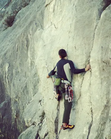
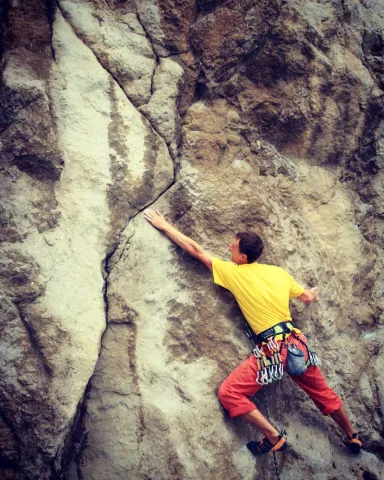
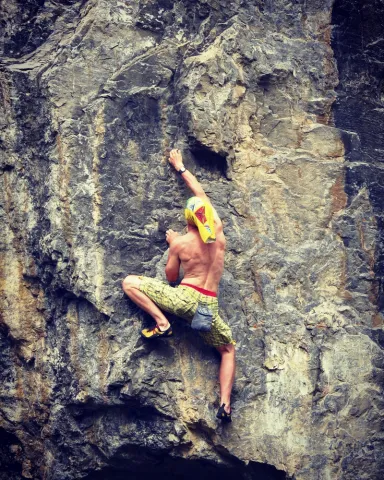
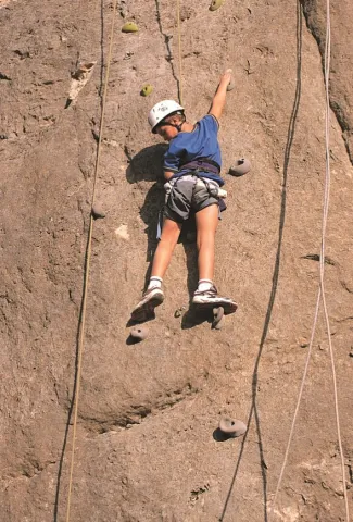
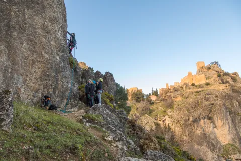
It is a small area integrated into the urban centre. It is located in front of the municipal pool. Comfortable and undergraduate. The average height is 8 meters. The maximum height is 12 meters. It is equipped and very good for initiation.

Latitud
37.785244
Longitud
-3.509375
Distrito
Municipio
Ubicación en el mapa
POINT (-3.509375 37.785244)
imagen
Image
shutterstock_1048500664.jpg
Imagen principal
Activado
imagen
Image
shutterstock_279617825.jpg
Imagen principal
Desactivado

Friends

icon-intereses-amigos

Nature

icon-intereses-naturaleza

Adventure

icon-intereses-aventura

Solo travel

icon-intereses-viajar-solo

Gastronomy

icon-intereses-gastronomia

Sport

icon-intereses-deporte

Municipality

icon-intereses-municipio

For couples

icon-intereses-en-pareja
Las Cimbras
Desactivado
Coordenadas / Huso 30S
30S x = 455148 and = 4182110

La Cueva

Submitted by brandcode_deweloper on
Id
1908346
Descripción larga

Where to sleep. -There is a camping area (meringeros) a few kilometers later, in the Cañada de las Azadillas. We have to ask the day care center for permits. The proximity of the city of Jaén offers accommodation and restaurants of all categories.

Where to drink. -In the cave itself or in the meringers.

Information and books. -www.usuarios.lycos.es / atope / otinar.htm

Notes and warnings. -As a livestock area, under no reason should one climb when he has won in the cave. High difficulty area. Recommended for climbers that reach sufficient level.

How to get there. -From Jaén capital you take the road to Puente la Sierra, to continue to the Pantano de Quiebrajano. Before you get to the recreational area, a lane goes right. We have to park at the bottom without obstructing the track. In this area interesting climbing areas are concentrated.

Breve descripción

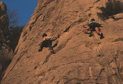
Probably one of the most interesting climbing schools in Andalusia. Their interest is increased by being placed in a area of high landscape value. It is a cave with high difficulty itineraries on ball formations, stalactites and giant jets. A complete collection of karmic formations (shaped in limestone) This school is a paradise of continuity. The tracks have reliable anchorages for sports climbing. The average height is: 25 meters. The maximum is 30 meters.

Latitud
37.674288
Longitud
-3.749732
Distrito
Municipio
Ubicación en el mapa
POINT (-3.749732 37.674288)
imagen
Image
shutterstock_1386587255%20%281%29.jpg
Imagen principal
Activado
imagen
Image
shutterstock_532809607.jpg
Imagen principal
Desactivado
imagen
Image
shutterstock_527300206.jpg
Imagen principal
Desactivado

Friends

icon-intereses-amigos

Nature

icon-intereses-naturaleza

Adventure

icon-intereses-aventura

Solo travel

icon-intereses-viajar-solo

Gastronomy

icon-intereses-gastronomia

Sport

icon-intereses-deporte

Municipality

icon-intereses-municipio

For couples

icon-intereses-en-pareja
Alta
La Cueva
Desactivado

Number of routes:50

You're up to V:0%

V + to 6c + routes: 0%

Vies from 7a to 7c +:30%

Eight-way:70%

Best time:From spring to autumn

Coordenadas / Huso 30S
30S x = 433885 and = 4169942
Tramo de asfalto o cemento
 
Tramo de pista o camino forestal
 
Tramo de vía pecuaria
 
Tramo de senda
 

La Cantera

Submitted by brandcode_deweloper on
Id
1908295
Descripción larga

For water, food and accommodationYou can take advantage of the city of Jaén, next to which is this climbing area.

Notes and warnings.- The estate is an olive grove, so it is not appropriate to get close to the walls. We must also park in places that do not stop the passage.

How to get there.- From Jaén capital you take the road of Los Villares (C-3221). At kilometer two, a small lane that takes directly to the area is on the right. In Jaén this area is known as the Fuente de la Peña, an old laundry area on the outskirts of the city. The scarves go from there to the quarry.

Breve descripción

They are not too many tracks and some of the older ones have a veiled equipment, but the slightly collapsed and good quality orange wall offers itineraries with many holes and rigs. This is a sports climbing school, where most of the fixations are reliable. The characteristics of these walls make the tracks explosive. The rock is limestone. The maximum height of the walls is 15 meters. It is a good area of boulder, sometimes very powerful.

Latitud
37.751413
Longitud
-3.804531
Distrito
Municipio
Ubicación en el mapa
POINT (-3.804531 37.751413)
imagen
Image
rendered%20%281%29.jpg
Imagen principal
Activado
imagen
Image
shutterstock_105196313.jpg
Imagen principal
Desactivado
imagen
Image
shutterstock_528238198.jpg
Imagen principal
Desactivado

Friends

icon-intereses-amigos

Nature

icon-intereses-naturaleza

Adventure

icon-intereses-aventura

Solo travel

icon-intereses-viajar-solo

Gastronomy

icon-intereses-gastronomia

Sport

icon-intereses-deporte

Municipality

icon-intereses-municipio

For couples

icon-intereses-en-pareja
La Cantera
Desactivado

Number of routes:26

You're up to V:0%

Votes from V + to 6c +:70%

Vies from 7a to 7c +:30%

Eight-way:0%

Best time:From autumn to spring

Coordenadas / Huso 30S
30S x = 429126 and = 4178539

Cerro Golondrina

Submitted by brandcode_deweloper on
Id
1908278
Descripción larga

For water, food and accommodation.- Water should be brought, as the nearest water is in Bedmar or Jodar. The accommodation and restaurants of the immediate villages are ideal for finding supply.

How to get there.- The area is 60 kilometres from Jaén capital. From this city you have to go to Bedmar (C-328). After that municipality we turn right through the crossing with the C-325. We arrived shortly after the area. The walls have no loss. They get up in the middle of the hill. There's enough space to park on both sides of the road.

Breve descripción

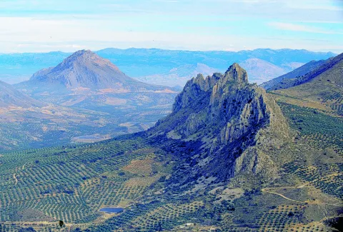
It is a very bright wall, which is integrated into an interesting relief formation and surrounded by a landscape with magnificent views. It is located at the limits of the Natural Park of Sierra Magina. Although it is a school of local interest, it may be of interest for a short visit. His inclination is quite vertical. The insurance system allows sports climbing with a certain technical character. The limestone walls reach 25 meters of level, with an average height of 15 meters.

Latitud
37.813578
Longitud
-3.340539
Distrito
Municipio
Ubicación en el mapa
POINT (-3.340539 37.813578)
imagen
Image
Natu010.jpg
Imagen principal
Activado
imagen
Image
2.jpg
Imagen principal
Desactivado
imagen
Image
1.jpg
Imagen principal
Desactivado

Friends

icon-intereses-amigos

Nature

icon-intereses-naturaleza

Adventure

icon-intereses-aventura

Solo travel

icon-intereses-viajar-solo

Gastronomy

icon-intereses-gastronomia

Sport

icon-intereses-deporte

Municipality

icon-intereses-municipio

For couples

icon-intereses-en-pareja
Cerro Golondrina
Desactivado

Number of routes:16

You're up to V:60%

Votes from V + to 6c +:40%

Vies from 7a to 7c +:0%

Eight-way:0%

Best time:spring and autumn

Coordenadas / Huso 30S
30S x = 470026 and = 4185186
Tramo de asfalto o cemento
 
Tramo de pista o camino forestal
 
Tramo de vía pecuaria
 
Tramo de senda
 

Route de la "Tapa Nazarí"

Submitted by brandcode_deweloper on
Id
1477225
Descripción larga

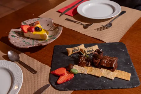
The Route of the Tapa Nazarí is held every November in our town as an activity included within the Cultural November, organized by the Arjona City Council. It is certainly one of the most popular activities that has become a tourist attraction, with a level of tapas corresponding to the most demanding palates. All the cafeterias, Bars and restaurants of our town, participate in this gastronomic activity, make different dishes, which serve in individual portions as a cover. Among all the establishments compete to take the prize in the different forms of the contest: Tapa Nazarí, Tapa Autóctona, Tapa Diseño, next to the "typical cover of the house." The awards are awarded by a jury of culinary experts from our locality and members of the Municipal Corporation.

Arjona during these days becomes a gastronomic reference of our province, there are many visitors who come to our town these days, dedicating the morning to make guided visits to the monumental heritage and continuing at noon with the gastronomic tasting that these days offer

Latitud
37.936476
Longitud
-4.055304
Distrito
Municipio
Ubicación en el mapa
POINT (-4.055304 37.936476)
imagen
Image
tapas_recurso_jaen-28-640.jpg
Imagen principal
Activado
imagen
Image
tapa_nazar%C3%AD.jpg
Imagen principal
Desactivado

Family

icon-intereses-familia

Friends

icon-intereses-amigos

Nature

icon-intereses-naturaleza

Adventure

icon-intereses-aventura

Solo travel

icon-intereses-viajar-solo

Culture

icon-intereses-cultura

Gastronomy

icon-intereses-gastronomia

Sport

icon-intereses-deporte

Municipality

icon-intereses-municipio

Low-cost tourism

icon-intereses-turismo-low-cost

Eco-friendly

icon-intereses-eco-friendly

For couples

icon-intereses-en-pareja
Ruta de la "Tapa Nazarí"
All year round
Desactivado
Coordenadas / Huso 30S
30S x = 407266 and = 4199292

Route rincones literarios de Juan Eslava Galán

Submitted by brandcode_deweloper on
Id
1477015
Breve descripción

The route Rincones Literarios is born by the number of readers, arjonero and internationally renowned writer Juan Eslava Galán, who come to the town, to see physically and know the corners, stories and legends that appear on the pages of his books and which have the main motive of the town, Arjona. To this end, a guided tour has been designed to make known these literary scenarios that in Arjona have a physical presence. During the route and in front of the monuments, the guide proceeds to read fragments of these works, which describe in the fist and letter of Juan Eslava Galán the monument or place in question.

Latitud
37.936494
Longitud
-4.055315
Distrito
Municipio
Ubicación en el mapa
POINT (-4.055315 37.936494)
imagen
Image
juan-eslava.jpg
Imagen principal
Activado
imagen
Image
Ruta%20rincones%20literarios%20de%20Juan%20Eslava%20Gal%C3%A1n.jpg
Imagen principal
Desactivado

Culture

icon-intereses-cultura

Friends

icon-intereses-amigos

Adventure

icon-intereses-aventura

Sport

icon-intereses-deporte

Eco-friendly

icon-intereses-eco-friendly

For couples

icon-intereses-en-pareja

Family

icon-intereses-familia

Gastronomy

icon-intereses-gastronomia

Municipality

icon-intereses-municipio

Nature

icon-intereses-naturaleza

Low-cost tourism

icon-intereses-turismo-low-cost

Solo travel

icon-intereses-viajar-solo
Ruta rincones literarios de Juan Eslava Galán
All year round
Desactivado
Coordenadas / Huso 30S
30S x = 407265 and = 4199294

El callejón de las bruja

Submitted by brandcode_deweloper on
Id
1476912
Descripción larga

Departure from the Echo-Parque de Arjona, start of the route by the so-called "Allejón de las Brujas" from the Km 0 to the 3,4 Km, reaching the recreational site called "La bridge." Same itinerary back, ending the Eco- Park.

Information about the Itinerary:

The itinerary is fully marked. Access to the point of departure can be made by car - as well as to the site called "La Puente."
In the course of the walk you can see, both on the right and left margin, species of shrubs and Mediterranean mountains that persist, among which we can highlight, Granado (Punica granatum), Zarzamora (Rubus ulmifolius), Almendro Silvestre or bitter (Prunus amygdalus), Acebuche (European olea silvestris), Chaparro (Quercus ilex)...
At the end of the journey, the visitor comes to a municipal road or green area, called the "La Puente" road, where you can enjoy a recreational area, where we also find some tree species such as Catalpa, Falsa Pepia, Olmo and Alamos among others.

One of the Legends of the Place called "Witch Street"

A few years ago, a middle-aged man was walking on the so-called "Cuesta del Monte," coinciding with the fall of the afternoon. The martial passage he was carrying did not stop the night from coming, dinning in black the horizon, leaving it with no more light than the moon itself and no more reference than the stars, accompanied along his journey by a sound of slack, sound that became ever more intense and close until he found what caused that sound, was a small, disoriented lamb that claimed with his cry help. This good man hastened to take him and put him on the shoulder, perhaps with the intention of taking him home and taking care of him with the rest of his animals or perhaps to see if he could find the flock or the shepherd along the way looking for him. But the pretensions of this good man, soon they went to the stray, when by passing through the place called "alley of witches" he felt like a voice whispered to him in the ear, "You have teeth like me," the man looked back and discovered that it was the lamb who spoke to him, such was the fear that the man who released the animal and began to run to his destination.

Breve descripción

Eco-healthy route

Latitud
37.936476
Longitud
-4.055304
Distrito
Municipio
Ubicación en el mapa
POINT (-4.055304 37.936476)
imagen
Image
callejon-brujas.png
Imagen principal
Activado
imagen
Image
Callej%C3%B3n%20de%20las%20Brujas.png
Imagen principal
Desactivado

Nature

icon-intereses-naturaleza

Friends

icon-intereses-amigos

Adventure

icon-intereses-aventura

Culture

icon-intereses-cultura

Sport

icon-intereses-deporte

Eco-friendly

icon-intereses-eco-friendly

For couples

icon-intereses-en-pareja

Family

icon-intereses-familia

Gastronomy

icon-intereses-gastronomia

Municipality

icon-intereses-municipio

Low-cost tourism

icon-intereses-turismo-low-cost

Solo travel

icon-intereses-viajar-solo
El callejón de las bruja
Activado
Coordenadas / Huso 30S
30S x = 407266 and = 4199292
Tramo de asfalto o cemento
 
Tramo de pista o camino forestal
 
Tramo de vía pecuaria
 
Tramo de senda
 

CIRCUIT 9. EXPLORING THE SIERRA DE LAS VILLAS. CULTURA, PATRIMONIO Y GASTRONOMÍA

Submitted by brandcode_deweloper on
Id
13500143
Descripción larga

Day 1.

Arrived at the accommodation.

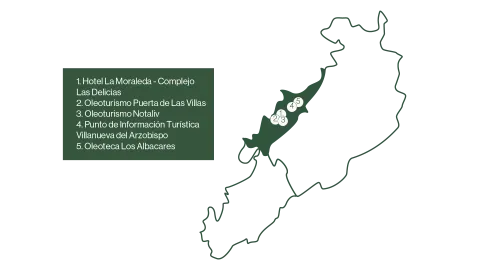
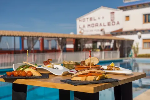
Enjoy your stay with a taste of typical saw tapas in Hotel La Moraleda- Las Delicias Complex.
Duration of experience: Minimum stay of 2 nights.

Price: from 195 €/ stay.

Day 2.

Experience 1.

Visit to the mill with breakfast of typical products in Oleoturismo Puerta de Las Villas.

Duration of experience: 1 and a half hours.

Price: 15 €/ person from 12 years. €8 / children aged 6-11. Free admission for children under 6 years of age.

Experience 2.

Tates the local products of Degusta Jaén in Oleoturism Notaliv Gourmet.

Duration of experience: 1 and a half hours.

Price: 115 €/ person.

Day 3

Experience 1.

Visit Villanueva del Archbishop from the eyes of his most famous characters with the Tourist Information Point of Villanueva del Archbishop.

Duration of experience: 2 and a half hours.

Price: free.

Experience 2.

The flavors of extra virgin olive oil with Oleoteca los Albacares.

Duration of experience: 1 and a half hours.

Price: €7,5 / adult and €5,50 / child

Day 4.

Discover Villanueva's identity through its architecture with the Tourist Information Point of Villanueva del Archbishop.

Duration of experience: 2 and a half hours.

Price: free.

(*) Prices may be subject to change.

GEOLOCALIZATION

Breve descripción

A circuit designed for those who want to immerse themselves in the natural and cultural beauty of the Sierra de Las Villas. Various experiences of oleoturism are offered, where travelers will discover the process of making extra virgin olive oil, a real local treasure. On many occasions you can combine it with the rich gastronomy of the area, which offers local and quality products, highlighting its authentic flavors.

If you prefer to enter the historical heritage of your municipalities you can do so with guided tours that make known your most emblematic traditions and monuments.

A circuit that combines culture, sport and the pleasure of gastronomy, allowing to discover the Sierra de Las Villas in a unique and sustainable way.


Latitud
38.3204
Longitud
-2.6801
Ubicación en el mapa
POINT (-2.6801 38.3204)
imagen
Image
mapas-lasvillas-4-png
Imagen principal
Activado
imagen
Image
dsc08437-1-jpg
Imagen principal
Desactivado
imagen
Image
dsc08042-1-jpg
Imagen principal
Desactivado
imagen
Image
_mg_5197-jpg
Imagen principal
Desactivado

Friends

icon-intereses-amigos

Nature

icon-intereses-naturaleza

Solo travel

icon-intereses-viajar-solo

Gastronomy

icon-intereses-gastronomia

For couples

icon-intereses-en-pareja

Family

icon-intereses-familia

Adventure

icon-intereses-aventura

Culture

icon-intereses-cultura

Sport

icon-intereses-deporte

Municipality

icon-intereses-municipio

Low-cost tourism

icon-intereses-turismo-low-cost

Eco-friendly

icon-intereses-eco-friendly
CIRCUITO 9. EXPLORANDO LA SIERRA DE LAS VILLAS. CULTURA, PATRIMONIO Y GASTRONOMÍA
Desactivado

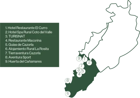
CIRCUIT 8. EXPLORING THE SIERRA DE CAZORLA-GASTRONOMÍA, NATURALEZA Y AVENTURA

Submitted by brandcode_deweloper on
Id
13495601
Descripción larga

Day 1.

Arrived at the accommodation.

Option A.

The flavors that remind the grandmother's in Hotel El Curro.
Duration of experience: Minimum stay 2 nights.
Price: from 220 €.
(*) The price is for standard double room 2 nights, with 2 breakfast and a meal or dinner for 2 people.

Option B.

Relax in the middle of the Natural Park of the Serras de Cazorla, Segura and Las Villas in Hotel Spa Rural Coto del Valle.
Duration of experience: Minimum stay 2 nights.
Price: From €191 per room and night.
(*) The price is for a standard double room, with buffet breakfast and relax pack for 2 people. Not valid on weekends or high season.
(* *) The price indicated is for spring / summer season from Monday to Thursday. If you want to enjoy this experience on weekends and high season, check availability and price with the hotel.


Day 2.

Experience 1.

Discover the "Friend Felix" route with Turisnat.
Duration of experience: Between 4: 30 and 5: 00h.
Price: From 35 €/ person and children from 4 to 12 years from 20 €/ person.

Experience 2.

Flora and fauna, a gastronomic tribute to Felix Rodriguez de la Fuente in the Lusco Restaurant.
Duration of experience: 2 hours.
Price: 65 €/ person.

Day 3.

Experience 1.

Discover how water models the landscape and life of its inhabitants with Cazorla guides.
Duration of experience: 3 to 4 hours.
Price: €35 (4 people), €30 (5 to 8 people) or €25 (9 to 15 people).


Experience 2.

Change of accommodation.

Rural accommodation La Rosita- Senderist escape.
Duration of experience: Minimum stay 2 nights.
Price: From 640 €(for groups from 4 to 10 people). Breakfast supplement or snack of typical products Dislike Jaén: 35 €/ stay.

Day 4.

Hiking route of Accommodation La Rosita.

Day 5.

Enjoy a day of adventure activities.

Option A.

Enjoy nature through the ferrata track of La Mocha with Tierraventura Cazorla.
Duration of experience: 3 to 4 hours.
Price: 40 €/ person.

Option B.

Discover the bowels of the Guadalquivir River, coming down its rails with Adventure Sport.
Duration of experience: 4 hours.
Price: from 40 €/ person.

Day 6.

In search of the broken bones with Cañamares orchard.
Duration of experience: 5 hours.
Price: 30 €/ person.

(*) Prices may be subject to change.

GEOLOCALIZATION

Breve descripción

A circuit through the Sierra de Cazorla that invites you to discover its heritage, both natural and cultural, its territory and its adventure. Along this tour, travelers will be able to enjoy the guided hiking routes that offer the opportunity to explore the unique landscapes of this saw in depth, while the most adventurous can be challenged by action activities in full nature such as the ferrata or the barranquism.

The local cuisine, with its indigenous flavors, complement the experiences, providing a sample of the region's culinary culture, which in some cases offers tributes to characters who have left their mark in the Natural Park Sierras de Cazorla, Segura and Las Villas.

This circuit combines nature, adventure and rest, offering a complete experience in the heart of the Sierra de Cazorla.

Latitud
37.9143
Longitud
-3.0072
Municipio
Ubicación en el mapa
POINT (-3.0072 37.9143)
imagen
Image
mapas-cazorla-3-2-png
Imagen principal
Activado
imagen
Image
_mg_4612-jpg
Imagen principal
Desactivado
imagen
Image
_mg_7831-1-jpg
Imagen principal
Desactivado
imagen
Image
p7120160-2-jpg
Imagen principal
Desactivado

Seniors

icon-intereses-senior

Friends

icon-intereses-amigos

Nature

icon-intereses-naturaleza

Groups

icon-intereses-grupos

Gastronomy

icon-intereses-gastronomia

For couples

icon-intereses-en-pareja

Family

icon-intereses-familia

Adventure

icon-intereses-aventura

Sport

icon-intereses-deporte

Eco-friendly

icon-intereses-eco-friendly
CIRCUITO 8. EXPLORANDO LA SIERRA DE CAZORLA-GASTRONOMÍA, NATURALEZA Y AVENTURA
Desactivado

CIRCUIT 6. ENJOY WITH ALL 5 SENSES IN THE SIERRA DE CAZORLA

Submitted by brandcode_deweloper on
Id
13494638
Descripción larga

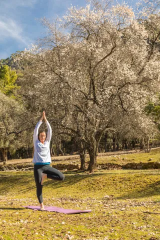
Option A. Yoga's withdrawal.

Arrived at the accommodation.

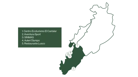
Disconnection in the Sierra de Cazorla, yoga and conscious feeding in Ecotourism and Nature Hall Center El Cantalar.
Duration of experience: 3 days and 2 nights.
Price: €275 / person.

Option B. Adventure activities to test your senses.

Day 1.

Arrived at the accommodation.

Day 2.

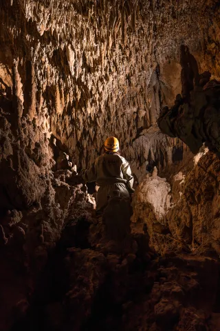
PB4 spelology with Adventure Sport.
Duration of experience: 4 hours.
Price: 35 €/ person.

Day 3.

Experience 1.

Discover the biodiversity of an ecological olive tree with WITHOUT MAS.
Duration of experience: 2 hours.
Price: 20 €/ person.

Experience 2.

Option A.

Live the sunset with the taste of our land in Aleuri Olympo.
Duration of experience: 2 hours.
Price: €9,90 / person.

Option B.

It savors the gastronomic menu "Eating the Moon" in Lusco Restaurant.
Duration of experience: 2 hours
Price: €52 / person

Day 4.

Seeds of nature in Ecotourism and Nature Hall Center El Cantalar.
Duration of experience: 2 hours.
Price: 15 €/ person.

(*) Accommodation options in the Sierra de Cazorla available on the circuit: Hotel & Spa Sierra de Cazorla, La Rosita Rural Accommodation, Hotel Al-Ándalus, Hotel Restaurante El Curro, Hotel Spa Rural Coto del Valle, Hotel Rural Los Nogales.

(* *) Prices may be subject to change.

GEOLOCALIZATION

Breve descripción

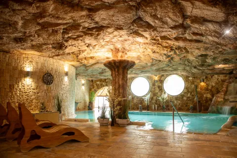
This circuit offers us a complete sensory experience, designed to connect body, mind and nature. Through a series of activities, you can explore your inner well-being through yoga withdrawal or feel the adrenaline of spelology, adding an adventure dose.

This circuit fuses outdoor activities, culture and well-being, offering an integral way to enjoy nature and local life, all in harmony with the environment.

Latitud
37.9143
Longitud
-3.0072
Municipio
Ubicación en el mapa
POINT (-3.0072 37.9143)
imagen
Image
mapas-cazorla-2-png
Imagen principal
Activado
imagen
Image
_mg_5557-jpg
Imagen principal
Desactivado
imagen
Image
_mg_4836-jpg
Imagen principal
Desactivado
imagen
Image
_mg_5895-1-jpg
Imagen principal
Desactivado

Seniors

icon-intereses-senior

Family

icon-intereses-familia

Friends

icon-intereses-amigos

Nature

icon-intereses-naturaleza

Groups

icon-intereses-grupos

Gastronomy

icon-intereses-gastronomia

Sport

icon-intereses-deporte

For couples

icon-intereses-en-pareja
CIRCUITO 6. DISFRUTA CON LOS 5 SENTIDOS EN LA SIERRA DE CAZORLA
All year round
Desactivado