Saltar al contenido principal
icon-intereses-deporte

Scenic Drive: Piscifactoría de Borosa - Hornos de Segura

Submitted by brandcode_deweloper on
Id
5713838
Descripción larga
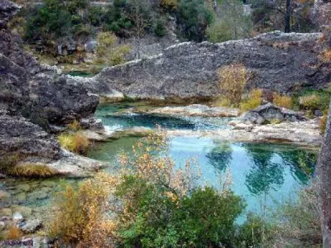
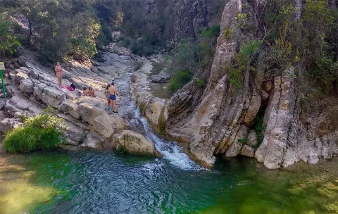
  • Km 0 - Piscifactory and River Borosa River Interpreting Center. In this Centre we will know the importance of water and river ecosystems in the Natural Park, in which emblematic species such as the common trout and the otter stand out.

  • Km 1,7 - Vinagre Tower. This area is one of the most crowded in the Park and is located in a geographically privileged area for its centrality. Here it is essential to know the Park Visitors Center, which has been recently modernized and has various interactive resources. It has a Natural Park Store, toilets, cafe, rest room and children's play area on the outside. Very close to this center is the Botanical Garden, a pleasant place with a wide and careful selection of natural park plants, from small herbaceas to large trees. It is a perfect place to observe and learn to distinguish them or simply to take a pleasant walk between lush vegetation.

  • Km 6.5 - Coto Ríos. This village, on the banks of the Guadalquivir, was built in the 1960s of last century to house families living in scattered villages and cortijos and whose houses were expropriated to create the National Cazorla-Segura Hunting Coto (now the Andaluza de Caza Reserve). It has medical assistance, shops and other services, in addition to several campsites.

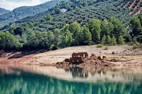
  • Km 13.3 - Wild Fauna Park Collado del Almond. In their enclosure they pasture in semi-freedom deer, mountain goats, wos and muflons. You can see them and photograph them by walking a pleasant itinerary with fountains, banks and several viewpoints with splendid views of the Tranco reservoir and the ruins of the castle of Bujaraiza.

  • Km 14 - FRF look. It is one of the milestones of the Route of the same name, dedicated to the mythical naturalist Felix Rodríguez de la Fuente, who from this point of view filmed the famous scenes of the berrea of the deer in the 1970s. In front of it is Mount Bujaraiza, which sometimes, when the reservoir is very full, becomes an island, and is crowned by the ruins of an Arab turret.

  • Km 17.6 - Old-garden controlled area. This place is very nice to eat and rest, except on the dates you are occupied by some camp.

  • Km 19.2 - House of Crafts Los Casares. It is an old Forest House converted into a shop of crafts and products from the Park.

  • Km 26 - Old Control Recreative Area. It is a large and recently built area with magnificent views over the northern part of the Tranco reservoir. It has banks, tables to eat and fountain.

  • Km 28.4 Tranco Dam - This impressive dam, whose height on the Guadalquivir channel is 82 meters, is one of the largest in Spain. In its surroundings there are several restaurants, terraces and water sports facilities, as well as the village that was raised for the workers who built the dam.

  • Km 31.5 - The Parral Recreative Area. It is in the middle of the carrasco pine pinar and has a look-out with good views over the waters of the Tranco reservoir.

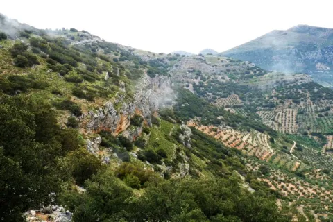
  • Km 35.7 - Cñada Morales. When it reaches this village the landscape is opened and no longer exclusively forest, to give way to large humanized areas with olive groves, orchards and scattered cortijos.

  • Km 44.6 - Safe Furnaces. This small town, built on the top of a peñasco, is in the center of the Natural Park. Its monuments, views and irregular alleys of the Arab past, served him the declaration of Artistic Historical Set.

Breve descripción

It is one of the most busy and popular routes of the Natural Reserve, which combines an attractive landscape dominated by the Tranco water reservoir and the opportunity to visit interesting facilities where visitors can enjoy discovering and observing the natural heritage of this protected space. Most of the route follows the winding road A-319.

Do not forget to drive with caution, especially in high season, when there is a greater influx of tourists. You will discover many viewpoints and recreational areas that are good places to stop, but we especially recommend the stops and visits described below. You will find more information about most of these places on this website.

Latitud
37.9502
Longitud
-2.8601
Distrito
Municipio
Ubicación en el mapa
POINT (-2.8601 37.9502)
imagen
Image
piscifactoria%20borosa.jpg
Imagen principal
Activado
imagen
Image
Piscifactoria%20Borosa%2C%20Hornos%20del%20Segura.jpg
Imagen principal
Desactivado
imagen
Image
Piscifactoria%20Borosa%2C%20Hornos%20del%20Segura2.jpg
Imagen principal
Desactivado
Se recomienda al menos 1 día completo.

Nature

icon-intereses-naturaleza

Friends

icon-intereses-amigos

Adventure

icon-intereses-aventura

Culture

icon-intereses-cultura

Sport

icon-intereses-deporte

Eco-friendly

icon-intereses-eco-friendly

For couples

icon-intereses-en-pareja

Family

icon-intereses-familia

Gastronomy

icon-intereses-gastronomia

Municipality

icon-intereses-municipio

Low-cost tourism

icon-intereses-turismo-low-cost

Solo travel

icon-intereses-viajar-solo
Ruta en coche: Piscifactoría de Borosa - Hornos de Segura
45 km
By car, on foot
All year round
Desactivado

Piscifactory del Borosa

Safe Furnaces.

Scenic Drive Mogón Charco del Aceite

Submitted by brandcode_deweloper on
Id
5713657
Descripción larga


1.    Km 0. Mogón. This beautiful village, which belongs to the municipality of Villacarrillo, lies in the Guadalquivir Valley. Its olive groves and fertile river plains are also watered by the Aguascebas River, as both waterways converge at this point. It has a large, well-equipped bathing area in the “El Molinillo” beauty spot.
2.    Km 9.9. La Osera and Cerro Vilorto Viewpoints. On our left are these two viewpoints, offering magnificent panoramic views of La Osera, one of the most iconic natural areas in these mountains.
3.    Km 14. Curva del Tambor. Its name comes from its pronounced circular layout. From here, looking eastwards, there are extensive views over the Cañamares River Valley, the waterfall and the vulture nesting site at Peña Palomera, as well as the villages of Cazorla, La Iruela and Burunchel.
4.    Km 18.5. Chorrogil Waterfall. Approximately 500 metres before reaching the Aguascebas Reservoir, a dirt track begins on the right-hand side and leads us close to this spectacular horsetail-shaped waterfall. Among the lush vegetation are several birch trees, a northern species whose presence at this latitude is truly exceptional. Its multicoloured rock face makes the area even more attractive.
5.    Km 19. Aguascebas Reservoir. This charming artificial lake supplies drinking water to the villages throughout La Loma. It is also a high-mountain rainbow trout fishing reserve. Bathing is not permitted.
6.    Km 22. La Fresnedilla. This is the main hub of this part of the Sierra de las Villas. It is a small village equipped with a primary school and a municipal hostel. Around 700 metres from this point, several tracks branch off to the left, providing access to charming places that are well worth exploring on foot, such as Arroyo del Torno, Nava del Milano and the summit of Navazalto.
7.    Km 24. Collado del Lobo, Nava del Rico and Collado del Pocico. A particularly distinctive type of vegetation catches our attention here: the juniper woodland. Magnificent specimens of Phoenician juniper occupy the limited soil between the limestone rocks at Lancha del Sabinar. On our right, a track provides access to beautiful places such as Cruz de Juan Núñez, Cortijo de la Cruz, Las Castañetas and Prado de los Chopos.
8.    Km 28. Cerrada de San Ginés. On our right begins the track that provides access to the highest areas of this remarkable mountain range and brings us closer to this natural site. The waters of the small Aguascebas de Gil Cobo River flow through the canyon, alternating between distinctive waterfalls and refreshing pools. The first section of this area is well worth exploring on foot, both for its undeniable beauty and for its extraordinary botanical wealth, which includes numerous endemic species and specimens of yew, holly and birch. The Gil Cobo Recreational Area is located just a few metres from the beginning of this forest track.
9.    Km 34.5. Cueva del Peinero. A recreational area located in a setting of majestic beauty beside the Aguascebas Grande River, whose waters flow through lush riverside vegetation and between large stone blocks.
10.    Km 40. Collado del Ojuelo. This location is a crossroads. To the left, the forest track leads to places such as Collado de la Tobilla, La Muela and Cañada de la Madera. To the right, the Tableros track, which is closed to vehicles by a barrier, provides access to lesser-known locations such as Prado de los Chortales, Cañada Somera, Collado de los Hermanillos and Caballo de Torraso.
11.    Km 47. Agua de los Perros. This spectacular site is dominated by the enormous dome known as Iglesia de los Perros. Its centre is pierced by an opening resembling a skylight, through which the stream that flows into it falls like fine raindrops. At Piedra del Agujero there is an enormous opening carved into the rock by erosion, as well as a natural bridge shaped in the rock by the stream. Visitors can cool down at its spring of cold, crystal-clear water.
12.    Km 48. Collado del Agua de los Perros. At an altitude of 1,200 metres, this location is well worth a stop to admire the views, the pine forests and the beautiful specimens of Spanish juniper.
13.    Km 50. Mirador del Tapadero. An essential stop at this viewpoint overlooking the abyss. Below, the narrow and turbulent course of the Chillar Stream can be seen.
14.    Km 55.4. Fuente de los Cerezos Regulated Campsite. Beside the road stands a beautiful fountain with two spouts. Near this location, approximately 300 metres to the right, beside the first stream, we can see one of the few surviving tar kilns, traditionally used to extract juniper tar, that remains fully intact within the Natural Park. It is a silent reminder of how people once made use of the natural resources of these mountains.
15.    Km 58.2. Puente de los Agustines – Charco del Aceite. After crossing the bridge over the Guadalquivir River, a short turning on our right leads to a delightful bathing area. The Charco del Aceite Recreational Area is a natural setting where the Guadalquivir forms a large pool of clean, refreshing water.

Breve descripción

The winding and winding route of this road, which is perfectly framed in this beautiful environment, will discover a part of this unexplored and almost unknown paradise and will show us many landscapes of a prodigious beauty, where water is often the protagonist.

We will find numerous cortijos, some standing and others in ruins, faithful examples of popular architecture. As we advance our journey, we are shown forests of majestic pine trees, authentic sabinars, dense riverside forests in the streams and centuries-old examples of oak trees and complaints.

Latitud
38.2803
Longitud
-2.7204
Municipio
Ubicación en el mapa
POINT (-2.7204 38.2803)
imagen
Image
Ruta%20en%20coche%20Mog%C3%B3n%20Charco%20del%20Aceite%205.jpg
Imagen principal
Activado
imagen
Image
Ruta%20en%20coche%20Mog%C3%B3n%20Charco%20del%20Aceite2.jpg
Imagen principal
Desactivado
imagen
Image
Ruta%20en%20coche%20Mog%C3%B3n%20Charco%20del%20Aceite3.jpg
Imagen principal
Desactivado

Nature

icon-intereses-naturaleza

Friends

icon-intereses-amigos

Adventure

icon-intereses-aventura

Culture

icon-intereses-cultura

Sport

icon-intereses-deporte

Eco-friendly

icon-intereses-eco-friendly

For couples

icon-intereses-en-pareja

Family

icon-intereses-familia

Gastronomy

icon-intereses-gastronomia

Municipality

icon-intereses-municipio

Low-cost tourism

icon-intereses-turismo-low-cost

Solo travel

icon-intereses-viajar-solo
Image
64f15156-b2a3-d91a-f05f-b2bbb7f0c86a?t=1606928077396
Ruta en coche Mogón Charco del Aceite
60 km
By car, on foot
All year round
Desactivado

The use of all-terrain vehicle is recommended if we move away from the road.

Tramo de asfalto o cemento
 
Tramo de pista o camino forestal
 
Tramo de vía pecuaria
 
Tramo de senda
 

Scenic Drive del Reservoir Tranco

Submitted by brandcode_deweloper on
Id
5713331
Breve descripción

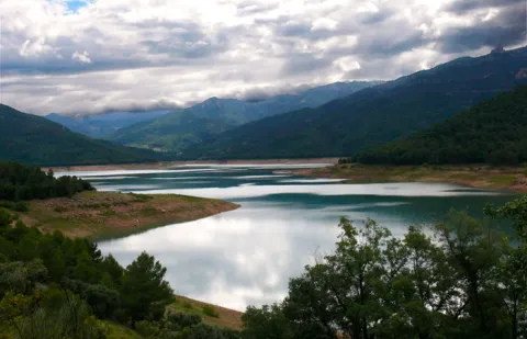
This 43 km route is one of the most classic of the Natural Park. It runs for the most part on the left side of the Tranco reservoir, so the landscape harmoniously combines the platitude of the great water sheet with the rotunity of the great mountains around it, many of them covered by dense pine trees. Not in vain, most of the area is especially protected under the figure of Bujaraiza Reserve Area.

During the first miles, the road runs very close to the Guadalquivir, in the last stretch in which its waters run free before being packed in the Tranco.

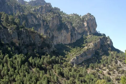
The landscape of the reservoir is purely forest, with the predominance of the carrasco pine under whose shade grows a very rich Mediterranean forest.

From the village of Cañada Morales, already near Hornos, the landscape is transformed into a mosaic of mountain olive groves, pine-covered mountains and small villages.

The route has many points to stop at, such as the views and recreational areas of the reservoir and, above all, some of the most relevant public facilities of the Natural Park, such as the Collado del Almond Wildlife Park, the Torre del Vinagre Visitors Center and the Botanical Garden of the same name. It is also worth knowing the villages near the Hornos de Segura.

Latitud
37.9801
Longitud
-2.7902
Distrito
Municipio
Ubicación en el mapa
POINT (-2.7902 37.9801)
imagen
Image
Ruta%20en%20coche%20del%20Embalse%20del%20Tranco%205.jpg
Imagen principal
Activado
imagen
Image
Ruta%20en%20coche%20del%20Embalse%20del%20Tranco.jpg
Imagen principal
Desactivado

Nature

icon-intereses-naturaleza

Friends

icon-intereses-amigos

Adventure

icon-intereses-aventura

Culture

icon-intereses-cultura

Sport

icon-intereses-deporte

Eco-friendly

icon-intereses-eco-friendly

For couples

icon-intereses-en-pareja

Family

icon-intereses-familia

Gastronomy

icon-intereses-gastronomia

Municipality

icon-intereses-municipio

Low-cost tourism

icon-intereses-turismo-low-cost

Solo travel

icon-intereses-viajar-solo
Ruta en coche del Embalse del Tranco
43 km
By car, on foot
All year round
Desactivado

We suggest...

  • The route deserves a full day, without the visit to Hornos.
  • Don't stop quietly in some of the sights and recreational areas. The views are unpayable.
  • It is appropriate to spare no time in El Collado del Almond and Torre del Vinagre, because the resources they offer will love you and will allow you to understand and admire the impressive ecological heritage of the Natural Park.
Tramo de asfalto o cemento
 
Tramo de pista o camino forestal
 
Tramo de vía pecuaria
 
Tramo de senda
 

Scenic Drive de los Miradores

Submitted by brandcode_deweloper on
Id
5713131
Breve descripción

This route runs the first 20 km that has the road A-317 from Hornos to Pontones and Santiago de la Espada. This is a very panoramic section whose seven viewpoints make it an authentic landscape route. All are equipped with parking, banks, stationery and wooden fences. Some also have tables to eat. The viewpoints have attractive ceramic panels, which serve to interpret the landscape and to know some aspects of the natural and cultural heritage of the environment.

The look at La Morra de Los Canalizos (km 31) has tables to eat. A little further we found the crosses to Hornos el Viejo and La Plantera. It is highly advisable to turn around this last village, with its scattered population and large oaks, and even down to the Tranco reservoir, to take a relaxing walk along its margin.

In the impressive Mirabuenos lookout (km 35) the views change quite a lot: from the humanized landscape of the previous lookout, with extensive olive areas and numerous cortijos and villages, we go to the vast panoramic high mountain, where the large forests dominate.

The view of Las Huelguecillas (km 36), which has tables to eat, is on an extensive promontory, and thanks to its situation as a small "peninsula" aerial we enjoy a very wide panoramic in all directions.

The Pradillos lookout (km) is the last and has a special charm for being at 1,340 m of altitude. This section of the A-317 ends when it stops climbing. You'll find a crossing and you'll have two options. If you keep going, you'll go to Pontoons and the birth of the Segura. You will find a livestock landscape, with very clear views. If you choose to turn left, you will enter a more forest landscape. You can complete your route in a circular way by returning to the Hornos de Segura on the roads of La Suma and la Garganta (A-317a).

Latitud
37.9204
Longitud
-2.9803
Distrito
Municipio
Ubicación en el mapa
POINT (-2.9803 37.9204)
imagen
Image
Ruta%20en%20coche%20de%20los%20Miradores2.jpg
Imagen principal
Activado
imagen
Image
Ruta%20en%20coche%20de%20los%20Miradores.png
Imagen principal
Desactivado
imagen
Image
MIR15.jpg
Imagen principal
Desactivado

Nature

icon-intereses-naturaleza

Friends

icon-intereses-amigos

Adventure

icon-intereses-aventura

Culture

icon-intereses-cultura

Sport

icon-intereses-deporte

Eco-friendly

icon-intereses-eco-friendly

For couples

icon-intereses-en-pareja

Family

icon-intereses-familia

Gastronomy

icon-intereses-gastronomia

Municipality

icon-intereses-municipio

Low-cost tourism

icon-intereses-turismo-low-cost

Solo travel

icon-intereses-viajar-solo
Ruta en coche de los Miradores
By car, on foot
All year round
Desactivado

Scenic Drive Cazorla - Cerrada del Utrero - Torre del Vinagre

Submitted by brandcode_deweloper on
Id
5712511
Descripción larga

Km 0. Caraway. The best way to enjoy Cazorla is to get lost in the streets of the old town and to discover some of its wonders, but on this occasion we propose some forced visits: the Plaza de Santa María, the Castle of the Yedra and some churches such as that of the Carmen or San Francisco of Renaissance style.

Km 1.5. The Iruela.Here we propose to stop you again, leave the car by the road and walk up one of the steep streets that lead to the castle that was owned by the Templars. From above you will have a beautiful view of the Guadalquivir depression. Next to the castle you can also visit the Church of Santo Domingo - and know the details of its foundation and history. Back in the car you will enjoy slimmed streets full of flowers that cheer the view.

Km 12. Air Pass lookout.We go up the road that leads us to the Natural Park and to say goodbye to the countryside, nothing better than to stop at this Mirador and enjoy its views. From here we change villages, castles and olive trees to valleys, rivers and mountains.

Km 13. View of the Port of the Doves (1200 m).The landscape changes dramatically. You will find a great panoramic view of the Alto Valle del Guadalquivir, surrounded by beautiful mountains, including the Poyos de la Mesa on the right, unmistakable by its steep cliffs. It is also a good point to observe rapacious birds such as the royal eagle or the leonate vulture.

Km 16. Valley splash.In fact, the Valley Empalme is not a stop but a crossroads. We can turn left and descend to Cold Arroyo, but at this point we will follow the right-hand option following the JF-7092 road that leads us to the Utrero Clock.

Km 19.5. Closed from the Utrel. 3.5 Km from the Empalme del Valle you can reach a bridge over the Guadalquivir River. At this point we have to leave the car. Here begins a circular route of approximately 45 minutes that we will walk. It is a charming walk next to a Guadalquivir that is going to fit in and that later receives the surprise from the air of the stream of Linarejos. Impossible.

Km 23. Valley splash.Back to the road crossing we now continue on the right, following the A-319 road towards Cold Arroyo.

Km 30. Cold Arroyo.At this point in the road we can visit the Ethnographic Museum of Arts and Customs of the Natural Park. Cold Arroyo is also a good place to take something or make some unexpected purchase.

Km 33. Tejina Recreative Area.A stop on the way to rest, relax and eat outdoors if that's your choice.

Km 40. Vinagre Tower.This is certainly a strategic place within the Park because of it some of the routes that will take you to places as famous as the Cerrada de Elias or the Laguna de Valdeazores. At this point there are also a number of facilities that allow you to know the Park. You will find information about this extraordinary enclave in the area "Passeos por el Valle."

Breve descripción

History and nature by the Guadalquivir River are the proposals for this route full of contrasts that leads us to some of the most significant points of the Natural Park of the saws of Cazorla, Segura and the Villas.

The great protagonist is, of course, the Guadalquivir River, which we will see docile in the olive and narrow and noisy countryside in the high parts of the valley where he has been in charge of modeling the magnificent landscapes we will see. You can appreciate the contrast between people full of history and culture, who live together with a natural environment that is invariable and full of life: you will find wild animals, forests that cover the whole landscape, high mountains and water everywhere.

Latitud
37.9143
Longitud
-3.0072
Municipio
Ubicación en el mapa
POINT (-3.0072 37.9143)
imagen
Image
Ruta%20en%20coche%20Cazorla%20-%20Cerrada%20del%20Utrero%20-%20Torre%20del%20Vinagre%205.jpg
Imagen principal
Activado
imagen
Image
Ruta%20en%20coche%20Cazorla%20-%20Cerrada%20del%20Utrero%20-%20Torre%20del%20Vinagre%20%281%29.jpeg
Imagen principal
Desactivado
imagen
Image
5vinagre_vista_bosque_caducifolio.jpg
Imagen principal
Desactivado
1 día

Nature

icon-intereses-naturaleza

Friends

icon-intereses-amigos

Adventure

icon-intereses-aventura

Culture

icon-intereses-cultura

Sport

icon-intereses-deporte

Eco-friendly

icon-intereses-eco-friendly

For couples

icon-intereses-en-pareja

Family

icon-intereses-familia

Gastronomy

icon-intereses-gastronomia

Municipality

icon-intereses-municipio

Low-cost tourism

icon-intereses-turismo-low-cost

Solo travel

icon-intereses-viajar-solo
Ruta en coche Cazorla - Cerrada del Utrero - Torre del Vinagre
40 km (solo ida)
By car, on foot
All year round
Desactivado

Caraway

The Vinagre Tower.

Tramo de asfalto o cemento
 
Tramo de pista o camino forestal
 
Tramo de vía pecuaria
 
Tramo de senda
 

Scenic Drive carretera de La Cumbre

Submitted by brandcode_deweloper on
Id
5712445
Breve descripción

This area is not what suggests its name, but a long and wide range of water between the basins of Guadalquivir and Segura. It is surrounded by the quiet road A-317a, through which you can enjoy a very wooded landscape dominated by larix pine pines, with some points from which a memorable panorama is dominated to the Tranco reservoir, the Las Villas saw and the Banderillas mountain range.

You can take advantage of this stretch of road to close a car circuit with the Miradores Route and the Hornos Grain road. If you want to walk, we recommend the public road that goes east in the direction of the village of Cabeza Gorda passing through the old forest house of the Fuente del Chorro, which passes through dense pine forests.

Latitud
37.9002
Longitud
-2.9701
Distrito
Municipio
Ubicación en el mapa
POINT (-2.9701 37.9002)
imagen
Image
499_img.png
Imagen principal
Activado
imagen
Image
Ruta%20en%20coche%20carretera%20de%20La%20Cumbre.jpg
Imagen principal
Desactivado

Nature

icon-intereses-naturaleza

Friends

icon-intereses-amigos

Adventure

icon-intereses-aventura

Culture

icon-intereses-cultura

Sport

icon-intereses-deporte

Eco-friendly

icon-intereses-eco-friendly

For couples

icon-intereses-en-pareja

Family

icon-intereses-familia

Gastronomy

icon-intereses-gastronomia

Municipality

icon-intereses-municipio

Low-cost tourism

icon-intereses-turismo-low-cost

Solo travel

icon-intereses-viajar-solo
Ruta en coche carretera de La Cumbre
By car, on foot
All year round
Desactivado

Trail Veredón-Mojón Blanco

Submitted by brandcode_deweloper on
Id
4982563
Descripción larga

The path from the Veredón to Mojón Blanco runs along the Pecuaria route Colada Fuente de la Teja, in Pegalajar. It allows us to climb to the peak in which the municipal terms of Pegalajar, Mancha Real and Torres are joined, and from which are seen spectacular views of the Bercho umbria, one of the most steep and wild areas of the municipal term Pegalajar. We can also enjoy amazing views of the Sierra de Jaén.

It is a relatively short path that we can complete with a visit to the beautiful village of Pegalajar and its famous pond, which in the years of abundant rains appears as a huge pond within the urban centre.

This path can be linked to those who come from the Royal Mancha, as well as other pecuary ways, or even, to the Pico Almadén.

Breve descripción

The path from the Veredón to Mojón Blanco runs along the Pecuaria route Colada Fuente de la Teja, in Pegalajar. It allows us to climb to the peak in which the municipal terms of Pegalajar, Mancha Real and Torres are joined, and from which are seen spectacular views of the Bercho umbria, one of the most steep and wild areas of the municipal term Pegalajar. We can also enjoy amazing views of the Sierra de Jaén.

It is a relatively short path that we can complete with a visit to the beautiful village of Pegalajar and its famous pond, which in the years of abundant rains appears as a huge pond within the urban centre.

This path can be linked to those who come from the Royal Mancha, as well as other pecuary ways, or even, to the Pico Almadén.

Latitud
37.7861
Longitud
-3.6286
Distrito
Municipio
Ubicación en el mapa
POINT (-3.6286 37.7861)
imagen
Image
1561_SS_05.jpg
Imagen principal
Activado
imagen
Image
Sendero%20Vered%C3%B3n-Moj%C3%B3n%20Blanco.jpg
Imagen principal
Desactivado
imagen
Image
1561_SS_04.jpg
Imagen principal
Desactivado
imagen
Image
1561_SS_02.jpg
Imagen principal
Desactivado
1 h 30 min

Nature

icon-intereses-naturaleza

Friends

icon-intereses-amigos

Adventure

icon-intereses-aventura

Culture

icon-intereses-cultura

Sport

icon-intereses-deporte

Eco-friendly

icon-intereses-eco-friendly

For couples

icon-intereses-en-pareja

Family

icon-intereses-familia

Gastronomy

icon-intereses-gastronomia

Municipality

icon-intereses-municipio

Low-cost tourism

icon-intereses-turismo-low-cost

Solo travel

icon-intereses-viajar-solo
Medium
Sendero Veredón-Mojón Blanco
2,9 km
On foot
All year round
Desactivado
  • In front of COVID19, keep the safety distance and carry a mask, avoid agglomerations and contact with surfaces, wash your hands frequently, use hydroalcoholic gel and consult the available digital materials. Take care of your health and others.
  • It works to prevent fires. Do not throw cigarettes or any other object that produces combustion.
  • By consuming local products and having companies in the area you will contribute to rural development.
  • He lives with the local people and other users. It respects private property and property.
  • Unwind in a sustainable way: public transport, bike, walk, shared vehicle...
  • Noise is another form of pollution. In silence you will enjoy your experience more.
  • It facilitates the use of people with special needs.
  • The trash doesn't come back alone. Take her with you to the nearest container. Reduce, reuse, recycle.
  • Don't leave a mark on your way through nature.
  • It practices a responsible and committed tourism with the environment. Be a real ecotourist!
  • Respect the facilities at your disposal. We all pay for your maintenance.
  • Check the weather forecast before starting your activity.
  • Avoid going out alone. If you do, it communicates tour and time of return to other people.
  • Extreme caution under adverse conditions and with the occasional presence of animals or motor vehicles.
  • Please provide prior information on the possible existence of cynegetic activity.
  • It has water, sun protection, proper clothes and shoes.
  • It carries a mobile with enough battery in case of emergency (112), but remember that there is not always coverage.
  • Don't even bother animals. You would negatively alter his behavior.
  • For your safety and the safety of the environment, don't get out of the signposted road or take shortcuts.
  • Remember that the capture of animals, light fire, fish and collect plants or minerals is prohibited.
  • If you bring a dog, take him with his strap and make sure he doesn't bother other animals or people.
  • Your safety is our concern, but it's your responsibility.

Thank you for your cooperation!

From the city centre of Pegalajar itself, go along the Vereda Real Ubeda-Granada, along the track leading to Mount Bercho. The path begins about 5 km from the village.

Tramo de asfalto o cemento
 
Tramo de pista o camino forestal
 
Tramo de vía pecuaria
 
Tramo de senda
 

Trail Ascent to Hoando de la Laguna

Submitted by brandcode_deweloper on
Id
4982394
Descripción larga

We begin our itinerary on the way to Los Orchertos, between olive groves and orchards irrigated by the waters of the Garganton River that are transported through the existing waterfalls. Then we link with the pecuaria track, which ascends between aulagas and rosemary by this path used for transhumanism. In our tour we will see the Torre del Lucero, a relatively well-preserved atalaya, which during the Reconquest (XIII-XV) was part of the defensive system of the kingdom of Granada.

From the Collado del Lucero we see the castles of Bélmez and Solera and we enter into an encore mixed with some maple. We walk through a Kárstico modeling landscape, a limestone that culminates with a dolina known as the Hoyo de la Laguna, the largest of this protected space.

From the end of the path you can link with the signposted path Caño del Aguadero, with beginning in the recreational area Cuadros.

Breve descripción

This beautiful path has its beginning next to the park of the Birth, located in the urban town of Bélmez de la Moraleda, entering into the heart of the Sierra Magina Natural Park by the Cordel de la Laguna. In this area we can see the agricultural, livestock and forestry uses of the area, various defensive constructions and the Arctic modeling of Sierra Magina.

Latitud
38.1104
Longitud
-2.5903
Distrito
Ubicación en el mapa
POINT (-2.5903 38.1104)
imagen
Image
1552_SS_05.jpg
Imagen principal
Activado
imagen
Image
Sendero%20Subida%20al%20Hoyo%20de%20la%20Laguna2.jpg
Imagen principal
Desactivado
imagen
Image
1552_SS_04.jpg
Imagen principal
Desactivado
imagen
Image
1552_SS_01.jpg
Imagen principal
Desactivado
2 h 30 min

Nature

icon-intereses-naturaleza

Friends

icon-intereses-amigos

Adventure

icon-intereses-aventura

Culture

icon-intereses-cultura

Sport

icon-intereses-deporte

Eco-friendly

icon-intereses-eco-friendly

For couples

icon-intereses-en-pareja

Family

icon-intereses-familia

Gastronomy

icon-intereses-gastronomia

Municipality

icon-intereses-municipio

Low-cost tourism

icon-intereses-turismo-low-cost

Solo travel

icon-intereses-viajar-solo
Medium
Sendero Subida al Hoyo de la Laguna
5,5 km
On foot
All year round
Desactivado
  • In front of COVID19, keep the safety distance and carry a mask, avoid agglomerations and contact with surfaces, wash your hands frequently, use hydroalcoholic gel and consult the available digital materials. Take care of your health and others.
  • It works to prevent fires. Do not throw cigarettes or any other object that produces combustion.
  • By consuming local products and having companies in the area you will contribute to rural development.
  • He lives with the local people and other users. It respects private property and property.
  • Unwind in a sustainable way: public transport, bike, walk, shared vehicle...
  • Noise is another form of pollution. In silence you will enjoy your experience more.
  • It facilitates the use of people with special needs.
  • The trash doesn't come back alone. Take her with you to the nearest container. Reduce, reuse, recycle.
  • Don't leave a mark on your way through nature.
  • It practices a responsible and committed tourism with the environment. Be a real ecotourist!
  • Respect the facilities at your disposal. We all pay for your maintenance.
  • Check the weather forecast before starting your activity.
  • Avoid going out alone. If you do, it communicates tour and time of return to other people.
  • Extreme caution under adverse conditions and with the occasional presence of animals or motor vehicles.
  • Please provide prior information on the possible existence of cynegetic activity.
  • It has water, sun protection, proper clothes and shoes.
  • It carries a mobile with enough battery in case of emergency (112), but remember that there is not always coverage.
  • Don't even bother animals. You would negatively alter his behavior.
  • For your safety and the safety of the environment, don't get out of the signposted road or take shortcuts.
  • Remember that the capture of animals, light fire, fish and collect plants or minerals is prohibited.
  • If you bring a dog, take him with his strap and make sure he doesn't bother other animals or people.
  • Your safety is our concern, but it's your responsibility.

Thank you for your cooperation!

From the A-401 take the region road JA-4201 or the region JA-4202 to reach the municipality Bélmez de la Moraleda. The path begins in the urban core itself, at the end of Sierra Magina Avenue.

Trail Pine Forest of Cánava

Submitted by brandcode_deweloper on
Id
4982102
Descripción larga

We began our path in the hermitage of the Virgin of Cánava, near a beautiful square with a magnificent fountain of several years, and with a thick grove around.

Breve descripción

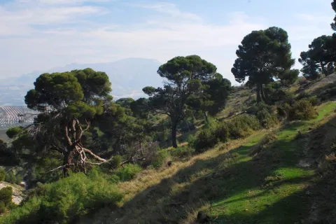
The singularity of this corner of Sierra Magina is undeniable: a forest anchored in the past that for years has remained unchanged. A rise to a pine forest that has been preserved in a state very close to the natural one and which, therefore, retains an unusual beauty intact.

This pine was declared a Pinar Natural Monument of Canavas by the Junta de Andalucía on November 23, 2001. It belongs to the municipal term of Jimena, and is one of the few centenary forests of carrasco pine that remain in Andalusia, with specimens up to 250 years. It borders the edge of the limestone mountain massif and the countryside of the Jaén olive groves. On the way we will access unforgettable landscape panorama and we will be able to observe a wide variety of flora and fauna associated with the different areas to be crossed.

Latitud
37.8244
Longitud
-3.3956
Distrito
Municipio
Ubicación en el mapa
POINT (-3.3956 37.8244)
imagen
Image
1116_SS_02.jpg
Imagen principal
Activado
imagen
Image
Pinar_de_c%C3%A1nava.jpg
Imagen principal
Desactivado
imagen
Image
1116_SS_10.jpg
Imagen principal
Desactivado
imagen
Image
1116_SS_07.jpg
Imagen principal
Desactivado
1 h

Nature

icon-intereses-naturaleza

Friends

icon-intereses-amigos

Adventure

icon-intereses-aventura

Culture

icon-intereses-cultura

Sport

icon-intereses-deporte

Eco-friendly

icon-intereses-eco-friendly

For couples

icon-intereses-en-pareja

Family

icon-intereses-familia

Gastronomy

icon-intereses-gastronomia

Municipality

icon-intereses-municipio

Low-cost tourism

icon-intereses-turismo-low-cost

Solo travel

icon-intereses-viajar-solo
Baja - Media
Sendero Pinar de Cánava
1,7 km
On foot
All year round
Desactivado
  • In front of COVID19, keep the safety distance and carry a mask, avoid agglomerations and contact with surfaces, wash your hands frequently, use hydroalcoholic gel and consult the available digital materials. Take care of your health and others.
  • It works to prevent fires. Do not throw cigarettes or any other object that produces combustion.
  • By consuming local products and having companies in the area you will contribute to rural development.
  • He lives with the local people and other users. It respects private property and property.
  • Unwind in a sustainable way: public transport, bike, walk, shared vehicle...
  • Noise is another form of pollution. In silence you will enjoy your experience more.
  • It facilitates the use of people with special needs.
  • The trash doesn't come back alone. Take her with you to the nearest container. Reduce, reuse, recycle.
  • Don't leave a mark on your way through nature.
  • It practices a responsible and committed tourism with the environment. Be a real ecotourist!
  • Respect the facilities at your disposal. We all pay for your maintenance.
  • Check the weather forecast before starting your activity.
  • Avoid going out alone. If you do, it communicates tour and time of return to other people.
  • Extreme caution under adverse conditions and with the occasional presence of animals or motor vehicles.
  • Please provide prior information on the possible existence of cynegetic activity.
  • It has water, sun protection, proper clothes and shoes.
  • It carries a mobile with enough battery in case of emergency (112), but remember that there is not always coverage.
  • Don't even bother animals. You would negatively alter his behavior.
  • For your safety and the safety of the environment, don't get out of the signposted road or take shortcuts.
  • Remember that the capture of animals, light fire, fish and collect plants or minerals is prohibited.
  • If you bring a dog, take him with his strap and make sure he doesn't bother other animals or people.
  • Your safety is our concern, but it's your responsibility.

Thank you for your cooperation!

As a surprise and a complement to this path, we can go a little more than 100 meters and reach the Caracoles, an ancient and magical village of quarries that worked the round mill stone, in which we will find some of its unique buildings in dry stone.

Up to Jimena for the A-320 (Real- Bedmar Mancha) connects with the A-316 (Estepa-Ubeda) and the A-401 (Ubeda-Moreda). From there go to the upper part of the village to the hermitage of the Virgin of Canava, where you will find the beginning of the path.

Tramo de asfalto o cemento
 
Tramo de pista o camino forestal
 
Tramo de vía pecuaria
 
Tramo de senda
 

Trail las Viñas

Submitted by brandcode_deweloper on
Id
4981725
Descripción larga

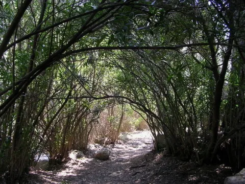
It begins in the recreational area of Cuadros, parallel to the Aldelfal de Cuadros trail, which allows us to enjoy beautiful views of the adelfal and its pink flowers in spring and summer. Little by little we will go up and get to know the main water births of Bedmar (Los Sistillos), always accompanied by the extraordinary views of this unique site.

In our ascent we will find the cornicabra abundantly. This plant acquires tones from yellow to red in the autumn, the best time to appreciate the beauty of these formations.

We will go up to privileged locations from which we will see wide panoramic views of the Sierra Magina Natural Park. A varied vegetation will be offered at our pace, both natural and cultivated. And we will also be able to know something about the history and heritage of these mountains.

If we turn a little bit, we can visit the view-conditioning at the Torreón de Cuadros. This watchtower looks at the steep valley of the Cuadros River and a beautiful landscape of gardens and crops. The contrast of this landscape well deserves that little effort as it deviates.

Breve descripción

This is a circular path of making it difficult to average, in which we will find a great diversity of very interesting elements.

Latitud
37.8244
Longitud
-3.3956
Distrito
Municipio
Ubicación en el mapa
POINT (-3.3956 37.8244)
imagen
Image
724_SS_04.jpg
Imagen principal
Activado
imagen
Image
sendero%20las%20vi%C3%B1as.jpg
Imagen principal
Desactivado
imagen
Image
724_SS_06.jpg
Imagen principal
Desactivado
imagen
Image
724_SS_05.jpg
Imagen principal
Desactivado
3 h

Nature

icon-intereses-naturaleza

Friends

icon-intereses-amigos

Adventure

icon-intereses-aventura

Culture

icon-intereses-cultura

Sport

icon-intereses-deporte

Eco-friendly

icon-intereses-eco-friendly

For couples

icon-intereses-en-pareja

Family

icon-intereses-familia

Gastronomy

icon-intereses-gastronomia

Municipality

icon-intereses-municipio

Low-cost tourism

icon-intereses-turismo-low-cost

Solo travel

icon-intereses-viajar-solo
Medium
Document
Sendero las Viñas
8,7 km
On foot
All year round
Desactivado

Recreative area of squares

  • In front of COVID19, keep the safety distance and carry a mask, avoid agglomerations and contact with surfaces, wash your hands frequently, use hydroalcoholic gel and consult the available digital materials. Take care of your health and others.
  • It works to prevent fires. Do not throw cigarettes or any other object that produces combustion.
  • By consuming local products and having companies in the area you will contribute to rural development.
  • He lives with the local people and other users. It respects private property and property.
  • Unwind in a sustainable way: public transport, bike, walk, shared vehicle...
  • Noise is another form of pollution. In silence you will enjoy your experience more.
  • It facilitates the use of people with special needs.
  • The trash doesn't come back alone. Take her with you to the nearest container. Reduce, reuse, recycle.
  • Don't leave a mark on your way through nature.
  • It practices a responsible and committed tourism with the environment. Be a real ecotourist!
  • Respect the facilities at your disposal. We all pay for your maintenance.
  • Check the weather forecast before starting your activity.
  • Avoid going out alone. If you do, it communicates tour and time of return to other people.
  • Extreme caution under adverse conditions and with the occasional presence of animals or motor vehicles.
  • Please provide prior information on the possible existence of cynegetic activity.
  • It has water, sun protection, proper clothes and shoes.
  • It carries a mobile with enough battery in case of emergency (112), but remember that there is not always coverage.
  • Don't even bother animals. You would negatively alter his behavior.
  • For your safety and the safety of the environment, don't get out of the signposted road or take shortcuts.
  • Remember that the capture of animals, light fire, fish and collect plants or minerals is prohibited.
  • If you bring a dog, take him with his strap and make sure he doesn't bother other animals or people.
  • Your safety is our concern, but it's your responsibility.

Thank you for your cooperation!

From the village of Bedmar we will take the road leading to the Sanctuary of the Virgin of Cuadros, just before crossing the bridge over the river we will deviate on the left track until we reach the recreational area Adelfal de Cuadros, the starting point of this path.

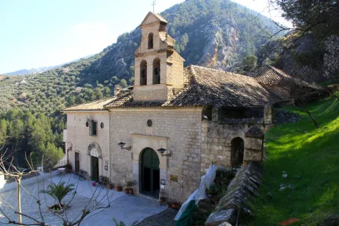
To end the path we will pass by the beautiful hermitage of the Virgin of Cuadros, and next to the impressive Cueva del Agua, ideal to visit in summer and refresh, if we want to walk within the river and discover three caves through which the river runs forming spectacular formations as a result of the water's spread over time. In this case, it is recommended to wear shoes and clothes for water.