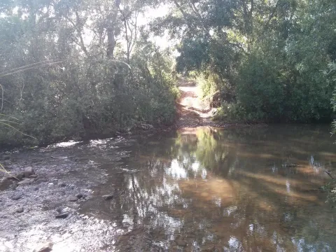
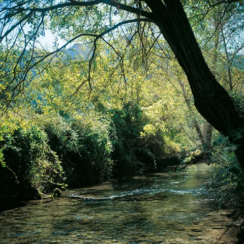
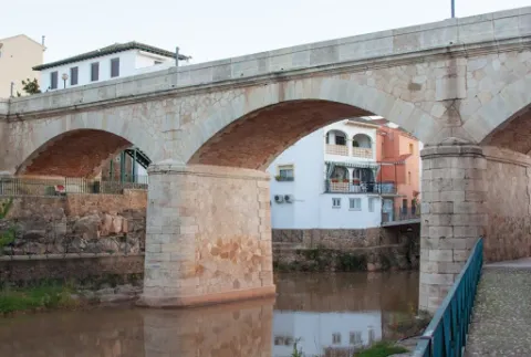
Río Guadalimar
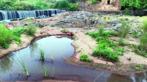
It receives from the right to the rivers Onsares, Guadalmena and Guadalén. On the left to the rivers Cotillas, Arroyo Frio, Carrizas, Morles, Trujala and the creek of Peñolite. On its way through the Sierra de Segura.
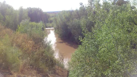
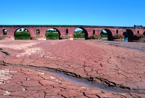
In Roman times it was called the Tago, Tagus or Tugio River, just as its birth was the Sierra de Tugia. Its Arabic name "wad al-ihmar" means "red river," which is curiously as it is called in the area, by the red color of its waters.
The Guadalimar River is a river in the south of Spain, a tributary of the Guadalquivir River that is born at the foot of the Sarga peak (1770 m.), in the Alcaraz Sierra, in the province of Albacete, resulting from the confluence of several streams in the surroundings of Villaverde de Guadalimar. It provides its waters to the Guadalquivir in the municipality of Jabalfifth (Jaén province).
The forest track, 9 km long, is very pleasant to travel and has no loss, as it is only to follow right, and is also marked as GR-7. It always runs by the river, with very little level, except in a section where it is separated by forming several elevation curves.
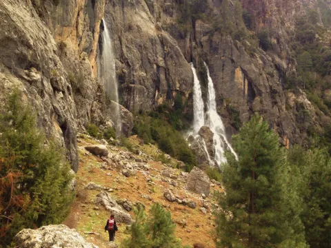
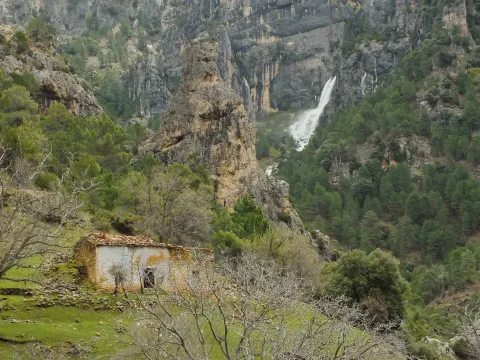
It is not necessary to travel throughout to enjoy these places, but if you arrive at the end you will find a lookout with unforgettable views of the Reco del Aguamulas. It is the rocky amphitheatre where this river is born, on whose base there are abandoned meadows and gardens.
You will also see the cords - already ruin - of La Fresneilla. In them lived the last inhabitant of these valleys, called Máximo Fernández Cruz, nicknamed "the Cojo de la Fresnedilla." This serrano character fought for thirty years not to leave the land he was born, from which were expelled the close to a hundred neighbors of the Aguamulas environment who suffered expropriation when the National Cote of Hunting was created in 1960. In 1982, Maximo paid for his resistance with the prison.
We suggest...
In the campsite Llanos de Arance (road A-319) you have to take the forest track that crosses the Guadalquivir. At 3 km, after wading the Aguamulas, the crossing is taken to the right and followed 1 km to the barrier in the forest house of Los Bonal, where you can leave the car.
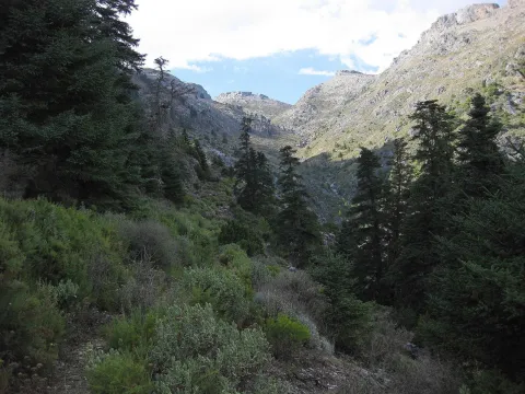
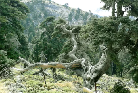
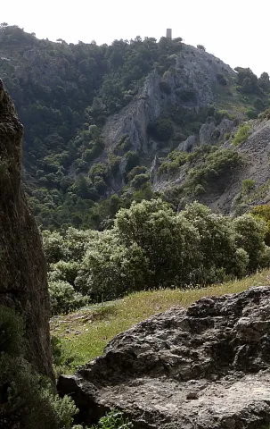
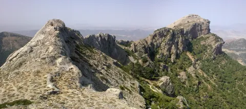
The Aguamulas is a small tributary of the Guadalquivir that runs one of the most beautiful valleys of the park, forming numerous rapids and pozas. It is enjoyed walking through a nice forest track between pine trees, in the shadow of which is developed a thick Mediterranean vegetation with oaks, madroños, lentils and cornicabra. At the bottom are the impressive walls of the Banderillas, whose summit is about 2,000 m high.
With an external appearance similar to that of other rural cortijos, it now retains remains of what was an ancient hermitage, called the hermitage of San Ildefonso.
As in most rural areas of Jaén, these ancient cortijos of the 18th and 19th centuries are owned by large families and have over the years served as a residence for farm workers and olive collectors.
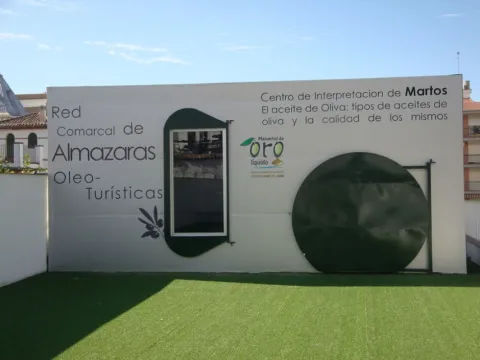
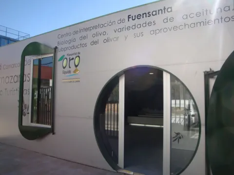
The Network is made up of nine Interpretation Centres in Almazaras Oileteras in the Sierra Sur de Jaén for the promotion of olive cultivation. Each Centre has a different theme on various aspects related to olive oil, such as olive oil production systems and evolution throughout history, olive oil qualities and uses, olive oil cultivation systems, olive oil analysis and olive oil marketing system, olive biology, olive varieties, olive by-products, olive oil and its uses, olive heritage, traditions, olive oil types and olive oil quality and history.
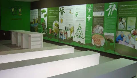
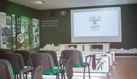
The Interpreting Centres have a space of about 85 square meters arranged for interpretation, teaching and tourism use, equipped with latest technology such as touch screen, and multitactile, to enjoy games and multimedia application, interpretative panels or 3D projection canyon.
It is intended to take advantage of olive oil and olive oil, very abundant resources in the region, such as tourism resources, to value the idle resources (facilities, machinery, documentation etc.) of the almazaras, for as long as they are not in the full process of collecting and producing oil, to promote knowledge about the different uses of the olive and olive oil, to promote knowledge of the culture, traditions and related customs, and to diversify the comarcal tourist offer by taking advantage of the resources available such as the almazaras, olive and olive oil.
Oilticulture will be promoted and disseminated in a didactic, dynamic and attractive way for a wide range of audiences, from thematic staff, professionals from the olive sector, people from school or training ages, to tourists or local audiences. Visitors will be able to connect intellectually and emotionally, through the Network's interpretative script, to the fascinating world of cultural and ethnographic heritage that olive oil and olive oil form around them.
The Comarcal Network of Almazaras Ole- touristic can be visited through the tourist route that connects the nine Interpretation Centres with the main tourist attractions of the municipalities of the Sierra Sur de Jaén: Alcalá la Real, Alcaudete, Castillo de Locubín, Friiles, Fuensana, Jamilena, Martos, Torredelcampo, Valdepeñas de Jaén and Los Villares can be traveled under the enigmas of liquid gold and the sea of olive trees that shape the orography of this territory. On the other hand, the visit to the Centres will be completed with an internal route through the facilities of the milling plants that make up the Network, adapted to the resources, and particular characteristics of each of them and of the visiting public.
The project is funded by the European Agricultural Fund for Rural Development (EAFRD) at 40% in the framework of the Global Action Plan, of the Council for Agriculture, Fisheries and the Environment, and by 60% from the Sustainable Tourism Initiative - Lands of Romance and Legend, of the Council for Tourism and Trade.
TheComarcal Network of Almazaras Ole- touristis a project promoted by the Association for Rural Development of the South Sierra de Jaén (ADSUR). It is a commitment to economic diversification by taking advantage of the tourist potential that the mills offer as a factor of sustainable development and as an element of territorial identity.
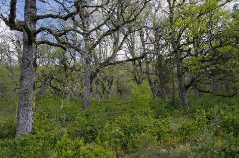
The Barrio del Guadalentín is one of the best complaints forests in the park. Among the complaints, on the other side of the ravine, the Poyos de la Carilong rise majestic. The whole set, whimsical, river and rocky fleshly make this walk a true enjoyment of our nature.
In other times, one of the most widespread forest formations in the mountains was the deniigal, embedded in deep soils, with abundant organic matter and quality. In this forest the dominant tree is the whine (Quercus faginea). In the colonization of the saw the human being occupied these rich and fertile soils for use, cutting the forest and taking advantage of its offal as fuel and material for construction. Later on it was the naval industry that was supplied with the wood of the Robledals or Robledals. In our days, the robledal, as it is named in the saw, survives in areas that are short-lived, in bright slopes and in the bottom of valleys like rodents or bosquets.
The complaints (Quercus faginea) are accompanied by some salgarean pine (Pinus nigra salzmannii) and some oaks (Quercus ilex ballota). In the forest, we find trees such as cereals (Prunus mahaleb) and pespejones (Sorbus torinlis), and shrubs such as majuelos (Crataegus monogina), skirmishes (Rosa spp.), laureolas (Daphne laureola), thorns (Berberis vulgaris australis). And by covering the ground, we find a herbaceous entourage among which we highlight grasses such as Brachypodium sylvaticum, Brachypodium phoenocoids, Festuca arundinacea, Dactylis glomerata, and Piptaterum meliaceum. Other species that we find in the complaint are the gold button (Geum sylvaticum), violets (Viola odorata), primaveras (Primula vulgaris), consueldas (Prunella grandiflora, P. laciniata, P. vulgaris), filippines (Filipendula vulgaris), eléboros (Helleborus foetidus), narcissos (Narcissus triandrus pallidulus) and wild jacintos (Scilla paui).
LOCATION
To access, we follow the road from Vadillo Castril to the San Pedro Navy. At the height of Los Collados it becomes a ground track, but with good firm. As we overcome the San Pedro Navy, we will be waiting for the second detour to our right. It is a closed track to the traffic of vehicles that is located a few meters from the old forest house of Fuente Steel, which is currently abandoned, but is kept standing and seen from the track. As we pass through it, about 200 meters away we find the detour, where we park and walk along the track. We will soon begin to enter a splendid forest of complaints.
Environ del Barranco del Guadalentín
With regard to the faunistic species that inhabit the environment, mention the wolf, the lince, the otter, the imperial eagle, the royal eagle or the azor.
Location: To the north-east of the town, in the heart of the Natural Park of Despeñacolos.
Distance: 16 km.
Medium: Tourism vehicle.
Access route: Departing from the village by the highway of Andalusia in the sense of Madrid and taking, to the right and after going about 6 km, the road J-6.110 towards Aldeaquemada.
This enclave, which belongs to the Natural Park of Despeñacolos, stands out for its biodiversity; thus, among the plant species present, there are complaints, alcornoques, maples and other typical of the humid Mediterranean forest.
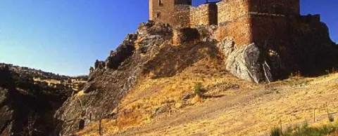
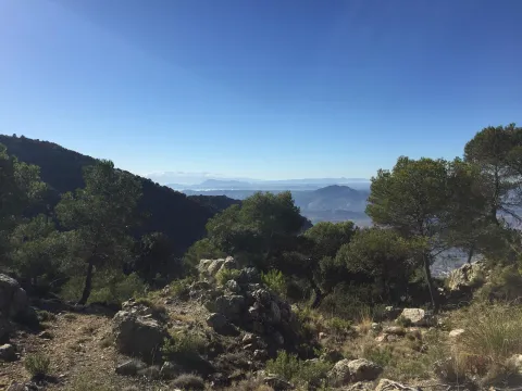
From the watchtower we will be able to contemplate a panoramic that will help us to know the environment better. Looking south a large ravine, which is named after the port, communicates the hill with the stepparian Valle del Guadiana Menor. The ravine is narrowed at the end in a rocky portico, which served for the Arabs to build the fortin of the Castle of Peña Negra. Once the Muslims were expelled, the new occupants raised the Tícar Sanctuary over the walls of the fortress. Looking to the west, the Peña de las Carboneras, one of the summits of the smallest and colecte orographic unit of the mountain massif, stands at the front: the Quesada saw, which houses numerous rock paintings of the Levine art, considered by UNESCO as the World Heritage Site.
To the north our view is lost in the olive sea of the Jiennense countryside, which as waves in a time, is aggressive in the slopes of the Cazorla saw, whose alignment is clear to the right of the olive tree. As we look east, our view inevitably stops at the Rayal Picon (1,834 m of altitude), the first important elevation of the Sierra de Cazorla from the south and impressive limestone mole that has a vertical cut on its north face. The name Rayal was synonymous with the border in the Middle Ages and the torreon in which we are located reminds us that this space was a border with the Nazareth Kingdom of Granada for almost three centuries.
We suggest...
The Port of Tiscar is the highest point on the road A-6206, the winding mountain road that unites Quesada with the two southernmost villages of the Natural Park: Pozo Alcón and Hinojares. To get to this beautiful hill, if we leave from Quesada, at the exit we will continue straight, avoiding to the right the detour to Huesa (there is an indicator to the Port of Tíscar), until the rise, about 8.5 km later, where we find a signal indicating the location and altitude. From Hinojares (18 km) and Pozo Alcón (23 km) you have to take the A-6206 inverse to the previous one, always direction to Quesada at all the crosses.
The Port of Tíscar is not only the mountain barrier to be saved to go to the Sanctuary of Our Lady of Tíscar, the historical patron of the advance of Cazorla and now of Quesada, and one of the most emblematic religious symbols of these mountains. It is an agribusiness area, with spectacular views, where it is easy to see the mountain goat, a corner full of history and nature. Leaving the vehicle in the parking areas in the same port, taking a small walk we arrive to a medieval watchtower, the Atalaya del Infante Don Enrique (14th century), an excellent lookout, with views to which for nothing in the world we must give up if we are there.
It is a one-eye bridge made up of a half-point arch, quite robust and with pillars and paraments that make a curve to the Cañamares River. The shillery is well worked and is quite regular in size.
It has traditionally been given as a certain chronology for this construction the first centuries of the Christian era coinciding with the Roman presence on our lands, and the proximity of the Almansas, where there was an important settlement at the time.
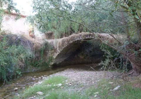
In Puente de Génave we find the Old Bridge or Roman Bridge, on the river Guadalimar, of stone, reduced arch and one eye, in which the masonry is alternated with the silery. They highlight the environment and configuration of the village, being a forming element of the settlement of the village around the river and an essential step to know the riverside and its implementation in the territory.