Saltar al contenido principal
icon-intereses-municipio

Museum of Alfarería "Paco Tito"

Submitted by brandcode_deweloper on
Id
2279201
Descripción
Breve descripción

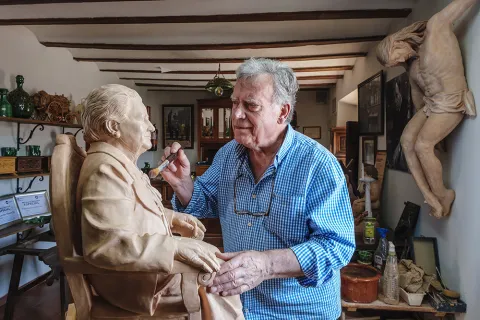
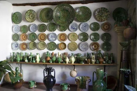
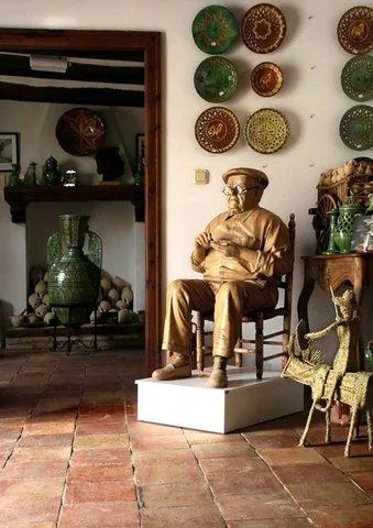
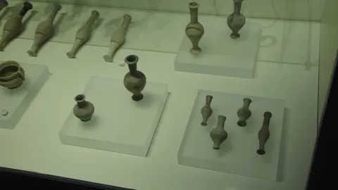
The museum houses reproductions of the traditional pieces of the ubetense pottery as well as pieces as curious as a baptismal pile, a parrot or even a bathtub; collected during the extensive career as potter of Paco Tito. You can visit the exhibition and at the same time have the opportunity to contemplate the potter working in the centenary worker.

Telecomunicaciones
Sitio web
https://pablotito.es/
Teléfono de contacto
953 751 496
Correo electrónico
museo@pacotito.com
Ubicación
Código Postal
23400
Latitud
38.012530
Longitud
-3.364120
Dirección
C/ de Valencia, 22
Municipio
Ubicación en el mapa
POINT (-3.36412 38.01253)
Tipos de punto de interés
Imágenes carrusel
imagen
Image
Ubeda%20alfar%20pablo%20tito.jpg
Imagen principal
Desactivado
imagen
Image
tito1.jpg
Imagen principal
Desactivado
imagen
Image
image_105805.jpeg
Imagen principal
Desactivado
imagen
Image
26456567085_2366ce5130_b.jpg
Imagen principal
Desactivado
imagen
Image
museo-de-alfareria-paco.jpg
Imagen principal
Desactivado
imagen
Image
image_105807.jpeg
Imagen principal
Desactivado
Imágenes cabecera
imagen
Image
Ubeda%20alfar%20pablo%20tito%202.jpg
Imagen principal
Activado
Horario
Monday to Saturday: 08: 30 - 14: 00 and 16: 00 - 20: 00. Saturdays: 08: 00 - 14: 00 and 17: 00 - 20: 00. Sundays and holidays: 10: 00 - 13: 30.
Microsite al que pertenece
Loading map
Preparing points of interest and routes...

Jaén Cathedral Museum

Submitted by brandcode_deweloper on
Id
2279105
Descripción
Breve descripción

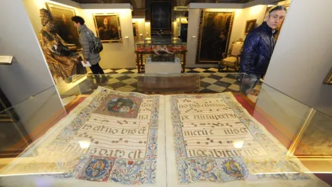
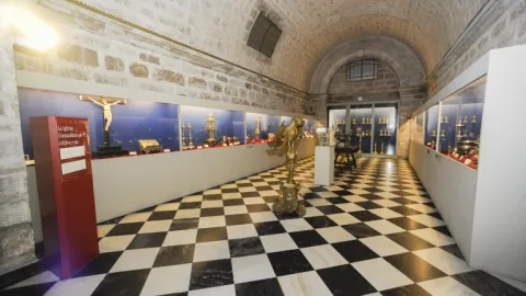
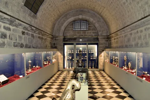
Museum located in the cathedral of Jaén, in the old pantheon of Canonigo. The exhibition of Sacred Art is distributed in four sections: History of Salvation (ancient alliance); Jesus Christ, fullness: Incarnation and Redemption; Mary and the Church (evangelization, worship and charity); and the end of time: eschatology.

Ubicación
Nombre
Exposición Permanente de Arte Sacro
Código Postal
23002
Latitud
37.765949
Longitud
-3.789911
Distrito
Municipio
Ubicación en el mapa
POINT (-3.789911 37.765949)
Tipos de punto de interés
Imágenes carrusel
imagen
Image
11%20%281%29.jpg
Imagen principal
Desactivado
imagen
Image
10%20%282%29.jpg
Imagen principal
Desactivado
imagen
Image
12.jpg
Imagen principal
Desactivado
imagen
Image
13.jpg
Imagen principal
Desactivado
imagen
Image
14.jpg
Imagen principal
Desactivado
Imágenes cabecera
imagen
Image
DSC_0068.jpg
Imagen principal
Activado
Horario
Monday to Saturday: 10: 00 - 14: 00 and 16: 00 - 19: 00. Sundays: 10: 00 - 12: 00 and 16: 00 - 19: 00.
Loading map
Preparing points of interest and routes...

Archaeological Museum of Úbeda

Submitted by brandcode_deweloper on
Id
2343886
Descripción
Descripción larga

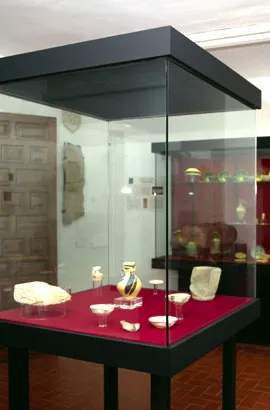
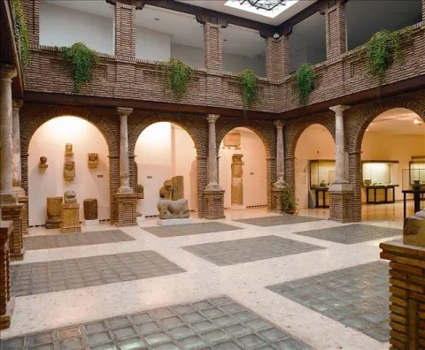
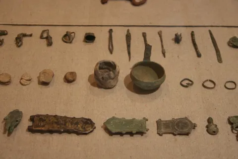
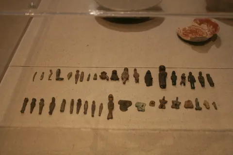
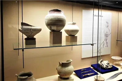
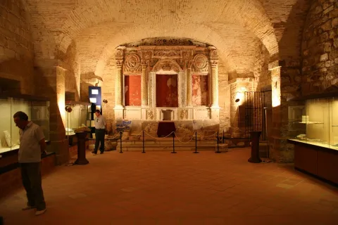
The museum building is especially remarkable, as it is a Mudejar house, a beautiful 14th-century building discovered during some works. It is known as Casa Mudéjar and presents a repertoire of pieces of paleolithic deposits of the province and objects of the Bronze Age excavated in the Alcázar district of the urban nucleus of Ubeda. The Roman-era pieces come from Ubeda, the Old One (the Salary Colony founded by Augusto). We also find pieces from the Iberian site of Castellones de Ceal and Iberian exvotes from the Collado de los Jardines Sanctuary.

Breve descripción

The Museum of Ubeda was created as a Section of the Museum of Jaén according to a 1972 decree (964 / 1972 of 16 March) in order to "gather, preserve and expose in it all works of artistic, archaeological and historical interest to serve as an educational element and to be exponents of the history and culture of that town."

Telecomunicaciones
Sitio web
www.museosdeandalucia.es/web/museoarqueologicodeubeda
Teléfono de contacto
953 779 432
Correo electrónico
museoarqueologicoubeda.ccul@juntadeandalucia.es
Ubicación
Código Postal
23400
Latitud
38.010550
Longitud
-3.368010
Dirección
C/ Cervantes, 6
Municipio
Ubicación en el mapa
POINT (-3.36801 38.01055)
Tipos de punto de interés
Imágenes carrusel
imagen
Image
1%20%281%29.jpeg
Imagen principal
Desactivado
imagen
Image
7622242704_2c85fd8386_b.jpg
Imagen principal
Desactivado
Imágenes cabecera
imagen
Image
article%20%281%29.jpg
Imagen principal
Activado
Horario
Wednesday to Saturday: 09: 00 - 20: 30. Tuesday: 14: 30 - 20: 30. Sundays and holidays: 09: 00 - 14: 30.
Microsite al que pertenece
Loading map
Preparing points of interest and routes...

Archaeological Museum of Linares - Casa del Torreón

Submitted by brandcode_deweloper on
Id
6243021
Descripción
Breve descripción

Museum located in the so-called Torreón house, an old 17th-century palace belonging to the Dávalos family. The centre was established in 1956 thanks to the initiative of Mr Rafael Contreras de la Paz. The material exposed belongs almost exclusively to the remains found in the ancient Iberorromanic city of Catulo. The exhibition is structured on three floors: low, basement and first.

Telecomunicaciones
Sitio web
https://castulolinares.com/visita/museo/
Ubicación
Código Postal
23700
Latitud
38.093240
Longitud
-3.634420
Dirección
C/ Gral. Echagüe, 2
Distrito
Municipio
Ubicación en el mapa
POINT (-3.63442 38.09324)
Tipos de punto de interés
Imágenes carrusel
imagen
Image
museo%20arqueologico%20de%20linares%202.jpg
Imagen principal
Desactivado
imagen
Image
21linar.jpg
Imagen principal
Desactivado
Imágenes cabecera
imagen
Image
_MG_1767.JPG
Imagen principal
Activado
Horario
1 ene - 15 Jun: 09: 00 - 20: 00. 16 Jun - 15 sept: 09: 00 - 15: 00. 16 sept - 31 Dec: 09: 00 - 20: 00. Sundays and holidays: 09: 00 - 15: 00. Closed Monday and 1 ene, 1 may, 24, 25 and 31 Dec.
Microsite al que pertenece
Loading map
Preparing points of interest and routes...

Iberian Museum of Castellar

Submitted by brandcode_deweloper on
Id
4653611
Descripción
Descripción larga

It has two exhibition rooms and a courtyard of weapons, where the archaeological pieces of greater dimensions and weight are concentrated. Throughout the visit we can see various backgrounds, the fruit of the historical, cultural, archaeological, artistic and social development of Castellar.
From the prehistoric time we found axes and various stone supplies.

On the ground floor the remains of a Roman-era field have been musealized: coins, columns of buildings, etc.

In the next floor, objects of the Iberian culture of the Cueva de la Lobera shrine are exposed, one of the numerous archaeological sites of the municipal term of Castellar, a town whose origins are located in the final period of the Copper Age and the beginning of the Bronze Age.

Breve descripción

The museum is located within the tower of tribute (main tower of a fortress) of the 14th century Palace of Medinacelli, known as the Castle of Pallarés.

Telecomunicaciones
Teléfono de contacto
953 460 005
Correo electrónico
ayucastellar@castellariegos.com
Ubicación
Latitud
38.255880
Longitud
-3.128810
Dirección
Plaza de la Constitución, 1
Distrito
Municipio
Ubicación en el mapa
POINT (-3.12881 38.25588)
Tipos de punto de interés
Imágenes carrusel
imagen
Image
Castellar%20028.jpg
Imagen principal
Desactivado
imagen
Image
Castellar%20032.jpg
Imagen principal
Desactivado
imagen
Image
Castellar%20030.jpg
Imagen principal
Desactivado
Imágenes cabecera
imagen
Image
Castellar%20038.jpg
Imagen principal
Activado
Horario

Monday to Friday: 09: 00 - 14: 00. Groups off schedule: contact Lucas Rubio, 953 460 005.

Loading map
Preparing points of interest and routes...

Arjona Archaeological Museum

Submitted by brandcode_deweloper on
Id
1476831
Descripción
Descripción larga

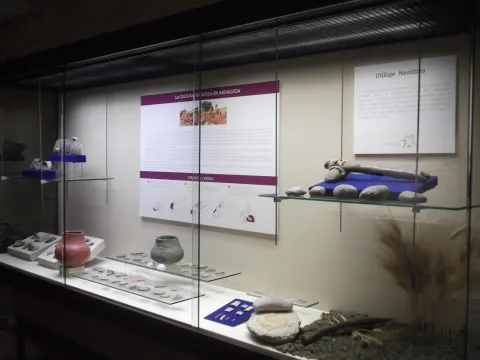
The archaeological museum consists of three rooms, a first room dedicated to Prehistory, where you can observe all the material remains of the Paleolithic, Mesolithic, Neolithic, Calcolytic and Age of Metals.

The contents of the vitrines in this room are very rich, in a first finding from, lytic remains of the Middle Paleolithic as Proto-Bifaces to Argaric arrows of type "Palmeta," already made in the time of the metals. In this room you can see the reconstruction of a Paleolithic cave and a Neolithic Cabin, which becomes the didactic bet of this room.

The Second Hall is dedicated to history, starting from the Colonizing peoples to the modern time, highlighting an important sample of Iberian, Roman and Muslim epigraphic remains, along with an extensive and very complete collection of numomatics. To this is added all kinds of ceramic artifacts, in glass and marble that make this room the most complete of the museum. In this room it is also committed to the interpretation of archaeological monuments, in this case the real-scale reconstruction of the Plaza Principesca de la Necópolis de Piquía, a grave of important dimensions in which a prominent funerary jacuar was found, among which a total of 7 ceramic vessels, 4 of which have been restored by the team of archaeologists of the Andaluz Centre of Ibera Archaeology of the University of Jaén.

The third room is dedicated to two illustrious characters in the history of Arjona, El Rey Alhamar and Helvia Paulina, both born in the town, who have been very prominent in their respective Muslim and Roman periods respectively. This room is complemented by a Audiovisual Room, which is born with the aim of completing the activities scheduled by the museum for the visitor.

Breve descripción

The one opened on November 22, 2012, has a collection close to the 3,000 pieces, ranging from fossil remains to pieces related to modern archaeology. The museum offers the visitor a chronological tour, where the visitor will be able to discover the different prehistoric and historical stages that have been passed through Arjona, and this will make it considered the remains of the material culture that these cultures have left in our locality and its broad municipal term, all of which are focused in a very didactic and pedagogical way that makes the museum attractive to both the most scholar and those less familiar with history and archaeology.

Telecomunicaciones
Teléfono de contacto
669 968 626
Ubicación
Latitud
37.935371
Longitud
-4.054647
Distrito
Municipio
Ubicación en el mapa
POINT (-4.054647 37.935371)
Tipos de punto de interés
Imágenes carrusel
imagen
Image
7.jpg
Imagen principal
Desactivado
imagen
Image
thb_g_iberos.jpg
Imagen principal
Desactivado
Imágenes cabecera
imagen
Image
Img%20189.jpg
Imagen principal
Activado
Microsite al que pertenece
Loading map
Preparing points of interest and routes...
Marcas de calidad

Almedina de Cazorla Historical Oil Mill Museum

Submitted by brandcode_deweloper on
Id
924903
Descripción
Descripción larga

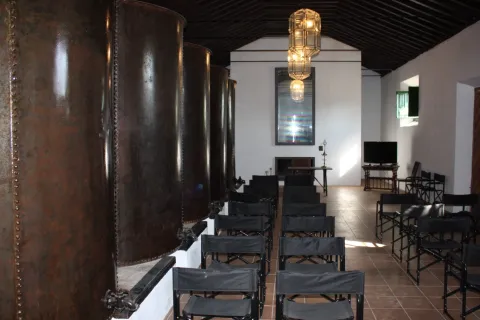
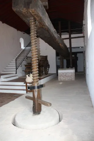
The visit begins by showing a magnificent press of wooden beam of 15 meters in length and a quintal of 2400 Kg. It is one of the most long beam presses preserved, and is also shown one of the few large copper boilers in Spain intended to heat the water from the charge in the second pressure of the capachos.

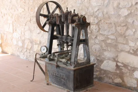
In a second room two hydraulic presses are displayed, a blood mill of conical stones, and two systems of continuous extraction of recent installation: one of three phases, of the first brought to Andalusia, and the current of two phases.

Breve descripción

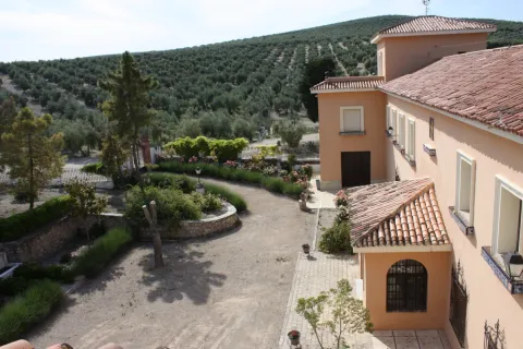
This is a unique space where theThe Almedina Museum of Cazorla. A visit shows the culture of olive oil and its extraction techniques. Three factories and three wineries corresponding to three stages of oil technology can be visited at the museum: the pressure stage of the mass per beam and quintal, the hydraulic presses system and the continuous extraction systems.

Telecomunicaciones
Teléfono de contacto
953 720 331 / 600 079 829
Correo electrónico
fslv4@yahoo.es
Ubicación
Código Postal
23470
Latitud
37.929740
Longitud
-3.048510
Dirección
Carretera Peal de Becerro-Tranco A-319, km. 12
Municipio
Ubicación en el mapa
POINT (-3.04851 37.92974)
Tipos de punto de interés
Imágenes carrusel
imagen
Image
IMG_4068.jpg
Imagen principal
Desactivado
imagen
Image
IMG_6029.jpg
Imagen principal
Desactivado
imagen
Image
IMG_4079.jpg
Imagen principal
Desactivado
imagen
Image
IMG_4076.jpg
Imagen principal
Desactivado
imagen
Image
IMG_6037.jpg
Imagen principal
Desactivado
Imágenes cabecera
imagen
Image
IMG_6016%20%281%29.jpg
Imagen principal
Activado
Loading map
Preparing points of interest and routes...

Professor Sotomayor Archaeological Museum

Submitted by brandcode_deweloper on
Id
2335242
Descripción
Descripción larga

It was opened in 1999, and is included in the Andalusian Register of Museums and Museum Collections of the Council of Culture of the Junta de Andalucía.

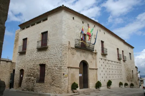
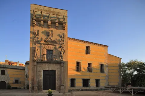
The palace belongs to a property set listed as BIC. It was built by the Cárdenas- Valdivia lineage and the first documents that have been preserved date back to 1570. The splendid torre- cover that characterizes it was built around 1620, it is known to stand out over the defensive system of the nearby door of the wall. The typical Renaissance pillow, a curved fronton broken and finished in volts, is one of the heraldic shields (Cárdenas). On both sides we find atlants, and on these, two other shields. The five lions on the upper ledge carrying five shields are also visible. The interior of the house is articulated as the Renaissance Italian palaces, around a courtyard with four crunches, dating back to the 17th century. Finally, the cavalry stands out for a mural painting of a shield with two rampant lions and the family's lineage. The building also houses the Casa del Alfarero.

Breve descripción

Located in the Children's Palace of Don Gome, the Archaeological Museum Professor Sotomayor is an exciting cultural journey through the archaeology and history of this municipality. It shows remarkable pieces of all cultures (ibera, Roman, Visigoda...) that have shaped our historical legacy.

Telecomunicaciones
Sitio web
https://www.andujar.es/areas-municipales/patrimonio/museos-municipales/museo-arqueologico-profesor-sotomayor
Teléfono de contacto
953 513 178 / 953 500 603
Correo electrónico
museoarqueologicoandujar@gmail.com
Ubicación
Código Postal
23740
Latitud
38.036670
Longitud
-4.053680
Dirección
C/ Maestra, s/n
Distrito
Municipio
Ubicación en el mapa
POINT (-4.05368 38.03667)
Tipos de punto de interés
Imágenes carrusel
imagen
Image
Museo_con_N_-_Museo_Arqueologia_II_-_07oct19.jpg
Imagen principal
Desactivado
imagen
Image
60359598_2269318409997592_1025839860474183680_o.jpg
Imagen principal
Desactivado
imagen
Image
18836792_1872376626358441_5558742584267399321_o.jpg
Imagen principal
Desactivado
Imágenes cabecera
imagen
Image
IMG_1572.jpg
Imagen principal
Activado
Horario
Thursday to Saturday: 10: 00 - 14: 00 and 17: 00 - 20: 00. Festivals closed.
Microsite al que pertenece
Loading map
Preparing points of interest and routes...

Walls and Tower of Boabdil

Submitted by brandcode_deweloper on
Id
321066
Descripción
Descripción larga

El asentamiento romano de Obulco, aunque conserve su importancia, parece sufrir un significativo retroceso en época visigoda. La población que encuentran los musulmanes, de dimensiones más reducidas que la romana, necesitaría unas defensas ajustadas a su extensión real. El enclave de Hisn Bulkūna se dotó de una nueva muralla, mientras que se reforzaría el área más elevada que albergaba la mayoría de los edificios de carácter público, residencial y religioso, para lo que se reutilizan algunos elementos anteriores. Recientes investigaciones arqueológicas han aportado las primeras hipótesis del trazado de la muralla musulmana de la ciudad, que también contó con grandes arrabales extramuros. El recinto amurallado estaría jalonado por diecisiete torres, conservándose en la actualidad ocho de ellas. La población alcanzaría su máxima extensión en torno a los siglos XII y XIII, mientras que sus estructuras defensivas se mantuvieron hasta desaparecer entre los siglos XVII y XVIII.

Tras la llegada de los castellanos a Porcuna, probablemente en 1240, la Orden de Calatrava acentuaría su capacidad defensiva, conformando un enclave organizado en tres áreas claramente diferenciadas, por un lado incorporan un alcázar, convertido en fortaleza y residencia del comendador, junto a él, cabría identificar la villa, que ocuparía el antiguo espacio donde se desarrollaba la alcazaba islámica, y finalmente, las áreas residenciales amuralladas anexas al núcleo principal, cuyas barreras son conocidas como cercas bajas. Entre los siglos XIV y XV dentro del castillo se habilitó un complejo palacial, conocido a través de descripciones documentales. Por su parte, el recinto superior o castillo contaría con ocho torres, de las que se conservan restos de cinco, algunas de las cuales datarían de época musulmana, a las que hay que añadir la del Homenaje, actualmente desaparecida, que pudo emplazarse en el centro del mismo, y la imponente Torre Nueva.

Su interior se dividía en dos zonas, una militar al norte, en la que se elevaba la torre del Homenaje rodeada por dependencias de servicio (hornos, cocina, establos, etc.) y una noble al sur, con los edificios principales (la iglesia de Santa Catalina, sala de armas, y diversas salas con funciones residenciales y administrativas del Maestre de la Orden). 

Se han identificado tres de las puertas de la ciudad, la antigua Puerta de la Villa, a la que posiblemente corresponda el Arco de los Remedios, junto al ayuntamiento, la Puerta de Martos, en el entorno de la Torre Nueva, y la puerta Meridional, emplazada en una casa de la calle General Aguilera, así como una torre albarrana, adelantada a la línea de muralla con la que enlazaba a través de un pasaje central cubierto por una bóveda de medio cañón en la parte delantera, y rebajada en la trasera. 

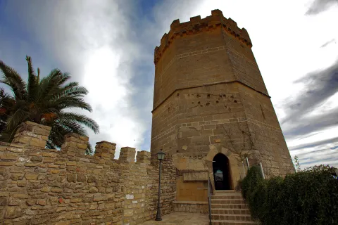
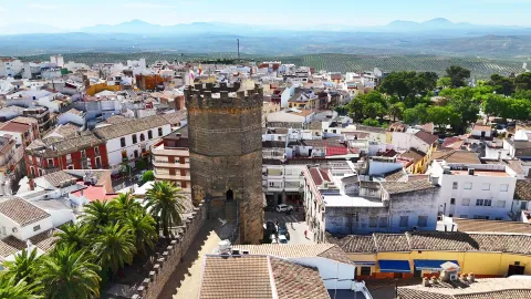
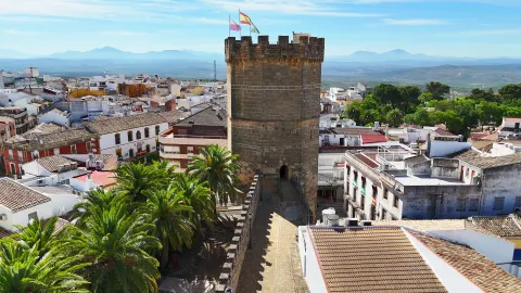
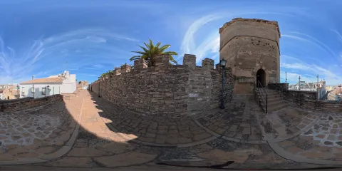
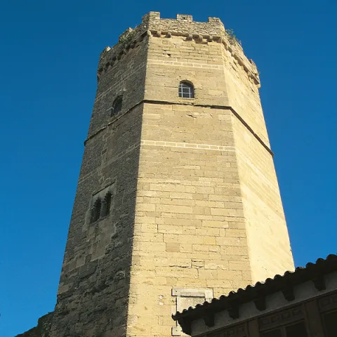
El extremo sur del alcázar estaba protegido por la Torre Nueva, conocida popularmente como Torre de Boabdil, quien según las fuentes estuvo preso en el Castillo de Porcuna tras ser capturado en la batalla de Lucena. Se identifica como una torre de planta octogonal, de estilo gótico y mudéjar, que se adosa a las murallas y estructuras del castillo y alcanza los 28 metros de altura. La puerta de entrada está defendida por un matacán en la coronación y al igual que las interiores enmarcada por un arco apuntado. Los ventanales de la primera planta tienen un doble arco polilobulado, presente en otras fortalezas del señorío de la Orden en el Alto Guadalquivir, junto a ello, los pretiles de la terraza están volados sobre ménsulas simulando un matacán corrido. En la fachada sur se puede ver una cartela con la cruz de Calatrava flanqueado por dos escudos de la familia Guzmán y la inscripción: ESTA TORRE MANDO FAÇER EL MUI ESTRENUO E MUI NOBLE CAVALLERO DON LUIS DE GUZMAN POR LA DIVINA PROVIDENCIA MAESTRE DE CALATRAVA EL AÑO DEL SEÑOR DE MIL E CCCXXXV AÑOS. 

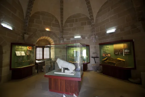
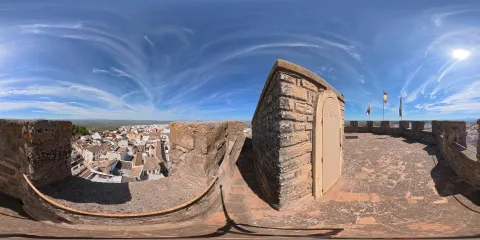
Internamente se estructura en una planta baja maciza y dos salas superiores más terraza, que se comunican mediante escaleras embutidas en el muro norte de la torre. Las salas se cubren con bóvedas de nervios, sobre ménsulas con decoraciones vegetales y clave con heráldica de la Orden. Actualmente alberga el museo arqueológico municipal.

A partir del siglo XVII, la pérdida de función militar del Castillo inició un proceso de deterioro que culminó con el Terremoto de Lisboa de 1755, que alcanzó gran intensidad en la localidad, provocando graves desperfectos y derrumbes en murallas y torres. Los bombardeos de la Guerra Civil también infringieron también grandes daños a los restos de la fortificación. Los cambios en la configuración urbana acabaron por enmascarar los recintos, subsistiendo lienzos de muralla y de torres entre el caserío, al ser utilizados como medianeras de las casas, pero lamentablemente algunos de ellos fueron demolidos. Desde mediados del siglo XX el espacio de la Torre Nueva ha sufrido agresivas intervenciones que han alterado su aspecto original.

El cerro del Castillo forma parte de un conjunto de cerros amesetados en parte de los cuales se extiende la ciudad. Las primeras ocupaciones de Porcuna se producen entre el Neolítico y el Calcolítico, en el tercer milenio a.n.e., sobre los cerros de los Alcores y Albalate, y se mantendrán durante la Edad de Bronce, hasta convertirse en la polis de Ibolca en época Ibérica. En torno al siglo VII a.n.e. se produjo un desplazamiento del asentamiento hacia el cerro del castillo, de mayor altitud.

Las investigaciones arqueológicas parecen indicar que en época Romana Republicana se construye una potente muralla rodeando la ciudad de Obulco que se mantendrá hasta finales de época Alto Imperial, en la que se van abandonando algunos sectores de la ciudad. La localidad, aunque conserve su relevancia en la comarca, parece sufrir un fuerte retroceso en época visigoda. 

En 1232 Muhammad ibn Yusuf ibn Nasr ibn al-Ahmar (Alhamar o Muhammad I), originario de Arjona, se proclama sultán en Jaén y un año más tarde extiende su autoridad a Porcuna y Córdoba. En 1234 Muhammad I se declara vasallo de Ibn-Hud, nombrado gobernador de Andalucía por el califa abbasí, a cambio de su vasallaje Ibn Hud lo reconocerá como rey de Jaén, Arjona y Porcuna. Entre 1240 y marzo de 1241 el rey Fernando III consigue hacerse con esta población, que inmediatamente la cedería a la Orden de Calatrava, institución que la convertirá en una de sus principales encomiendas en el señorío que ostenta en el Alto Guadalquivir. 

Los siglos XIII y XIV estuvieron marcados por la inestabilidad causada por las continuas incursiones de los musulmanes en la zona. Tras la batalla en Lucena de 1483, que supuso la derrota y la captura del rey granadino, Boabdil es enviado a Porcuna donde quedó retenido un tiempo, de ahí el nombre por el que se conoce popularmente a la Torre Nueva.

A finales de siglo XVII la Corona retiró los presupuestos para el mantenimiento de las fortificaciones a la Orden de Calatrava, lo que inició un proceso de abandono y ruina. El Terremoto de Lisboa de 1755 afectó gravemente a Porcuna, causando graves desperfectos a las estructuras defensivas, ya muy deterioradas. 



Breve descripción

Since the Islamic period Porcilla was defended by two walled enclosures, built of sandstone. The first, more extensive, compound surrounded the city, while the second, formed a space of political-military power located at the east end of the villa. The development it reached in the Middle Ages overflowed its walls, emerging fortified arrabals. Disappeared by the abandonment, the effects of the Lisbon earthquake of 1755 and the urban restructuring of the 19th and 20th centuries. The medieval defensive elements are resurrecting between the village of the present city, thanks to archaeological research. The most representative vestige of this fortified ensemble is the New Tower, with an ochavada floor, built in 1335 by the Order of Calatrava in Gothic-Mudejar style. It currently houses the Archaeological Museum of Porcilla.
The location of Porcra is characterized by its altitude, visual domain and abundance of water, which has favored its occupation from the 3rd Millennium BC to the present. The Islamic settlement of Hisn Bulkūna was built on the Roman Obulco, which has left numerous vestiges (an amphitheater, the Calderon tank, the fortified enclosures of the Comendador and Jabonero and the noble houses of the San Benito sector). Its strategic position in the Upper Guadalquivir countryside made Hisn Bulkūna the head of an administrative district (Iqlim), where all the tax collection of the region was concentrated. This enclave would reach its maximum extent around the 12th and 13th centuries. It was conquered by Fernando III in 1240, who would give it to the Order of Calatrava, making it an important envoy within the broad dominion that the Calatraves formed in the south-western sector of the kingdom of Jaén. From this moment on their defenses were increased given their proximity to the border with the Nazari kingdom of Granada. At the end of the 15th century the king of Granada Boabdil was temporarily held in the alcázar of Porcra after being defeated and captured in the battle of Lucena (1483).

Telecomunicaciones
Teléfono de contacto
953 545 130
Correo electrónico
oficinaturismo@porcuna.es
Ubicación
Código Postal
23790
Latitud
37.869780
Longitud
-4.184050
Dirección
C/ José Moreno Torres, s/n
Distrito
Municipio
Ubicación en el mapa
POINT (-4.18405 37.86978)
Tipos de punto de interés
Imágenes carrusel
imagen
Image
Castillos_ruta_porcuna.jpg
Imagen principal
Desactivado
imagen
Image
muralla_y_torre_boabdil.jpg
Imagen principal
Desactivado
imagen
Image
Murallas y Torre de Boabdil
Imagen principal
Desactivado
imagen
Image
Murallas y Torre de Boabdil
Imagen principal
Desactivado
Imágenes cabecera
imagen
Image
CyB_Porcuna_01
Imagen principal
Desactivado
imagen
Image
CyB_Porcuna_02
Imagen principal
Desactivado
Horario
Tuesday to Sunday: 10: 00 - 13: 00. No time to contact the phone indicated.
Microsite al que pertenece
Otros servicios

For groups outside these hours, contact the telephone: 953544004 / 666445513.

Modelo 3D
Experiencia 360
Image
CyB_Porcuna
Image
CyB_Porcuna
Loading map
Preparing points of interest and routes...

City Walls

Submitted by brandcode_deweloper on
Id
1909116
Descripción
Descripción larga

After the Christian conquest, some of his canvases (those who would have suffered the greatest destruction in the assault on the village or were in a worse state of conservation) are reinforced through coatings made with walls of irregular rippled masonry, which in most cases are mounted on the tapiales, reaching the defenses higher height. For the defense of the paraments, new-floor towers are built and the tapial towers are reinforced.

The urban core was accessed through several doors, of which we have located two: La Villa and Santa Ana. They were protected or flanked by towers, or located in a wall break, which facilitated their defense and control of visitors.

Breve descripción

The urban fence or walls that surrounded and protected the core of the population were built in Islamic times, with a tapial of land on a small base of masonry. The canvases were defended by square-floor towers, built with the same material, not knowing if, at the adarve level, they would have any room or level, where the sentries were covered, or were crowned by levels of terraces.

Ubicación
Latitud
37.588140
Longitud
-4.081294
Distrito
Municipio
Ubicación en el mapa
POINT (-4.081294 37.58814)
Tipos de punto de interés
Imágenes carrusel
imagen
Image
murallas%20urbanas.png
Imagen principal
Desactivado
Imágenes cabecera
imagen
Image
main_image_79940.jpeg
Imagen principal
Activado
Loading map
Preparing points of interest and routes...