Saltar al contenido principal
icon-intereses-municipio

Alto de Santa Ana Mill-Museum

Submitted by brandcode_deweloper on
Id
2343682
Descripción
Descripción larga

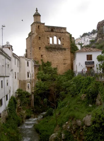
It was the first, and therefore oldest, to operate in Valdepeñas. It began to ground the day on August 15, 1540 and had two milling stones. Its owner, Juanín LeClerque, called it the Upper Mill of Santa Ana and also built a second mill, called the Bajo of Santa Ana, which also had two stones. Both mills were the only ones in Valdepeñas until the 18th century.

In 1787, the batan, used until then to cast wool, was transformed into a mill, and was built in the area of El Ejido de San Sebastián by Catherine González de Medina.

It is currently dedicated to the museum and divided into three sections: Portal, dedicated to the historical part; Molino, dedicated to the mill, its parts and operation; and Hoorno, which hosts a small sample of objects and techniques specific to the popular arts and customs of Valdepeñas and its region.

Breve descripción

3-storey Arab-origin hydraulic flour mill. The construction is in bankruptcy, adapting to the skirt of a hillside. In its interior are presented useful and tools of the 19th century.

Telecomunicaciones
Teléfono de contacto
953 310 044 / 953 310 111
Correo electrónico
serafinpulido@msn.com
Ubicación
Código Postal
23150
Latitud
37.590170
Longitud
-3.823590
Dirección
Molino de Santa Ana, 29
Distrito
Ubicación en el mapa
POINT (-3.82359 37.59017)
Tipos de punto de interés
Imágenes carrusel
imagen
Image
Valdepe%C3%B1as%20de%20Ja%C3%A9n%20027.jpg
Imagen principal
Desactivado
imagen
Image
Valdepe%C3%B1as%20de%20Ja%C3%A9n%20028.jpg
Imagen principal
Desactivado
Imágenes cabecera
imagen
Image
Valdepe%C3%B1as%20de%20Ja%C3%A9n%20031.jpg
Imagen principal
Activado
Horario
Concerted visits. Weekends: 10: 00 - 14: 00 and 17: 00 - 20: 00.
Microsite al que pertenece
Loading map
Preparing points of interest and routes...

Flour Mill and Frondosa Naturaleza Interpretation Centre

Submitted by brandcode_deweloper on
Id
2343514
Descripción
Breve descripción

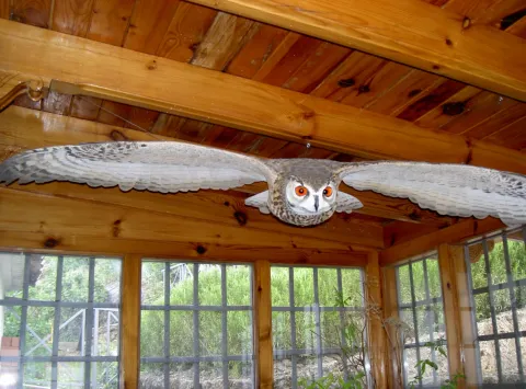
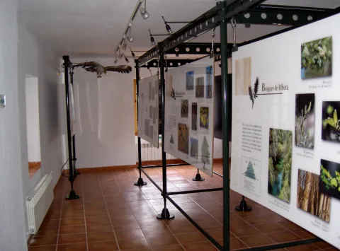
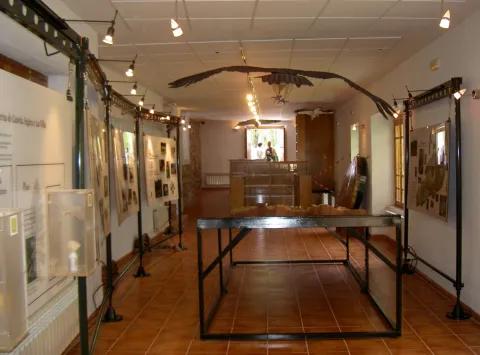
Frondosa Nature contains, among other elements, audiovisual, olfactory panels, images and sounds of the flora and fauna of this protected natural space, bird reproductions and a model of the Natural Park of Cazorla, Segura and the Villas.

Telecomunicaciones
Sitio web
www.almagaia.eu
Teléfono de contacto
953 721 330
Correo electrónico
info@almagaia.es
Ubicación
Nombre
La Casa de la Luz.
Código Postal
23470
Latitud
37.905224
Longitud
-2.998526
Dirección
Camino del Ángel, 7-9
Municipio
Ubicación en el mapa
POINT (-2.998526 37.905224)
Tipos de punto de interés
Imágenes carrusel
imagen
Image
PICT5925.jpg
Imagen principal
Desactivado
imagen
Image
PICT5929.jpg
Imagen principal
Desactivado
imagen
Image
PICT5927.jpg
Imagen principal
Desactivado
imagen
Image
PICT5926.jpg
Imagen principal
Desactivado
Imágenes cabecera
imagen
Image
PICT5936.jpg
Imagen principal
Activado
Horario
10: 30 - 13: 30 and 16: 00 - 19: 00.
Loading map
Preparing points of interest and routes...

Mill of the Cubo

Submitted by brandcode_deweloper on
Id
4884561
Descripción
Breve descripción

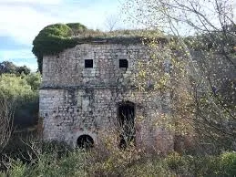
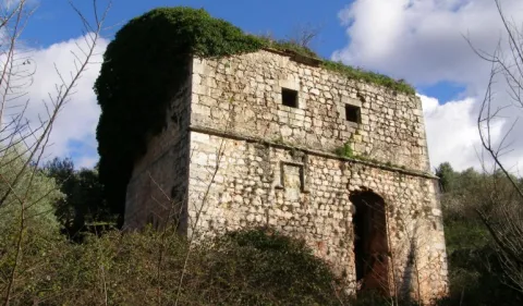
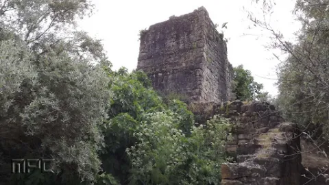
It is a fortified flour mill that takes the name of the stream of the cube, is built by the Order of Calatrava in 1437. It is the largest and best preserved fortified mill built by the South Peninsular Military Orders. In this place, down to the river of the Cube, we find an area of high ecological and landscape value.

Telecomunicaciones
Sitio web
www.tosiria.com
Teléfono de contacto
622 626 159
Ubicación
Código Postal
23650
Latitud
37.743900
Longitud
-3.940700
Distrito
Municipio
Ubicación en el mapa
POINT (-3.9407 37.7439)
Tipos de punto de interés
Imágenes carrusel
imagen
Image
molino%20del%20cubo.jpg
Imagen principal
Desactivado
imagen
Image
molino%20del%20cubo%202.jpg
Imagen principal
Desactivado
Imágenes cabecera
imagen
Image
molino.jpg
Imagen principal
Activado
Loading map
Preparing points of interest and routes...

Lower Mill or Vicarage Mill

Submitted by brandcode_deweloper on
Id
4707246
Descripción
Descripción larga

It consists of one wheel and two milling stones, the first to mould wheat and the second for other grain types; the network of acequias and canals that fed it is kept in use but only for the irrigation of the annexed gardens.

Breve descripción

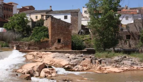
This flour mill is located on the right bank of the Guadalimar, upstream of the core of Puente de Génave, being the most interesting from the architectural and historical point of view. It appears to be mentioned in Philip II's Relations in which it is said that it is "a particular flour mill in which all the neighbors of Génave grind" and that they went here due to the absence of streams with sufficient flows for the construction of a mill in that locality; from this circumstance derives the name of "Génave mill" with which it is also known.

Telecomunicaciones
Sitio web
www.puentedegenave.es/el-municipio/patrimonio-historico.html
Correo electrónico
pgenave@puentedegenave.es
Ubicación
Código Postal
23350
Latitud
38.354562
Longitud
-2.803199
Distrito
Municipio
Ubicación en el mapa
POINT (-2.803199 38.354562)
Tipos de punto de interés
Imágenes carrusel
imagen
Image
111430.jpg
Imagen principal
Desactivado
Imágenes cabecera
imagen
Image
Almazara_de_la_Vicarxa.jpg
Imagen principal
Activado
Loading map
Preparing points of interest and routes...

Canena Small Mill

Submitted by brandcode_deweloper on
Id
8001060
Descripción
Descripción larga

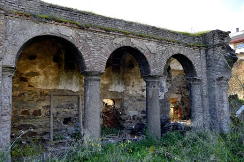
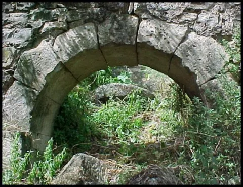
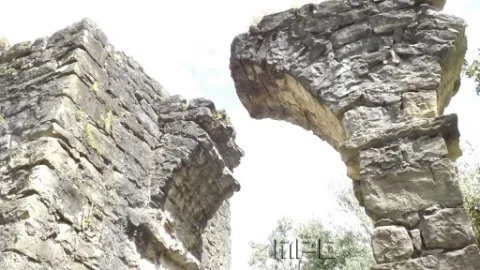
The mill is a hydraulic construction of at least Roman times that served for the grinding of cereal. The initial remains could be dated in the Roman era, but then much improved in the 16th century when it was bought by Francisco de los Cobos. The existing remains allow to contemplate several arches of the aqueduct, the water storage tank and hydraulic drive.

Breve descripción

The architectural and urban elements of interest of Canena are the aqueduct and mill of El Molinillo, located next to the stream of the Yedra.

Telecomunicaciones
Sitio web
https://canena.es/
Correo electrónico
canena@canena.es
Ubicación
Código Postal
23420
Latitud
38.047680
Longitud
-3.482890
Dirección
Carretera 322 Km. 135
Municipio
Ubicación en el mapa
POINT (-3.48289 38.04768)
Tipos de punto de interés
Imágenes carrusel
imagen
Image
molinillo%20canena.jpg
Imagen principal
Desactivado
imagen
Image
molinillo%20canena3.jpg
Imagen principal
Desactivado
Imágenes cabecera
imagen
Image
molinillo%20canena2.jpg
Imagen principal
Activado
Loading map
Preparing points of interest and routes...

Viewpoints: Balconies overlooking the countryside

Submitted by brandcode_deweloper on
Id
6551106
Descripción
Descripción larga

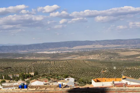
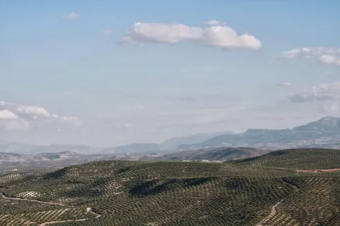
For this reason, the Arjona Historical Set is "Balcony de la Campiña." This aspect of "Balcony" of the countryside has been taken care of in Arjona, with the construction of looking parks that offer the citizen the possibility to contemplate the landscape of the countryside of Olivar, as well as the silhouette that leave on the horizon, other cities or geographical accidents such as the plain of the Guadalquivir Valley in Andújar, with Sierra Morena behind its back in its northern landscape, or the mountain chains of Sierra Magina, the Peña de Martos or the site of the Castle of Santa Catalina (Jaén) to the south.

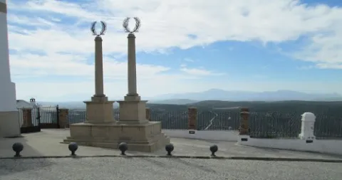
Most of these viewpoints are located within the tour of the guided tours, two of them, those called "Mirador del Cemeterio de los Santos" and the "Mirador de la Plaza del Rey Alhamar," are specifically located in the area of the primitive Alcázar, that is, in the highest area of the town, the first looks to the North and the second to the South. The other viewpoints are located at lower levels, not less interesting, on Sol Street and Adarves Street.

These viewpoints provide an extraordinary incentive to the Uruguayan monumental heritage, providing landscape values of a strategic nature, which makes it a reference point to contemplate much of the North countryside and the South Serrania of the province.

Breve descripción

Arjona becomes a strategic enclave that controls a delimited visual panorama on the horizon, to the North by Sierra Morena and to the South by Sierra Magina. That is why we can distinguish 4 areas with a high or very high environmental aesthetic level, as well as enclaves from which you can see a panoramic view that acquires value by itself.

Ubicación
Código Postal
23760
Latitud
37.936475
Longitud
-4.055188
Distrito
Municipio
Ubicación en el mapa
POINT (-4.055188 37.936475)
Tipos de punto de interés
Imágenes carrusel
imagen
Image
12.jpg
Imagen principal
Desactivado
imagen
Image
10.jpg
Imagen principal
Desactivado
Imágenes cabecera
imagen
Image
13.jpg
Imagen principal
Activado
Microsite al que pertenece
Loading map
Preparing points of interest and routes...

Viewpoint Paseo de Antonio Machado

Submitted by brandcode_deweloper on
Id
7500350
Descripción
Breve descripción

Known as La Muralla, this perimeter street to the city of Baeza offers beautiful views over the olive grove, the Guadalquivir valley and the natural park of Sierra Magina.

Ubicación
Código Postal
23440
Latitud
37.992360
Longitud
-3.469560
Municipio
Ubicación en el mapa
POINT (-3.46956 37.99236)
Tipos de punto de interés
Imágenes carrusel
imagen
Image
Baeza_Paseo_Antonio_Machado_010.jpg
Imagen principal
Desactivado
Microsite al que pertenece
Loading map
Preparing points of interest and routes...

Viewpoint el Tapadero

Submitted by brandcode_deweloper on
Id
913206
Descripción
Descripción larga

A tortuous sabina mora, with the trunk tanned by the passage of years and the inclemences of time, welcomes us to the lookout, from which you can see an impressive and majestic panorama of the saw of Las Villas, which as a balcony opens to show us, in a close-up, the delicious valley of Chillar stream and, at the bottom, the valley of the Guadalquivir River, which is lost among the olive lomas.

We suggest:

  • Continue our promotion, to the Collado del Agua de Los Perros, which with its 1200 m altitude, allows us to have a magnificent and spectacular view of this saw.
  • Consider the twilight on the horizon. The tenuous light that surrounds the place produces fantastic tones on the rocks and accentuates the powerful forms of its relief, accentuating the magical charm of the place.

Carretera JH-1755, which links the town of Villanueva del Archbishop with the village of Tranco, known as "Transversal de las Villas." The location of the lookout is well marked by a sign.

Breve descripción

This lookout is located on the top of a rocky wall, with more than 200 m of vertical fall, on an abyss whose vision produces impression. The steep slopes are populated by Mediterranean forest spots, which anchor their roots in the pure rock. It is common to observe the mountain goats climbing along the hillsides, as well as the majestic flight of great rapaces, especially leonate vultures, but also royal eagles, scallops, baskets, hawks, gavilanes... and, if there is luck, even the recently reintroduced bones.

Ubicación
Latitud
37.912893
Longitud
-3.003887
Municipio
Ubicación en el mapa
POINT (-3.003887 37.912893)
Tipos de punto de interés
Imágenes carrusel
imagen
Image
miradorT.jpg
Imagen principal
Desactivado
Imágenes cabecera
imagen
Image
mirador-tapadero.png
Imagen principal
Activado
Loading map
Preparing points of interest and routes...

Viewpoint El Portichuelo

Submitted by brandcode_deweloper on
Id
5925155
Descripción
Breve descripción

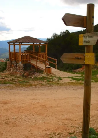
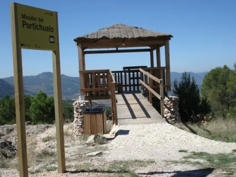
From this viewpoint we can get a wonderful and very close view of the village of Siles, as it is just 3 km from the Villa.
Access to this lookout is through a forest track accessible with any type of vehicle (car, bike, mountain bike, etc.) and access to the lookout is also adapted for people with disabilities.

Ubicación
Latitud
38.388600
Longitud
-2.581570
Distrito
Municipio
Ubicación en el mapa
POINT (-2.58157 38.3886)
Tipos de punto de interés
Imágenes carrusel
imagen
Image
miradorportichuelo.png
Imagen principal
Desactivado
Imágenes cabecera
imagen
Image
11.jpg
Imagen principal
Activado
Loading map
Preparing points of interest and routes...

Viewpoint of the Keep / Tower de Cuadros

Submitted by brandcode_deweloper on
Id
2980306
Descripción
Descripción larga

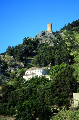
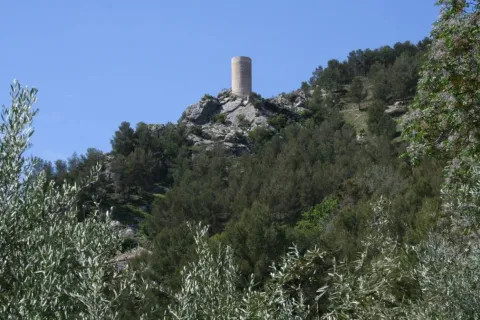
It is a watchtower, of Arab origin, perfectly conditioned as a lookout that offers the visitor beautiful views of the valley of the Cuadros River, surrounded by gardens and crops, and part of the Natural Park of Sierra Magina. It is accessed through the signposted path of the Viñas and is a privileged place to contemplate one of Europe's largest highland forests, whose glasses intertwine with each other by forming a plant vault that barely lets the sky see.

Breve descripción

The lookout is located near the recreational area El Adelfal de Cuadros, near the shrine of the Virgin of Cuadros, south of the city centre, about 4 km. of Bedmar; access directly by the road JV-3.222.

Ubicación
Código Postal
23537
Latitud
37.789330
Longitud
-3.409500
Dirección
Camino de Fresneda a Cuellos
Distrito
Municipio
Ubicación en el mapa
POINT (-3.4095 37.78933)
Tipos de punto de interés
Imágenes carrusel
imagen
Image
Mon443.jpg
Imagen principal
Desactivado
Imágenes cabecera
imagen
Image
20.jpg
Imagen principal
Activado
Microsite al que pertenece
Loading map
Preparing points of interest and routes...