Saltar al contenido principal
icon-intereses-municipio

Fountain Taza de Pozo Alcón

Submitted by brandcode_deweloper on
Id
8109717
Descripción
Descripción larga

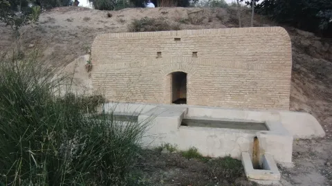
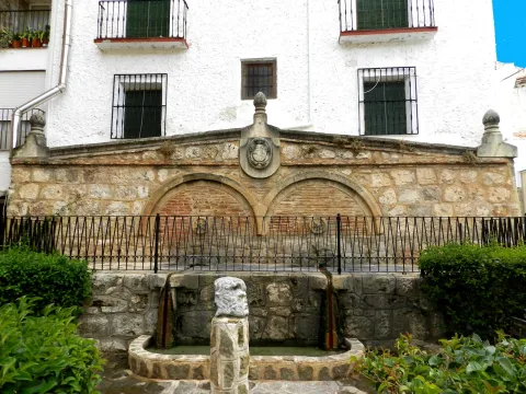
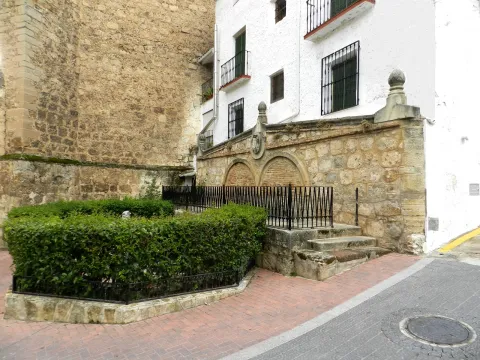
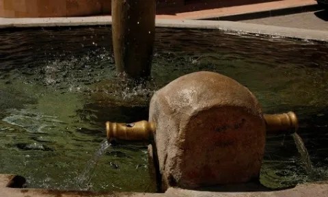
Located on a side of the Church of the Incarnation. Decorative source of vertical pipe type cup that spills to an octagonal pillar. It has two side pipes on the perimeter of the pillar that they used to serve to fill the cantars.

Breve descripción

Dodecagonal source with a single pipe on one side

Telecomunicaciones
Teléfono de contacto
953 738 041
Correo electrónico
ayuntamiento@pozoalcon.es
Ubicación
Código Postal
23485
Latitud
37.705600
Longitud
-2.933550
Dirección
C/ Monje, 2. Pozo Alcón
Municipio
Ubicación en el mapa
POINT (-2.93355 37.7056)
Tipos de punto de interés
Imágenes carrusel
imagen
Image
Fuente%20Taza2%20%281%29.jpg
Imagen principal
Desactivado
imagen
Image
Fuente%20Taza3%20%281%29.jpg
Imagen principal
Desactivado
Imágenes cabecera
imagen
Image
Fuente%20Taza%20%281%29.jpg
Imagen principal
Activado
Loading map
Preparing points of interest and routes...

Fountain Taza

Submitted by brandcode_deweloper on
Id
4485433
Descripción
Descripción larga

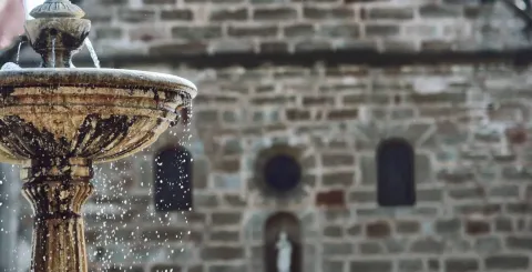
The most ornamental of all sources in Guarroman was the one known as Fountain Taza. Made of sandstone as well as all the important buildings of the village.

Located in the Plaza de la Constitución, right in front of the church, it has witnessed the nights of San Juan in which young people and children played to wet each other with cubes full of their water.

Breve descripción

In 1887 Mayor Lucas Guillén carried out the work of bringing the waters to Guarroman, building public sources.

Ubicación
Código Postal
23210
Latitud
38.181800
Longitud
-3.687170
Distrito
Municipio
Ubicación en el mapa
POINT (-3.68717 38.1818)
Tipos de punto de interés
Imágenes carrusel
imagen
Image
guarroman7-e1488617593616-1170x597%20%281%29.jpg
Imagen principal
Desactivado
Imágenes cabecera
imagen
Image
Fuente%20Taza.jpg
Imagen principal
Activado
Loading map
Preparing points of interest and routes...

Fountain of the Raso

Submitted by brandcode_deweloper on
Id
8091917
Descripción
Breve descripción

Enable as a recreational area. It is located 5 km north of Fries by the road towards Valdepeñas de Jaén. In the middle of Sierra Martina. Serrano landscape that stands out for the presence of typical plant species of the Mediterranean forest.

Telecomunicaciones
Sitio web
www.frailes.es/fuente-del-raso-frailes
Teléfono de contacto
953 599 541
Ubicación
Código Postal
23690
Latitud
37.509919
Longitud
-3.831940
Distrito
Municipio
Ubicación en el mapa
POINT (-3.83194 37.509919)
Tipos de punto de interés
Imágenes carrusel
imagen
Image
Fuente%20del%20raso3.jpg
Imagen principal
Desactivado
Imágenes cabecera
imagen
Image
Fuente%20del%20raso.jpg
Imagen principal
Activado
Loading map
Preparing points of interest and routes...

Fountain of the Gargantón

Submitted by brandcode_deweloper on
Id
5845859
Descripción
Breve descripción

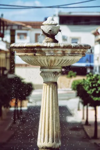
Caudalosa fountain fed by the Garganton River, one of the most important watercourses on the southern side of the Sierra Magina mountains. In summer the park and the bar next to the fountain are places to stop.

Ubicación
Latitud
37.723720
Longitud
-3.382640
Distrito
Ubicación en el mapa
POINT (-3.38264 37.72372)
Tipos de punto de interés
Imágenes carrusel
imagen
Image
1465030943_456942_1465032471_album_normal%20%281%29.jpg
Imagen principal
Desactivado
imagen
Image
fuente%20%282%29.jpg
Imagen principal
Desactivado
Imágenes cabecera
imagen
Image
13641265.jpg
Imagen principal
Activado
Microsite al que pertenece
Loading map
Preparing points of interest and routes...
Fountain of the Espino

Submitted by brandcode_deweloper on
Id
1869147
Descripción
Descripción larga

Location: To the south of the city centre, on the road to the mountains.

Distance: 4 hours.

Medium: On foot.

Access route: By mountain sidewalk.

Breve descripción

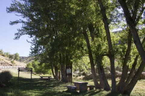
It is a water birth located in the middle of the Mediterranean mountain, with geological and vegetable formations of high natural value.

Ubicación
Latitud
37.740100
Longitud
-3.461470
Distrito
Ubicación en el mapa
POINT (-3.46147 37.7401)
Tipos de punto de interés
Imágenes carrusel
imagen
Image
Fuente%20del%20Espino%202.jpg
Imagen principal
Desactivado
Imágenes cabecera
imagen
Image
Espino1.png
Imagen principal
Activado
Microsite al que pertenece
Loading map
Preparing points of interest and routes...
Fountain of the Escribano

Submitted by brandcode_deweloper on
Id
4970637
Descripción
Descripción larga

The source of the scribe has a very low flow rate, approximately between 0-1 l / s, although it is rarely exhausted. The use of water from this spring is now rural and livestock. Today the water of the spring is used very little, but in the past century, it was a source very frequented by the arjonilleros, using a part of it as a forklift for the cavalry and the rest of cattle, and another part for human supply. At the source the arjonilleros collected water, in pitchers and flyers, which they used for their domestic use, to refresh in the agricultural work...

There is no doubt that the picture presented by the source of the scribe earlier, according to the testimonies that come to us from the mouth of the older, must be bewildered. Men and women with the pitcher at their expense, or donkeys and carrying animals that were carrying in the serons the pitchers and flyers.

Breve descripción

It has traditionally been a watershed for animals and pour its water into the stream of the Fountain of the scribe. This old source was rebuilt in 1947 and 2015.

Telecomunicaciones
Sitio web
www.arjonillapatrimoniohistorico.blogspot.com/2017/09/la-fuente-del-escribano.html
Ubicación
Código Postal
23750
Latitud
37.967830
Longitud
-4.126910
Distrito
Municipio
Ubicación en el mapa
POINT (-4.12691 37.96783)
Tipos de punto de interés
Imágenes carrusel
imagen
Image
Fuente%20del%20Escribano.jpg
Imagen principal
Desactivado
imagen
Image
Fuente%20del%20Escribano%202.jpg
Imagen principal
Desactivado
Imágenes cabecera
imagen
Image
fuente-escribano.jpg
Imagen principal
Activado
Loading map
Preparing points of interest and routes...
Fountain of the Comendador

Submitted by brandcode_deweloper on
Id
4861505
Descripción
Descripción larga

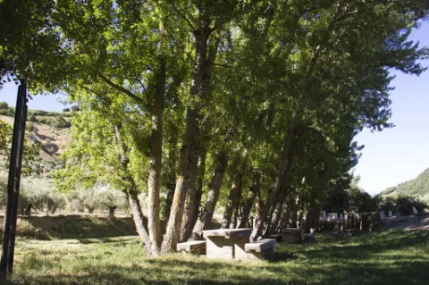
With double deck and pool. Next to the modern source is another very old one of possible Ibero-Roman origin.

Breve descripción

It is a beautiful area, easily accessible, with a natural water spring.

Telecomunicaciones
Sitio web
www.porcuna.jaenescondido.es/fuente-del-comendador.html
Correo electrónico
contacto@jaenescondido.es
Ubicación
Latitud
37.871140
Longitud
-4.183990
Distrito
Municipio
Ubicación en el mapa
POINT (-4.18399 37.87114)
Tipos de punto de interés
Imágenes carrusel
imagen
Image
Fuente%20del%20Comendador.jpg
Imagen principal
Desactivado
imagen
Image
Fuente%20del%20Comendador%202.jpg
Imagen principal
Desactivado
Imágenes cabecera
imagen
Image
fuente.jpg
Imagen principal
Activado
Loading map
Preparing points of interest and routes...
Fountain of Mateo de Inurria

Submitted by brandcode_deweloper on
Id
4520130
Descripción
Descripción larga

The sources have a precious urban, architectural or symbolic value not only in public spaces. They also have it in private spaces, such as the stone source of Mateo de Inurria, dated 1851, which is preserved in the house of Federico Bayona and Teresa Fernández. Although small (one and a half meters), its proportionality and sensuality of forms, its vistosity and symmetry, give it a remarkable monumental packaging.

Telecomunicaciones
Sitio web
www.fuensantademartos.es/el-municipio/patrimonio-historico.html
Ubicación
Código Postal
23610
Latitud
37.646047
Longitud
-3.907370
Distrito
Ubicación en el mapa
POINT (-3.90737 37.646047)
Tipos de punto de interés
Imágenes cabecera
imagen
Image
Fuensanta%20de%20Martos5.jpg
Imagen principal
Activado
Loading map
Preparing points of interest and routes...
Fountain of los Chorros

Submitted by brandcode_deweloper on
Id
4672111
Descripción
Breve descripción

It dates back to the late 18th century, although its construction date is not well known. It's made of masonry and landscape structure. It is made up of a frontis with two half-point arches and a triangular fronton that in its center hosts a shield of the Bourbons.

Ubicación
Código Postal
23370
Latitud
38.317760
Longitud
-2.658810
Distrito
Municipio
Ubicación en el mapa
POINT (-2.65881 38.31776)
Tipos de punto de interés
Imágenes carrusel
imagen
Image
fuente%20los%20chorros.JPG
Imagen principal
Desactivado
Imágenes cabecera
imagen
Image
DSCN1418.jpg
Imagen principal
Activado
Horario
10: 00 - 14: 00 and 17: 00 - 21: 00.
Loading map
Preparing points of interest and routes...
Fountain of las Generaciones

Submitted by brandcode_deweloper on
Id
4485686
Descripción
Descripción larga

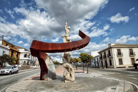
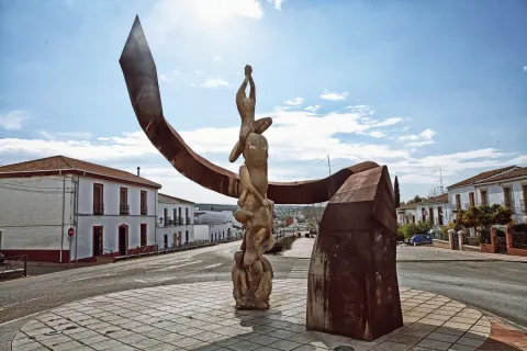
This contemporary work of the local sculptor Javier Ruiz Abel and represents the seven generations of Guarromanos, each raising upon himself the next and all of them surrounded by the tree of life, an oak, which is the representative tree of the New Populations.

Ubicación
Código Postal
23210
Latitud
38.181940
Longitud
-3.688560
Distrito
Municipio
Ubicación en el mapa
POINT (-3.68856 38.18194)
Tipos de punto de interés
Imágenes carrusel
imagen
Image
garroman-1170x780%20%282%29.jpg
Imagen principal
Desactivado
Imágenes cabecera
imagen
Image
Fuente%20de%20las%20generaciones.jpg
Imagen principal
Activado
Horario
Monday to Friday: 09: 00 - 19: 00.
Loading map
Preparing points of interest and routes...