Saltar al contenido principal
icon-intereses-municipio

Hamlet of los Onsares

Submitted by brandcode_deweloper on
Id
3965005
Descripción
Descripción larga

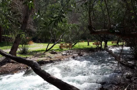
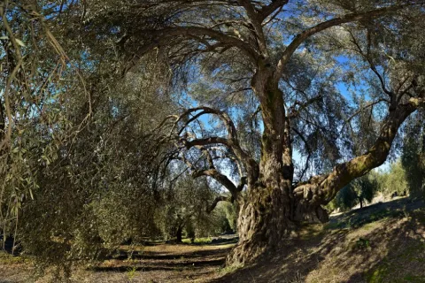
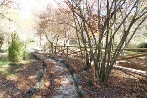
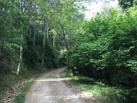
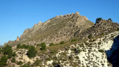
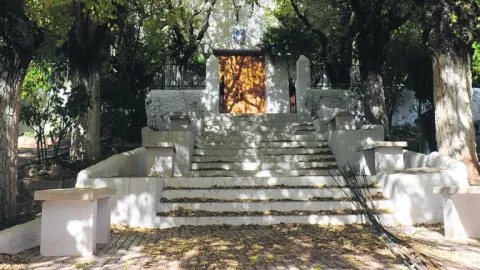
Next to the tributary channel, covered by a thick riverside vegetation, the small gardens of Onsares, between centenary chopos and olive plantations, extend. The village is surrounded by the forest peaks of the Segura mountains, framed by the highest mountains of the territory.

Even it is accessed from Villarrodrigo through a road that crosses the Port of Onsares between the peaks of La Atalaya and El Morrón.

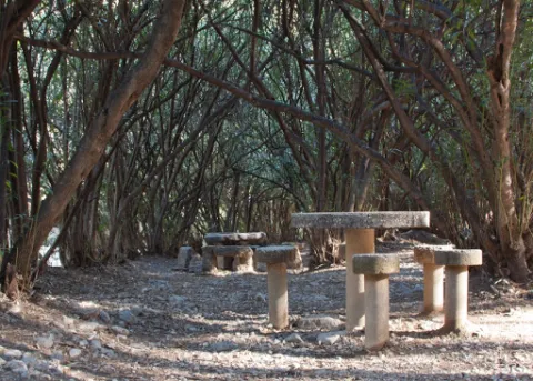
Next to Onsares are the recreational area of the Dehesa del Bear and the imposing Peña del Cambrón, natural view of the saws of Segura and Alcaraz.

Breve descripción

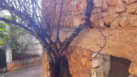
The village ofOnsarsis located in one of the most idyllic landscapes of Villarrodrigo. The river of the same name passes south of the municipal term a bright valley where its traditional farmhouses are scattered.
Ubicación
Código Postal
23393
Latitud
38.458870
Longitud
-2.604820
Distrito
Municipio
Ubicación en el mapa
POINT (-2.60482 38.45887)
Tipos de punto de interés
Imágenes carrusel
imagen
Image
onsares.jpg
Imagen principal
Desactivado
Imágenes cabecera
imagen
Image
onsares%202.jpg
Imagen principal
Activado
Loading map
Preparing points of interest and routes...

Hamlet of Los Guindos

Submitted by brandcode_deweloper on
Id
2854730
Descripción
Descripción larga

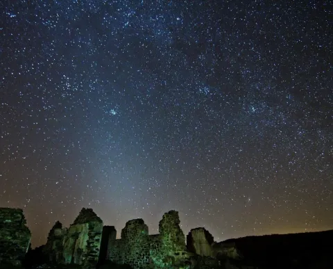
The village of Los Guindos, in the town of La Carolina, has a spectacular north and west horizon, where on winter nights it is possible to observe the elusive zodiacal light.

Especially recommended in the autumn and winter months with the arms of Perseus and Orion hiding in the west.

With easy access and very close to the A-4 motorway, we are facing a magnificent enclave from which to enter into the wonders of the universe within the framework of the Reserve and Starlight Tourist Destination of Sierra Morena.

Breve descripción

The ancient mining complexes in the northern province of Jaén are magnificent observation sites, the presence of ancient mineral loading and discharge structures offer the possibility to install our telescopes in large, barrier-free vents.

Ubicación
Latitud
38.308570
Longitud
-3.683200
Distrito
Municipio
Ubicación en el mapa
POINT (-3.6832 38.30857)
Tipos de punto de interés
Imágenes carrusel
imagen
Image
JJG_1255.jpg
Imagen principal
Desactivado
Imágenes cabecera
imagen
Image
Aldea de Los Guindos
Imagen principal
Activado
Microsite al que pertenece
Loading map
Preparing points of interest and routes...
Marcas de calidad

Hamlet of Fuentefría

Submitted by brandcode_deweloper on
Id
8146351
Descripción
Descripción larga

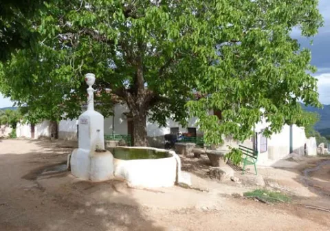
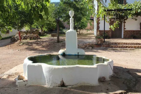
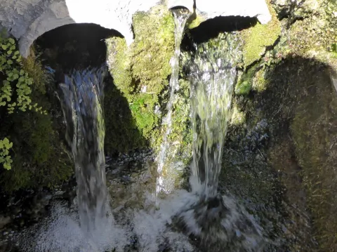
We highlight the source that is located in the centre of the village, where you can reach a track in good condition that leaves south from Collado Mahón (on the road from Torres de Albanchez to Villarrodrigo). The source of the work and with two years pours to two semicircular pillars. The water is the toima of a spring in an olive grove about 300 m south-west.

Breve descripción

In this village we will have the opportunity to contemplate beautiful views of the Natural Park. Near the settlement we can visit the Fucofría fountain, a water spring located at the foot of Mount La Cordera.

Telecomunicaciones
Teléfono de contacto
953 494 005
Ubicación
Código Postal
23391
Latitud
38.415062
Longitud
-2.676886
Dirección
Carretera de Torres de Albanchez
Distrito
Ubicación en el mapa
POINT (-2.676886 38.415062)
Tipos de punto de interés
Imágenes carrusel
imagen
Image
fuente%20de%20Fuenfr%C3%ADa3.jpg
Imagen principal
Desactivado
imagen
Image
fuente%20de%20Fuenfr%C3%ADa2%20%281%29.jpg
Imagen principal
Desactivado
Imágenes cabecera
imagen
Image
fuente%20de%20Fuenfr%C3%ADa%20%281%29.jpg
Imagen principal
Activado
Horario
is
Loading map
Preparing points of interest and routes...

La Garza Airfield

Submitted by brandcode_deweloper on
Id
1921586
Descripción
Breve descripción

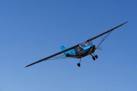
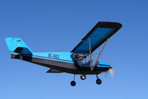
"César Portillo" airfield, located 3 km north of the city of Linares and 1 km. of the "La Garza" sports complex. It is accessed by the A-312 from Linares towards Arquillo. It has a grass track of 400 x 20 meters. It houses the headquarters of the Aeroclub Linares. At this aerodrome, national tests are held annually in the mode of aeromodelism by radio control.

Ubicación
Código Postal
23700
Latitud
38.102860
Longitud
-3.628020
Distrito
Municipio
Ubicación en el mapa
POINT (-3.62802 38.10286)
Imágenes carrusel
imagen
Image
ULM%20008%20%281%29.jpg
Imagen principal
Desactivado
Imágenes cabecera
imagen
Image
ULM%20007%20%281%29.jpg
Imagen principal
Activado
Loading map
Preparing points of interest and routes...

Adelfar del Río Cuadros

Submitted by brandcode_deweloper on
Id
5845551
Descripción
Breve descripción

The natural adelfal of the Cuadros River is probably one of the largest and most important of the Iberian peninsula. In this case they form a curious gallery forest.

Ubicación
Latitud
37.790160
Longitud
-3.407520
Distrito
Municipio
Ubicación en el mapa
POINT (-3.40752 37.79016)
Tipos de punto de interés
Imágenes carrusel
imagen
Image
unnamed.jpg
Imagen principal
Desactivado
imagen
Image
rio-cuadros-bedmar-garciez_14676034_20200923133251.jpg
Imagen principal
Desactivado
Imágenes cabecera
imagen
Image
727_ss_01-1-jpg
Imagen principal
Activado
Microsite al que pertenece
Loading map
Preparing points of interest and routes...

Aqueduct

Submitted by brandcode_deweloper on
Id
4540839
Descripción
Descripción larga

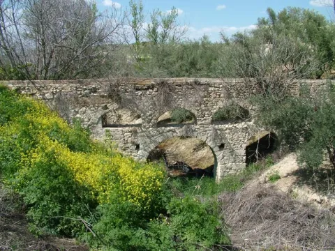
In Hornos de Peal, one of the pedanias of Peal de Becerro, is still in operation an old aqueduct, which has been built by Roman, which continues to challenge the passage of time and that of a river that crosses it below by deteriorating it.

Ubicación
Código Postal
23460
Latitud
37.913500
Longitud
-3.112890
Municipio
Ubicación en el mapa
POINT (-3.11289 37.9135)
Tipos de punto de interés
Imágenes carrusel
imagen
Image
acueducto.jpg
Imagen principal
Desactivado
Imágenes cabecera
imagen
Image
Monumentos7AcueductodeHornosdePeal.jpg
Imagen principal
Activado
Loading map
Preparing points of interest and routes...

Acebuche de Las Hoyas

Submitted by brandcode_deweloper on
Id
7459299
Descripción
Descripción larga
  • In some places it is described as a millennial and in others, a centenary.
  • Access is made by asphalt road on foot or by car.
Breve descripción

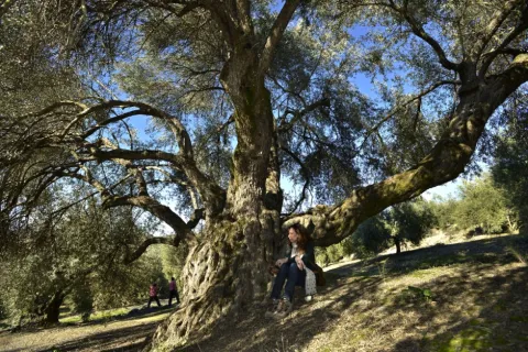
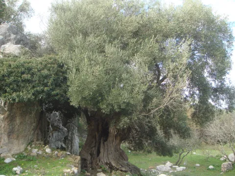
The Acebuche de Las Hoyas is distinguished both by its extraordinary dimensions and by its age. It is located near the limit of the Natural Park Sierras de Cazorla, Segura and Las Villas. It stands out its height of 15 meters and a large conical-shaped comb that measures almost 10 meters of perimeter at its base. The projection of the cup is 132.73 m ². The fuse has very obvious and longitudinal ostenses and filigranes, especially on the foot, which show the second reason for singularity, age, as it is sure to exceed 350 years.

Ubicación
Código Postal
23476
Latitud
37.938670
Longitud
-2.991190
Dirección
Carretera de La Iruela a Los Prados, Km. 2,500. Paraje de las Hoyas
Municipio
Ubicación en el mapa
POINT (-2.99119 37.93867)
Tipos de punto de interés
Imágenes carrusel
imagen
Image
eb6c7c01c4e98e1f2578f9959463b973_XL%20%281%29.jpg
Imagen principal
Desactivado
imagen
Image
Acebuche.jpeg
Imagen principal
Desactivado
Imágenes cabecera
imagen
Image
eb6c7c01c4e98e1f2578f9959463b973_2_XL.jpg
Imagen principal
Activado
Loading map
Preparing points of interest and routes...

Holly and Lauroid Forests de alta montaña

Submitted by brandcode_deweloper on
Id
919588
Descripción
Descripción larga

By withdrawing the ice, the Azebos undertook a migration to the contrary, reconquering to the north the lost territory, so we can say that all the Azebos of Europe are descendants of ours. So, when we enjoy this forest, let us remember that these stalks are waiting for the next glaciation... so that, after it, Europe will again have stalks.

This forest is accompanied as a vault by a canopy of salgary pines and a tapestry of ferns (Pterydium aquilinum) and herbaceas (Dactylis glomerata, Poa nemoralis, Festuca nevadensis, Brachypodium sylvaticum, Viola kitaibeliana, Bellis perennis, Sanicula europea) and others better known as the wild strawberry (Fragaria vesca), the tears of David or the seal of Solomon (Polygonatum), and the greater (Pallatago (Pallatago).

LOCATION

We take the road that leaves a mile from Siles in the direction of the Azebeas. We follow it until we reach a crossing that comes to our right, is wide and has a barrier and a sign that announces us the public use path of Navalperal. It is only necessary to walk half a mile before reaching the forest house of the Azebeas. Both to our right and to our left is a splendid forest of steels accompanied by hazelnuts.

Breve descripción

The acebedas, where the dominant tree or bush is the acebo (Ilex aquifolium), is such a closed formation that it does not allow the development of sotoscala. Finding a forest like this in the south, in Andalusia, is a luxury. These forests extend through the center and north of the Peninsula, and the ones we have here are a vegetable jewel. These balls came here thousands of years ago, pushed south by the cold and ice of the last glaciation.

Ubicación
Latitud
38.387861
Longitud
-2.582637
Distrito
Municipio
Ubicación en el mapa
POINT (-2.582637 38.387861)
Imágenes carrusel
imagen
Image
604_AR_01.jpg
Imagen principal
Desactivado
imagen
Image
Acebedas-2.jpg
Imagen principal
Desactivado
imagen
Image
Acebedas.png
Imagen principal
Desactivado
Imágenes cabecera
imagen
Image
acebeas.jpg
Imagen principal
Activado
Loading map
Preparing points of interest and routes...

Layer Fan Stratification en Hinojares (Arroyo Turrillas)

Submitted by brandcode_deweloper on
Id
660720
Descripción
Descripción larga

This set of layers is an angular discord with expansive overlaps over materials of triatic age. This is a magnificent example of the filling of an alluvial fan, fed by the prebetic reliefs immediately to the north.

Source: Inventory of Georresources of Andalusia. Environmental Council. Junta de Andalusia.

Breve descripción

In the Arroyo Turrillas flora a powerful unit of conglomerates, limos, and clays with carbonates of continental origin, which form a spectacular range of layers.

Ubicación
Latitud
37.715542
Longitud
-2.998754
Municipio
Ubicación en el mapa
POINT (-2.998754 37.715542)
Tipos de punto de interés
Imágenes carrusel
imagen
Image
P1080987.JPG
Imagen principal
Desactivado
imagen
Image
P1080773.JPG
Imagen principal
Desactivado
Imágenes cabecera
imagen
Image
P1090156.JPG
Imagen principal
Activado
Loading map
Preparing points of interest and routes...

Centro Comercial Abierto de Andújar

Submitted by brandcode_deweloper on
368830
Facebook
https://www.facebook.com/cca.andujar
Breve descripción

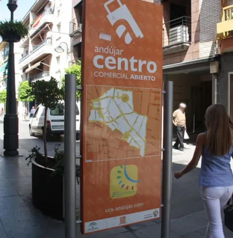
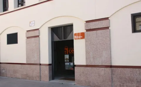
The Open Commercial Centre of Andújar has been officially recognized as the Open Commercial Centre of Andalusia by the Tourism and Trade Council of the Junta de Andalucía. The Chamber of Commerce and Industry of Andújar, which manages the Open Commercial Centre, was aware yesterday of the need to overcome the need for official recognition and will place the municipality of Andújar in the small group of Andalusian cities that have this quality distinction.

Teléfono
953 511 997
Sitio web
http://www.cca-andujar.com/
Correo electrónico
info@cca-andujar.com
Nombre
Centro Comercial Abierto de Andújar
Código Postal
23780
Latitud
38.04029
Longitud
-4.05462
Dirección
Pza. Rivas Sabater
Ciudad
Ubicación en el mapa
POINT (-4.05462 38.04029)

"

  • San Francisco Street
  • Calle Corredera de Capuchino
  • Ollerias Street
  • August 12 Avenue
  • Square of the Constitution
  • Calle Ibáñez Marín
  • Calle Ramón y Cajal
  • Calle Los Hornos

"

imagen
Image
cca-andujar
Imagen principal
Activado
imagen
Image
centro comercial
Imagen principal
Desactivado
imagen
Image
centro comercial
Imagen principal
Desactivado
Loading map
Preparing points of interest and routes...