Saltar al contenido principal
icon-intereses-en-pareja

La Iruela

Submitted by brandcode_deweloper on
Id
918750
Descripción
Descripción larga

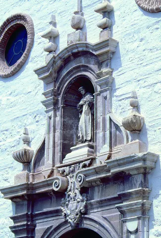
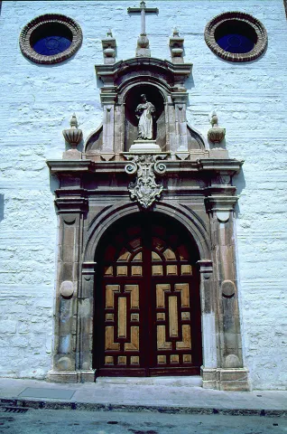
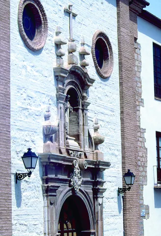
Next to the castle you will find the ruins of the Church of Sto. Silos Sunday. The legend tells that it was built on the place where the Arabs held captive Christians in prison and there was Santo Domingo doing his job. In the building there are traces of the disciples of Vandelvira. It's a must-see for any lover of history.

The Iruela was part of Cazorla until 1370, when Archbishop D. Gome Manrique gave it independence, power and shield. His political and territorial position has allowed him to preserve an important heritage: the Conistory House - a proud building in the Mudejar style of Toledan - and the Church of the Immaculate Conception are part of this legacy.

The population has a core worth visiting. The streets are steep and narrow, with crouched houses and flowers on the balconies. In the center there is a beautiful fountain from which several roads arise to surround the village. From here you can go up to Temple Street on a beautiful stone road accompanied by fig trees and cypresses.

We suggest:

  • About five minutes from La Iruela you will find Burunchel. Come to know the Hermitage of San Julián and the temple of the Holy Spirit among other attractions of this pedany.
  • On August 27, during the summer parties of the village you will see a curious pyrotechnic show, in which the castle is also the protagonist.
Breve descripción

The road that goes up to the saw from Cazorla borders this small, but amazing population. Its best known profile is due to the castle, a legendary fortress that became owned by the Templars and dominates the Guadalquivir Valley. The need to defend itself has given rise to this fortification which, because of its most abrupt aspect, is inexortable. But the Iruela is more attractive.

Ubicación
Latitud
37.920351
Longitud
-2.994140
Municipio
Ubicación en el mapa
POINT (-2.99414 37.920351)
Tipos de punto de interés
Imágenes carrusel
imagen
Image
iruela.jpeg
Imagen principal
Desactivado
Imágenes cabecera
imagen
Image
La-Iruela-Jaen-nuevo-municipio-turistico-de-Andalucia-foto-de-Junta.jpg
Imagen principal
Activado
Loading map
Preparing points of interest and routes...
Marcas de calidad

Archivo Histórico Provincial de Jaén

Submitted by brandcode_deweloper on
Id
PUN-0012
Perfil de redes sociales
Descripción
Descripción larga
In 1952, already at the expense of the Institute of Giennese Studies, the notarial protocols of the Jaén and Andújar district were transferred to some premises. A group of fellows, with no specific knowledge or direction, tried to formalize this first delivery. Following the appointment of Don Melchor Lamana Navascués, an official of the Optional Corps of Archives and Libraries, as director of the Provincial Historical Archive of Jaén (hereinafter AHPJ), the scientific organization of these funds is carried out in a place given by the City Council on Julio Ángel Street. As a result of the new situation, the centenary protocols were received from the districts of Alcalá la Real, Huelma and La Carolina, as well as the books of the Mortgage Contaduries of Andújar, La Carolina and Jaén. The delegation of the Ministry of Finance transferred its historical fund: Intencia, Unique Contribución, which includes the Marqués de la Ensenada, Colonization of Sierra Morena and Provincial Administration of Income. The AHPJ moved in 1973 to the so-called "House of Culture," where it shared a building with the State Public Library. Once again, it was able to receive funds from the Commission of Supply and Transport, Notarial districts of Cazorla, Linares, Martos and Villacarillo, Books of Accounts of Mortgages of Linares, Court of Jaén District, Delegation of Statistics, and as always of Finance. In 1977, the Decree of Legal Creation of the AHPJ was published. The precariousness of space forced most funds to be placed on the ground, hence they were not accessible. This, together with the collapse in the growth of the State Library, leads the Ministry of Culture to seek new and definitive building for the AHPJ. The efforts culminated in the cession of the use of the Royal Convent of Santa Catalina Martir, of the order of Santo Domingo, property of the Ella. Provincial Council. From the whole of convent and church, declared Good of Cultural Interest and located in the old town of the city, the building corresponding to the convent was rehabilitated, by the architect Don Luis Berges Roldán. The project was completed for two purposes, to recover an emblematic building of the city and to provide Jaén with a file of 7,089 square meters, of which 2,515 are for deposits that enable it for more than 12,000 linear meters of open shelf. The transfer and its immediate implementation took place in July 1989, although it was officially reopened on 30 November 1989. Since then, AHPJ has tripled its funds, with effective coordination with agencies throughout the public administration. It is managed by the Autonomous Community of Andalusia, although the ownership of the Archive and its funds belong to the State.
Breve descripción
The Decree of 8 March 1931 created, at the regulatory level and in a general manner, all the Provincial Historical Archives. In Jaén, the efforts to implement the creation were initiated by the official of the Optional Corps, Don Antonio Alcalá Venceslada, without the desired results being produced; justified negative reports of the then Inspector General, Don Miguel Gómez del Campillo, aborted the first attempts.
Telecomunicaciones
Sitio web
https://www.juntadeandalucia.es/organismos/turismoculturaydeporte/areas/cultura/archivos/archivos-consejeria/archivo-historico-provincial-jaen.html
Teléfono de contacto
953 313 570 / 953 313 571
Correo electrónico
informacion.ahp.ja.ccul@juntadeandalucia.es
Ubicación
Código Postal
23003
Dirección
C/ Santo , 12
Distrito
Municipio
Tipos de punto de interés
Imágenes cabecera
imagen
Image
Real_Convento_de_Santo_Domingo
Imagen principal
Desactivado
Microsite al que pertenece

Paraninfo Antigua Universidad de Baeza

Submitted by brandcode_deweloper on
Id
PUN-0007
Perfil de redes sociales
Descripción
Breve descripción
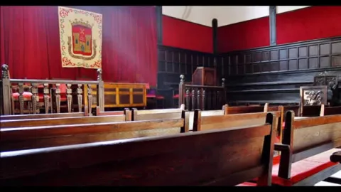
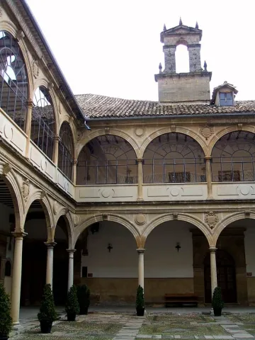
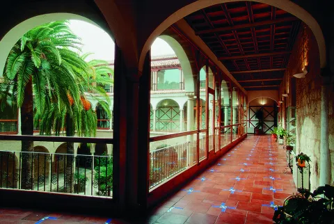
The building of the second half of the 16th century, is structured around a large courtyard with double half-point arches on the dogrous columns and ancestors at the top and in the mirrors and shields. Around are distributed the dependencies, with stone garrison in the lower cloister; among others are the staircase and, above all, the paraninfo, the square floor space, with the gradual and high wooden ceiling, of pairs, knuckles and straps, with a horizontal cloth carved from cassettes and hexagon.
Telecomunicaciones
Sitio web
www.juntadeandalucia.es/cultura/agendaculturaldeandalucia/evento/antigua-universidad-de-baeza
Teléfono de contacto
953 779 522
Correo electrónico
23000817.edu@juntadeandalucia.es
Ubicación
Código Postal
23440
Dirección
San Juan de Ávila, Baeza
Municipio
Tipos de punto de interés
Imágenes carrusel
imagen
Image
Baeza.-Paraninfo-de-la-Antigua-Universidad.jpg
Imagen principal
Desactivado
Imágenes cabecera
imagen
Image
Baeza_-_Antigua_Universidad_08.JPG
Imagen principal
Activado
Microsite al que pertenece

Plaza del Pópulo

Submitted by brandcode_deweloper on
Id
PUN-0006
Perfil de redes sociales
Descripción
Descripción larga
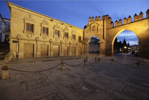
(…) In a serene square, which has an elegant but mutilated and dismantled palace, a graceful altar with rag flowers next to the aristocratic seriousness of a triumphal arch with a warrior air, and a fountain with lions blurred in the stone (…) The Plaza del Populo was one of the most important squares in Baeza, which housed the main public buildings. In this square were located institutions such as the Old Butcher Shops - current headquarters of the courts -, the Civil Court and Public Notary Office or Casa del Pópulo - current Tourist Office -, the Arco de Villalar, the Puerta de Jaén or the Fuente de los Leones, named after the ornamental elements in the shape of a lion through which the water gushed and which apparently come from the Ibero-Roman ruins of Cástulo, which today is in questionable, because for experts in Iberian sculpture its carving in siliceous stone and its formal appearance suggest a much more modern chronology.
Breve descripción
As he does with the Santa María square, Federico García Lorca describes the plaza del Pópulo or Lions square in an admiring and somber way, lamenting the abandonment in which it is found.
Telecomunicaciones
Teléfono de contacto
953 303 572
Ubicación
Código Postal
23001
Dirección
C/ Roldán y Marín, 1
Municipio
Tipos de punto de interés
Imágenes cabecera
imagen
Image
Baeza-plaza-del-pópulo-y-arco
Imagen principal
Desactivado

Former Hospital of San Juan de Dios

Submitted by brandcode_deweloper on
Id
PUN-0004
Perfil de redes sociales
Descripción
Breve descripción
In the old town of Jaén, since the 15th century, there was a great hospital called St. John of God. Thanks to the private donations and the patronage of the Municipal Council, this health institution became, over time, one of the longest hospitals in Spanish history, and the largest single hospital in Jaén. For several centuries, he obtained the merit and honour of being a true care model that managed to spread throughout the Spanish monarchy.
Telecomunicaciones
Sitio web
www.dipujaen.es
Teléfono de contacto
953 248 000
Correo electrónico
ieg@dipujaen.es
Ubicación
Código Postal
23004
Dirección
Plaza San Juan de Dios, 2
Distrito
Municipio
Tipos de punto de interés
Imágenes carrusel
imagen
Image
Mon169.jpg
Imagen principal
Desactivado
imagen
Image
Mon468.jpg
Imagen principal
Desactivado
imagen
Image
Mon466.jpg
Imagen principal
Desactivado
imagen
Image
Mon457.jpg
Imagen principal
Desactivado
imagen
Image
Mon455.jpg
Imagen principal
Desactivado
Imágenes cabecera
imagen
Image
H._San_Juan_de_Dios_x19x.jpg
Imagen principal
Activado
Microsite al que pertenece

Palacio Diputación Provincial de Jaén

Submitted by brandcode_deweloper on
Id
PUN-0003
Perfil de redes sociales
Descripción
Descripción larga
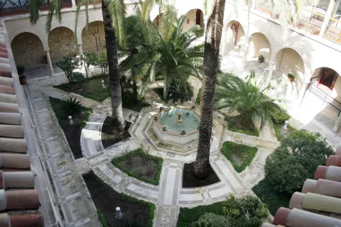
Before finding the right building for the government and provincial administration, the Diputación was located in different buildings in the old town of the capital. Finally, in 1891 the provincial government will move to the Plaza de San Francisco from where still today the Provincial Palace continues to preside over the passage of Bernabé Soriano Street, from the vicinity of the Cathedral. The Provincial Palace is the main work of the civil architecture of the city of Jaén. It was not the first time the Diputación had occupied this site. In fact, the first building that houses the Institution was the Convent of San Francisco, built in 1246 by Fernando III the Holy as a palace with chapel and donated in 1354 by King Pedro el Cruel to the Franciscan friars. With the deamortization, like the rest of the city's convents, it will pass to public hands by hosting our Diputación. It was the poor state of the building that led the Provincial Council to travel through other enclaves of the capital, although the desire to return to that Plaza remained latent. In the middle of 1867, threatening ruin, the convent was demolished to raise in the same place, after almost thirty years of construction, the current Provincial Palace. Jorge Porrua and Moreno were the architect of the project that guides the construction: a traditional building with two floors and basement that revolve around an interior courtyard. In front of the façade, thought of as neoclassical but removed with the neobaroque taste of the architect Justino Flores de Llamas; on the opposite face, the north, a semicircular form that resembles a hemicycle, symbolic space of local democracy. When entering the building the first stop is for the courtyard. It condemns the light and the transfer through the vain galleries, filling the dependencies with life. Coronado with balustrated columns and carpeted by the gardens, round around a fountain from which the image of the virgin emerges. A sculptural set from the Convent of Dominics of the Guard and donated by its owners, to occupy in principle the courtyard of the Provincial Museum. On the first floor, the office of the Presidency is located among others. Already on the second floor is the Hall of Illustrated Characters on whose walls and as witnesses of time are the portraits of jiennenses highlighted throughout history. The balcony of this room serves as a privileged lookout from which to contemplate the Cathedral. Also on this floor is the Salon de Plenos, the heart of local democracy in the province. The Full Hall or Sessions Hall owes its harmonious decoration to the project of the architect Justino Flórez Llamas. Its style recovers the historical mannerist tendencies. The entrance view to the stay draws three parts, the largest central. Most of the decoration is concentrated on the top of the walls in which striated columns give rise to interdices in which large medallions are placed with glass windows supported by children. Most of the windows have civil symbolology related to the province, mainly shields of various municipalities. Close the decoration the roof divided into fifteen milled quadrants in which the three spider lamps that set the living room in a place. The wealth and grandiosity of the stay seems to try to rise to the function assigned to it. The Chamber provides for the full meetings of the Members, at the head of them the President and the other Members in the form of an Chamber. The banks for the attendees are available in front. The plenary sessions of the Council are open to all citizens.
Breve descripción
The Provincial Palace of Jaén is the main work of the civil architecture of the city of Jaén and houses the headquarters of the Provincial Diputación.
Telecomunicaciones
Sitio web
https://www.dipujaen.es/conoce-diputacion/sedes-y-directorios/palacio-provincial/
Teléfono de contacto
953 303 573
Correo electrónico
secretariaturismo@dipujaen.es
Ubicación
Código Postal
23006
Dirección
Plaza San Francisco. S/N
Distrito
Municipio
Tipos de punto de interés
Horario
Monday to Friday: 09: 00-15: 00 / Weekends and holidays: 10: 00-14: 00

Forestrand Track Peña del Olivar - Puentehonda

Submitted by brandcode_deweloper on
Id
931026
Descripción larga

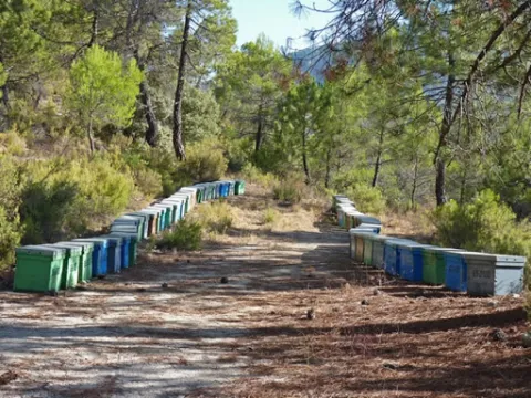
The track runs on the northwest face of Mount Bucentaina. When we have been walking for about 20 minutes we will reach the source of the Noguerón, from which there is plenty of water. In this place, the path PR-A 175 is separated by a path to the left. We're still on the main road.

At first we will see the mountains and olive groves around Siles, and then enter the forest. It is one of the best pineapples of carrasco pine the Natural Park. Just as the village of Puentehonda appears before us, we see on the left, on the same road, two gigantic and venerable specimens of carrasco pine, which are included in the Inventory of Singular Trees of Andalusia with the names of Pino de los Barrilos de Puentehonda and Pino del Cerro Bucentaina and respectively. The latter is 32 m high and 4.5 m in diameter at its base.

We will also find in our way an indication to go up a narrow and steep path to the remains of the castle of Puentehonda, whose ruins, corresponding to two towers, are half hidden in the thickness of the forest.

The village of Puentehonda, at the foot of the Peñalta, has a small recreational area with a fountain in which it is worth resting. The way back and forth, doing so quietly, will take about four hours.

Breve descripción

This route, of just under 5 km, runs along a narrow forest track that we recommend to walk. Its main attraction is the carrasco pine forest that crosses, under which grows a closed forest of oak, madroños and doves. The first kilometer is quite steep, but the rest is barely at a level. To reach the village of Puentehonda it is enough to follow the track, without taking any detour, until it ends up in another of greater width. The other side of the village is the village.

Latitud
38.1402
Longitud
-2.5704
Distrito
Ubicación en el mapa
POINT (-2.5704 38.1402)
imagen
Image
unnamed%20%2812%29.jpg
Imagen principal
Activado
imagen
Image
1%20%282%29.png
Imagen principal
Desactivado
imagen
Image
20.jpg
Imagen principal
Desactivado

Nature

icon-intereses-naturaleza

Friends

icon-intereses-amigos

Adventure

icon-intereses-aventura

Culture

icon-intereses-cultura

Sport

icon-intereses-deporte

Eco-friendly

icon-intereses-eco-friendly

For couples

icon-intereses-en-pareja

Family

icon-intereses-familia

Gastronomy

icon-intereses-gastronomia

Municipality

icon-intereses-municipio

Low-cost tourism

icon-intereses-turismo-low-cost

Solo travel

icon-intereses-viajar-solo
Pista Forestal Peña del Olivar - Puentehonda
Desactivado

Cerrada del Utrero and Cascada de Linarejos

Submitted by brandcode_deweloper on
Id
930180
Descripción larga

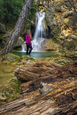
The Guadalquivir made this canyon narrow and deep, leaving some streams - like that of Linarej- hanging on the heights. When this stream is at the throat it forms the spectacular Cascade of Linarejos, which after standing in some pozas joins the Guadalquivir to descend to the valley.

The path is 1.6 km and on its circular route it surrounds the "Peñón del Lanchón" to return to the road in a pleasant walk of about 45 minutes.

In the final part of the road - just before returning to the asphalt - you reach a pine-resinero or black forest (Pinus pinaster) that was used to obtain the resin with which the water used to be made. In these trees you will see the furrows that the resineros opened to allow the exit of this sap.

We suggest:

  • Observe the numerous rupicular birds that nest on the rocky wall in front of our path, as we pass the waterfall of Linarejos. You will see small species, such as the victor, the lone rocher or the white lavender, sharing space with much larger ones like the leonate vulture.
  • Get to know the small town of Vadillo-Castril, where the old Rife sawmill was and today it is the home of two agencies of great importance for the Natural Park: the School of Forest Capataces and the Forest Defense Center.
Breve descripción

The site known as Cerrada del Utroo-Linarejos is an amazing natural work sculpted by the Guadalquivir in the limestone that surrounds it. The path is on foot, and it will allow you to appreciate the sharp rocks and objades created by water over hundreds of thousands of years. It is a charming walk where the labiérnago, the cornicabra, and the willow accompany you to one of the most photographed places in the Park: the "horse tail" or Cascada de Linarejos.

Latitud
37.9054
Longitud
-2.9553
Municipio
Ubicación en el mapa
POINT (-2.9553 37.9054)
imagen
Image
cascada_de_linarejos_g.jpg
Imagen principal
Activado
imagen
Image
arroyo-de-linarejos-jpg
Imagen principal
Desactivado

Family

icon-intereses-familia

Friends

icon-intereses-amigos

Nature

icon-intereses-naturaleza

Adventure

icon-intereses-aventura

Solo travel

icon-intereses-viajar-solo

Culture

icon-intereses-cultura

Gastronomy

icon-intereses-gastronomia

Sport

icon-intereses-deporte

Municipality

icon-intereses-municipio

Low-cost tourism

icon-intereses-turismo-low-cost

Eco-friendly

icon-intereses-eco-friendly

For couples

icon-intereses-en-pareja
Cerrada del Utrero y Cascada de Linarejos
Desactivado

El Aguardentero

Submitted by brandcode_deweloper on
Id
929850
Descripción larga

We deviate from the road, in order to see, upstream, a spectacular leap of water, with a large poza in its base, whose waters look an emerald green by the reflection of the lush vegetation surrounding it. Let us take our way back, to reach a small hill, with a very particular silhouette. It is the Paso del Aguartedo, place of impressive views towards the countryside.

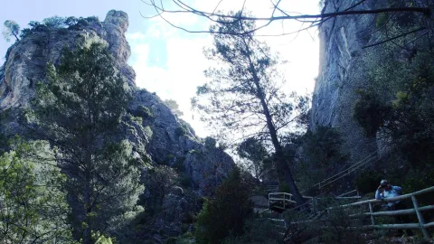
The path is conditioned and low, with a serpentating route, on a steep and rocky slope. On our left we found a striking oquity - an ashtray - where the shepherds used to keep their cattle. Below we reach a small lookout, where the path is fork. We follow the one on the right, until we get back to the channel to contemplate the majestic cascade of the Osera, perhaps one of the highest and beautiful waterfalls of Andalusia.

We continue along the path marked, by the narrow and steep ravine, enjoying the multiple pozas of the channel, to a walkway that crosses the river and back the path to the Odera lookout. If at this point we continue along the road that goes parallel to the channel, we will reach the explanade of La Osera, place where the vehicles are left when it is accessed from Mogón.

For these wonderful places it is very easy to observe the flight of the leonate vulture. The real eagle is also present and, if we look well, we can even see the little perdicular eagle.

We suggest:

  • In a place like this, where water is the protagonist, spring is, of course, the most splendid season.
  • The path can also be done in the ascending sense, starting from Mogon.

The most recommended option is to make the path down. From the reservoir of Aguascebas, the walk is 4.5 km, from the km 18.8 of the road JH-7155 (Transversal de las Villas). At this point, to our left are the houses of the reservoir and, right behind it, we can observe an old quarry, where the path starts.

Breve descripción

This path will allow you to discover one of the most charming environments in the Las Villas mountains. It runs along the natural channel of the river Aguascebas Chico, where we will discover unusual and unexpected corners. Following him, on our right, we found fenced land of ancient crops and a small cortijo half-melting. This place is known as "Las Ramblillas." In the deep valley you can see the river Aguascebas Chico.

Latitud
38.1901
Longitud
-2.6903
Municipio
Ubicación en el mapa
POINT (-2.6903 38.1901)
imagen
Image
aguardentero.jpg
Imagen principal
Activado
imagen
Image
El%20Aguardentero.png
Imagen principal
Desactivado
imagen
Image
15483593Master.jpg
Imagen principal
Desactivado

Nature

icon-intereses-naturaleza

Friends

icon-intereses-amigos

Adventure

icon-intereses-aventura

Culture

icon-intereses-cultura

Sport

icon-intereses-deporte

Eco-friendly

icon-intereses-eco-friendly

For couples

icon-intereses-en-pareja

Family

icon-intereses-familia

Gastronomy

icon-intereses-gastronomia

Municipality

icon-intereses-municipio

Low-cost tourism

icon-intereses-turismo-low-cost

Solo travel

icon-intereses-viajar-solo
Baja
El Aguardentero
Desactivado
Tramo de asfalto o cemento
 
Tramo de pista o camino forestal
 
Tramo de vía pecuaria
 
Tramo de senda
 

Río Guazalamanco

Submitted by brandcode_deweloper on
Id
913911
Descripción larga

Once the asphalt ramp is over, the most painful stretch of the road, we reach an excellent lookout that allows us to enjoy a good view of the reservoir and the Valentine Barrio. A little later the track runs parallel to the river. When it wanders the way, without crossing, we follow the shore to the corners full of charm that we will meet. Later we will be forced to leave the shore to access a lane. We continue upstream, until we reach the Dike Cascade, very easy to distinguish because in its crown it has stone walls. A little lower, hidden in the bush, a beautiful leap of water is hidden that we must not miss.

Overcoming the Cascade of the Dique, part of a path that, at first, crosses the channel twice and takes us to the head of the river. Leaving the bottom of the ravine for a long time, and then returning to it, when the road ends on a forest track, we reach the bottom of the Cerrada de Navas, where the Guazalanco offers one of its most beautiful pictures.

However, to get to this point from above and to make the way down the stream, you can make an interesting route from the Nature Hall and Botanical Garden of El Hornico: Route of Guazalamanco on the Prays of Arredondo. This circular itinerary is signposted and has 13.2 (circular) length. If two vehicles are available and leaving one on the Cuesta del Cement, we reduce the route to 8.8 km and, in addition, we avoid the most flat and monotonous part of the route, the Dehesa del Rincón.

The most direct access to the Guazalamanco River is by the Dehesa del Rincón. From Pozo Alcón you have to take the A-326, up the Avenida de la Bolera, direction to Castril. By passing the campsite de la Bolera and the Km. 7, we take a detour that comes to our left and that borders the Forest House of la Bolera (it indicates to the Hornico). On an unasphalted road, always following the main road, 6,7 km from its start a fork to the left, in a slope, is left, which is asphalted (Cuesta del Cement). Although with an apron we can reach the Pasada de Guazalamanco, by a forest track parallel to the channel, the most recommended option is to leave the vehicle at the foot of the hill and take a small walk to the Cascade del Dique (round and round 2.5 km), and enjoy the many corners that this beautiful and wild mountain stream offers us.

Breve descripción

Guazalamanco is a mountain channel of permanent and turbulent waters, loaded with oxygen and gelid glass. Each of its corners invites us to recreate our senses, to remain still, in silence, as if we wanted to merge with nature and return to our origins. If you forget the camera in the car, when you discover the stream you will return to your steps to restart the road, now with the machine ready.

Latitud
38.1704
Longitud
-2.7002
Municipio
Ubicación en el mapa
POINT (-2.7002 38.1704)
imagen
Image
cascada-del-guazalamanco.jpg
Imagen principal
Activado
imagen
Image
guazalmanco.jpg
Imagen principal
Desactivado

Nature

icon-intereses-naturaleza

Friends

icon-intereses-amigos

Adventure

icon-intereses-aventura

Culture

icon-intereses-cultura

Culture of the Bull

icon-intereses-cultura-del-toro

Sport

icon-intereses-deporte

Eco-friendly

icon-intereses-eco-friendly

For couples

icon-intereses-en-pareja

Family

icon-intereses-familia

Gastronomy

icon-intereses-gastronomia

Municipality

icon-intereses-municipio

Low-cost tourism

icon-intereses-turismo-low-cost

Solo travel

icon-intereses-viajar-solo
Baja
Río Guazalamanco
Activado