Saltar al contenido principal

Visitor Centre Viñas de Peñallana

Submitted by brandcode_deweloper on
Id
2343298
Descripción
Descripción larga

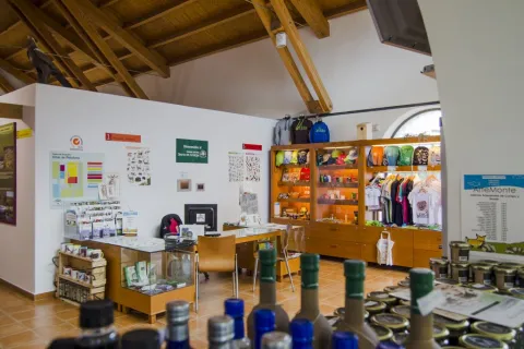
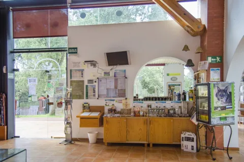
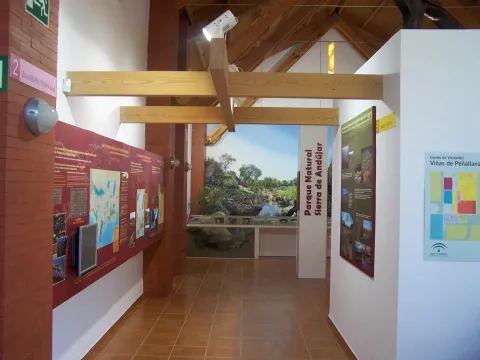
As if a portion of the natural park had been removed, in this center, the visitor can taste his morphology or walk through a recreated Mediterranean forest where to identify plant species and their aromas or discover its inhabitants in a fun way. Many emblematic species threatened find refuge in these saws; this is the case of the Iberian wolf, whose cubit is faithfully reproduced.

Among all the emblematic species of the park, the Iberian lince stands out. Its traces will lead the user to discover its habitat and behavior, as well as the problem that makes it the most threatened felline on the planet.

In this centre you can also know the way of life of its inhabitants, their historical development and how a harmonious exploitation of resources allows the conservation of valuable environments such as the Andújar saws.

Breve descripción

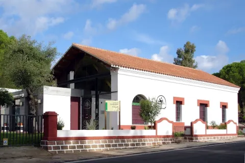
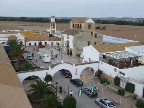
At the entrance of the Sierra de Andújar Natural Park, the Viñas de Peñallana visitors' centre is located, where you can find a first approach to the different environments of the environment and the multitude of living beings that inhabit them.

Telecomunicaciones
Teléfono de contacto
699 275 531
Correo electrónico
cvvinaspenallana@reservatuvisita.es
Ubicación
Código Postal
23740
Latitud
38.116430
Longitud
-3.964010
Dirección
Carretera del Santuario A-6177, km. 13
Distrito
Municipio
Ubicación en el mapa
POINT (-3.96401 38.11643)
Tipos de punto de interés
Imágenes carrusel
imagen
Image
709_CV_04.jpg
Imagen principal
Desactivado
imagen
Image
709_CV_03.jpg
Imagen principal
Desactivado
imagen
Image
709_CV_01.jpg
Imagen principal
Desactivado
Imágenes cabecera
imagen
Image
Imagen_006.jpg
Imagen principal
Activado
Horario
Summer: Saturdays and Sundays 08: 00 - 14: 00 (18 Jun to 31 Aug).
Microsite al que pertenece
Loading map
Preparing points of interest and routes...

Castle of la Aragonesa

Submitted by brandcode_deweloper on
Id
4276980
Descripción
Breve descripción

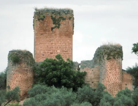
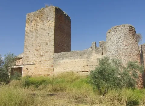
The Castle of La Aragonesa is located in the area of La Aragonesa, near the village of San Julián, in the municipal term of Marmolejo and close to the provincial boundary between Córdoba and Jaén. During Islamic domination, Marmolejo must have been a small village or cortijo, since it is hardly mentioned in the chronicles until 1311 in which it is mentioned as a parish. It had a small castle, in which was the hermitage of San Lorenzo. From this castle there is only news that in the 15th century it was in dispute between the Marquis of Villena and the constable Miguel Lucas of Iranzo.
The best preserved medieval settlement in its term is the castle of the Aragonese, of Islamic origin, which after the conquest was used to transform it into a palaciega residence.

Telecomunicaciones
Sitio web
www.villademarmolejo.es/urbanismo-y-monumentos/monumentos/castillo-de-la-aragonesa/
Teléfono de contacto
953 540 126
Correo electrónico
info@ayuntamientodemarmolejo.es
Ubicación
Código Postal
23770
Latitud
38.021580
Longitud
-4.254150
Distrito
Municipio
Ubicación en el mapa
POINT (-4.25415 38.02158)
Tipos de punto de interés
Imágenes carrusel
imagen
Image
Castillo%20de%20la%20Aragonesa%203.png
Imagen principal
Desactivado
Imágenes cabecera
imagen
Image
Castillo%20de%20la%20Aragonesa%20%281%29.jpg
Imagen principal
Activado
Horario
24 h.
Microsite al que pertenece
Loading map
Preparing points of interest and routes...

Castle of Burgalimar

Submitted by brandcode_deweloper on
Id
320772
Descripción
Descripción larga

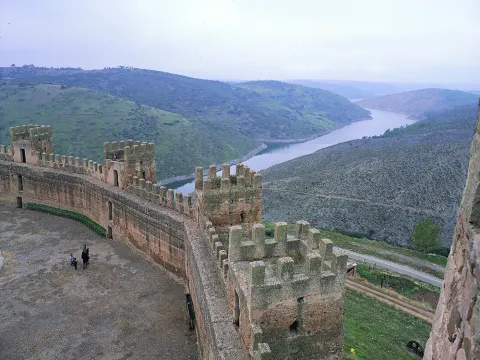
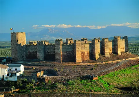
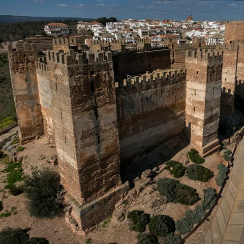
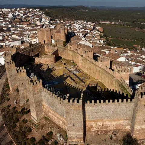
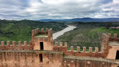
El castillo de Baños de la Encina, tradicionalmente ha sido considerado una obra califal a partir de la confusión generada por una lápida fundacional que le fue atribuida erróneamente, constatándose que la misma estuvo emplazada en la muralla de Talavera de la Reina, siendo todos los epígrafes que se han registrado en la localidad de carácter funerario. La fortaleza ocupa la zona de mayor altitud del Cerro del Cueto, mientras que la población de Baños de la Encina se extiende por sus vertientes norte y este, junto a uno de los afluentes más caudalosos e importantes del río Guadalquivir, el Rumblar.

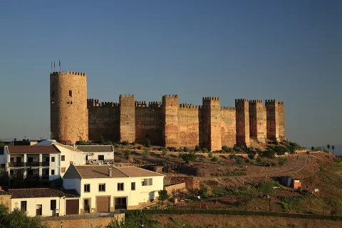
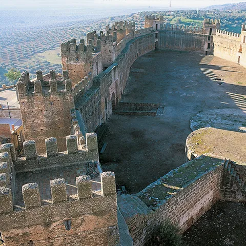
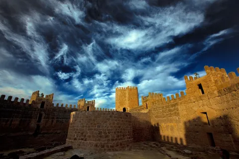
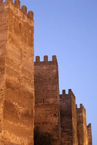
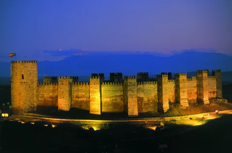
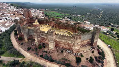
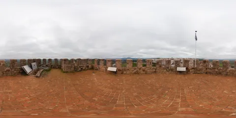
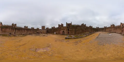
Se trata de un monumental recinto defensivo, conformado por paños de muralla jalonados por quince torres cuadradas de tapial de argamasa (Tabiyya), revestido con cal que reproduce la técnica del “falso despiece”, entre las que destaca la torre norte por sus dimensiones. El recinto se adapta perfectamente a la orografía del terreno, conformando una fortaleza amurallada con forma elíptica, estratégicamente posicionada, ya que controla Sierra Morena por el norte y toda la campiña jiennense, por el sur. 

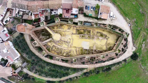
En el espacio interior se disponen diferentes estancias, en su mayoría de planta cuadrada, a ambos lados del recinto, existiendo en la zona central, la más elevada del cerro, un aljibe de planta rectangular, dividido en dos salas por un muro medianero, cubiertas por bóvedas de cañón.

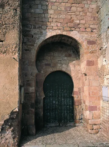
La entrada al recinto se realizaba en recodo, utilizando un estrecho pasillo que se formaría entre la muralla y las diferentes estancias, para alcanzar la parte sur del recinto o incluso el acceso al aljibe. De la misma forma, hacia el norte, las dependencias de la fortaleza estarían separadas o distribuidas siguiendo otro vial, en esta ocasión empedrado, que llegaría hasta la torre más septentrional del recinto. Estas dos calles, que circulan de sur a norte, dividen y ordenan la mitad septentrional del castillo en tres alargados espacios, a la vez que daban acceso a las torres, en cuyo interior se disponen pequeñas estancias superpuestas. Ambas calles se cortan con la reforma cristiana y la construcción del alcazarejo, pero se conservan algunos restos en este nuevo espacio cristiano.

Enfrentada con la entrada principal, en la zona occidental del lienzo de muralla, se emplaza la Pontanilla, puerta delimitada por dos muros, posteriormente reformados, con el mismo sistema defensivo que la entrada principal, con un pasillo estrecho y quebrado.

Tras la conquista por Fernando III de Castilla en 1225 se produce un reordenamiento interno del castillo y de su sistema defensivo. 

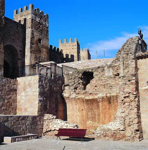
Se construye en la zona norte el Alcazarejo, con un torreón circular y dos murallas de sillarejos que se adosan a los lienzos musulmanes del castillo. Así se obtiene un espacio romboidal, que se convierte en el último reducto defensivo y protege la Torre del Homenaje, que sustituye a la original torre islámica. De mayores dimensiones y edificada en mampostería, se accedería a ella por los adarves laterales. En el interior del recinto externo se han documentado otras dependencias castellanas, como un espacio de almacén y bodega en el rincón este y estructuras posiblemente destinadas a horno para pan y lagar.

La utilización del Castillo como cementerio hasta 1928, afectó gravemente a los restos arqueológicos, pudiéndose observar en la actualidad las improntas de los nichos en algunos lienzos de la muralla oeste.

La riqueza minera y su ubicación estratégica atrajeron pobladores desde época prehistórica al Cerro del Cueto. La primera ocupación de importancia registrada, ligada al auge de la minería del cobre y después del bronce data del II milenio a.n.e., coincidiendo temporalmente con el poblado de Peñalosa. Son asentamientos con las similares características, que se deben considerar de la misma estructura político-económico-social. 

La ocupación iberorromana parece concentrarse en la zona más alta del cerro, donde se han documentado varias fases de ocupación casi ininterrumpidas que se extienden desde el ibérico pleno hasta época romana tardía. 

Tras la conquista musulmana de la Península Ibérica, la población se instalaría en las faldas del recinto defensivo. En la zona más elevada debió existir un bastión militar que reutilizaría los muros y lienzos preexistentes.

Tradicionalmente se ha considerado que el castillo de Baños de la Encina fue edificado durante el reinado de al-Hakam II en la segunda mitad del siglo X, a partir de la atribución errónea de una lápida epigráfica depositada en el Museo Arqueológico Nacional, sin embargo, las últimas investigaciones han puesto de manifiesto la edificación de este conjunto defensivo en un periodo anterior a los acontecimientos bélicos que culminaron con la Batalla de las Navas de Tolosa (1212), para servir de baluarte defensivo junto a los castillos de Castro Ferral, Las Navas de Tolosa o Vilches, ante el avance de las tropas cristianas, guiadas por sus monarcas, entre los que destacarían Alfonso VII y Alfonso VIII.

Tras su conquista en 1225 por Fernando III, pasó a formar parte de un amplio territorio concejil bajo la jurisdicción de la ciudad de Baeza, siendo objeto de significativas remodelaciones internas concentradas en la parte más septentrional de la fortaleza.

A lo largo de los siglos XVI y XVII, la población va realzando su poder económico y social con la construcción de grandes edificios señoriales de familias de un cierto rango social, provenientes sobre todo de Baeza y Linares, que se irán estableciéndose a ambos lados de la vía principal. La posibilidad de que la villa estuviese delimitada por una cerca muraria, con una función más fiscal que defensiva, está avalada por algunos vestigios aún perceptibles en el núcleo urbano. En época de Felipe IV, en 1626, Baños adquiere la independencia jurisdiccional, desgajándose del gran Concejo de Baeza.

El castillo parece mantener su carácter militar hasta el siglo XVII, a partir del cual sufrirá un proceso de deterioro y abandono que se prolongará con toda probabilidad hasta el siglo XIX, cuando se comenzará a utilizar el patio de armas como cementerio municipal hasta bien entrado el siglo XX.

 

Breve descripción

In the Cerro del Cueto, a rocky elevation of 430 m above sea level, the imposing castle of Baños de la Encina, a defensive enclosure built in the 12th century and reformed after the Christian conquest, is now erected. Its strategic position allowed it to control Sierra Morena in the north and the entire Jiennense countryside in the south. It is made up of an alcázar and an outer enclosure jalonado by fourteen square towers made of argamase tapial and a tower of Tribute in irregular masonry. In its interior, archaeological interventions have shown, in its most southern sector, an occupation since prehistoric to Roman times. At present, remains of a Bronze Age village or a step that could belong to a large Roman cult building are preserved.
The mining wealth of this region and its strategic location on the communication routes between Andalusia and the Plateau, have led to the settlement of different populations at its top, highlighting an important settlement of the Bronze Age, coetany of Peñalosa. Several almost uninterrupted phases of occupation have also been documented, ranging from the full Iberian to late Roman times. In the Middle Ages, in the face of the advancement of Christian armies, a network of fortifications is created in the surroundings of Sierra Morena, of which will form part the castle of Baños, built in the 12th century by the Almohades and reinforced by the Castilians after its conquest in 1225. The population boom throughout the 16th and 17th centuries has been reflected in the numerous nobility buildings that the town retains.

Telecomunicaciones
Teléfono
<p>José María Rodríguez Valle</p>
Sitio web
www.laencinaturismo.com
Teléfono de contacto
953 613 338 / 626 818 446
Correo electrónico
info@laencinaturismo.com
Ubicación
Nombre
Cerro del Cueto
Código Postal
23711
Latitud
38.170310
Longitud
-3.775320
Dirección
Plaza de Santa María, 1
Distrito
Ubicación en el mapa
POINT (-3.77532 38.17031)
Tipos de punto de interés
Imágenes carrusel
imagen
Image
Mon290.jpg
Imagen principal
Desactivado
imagen
Image
_MG_1884%20%281%29.jpg
Imagen principal
Desactivado
imagen
Image
Castillo de Burgalimar
Imagen principal
Desactivado
imagen
Image
Castillo de Burgalimar
Imagen principal
Desactivado
imagen
Image
Castillo de Burgalimar
Imagen principal
Desactivado
imagen
Image
Castillo de Burgalimar
Imagen principal
Desactivado
imagen
Image
Castillo de Burgalimar
Imagen principal
Desactivado
imagen
Image
Castillo de Burgalimar
Imagen principal
Desactivado
imagen
Image
Castillo de Burgalimar
Imagen principal
Desactivado
imagen
Image
Castillo de Burgalimar
Imagen principal
Desactivado
imagen
Image
Castillo de Burgalimar
Imagen principal
Desactivado
imagen
Image
Castillo de Burgalimar
Imagen principal
Desactivado
imagen
Image
Castillo de Burgalimar
Imagen principal
Desactivado
Imágenes cabecera
imagen
Image
cyb_banosdelaencina_castillo_01
Imagen principal
Desactivado
imagen
Image
cyb_banosdelaencina_castillo_02
Imagen principal
Desactivado
imagen
Image
cyb_banosdelaencina_castillo_04
Imagen principal
Desactivado
Horario
All year round except 25 Dec, 1 and 6 Jan: Monday to Friday 11: 00 - 14: 00. 16 sept - 15 Jun: 16: 00 - 18: 00. 16 Jun - 15 sept: 19: 00 - 21: 00. Guided tours every 45 minutes. More info: www.laencinaturismo.com / 626 818 446.
Experiencia 360
Image
cyb_banosdelaencina_360_torre
Image
cyb_banosdelaencina_patiodearmas360
Loading map
Preparing points of interest and routes...

Casa-palacio de los Niños de Don Gome

Submitted by brandcode_deweloper on
Id
1914212
Descripción
Descripción larga

The house was part of the majority created in 1571 by Doña María Baltodano, wife of Don Gome de Cárdenas. It will be Elvira Cárdenas Baltodano and her husband Don Luis Valdivia Figueroa, gentleman of Santiago, who begin the construction of the said house.

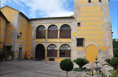
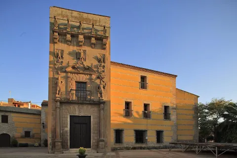
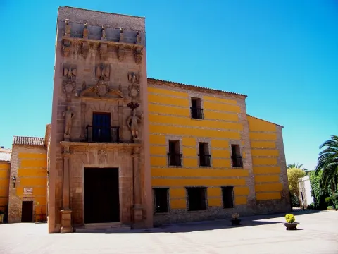
Two elements of very different use make up the house of the Children of Don Gome: the house of the inhabitants and the cavalry. On the façade of the house, built in a plane more advanced than that of the cavalry, stands out its porta-tower, built unlike the other elements of the set in sandstone. Portada- tower that was built in the second third of the 17th century by Don Gome de Valdivia, Cárdenas and Guzmán and Doña Mayor Nicuesa and that is formally framed in the Baroque style.

The façade, retranqued with respect to Maestra Street, is preceded by a spacious square, which was public until 1848, year which was annexed to the house and closed with a wall lined with door and half-point vanos.

The pillow cover is almost unnoticed by the exuberant decoration, two Indian-accent, repetitive heraldic, and a highlighted cornice, as more prominent elements. Inside are preserved the cavalry with part of the fish, a porticated courtyard and the winery.

The building currently has a cultural use, in it is located the Archaeological Museum Professor Sotomayor, is the seat of the courses of the University of Autumn of the University of Jaén and the corporation performs the plenums in the hall of the Caballeros

Breve descripción

A solariega house from the late 16th and early 17th century, belonging to the Cardenas- Valdivia lineage. It is located on Maestra Street, near the arch of the Virgin Mary, missing in 1778.

Telecomunicaciones
Sitio web
https://www.turismodeandujar.com/palacio-don-gome
Teléfono de contacto
953 500 603
Ubicación
Código Postal
23740
Latitud
38.036130
Longitud
-4.052050
Dirección
C/ Maestra, s/n
Distrito
Municipio
Ubicación en el mapa
POINT (-4.05205 38.03613)
Tipos de punto de interés
Imágenes carrusel
imagen
Image
Anotaci%C3%B3n%202020-04-16%20073945.jpg
Imagen principal
Desactivado
imagen
Image
ni%C3%B1os%20de%20don%20gome.jpg
Imagen principal
Desactivado
imagen
Image
Anotaci%C3%B3n%202020-04-16%20074107.jpg
Imagen principal
Desactivado
imagen
Image
Anotaci%C3%B3n%202020-04-16%20074030.jpg
Imagen principal
Desactivado
imagen
Image
IMG_1572.jpg
Imagen principal
Desactivado
Imágenes cabecera
imagen
Image
Ni%C3%B1os%20de%20Don%20Gome.jpg
Imagen principal
Activado
Horario
Winter: Tuesday to Friday 10: 30 - 13: 30 and 16: 30 - 18: 30, Saturday and Sunday 12: 15 - 14: 00, except holidays. Summer: Tuesday to Friday 09: 00 - 14: 00, Saturday and holiday 11: 00 - 14: 00.
Microsite al que pertenece
Loading map
Preparing points of interest and routes...

Count of La Quintería House

Submitted by brandcode_deweloper on
Id
8090970
Descripción
Descripción larga

The infant Charles III, son of Philip V, in one of his travels, stayed in this palace on October 27, 1731, then the infant Charles III, King of Spain from 1759.
He stayed in this palace to avoid an outbreak of smallpox plaguing Andújar.
In the afternoon he was distracted by hunting from his window and at nightfall he witnessed from the windows of his room the artefacts that were prepared for such an occasion in Andújar.

Breve descripción

In 1705, King Philip V awarded the title of Count of the Quinteria to Eugene José de Miranda and Gamboa of the local nobility, and was issued in the name of Manuel Francisco de Cárdenas and Palomino, his son-in-law, the first Count of the Quinteria.

Telecomunicaciones
Sitio web
www.vreina.com
Teléfono de contacto
953 537 110
Ubicación
Código Postal
23730
Latitud
38.016530
Longitud
-3.951620
Distrito
Ubicación en el mapa
POINT (-3.95162 38.01653)
Tipos de punto de interés
Imágenes carrusel
imagen
Image
Casa%20del%20Conde%20de%20La%20Quinter%C3%ADa2.jpg
Imagen principal
Desactivado
imagen
Image
Casa%20del%20Conde%20de%20La%20Quinter%C3%ADa3.jpg
Imagen principal
Desactivado
Imágenes cabecera
imagen
Image
Casa%20del%20Conde%20de%20La%20Quinter%C3%ADa.jpg
Imagen principal
Activado
Microsite al que pertenece
Loading map
Preparing points of interest and routes...

Basilica and Royal Sanctuary of Nuestra Señora de la Cabeza

Submitted by brandcode_deweloper on
Id
910348
Descripción
Descripción larga
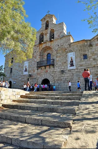
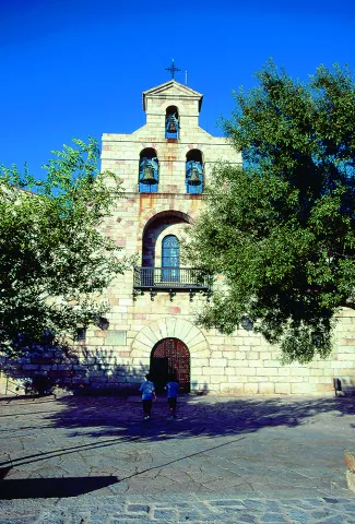
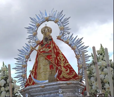
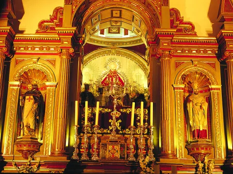
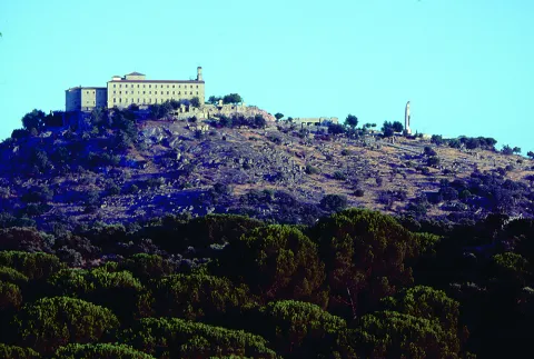
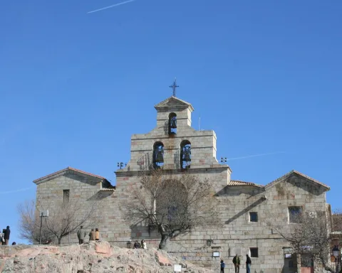
Nothing remains of the primitive hermitage, since throughout the 16th century and on its foundations, a sanctuary was built, a large part of it destroyed during the last Civil War (1936-1939). The siege and defense of the Sanctuary of the Virgin of Cabeza was magnified by the Franco regime. But until it became a parish headquarters, the Sanctuary has gone through different vicissitudes since its origin. According to all indications, the construction works began in 1287 and ended in 1304, first being a small hermitage that the people of Andújar built in the heart of Sierra Morena. However, the expansions and reforms have been almost constant throughout the ages, reaching their maximum splendor in the 16th century, between 1530 and 1590, when it became a Sanctuary, very similar to the one we know today. In 1945 the architect Prieto Moreno, conservator of the Alhambra, directed the restoration works of the architectural complex, which became one of the most precious symbols of the national Catholicism of the dictator Francisco Franco. The pilgrimage continues to be celebrated, as is custom and tradition, on the last Sunday of April, although the image that is venerated, carved by the Granada sculptor Navas Parejo, is not the original one, since it disappears in strange and still unclear circumstances in the aforementioned contest. Thanks to the Book of Chapters of the Brotherhood (1554-1565), preserved in the Diocesan Archive of Jaén (made known by J. Domínguez, R. Frías and S. Lázaro), we know numerous data about the level of work on the new Renaissance church during these years, although the process began years ago; The new factory began at the head, with the large main chapel being built between the years 1534 and 1541 according to a late Gothic plan, being separated from the rest by a beautiful Renaissance railing. The works on the rest of the temple passed through various hands and circumstances. The Trinitarian Community has addressed two new expansions. The first consisted of raising the projecting floor, building another pavilion in the rear area of ​​the North wing. Thus, the entire structure of the cloister patio was completed in a harmonious and functional way. The second phase was carried out in 1965 in the entire north wing, adding a three-story building to expand the rooms of the Trinitarian priests who attend to worship, permanently since 1930. The central nave is separated from the Main Chapel by a 16th century grille, restored by the School of Arts and Crafts of Granada, which closes an opening with a semicircular arch. The High Altar has a large space in the center, behind which is the Virgin's dressing room; carving by José Navas Parejo, which replaced the old one that disappeared during the civil war. The side chapels of the nave are occupied by different altars, containing various images, such as a Crucified by the sculptor Mariano Benlliure, the Virgin of Pilar, Blessed Marcos Criado, San Juan Bautista de la Concepción, the Holy Trinity and the Virgin of Carmen. In the choir there is a magnificent organ, a gift from the Civil Guard, inaugurated by the famous master organist Guridi. Behind the Main Chapel is the sacristy. In 1555, the master stonemason Domingo de Azpeitia undertook to build a temple with three naves with column supports, however, at the express wish of the prelate Don Diego Tavera (1555-1560), this approach was radically transformed, prohibiting the execution of the pillars. Don Diego Tavera sent Andrés de Vandelvira to give new plans for the church, as noted in the minutes of April 27, 1558 of the aforementioned Book of Cabildos. Vandelvira eliminated the pillars with the idea of ​​designing a different, larger church, with a single nave with chapels-niches open to it. In 1559, Vandelvira visited the works and presented new plans for its conclusion, as well as the design of the main façade. For less than a year the construction was under the control of Francisco del Castillo “El Mozo”, and the Brotherhood even required a certain report from Hernán Ruiz II. In 1562, the Brotherhood requested a new inspection of Andrés de Vandelvira, but he did not respond. In any case, the project continued with the stonemasons proposed by Vandelvira, Juan Martínez and Domingo de Jay, who executed what remained following the guidelines and the plan designed by the Master. This must have been the case, as can be seen from the description of the temple that Salcedo de Olid made in the 17th century: “It has a nave without columns (...) and the main chapel is distinguished, majestic and very attractive.” Based on the remains preserved after its destruction in 1936, the Vandelvirian temple actually included a church with a large nave, covered with a barrel vault and niche chapels, which was separated from the main chapel by a powerful main arch. From the exterior, quite compact, only the façade at the foot is notable with three axis elements: doorway, balcony and belfry. The ornamental nudity of the complex is contemporary with the latest work of Andrés de Vandelvira. The Trinitarian Community has addressed two new expansions. The first consisted of raising the projecting floor, building another pavilion in the rear area of ​​the North wing. Thus, the entire structure of the cloister patio was completed in a harmonious and functional way. The second phase was carried out in 1965 in the entire north wing, adding a three-story building to expand the quarters of the Trinitarian priests who attend to worship, permanently since 1930. OTHER NON-ARCHITECTURAL ARTISTIC MANIFESTATIONS. A Museum has been installed in the Sanctuary with diverse and varied pieces of varying artistic quality. Among all of them, we highlight two paintings from the 17th century with representations of the famous Nuestra Señora de la Cabeza Pilgrimage, an image lost in the last Civil War of 1936-1939. After the war, a new carving was commissioned from the Granada workshops of Navas Parejo, which is the one that has been venerated in Cabezo ever since. One of the few pieces saved from the destruction of the said Sanctuary was the grille of the main chapel, restored in 1941 at the School of Arts and Crafts of Granada. Hired in 1564, it depicts the apparition of the Virgin to the shepherd of Colomera. LITERATURE In the middle of the Civil War, the military rebellion in the province of Jaén failed, a group of civil guards along with their families settled in the Sanctuary of the Virgen de la Cabeza, this being the scene of a bloody siege by the Republican troops. A monument commemorates this event at the entrance to the Sanctuary and if you look closely, traces of shrapnel can still be seen on the side walls of the Basilica. Miguel Hernández will journalistically describe the assault of this siege, transmitting in detail its development, which will last from September 14, 1936 to May 1, 1937, when the besieged surrender. Southern Front. Number 15, May 13, 1937 (...) "The building of the Head dawns before the bloody and dark dawn. In it I saw the representation of a tricorn monster... (...)
Breve descripción
Basilica and Royal Sanctuary of Nuestra Señora de la Cabeza
Ubicación
Código Postal
23740
Latitud
38.179340
Longitud
-4.035280
Dirección
Carretera del Santuario
Distrito
Municipio
Ubicación en el mapa
POINT (-4.03528 38.17934)
Tipos de punto de interés
Imágenes carrusel
imagen
Image
Basi_lica_de_la_Cabeza_1.jpeg
Imagen principal
Desactivado
imagen
Image
Anotaci%C3%B3n%202020-04-16%20082134.jpg
Imagen principal
Desactivado
imagen
Image
Mon504.jpg
Imagen principal
Desactivado
imagen
Image
Captura%20Virgen%20de%20la%20Cabeza.PNG
Imagen principal
Desactivado
imagen
Image
Mon030%20%281%29.jpg
Imagen principal
Desactivado
imagen
Image
Mon134.jpg
Imagen principal
Desactivado
imagen
Image
Mon506.jpg
Imagen principal
Desactivado
Imágenes cabecera
imagen
Image
11072966_740607829371873_2670746898130716885_o%20%285%29.jpg
Imagen principal
Activado
Horario
Every day: 09:00 - 14:00 and 16:30 - 20:00.
Loading map
Preparing points of interest and routes...

Rock Art Baños de la Encina

Submitted by brandcode_deweloper on
Id
10893221
Descripción
Descripción larga

These more or less realistic but generally schematic manifestations reproduce human beings, animals and symbols, forming isolated scenes. The representations not only evoke and report part of daily life, but leave us witness to its complex and mysterious spirituality.

Outdoor museums

These sites can be considered authentic open-air museums of incalculable value, the preservation of which concerns each and every fellow citizen. When visiting them, we must remember with all due respect that we contemplate figures made by the primitive man, but not least human and intelligent, more than 4,000 years ago. All are by law, Cultural Interest Property, the maximum figure of protection that our legislation grants to a property.

Visit the paintings

Visiting these places can be difficult and frustrating, not only because of their access; it can be dangerous, but because sometimes their conservation status is the least poor; and it is recommended that they be visited with a specialist. For this purpose, before scheduling the visit, it is advisable to consult with someone familiar with the place (to advise and guide) or even to be accompanied by a responsible local guide (it is advisable to contact local authorities or associations).

The most representative coats in the area of Baños de la Encina would be the coats of the Nava el Sach and the Barrio del Bu.

Breve descripción

The Rupestre Art, "art on rock," is composed of the pictorial manifestations that our remote ancestors left on the walls of numerous covacas and petreous coats of our saws, in prehistoric times (in our region, from the Neolithic, to the Bronze Age).

Ubicación
Código Postal
23711
Latitud
38.174294
Longitud
-3.774604
Distrito
Ubicación en el mapa
POINT (-3.774604 38.174294)
Tipos de punto de interés
Microsite al que pertenece
Loading map
Preparing points of interest and routes...

Recreational Area La Recta

Submitted by brandcode_deweloper on
Id
2980342
Descripción
Descripción larga

La Recta is a recreational area that has barbecues and tables and is accessed by a signposted path. Its characteristic vegetation is made up of the typical riverside forests of the Sierras de Andújar Natural Park: alarms, sargas, talles, strawberries, which serve as a refuge to faunistic species such as royal herons, zampullines, water cocks, otters. Very close is a watershed to give water to the abundant deer of this saw, next to the dam of the Encinarejo

Breve descripción

It is accessed by the road J-5010 of Andujar to the Sanctuary of the Virgin of the Head, turning left by a track leading to the New Place, very close to the Jandula River.

Telecomunicaciones
Sitio web
www.turismodeandujar.com/areas-recreativas
Teléfono de contacto
953 504 959
Correo electrónico
turismodeandujar@andujar.es
Ubicación
Código Postal
23740
Latitud
38.154730
Longitud
-4.021100
Dirección
Carretera A-6177
Distrito
Municipio
Ubicación en el mapa
POINT (-4.0211 38.15473)
Tipos de punto de interés
Imágenes carrusel
imagen
Image
%C3%81rea%20recreativa%20La%20Recta%202.jpg
Imagen principal
Desactivado
imagen
Image
%C3%81rea%20recreativa%20La%20Recta%203.jpg
Imagen principal
Desactivado
Imágenes cabecera
imagen
Image
%C3%81rea%20recreativa%20La%20Recta%20%281%29.jpg
Imagen principal
Activado
Microsite al que pertenece
Loading map
Preparing points of interest and routes...

Jabalí Recreational Area

Submitted by brandcode_deweloper on
Id
2981139
Descripción
Descripción larga

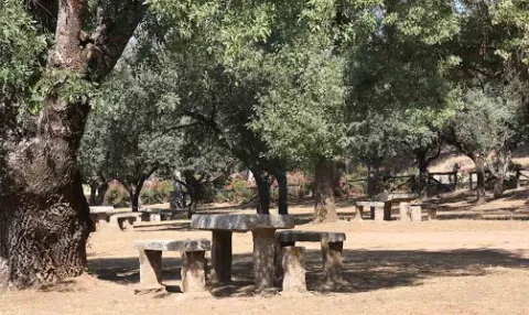
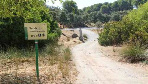
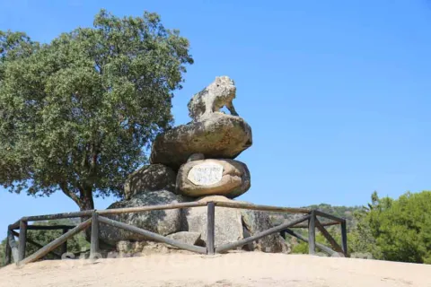
The recreational area of the Jabali is distinguished by the abundance of oak trees surrounded by pine trees, very characteristic of the Sierras de Andújar Natural Park, to which it belongs. It is perfectly equipped to celebrate a family picnic, with tables, banks, barbecues, containers, and even a fountain. His name is given by the remarkable stone sculpture of the lone boar who presides over the space, the work of local artist Luis Aldehuela. The enclave links with the path that connects El Jabali with the Encinarejo.

Breve descripción

It is accessed by the road J-5010, from Andújar to the Sanctuary Virgen de la Cabeza, diverting about 5 km. before reaching the Basilica, right on one of the road's margins. The vehicles can be parked in the same recreational area.

Telecomunicaciones
Sitio web
www.turismodeandujar.com
Teléfono de contacto
953 508 200
Correo electrónico
turismodeandujar@andujar.es
Ubicación
Código Postal
23740
Latitud
38.183160
Longitud
-4.015840
Dirección
Carretera A-6178
Distrito
Municipio
Ubicación en el mapa
POINT (-4.01584 38.18316)
Tipos de punto de interés
Imágenes carrusel
imagen
Image
sierra-de-andujar-42.jpg
Imagen principal
Desactivado
imagen
Image
sierra-de-andujar-38.jpg
Imagen principal
Desactivado
imagen
Image
sierra-de-andujar-40.jpg
Imagen principal
Desactivado
imagen
Image
sierra-de-andujar-39.jpg
Imagen principal
Desactivado
Imágenes cabecera
imagen
Image
sierra-de-andujar-43.jpg
Imagen principal
Activado
Microsite al que pertenece
Loading map
Preparing points of interest and routes...

Venison with quince paste

Submitted by brandcode_deweloper on
349180
Distrito
Municipio
imagen
Image
venado-membrillo.jpg
Imagen principal
Activado
Medium

We peel and cut the membrane, add the sugar and water and reduce it to slow heat; then we pass it and reserve it.

We put all the ingredients in a pot and reduce them to slow heat; then we reserve it.

For the trusted figs, all four units are trusted in syrup.

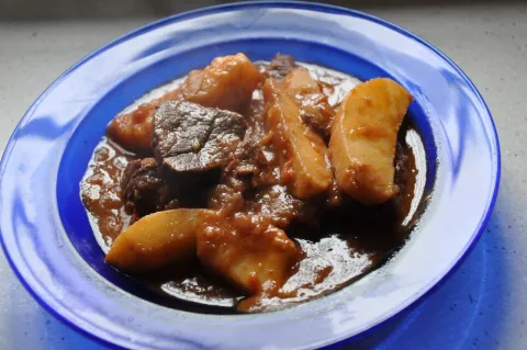
We took the back, splattered it, and fried it with strong fire on both sides. We booked it and split it into eight steaks, two per ration. We mount the dish: 2 fillets with a little salsa covering half filet, a tablespoon of mashed mast and, above all, a trusted fig.

Desactivado

800 gr, thickle sauce, mashed mast, 4 units of confide figs, oil, salt and pepper.

For mashed mast: 200 gr of mast, 200 gr of sugar, 500 cl. of water.

For the carob sauce: meat juice, vinegar, caramel, 1 cup of port.