Saltar al contenido principal

Church of San Mateo

Submitted by brandcode_deweloper on
Id
5868546
Descripción
Descripción larga

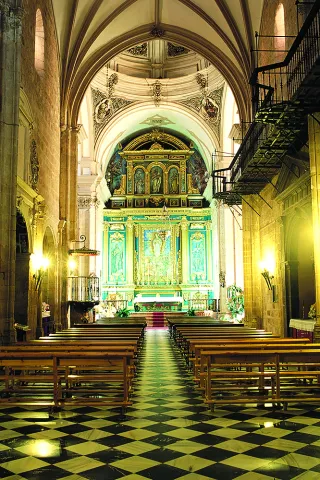
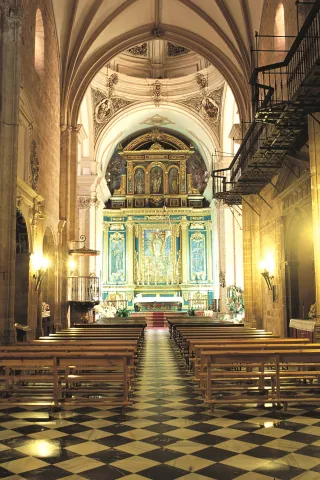
Inside it is a great altarpiece, work by Francisco Palma Burgos. The pulpit, chorus and baptismal pile of the mid-18th century also stand out. But its most important elements are the Sagrarian, one of the jewels of the sacred art of the province of Jaén, dates from the 17th century, built of ebony wood, ivory, silver and shell of Carey, and composed of a plateau with a baroque dome framed by four columns of shell with capitals and silver basements.

Breve descripción

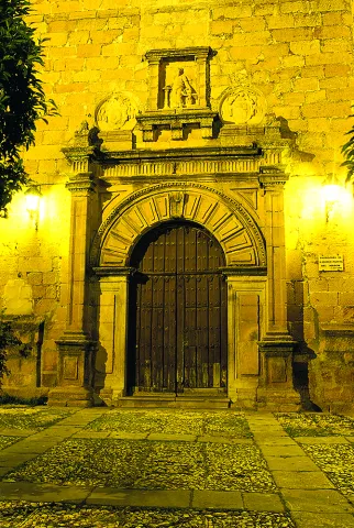
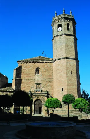
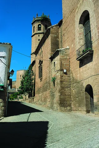
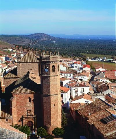
Although the main body is Gothic, the tower has Renaissance finishes, as well as the main cover and expansion developed in the first half of the 18th century from the cruise.

Telecomunicaciones
Sitio web
www.bdelaencinaturismo.com
Teléfono de contacto
953 614 097
Correo electrónico
turismo@bdelaencina.com
Ubicación
Código Postal
23711
Latitud
38.171290
Longitud
-3.774220
Dirección
Plaza de la Constitución, s/n
Distrito
Ubicación en el mapa
POINT (-3.77422 38.17129)
Tipos de punto de interés
Imágenes carrusel
imagen
Image
Mon258.jpg
Imagen principal
Desactivado
imagen
Image
Mon260.jpg
Imagen principal
Desactivado
imagen
Image
Mon259.jpg
Imagen principal
Desactivado
imagen
Image
Mon262.jpg
Imagen principal
Desactivado
imagen
Image
Mon518.jpg
Imagen principal
Desactivado
Imágenes cabecera
imagen
Image
INTERIOR_IGLESIA_DE_SAN_MATEO.jpg
Imagen principal
Activado
Microsite al que pertenece
Loading map
Preparing points of interest and routes...
Granites of La Puerta de Segura

Submitted by brandcode_deweloper on
Id
876209
Descripción
Descripción larga

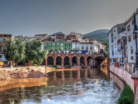
Aflation of paleozoic granite surrounded by prebetic (triasic) materials with which it has a relationship of inconformity. Part of the village is built on the granite, which force a meandro in the Guadalimar River.

These are pink-coloured granules in afloor, in which large quartz and feldspar crystals are distinguished, in general unmeteorized. They are part of a recently exhumed paleorelieve after the erosion of the triastic clays and herring that cover them regionally. This is the granitic outcrop of the Central Iberian Zone of the southernmost Iberian Massif and further into the Betic Externs.

Source: Inventory of Georresources of Andalusia. Environmental Council. Junta de Andalusia.

Breve descripción

Granites of The Safe Gate

Ubicación
Latitud
38.079566
Longitud
-4.164839
Distrito
Municipio
Ubicación en el mapa
POINT (-4.164839 38.079566)
Tipos de punto de interés
Imágenes carrusel
imagen
Image
puerta-segura%20%281%29.jpg
Imagen principal
Desactivado
Imágenes cabecera
imagen
Image
la_puerta_segura_1.jpg
Imagen principal
Activado
Loading map
Preparing points of interest and routes...

Hermitage of the Cristo del Llano

Submitted by brandcode_deweloper on
Id
5868386
Descripción
Descripción larga

It is a shrimp-tower in spadna that dominates by its volume the rest of the temple, whose interior stands out by its funning decoration with geometric and vegetable elements that fill its walls to frescoes with scenes of the New Testament that close the vault in height. It is a building built of reddish stone of regular cut and seat, with a ship with high choir at the feet to which it is accessed through a staircase inserted into a volume attached on the west side; cruise and high presbytery on steps, behind which the shrimp is available.

Breve descripción

Work of the 17th century, extended in its header with one of the most impressive shrimp of the Andalusian baroque.

Telecomunicaciones
Sitio web
www.laencinaturismo.com
Teléfono de contacto
953 613 029
Correo electrónico
info@laencinaturismo.com
Ubicación
Código Postal
23711
Latitud
38.175190
Longitud
-3.774800
Dirección
Plaza de La Ermita, 1
Distrito
Ubicación en el mapa
POINT (-3.7748 38.17519)
Tipos de punto de interés
Imágenes carrusel
imagen
Image
2.jpg
Imagen principal
Desactivado
imagen
Image
1.jpg
Imagen principal
Desactivado
imagen
Image
3.jpg
Imagen principal
Desactivado
Imágenes cabecera
imagen
Image
_MG_1989.jpg
Imagen principal
Activado
Horario
Monday to Friday: 13: 15 - 14: 15. Saturdays, Sundays and holidays: 11: 00 - 14: 00 and 16: 30 - 18: 30.
Microsite al que pertenece
Loading map
Preparing points of interest and routes...

Rumblar Reservoir

Submitted by brandcode_deweloper on
Id
6115043
Descripción
Breve descripción

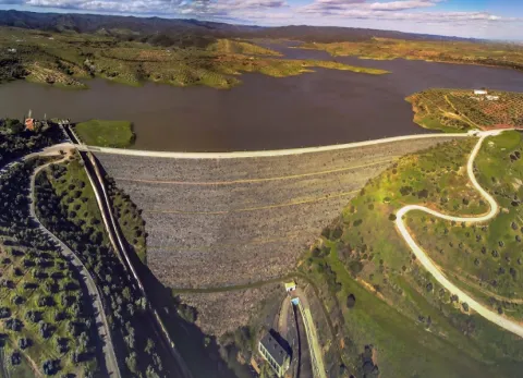
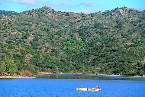
The tent, barbo and Black Bass are present, although the big fish are very rare. The average size is small or at most medium, so it's a perfect place with polo and it can end with a lot.

Ubicación
Código Postal
23711
Latitud
38.191160
Longitud
-3.785430
Distrito
Ubicación en el mapa
POINT (-3.78543 38.19116)
Imágenes carrusel
imagen
Image
Playa-el-tamujoso-embalse-del-rumblar-e1435315737961.jpg
Imagen principal
Desactivado
imagen
Image
Natu159.jpg
Imagen principal
Desactivado
Imágenes cabecera
imagen
Image
Natu103.jpg
Imagen principal
Activado
Microsite al que pertenece
Loading map
Preparing points of interest and routes...
Yeguas Reservoir

Submitted by brandcode_deweloper on
Id
6115426
Descripción
Breve descripción

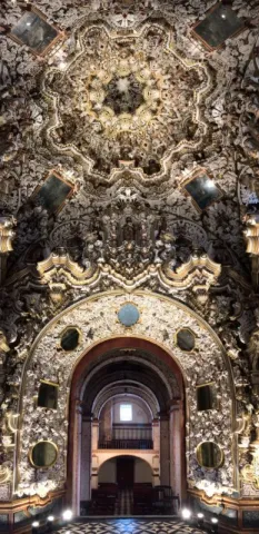
An English stage, ideal for facing tents and barbs above the kilo.It therefore requires a reel and a certain distance to deceive its untrustworthy fish, which usually enter into fine, half-water, and with continuous barley of spice. A very sophisticated plug is also used, with elastic to the third, fourth or fifth tranche, or the bologna in case this technique is dominated.

Ubicación
Código Postal
23770
Latitud
38.079566
Longitud
-4.164839
Distrito
Municipio
Ubicación en el mapa
POINT (-4.164839 38.079566)
Imágenes carrusel
imagen
Image
embalse_yeguas.png
Imagen principal
Desactivado
Imágenes cabecera
imagen
Image
Yeguas_Ferro.jpg
Imagen principal
Activado
Microsite al que pertenece
Loading map
Preparing points of interest and routes...
Jándula Reservoir

Submitted by brandcode_deweloper on
Id
5861609
Descripción
Breve descripción

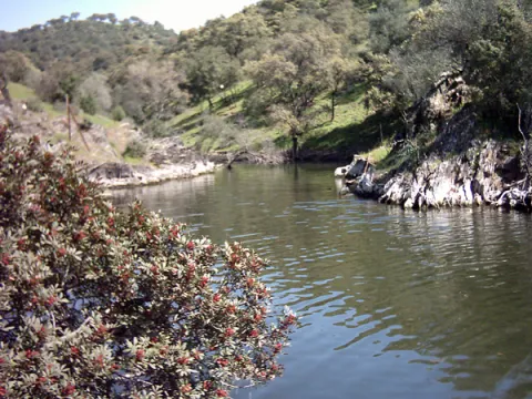
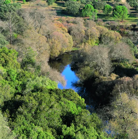
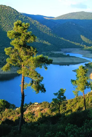
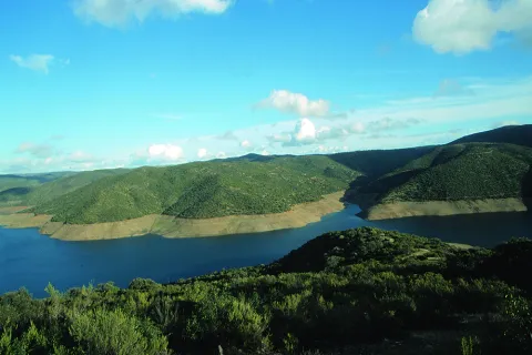
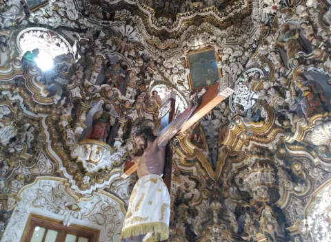
From this viewpoint you can see a beautiful landscape, in which rounded lomas occur with adhesitated extensions around the Jandula reservoir. The effect of the soil reflections on the packaged waters provides a beautiful picture. It is curious to see the clear line that borders the banks of the loins, which suggests how far the water level reaches in rainy times. The reservoir contains species such as black-bass, tent and barb. And next to them, a fish that is only found in these waters and tributaries of the Jandula, called Bogardilla. An ideal time to visit this viewpoint is the autumn, when deer will give us the sound show of the berrea. And with a little luck, we can contemplate the struggle of the males, horn against horn, on their arduous path to reproduction.

Telecomunicaciones
Teléfono de contacto
953 549 030
Ubicación
Código Postal
23740
Latitud
38.258730
Longitud
-3.934320
Distrito
Municipio
Ubicación en el mapa
POINT (-3.93432 38.25873)
Imágenes carrusel
imagen
Image
Natu054.jpg
Imagen principal
Desactivado
imagen
Image
rio-jandula.jpg
Imagen principal
Desactivado
imagen
Image
Natu073.jpg
Imagen principal
Desactivado
imagen
Image
Natu419.jpg
Imagen principal
Desactivado
imagen
Image
Natu425.jpg
Imagen principal
Desactivado
imagen
Image
Natu388.jpg
Imagen principal
Desactivado
imagen
Image
Natu384.jpg
Imagen principal
Desactivado
imagen
Image
Natu118%20%281%29.jpg
Imagen principal
Desactivado
imagen
Image
Natu185.jpg
Imagen principal
Desactivado
Imágenes cabecera
imagen
Image
Natu071.jpg
Imagen principal
Activado
Microsite al que pertenece
Loading map
Preparing points of interest and routes...
Ropera Reservoir

Submitted by brandcode_deweloper on
Id
6217864
Descripción
Breve descripción

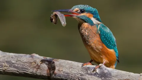
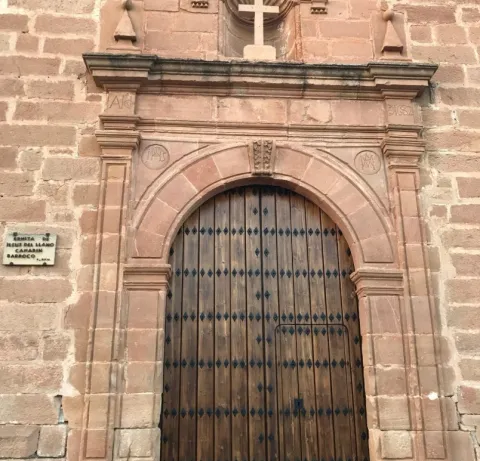
Located in the municipal term of Marmolejo this reservoir is important for the reproduction of Common Calamón, they also raise Common Avetorillo, Imperial Garza, White Cigareña, Common Ciguenuela, Chico Chorlitejo and Martín Pescador. Crab Garcilla in passage, and invert of aquatics.

Ubicación
Código Postal
23770
Latitud
38.063668
Longitud
-4.177130
Distrito
Municipio
Ubicación en el mapa
POINT (-4.17713 38.063668)
Imágenes carrusel
imagen
Image
F195_Foto_01.jpg
Imagen principal
Desactivado
imagen
Image
martin.jpg
Imagen principal
Desactivado
Imágenes cabecera
imagen
Image
11253827Master.jpg
Imagen principal
Activado
Microsite al que pertenece
Loading map
Preparing points of interest and routes...
Encinarejo Reservoir

Submitted by brandcode_deweloper on
Id
2980354
Descripción
Descripción larga

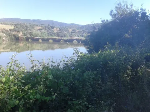
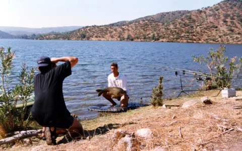
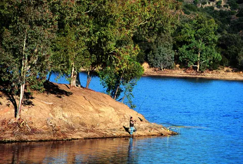
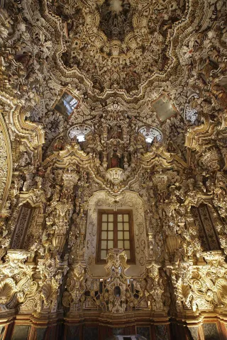
Embalse is located in the Sierra de Andújar Natural Park, in the middle of Sierra Morena, known by all Andalusian fishermen for being one of the largest swamps to practice carpfishing. With calm and clean waters, the Jandula flows into it. The most commonly seen species are tents, gypsy barbs and black bass.

Breve descripción

It is accessed by the J-5010 road from Andujar to the Sanctuary of the Virgin of the Head, diverting on a land road that leads directly to the enclave.

Ubicación
Código Postal
23740
Latitud
38.184490
Longitud
-3.985750
Dirección
Carretera A-6177
Distrito
Municipio
Ubicación en el mapa
POINT (-3.98575 38.18449)
Imágenes carrusel
imagen
Image
Natu090.jpg
Imagen principal
Desactivado
imagen
Image
BOIL-JAE-Encinarejo.jpg
Imagen principal
Desactivado
imagen
Image
Natu435.jpg
Imagen principal
Desactivado
imagen
Image
Natu410.jpg
Imagen principal
Desactivado
imagen
Image
Natu399.jpg
Imagen principal
Desactivado
imagen
Image
Natu391.jpg
Imagen principal
Desactivado
imagen
Image
Natu116.jpg
Imagen principal
Desactivado
imagen
Image
Natu346.jpg
Imagen principal
Desactivado
Imágenes cabecera
imagen
Image
Cesar%20Puente-Ortega%2016-3-05%20%281%29.jpg
Imagen principal
Activado
Microsite al que pertenece
Loading map
Preparing points of interest and routes...
El Batanejo

Submitted by brandcode_deweloper on
Id
4524622
Descripción
Breve descripción

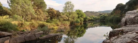
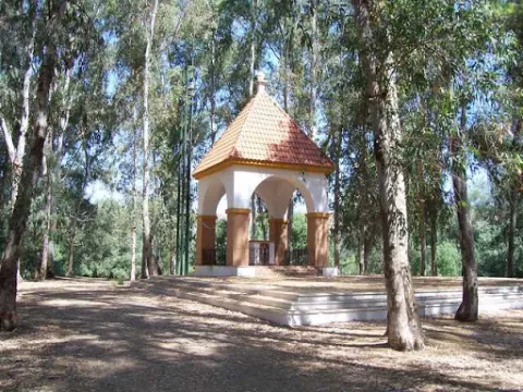
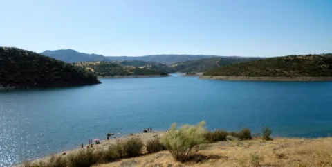
In the vicinity of the town of Villanueva de la Reina we can visit the beautiful and traditional area known as El Batanejo. It is located on the banks of the Guadalquivir River, where the large amount of eucalyptus and its conditioned places will allow us to enjoy an ideal place for rest.

Ubicación
Código Postal
23730
Latitud
38.026220
Longitud
-3.910080
Distrito
Ubicación en el mapa
POINT (-3.91008 38.02622)
Tipos de punto de interés
Imágenes carrusel
imagen
Image
batanejo.jpg
Imagen principal
Desactivado
Imágenes cabecera
imagen
Image
unnamed.jpg
Imagen principal
Activado
Microsite al que pertenece
Loading map
Preparing points of interest and routes...

Control Checkpoint of La Cabrera

Submitted by brandcode_deweloper on
Id
2854602
Descripción
Descripción larga

The access road runs through a relatively easy forest track; this track is taken from the same town of Marmolejo, after crossing the bridge over the Guadalquivir River at the height of the spa.

Right on the north bank of the river a right turn is taken towards the Aliseda, follow those signs and this way for 12.5 km until you reach the closed control door. There you can leave the vehicle and put things on the other side by entering the pedestrian door.

This point is especially suitable for those fans with telescopes and their own means in search of an outstanding sky and with light-taking to connect their equipment.

Breve descripción

Another privileged place is La Cabrera Control, in Marmolejo. The great advantage of this enclave is that it currently has an electric current that can be taken directly from an external plug that is located on the wall of the guard's surveillance shed.

Telecomunicaciones
Sitio web
www.andalucia.org/es/marmolejo-turismo-cultural-control-de-la-cabrera
Ubicación
Latitud
38.044893
Longitud
-4.170983
Distrito
Municipio
Ubicación en el mapa
POINT (-4.170983 38.044893)
Tipos de punto de interés
Imágenes carrusel
imagen
Image
Sendero%20Control%20de%20la%20Cabrera-Santuario%20Virgen%20de%20la%20Cabeza2.jpg
Imagen principal
Desactivado
Imágenes cabecera
imagen
Image
JJG_1117%20%281%29.jpg
Imagen principal
Activado
Microsite al que pertenece
Loading map
Preparing points of interest and routes...