Saltar al contenido principal

Professor Sotomayor Archaeological Museum

Submitted by brandcode_deweloper on
Id
2335242
Descripción
Descripción larga

It was opened in 1999, and is included in the Andalusian Register of Museums and Museum Collections of the Council of Culture of the Junta de Andalucía.

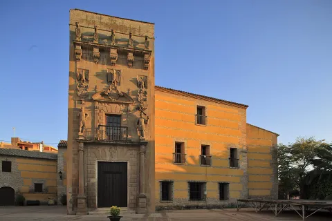
The palace belongs to a property set listed as BIC. It was built by the Cárdenas- Valdivia lineage and the first documents that have been preserved date back to 1570. The splendid torre- cover that characterizes it was built around 1620, it is known to stand out over the defensive system of the nearby door of the wall. The typical Renaissance pillow, a curved fronton broken and finished in volts, is one of the heraldic shields (Cárdenas). On both sides we find atlants, and on these, two other shields. The five lions on the upper ledge carrying five shields are also visible. The interior of the house is articulated as the Renaissance Italian palaces, around a courtyard with four crunches, dating back to the 17th century. Finally, the cavalry stands out for a mural painting of a shield with two rampant lions and the family's lineage. The building also houses the Casa del Alfarero.

Breve descripción

Located in the Children's Palace of Don Gome, the Archaeological Museum Professor Sotomayor is an exciting cultural journey through the archaeology and history of this municipality. It shows remarkable pieces of all cultures (ibera, Roman, Visigoda...) that have shaped our historical legacy.

Telecomunicaciones
Sitio web
https://www.andujar.es/areas-municipales/patrimonio/museos-municipales/museo-arqueologico-profesor-sotomayor
Teléfono de contacto
953 513 178 / 953 500 603
Correo electrónico
museoarqueologicoandujar@gmail.com
Ubicación
Código Postal
23740
Latitud
38.036670
Longitud
-4.053680
Dirección
C/ Maestra, s/n
Distrito
Municipio
Ubicación en el mapa
POINT (-4.05368 38.03667)
Tipos de punto de interés
Imágenes carrusel
imagen
Image
Museo_con_N_-_Museo_Arqueologia_II_-_07oct19.jpg
Imagen principal
Desactivado
imagen
Image
60359598_2269318409997592_1025839860474183680_o.jpg
Imagen principal
Desactivado
imagen
Image
18836792_1872376626358441_5558742584267399321_o.jpg
Imagen principal
Desactivado
Imágenes cabecera
imagen
Image
IMG_1572.jpg
Imagen principal
Activado
Horario
Thursday to Saturday: 10: 00 - 14: 00 and 17: 00 - 20: 00. Festivals closed.
Microsite al que pertenece
Loading map
Preparing points of interest and routes...

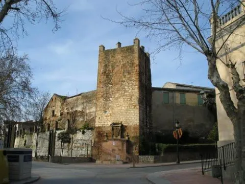
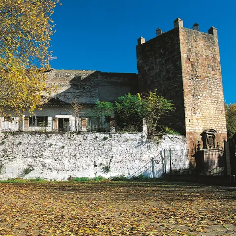
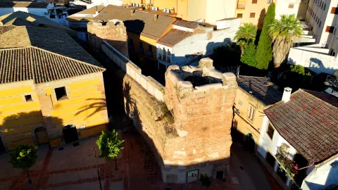
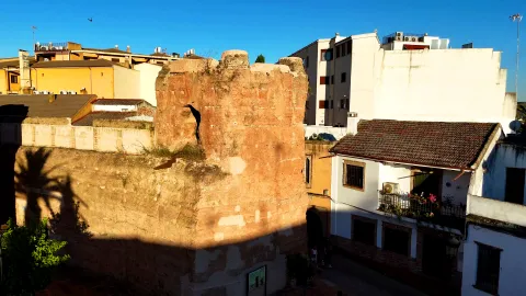
Walls of Andújar

Submitted by brandcode_deweloper on
Id
320995
Descripción
Descripción larga

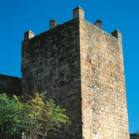
El castillo de Arjonilla está formado por una torre de planta cuadrangular de sillarejo, de 17 m de altura, estructurada en tres plantas abovedadas, más terraza dotada de merlatura y almenas; conserva el tramo de escalera que comunica la segunda planta con la terraza, que se encuentra embutida en el muro noroeste. El torreón fue objeto de transformaciones internas, entre las que habría que destacar la demolición del lienzo original para articular una entrada en recodo al interior de la fortaleza, con arco apuntado de ladrillo. Se añadieron también las escaleras adosadas al muro sureste que comunican las plantas 2ª y 3ª, cegando parcialmente una puerta. 

A esta torre se adosó un recinto amurallado de tendencia cuadrangular, que en su flanco norte se adelanta para unirse a la torre, dando lugar a un polígono de siete lados. Sus ángulos estarían protegidos por torres de planta circular, de las que se conserva la de su extremo noreste. Las murallas contarían con caminos de ronda almenados a los que se accedería a través de rampas.

En el interior del recinto se ha documentado un posible torreón, se trata de una estructura de planta cuadrangular de 12 x 12 m, con adosamientos y refuerzos en su lado oeste, de la que sólo se conservan los cimientos. Este basamento ha sido relacionado con la cimentación de su Torre del Homenaje, que para algunos autores pudo resultar de la habilitación de la antigua torre de alquería para estos fines. Estudios futuros deberán determinar si su origen es anterior o posterior a la actual fortaleza.

La fortificación continuará ocupada una vez perdida su función militar, erigiéndose edificios que han dejado vestigios en su interior. En un primer momento, probablemente a mediados del siglo XVI, sería utilizado como lugar de enterramiento, ya que se han hallado numerosos osarios construidos en ladrillo y excavados en la base geológica. 

A esta necrópolis se superponen dos grandes edificios rectangulares que apoyan en el muro sureste de la fortificación. El resto de muros, en los que se abren estrechas puertas, fueron levantados con pequeñas piedras mezcladas con barro. Parecen datar de los siglos XVI y XVII.

Posteriormente se construyeron otras dependencias de funcionalidad desconocida, compartimentadas mediante muros de piedra y cal y canto o de ladrillo. Revocadas de yeso blanco, en las paredes se abren vanos con pilares para soportar arcadas de ladrillo. Entre estas estructuras existiría un espacio abierto o patio con un empedrado de cantos de río.

Pero la transformación más agresiva se corresponde con la demolición del muro sur del recinto para comunicar la fortaleza con un edificio residencial nobiliario, que contaría con una instalación industrial, concretamente una almazara para la obtención de aceite de oliva. La instalación de canales de ladrillo atravesando los edificios y dependencias anteriores, quizá relacionados con el nuevo uso industrial que adquiere la fortificación, indica que todos ellos se encontraban ya en desuso o demolidos. 

Finalmente, el recinto formaría parte de un antiguo grupo escolar y de un antiguo cuartel de la Guardia Civil.

La aparición de dos sarcófagos visigodos en las inmediaciones de Arjonilla, en el paraje popularmente conocido como Las Herrerías o cortijo del Mono (uno de ellos integrado en el altar de la Parroquia de la Encarnación y el otro expuesto en el Museo Provincial de Jaén), y de una lápida funeraria de mediados del s. VII que actualmente se encuentra desaparecida, apuntan a la existencia de un lugar de culto cristiano junto a una necrópolis de cierta importancia. La población de este asentamiento visigodo, cercano a Arjonilla, podría haberse visto mermada por la inestabilidad causada por los enfrentamientos entre la aristocracia local y los musulmanes recién llegados, y haber abandonado el lugar huyendo a cotas más elevadas o a lugares fortificados.

Arjonilla no aparece citada en las fuentes escritas islámicas, lo que sumado a la ausencia de un registro arqueológico parece indicar que debió ser un emplazamiento rural de relativa importancia. El origen de Arjonilla pudo estar en una pequeña alquería, ocupada entre los siglos VIII-XI, supeditada a Aryûna (Arjona), en la cual, a partir del s. XI con el surgimiento de los diferentes reinos de taifas y las invasiones almorávides y almohades, ante la necesidad de defender a su población de las agresiones externas, pudo reforzarse con la construcción de una primera fortificación, la cual pudo materializarse con la edificación de una torre de alquería, o bien cercar la población con un sencillo recinto de muralla.  

La conquista castellana de este territorio se produjo en 1244, lo que nos hace suponer que temporalmente se integraría en el Concejo de Arjona. No obstante, en 1282, Sancho IV concede el lugar de Arjonilla al arcediano de Úbeda, Gonzalo Pérez, separándola administrativamente de Arjona, aunque en 1331 fue vendida de nuevo a Arjona. En 1397 se encontraba dentro de las posesiones de Ruy López Dávalos. Sin embargo, en los documentos referentes a todos estos hechos no queda constancia de la existencia de una fortificación en esta población. El primer documento con una referencia a la misma, fue emitido durante el reinado de Juan II, en el que se exige a la Orden de Calatrava morar y reconstruir el Castillo de Arjonilla. Estos datos corroboran la permuta que el monarca castellano efectuó en 1434 con la Orden Militar de Calatrava, al cambiar los poblados de Maqueda, San Silvestre y Colmenar por Arjona, Arjonilla, La Figuera, Recena y ¾ partes de Jimena, poblaciones que a partir de este momento se integrarían en el gran señorío que esta institución ha consolidado en el sector suroccidental del antiguo reino de Jaén. En 1553 el emperador Carlos I le concedería el título de Villa.

Todos estos datos apuntan a que la fortaleza debió ser ampliada y reestructurada entre finales del siglo XIII y principios del XIV, principalmente a partir del momento en que Arjonilla se integró en los dominios calatravos.  

Entre los siglos XVI y XVII, la existencia de la ermita de Santa Catalina en el interior del recinto parece estar relacionada con su uso como necrópolis. No descartándose la posibilidad de que esta, también pudiera corresponderse con el espacio de culto erigido por los calatravos en el interior de la fortaleza. El castillo continuó en uso, ya desprovisto de su función defensiva, sufriendo profundas transformaciones, sobre todo tras el siglo XVII cuando se incorpora a la casa del Marqués de la Merced.

LEYENDAS

Macías el enamorado. Macías paje del marqués de Villena y Doña Elvira, dama de la marquesa, se enamoraron manteniéndolo durante un tiempo sus amores en secreto, hasta que, en ausencia del joven, su señor caso a Doña Elvira con Hernán Pérez de Vadillo, marqués de Porcuna. Enloquecido, Macías comenzó a cantar su pena rondando la casa de Doña Elvira. Su marido, celoso, lo denunció ante el marqués, quien ordenó encarcelarlo en la torre del castillo de Arjonilla.

Pero el trovador continuó cantado y sus cánticos se extendieron por la ciudad llegando a oídos del marqués de Porcuna que, loco de ira le lanzó un venablo a través de la ventana de su celda. Macías cayó herido de muerte. Se le enterró en la iglesia de Santa Catalina de Arjonilla y en su losa se podía leer “aquí yace Macías el Enamorado”. Se dice que todavía hoy se puede ver una figura femenina vestida de blanco deslizarse por las murallas del castillo hasta llegar a la mazmorra donde pereció Macías.

Breve descripción

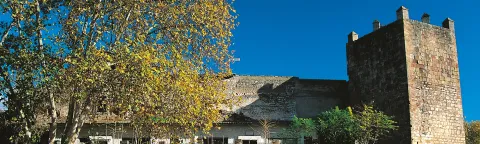
Arjonilla is located in the Western countryside of Alto Guadalquivir, in an area of little relief and flanked by streams. Its castle, of Christian structure and configuration, could have its origin in an ancient Islamic fortification, probably almohade. This fortress is structured in a walled enclosure that preserves two towers: a circular skimmer and a 17 m high quadrangular floor tower, structured on three vaulted floors, which overlooks on a sunny terrace and opens access to the interior of the fortress. Within the enclosure, different vestiges are preserved, including the base of a possible turret, which has been identified with the remains of the Tower of Homage, as well as the foundations of various buildings, next to the corridors that articulated the different spaces enabled within the fortress.
La Campiña del Alto Guadalquivir was characterized by a rural population scattered around Roman villas and the subsequent Islamic houses. Although in the vicinity of Arjonilla there must have been a Visigodic settlement, its origin must be related to one of those small Islamic rural settlements, which emerged between the VIII- XI centuries. Supported to madinat Aryûna (Arjona), its first defensive elements would date from the Almohad era, in all likelihood a tower of alquería, but it will be after the Spanish conquest, around 1244, that it will be when the fortress that has come to this day is built. In this fortification the tradition places the stage of the prison and death of Macias el Enamorado, whose loves inspired works by Lope de Vega, "Porfiar to die" and Mariano José de Larra, "El doncel de Don Enrique el Doliente."

Telecomunicaciones
Teléfono de contacto
953 504 959
Correo electrónico
turismo@ayto-andujar.es
Ubicación
Código Postal
23740
Latitud
38.034960
Longitud
-4.050580
Dirección
C/ Luis Vives
Distrito
Municipio
Ubicación en el mapa
POINT (-4.05058 38.03496)
Tipos de punto de interés
Imágenes carrusel
imagen
Image
Castillos_ruta_andujar2.jpg
Imagen principal
Desactivado
imagen
Image
murallas_andujar2.jpg
Imagen principal
Desactivado
imagen
Image
Murallas de Andújar
Imagen principal
Desactivado
imagen
Image
Murallas de Andújar
Imagen principal
Desactivado
imagen
Image
Murallas de Andújar
Imagen principal
Desactivado
Imágenes cabecera
imagen
Image
CyB_Andujar_01
Imagen principal
Activado
imagen
Image
CyB_Andujar_02
Imagen principal
Desactivado
Horario
24 h.
Experiencia 360
Image
CyB_Andujar
Image
CyB_Andujar
Loading map
Preparing points of interest and routes...

Viewpoint of Los Alarcones

Submitted by brandcode_deweloper on
Id
5860849
Descripción
Descripción larga

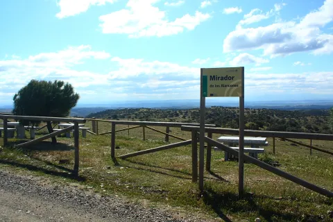
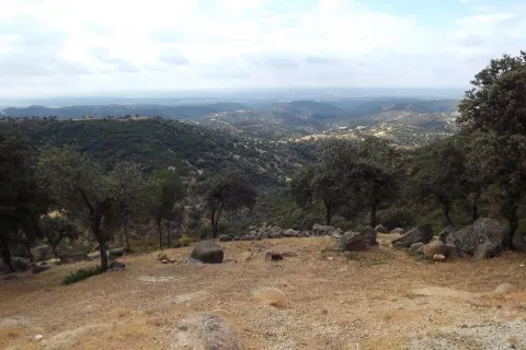
This lookout, located between adhesives, shows us in the distance the saws of Los Calderones and Ambroz, which make up the north-eastern end of the Sierra de Andújar Natural Park. This place, greatly linked to well-known cattle, opens a landscape where the humanized and the natural live together in balance. In these dehesas, the predominant species is the oak, which is altered in some areas with cork. It is curious to see how the higher stripes of solana show areas of rallies and sometimes covered with pringy pits, while in the most intertwined umbria in the valleys that make up these loins, vegetation hardly allows to see the ground. Many cynegetic species find shelter and food in these formations. It is not unusual to cross with some partridge followed by its partridges or to check how some eagle merods through the area for food.

Breve descripción

On the local road that links the farms of Los Escoriales and Sealadores.

Telecomunicaciones
Teléfono de contacto
953 549 030
Ubicación
Código Postal
23740
Latitud
38.038650
Longitud
-4.051620
Distrito
Municipio
Ubicación en el mapa
POINT (-4.05162 38.03865)
Tipos de punto de interés
Imágenes carrusel
imagen
Image
miradorAlarcones.jpg
Imagen principal
Desactivado
Imágenes cabecera
imagen
Image
mirador%20sierra%20andujar.JPG
Imagen principal
Activado
Microsite al que pertenece
Loading map
Preparing points of interest and routes...

Viewpoint of Las Majadillas

Submitted by brandcode_deweloper on
Id
5860740
Descripción
Breve descripción

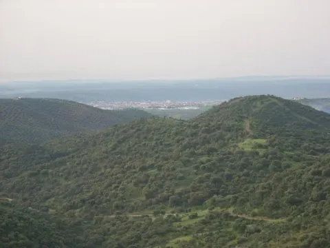
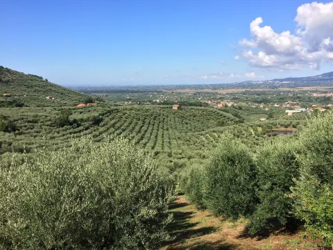
Half way to the path of the Centenera, on the public mountain called the Baldius. The view of the Majadillas attracts by the divergence of its landscapes; on the one hand, an agricultural landscape where the olive trees predominate, although in the areas near the Vega del Guadalquivir, the irrigated crops stand out, and on the other, an agribusiness landscape dominated by plucked oak of Mediterranean mountain. The town of Marmolejo, known for its medicinal water springs, which led to the creation of the spa and which deal with kidney and digestive problems, can be seen at a distance. To the right of Marmolejo we see the Guadalquivir valley, which is seen between mountains. However, despite the fantastic views, we advise the visitor to turn from time to time the look to the sky, as it is possible to see eagles such as the scum or the real one, whose bearing will surprise us.

Ubicación
Código Postal
23770
Latitud
38.045009
Longitud
-4.170940
Distrito
Municipio
Ubicación en el mapa
POINT (-4.17094 38.045009)
Tipos de punto de interés
Imágenes carrusel
imagen
Image
miradormarmolejo.jpg
Imagen principal
Desactivado
Imágenes cabecera
imagen
Image
6345963Master.jpg
Imagen principal
Activado
Loading map
Preparing points of interest and routes...

Viewpoint of Camino Viejo

Submitted by brandcode_deweloper on
Id
5860474
Descripción
Breve descripción

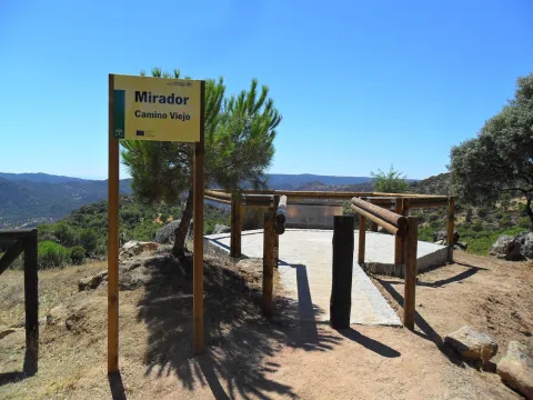
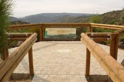
Near the Sanctuary of the Virgin of the Head, right on the path that goes from here to New Place. The Viewer of the Old Way of Andújar is located in a place where landscapes, history and tradition take their own life. The road leading to the lookout is traveled throughout the year by a multitude of pilgrims on their journey to the Sanctuary of the Virgin of the Head, Queen and Lady of Sierra Morena, which is also the oldest known Romry. To the attractive views of the place we must add this added value, as it is part of the culture, idiosyncrasy and fervor of its people. From the balcony we can see the refreshing beauty of the valley of the Jandula River (tributary of the Guadalquivir, to which it is joined later) with a typical and lush riverside forest, where the olmos take special prominence. Right across the street, covered with a pine cloak, the Marquitos hill stands out and, to its left down, the area called the New Place, where you can see the facilities of a forest nursery. The vegetation is typically Mediterranean, alternating areas of oak with pine and black areas.

Telecomunicaciones
Teléfono de contacto
953 549 030
Ubicación
Latitud
38.037700
Longitud
-4.053800
Distrito
Municipio
Ubicación en el mapa
POINT (-4.0538 38.0377)
Tipos de punto de interés
Imágenes carrusel
imagen
Image
miradorcaminoviejo.jpg
Imagen principal
Desactivado
Imágenes cabecera
imagen
Image
M_Camino_Viejo01.jpg
Imagen principal
Activado
Loading map
Preparing points of interest and routes...

Viewpoint Castle of Baños de la Encina

Submitted by brandcode_deweloper on
Id
7473108
Descripción
Breve descripción

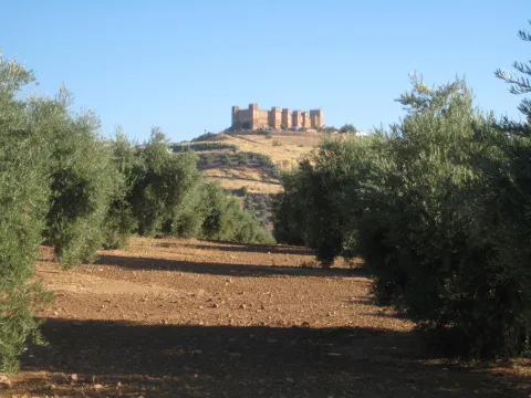
One of the oldest castles in Europe, a film scene, magnificent Almohad military construction, allows us an extensive view of the olive grove near Sierra Morena.

Ubicación
Nombre
Cerro del Cueto
Código Postal
23711
Latitud
38.170310
Longitud
-3.775320
Dirección
Plaza de Santa María, 1
Distrito
Ubicación en el mapa
POINT (-3.77532 38.17031)
Tipos de punto de interés
Imágenes carrusel
imagen
Image
mirador.jpg
Imagen principal
Desactivado
Imágenes cabecera
imagen
Image
banos-encina.jpg
Imagen principal
Activado
Loading map
Preparing points of interest and routes...

Mines of the Centenillo

Submitted by brandcode_deweloper on
Id
2854769
Descripción
Descripción larga

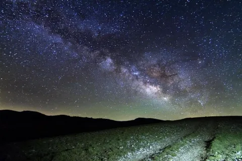
In spring it is possible to enjoy the elusive zodiacal light, while in summer it is an excellent place to observe the constellations that are being hidden in the West. Especially recommended to observe in group the different rains of stars that take place throughout the year due to their wide accessibility and the size of the explanade, where large groups can meet.

It is an excellent place to approach the family to enjoy the firmament on winter and spring nights. We recommend not to leave the explanade and not to go into the ruins under any circumstances for security matters.

Breve descripción

Few places are thought to be more appropriate for the observation of the firmament than the set of ancient mines abandoned from "El Centenillo," in Baños de la Encina, Jaén. Just 500 metres from this village in the west direction, we find a large explanade surrounded by old abandoned buildings. The horizon in the north, west and south direction is completely free of light pollution, with an impressive darkness in the cenit. This area is currently being restored.

Ubicación
Latitud
38.348123
Longitud
-3.732338
Dirección
Pedanía El Centenillo
Distrito
Ubicación en el mapa
POINT (-3.732338 38.348123)
Tipos de punto de interés
Imágenes carrusel
imagen
Image
_MG_9754%20%281%29.jpg
Imagen principal
Desactivado
Imágenes cabecera
imagen
Image
_MG_9754%20%281%29.jpg
Imagen principal
Activado
Microsite al que pertenece
Loading map
Preparing points of interest and routes...
Interés

Iberian Lynx

Submitted by brandcode_deweloper on
Id
1914733
Descripción
Descripción larga

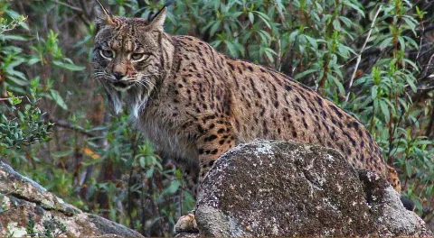
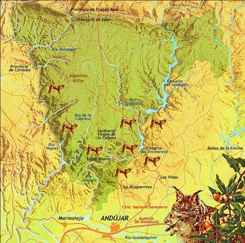
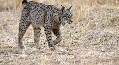
Although Iberian lince has been a protected species since 1966, this wonderful feline is in danger of extinction. At present, only two populations are viable and consolidated for the development and proliferation of this species: the one in Doñana and the one in the natural spaces Sierra de Cardeña and Montoro Natural Park and Sierra de Andújar Natural Park, where the most important population of the nail cat is located.

To see a lince in Andújar

To try to locate and observe an Iberian lince we must look for a good observatory from which we see a lot of saw, many slopes, rosquets, bushes and above all, many clear pasture. Among the best areas for an observation day are:

Road of the boat on its last stretch.

Road and recreational area of the Encinarejo.

Embalse of the Encinarejo from the north bank.

All the viewpoints in the south of the park.

Jabali Path.

Recreative area of the line in New Place.

Located at the observatory, it is essential to be always very attentive and silent, so, even in plain sight, we can distinguish a lineage moving if it is not too far away. We will also start a sweep of the area by means of binoculars. With them we will be looking at the clear and the exits of the land; so we can discover some cat placed on a rock. The telescope should be left for the last search, to go looking further and to go looking very slowly or even to look at the animal once we have discovered it.?

As with almost all predators, the corvids are also very aggressive with the Iberian lince (perhaps this is the animal with which they are most rattled), so we have to be very long-awaited of the movements and demands of the urracas. 50% of the success of observing a lince can come from being able to interpret the corvids.

For the sake of the species and the future visitors who seek to see the great cat, we must respect all the rules of public use, be respectful of the environment, always remain silent and do not in any way disturb animals. Nor should we enter privately owned farms without authorization or deviate from established paths.

Breve descripción

The largest number of the nail cat population

Ubicación
Latitud
38.039236
Longitud
-4.050560
Distrito
Municipio
Ubicación en el mapa
POINT (-4.05056 38.039236)
Imágenes carrusel
imagen
Image
Anotaci%C3%B3n%202020-04-16%20083233.jpg
Imagen principal
Desactivado
imagen
Image
Anotaci%C3%B3n%202020-04-16%20083330.jpg
Imagen principal
Desactivado
Imágenes cabecera
imagen
Image
Anotaci%C3%B3n%202020-04-16%20083259.jpg
Imagen principal
Activado
Microsite al que pertenece
Loading map
Preparing points of interest and routes...

Church of Santa María la Mayor

Submitted by brandcode_deweloper on
Id
5867824
Descripción
Breve descripción
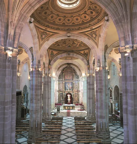
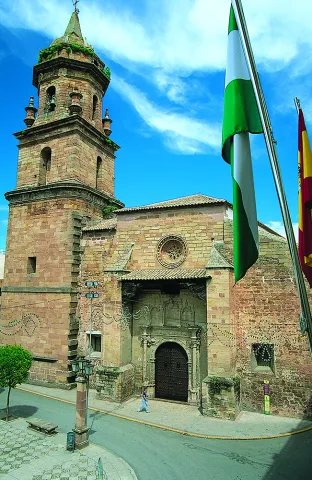
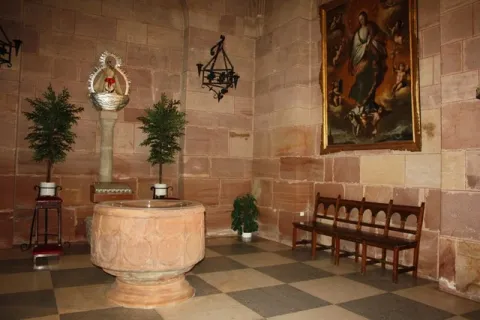
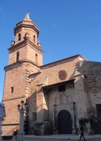
The Iglesia de Santa Marina de Andújar, one of the oldest and most representative temples in the city, is presented as a setting of great heritage value for the celebration of cultural events, institutional presentations or unique events. Its sober and elegant architecture creates a solemn and evocative atmosphere that adds a unique character to any gathering. Capacity: Old Church Room: 125 Location: Andujar Available services: Television, sound table, recording, projector and public address system
Ubicación
Código Postal
23740
Latitud
38.037410
Longitud
-4.055990
Dirección
Plaza Sta. María, s/n
Distrito
Municipio
Ubicación en el mapa
POINT (-4.05599 38.03741)
Tipos de punto de interés
Imágenes carrusel
imagen
Image
Iglesia%20de%20Santa%20Mar%C3%ADa%20Andujar2.jpg
Imagen principal
Desactivado
Imágenes cabecera
imagen
Image
INTERIOR_IGLESIA_DE_SANTA_MARIA.jpg
Imagen principal
Activado
Horario
Winter: Tuesday to Sunday 11:30 - 13:30 and 17:30 - 20:00. Summer: Tuesday to Sunday 11:30 - 13:30 and 18:00 - 21:30.
Loading map
Preparing points of interest and routes...

Church of San Miguel

Submitted by brandcode_deweloper on
Id
6231070
Descripción
Descripción larga

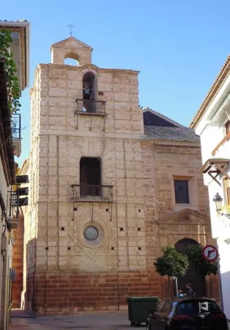
It is a church of Gothic origin, and in its interior it stands out among other important aspects: its high dimensions, the pointed arches and the vaults of a sexpartite type with which its central ship is covered; as well as a profusely decorated craft that is under the choir. On the outside it has a magnificent architectural set, with its robust tower, with a top body of hogged bells on others of square base and decreasing section, topped by the classic stone vases in the corner and a sharp chapitel; the general body of the church made in stone of great chromatic beauty; and three covers, of them the most interesting, the one located on its southern façade, of beautiful silver bill, dated in 1530, with three hornacinas covered by a weave between contrapres and a small upper roseton.

Breve descripción

The important church of San Miguel de Andújar is located within the ancient medieval complex of the villa, and is certainly its oldest temple.

Telecomunicaciones
Sitio web
www.andujar.es
Teléfono de contacto
953 500 129
Ubicación
Código Postal
23740
Latitud
38.036980
Longitud
-4.053880
Dirección
Plaza de España, s/n
Distrito
Municipio
Ubicación en el mapa
POINT (-4.05388 38.03698)
Tipos de punto de interés
Imágenes carrusel
imagen
Image
Mon010.jpg
Imagen principal
Desactivado
imagen
Image
san_miguel_Copiar.jpg
Imagen principal
Desactivado
Imágenes cabecera
imagen
Image
c1b70d336e1365b03792ae8456c63864.jpg
Imagen principal
Activado
Horario
Winter: Tuesday to Sunday 11: 30 - 20: 30. Summer (jul - ago): Tuesday to Sunday 11: 30 - 13: 00.
Microsite al que pertenece
Loading map
Preparing points of interest and routes...