Saltar al contenido principal

Bridge Renaissance

Submitted by brandcode_deweloper on
Id
4276894
Descripción
Breve descripción

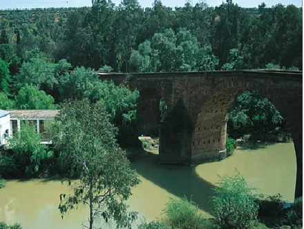
It is one of the most important historical and artistic milestones of Marmolejo, along with the Parish Church of Our Lady of Peace and the spa of medicinal waters that spring up next to the same channel of the Guadalquivir River. Precisely bridge and spa linked their existence since the discovery of the therapeutic utility of the waters of these springs at the end of the 18th century (whose first news appears in theTreaty on the main medicinal sources of AndalusiaJohn of God Help, 1794) and the first facilities began to be built. But before thousands of swimmers turned this quiet place into bustling, there was already an architectural element in the environment: the San Bartolomé Bridge, possibly called for opening the day of the onomastics of this Holy, on August 24.

Telecomunicaciones
Sitio web
www.villademarmolejo.es/urbanismo-y-monumentos/monumentos/puente-de-san-bartolome/
Ubicación
Código Postal
23770
Latitud
38.054040
Longitud
-4.193410
Distrito
Municipio
Ubicación en el mapa
POINT (-4.19341 38.05404)
Tipos de punto de interés
Imágenes carrusel
imagen
Image
puente%20renacentista-1.png
Imagen principal
Desactivado
Imágenes cabecera
imagen
Image
puente%20renacentista_marmolejo-1.png
Imagen principal
Activado
Microsite al que pertenece
Loading map
Preparing points of interest and routes...

Parish Church of Our Lady of Peace

Submitted by brandcode_deweloper on
Id
4276831
Descripción
Breve descripción

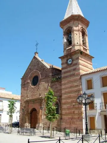
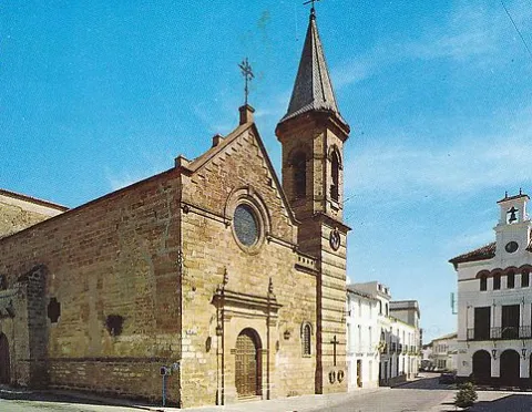
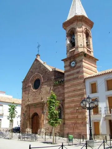
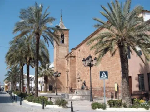
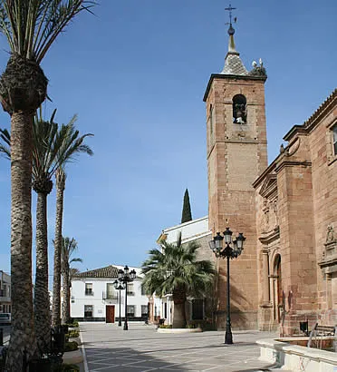
The Parish Church of Our Lady of Peace is located in Marmolejo. The origins of this church date back to the 14th century. This early foundation was added to the cruise in the 15th and 16th centuries and in the 18th the two covers. But the general configuration presented by this church today is the result of the reform carried out at the end of the 19th century by the architect Justino Flórez Llamas, under the historical and eclectic lexicography of the time, and which focused primarily on the west tower and facade.

Telecomunicaciones
Sitio web
www.villademarmolejo.es/urbanismo-y-monumentos/monumentos/iglesialapaz/
Teléfono de contacto
953 540 210
Ubicación
Código Postal
23770
Latitud
38.044960
Longitud
-4.170870
Dirección
Plaza de la Constitución, 3
Distrito
Municipio
Ubicación en el mapa
POINT (-4.17087 38.04496)
Tipos de punto de interés
Imágenes carrusel
imagen
Image
Parroqu%C3%ADa%20de%20Nuestra%20Se%C3%B1ora%20de%20la%20Paz3.jpeg
Imagen principal
Desactivado
imagen
Image
Parroqu%C3%ADa%20de%20Nuestra%20Se%C3%B1ora%20de%20la%20Paz.png
Imagen principal
Desactivado
Imágenes cabecera
imagen
Image
image_105936.jpeg
Imagen principal
Activado
Microsite al que pertenece
Loading map
Preparing points of interest and routes...

Parish of the Natividad de Nuestra Señora

Submitted by brandcode_deweloper on
Id
4523566
Descripción
Breve descripción

It was built on an earlier medieval temple and was founded in 1604 by Maria Notario de Lara, although its interior denotes Gothic traces. It is important to note its Major Retail of the S. XV). At the foot, it has a square base tower with two floors and a bell tower with half-point arches, which crown a pointed capital. On its northern side is the Chapel of the Rosary, an example of the Andalusian rococo of the first half of the 18th century.

Telecomunicaciones
Sitio web
www.vreina.com
Teléfono de contacto
953 537 127
Ubicación
Código Postal
23730
Latitud
38.005440
Longitud
-3.919940
Dirección
Plaza la Constitución, 9
Distrito
Ubicación en el mapa
POINT (-3.91994 38.00544)
Tipos de punto de interés
Imágenes carrusel
imagen
Image
Parroquia%20de%20la%20Natividad%20de%20Nuestra%20Se%C3%B1ora.jpg
Imagen principal
Desactivado
Imágenes cabecera
imagen
Image
villanuevareina.jpg
Imagen principal
Activado
Microsite al que pertenece
Loading map
Preparing points of interest and routes...

Natural Park Sierra de Andújar

Submitted by brandcode_deweloper on
Id
1914790
Descripción
Descripción larga

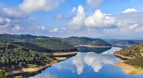
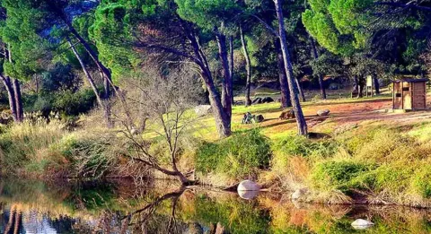
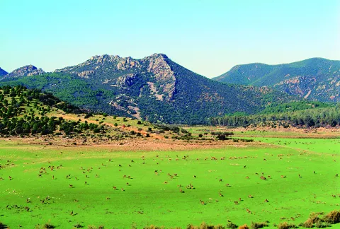
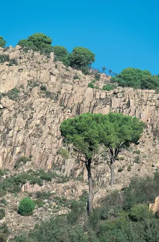
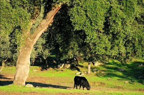
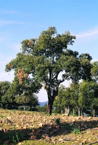
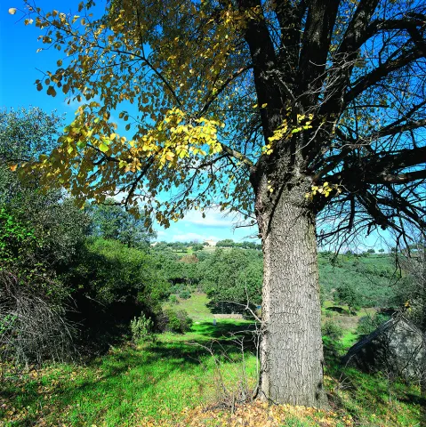
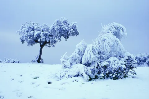
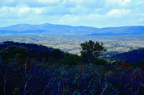
The Sierra de Andújar Natural Park has a varied morphology and altitude. The most extensive natural vegetation spots in Sierra Morena are observed in this environment, with the oaks, the complaints and the alcornoques being the predominant species.

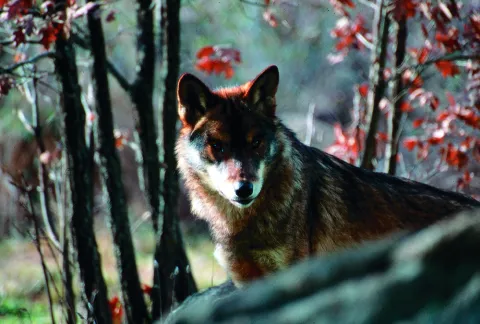
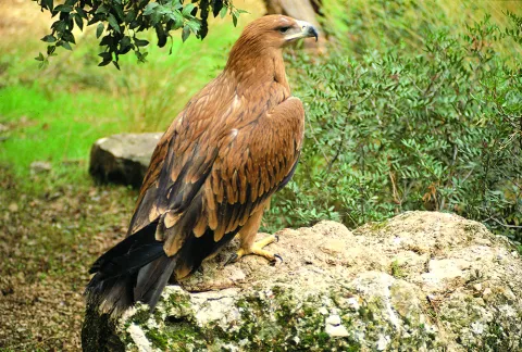
In Sierra Quintana, Atlantic obledals are located. In addition, valuable species of fauna, such as the lince or the royal eagle, find in the Sierras de Andújar one of its few shelters within the Iberian Peninsula.

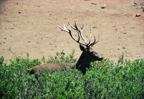
Livestock is of some importance in the local economy, with extensive dehesas dedicated to the raising of ligia bulls or to the exploitation of deer, gores, lambs, muflons and boars. Thus, hunting sport is a major economic resource in the famous public and private areas of the Park.

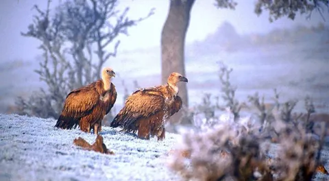
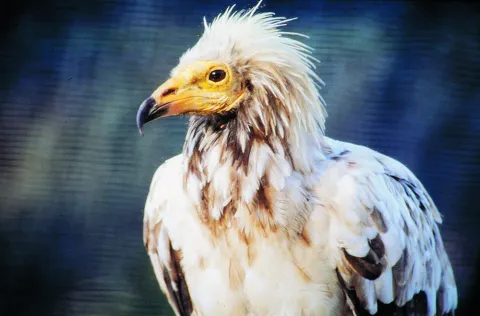
It is not difficult to see in the sky of the Sierra de Andújar Natural Park the spectacular flights of the royal, perdicular and imperial eagles, the last one on the Iberian Peninsula and which has in this area one of its last shelters. Three carrion species can also be observed: the leonate vulture, the black and the alenoche.

Of tourist interest are the Sanctuary of the Virgin of the Head, where each year by May is celebrated the oldest Romeria in Spain, the Jandula and Encinarejo reservoirs, the Cercado del Ciprés Environmental Complex, which has a botanical garden and a Nature Hall, among other facilities, or the Mirador del Peregrino.

BASIC PARTICULARS

Geographical location: To the north-west of the province

Municipalities: Andújar, Baños de la Encina, Villanueva de la Reina and Marmolejo

Coordinates: 38º16 'N; 4º6' W

Date of declaration1989

Area74,774 ha.

Altitude: between 500 and 1,290 m. (Pico Burcio del Pino)

Climate data:
- Average monthly temperatures: Between 9 ° C (January) and 28 ° C (August)
- Average annual accuracy: 570 mm.

Main training:
Mediterranean mountain of cherries and river vegetation

Natural Park Office:
Environmental complex Cercado del Ciprés
The way of the Rubials, s / n. 23740 Andújar
Tel.: + 34 953 539 620
Fax: + 34 953 012 508
Email:pn.andujar.cma @ juntadeandalucia.es

Visitors' Centre:
Peñallana vineyards
Ctra. A-6177 Andújar - Virgin of the Head Sanctuary, Km. 13. 23740 Andújar
Tel.: 953 549 030
Email:cv _ vinasdepenallana @ egmasa.es

Other protection figures:
Area of Special Protection for Birds [ZEPA (2002)]

Other equipment for public use:
- La Recta recreational area
- Recreative area of the Encinarejo
- Recreative area of the Aliseda
- Jabali recreational area
- Mirador de las Mahadillas
- Jandula Viewer
- Viewer of the Old Way
- Cosomal Viewer

More information:
http: / / www.juntadeandalucia.es / environment / site / web /
http: / / www.prodecan.es /

Breve descripción

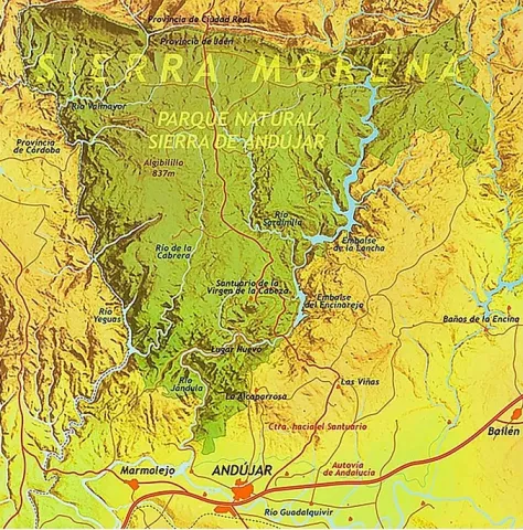
The Natural Park of Sierra de Andújar is located to the northwest of the province of Jaén, in the heart of Sierra Morena, just a step from the city of Andújar. It has an area of 74,774 hectares, and contains four municipal terms: Andújar, Baños de la Encina, Villanueva de la Reina and Marmolejo.

Ubicación
Latitud
38.289780
Longitud
-4.028650
Distrito
Municipio
Ubicación en el mapa
POINT (-4.02865 38.28978)
Tipos de punto de interés
Imágenes carrusel
imagen
Image
Anotaci%C3%B3n%202020-04-16%20084514.jpg
Imagen principal
Desactivado
imagen
Image
Anotaci%C3%B3n%202020-04-16%20084445.jpg
Imagen principal
Desactivado
imagen
Image
Anotaci%C3%B3n%202020-04-16%20084429.jpg
Imagen principal
Desactivado
imagen
Image
Anotaci%C3%B3n%202020-04-16%200884850.jpg
Imagen principal
Desactivado
imagen
Image
Natu044.jpg
Imagen principal
Desactivado
imagen
Image
Natu422.jpg
Imagen principal
Desactivado
imagen
Image
Natu424.jpg
Imagen principal
Desactivado
imagen
Image
Natu135.jpg
Imagen principal
Desactivado
imagen
Image
Natu161.jpg
Imagen principal
Desactivado
imagen
Image
v-lwu0Cw.jpeg
Imagen principal
Desactivado
imagen
Image
Natu174.jpg
Imagen principal
Desactivado
imagen
Image
Natu267.jpg
Imagen principal
Desactivado
imagen
Image
Natu141.jpg
Imagen principal
Desactivado
imagen
Image
Natu142.jpg
Imagen principal
Desactivado
imagen
Image
Natu139.jpg
Imagen principal
Desactivado
imagen
Image
Natu158.jpg
Imagen principal
Desactivado
imagen
Image
Natu222.jpg
Imagen principal
Desactivado
imagen
Image
Natu245.jpg
Imagen principal
Desactivado
imagen
Image
Natu247.jpg
Imagen principal
Desactivado
imagen
Image
Natu248.jpg
Imagen principal
Desactivado
Imágenes cabecera
imagen
Image
9576153667_3b55af2da2_b.jpg
Imagen principal
Activado
Microsite al que pertenece
Loading map
Preparing points of interest and routes...

Cercado del Ciprés Forest Park

Submitted by brandcode_deweloper on
Id
2980366
Descripción
Descripción larga

This peri-urban environmental park occupies 11 hectares of land and has recreational areas, bike lane, trails, viewpoints, wooden buildings, classrooms, aviary, artificial lake and botanical garden. In the Cercado del Ciprés we will enjoy a beautiful courtyard of oranges, which presents a system of irrigation lacquers that reminiscent of the gardens of Muslim design. Here are the offices of the Sierras de Andújar Natural Park as well as a visitor information point. The environmental education activities they organize include the scientific nesting of birds and workshops on beekeeping, fishing and identification of animal prints.

Breve descripción

The Cercado del Ciprés forest park is located on the outskirts of the city of Andújar, next to the Alto Guadalquivir Regional Hospital, on the Rubiales Road and just 250 m from the Andalusian motorway.

Ubicación
Código Postal
23740
Latitud
38.042910
Longitud
-4.026890
Dirección
Camino de los Rubiales, s/n
Distrito
Municipio
Ubicación en el mapa
POINT (-4.02689 38.04291)
Imágenes carrusel
imagen
Image
parqueforestal.jpg
Imagen principal
Desactivado
imagen
Image
area%20recreativa%202.jpg
Imagen principal
Desactivado
Imágenes cabecera
imagen
Image
ZAC7.jpg
Imagen principal
Activado
Loading map
Preparing points of interest and routes...

Guadalquivir Park

Submitted by brandcode_deweloper on
Id
8147398
Descripción
Descripción larga

The different meanders formed by the Guadalquivir in its way through Villanueva de la Reina allow an exuberant vegetation with tree species, among which are willows, alms, chopos, zarzas and eucalyptos. Among the fauna, it is common to find real anades, storks, leper galapagos, real garzas, American red crabs, viperine creams, the fishing martin, beehive or nightingale. We have access for two areas: to the left on Calle la Tercia and, on the right, to the Paseo del Oil. The Park has landscaped recreational areas, a gateway to cross the river to the area of Las Viñas, and the fairground.

Breve descripción

The Guadalquivir Park is a magnificent landscaped area on the banks of the Guadalquivir River, about 500 metres long, divided into two parts: the park itself and the Paseo del Eil; on this walk we can find a real press of ancient oil. Inside the park also runs the bike lane that sepents and crosses the river.

Telecomunicaciones
Teléfono de contacto
953 537 110
Ubicación
Código Postal
23730
Latitud
38.005481
Longitud
-3.914568
Dirección
C/ Santa Potenciana, 14
Distrito
Ubicación en el mapa
POINT (-3.914568 38.005481)
Tipos de punto de interés
Imágenes carrusel
imagen
Image
Parque%20del%20Guadalquivir2.jpg
Imagen principal
Desactivado
imagen
Image
Parque%20del%20Guadalquivir3.jpg
Imagen principal
Desactivado
Imágenes cabecera
imagen
Image
Parque%20del%20Guadalquivir.jpg
Imagen principal
Activado
Microsite al que pertenece
Loading map
Preparing points of interest and routes...

Museo Keep / Tower del Recuerdo
Submitted by brandcode_deweloper on
Id
5871246
Descripción
Descripción larga

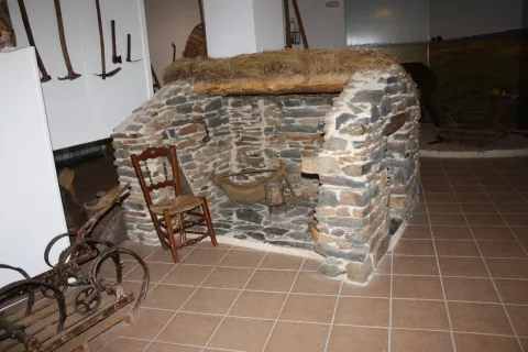
The Torreon, on its three floors, consists of a "honey room" and souvenir and beekeeping shop, an audiovisual room and workshop, the generic museum space, common areas for temporary exhibitions and a room dedicated specifically to the Bronze Age, in the Rumblar River Basin.

Telecomunicaciones
Sitio web
https://www.bdelaencinaturismo.com/actividades-y-rutas/
Teléfono de contacto
953 613 229 / 630 911 531
Correo electrónico
torreon.recuerdo@hotmail.com
Ubicación
Código Postal
23711
Latitud
38.172280
Longitud
-3.775330
Dirección
Av. José Luis Mesías, s/n
Distrito
Ubicación en el mapa
POINT (-3.77533 38.17228)
Tipos de punto de interés
Imágenes carrusel
imagen
Image
1.jpg
Imagen principal
Desactivado
imagen
Image
IMG_6016.jpg
Imagen principal
Desactivado
imagen
Image
IMG_6040%20%281%29.jpg
Imagen principal
Desactivado
imagen
Image
IMG_6019.jpg
Imagen principal
Desactivado
imagen
Image
IMG_6038%20%282%29.jpg
Imagen principal
Desactivado
Imágenes cabecera
imagen
Image
IMG_5853.jpg
Imagen principal
Activado
Horario
Winter: Thursday 16: 30 / 17: 30 / 18: 30. Friday and Saturday: 11: 00 / 12: 00 / 13: 00 / 16: 30 / 17: 30 / 18: 30. Sunday: 11: 00 / 12: 00 / 13: 00. Summer: Thursday 17: 00 / 18: 00 / 19: 00. Friday and Saturday: 11: 00 / 12: 00 / 13: 00 / 17: 00 / 18: 00 / 19: 00. Sunday: 11: 00 / 12: 00 / 13: 00.
Microsite al que pertenece
Loading map
Preparing points of interest and routes...

Virgen de la Cabeza Marian Museum

Submitted by brandcode_deweloper on
Id
5871152
Descripción
Descripción larga

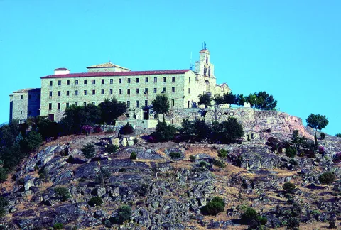
The museum is divided into three rooms, highlighting in the first one the mantos of the greatest historical significance, as well as a picture of the 17th century Romeria and the custody donated by Mussolini; in the second, we can see the mantos donated by the kings of Spain and other personalities, several reproductions of the image of the Virgin of the Head, its processional cage and several vitrines with objects of high significance; in the third room we can find a model of the sanctuary on a scale of 1 / 50, work by Manuel Molina and the pinacoteca of the painter Arsenia on the Menerora.

Breve descripción

The Marian museum "Virgen de la Cabeza" is located in the very premises of the sanctuary (32 km from Andújar). Promised by the Trinity Fathers community, it contains an important artistic, documentary and anthropological exhibition of the historical legacy towards devotion to the Virgin of the Head.

Telecomunicaciones
Sitio web
www.santuariovirgencabeza.org
Teléfono de contacto
953 509 015
Correo electrónico
secretaria@santuariovirgencabeza.org
Ubicación
Nombre
Santuario de la Virgen de la Cabeza
Código Postal
23740
Latitud
38.039236
Longitud
-4.050560
Distrito
Municipio
Ubicación en el mapa
POINT (-4.05056 38.039236)
Tipos de punto de interés
Imágenes carrusel
imagen
Image
6.jpg
Imagen principal
Desactivado
imagen
Image
DSC00639-1.jpg
Imagen principal
Desactivado
imagen
Image
5.jpg
Imagen principal
Desactivado
imagen
Image
Anotaci%C3%B3n%202020-04-16%20082158.jpg
Imagen principal
Desactivado
imagen
Image
Mon503.jpg
Imagen principal
Desactivado
Imágenes cabecera
imagen
Image
Anotaci%C3%B3n%202020-04-16%20082134.jpg
Imagen principal
Activado
Horario
Winter: Saturday 11: 00 - 13: 00 and 16: 00 - 20: 00. Groups can make an appointment. Summer: Saturday 11: 00 - 13: 00 and 16: 00 - 20: 00. Groups can make an appointment.
Microsite al que pertenece
Loading map
Preparing points of interest and routes...

Museum of Artes Plásticas "Antonio González Orea"

Submitted by brandcode_deweloper on
Id
5871105
Descripción
Breve descripción

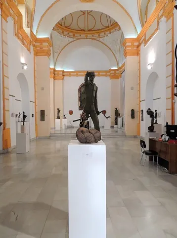
The Museum is located in the Old Convent of Capuchino Mothers. The building is of a conventional type, it responds to a single ship, covered by a canyon vault with lunetes in all its sections, with the exception of that of the major chapel, in which a semi-spherical vault appears on the breast.

Telecomunicaciones
Teléfono de contacto
953 505 903
Correo electrónico
museorea@gmail.com
Ubicación
Código Postal
23740
Latitud
38.041210
Longitud
-4.056820
Dirección
C/ Calancha, 19
Distrito
Municipio
Ubicación en el mapa
POINT (-4.05682 38.04121)
Tipos de punto de interés
Imágenes carrusel
imagen
Image
Museo%20G%C3%B3mez%20Orea%20%281%29%20%281%29.jpg
Imagen principal
Desactivado
imagen
Image
Museo%20G%C3%B3mez%20Orea%20%282%29.jpg
Imagen principal
Desactivado
Imágenes cabecera
imagen
Image
Museo%20G%C3%B3mez%20Orea%20%283%29.jpg
Imagen principal
Activado
Horario
Thursday to Saturday: 10: 00 - 14: 00 and 17: 00 - 20: 00.
Microsite al que pertenece
Loading map
Preparing points of interest and routes...

Museum of Arte Contemporáneo Mayte Spínola

Submitted by brandcode_deweloper on
Id
4277019
Descripción
Breve descripción

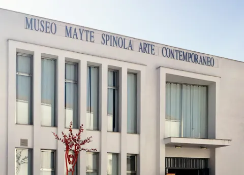
TheMuseum of Contemporary Art Mayte Spinolaof Marmolejowas created in 2004 with a donation from the artists belonging to the Group for Art and Culture, which leads Spinola, at the opening were the dukes of Lugo, Ana de Orleans and Carmen Thyssen- Bornemisza, among other personalities.

Telecomunicaciones
Sitio web
https://museomaytespinolamarmolejo.com/
Teléfono de contacto
626 908 226
Correo electrónico
museomaytespinola@ayuntamientodemarmolejo.es
Ubicación
Código Postal
23770
Latitud
38.047100
Longitud
-4.173500
Dirección
C/ Jesús, 29
Distrito
Municipio
Ubicación en el mapa
POINT (-4.1735 38.0471)
Tipos de punto de interés
Imágenes carrusel
imagen
Image
4.jpg
Imagen principal
Desactivado
imagen
Image
3.jpg
Imagen principal
Desactivado
Imágenes cabecera
imagen
Image
unnamed%20%282%29.png
Imagen principal
Activado
Microsite al que pertenece
Loading map
Preparing points of interest and routes...