Saltar al contenido principal

La Casa de Baños Rural Accommodation

Submitted by brandcode_deweloper on
Id
4348987
Descripción
Breve descripción

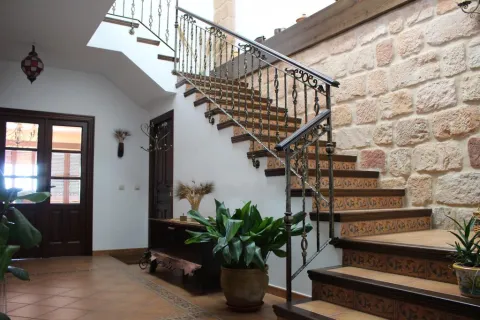
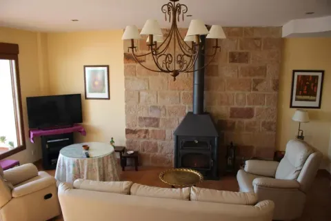
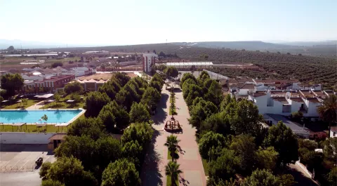
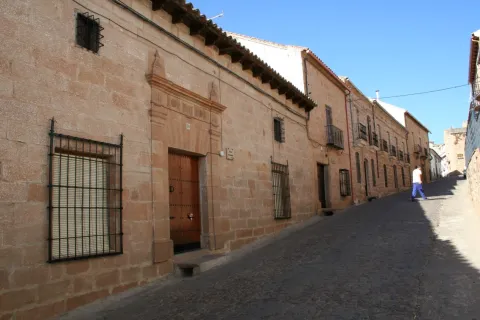
The Casa de Baños is a rural accommodation located in Baños de la Encina, very close to the town square and the monumental area of the village.

Información de contacto
Teléfono
625 668 495
Ubicación
Código Postal
23711
Latitud
38.172749
Longitud
-3.771871
Dirección
C/ de la Cruz, 32
Distrito
Ubicación en el mapa
POINT (-3.771871 38.172749)
Tipo de alojamiento
Imágenes
imagen
Image
77648054.jpg
Imagen principal
Activado
imagen
Image
banos1.png
Imagen principal
Desactivado
Loading map
Preparing points of interest and routes...
El Hotel

Farm house La Casa de Baños located in Baños de la Encina. This beautiful farmhouse is ideal for enjoying the natural and cultural richness of the environment. The property is well-maintained and is ideal if you are looking to spend a few days on holiday and know the area. Do not hesitate to contact you to request additional information.

Villanueva de la Reina

Submitted by brandcode_deweloper on
Id
787504
Perfil de redes sociales
Facebook
https://www.facebook.com/VillanuevaDeLaReina/
Descripción
Breve descripción

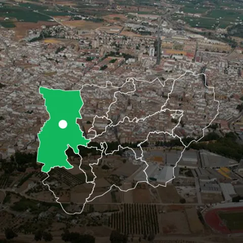
Villanueva de la Reina is located in a privileged area to the north-west of the province and belongs to the region of la Campiña.

Its municipal term forms an elongated strip occupying the medium region of Guadalquivir and has a flat and unhighlighted orography. La ribera del Guadalquivir, as it crosses the municipality, is conducive to the existence of orchards and irrigation olive groves.

The northern part of the term is occupied by the Mediterranean forest landscape of Sierra Morena, which in turn forms part of the Natural Park of the Sierra de Andújar.

The economic activity of the municipality is basically based on agriculture, mainly olive, promoted by the excellent fertile land of the Vega. The cultivation of the asparagus and in general the fruit and fruit crops are important. In recent years this activity tends to diversify, looking like the handling industry, mainly asparagus for export and under-coat cultivation.

Its municipal term includes the pedanities of: La Countess, La Crujía, La Quintería and Rincón de San Ildefonso.

Among its historical-artistic heritage is the Church of Our Lady of Nativity, the City Hall, the Chapel of the Cortijo of San Nicolás and the Press of the Tower, a press of oil mill from the 18th century.

Telecomunicaciones
Teléfono
953 537 110
Sitio web
www.vreina.com
Fax
953 537 502
Correo electrónico
vreina@promojaen.es
Ubicación
Nombre
Villanueva de la Reina
Latitud
38.005160
Longitud
-3.914690
Distrito
Imágenes
imagen
Image
9eec0947-4e96-d628-ff1f-09b1e45ed344?t=1594823444734
Imagen principal
Desactivado
imagen
Image
3e0c8147-c039-1d1f-0819-d526b9e3abb0?t=1610978789230
Imagen principal
Desactivado
imagen
Image
bdcbb137-926c-d3ae-13a5-4a906409f681?t=1594823444071
Imagen principal
Desactivado
imagen
Image
3bae9ce7-6b92-c6b0-d516-a9b56578601e?t=1594823448503
Imagen principal
Desactivado
imagen
Image
e4c67879-5466-d96f-c5a8-a9d913f664b0?t=1594823460914
Imagen principal
Desactivado
imagen
Image
03488039-8206-0b72-029e-ad2dd5e2a914?t=1595431570981
Imagen principal
Desactivado
Imágenes cabecera
imagen
Image
Villanueva de la Reina
Imagen principal
Desactivado
Datos de interés

Tourist area: Sierra Morena / Sierras de Andújar and Despeñacolos
Distance to the capital (km): 35
Altitude over sea level (m): 220
Extension (km ²): 209
Number of inhabitants: 3,081
Gentillo: Villanovens
Postal code: 23730

Videos
Video file
Cultura

From its heritage we highlight the following monuments:

  • Church of Our Lady's Nativity. It dates from the 15th to the 18th century. It is made up of a three-ship plant. A previous one is preserved Mudejar chapel from the 13th century, at the foot of the temple with an outside entrance door. The current altarpiece was made in 1961, as the previous one was burned in the Civil War. There was a major altarpiece of the school of Alonso Berruguete attributed to Sebastián Solís, which was burned during the Spanish civil war. The present one was performed in 1961 by the talented master Mariano Piñar Ferrer. The chapel of the Rosary, located in the northern part of the left ship of the temple, stands out the plaster of its vault as an example of the Andalusian rock art of the 18th century.
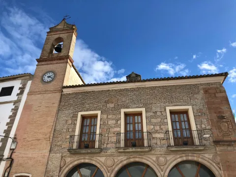
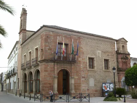
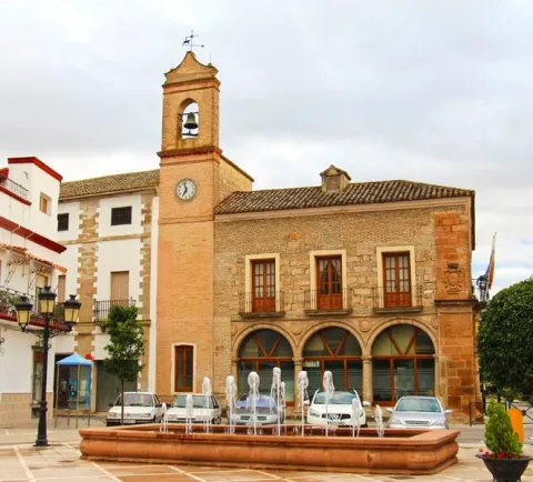
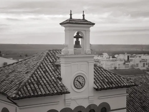
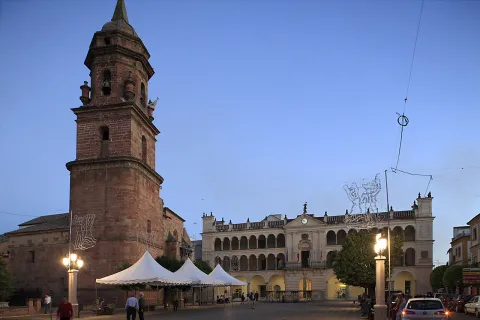
  • City Hall. The building of the Conistory House dates from the 18th century, and it is located in the corner with two facades. It is a large building and presents its two facades with silery stone, on two floors high. In the main facade shows its cover, where a half-point arch-finished hole opens, framed in two-fold semi-columns. A ledge separates it from the top floor where a balcony opens. The left side is composed of three half-point arches on ground-floor columns, and intoned holes on the upper floor. Next to it is a tower, on the upper body it shows a watch and above it is a bell.
  • Fachada from the chapel of the cortijo of San Nicolás. It is attached to the City Hall building. Baroque style, It consists of a cover of silery with a half-point arch flanked by two double pilasters, a second body with baking and a third one that overcomes with swordwork.
  • Press of the Tower old oil mill press. Possibly from the 17th century, currently located in the park of Guadalquivir.
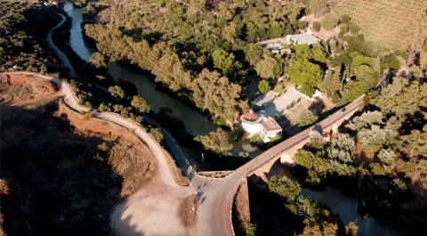
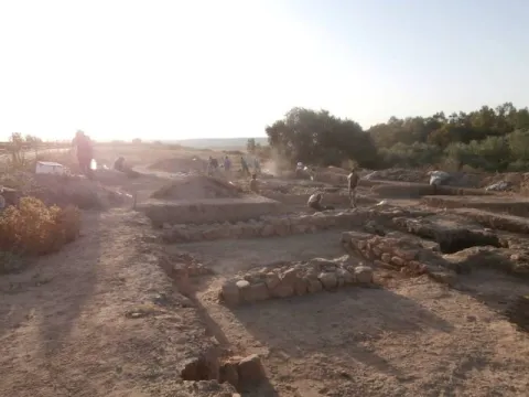
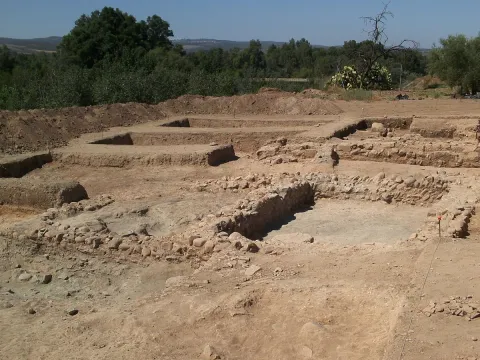
  • It has a archaeological site of the Roman era in the Hermitage of Santa Potenica, next to the Guadalquivir River, as well as two hermites, that of San Marcos and that of the Holy Christ of the Humiliadero.
  • The parish church of theImmaculate Conception, shows in its arches and Gothic pillars that origin, although it is transformed in the first decade of the 17th century. Hence its elegant classic cover and the tower with a beautiful chapiel.
Naturaleza

The municipal term of Villanueva de la Reina is an elongated strip that occupies the middle region of the Guadalquivir River, and in it we can distinguish the following areas:

  • In the north From the term, the landscape is mountainous. This area belongs to the Natural Park of the Sierra de Andújar. A half mountain area with a varied morphology and altitude. It has a rich and varied fauna in which the Iberian lince stands out. The vegetation of this area is made up of: oaks, alcornoques, pines, oaks, cornicabres and bushes such as rosemary and thyme. In his fauna We find: deer, we go, lynches, boars, imperial eagle, black vulture and the leonate vulture.
  • Area of the countryside, in which the cultivation of the olive tree predominates, which also serves as a shelter and sustenance for species that live in this ecosystem: insect birds, parrots, codornices, clumsy pigeon... and mammals such as rabbit, hare, fox or badger.
  • In the central area, the quiet course of the Guadalquivir River determines the Vega, where fertile land is dedicated to the cultivation of orchards and fruit trees. The cultivation of asparagus is of great importance. The forest called gallery, which grows next to the river's riverside is the predominant vegetation, and is made up of chopos, allies, strawberries, mimberas, willows... With a fauna characteristic of this place: storks, storks, tents, trout, salamanders, frogs... as well as the fauna of these areas.
  • To hisr, it's a dry area, where cereals are especially grown.

A territory with areas of different characteristics and that each of them provides the vegetation and fauna that characterizes it, and that makes Villanueva de la Reina a municipality with a privileged natural wealth.

A place very visited by the neighbors of Villanueva de la Reina is, The Battle. It is located next to the Guadalquivir River and is a recreational area that is populated by a lot of eucalyptus, fountains, children's playground, ideal for spending the day with the family.

Here it is preserved a Batan, machine that was composed of thick wooden mocks moved by a shaft to hit, unfat and sharpen the cloth.

In this place is celebrated the Romeria of Santa Potencio.

Fiestas y Eventos

The following parties are held in Villanueva de la Reina:

  • Saint Anton. It is held on January 17. The night before are done "lumbres" with olive branches in different parts of the village. Around the lumbres you sing, dance, drink and roast chorizos, cheeks...
  • Carnivalwhich is held on Saturday after ash Wednesday. A party with a lot of roots and in which the neighbors come out to see the comparsas and the people dressed in "mask."
  • Holy Week. During the Holy Week processions, the "armed," typical Roman soldiers who walk in front of the steps, dressed in the typical Baroque suits and sing the traditional ones "Passion Cups" and "Questions.", songs that sing without musical accompaniment.
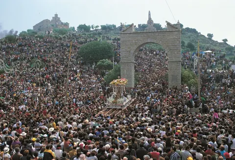
  • Romeria in honor of Santa Potentena. It takes place the second weekend of May, in the place called the Batanejo. It starts on Friday with the traditional paellaon Saturday with the walk through the streets of the village of Brotherhood of Santa Potenica accompanied by the authorities and people dressed in typical flamenco suits, who are followed by beautifully gilded carrots. The party will end on Sunday with the procession of Santa Potentian to the Batanejo.
  • San Isidro. It is the pattern of the village of The Quinteria and is held on May 15. On that day, activities are organized for children and older people and the Holy One is processed.
  • Patronal parties in honor of Santa Potentena. Which take place on the first weekend of August, from Thursday to Sunday. On Saturday the tasting of the "Singing" eggplants in vinegar and in the afternoon the procession in honor of Santa Potencio.
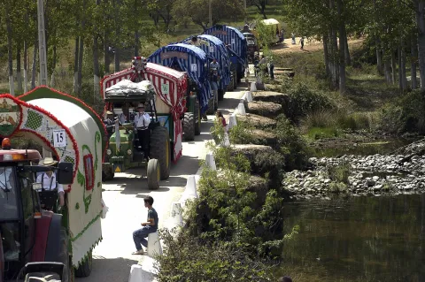
  • Romeria de Santa María de la Cabeza. It takes place on the last Sunday of April in the sanctuary of the Virgin of the Head which is found in the middle of Sierra Morena. It is the oldest rosemary in Spain, and there come neighbors of the surrounding villages, dressed as rosemary and with the gilded carrots, which look like rivers of color that climb up the mountain. A very bright and emotional romance.
  • The "Monones", are native songs / Coplas of Villanueva de la Reina that maintain the tradition of going out alone or in group on the streets to sing them at Christmas. The content is jumpy, loving or spicy. Contests are organized and the number of participants is increasing each year.
Gastronomía

There are two ideas that are present in all the dishes that make up the gastronomy of Villanueva de la Reina: The first is that the virgin olive oilproduced in their fields, will be present in all their dishes; and the second is that they will be used as ingredients those products on the ground, vegetables, fruit or mountain meat during the hunting season.

Among the most traditional dishes, we highlight:

  • "Old clothes." or the rest of the cooking: cooked chickpeas, onions, garlic, egg, salt and oil.
  • "Lent power": chickpeas, olive oil, flour, cinnamon and lemon scrapes.
  • "Tyruabuzas": eggs, olive oil, flour, cinnamon and lemon scrapes.
  • "Pipirrana", is a salad in which tomatoes, cooked eggs, green peppers, onions and tuna are chopped.
  • Monkey stew. (Rabbit, hare, perdiz)

In pastry shops:

  • "Bienmesabe", a dessert with clear Arab reminiscent, which carries almonds, sugar, water, egg yolks, lemon shell and cinnamon in stick. It is in the form of a pasty cream with an exquisite taste.
  • "Pestiños", rosy types passed through the frying pan, to which sugar is added.
Historia

Vestiges located on the terraces of Guadalquivir confirm its paleolithic origins; the settlement of The Crujia is one of the archaeological sites already of the Neolithic. The human presence during the Iberian era is evident in other settlements and in the discovery of abundant ceramics.

These lands were very moved by being located on the way from Cástulo to Iliturgi, from the Via Augusta. In the Vasos of Vicarello, the route from Cadiz to Rome by Cattulo appears, and a stop is mentioned. Ad Noulas or Nobia, identified with the Vega Baja site, close to the current city centre. It was the old one. Ipra where findings reveal systems of Roman parcelation, in places such as the Garden of Enmedio, Arroyo del Tesoro, the Crafts or in the surroundings of the pedanea The Quinteria. The most emblematic is the villa of Santa Potencio.

In Muslim times it was a small alquería, given to Andújar after his conquest by Alfonso X. In the 15th century, it was the scene of the battle of San Bernabé, in which when the Andújar of his battle against Don Juan de la Cueva in Baeza, led by the Constable Iranzo, returned, were surprised by Don Fabrique and those of Córdoba with 500 horses and 800 children.

In 1628 Bishop Moscoso and Sandoval began a process on the miracles of Santa Potenica, weaver whose martyrdom consisted of pairing; ten years later he was beatified by Urban VIII.

During the French invasion, General Castaños organized here the column that he defeated at the Battle of Bailén. On July 22, 1808, the French capitulation was signed at the Casa de Postas de Villanueva de la Reina.

The old one Villanueva de Andújar was segregated from this city in 1790 and took the name of Villanueva del Río, until later, for aid received from Queen Elizabeth II, he changed his name to the current one.

Imagen principal
imagen
Image
Villanueva de la Reina
Imagen principal
Activado

Marmolejo

Submitted by brandcode_deweloper on
Id
745355
Perfil de redes sociales
Facebook
https://www.facebook.com/aytomarmolejo/
Twitter
https://twitter.com/aytodemarmolejo
Youtube
https://www.youtube.com/@AyuntamientodeMarmolejo
Instagram
https://www.instagram.com/aytodemarmolejo/
Descripción
Breve descripción

Marmolejo is a town in the region of the Jienese countryside that is located to the west of it, limiting to the province of Córdoba, on the banks of the Guadalquivir.

The northern half of its municipal term is mountain (Sierra Morena) and a sector of this area is integrated into the Natural Park of the Sierra de Andújar.

In the southern half the cultivated areas are concentrated, in which the olive tree is the majority, although the Vega del Guadalquivir is important irrigated crops such as corn, cotton, alfalfa and a wide variety of horticultural products.

The economy of the town is based on agriculture, livestock, forest and cicnetics and the hotel, motivated by the traffic of passengers from the nearby motorway of Andalusia (A-4).

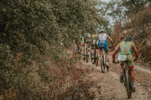
Among its parties are the celebration of Corpus Christi, the Marmoleño carnival, the Holy Week, the Romeria de la Virgen de la Cabeza and the celebration of its patrons, Our Lady of Peace and San Julián. In addition to its festivities, it is important to highlight sporting events such as the Duathlon Cross Villa de Marmolejo or other events such as the Student's Hall and Christmas lighting.

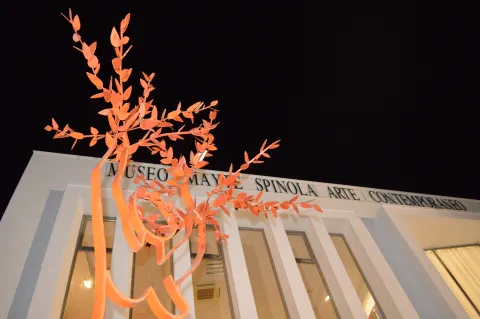
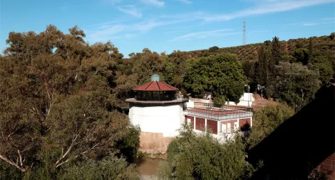
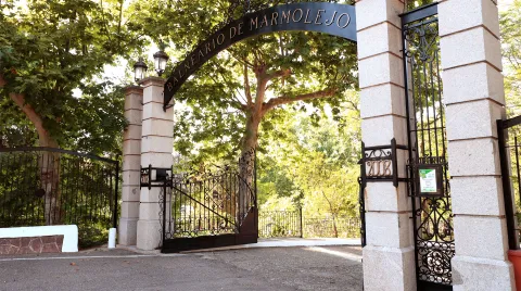
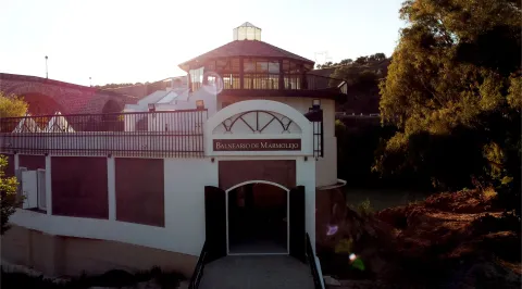
The Marmolejo Spa and the Museum of Contemporary Art Mayte Spínola are the most important.

Marmolejo is famous for its medicinal waters, which have given rise to a famous spa, immortalized, among others, by Palacio Valdés in his novel "La Sis San Sulpicio."

Telecomunicaciones
Teléfono
618 552 056
Sitio web
www.marmolejo.es/home
Fax
953 540 151
Correo electrónico
info@ayuntamientodemarmolejo.es
Ubicación
Nombre
Marmolejo
Latitud
38.045600
Longitud
-4.171100
Distrito
Municipio
Ubicación en el mapa
POINT (-4.1711 38.0456)
Imágenes
imagen
Image
12-4-jpg
Imagen principal
Desactivado
imagen
Image
ayto-2-1-jpg
Imagen principal
Desactivado
imagen
Image
la-pepa-2-1-jpg
Imagen principal
Desactivado
imagen
Image
paseo-1-1-jpg
Imagen principal
Desactivado
imagen
Image
museo-1-4-jpg
Imagen principal
Desactivado
imagen
Image
ermita-de-jesus-1-1-jpg
Imagen principal
Desactivado
imagen
Image
castillo-de-la-aragonesa-1-jpg
Imagen principal
Desactivado
imagen
Image
10-7-jpg
Imagen principal
Desactivado
imagen
Image
balenario-de-marmolejo-2-jpg
Imagen principal
Desactivado
imagen
Image
balenario-de-marmolejo-4-jpg
Imagen principal
Desactivado
imagen
Image
balenario-de-marmolejo-12-jpg
Imagen principal
Desactivado
imagen
Image
balneario-1-1-jpg
Imagen principal
Desactivado
imagen
Image
puente-san-bartolome-0-jpg
Imagen principal
Desactivado
imagen
Image
centro-de-interpretacion-balneario-1-jpeg
Imagen principal
Desactivado
imagen
Image
consulta-del-medico-2-jpg
Imagen principal
Desactivado
imagen
Image
diosa-higea-1-jpeg
Imagen principal
Desactivado
imagen
Image
diosa-higea-2-jpg
Imagen principal
Desactivado
imagen
Image
solises-1-1-jpg
Imagen principal
Desactivado
imagen
Image
jardines-balneario-2-jpg
Imagen principal
Desactivado
imagen
Image
jardines-balneario-8-jpeg
Imagen principal
Desactivado
imagen
Image
sierra-marmolejo-10-jpg
Imagen principal
Desactivado
imagen
Image
sierra-marmolejo-18-jpg
Imagen principal
Desactivado
imagen
Image
tranvia-1-jpg
Imagen principal
Desactivado
imagen
Image
sierra-marmolejo-15-jpg
Imagen principal
Desactivado
imagen
Image
sierra-marmolejo-14-jpg
Imagen principal
Desactivado
imagen
Image
sierra-marmolejo-16-jpg
Imagen principal
Desactivado
Imágenes cabecera
imagen
Image
Marmolejo
Imagen principal
Desactivado
Datos de interés

Tourist area: Sierra Morena / Parque Natural de la Sierra de Andújar
Distance to the capital (km): 63
Altitude over sea level (m): 248
Extension (km ²): 178
Number of inhabitants: 7,099
Gentillo: Marmoleños
Postal code: 23770

Videos
Video file
Cultura

Among its artistic heritage, we highlight:

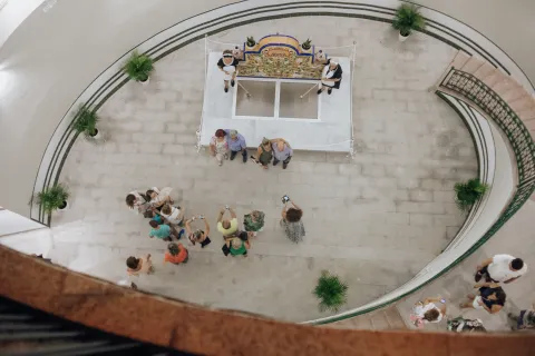
  • Marmolejo Spa. The waters of the Marmolejo Spa have been used since the Roman period in Hispania. At the end of the 19th century, the current spa was built alongside its three springs: San Luis, Buena Esperanza and Fuente Agria, declared of public utility in 1816 and recognised as medicinal mineral waters in 1869. It is the most renowned spa in the province, having received awards at the Universal Expositions in Paris, London and Chicago. Distinguished figures such as Armando Palacio Valdés, Santiago Ramón y Cajal and Charles Chaplin visited the spa. These bicarbonate-rich ferruginous waters are recommended for liver, digestive and kidney ailments. The golden age of this jewel of Marmolejo can be discovered at the famous "Doctor's House", now converted into an interpretation centre. The monument and its gardens have been declared a Historic Site and a Site of Cultural Interest.
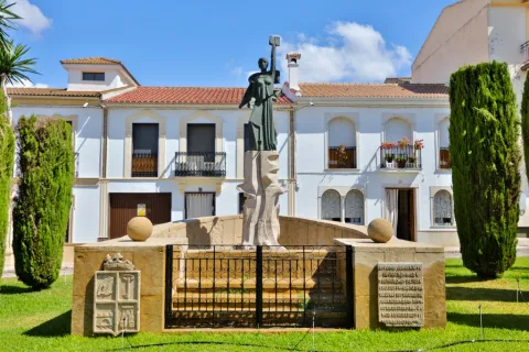
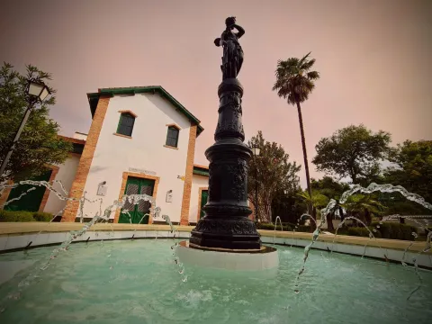
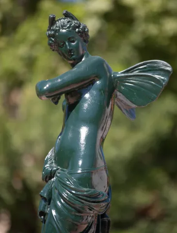
  • Hygieia Goddess – Nereid by Mathurin Moreau. This is undoubtedly the most important sculpture and the one with the greatest sentimental value in Marmolejo's artistic heritage. Cast at the French Val d'Osne foundry and sculpted by Mathurin Moreau at the end of the 19th century, this bronze sculpture is popularly known as the Goddess Hygieia. It is located in the gardens of the Marmolejo Spa.
  • San Bartolomé Bridge. A magnificent Renaissance bridge spanning the Guadalquivir River. Designed by Benito del Castillo, it is one of the most spectacular bridges across the river. It was built between 1550 and 1587 and consists of seven semicircular arches supporting barrel vaults, resting on piers reinforced by semicircular cutwaters with conical tops on one side and triangular ones on the other. The bridge was remodelled in the 19th century, preserving the three largest arches from the original 16th-century structure. It has been declared a Site of Cultural Interest (BIC).
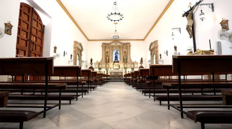
  • Parish Church of Our Lady of Peace. This is the most outstanding monument in the historic centre. The building housing the parish church was constructed in the 14th century. The transept was added during the 15th and 16th centuries, and the two entrance façades were built in the 18th century. However, the church's current appearance is the result of a renovation carried out at the end of the 19th century by the architect Justino Flores Llamas. Inside, the most remarkable feature is the central 18th-century Baroque altarpiece, brought from a Dominican convent in the town of Benavente (Zamora).
  • Church of Jesús. The Hermitage of Jesús is of Baroque origin and was one of the many hermitages that once existed in the town. It is the only one that has survived thanks to its reconstruction in 1887. It takes its name from the statue of Nuestro Padre Jesús Nazareno, which can be seen inside together with the largest collection of images carried in Marmolejo's Holy Week processions, as well as the Virgin of La Cabeza.
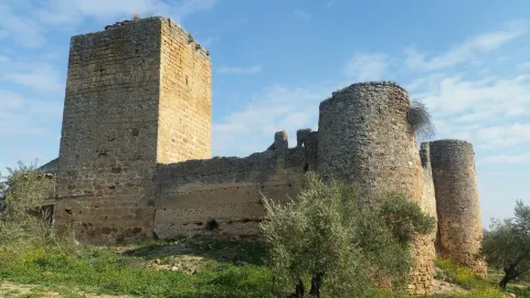
  • Aragonesa Castle. Located on the border between Jaén and Córdoba, in the Guadalquivir Valley, it stands near one of the branches of the Roman road that followed the river. Two distinct construction phases can be identified: the first, of Muslim origin, when the Berber fortress was built, and the second, during the Christian period, when the Keep of the rural castle that replaced the fortress was erected. This tower dates from the late 13th or early 14th century. In 1985 it was declared a Site of Cultural Interest (BIC) by the Regional Government of Andalusia.
  • Mayte Spínola Museum of Contemporary Art. Founded in 2004, the museum was created from donations made by artists belonging to the "Proarte y Cultura" group, founded by artist and patron Mayte Spínola, with new works added regularly. The museum's board of trustees is chaired by the Mayor of Marmolejo, Manuel Lozano Garrido. It houses an eclectic collection reflecting the diverse trends in contemporary art from the late 20th and early 21st centuries. Today it contains more than 300 works by Spanish and international artists, making it a true oasis of art in the province of Jaén, as it is the only museum of its kind in the province.
  • Hermitage of the Holy Christ. A small single-storey building dating from 1910, located at the end of Calvario Street on the boulevard connecting the town centre of Marmolejo with its Spa.
  • San José Market Hall. Local market designed by Ramón Pajares and inaugurated in 1953 under the "Regiones Devastadas" reconstruction programme. Even today, fresh fruit and vegetables from the fertile gardens of Marmolejo remain the market's main products.
  • La Pepa. Sculpture dedicated to the 1978 Spanish Constitution, popularly known as "La Pepa", created by the artist Miguel Fuentes del Olmo. The female-shaped sculpture symbolizes the right path to follow, and the folds of her dress feature a representation of the physical map of Spain.
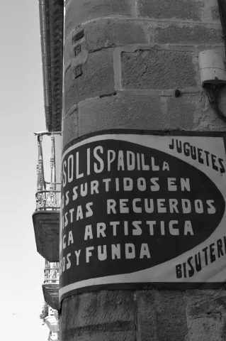
  • Esquina de los Solises. This is one of the most emblematic and oldest places in Marmolejo. The building on this corner is constructed from local azucarera stone. Its name comes from the nickname by which the owners of the shop located there, Solís Bazaar, were known, preserved just as it was during Marmolejo's golden age. There is a popular local saying referring to this place: «You're older than the Solises Corner.»
  • Paseo de la Libertad. This is the largest green and recreational area in the urban center of Marmolejo, dating from the early 20th century. It stretches from the La Pepa sculpture to the water tower, better known as La Torre. In its central area stands the most iconic ornamental fountain, featuring the word "freedom" written in more than forty languages.
  • Marmolejo Town Hall. In 1929, Luis Berges, architect of the Jaén Provincial Council, remodeled the former municipal building, which originally had only one floor, adding a second one. The building seen today preserves the 1929 structure, although it has undergone further renovations in 1989 and 2014.
  • San Lorenzo Castle Square. In order to recover the history of the former San Lorenzo Castle, part of the castle wall has been reconstructed in the former Juan XXIII Square. The castle, of Roman origin and successively adapted during the Hispano-Muslim and later Castilian periods, once stood near this location. The discovery of the old well has also enhanced the square's historical and heritage value.
  • Spa Visitors' Boulevard. Accessible promenade leading to the Spa, where visitors can read murals featuring passages from the book The Life of the Spa Visitor in the Famous Town of Marmolejo, written by Doctor Thebussem and published in 1893. This is the route followed by thousands of spa visitors over the centuries in search of relief from their ailments through Marmolejo's renowned mineral-medicinal waters.

Nature

Marmolejo is located at the foothills of the Sierra Morena mountain range, separated from it by the Guadalquivir River. It is popularly known as the "town of the three harvests", as it produces olive, fruit and vegetable, and cotton crops.

It has a large number of mineral water springs scattered throughout its lush landscape. Many of these springs are officially recognized as medicinal mineral waters with remarkable therapeutic properties.

This municipality lies between two natural parks: Sierra de Andújar Natural Park and Sierra de Cardeña y Montoro Natural Park, in the heart of the Sierra Morena mountain range.

Three major rivers flow through the municipality: the Guadalquivir, the Jándula, which forms the boundary between Marmolejo and Andújar, and the Yeguas River, which also marks the border with the province of Córdoba.

The Yeguas Reservoir, inaugurated in 1989, supplies water for local communities, irrigation, and hydroelectric power generation. Another reservoir on the Guadalquivir River is also located within the municipality of Marmolejo.

In the northern part of the municipality, in the heart of the Sierra Morena, there are natural ecosystems such as the dehesas, where scrubland has been cleared to leave isolated trees, mainly holm oaks and cork oaks, along with herbaceous species ideal for livestock grazing.

span style="font-size:11pt">Other plant formations include holm oak woodlands and cork oak forests, mixed with Portuguese oaks.

The area is also rich in aromatic plants such as Spanish lavender, rosemary, thyme, and marjoram. Along the banks of the Yeguas River, gallery forests of willows, ash trees, tamarisks, and tamujos can be found.

The wildlife is also rich and diverse. Birds of prey include the golden eagle, booted eagle, short-toed snake eagle, black kite, lesser kestrel, common kestrel, as well as numerous small bird species.

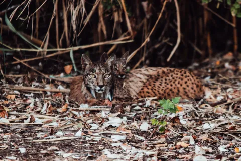
Among the mammals are the Iberian lynx, otter, and Egyptian mongoose. Other carnivores include the fox, weasel, stone marten, genet, badger, and wildcat. Reptiles include lizards and the snub-nosed viper.

The reservoirs provide habitat for water birds such as the purple heron, black-crowned night heron, and western marsh harrier.

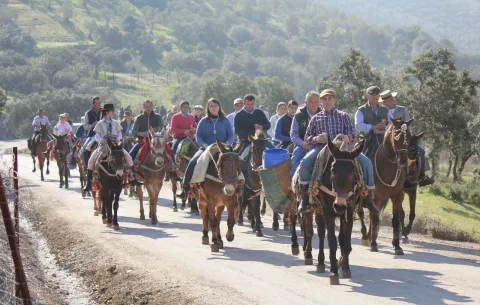
Without a doubt, this is an ideal area for hiking along the many trails that cross the region. Visitors can also take part in the traditional muladas, group excursions by mule or horseback with friends or local associations. The most popular route crosses the heart of the Sierra Morena and Sierra de Andújar Natural Park to reach the Sanctuary of the Virgin of the Head. This section forms part of the GR48 long-distance trail, which runs from Portugal to Santa Elena (Jaén), and can be explored on foot or by bicycle, passing the Cristóbal Relaño Viewpoint and the Virgin of the Head Viewpoint.

Other recommended hiking trails/routes include: The Las Flores Trails, Yeguas River Riverside Route, Guadalquivir Riverside Route, Birdwatching Route, El Pintado Route, Las Fuentes Route, and the Reservoir–El Comisario Path.

The Sierra de Marmolejo offers fantastic areas for stargazing, as it is part of the Starlight Reserve and Tourist Destination network. It has been recognized as one of the cleanest night skies in Europe for observing the stars.

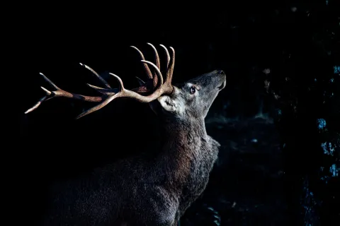
In addition to enjoying this wonderful experience, visitors can close their eyes and sharpen their hearing to witness every year one of the Sierra's most majestic natural spectacles, the Deer Rut (La Berrea), as one of Marmolejo's main sources of wealth is hunting. There is small game hunting (rabbits and partridges) in the southern part, within the northern Jaén countryside, and big game hunting (wild boar and deer) in the northern area, which lies within the Sierra de Andújar Natural Park.

Marmolejo also offers excellent opportunities for fishing, thanks to the Yeguas Reservoir, where species such as black bass, carp and Iberian nase can be found.

Festivals and Events

The local festival calendar is marked by religious celebrations. Among the most deeply rooted festivities are:

  • Three Kings Parade. It is considered one of the most creative and colorful parades in the province.
  • Feast of Our Lady of Peace. On the afternoon of January 24, the image of the Virgin is carried in procession by the town's young people.
  • Candlemas Day. Celebrated on the weekend closest to February 2, when residents of different neighborhoods light bonfires throughout Marmolejo.
  • Carnival. It is one of Marmolejo's liveliest and most popular celebrations, earning a prestigious place among the festivities held throughout the province of Jaén.
  • Holy Week. Marmolejo's Holy Week has a long-standing tradition and enjoys great popular participation. Its highlight is the early morning Maundy Thursday procession of Nuestro Padre Jesús Nazareno. It is an explosion of devotion and tradition that fills the town's streets with the scent of incense and candle wax.
  • Pilgrimage of the Virgin of the Head. It is probably the oldest pilgrimage in Spain and takes place on the last Sunday of April. On the Sunday before the main pilgrimage week, the image is transferred from the Church of Jesús to the Parish of Our Lady of Peace. On Saturday morning, the streets fill with colour, songs and joy as pilgrims, horses and decorated carts make their way to the Sanctuary of the Virgin of the Head, located in the heart of Sierra Morena.
  • San Isidro. Celebrated on the weekend closest to May 15, when the people of Marmolejo gather in the hamlet of San Julián, where Mass is celebrated and paella and cascaflote are served in the village square.
  • Corpus Christi Festival. It takes place sixty days after Easter Sunday, although in Marmolejo the celebrations are moved to the following Sunday. The streets are decorated with traditional coloured sawdust carpets, altars and balconies adorned with festive draperies to welcome the Blessed Sacrament during the procession.
  • Marmolejo Fair and Festival. Held on the third weekend of August. During these days, a wide variety of sporting, cultural, entertainment, musical and traditional activities bring the town to life.
  • Feast of Saint Julian. (San Julián is a hamlet located 7 km from Marmolejo.) It is celebrated on the weekend closest to September 5, when the image of the saint is carried in procession from the parish church to the Hermitage of San Julián on a cart pulled by a mule, accompanied by the annual chief stewards and devoted pilgrims.
  • Our Lady of the Pillar Day and All Saints' Day. On the weekends closest to October 12 and November 1, the people of Marmolejo gather in natural areas such as La Centenera, La Dehesilla, the Spa, El Baldío and the Fuente de Los Socialistas recreational area.

Naturaleza

Marmolejo is located at the foot of Sierra Morena, separating it from this the Guadalquivir River. It is popularly known as the "people of the three crops," as the olive, fruit and cotton crops are collected.

It has a large number of mineral water springs distributed along its lush landscape. Many of the springs are declared as mineromicinal and with great therapeutic properties.

This municipality is step between two natural parks: the natural park of Sierra Andújar and the natural park of Sierra de Cardis and Montoro, in the heart of Sierra Morena.

Three grand. rivers go through its municipal term: the Guadalquivir, Jandulawhich borders Marmolejo and Andújar, and the Yeguas River which also serves as a border with the province of Córdoba.

The Yeguas River reservoiropened in 1989, its water is intended for the supply of the populations, irrigation and the production of electricity. And in the term of Marmolejo is carried out another reservoir on the Guadalquivir River.

In the north of the city, located in the heart of Sierra Morena, we find natural ecosystems such as the dehesaswhere the shrubs have been removed and isolated trees are left, usually oak and / or cork and herbaceous species very suitable for livestock grass.

Other plant formations that we can observe are the Encinar and forests alcornoques, mixed with complaints.

It also highlights the presence of aromatic plants like the canopy, the rosemary, the thyme and the betteran. On the banks of the Yeguas River are the forests of galleries: saucedas, fresneas, tarais and tamujares.

The fauna It's also very diverse and abundant. The raptures are highlighted: the royal eagle, the driveway, the scum, the black millano, the primitive and the vulgar, as a large number of small birds.

Between the mammals: Iberian lince, otter, and meloncillo. Carnivores like: fox, weasel, chickpea, gineta, badger and cat montés. Reptiles like, the lizard and the snout viper.

The presence of the reservoirs allows the presence of water birds like the imperial garza, the martinete or the lizard.

Without a doubt, an ideal ground for hiking through the many trails that go through this area, where we can participate in the picturesque mules,mule or horse trips that take place in groups of friends or rock. The main route and the most demanded one is the one that passes through the heart of Sierra Morena and the Natural Park of Sierra de Andújar to reach the Sanctuary of the Virgin of the Head. This section belongs to the GR48 path from Portugal to St. Helena (Jaén). can also be done on foot or by bike and through the Mirador de las Cristóbal Relaño and the Mirador de la Virgen de la Cabeza.

Other paths / routes to be taken off are:The trails of Las Flores, Ruta Ribera del Río Yeguas, Ruta Ribera del Guadalquivir, Ruta ornithological, Ruta del Pintado, Ruta de Las Fuentes and Ruta del Pantano - Camino El Comisario.

The Sierra de Marmolejo has fantastic areas for astronomical observation as part of the reservation and tourist destinations Starlight. It has been listed as one of the cleanest night skies in Europe to observe the stars.

In addition to enjoying this wonderful experience, we can be surprised by closing our eyes and sharpening our ears to enjoy each year one of the most majestic natural courts in the Sierra, La Berrea, since one of Marmolejo's sources of wealth is the Cynegetic activity. There's minor hunting (rabbits and partridges) in the south, in the northern countryside of Jaén; and major game (boars and deer) in the northern part, which is inserted into the natural park of the Sierra de Andújar.

Marmolejo has great opportunities for the fishing, thanks to the Yeguas reservoir, and among the species we find black bass, tent or boga.

Fiestas y Eventos

The calendar of the parties is marked by religious celebrations. Among the most rooted parties in the population are:

  • Ride of the Magi kings. It is among one of the colorful creative in the province
  • Festivity of Our Lady of Peace. On January 24 in the afternoon, the image of the Virgin is processed and taken by the young people of the town.
  • Candelaria Day. It is held the weekend closest to February 2, in which the neighbors of different neighborhoods light fires throughout Marmolejo.
  • Carnival. It is one of Marmolejo's most joyful and busy parties, making itself a prestigious space with its programming in the province of Jaén.
  • Holy Week Marmoleña has a great tradition and great popular participation. It is the ultimate success of the procession of the morning on holy Thursday, of Our Father Jesus Nazarene. It is an explosion of fervor and tradition that floods the streets of the locality dl smell of incense and wax from the candles.
  • Romeria de la Virgen de la Cabeza. It is probably the oldest Romeria in Spain and takes place on the last Sunday of April. The Sunday before the Great Week the image is moved from the hermitage of Jesus to the parish of Our Lady of Peace. On Saturday morning, the streets are filled with color, songs and joy at the passage of the rosemary, horses and carts that go up to the Sanctuary of the Virgin of the Head, located in the heart of Sierra Morena.
  • San Isidrowhich is celebrated on the weekend closest to May 15 and the citizens of Marmolejo move to the pedanía of San Julián, where mass is held and they are invited to paella and cauclot in the square of this pedanía.
  • Festivity of Corpus Christi, takes place sixty days after the Sunday of Resurrection, although Marmolejo transfers the festive acts of the day indicated to the later Sunday. The streets of Marmolejo are dressed with the traditional carpets of stained sawdust, altars and balconies with the typical hangings to receive the Lord who will process that day through the streets.
  • Marmolejo fair and parties. The third weekend of August is held. During these days a variety of sports, cultural, animation, musical and traditional activities are organized that give life to the town.
  • Festivity of San Julián (San Julián is a pedany 7 km from Marmolejo). It takes place the next weekend to September 5 and the image of the saint is processed from the parish to the Hermitage of San Julián, in a carriage towed by a mule and accompanied by the older brothers of each year and the Roman devotees.
  • Our Lady of the Pilar Day and Day of All Saints. On the weekends closest to October 12 and November 1, the Marbles go to natural areas such as La Centenera, the Dehesilla, the Balneario, the Baldio or the recreational area of the Socialist Source
Loading map
Preparing points of interest and routes...
Imagen principal
imagen
Image
Marmolejo
Imagen principal
Activado

Baños de la Encina

Submitted by brandcode_deweloper on
Id
780098
Perfil de redes sociales
Facebook
https://www.facebook.com/AyuntamientoBanosdelaEncina
Twitter
https://twitter.com/ayto_banos
Youtube
https://www.youtube.com/user/bdelaencina2
Instagram
https://www.instagram.com/ayuntamientobanosdelaencina/
Descripción
Breve descripción

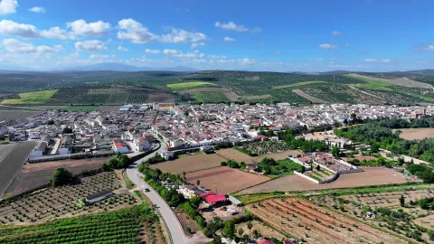
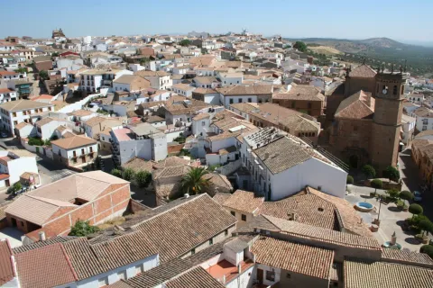
Baños de la Encina is a town located to the north-west of the province of Jaén, in the heart of Sierra Morena, being part of its municipal term included in the Sierra de Andújar Natural Park.

It is a town characterized by a rich cultural and natural heritage. Its abundant natural enclaves have a high ecological and landscape value.

The Rumblar reservoir or the brazen cattle shops give special beauty to the bathing landscapes. A picturesque place is the town of El Centenillo, a pedany with a past linked to mining that has inherited us very interesting vestiges of that extractor activity maintained until the second half of the 20th century.

Telecomunicaciones
Teléfono
953 613 338
Sitio web
www.bdelaencinaturismo.com
Fax
953 613 455
Correo electrónico
ayuntamiento@banosdelaencina.es
Ubicación
Nombre
Baños de la Encina
Latitud
38.175110
Longitud
-3.774660
Distrito
Ubicación en el mapa
POINT (-3.77466 38.17511)
Imágenes
imagen
Image
bb43412b-0b09-92e1-b5dd-2a3baaeef265?t=1616762819308
Imagen principal
Desactivado
imagen
Image
6e061618-da10-6b26-ebe5-300517ba8230?t=1616763048514
Imagen principal
Desactivado
imagen
Image
74310b79-8179-fae7-5b3e-b576735fa133?t=1616763048565
Imagen principal
Desactivado
imagen
Image
62832d7e-b9c5-e2e7-8c96-eaa006430cf6?t=1616763048614
Imagen principal
Desactivado
imagen
Image
7d8309d2-8fe8-afaa-52e1-30fa5ffd4344?t=1616763048663
Imagen principal
Desactivado
imagen
Image
5ad5a6f6-be90-af33-a942-c398c15eac8e?t=1585087446209
Imagen principal
Desactivado
imagen
Image
b8fc307b-b54e-2067-4fa8-d7b7e20df730?t=1616763335903
Imagen principal
Desactivado
imagen
Image
e80f5c5a-9de3-0a08-2ea9-d6e40613fec0?t=1616763335957
Imagen principal
Desactivado
imagen
Image
d5d6f262-ceaa-09c3-3124-4f3017e71822?t=1616763336007
Imagen principal
Desactivado
imagen
Image
5be66f78-cbbc-a026-651d-ffaef3679132?t=1616763336058
Imagen principal
Desactivado
imagen
Image
48647967-2b83-bcef-38bc-adf042b0be7d?t=1603119701256
Imagen principal
Desactivado
imagen
Image
8c045208-3641-3c84-2c69-e31fba4f077c?t=1616763336138
Imagen principal
Desactivado
imagen
Image
87fdbe3b-186b-19bd-8f89-e4a40bd26929?t=1616763491946
Imagen principal
Desactivado
imagen
Image
058a9ced-9222-cd95-ed71-43d8be494159?t=1616763492048
Imagen principal
Desactivado
imagen
Image
e6f47c26-b02d-fa14-8b66-df7a4cee0858?t=1616763492173
Imagen principal
Desactivado
imagen
Image
6de90817-a9cc-79c6-b605-f2af76b1648f?t=1616763336188
Imagen principal
Desactivado
imagen
Image
d4bc33bd-166f-3120-184e-4f2e5b6efdd7?t=1616763336243
Imagen principal
Desactivado
imagen
Image
1a4b34e9-0517-fd82-1815-920fb58433f6?t=1616763492470
Imagen principal
Desactivado
imagen
Image
798beea5-5af1-63e7-ac7d-4dceabb4b9ee?t=1616763492614
Imagen principal
Desactivado
imagen
Image
9c5a19f0-40c7-8be4-dbf1-e323dfae9bf9?t=1616763336434
Imagen principal
Desactivado
imagen
Image
43bfe44f-fb3e-b00e-99ad-015db6e53e10?t=1616769905170
Imagen principal
Desactivado
Información adicional
Curiosidades

Oficina Municipal de Turismo:

  • Avda. José Luis Messía, s/n. Centro de interpretación “Torreón del Recuerdo”
  • Tfno.: 953 613 338
  • https://www.laencinaturismo.com/
  • De Martes a domingo (lunes cerrado): de 10:00 h. a 13:30 h.
  • De Jueves a domingo: de 16:30 h. a 18:30 h. (verano de 18:30 h. a 20:30 h.)
Imágenes cabecera
imagen
Image
baños de la encina
Imagen principal
Desactivado
Datos de interés

Tourist area: Sierra Morena / Sierras de Andújar
Distance to the capital (km): 52
Altitude over sea level (m): 420
Extension (Km2): 392
Number of inhabitants: 2582
Gentillo: Bañuscos
Postal code: 23711

Videos
Video file
Cultura

Baños de la Encina has accumulated a rich artistic heritage that has been able to preserve and care for. To visit it is to connect with the tracks of other peoples and cultures that have passed through this territory.
From its heritage, we highlight:

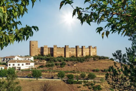
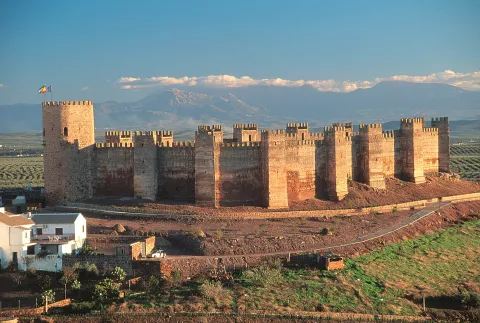
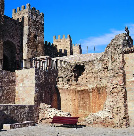
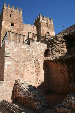
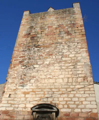
  • The castle of Bury al-Hamma (Burgalimar). The impressive silhouette of the castle dominates the rural landscape of Baños de la Encina. He rose in 968, in the califal period. It is flanked by a sturdy, almond wall with 14 towers, plus the Christian tower of tribute, and it has suffered little damage, constituting the best preserved fortified set of the time. The main Christian modification was introduced on one of the original 14 turreons: the Tribute Tower (also known as the "Gorda Tower"). This tower does not look to the countryside, but to the interior of the population, projecting itself above it, which indicates the transformation into a church building. It is Gothic and is built with irregular masonry, presenting cylindrical shape to the outside.
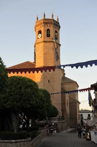
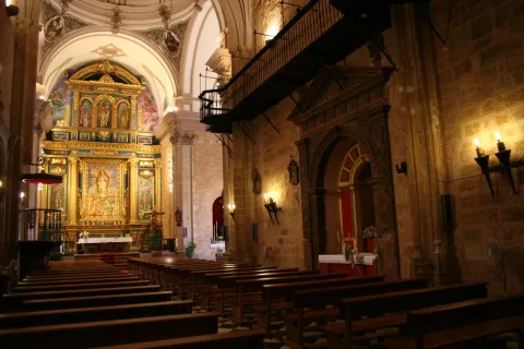
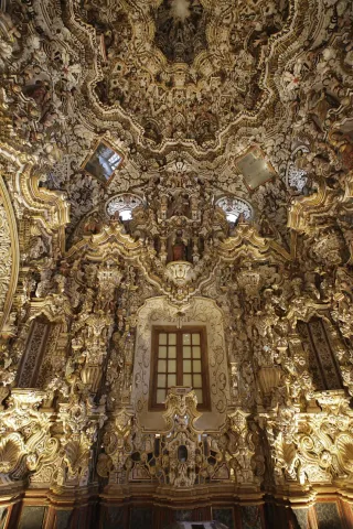
  • The Church of St. Matthew. It is Gothic, although the tower has Renaissance finishes, as does the main cover. The most important element in it is the sacred one, one of the jewels of the sacred art of the province dating from the 17th century. It is built of ebony wood, ivory, silver and shell of Carey that make up a plateau with baroque dome, framed by four columns of shell with capitals and silver basements.
  • Hermitage of the Jesus of the Llanus. Located in the middle of the Mesteño (sheep) rest, this sober building is raised, with a single ship and a bell tower in swordsman on the main facade. The construction takes place from the 16th to the 17th century. What surprises the interior is the Camarín Tower of the venerated image. Of clear granadine influence, it is a manifestation of the most expressive baroque of the 18th century.
  • Hermitage of the Virgin of Encina. The shrine of the Virgin of Encina is 4 km away. from Baths. It was built on a smaller and primitive one from the late 13th and early 14th century. In the 17th century a remodeling was carried out, leaving it as it is today.
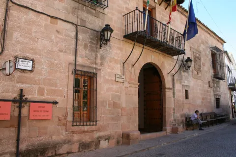
  • Conistory house. It dates from the 16th century, and stands out for its sober and simple aspect, nuanced by the simplicity of the grating. The cover is made up of a half-point arch, on which a balcony is opened with the typical bathrobe.
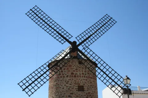
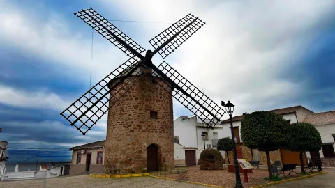
  • Wind Mill. Old wind mill of the 17th century, located in the upper part of the municipality.

Naturaleza

The Centenillo. It is a pedany that is located north of the municipal term and is located 18 km away. of the town of Baños de la Encina. A very old population, a result of the exploitation of their mines.

The year 1865 is the best time in this town, with the arrival of English entrepreneurs and the creation of a mining group that grouped 41 mines. A splendor that will be extinguished in 1963, year in which all the mines will be closed, passing the neighbors to live from the cynegetic activity.

To visit this landscape enclave to see the remains of the mining activity is to immerse us in the mining environment of that time: town of the miners, houses of the English leaders, scavengers, vagonets, laundry... Don't miss it!

Fiestas y Eventos

In addition to the celebrations of Christmas, Carnival or Holy Week, the following festivities are held in Baños de la Encina:

  • La Candelariawhich is celebrated on February 2 and the neighbors gather around great bonfires made with "ramon," remains of the pruning of the olive trees, as they eat, drink, sing and dance.
  • Romeria of Jesus of the Way. It is celebrated on the first Sunday of May, as before the great day of the Romeria de la Virgen de la Encina. This hermitage is on the way to the hermitage of the Virgin of Encina.
  • May Patronal Festivals. They take place during the second weekend of May. The main event is the Romeria de La Virgen de la Encina, in which on the 2nd Sunday of May, the image is moved to the sanctuary and all the bathrobes are accompanied by gilded carts, gilded horses or on foot. All with music, fair houses and good wine.
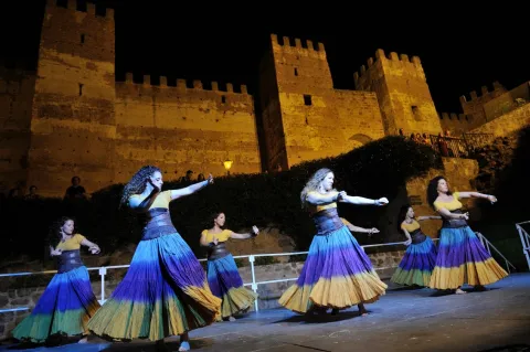
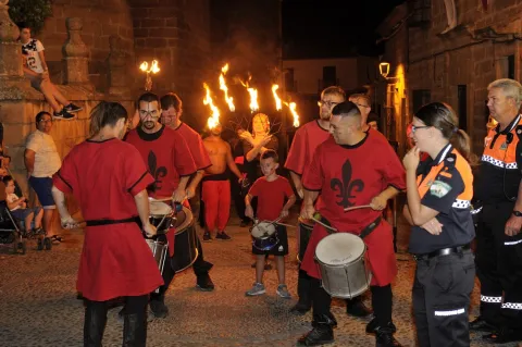
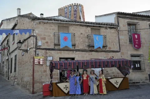
  • Medieval parties. They have been held for a few years in the square and the castle. Artisans stand, dramatic representations of the castle's take between Moors and Christians, stories of the time and dances.
  • Emigrant party. A party that takes place around the 15th of August, in honor of the bathrobes that are outside the village, with various cultural and sports events, in addition to the procession of the Virgin of Encina, which carry the migrants who cannot come to the rosemary. In the end, a migas contest, in which more than a hundred rocks participate, extends along the explanade.
  • Feast of All Saints (1 November). It is certainly one of the most rooted parties in Baños. This day men, and also women, form groups or "parañas," leaving the town leaving to cordijillo or huts of the saw, where they spend several days with their nights, dedicated to hunting birds with "liria," sharing bread, wine and jokes.

Gastronomía

The extra olive oil is harvested in the town and is an ingredient that enriches and gives a special taste to the gastronomy. Hunting meat, from both minor and major game animals, will also be the protagonist of many dishes.
Among the most typical, we highlight:

  • Knives, it is a "bread song" (what is left of a bread after taking off the miga) with oil and tomato that is accompanied by the traditional olives, beans, radishes and cod.
  • Carne de monte guisada (boar or deer). Due to the proximity of Sierra Morena there is an abundance of hunting, both smaller and larger.
  • Sweet peas, also called healthy gachas.
  • Migas serranas or healthy migas, are accompanied by melon, radishes or chocolate.
  • SobaA big, crispy oil cake.
  • Cigarettes, which can be acquired in any of the bakeries of the village. They are used in a special way at Easter.
  • Other typical products are: Coiled olives in various ways, honey, royal jelly, capers and capers in vinegar.

Historia

The settlements in these areas have been documented since early prehistoric times. The geological characteristics of the area, where there are cracks, cannons, caves or natural shelters, served to leave us evidence of its rock art. Thus:

  • The settlement of El Tambor dates back to the Copper Age.
  • And to the Bronze Age would correspond the three settlements that are located on the banks of the Rumblar River, with habitat on terraces and with powerful fortification systems: The Veronica, Peñalosa and Cerro de la Obra.

In the second millennium BC the mining of deposits rich in copper and bronze began. This would attract the Mediterranean civilizations of Greeks and Phoenicians.

During Roman times, In particular during the Empire, the exploitation of the silver mines and traces of this mining past we found them in The Centenillo, a paedania of Baños de la Encina. There are still traces of this exploitation in what is called the Roman trench of the Polygon.

In the period of Al-Andalus The fortress was built, which ended in 968 and was ordered to be built by Alhakem II.

The first Christian conquest will be carried out by Alfonso VII in 1147. It will then be passed from Christian to Arab hands to the final conquest in 1225 by Fernando III, the Holy One. This new territory will be incorporated into Baeza until 1246.

During the century XV It was the scene of clashes between the Constable Iranzo and the Maestres of the Orders of Calatrava and Santiago, a faithful reflection of the confrontation between the nobility and the Modern State.

At the end of the 17th and early 18th century the villa will take a new impulse with the intensification of agriculture and livestock.

But it's a end of XVIII when a number of events are emerging that will undermine the wealth of the villa:

  • On the one hand, it lost territory, in 1767, by the creation of Guarroman, Carboneros, La Carolina and Santa Elena, within the New Population Plan for Sierra Morena.
  • The ecclesiastical deamortization of Mendizábal, of 1835, as well as the Madoz's civilian,of 1855, they end up with the public mountains that brought wealth to Baños.
Otra información

Other places of interest belonging to the artistic heritage:

  • Court / House of Consumer. The current facilities of the Court are part of an old building for the collection of arbitrios (taxes) for the sale of perishable products in the town. Its construction dates back to the 17th and 18th centuries.
  • Hermitage of Jesus of the Way. This small hermitage is located 1 km away. of the hermitage of the Virgin of Encina, and a rosemary is performed on the first Sunday of May.
  • Ancient hermitage of Santa María del Cueto, of which part of a small tree that existed under it is preserved. These remains were dug up on the occasion of the remodeling works in the surroundings of the castle of Burgalimar.
  • Roman or Royal Road of the Port of the King. It is a stretch of a paved road of Roman origin that led from Toledo to the Guadalquivir valley.
  • Well of the Vega, It is a set made up of a well with a birch for cattle built with a cyclopean armchairs.
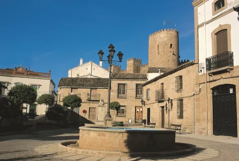
  • Plaza Mayor. This space located between the two hills that form the villa, equipped with water through the venero that would be the pillar of San Mateo, was a knot of encounter of the different pecuaries. It was a nerve center in the city.
  • Lordhouses, there are many houses blasphemed with shields that leave us witness of rich families in the town, that tell us of the glorious past of the town and that have been preserved over the years.
Loading map
Preparing points of interest and routes...
Imagen principal
imagen
Image
baños de la encina
Imagen principal
Activado

Andújar

Submitted by brandcode_deweloper on
Id
1304223
Perfil de redes sociales
Facebook
https://www.facebook.com/AyuntamientodeAndujar
Twitter
https://twitter.com/aytoandujar
Instagram
https://www.instagram.com/turismo_de_andujar/?hl=es
Descripción
Breve descripción

The city of Andújar is located at the foot of Sierra Morena, to the northwest of the province. Its municipal term is included in the Natural Park of the Sierra de Andújar, with half-mountain formations that contain a Mediterranean ecosystem, composed of masses of encinars, alcornoques, complaints, pineapples, oaks and bushes.

It is the most extensive and populated municipality of the region of La Campiña, on the banks of the Guadalquivir River, which divides the municipal term into two well-differentiated parts: one of Vega and countryside, to the south, and one of dehesas and Mediterranean forest in Sierra Morena, to the north.

Agriculture is very varied, with olive groves, although there are other crops such as cereals, legumes and cotton. It also has livestock and larger hunting that represent a significant economic income.

The city also stands out for a strong manufacturing presence: textile industries, concierges, ceramics... The construction activity, as well as small trade, occupy a significant number of people, although the latter, currently and due to the crisis, is resisting. In addition, the modernization and machining of the field makes it unable to absorb the group of unemployed.

Telecomunicaciones
Teléfono
953 504 959
Sitio web
www.andujar.es
Fax
953 508 207
Correo electrónico
turismodeandujar@andujar.es
Ubicación
Nombre
Andújar
Latitud
38.039610
Longitud
-4.054940
Distrito
Municipio
Ubicación en el mapa
POINT (-4.05494 38.03961)
Imágenes
imagen
Image
b0f7238b-8f63-ac27-4966-827e8a4fa6b8?t=1585581420642
Imagen principal
Desactivado
imagen
Image
b1bc38ae-53ae-5bc9-cebd-c7d32d33ba59?t=1585581420473
Imagen principal
Desactivado
imagen
Image
ca2cce8f-c738-3a80-a2c0-14697fd628ab?t=1616518390356
Imagen principal
Desactivado
imagen
Image
21589599-2dfb-bfd6-fe3d-ac2d69bc36c4?t=1616518390441
Imagen principal
Desactivado
imagen
Image
faa23b01-6f15-e7fa-755e-046cf270ce8f?t=1616518390491
Imagen principal
Desactivado
imagen
Image
b090f7c9-9aa9-8e0a-b5b0-de0cb34203b5?t=1616518390541
Imagen principal
Desactivado
imagen
Image
7cb8d394-b36c-6184-ea34-923bfdbbd7a1?t=1616518390652
Imagen principal
Desactivado
imagen
Image
0dcb1e5b-5c56-4471-e932-14f8fed5f461?t=1616518390711
Imagen principal
Desactivado
Información adicional
Imágenes cabecera
imagen
Image
bb48aa8d-9afc-13a3-7ec4-a1203be45aa8?t=1608747255282
Imagen principal
Desactivado
Datos de interés

Tourist area: Sierra Morena / Sierras de Andújar and Despeñacolos
Distance to the capital (km): 42
Altitude over sea level (m): 212
Extension (km ²): 964.9
Number of inhabitants: 36,793
Gentillo: Andujareños
Postal code: 23740

Videos
Video file
Cultura

The city of Andújar continues to maintain a heritage set of great interest, for the quality of its monuments and for the diversity of artistic styles that can be appreciated.

We highlight some of them:

  • Church of Santa Maria la Mayor. The construction of the church Santa María la Mayor, of a basic plant, began in the 15th century and ended in the first quarter of the 17th century. Its pillars and vaults of the first stretch are Gothic and the rest of the sets of the second half of the 16th century. The plant is articulated in 3 ships of 4 sections each. Among his works of great value is the 16th century paving and two pictorial works, the Prayer in the Garden of the Greco Olives and the Immaculate of Giuseppe Cessari. It has 3 covers: Northern front, in the square of Santa Maria. Designed in the early 16th century, in purist style. South front, dedicated to San Pedro. It is from the second half of the 16th century, in the strictest purism. Foot cover. It belongs to the Herriian style, is characterized by its absence of ornate and the sobriety of its elements.
  • The chapel of the Christ of Agonyis connected to the church of Santa Maria. It is a Neogotic style, built between 1923 and 1925, by Rafael and Mª Elvira Pérez de Vargas (condes de la Quinteria). It is a private chapel conceived as a crypt of the counts. It has a single ship, organized in two sections, with nerve vaults, the header is decorated with five windows pointed with glass windows.
  • Church of San Miguel. It dates from the second half of the 15th century and is a Gothic temple, with a basic plant of three ships. The plant, wider than the sides, ends in polygonal header, while the sides are flat. The interior lacks its own luminosity by not having windows, one of the most characteristic elements. Of its covers, the one of the feet is of a plateresque style; the northern cover is in the transit between the Gothic and the Renaissance; the southern cover has a double conopial bow flanked by pinacles. The 16th century tower has undergone numerous reforms as it is damaged by the Lisbon earthquake.
  • Church of San Bartolomé.It is the first parish built to extramurus and later founded. In the initial project it is conceived as a three-ship gothic, articulated in five sections. From the different remodeling, there are signs: at the door of the sacristy the late Gothic (16th century) is observed, the primitive cross vaults are replaced by others of mannerist sensitivity. The tower, which is inconclusive, is from the 17th century and recalls that of San Miguel, is attributed to Francisco del Castillo, the Young. Of the three doors, the one that gives the runner of San Bartolomé is the most interesting. Its vanity integrates a bent bow pointed by another conopial with cardinals and flanked by pinacles.
  • Church of Santa Marina.Mosque in Muslim times and Christian temple since the village was taken by Fernando III, the Holy (1225). It is a temple of three ships articulated in four sections. Its main chapel was remodeled in the 17th century, with a square section covered with a half-orange vault on the breast, in which the arms shields of Pedro and Luis Pérez de Vargas Palomino, their patrons, are located. Its two covers are of great simplicity, being that of the feet, of baroque style, which presents a greater monumental. He ceased to be a parish in 1843 although he remained open to worship until the 1970s. It is currently used as a cultural space.
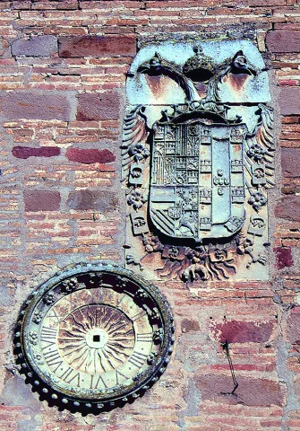
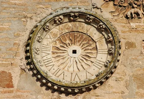
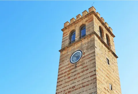
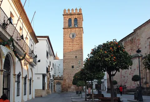
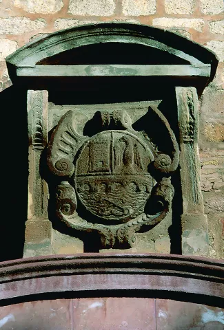
  • The Clock Tower.Mudéjar influence tower made in the time of Emperor Charles I (concluded on 20 August 1534). It was part of the royal prison and was conceived as a lookout to observe the village and the surrounding areas of the city. Head the square of Santa María, the heart of the medieval city. Its building is sober, based on alternating brick with stone armchairs. The almenas that kill the whole give it a strong tower air. Two elements stand out in this unique building: the Emperor's bicephalic shield and the beautiful silver-style watch that gives name to the tower. The towers of the church of Santa Maria, both the primitive and the modern, do not exceed the Clock tower in height, as a sign of the primacy of municipal civil power over religious power.
  • House of the Children of Don Gome.This single house of the Cárdenas and Valdivia is popularly known as "the Children of Don Gome," reference to the ten children who had the marriage and was built in the late 16th century. The Renaissance palace is built behind the Almohad wall and in the vicinity of the Sun gate. Torreada fachada built in late XVI and early XVII. Two elements of very different use make up the house of the Children of Don Gome, the house of the inhabitants and the cavalry. On the façade of the solariega house, built in a plane more advanced than that of the cavalry, stands out its portada- tower, built unlike the other elements of the whole in sandstone, in the second third of the 17th century, by Don Gome de Valdivia, Cárdenas and Guzmán and Dona Mayor Nicuesa, and that is in the Baroque style. The pillow cover is almost unnoticed by the exuberant decoration, two Indian-accent, repetitive heraldic, and a highlighted cornice, as more prominent elements. The Children's Palace of Don Gome is the venue of the courses of the University of Autumn. Inside is the Archaeological Museum Professor Sotomayor. The stables are preserved with part of the fish, a porticated courtyard and the winery. In the latter is the Casa del Alfarero, which includes the extensive and rich tradition of ceramics that has characterized this land.
  • Comedian house - town hall.The current town hall is located in the building that was built between 1620- 1631 for comedia house, which it maintained until 1680. In 1787, the Cabildo decided to move to it, as it had lost its old function. The fruit of this remodeling is its central body of neoclassical style and the beautiful staircase of "empire style." Three floors make up their beautiful façade: In the first one a portico and in the second one, a gallery as a lookout for the taurine celebrations of the time. The building is topped with an airy balustrada, articulated in pillars topped with pinacles. This facade has an Italian orientation and can be located within the most classical mannerism.
  • Roman bridge.Its construction dates back to the end of the second century and saves the Guadalquivir River. Built with sandstone armchairs of a seine or brown colour, it has fourteen eyes, of which the twelve on the right bank are of half-point arch and the other two scarves. Like the Merida bridge, it offers lightens or drains on pillars to facilitate the passage of water in the large rivals.
  • Basilica and Royal Sanctuary of Our Lady of the Head. Located in the heart of the Natural Park of the Sierra de Andújar, in the area known as the hill of the Cabezo, 32 km. north of the city of Andújar. The sanctuary is built between 1287 and 1304 and was reformed in the late 16th century. Since 1930 the trinitarians have served the cult in the sanctuary. The façade is made up of the door's vain, arco-sino balcony and two-body swordsman. The interior is a single ship covered with a barrel vault. The trinitarians community makes the enlargements of the two side buildings, leaving a harmonic set. In the very dependencies of the basilica is the Mariano Museum, where an important artistic, documentary and anthropological exhibition of the historical legacy has been developed through the centuries by devotion to the Virgin of the Head.
  • González Orea Museum of Plastic Arts.Located in the old convent of the Capuchino Mothers.
Naturaleza


Andújar, head of the region of the countryside of Jaén, with almost 965 km ² of area is the municipality with the largest extension of the province. The city is the third most populated in the province, with approximately 37,000 inhabitants.

Its municipal term is divided by the Guadalquivir River, with the Sierra de Andújar Natural Park in Sierra Morena in the north and the Vega and countryside in the south.

  • The Vega del Guadalquivir.The territory of the Vega del Guadalquivir is characterized by its very flat landscapes of irrigation, with intensive crops (oranges, lemoneros and orchards). The olive industry, textiles, wood furniture, crafts and ceramics are other sources of economic dynamism, along with the hotel, which takes advantage of natural tourism and its strategic location, right on the motorway of Andalusia.
  • Natural Park of the Sierra de Andújar.It focuses important landscape and wildlife attractions. It extends through the neighbouring municipalities of Villanueva de la Reina, Baños de la Encina and Marmolejo, occupying an area of 74,774 hectares. Agriculture is very varied and dominated by the olive tree, with livestock and major hunting as the predominant agricultural activities. The natural park, in the form of an almost perfect equilateral triangle, is a sample of the typical landscape of Sierra Morena. A large number of emblematic species find here their refuge between the Mediterranean mountain and the dehesas of the heart of the park, the steep northern saws and the dense southern pine trees. The most characteristic species are the oak and the cork in adherent form, while in the higher altitudes, where the humidity is higher, we find the complaint. From the hydrography of the park we highlight the river Jandula, tributary of the Guadalquivir, with numerous streams that will lead to it and that form numerous pools and lagoons. In the end of Andújar we will find numerous sites, trails and routes that will discover the beauty of this term, like the Juncillo path.
  • Junctile Path.Suggestive and easy 5.7 km road that travels a very representative space of Sierra Morena and this natural park. On the road A-6178, about nine kilometres from the Sanctuary of the Virgin of the Head, you reach a crossing with signs to Valdelagrana and Las Tapas, which is where the path begins. In it there are the dehesas on almost flat grounds and Mediterranean mountain stains, both populated by numerous animal species, including various birds, easily visible, or mammals, such as deer, boars, foxes or garduñas, difficult to see but whose traces we will find with some ease. The Madrona and Quintana saws, on the horizon behind these plains, evoke the many legends that these depopulated lands have inspired throughout history.
  • Visit center Viñas de Peñallana. The visitor center is located on the 13th kilometer of the road A-6177 that links the shrine of the Virgin of the Head with the town of Andújar, at the entrance of the natural park, where the visitor can find a first approach to the different environments of the environment, walk through a recreated Mediterranean forest where to identify plant species and their aromas or discover numerous emblematic endangered species that find refuge in these saws; it is the case of the Iberian wolf, the imperial eagle or the Iberian lince, the most threatened feline on the planet.
  • Environmental Park Cercado del Ciprés.It is located in the town of Andújar (past the Hospital Alto Guadalquivir). The Cercado del Ciprés Environmental Park has an area of 11 hectares on which there is an artificial lake and a stream. This complex represents the ecosystems of the Mediterranean forest and the typical river vegetation. It also has different recreational areas such as a bike lane, an aviary, rustic huts, wooden kiosks, lookout, pedestrian trails. In the main building, there is an information point that offers guidance for the visit to the Sierra de Andújar Natural Park. Next to the Cercado del Ciprés Environmental Park is the only Interpretation Centre of the Honey of all of Andalusia.

Recreational areas El Encinarejo, La Recta, El Jabali. These are traditional areas of leisure and recreation on the road that reaches the shrine of the Virgin of the Head. They have banks, barbecues, tables and containers, so they represent an excellent option to spend an outdoor day in the family.

  • In El Encinarejo, the characteristic vegetation is that of the forests of riverside, strawberries, allies, sardines, thelves and tarayes, which serve as a refuge to the representative fauna of this humid area, such as royal herons, zampullines, water cocks and, if we are lucky, some otter can be observed. Following the river bank you can reach the foot of the small, lake-like Encinarejo swamp dam. From El Encinarejo you can make several hiking routes, for example, being the starting point of the so-called Encinarejo path.
  • The Recreative Area The Straight, 2.7 km, is located on the left side of the road, on the banks of the Jandula River. From there a path is left for which you have to ask for authorization 15 days before.
  • In the El Jabali Recreative AreaOn some rocks there's a granite boar. Through it passes GR-48, which comes from the Encinarejo and reaches the Sanctuary. In addition, the El Jabali trail, of 3.2 km, is started.
Fiestas y Eventos


There are numerous parties and events held in the city of Andújar throughout the year, including the following:

  • Romeria de la Virgen de la Cabeza. It is the most outstanding party and has its origin in the first half of the 13th century. It is celebrated in the week of the last Sunday of April:

On Thursday a flower offering is made to the Virgin of the Head in the City Hall square.
Friday is the entrance to the cofradies of all of Spain on the Roman bridge.
On Saturday, people ride up on carts and horses to the sanctuary of the Virgin.
On Sunday, with the sanctuary full of Liturgypsies, they all want to see the mother of Sierra Morena, to process through the reels.
After four hours walking through the streets, the Virgin returns to her shrimp, when the rosemary return to their places of origin to wait for the rosemary of next year. It is declared a National Tourist Interest and Cultural Interest Fair.

  • Holy Week. It is considered the big week of the town, celebrated with great recollection and religiosity since ancient times. It highlights the artistic-cultural value of the dominating images of the different cofradies and hermandades that carry out their processions on the streets. The Old Holy Week begins on Palm Sunday with the Brotherhood of the Borriquilla, with the highest splendor being reached on Holy Thursday with Our Father Jesus of Great Power.
  • Patron party in honor of San Euphrassio. It is held on May 15. This saint, a disciple of the Apostle James, has become relevant to the city since 1597, when a relic of the saint was brought to Andújar. Since then, he has been his patron and is dedicated to worship and parties in his honor every year.

In addition, these other parties are held: Festival of the Candelaria (2 February), carnival, Cruces de Mayo, Feast of the Divine Pastor (16 July) and Santiago Apostle (25 July).

The following events also take place:

  • Anducab. Since 2004 the Morfológico-Functional Anducab competition has been held, which has been consolidated as one of the five most important competitions in Spain, scoring for the competition in the International Horse Hall (SICAB) that is held annually in Seville. The main objective of this fair is to offer the exhibition and sale of everything related to the world of the horse.
  • Iron and forge competition. This is a meeting of horseshoes from all over Spain in which they come together to show their skills in this modality, making "on-site" plastic horseshoes.
  • Agricultural Fair of Andalusia. Organized by the Jaén Farmers' Association, it is held for three days in October. It includes machinery and utility companies, institutional government stands and different products, such as honey, real jelly, sweets, etc.
  • On the horse from the rock rocks. These are days of coexistence in which a pilgrimage is made on horseback to the sanctuary of the Virgin of the Head. It brings together hundreds of horsemen who with their horses and mules run along the "old road" through the Natural Park to the sanctuary of the Virgin. These days are true "girl romaneries" that they carry out during the year different rosemary collectives.
  • Flamenco. It is a flamenco fashion walkway that takes place outdoors in the market square, unique heritage environment. It is attended by more than 10,000 people for four days (Friday afternoon, Saturday morning and afternoon and Sunday morning).
  • International Fair of Iberian Lince (FILYNX). The International Fair of Iberian Lince is a three-day tourism event for nature observation, with a special focus on Iberian lince, conservation tourism and ecotourism. Its first edition was in 2019.
Gastronomía


The gastronomy of Andújar is typical of the serrano villages. Everything revolves around a culinary jewel such as extra virgin olive oil, as well as the high variety of typical products of the earth. The hunting meat that provides us the natural environment of Andújar, attached to the vegetables of the rich land that irrigates the Guadalquivir River.

We can taste the following dishes:

  • Pipirrana: is a salad whose basic ingredients are onion, tomato, green pepper and cucumber. Sometimes it is added cooked egg, some kind of fish, meat priet or even sausages.
  • Andrajos: cooked in the broth of boiling minor game pieces with peppermint and a saffrito of vegetables and strips of flour made of jirones that take the name.
  • Ajoharina: A saffrito is made with tomato, onion, potato and eggplant. In the frying pan, dry red peppers are tasted, once toast is crushed in the mortar with cumins and salt. When everything is ready, water is added and at the end flour is to be weighed.
  • Mountain meat, preferably deer, which is cooked with potatoes and vegetables.
  • Flamenquin: which originated in Andújar. There is also a variant called flarosquin, or what is the same, flamenco with circular form.

In pastries we highlight: Holy Week panets, fried rosches, sigh and entangled.

Historia

Andújar is in a privileged situation because it is a crossroads of commercial routes and roads for the displacement of populations, that would explain the penetration of artistic and cultural influences from different backgrounds. The proximity of the Guadalquivir River will be an incentive to the settlements of the populations. The oldest remains found date from the Paleolithic, but it is in the Neolithic and first part of the Bronze Age that the population of the area is intensified, for its fertile land for the development of agriculture and mining in Sierra Morena. The first people to settle would be the Oretans, the Iberians who founded the ancient Isturgi in the place that today occupies the pedany of Los Villares de Andújar.

Everything indicates that it was a flourishing city during the Roman domain, linked to the production and marketing of the high-imperial ceramic (I-II centuries). At the end of Roman rule, the population moved to a nearby place, the current Andújar, losing the name of Isturgi with the arrival of the island.In the year 711, after the battle of Guadalete, the entire southern area of the peninsula would become al-Ándalus. Moving the population from Los Villares to the current Andújar.

In 1225, the city is conquered by Fernando III, the Holythe Christian troops of the orders of Santiago and Calatrava to settle in the city. The Muslim population leaves the cities of Andújar, Martos and Baeza, the first Christian inhabitants being settled.King Henry IV, in 1467, gives him the title of city. This would begin with a period of population growth and an increase in agricultural land, reaching 13,000 by the end of the 16th century. The population is mainly made up of farmers and farmers.

In 1808 he will be occupied by French troops, where General Dupont established his headquarters. From here he would send his troops to Bailén, a battle in which he would be defeated. During the Spanish civil war, Andújar was left on the Republican side, which meant that he was bombed by the Franco troops, causing death and resentment on both sides.

Today, the city of Andújar continues to have a part of its population occupied in the agricultural sector, it also has modern industries, and the tourism sector is making way to make known its rich artistic and natural heritage, which makes it able to face its future with optimism.

Loading map
Preparing points of interest and routes...
Imagen principal
imagen
Image
e6de5d04-2828-525b-0221-966572b7fb26?t=1603888972531
Imagen principal
Activado
Literatura

Discover San Juan de la Cruz and Miguel Hernández in Andújar.

A fascinating itinerary not to be missed.

Santa Potenciana Hermitage Archaeological Site

Submitted by brandcode_deweloper on
Id
4524002
Descripción
Breve descripción

The excavations of the Archaeological site Hermitage Santa Potenica de Villanueva de la Reina have been presenting new findings, withnew materials and structures that confirm this area as a historic crossing of cultures between large cities. An archaeological site that has, in five years, achieved great results andtake the municipality of Villanueva de la Reina to specialized and prestigious forums.

Telecomunicaciones
Sitio web
www.redjaen.es/francis/?m=c&o=93197
Teléfono de contacto
953 537 110
Ubicación
Código Postal
23730
Latitud
38.027860
Longitud
-3.912560
Distrito
Ubicación en el mapa
POINT (-3.91256 38.02786)
Tipos de punto de interés
Imágenes carrusel
imagen
Image
Yacimiento%20Ermita%20Santa%20Potenciana.jpg
Imagen principal
Desactivado
Imágenes cabecera
imagen
Image
Yacimiento_de_la_Ermita_de_Santa_Potenciana.jpg
Imagen principal
Activado
Microsite al que pertenece
Loading map
Preparing points of interest and routes...

Archaeological Site of Peñalosa

Submitted by brandcode_deweloper on
Id
10887417
Descripción
Descripción larga

Located in the municipality of Baños de la Encina, the argaric village of Peñalosa has been a reference in the research of the Bronze of Alto Guadalquivir. It sits on a slate slate in the form of a tongue, with two large slopes of strong slopes limiting to the north with the Rumblar River and to the south with the Salsipuas stream. The waters of the Rumbar reservoir now bathe the structures of this argaric village.

The town belongs to the Argar Culture, which was developed during the Bronze Age by the provinces of Almería, Murcia, Granada and part of those of Jaén and Alicante, and was inhabited about 400 years, from the mid-19th century a. C. until the mid-15th century a. C.

The site is a fortified village with houses built with slate on the hill and along its slopes on terraces, as steps, connected with each other by narrow streets and corridors, no significant architectural differences between the different terraces are seen. Within the village there are several different areas: on the top of the hill a fortified area with three houses connected to each other by the aforementioned corridors; generating a structured and organized area. On the north side, three natural and artificial terraces are alternated, interconnected with corridors, and in which houses are distributed. The village also has a large tank in the lower part that would collect the water from the rain and powerful defensive bastions that delimited the village. A characteristic feature of this culture was the interiors within the houses themselves, accompanying the deceased with joules corresponding to the social range they had within the village.
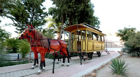
The main economic activity of the population was copper mining, especially the Azurite and Malakita, exploiting the mining wealth of the valley. The entire mining process has been documented: mining, reduction, casting and manufacturing of tools and ingots. Other economic activities such as looms and cereal processing, especially barley, have also been documented.

Socially, there are differences between the burials between those on the middle and upper terraces and those on the bottom; in addition, most burials on the upper terrace are located in exclusively funerary spaces, which has led to the hypothesis that it was a very hierarchical community, with a militarized elite (upper terrace) to which the mass of peasants - free warriors (middle terrace) would be subordinate and on whose base there would be a population layer in a servile state attached to the elite (lower terrace).

Breve descripción

In Peñalosa we can find the best-studied town of the Bronze Age of the Peninsular South, belonging to the Argar Culture and example of the socio-economic reality of this society.

Telecomunicaciones
Sitio web
www.bdelaencinaturismo.com/banos-de-la-encina/
Teléfono de contacto
953 613 338 / 626 818 446
Correo electrónico
info@laencinaturismo.com
Ubicación
Código Postal
23711
Latitud
38.170813
Longitud
-3.796032
Distrito
Ubicación en el mapa
POINT (-3.796032 38.170813)
Tipos de punto de interés
Imágenes carrusel
imagen
Image
Pe%C3%B1alosa%202.jpg
Imagen principal
Desactivado
imagen
Image
Pe%C3%B1alosa%203.jpg
Imagen principal
Desactivado
imagen
Image
Pe%C3%B1alosa%204.jpg
Imagen principal
Desactivado
imagen
Image
Pe%C3%B1alosa%205.jpg
Imagen principal
Desactivado
Imágenes cabecera
imagen
Image
Pe%C3%B1alosa1.jpg
Imagen principal
Activado
Microsite al que pertenece
Loading map
Preparing points of interest and routes...

Clock Tower and Plaza de Santa María

Submitted by brandcode_deweloper on
Id
6231552
Descripción
Breve descripción

It was the main square of the city during the 16th and 17th centuries, and the heart of the city from the low Middle Ages. It is thought that there was a mosque in the Muslim era that was converted to Christian worship, following the taking of the city by Fernando III. In this case, the Sahara or courtyard of Abluciones would generate the current Plaza de Santa María and its minaret the Torre del Clock. Already in the 15th century it was considered the first public space of the city and evidence of this is the fact that the Cabildo decided to build his house in it.

Telecomunicaciones
Sitio web
www.turismodeandujar.com/
Teléfono de contacto
953 504 959
Correo electrónico
turismodeandujar@andujar.es
Ubicación
Código Postal
23740
Latitud
38.037480
Longitud
-4.055490
Distrito
Municipio
Ubicación en el mapa
POINT (-4.05549 38.03748)
Tipos de punto de interés
Imágenes carrusel
imagen
Image
Mon500.jpg
Imagen principal
Desactivado
imagen
Image
Mon499.jpg
Imagen principal
Desactivado
imagen
Image
Mon498.jpg
Imagen principal
Desactivado
Microsite al que pertenece
Loading map
Preparing points of interest and routes...

Clock Tower

Submitted by brandcode_deweloper on
Id
1914290
Descripción
Descripción larga

Under the shield is a beautiful watch, carved in stone and of elegant bill, which probably gave name to the new construction. It is a clock that at the present time has no function, because of it only its cultivated sphere persists. Clock that would be replaced, surely in the 19th century, by the one we see below the looking body.

Everything seems to indicate, according to the capitular records of the 17th century, that the Clock Tower was an element attached to the royal prison with which it was communicated. On September 12, 1653, he reported that a prisoner had fled through the tower because of the watchmaker's neglect, which is why he would be punished and replaced. Surveillance tower from where the streets and people of Andújar are seen and from where the work rate of their neighbours was marked. At the present time, the Clock Tower is certainly one of the most representative elements of the monumental city of Andújar and part of the morphology of the square of Santa Maria.
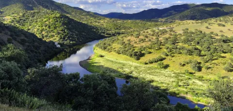
On the west front and at half height we find the imperial shield of Charles V and a watch carved in stone. In the first ornamental element, a bicephalous eagle carries the imperial crown and the gold Toison borders the shield. In the right canton the lineage of the Trastámara and the Habsburg and in the sinister of the House of Avís, which correspond to Charles V and his wife Isabel of Portugal, respectively. His presence is due to the coincidence of the execution of the work with the reign of Charles V, for it was customary at the time to leave witness to the reigning monarch in the new constructions. An imperial shield that reminds the Andujareans of their fidelity to the monarch in the years of the war of the Communities, as part of the Junta de las Ramblas. It was not in that same view his mayor, Francisco de Vergara, who "had sympathy for the Communists, and knew the city of the management he brought with them, was so outraged, that in the middle of Cabildo he took away the rod of justice." From the loyalty and obedience of the city the emperor was very pleased and proof of this was the letter he sent on July 20, 1520, from the city of Ipres, in which he thanked the city's attitude towards his person at those difficult times.
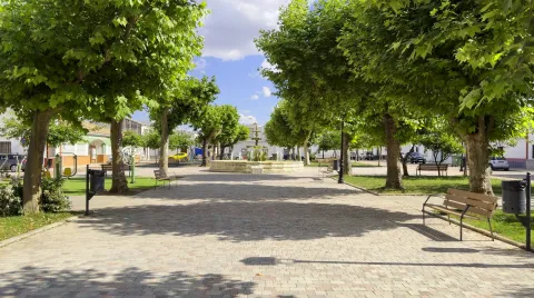
The only documentary source that exists today on this construction is on its west front and says: "The great knight Francisco / Alarcón twenty-four of Granada and his major mayor Sancho Díaz / Baeza, who is the king of this city, is now the only one who has been the author of this city. Mayordomo Alonso Yáñez."

At its base is the Municipal Tourism Office, from where you can access the Panoramic Mirador.

Breve descripción

Almond tower, built with stone and brick rows, with a lookout on its top, framed between cornlines and with half-point windows on all its fronts.

Telecomunicaciones
Sitio web
https://www.turismodeandujar.com/torre-del-reloj
Correo electrónico
ayuntamiento@arquillos.es
Ubicación
Código Postal
23780
Latitud
38.182350
Longitud
-3.430360
Dirección
Plaza de Santa María
Distrito
Municipio
Ubicación en el mapa
POINT (-3.43036 38.18235)
Tipos de punto de interés
Imágenes carrusel
imagen
Image
Anotaci%C3%B3n%202020-04-16%20081008.jpg
Imagen principal
Desactivado
imagen
Image
Anotaci%C3%B3n%202020-04-16%20081027.jpg
Imagen principal
Desactivado
Imágenes cabecera
imagen
Image
Anotaci%C3%B3n%202020-04-16%20081048.jpg
Imagen principal
Activado
Horario
Winter (16 sept - 14 Jun): Monday to Friday 09: 00 - 14: 15 and 16: 30 - 19: 15, Saturday 09: 00 - 14: 30. Summer (15 Jun - 15 Sept): Monday to Friday 07: 30 - 14: 30, Saturday 09: 00 - 13: 30.
Microsite al que pertenece
Loading map
Preparing points of interest and routes...

Tower of the Fuente Sorda

Submitted by brandcode_deweloper on
Id
6232212
Descripción
Breve descripción

Old deaf, tower of the Almohad wall, which in the 15th century was lined with silery. The shield of the city that decorates the central front is from the 16th century. It is made of stone, on cut and timbrated hides. Above it is a curved fronton held by two mencapsules as a baking. The source below must be of later chronology.

Telecomunicaciones
Sitio web
www.turismodeandujar.com
Teléfono de contacto
953 504 959 / 953 508 200
Correo electrónico
turismodeandujar@andujar.es
Ubicación
Código Postal
23740
Latitud
38.036330
Longitud
-4.057340
Dirección
C/ Alcázar, 5D
Distrito
Municipio
Ubicación en el mapa
POINT (-4.05734 38.03633)
Tipos de punto de interés
Imágenes carrusel
imagen
Image
Mon488.jpg
Imagen principal
Desactivado
imagen
Image
Mon491.jpg
Imagen principal
Desactivado
Imágenes cabecera
imagen
Image
10325717824_6a02e248a0_z.jpg
Imagen principal
Activado
Horario
24 h.
Microsite al que pertenece
Loading map
Preparing points of interest and routes...