Saltar al contenido principal

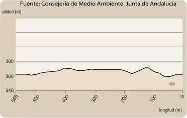
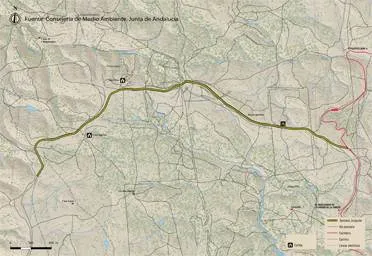
Trail Control de la Cabrera-Santuario Virgen de la Cabeza

Submitted by brandcode_deweloper on
Id
4949600
Descripción larga

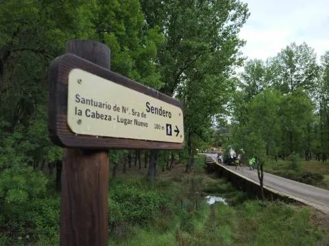
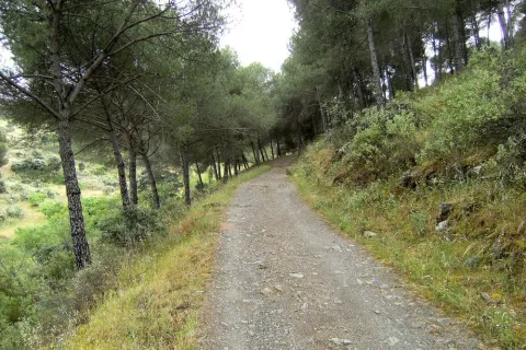
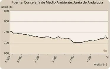
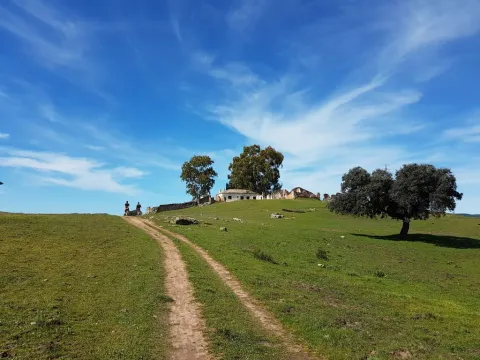
We started the tour on the access to the New Place Mount through the Cabrera Control. We go down a track that first crosses a lush forest of alcornoques and oaks and then a dehesa from where the Jandula River and the Sanctuary are seen.

We continue to descend on the track until we reach a granite gate crossed by a steel cable, known as the "Spinarejo Cable," which we cross and follow, on the same track, 150 m to then take a narrower path that goes to the right. Let us ascend through the pine until we reach the pedestrian door of the Majadillas, where we will leave the New Place Mount.

After a few more meters, we will link with a forest track that for about 4.7 km, crosses the heights of Navalasno and La Navarra. In this section we will observe a typical landscape of the granitic sector of the natural park, in which there are alternating broquets of oak and juniper, dehesas and rocky florings.

After reaching the ruins of the Cortijo de Navalasno Viejo we will soon go back to Mount Place Nuevo through the pedestrian door of the Fucovert.

It is now beginning a descent through a sidewalk between oak and granite that will take us to the Arroyo de los Santos. A beautiful seasonal channel flanked by large-scale strawberries. We will then ascend through a sidewalk through an open pinar until we reach another pedestrian door and a granite road that leaves for a forest track that we will take to the left and continue for 1.4 Km until we reach the Marmolejo Brotherhood, within the Sanctuary Village.

Breve descripción

The itinerary described above includes a section of the GR48 stage that can only be done on foot, by bicycle or by horse and runs along the traditional road from Marmolejo to the Sanctuary, coinciding with the Cordel de Marmolejo and other pecuary routes. It is a long tour, but it allows you to discover lonely places of enormous beauty.

Latitud
37.7796
Longitud
-3.7849
Distrito
Municipio
Ubicación en el mapa
POINT (-3.7849 37.7796)
imagen
Image
Sendero%20Control%20de%20la%20Cabrera-Santuario%20Virgen%20de%20la%20Cabeza.jpg
Imagen principal
Activado
imagen
Image
Sendero%20Control%20de%20la%20Cabrera-Santuario%20Virgen%20de%20la%20Cabeza2.jpg
Imagen principal
Desactivado
5 h 30 min

Nature

icon-intereses-naturaleza

Friends

icon-intereses-amigos

Adventure

icon-intereses-aventura

Culture

icon-intereses-cultura

Sport

icon-intereses-deporte

Eco-friendly

icon-intereses-eco-friendly

For couples

icon-intereses-en-pareja

Family

icon-intereses-familia

Gastronomy

icon-intereses-gastronomia

Municipality

icon-intereses-municipio

Low-cost tourism

icon-intereses-turismo-low-cost

Solo travel

icon-intereses-viajar-solo
Medium
Sendero Control de la Cabrera-Santuario Virgen de la Cabeza
15,5 km
On foot
All year round
Desactivado
  • In front of COVID19, keep the safety distance and carry a mask, avoid agglomerations and contact with surfaces, wash your hands frequently, use hydroalcoholic gel and consult the available digital materials. Take care of your health and others.
  • It works to prevent fires. Do not throw cigarettes or any other object that produces combustion.
  • By consuming local products and having companies in the area you will contribute to rural development.
  • He lives with the local people and other users. It respects private property and property.
  • Unwind in a sustainable way: public transport, bike, walk, shared vehicle...
  • Noise is another form of pollution. In silence you will enjoy your experience more.
  • It facilitates the use of people with special needs.
  • The trash doesn't come back alone. Take her with you to the nearest container. Reduce, reuse, recycle.
  • Don't leave a mark on your way through nature.
  • It practices a responsible and committed tourism with the environment. Be a real ecotourist!
  • Respect the facilities at your disposal. We all pay for your maintenance.
  • Check the weather forecast before starting your activity.
  • Avoid going out alone. If you do, it communicates tour and time of return to other people.
  • Extreme caution under adverse conditions and with the occasional presence of animals or motor vehicles.
  • Please provide prior information on the possible existence of cynegetic activity.
  • It has water, sun protection, proper clothes and shoes.
  • It carries a mobile with enough battery in case of emergency (112), but remember that there is not always coverage.
  • Don't even bother animals. You would negatively alter his behavior.
  • For your safety and the safety of the environment, don't get out of the signposted road or take shortcuts.
  • Remember that the capture of animals, light fire, fish and collect plants or minerals is prohibited.
  • If you bring a dog, take him with his strap and make sure he doesn't bother other animals or people.
  • Your safety is our concern, but it's your responsibility.

Thank you for your cooperation!

From the town of Marmolejo (Jaén), we take the road A-420 with direction to Cardeña (Córdoba), which goes to the spa of Marmolejo, next to the Guadalquivir River. In this place just after passing the Roman bridge we find a crossing, we must take to the right by the local race JV-5.001, for approximately 12 km (after walking the path La Centenera), we will take the detour to the left, by which the so-called Control of the Cabrera that gives access to the public mountain is accessed.

Trail Camino Viejo: tramo Santuario de Nuestra Señora de la Cabeza- Lugar Nuevo

Submitted by brandcode_deweloper on
Id
4935428
Breve descripción

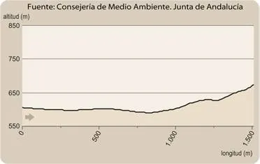
This path begins in Cerro del Cabezo, being all its descending path.

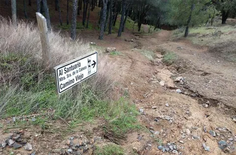
The first stretch of this path runs along the margin of the stream of the Virgin between jars, acebuchs and some aromatic plants such as the cantbone and the rosemary. On the left of this descent, called Cuesta de los Caracolillos, there is a magnificent view of Cerro del Cabezo, on which stands the sanctuary of the Virgin of the Head and of all the southern hillside of this, known as the Solanas of the Virgin.

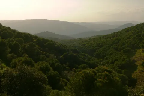
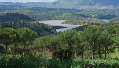
Around 1.7 km, you can reach the Old Way, from where you can see the Jandula River Valley as you pass through New Place. In addition, with a little luck, it can be seen, through the skies of the Sierra de Andújar Natural Park, the imperial eagle, the black vulture or the royal eagle, as on this area are often found.

From the viewpoint, the path goes on to have a more pronounced slope, and caution must be extreme. After the descent, the vegetation changes and there appears to the left a repopulation of pine piñonero, and on the right margin, to the front, a dehesa of burning. Through that dehesa we arrive to a Roman bridge that crosses the Jandula River, on whose shores there is a rich vegetation of strawberry, alyses and adelfas.

Latitud
38.0394
Longitud
-4.0511
Distrito
Municipio
Ubicación en el mapa
POINT (-4.0511 38.0394)
imagen
Image
1%20%281%29%20%281%29.jpg
Imagen principal
Activado
imagen
Image
Sendero%20Camino%20Viejo%20tramo%20Santuario%20de%20Nuestra%20Se%C3%B1ora%20de%20la%20Cabeza.jpg
Imagen principal
Desactivado
2 h 30 min

Nature

icon-intereses-naturaleza

Friends

icon-intereses-amigos

Adventure

icon-intereses-aventura

Culture

icon-intereses-cultura

Sport

icon-intereses-deporte

Eco-friendly

icon-intereses-eco-friendly

For couples

icon-intereses-en-pareja

Family

icon-intereses-familia

Gastronomy

icon-intereses-gastronomia

Municipality

icon-intereses-municipio

Low-cost tourism

icon-intereses-turismo-low-cost

Solo travel

icon-intereses-viajar-solo
Baja
Sendero Camino Viejo: tramo Santuario de Nuestra Señora de la Cabeza- Lugar Nuevo
5,5 km
On foot
All year round
Desactivado
  • In front of COVID19, keep the safety distance and carry a mask, avoid agglomerations and contact with surfaces, wash your hands frequently, use hydroalcoholic gel and consult the available digital materials. Take care of your health and others.
  • It works to prevent fires. Do not throw cigarettes or any other object that produces combustion.
  • By consuming local products and having companies in the area you will contribute to rural development.
  • He lives with the local people and other users. It respects private property and property.
  • Unwind in a sustainable way: public transport, bike, walk, shared vehicle...
  • Noise is another form of pollution. In silence you will enjoy your experience more.
  • It facilitates the use of people with special needs.
  • The trash doesn't come back alone. Take her with you to the nearest container. Reduce, reuse, recycle.
  • Don't leave a mark on your way through nature.
  • It practices a responsible and committed tourism with the environment. Be a real ecotourist!
  • Respect the facilities at your disposal. We all pay for your maintenance.
  • Check the weather forecast before starting your activity.
  • Avoid going out alone. If you do, it communicates tour and time of return to other people.
  • Extreme caution under adverse conditions and with the occasional presence of animals or motor vehicles.
  • Please provide prior information on the possible existence of cynegetic activity.
  • It has water, sun protection, proper clothes and shoes.
  • It carries a mobile with enough battery in case of emergency (112), but remember that there is not always coverage.
  • Don't even bother animals. You would negatively alter his behavior.
  • For your safety and the safety of the environment, don't get out of the signposted road or take shortcuts.
  • Remember that the capture of animals, light fire, fish and collect plants or minerals is prohibited.
  • If you bring a dog, take him with his strap and make sure he doesn't bother other animals or people.
  • Your safety is our concern, but it's your responsibility.

Thank you for your cooperation!

Important warning.As a preventive measure to prevent the contagion of the COVID19, this path must be crossed in the sense of ascending from the San Ginés Pubo Nuevo section, not allowing itself to be done in the direction of Pubo Nuevo to avoid crossing of trails at a short distance.

From Andújar we go up to the Sierra by the A-6177, to the visitor center Viñas de Peñallana, where we take the exit the Alcaparrosa JV-5011. In km 8 of that road we will find the indications that will lead us to San Ginés. Also, from Andújar by the road of the Chain.

Tramo de asfalto o cemento
 
Tramo de pista o camino forestal
 
Tramo de vía pecuaria
 
Tramo de senda
 

Trail Camino Viejo: tramo San Ginés-Lugar Nuevo

Submitted by brandcode_deweloper on
Id
4929187
Descripción larga

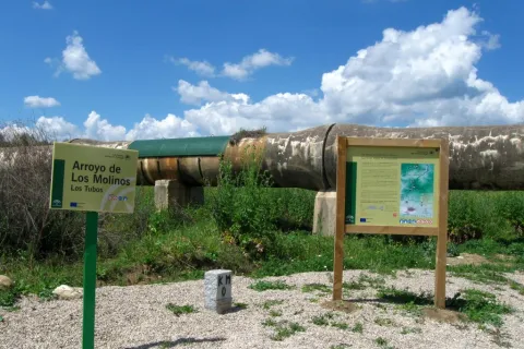
To take this path we will have to go to the northern part of the urban town of Andújar and from the cemetery take the Old Way or the San Amasio Way. The road is a track of land with good firm, up to the kilometer 1.9 where is the area known as Los Tubos, where the track is crossed by a huge tube of the Rumblar Canal.

In the area known as the "Tubos" is located the zero km of the route Camino Viejo - Cordel de los Molinos. From this point on the track through which we travel, it has worse firm, but it is passable by all-terrain vehicles for 900 meters more, until it reaches a rest area for the pilgrims and the sign of the beginning of the path. The starting signal is located next to a metal door that we will have to close to us to start the path on foot, on horse or by bicycle.

Breve descripción

The path runs along the Old Way to the Sanctuary, the route used by the rosemary to go from Andújar to The Sanctuary of Our Lady of the Head, for centuries. This rosemary is declared a party of national tourist interest.

We will enjoy beautiful panoramic views of the Sierra de Andújar Natural Park from the view of the Monument to the Pilgrim. A beautiful walk through a path full of history, culture and tradition in an incomparable framework.

The trail Los Cerrillos is part of the Old Way, used by the pilgrims to climb from Andújar to the Sanctuary of the Virgin of the Head. Part of the site known as Los Cerrillo and reaches the Hermitage of San Ginés, a traditional meeting point for pilgrims.

The path gently ascends from the countryside, crosses through areas of livestock pastures and goes into the Sierra, crossing mountains covered with oak trees, cantuesos and jaras. During the flowering season, in April and May, the landscape becomes especially attractive.

It is worth walking this path in order to see an interesting panorama of Andújar and the countryside of the Guadalquivir valley and to go through the intertwined paths excavated on the slate rocks by the continued passage of thousands of pilgrims: walkers, cyclists and riders

Latitud
38.0394
Longitud
-4.0511
Distrito
Municipio
Ubicación en el mapa
POINT (-4.0511 38.0394)
imagen
Image
1%20%281%29.jpg
Imagen principal
Activado
imagen
Image
Sendero%20Camino%20Viejo.%20tramo%20San%20Gin%C3%A9s.jpg
Imagen principal
Desactivado
imagen
Image
1315_SS_06.jpg
Imagen principal
Desactivado
imagen
Image
1315_SS_02.jpg
Imagen principal
Desactivado
imagen
Image
1636_SS_03.jpg
Imagen principal
Desactivado
imagen
Image
1636_SS_04.jpg
Imagen principal
Desactivado
imagen
Image
1636_SS_01.jpg
Imagen principal
Desactivado
2 h

Nature

icon-intereses-naturaleza

Friends

icon-intereses-amigos

Adventure

icon-intereses-aventura

Culture

icon-intereses-cultura

Sport

icon-intereses-deporte

Eco-friendly

icon-intereses-eco-friendly

For couples

icon-intereses-en-pareja

Family

icon-intereses-familia

Gastronomy

icon-intereses-gastronomia

Municipality

icon-intereses-municipio

Low-cost tourism

icon-intereses-turismo-low-cost

Solo travel

icon-intereses-viajar-solo
Medium
Sendero Camino Viejo: tramo San Ginés-Lugar Nuevo
5,6 km
On foot
All year round
Desactivado
  • In front of COVID19, keep the safety distance and carry a mask, avoid agglomerations and contact with surfaces, wash your hands frequently, use hydroalcoholic gel and consult the available digital materials. Take care of your health and others.
  • It works to prevent fires. Do not throw cigarettes or any other object that produces combustion.
  • By consuming local products and having companies in the area you will contribute to rural development.
  • He lives with the local people and other users. It respects private property and property.
  • Unwind in a sustainable way: public transport, bike, walk, shared vehicle...
  • Noise is another form of pollution. In silence you will enjoy your experience more.
  • It facilitates the use of people with special needs.
  • The trash doesn't come back alone. Take her with you to the nearest container. Reduce, reuse, recycle.
  • Don't leave a mark on your way through nature.
  • It practices a responsible and committed tourism with the environment. Be a real ecotourist!
  • Respect the facilities at your disposal. We all pay for your maintenance.
  • Check the weather forecast before starting your activity.
  • Avoid going out alone. If you do, it communicates tour and time of return to other people.
  • Extreme caution under adverse conditions and with the occasional presence of animals or motor vehicles.
  • Please provide prior information on the possible existence of cynegetic activity.
  • It has water, sun protection, proper clothes and shoes.
  • It carries a mobile with enough battery in case of emergency (112), but remember that there is not always coverage.
  • Don't even bother animals. You would negatively alter his behavior.
  • For your safety and the safety of the environment, don't get out of the signposted road or take shortcuts.
  • Remember that the capture of animals, light fire, fish and collect plants or minerals is prohibited.
  • If you bring a dog, take him with his strap and make sure he doesn't bother other animals or people.
  • Your safety is our concern, but it's your responsibility.

Thank you for your cooperation!

Important warning.As a preventive measure to prevent the contagion of COVID19, this path must be carried in the sense indicated in the starting sign.

From Andújar we go up to the Sierra by the A-6177, to the visitor center Viñas de Peñallana, where we take the exit the Alcaparrosa JV-5011. In km 8 of that road we will find the indications that will lead us to San Ginés. Also, from Andújar by the road of the Chain.

Route del Toro Bravo

Submitted by brandcode_deweloper on
Id
2854106
Descripción larga

The tour begins at point 0 of the road J-5010 to the Sanctuary of the Virgin of the Head and Puertollano. In the first three kilometers we move between the family gardens and the irrigations of the terraces of Guadalquivir to pass, at the point of kilometer 4,500, by olive land. From this point, coinciding with the state's stallion stop, the terrain becomes more serrano, first by shrubs and pasture dehesa, gradually passing to high density repopulation pines. At the kilometer point 12,300 we can visit the Visitor Center of the Natural Park Viñas de Peñallana, a place where magnificent recreational farms, known as "Viñas," are located. At the kilometer point 14,200 we take the right deviation on the JH-5002 road, which runs between more or less mixed pineas with lentils, coscojas and jars of great faunistic wealth and cynetic and livestock dedication. At this crossing there are two restaurants, last point for breakfast or a snack in two or three hours. The road has a regular state of conservation.

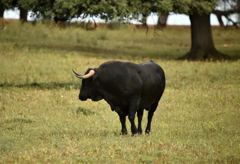
Around the 18th kilometer of the tour, the pineapple disappears, the landscape is dehesa of pastures with oak and cork trees, mainly, and panoramic views of the saw open on both sides. Towards kilometer 21 begins a magnificent adhesado encore in which the bulls of the Finca de los Escoriales, of the iron of D. Germán Gervás, founded in 1959, are pasted. In the km 24,100 we found the mines of Los Escoriales, which was already exploited by the Romans. At the kilometer 24,400 we are at a crossroads and a tentadero. The detour to the left will lead us to the Jandula Embalse. Following to the right we will pass through the Tapicas farms, the Farms of Flores- Albarrán, Navas of Benjamin Sordo or The Alarms of Samuel Flores, the latter since 1928, places where we can discover the bravo bull in its middle, the fences of protection and management, the places of food and abrevadero, along with some protected species or cynetics. From the kilometer point 32,800 you can see magnificent views that must not be lost: to the right, of the Sierra de Ambroz (761 m.), and to the left of the Embalse del Rumblar and the Castle of Burgalimar, in Baños de la Encina. From here on the road continues north, passing through the big house-cortijo of Los Alarcones. The landscape opens to the mountains of Ambroz and Los Calderones, at the northeastern end of the Natural Park of the Sierra de Andújar. At point kilometer 42, and coinciding with the beginning of the National Cote of Selladores- Contadero, we will see areas of small pinars that intermingle with the dehesa and the matorral; later the pinar spots are larger and dense although retaining some copies of alcornoque. The road improves and becomes descending, turning from the house of Selladores to the southeast. The landscape, leaving Selladores- Contadero, changes to a mountain of shrubs dominated by the lentisco jara and natural pastures; thus we arrive at Nava del Sach, in the kilometer 64, where there are catalogued rock paintings, to ascend from here to El Centenillo, a former mining village, in which environment we can see numerous scaffolding of the mines that operated until the 1950s, now converted into a residential core. In this small town we can make a recess to take an appetizer and taste the typical dishes of the place, including hunting meat stew and serrano products. We continue the last part of the route, already on a road of saw in perfect condition of conservation to La Carolina, distant about 16 km, descending from El Centenillo to the Rio Grande, where the pine definitely disappears to follow already on the ground of bushes and pastures and cross the river of the Campana.

Breve descripción

This route connects us to the north-west of the park, where you will find the National Contradero-Sealing Party.

Latitud
38.0394
Longitud
-4.0511
Distrito
Municipio
Ubicación en el mapa
POINT (-4.0511 38.0394)
imagen
Image
ruta-caballo.jpg
Imagen principal
Activado
imagen
Image
shutterstock_1717083154.jpg
Imagen principal
Desactivado
imagen
Image
shutterstock_3420981.jpg
Imagen principal
Desactivado
imagen
Image
shutterstock_1713194008.jpg
Imagen principal
Desactivado
5 h

Nature

icon-intereses-naturaleza

Friends

icon-intereses-amigos

Adventure

icon-intereses-aventura

Culture

icon-intereses-cultura

Sport

icon-intereses-deporte

Eco-friendly

icon-intereses-eco-friendly

For couples

icon-intereses-en-pareja

Family

icon-intereses-familia

Gastronomy

icon-intereses-gastronomia

Municipality

icon-intereses-municipio

Low-cost tourism

icon-intereses-turismo-low-cost

Solo travel

icon-intereses-viajar-solo
Image
6996ab12-e8a9-f353-626d-e1b608c315f1?t=1589486967838
Ruta del Toro Bravo
88 km
All year round
Desactivado

The ideal time to visit from October to the end of April. Set up for 4 hours minimum.

  • Peñallana vineyards
  • The Scoriales, area with cattle of ligia
  • National Contradero-Sealing Cow
  • Mirador Los Alarcornes
  • Mirador Los Pastores
  • El Centenillo, former mining village of Baños de la Encina
  • La Carolina, La Aliseda recreational area

In Andújar (opposite the monument of La Morenita and Carrefour shopping center)

Entrance to La Carolina from the Centenillo road.

Tramo de asfalto o cemento
 
Tramo de pista o camino forestal
 
Tramo de vía pecuaria
 
Tramo de senda
 

Trail Viewpoint Reand

Submitted by brandcode_deweloper on
Id
2555234
Descripción larga

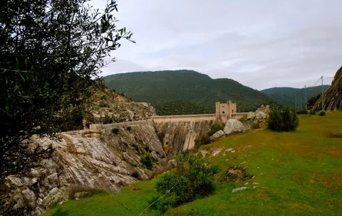
La Lancha is a village that rose for the construction of the Jandula dam, started in 1927 and completed four years later. It was inhabited by about 3,000 people in the most active moments. It is about 30 kilometres from Andújar in an unpopulated territory where malaria was endemic at that time. There is only one unasphalted road that reaches the village, the JF-5004, which comes from Los Escoriales for a journey also offered as a path marked by the Natural Park.

Already in La Lancha we must continue on the same road down to the dam, where the path begins. If we have reached here by car, we will leave it in this place to take a look at the Jandula reservoir first from the dam itself, and then make the short path. It has been almost eighty years since this great artificial lake was created, where the waters of the Jandula River are reinstated along about twenty kilometres from its channel, flooding its enclosed valley. The reservoir has a capacity of 322 Hm3 with a water sheet of 1,231 hectares. A new piece introduced in the geography of the saw which, of course, has had an important impact on the landscape, ecology and local and regional economy.

The variety of the local fauna, which we can see with some ease, is a clear example of such an induced transformation. Cormorans, with their lustful black plumages and bronze, are already common and it is not rare to see ducks or garzas. In the water there are species such as black-bass, carp or barb, and also a fish that is only found in these waters and tributaries of the Jandula, called the bogardilla.

From the side of the dam to which we have reached, we will take the road that goes south on the left side of the river, a hundred meters above it. Its appearance gives us clues on the landscapes before the construction of the dam. As we move away from the dam we gain perspectives on it, and we better explain its consideration as a historical monument.

Two hundred metres from the beginning of the road we find a stretch enlarged by a excavation at the foot of the village, which is nothing other than the granite quarry that was opened and exploited only for the construction of the dam and other works related to it, case of the village. Part of the image of integration of this great wall into the landscape is due to its stone coating of the place itself. We can see around some block of granite that was left unused, and also some other witnesses of the agitated activity during the construction of the dam. A little later, the road is close at a point where we end our route.

Breve descripción

This is a brief tour along with the Jandula dam, also known as La Lancha, which in itself is a monumental construction of a high heritage and, of course, economic and social value. It is located in an agribusiness and historically depopulated area of the interior of Sierra Morena. To the value of the Mediterranean mountain that naturally dominates it, this great artificial lake adds diversity to the landscape. The path is a follow-up to another one with a greater path that reaches the dam from the Scoriales.

Latitud
38.0394
Longitud
-4.0511
Distrito
Municipio
Ubicación en el mapa
POINT (-4.0511 38.0394)
imagen
Image
IMG_1821.jpg
Imagen principal
Activado
imagen
Image
Sendero%20Mirador%20del%20Rey.jpg
Imagen principal
Desactivado

Nature

icon-intereses-naturaleza

Friends

icon-intereses-amigos

Adventure

icon-intereses-aventura

Culture

icon-intereses-cultura

Sport

icon-intereses-deporte

Eco-friendly

icon-intereses-eco-friendly

For couples

icon-intereses-en-pareja

Family

icon-intereses-familia

Gastronomy

icon-intereses-gastronomia

Municipality

icon-intereses-municipio

Low-cost tourism

icon-intereses-turismo-low-cost

Solo travel

icon-intereses-viajar-solo
Baja
Image
41aee518-2679-dabc-b969-77dc1aea6436?t=1588958225609
Image
0d6c0d94-c307-8108-88b7-a2d0310c555f?t=1588958239153
Sendero Mirador del Rey
1,2 km
14m
14m
2
2
2
1
On foot
All year round
Desactivado

It is recommended to wear safe drinking water and clothing and adequate footwear. Take special care of possible falls. This path can be realized throughout the year. In summer, due to the special conditions of height, the insolation is very strong which, together with the lack of shadows, requires important solar protection.

- Granitic closed.
- Embalse of important dimensions with variable levels.
- The monumental Jandula dam, designed by the modernist architect Casto Fernández Shaw and associated village.
- granite quarry used for the construction of the dam and the village.

From Andújar you must take the road A-6177, north sense, to the sanctuary of the Virgin of the Head. After moving about 15 Km and passing the Park Visitors Center, you will turn right onto the JH-5002, towards the Jandula reservoir. We travel about 10 km to a crossing where we will have to turn left by the JF-5004. After another 10 Km we will reach the dam from where the path begins to our left

Tramo de asfalto o cemento
 
Tramo de pista o camino forestal
 
Tramo de vía pecuaria
 
Tramo de senda
 

Trail El Junquillo

Submitted by brandcode_deweloper on
Id
2553127
Descripción larga

At the beginning of the path you can access the road A-6178 that comes from the shrine of the Virgin of the Head, 19 kilometres from it. We will find the path signs at a road crossing with a track that leaves to the left towards Valdelagrana (see on the map) in a place known as Junquillo. We'll start the road along the track to a geodetic vertex that we'll see very close.

We will do all the way along this track, almost always flanked by fences of farms dedicated to livestock and hunting, and would support the cultivation of cereals. The vegetation varies between real oak forests and more or less dense adhesives. Many other plants of the Mediterranean mountain find here their space, such as the wild pyruetane or pear, of bright and expired leaves, from which we can see some specimens shortly after we start the road. We will also pass in the initial section under a high-voltage line that comes from Puertollano to the Guadalquivir valley to the south, direction in which we will observe the prominent Peñón de Rosalejo (805 m.).

We will leave the Las Losas cortijo to our right, surrounded by a more clear space. Half a kilometre later we will find the so-called moruno oven, a small stone building located between oak trees on the left side of the track.

In just over a kilometer we will reach a crossroads of roads and firewalls. We will have already observed the combination of both, that there are ways through which we have clear margins to serve at the same time as firewalls. This helps to prevent and extinguish fires, which pose a major threat, especially to low-mountain cynegetic farms, which host populations of boar, deer, gamo or muflon, but also to other more clarified spaces, such as dehesas, which have a predominantly livestock use. The high biodiversity of both types of mountains is protected by these infrastructure, and also by complementary ones, such as the rafts that abound in both types of farms.

Almost a kilometer later, we will find another crossing of roads this time belonging to surrounding farms. We will continue forward and a few meters later we will turn south, moving back to a more wooded area.

It is a good place to stop and look at the mountain chains that rise on the horizon in the northwest. About ten kilometres away we will see the Quintana saw, whose summits draw the border of the provinces of Jaén and Ciudad Real, and also of the Natural Park. In it we can distinguish the Burcio from the Pino (1,291 m), the highest peak of the Andalusian Sierra Morena. Further west is the Madrona saw, where the highest levels of all Sierra Morena are reached. Between the two saws is the main step to the famous valley of Alcudia, in which Fuenhot is located, a citizen population that we can see later. Already in the last stretch of the path we pass through a new crossing near a large cordial. A mile later the path ends in a suggestive dehesa next to a Canadian step.

Breve descripción

Here is a suggestive and easy road that travels a very representative space of Sierra Morena and this Natural Park. In it there are the dehesas on almost flat grounds and Mediterranean mountain stains, both populated by numerous animal species, including various birds, easily visible, or mammals, such as deer, boars, foxes or garduñas, difficult to see, but whose traces we will find with some ease. The Madrona and Quintana saws on the horizon, behind these plains, evoke the many legends that these depopulated lands have inspired throughout history.

Latitud
37.9601
Longitud
-3.0203
Distrito
Municipio
Ubicación en el mapa
POINT (-3.0203 37.9601)
imagen
Image
S_DelBronce%20%281%29.jpg
Imagen principal
Activado
imagen
Image
Sendero%20El%20Junquillo.jpg
Imagen principal
Desactivado
2 h 23 min

Nature

icon-intereses-naturaleza

Friends

icon-intereses-amigos

Adventure

icon-intereses-aventura

Culture

icon-intereses-cultura

Sport

icon-intereses-deporte

Eco-friendly

icon-intereses-eco-friendly

For couples

icon-intereses-en-pareja

Family

icon-intereses-familia

Gastronomy

icon-intereses-gastronomia

Municipality

icon-intereses-municipio

Low-cost tourism

icon-intereses-turismo-low-cost

Solo travel

icon-intereses-viajar-solo
Baja
Image
0ce51f4e-fee4-1cb7-b0f8-a5e9b393285f?t=1588957869502
Image
de88ea9c-25e6-d6ee-890c-5d7de505414d?t=1588957887533
Sendero El Junquillo
11,4 km
54m
54m
2
1
1
2
On foot
All year round
Desactivado

It is recommended to wear safe drinking water and clothing and adequate footwear. Ensure the potability of the water from the sources. Be careful with the traffic. This path can be realized throughout the year. In summer, due to the special conditions of height, the insolation is very strong which, together with the lack of shadows, requires important solar protection. The months of October and November are especially recommended, coinciding with the deer's berrhea.

- Mediterranean mountain and oak and cork dehesas.
- Junquillo site.
- Old morun oven.
- Sierra Quintana, with the peak Burcio del Pino (1,291 m.)

On the road A-6178, about 19 kilometres from the shrine of the Virgin of the Head, you reach a crossing with signs to Valdelagrana and Las Tapas, which is where the path begins

Trail El Santuario

Submitted by brandcode_deweloper on
Id
2545140
Descripción larga

If you come from Andújar on the road A-6177 towards the shrine of the Virgin of the Head, we will have to get to its vicinity, thus walking about 30 kilometers, to be located at the point of start of the path, located next to the road two hundred meters before the last crossing to the sanctuary.

We are at the foot of the hill of the Cabezo, the promontory where the sanctuary that we have in front of us is located, less than a kilometre away in a straight line and about 50 meters away. Surrounded by a forest of black pines, we take the way to the south-west, just up to a crossing - at about three hundred meters - where we have to turn 90 degrees to our right. We soon arrived at a cortijo called La Huerta de los Fráiles, a name that makes clear reference to its use by religious guardians of the sanctuary. We will round the building by recovering the south-west direction to keep it alone for two hundred meters, until we reach a crossing at which we will deviate by a track to the right.

We will pass under a high-voltage electric line and we will immediately cross the Membrellar stream, from where we can see panoramic views towards the valley of the Jandula River as it passes through the New Place, an emblematic public mountain for its great ecological and cynetic wealth. We gradually approach the slopes of the hill of the Cabezo and the urbanized space that occupy there various cofradies and facilities linked to the sanctuary and to the famous and multitudinary Romany that is celebrated on the last Sunday of April.

Moving in the same direction on foot of the hill, we will reach the asphalt road on which we start our way, to which we will join on our left to walk it just over 50 meters, always with due caution.

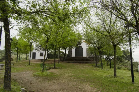
Thus we will reach the steep street of the Sanctuary, which goes up to it with a considerable slope of about three hundred meters. Above the hill ends the path, although here we are offered different offers, such as visiting the sanctuary and its surroundings, or approaching the lookout from where a wide view of Sierra Morena is covered.

Breve descripción

The proverbial depopulation of Sierra Morena, and the consequent preservation of its natural wealth, has here, in the Andújar saw, one of its clearest manifestations. In an agribusiness territory, 30 kilometres from Andújar, the sanctuary of the Virgin of the Head is raised, which finds its meaning in such a strange location. For centuries he has attracted a large number of pilgrims from remote places and year by year, he has concentrated crowds in one of the country's most popular romaneries. The path brings together in its brief journey nature and history, landscapes and tradition.

Latitud
38.0394
Longitud
-4.0511
Distrito
Municipio
Ubicación en el mapa
POINT (-4.0511 38.0394)
imagen
Image
715_SS_01%20%281%29.jpg
Imagen principal
Activado
imagen
Image
Sendero%20el%20santuario.jpg
Imagen principal
Desactivado
46 min

Nature

icon-intereses-naturaleza

Friends

icon-intereses-amigos

Adventure

icon-intereses-aventura

Culture

icon-intereses-cultura

Sport

icon-intereses-deporte

Eco-friendly

icon-intereses-eco-friendly

For couples

icon-intereses-en-pareja

Family

icon-intereses-familia

Gastronomy

icon-intereses-gastronomia

Municipality

icon-intereses-municipio

Low-cost tourism

icon-intereses-turismo-low-cost

Solo travel

icon-intereses-viajar-solo
Baja
Image
0555e93c-2269-03fc-3ed8-8a63f94e61a6?t=1588956745285
Image
ff19adf8-c065-2525-6249-b708ddf99062?t=1588956878234
Sendero El Santuario
3 km
82m
82m
2
1
1
1
On foot
All year round
Desactivado

- Mediterranean mountain and oak and cork dehesas.
- Cortijo La Huerta de los Fráiles.
- Membrellar Arroyo.
- Popular sanctuary on the hill of the Cabezo with various associated infrastructure and equipment.

From Andújar, you must take the road A-6177, north-east sense, to the sanctuary of the Virgin of the Head. After 30 Km we will find the beginning of the path, located next to the road two hundred meters before the last crossing to the sanctuary.

Tramo de asfalto o cemento
 
Tramo de pista o camino forestal
 
Tramo de vía pecuaria
 
Tramo de senda
 

Trail el Rumblar

Submitted by brandcode_deweloper on
Id
2542176
Descripción larga

Sierra Morena is a great natural space of internationally recognized importance. Much of the water resources consumed in the Guadalquivir basin, especially for urban supply, come from its vast territory.

The path begins in one of its water reservoirs and runs through spaces where we will find the explanation of its valued quality, which is no other than that of the conservation of the Mediterranean mountain, the dehesas and other ecosystems where many animals live, including the Iberian lince.

Leaving the town of Baños de la Encina, which well deserves a visit, we will head for the dam of the Rumblar reservoir on the road JH-5044 (5.5 Km). After crossing it, we will find the beginning of the path (see on the map), which runs in its entirety on the unasphalt road JV-5041.

We start the road parallel to the top of the reservoir, to get away from it by the moving Lomas of the Mesonero in a west direction. We are surrounded by a Mediterranean mountain made up of characteristic species, including the oak. A place where many animals that benefit from the water, and also from the microclimate, of the large artificial lake are camped. After two and a half miles of road, the relief and vegetation change radically, entering us in a plain with olive groves and open spaces where they embrace braves. It is a suitable place to see deer, especially during the summer season in autumn.

After crossing a stream and passing through other land of work, we will surround the imposing joint of La Nava de Andújar or Santa Amalia, which has, among other buildings, its own hermitage and school, as there were many families of farm workers. Immediately after the corrijada we return to a more rugged forest land next to the Mosquila saw, whose most outstanding hill we will see in front of us.

Walking the two kilometers of dehesas that separate La Nava from the Friscalejo House we will have the opportunity to see one of the many animals that live here. It won't be hard to see deer if we go quietly and watch. They often come close to the boarders we will see in the surroundings of the house. It is much more difficult to see a lince, but we will be attracted to the collaboration between owners and Administration to protect this emblematic species, from which is reported by signs along the way.

Later on, the path surrounds the House of Gorgogil, putting us at the foot of the Mosquila saw where, after a curve, we will find the birth of the Gorgogil stream. We continue to climb up the hill of the Mosquila which, after a firewall, we find again with a denser and more wooded vegetable cover. To our right, there continue to be dehesas in a flattened land, where we will find once again brava livestock.

If we look at the fences, we will observe the use of granite pilotes, the rocky material that dominates the area. But we will also discover samples of many other uses of this noble stone, such as eating machines and all kinds of works or buildings. And when it comes to geological resources, we approach the Scoriales, where the path ends. This is an old mining enclave from which different types of metals were drawn. Its name is derived from the scum or waste from the exploitation and treatment of minerals, which were accumulated here.

Breve descripción

From Baños de la Encina will go south along the road leading to the Rumblar swamp. Arrived at the junction, we will be diverted by the JH-5044 to the right. After about 5 km, the Rumblar dam is reached, which must be crossed. Next to the relief, the path begins.

Latitud
38.1706
Longitud
-3.7744
Distrito
Ubicación en el mapa
POINT (-3.7744 38.1706)
imagen
Image
Sendero%20el%20Rumblar1..jpg
Imagen principal
Activado
imagen
Image
Sendero%20el%20Rumblar2.jpg
Imagen principal
Desactivado
imagen
Image
Sendero%20el%20rumblar%205.jpg
Imagen principal
Desactivado
7 h 6 min

Nature

icon-intereses-naturaleza

Friends

icon-intereses-amigos

Adventure

icon-intereses-aventura

Culture

icon-intereses-cultura

Sport

icon-intereses-deporte

Eco-friendly

icon-intereses-eco-friendly

For couples

icon-intereses-en-pareja

Family

icon-intereses-familia

Gastronomy

icon-intereses-gastronomia

Municipality

icon-intereses-municipio

Low-cost tourism

icon-intereses-turismo-low-cost

Solo travel

icon-intereses-viajar-solo
Medium
Image
7cb1d67a-f19c-c38c-9426-8492cb08d823?t=1588956233179
Image
0c5e9723-aa4f-d41e-c7e4-3bca7ba6c4e0?t=1588956138798
Sendero el Rumblar
31,8 km
356m
356m
2
1
1
4
On foot
All year round
Desactivado

It is recommended to wear safe drinking water and clothing and adequate footwear. Ensure the potability of the water from the sources. Be careful with the traffic. This path can be realized throughout the year. In summer, due to the special conditions of height, the insolation is very strong which, together with the lack of shadows, requires important solar protection. The months of October and November are especially recommended, coinciding with the deer's berrhea.

- Mediterranean mountain and oak and cork dehesas.
- Presence of Iberian lince and brave cattle.
- Dam del Rumblar (1941), 65 meters high and 126 Hm3 of reservoir capacity.
- The Navy of Andújar.
- The birth of Gorgogil stream.
- Scorial mining enclave.

Leaving the town of Baños de la Encina, which well deserves a visit, we will head for the dam of the Rumblar reservoir on the road JH-5044 (5.5 Km). After crossing it, we will find the beginning of the path (see on the map), which runs in its entirety on the unasphalt road JV-5041.

Circular path

Iberian Lynx observation route (with access to a private estate)

Submitted by brandcode_deweloper on
Id
10281024
Descripción
Descripción larga

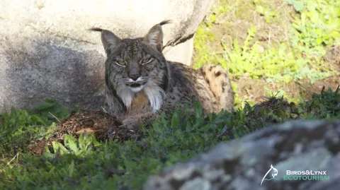
We offer you a 4x4 guided tour by local experts with great knowledge of the territory, with the intention to see the most threatened feline in the world, of which there are only just over 1100 copies left around the world: the Iberian Lince.

During the tour, we will be able to know as interesting aspects as their habitat, biology, behavior, observe the conservation actions that have been carried out for their recovery and make waiting in different areas to try to observe it. The Sierra de Andújar is the largest population core of the species, one of the best places to see it. In addition, we will try to find traces, prints and signs that indicate their presence in passing areas.

The day begins at dawn, with the aim of locating the different species that this corner of Sierra Morena offers us. To do this, you can choose to combine public areas with private areas, or to do all the activity inside the private estate.

The itinerary can be adapted to the different species that the visitor wishes to observe, although usually we begin by visiting the Sierra de Andújar Natural Park to discover the world of the nuances, the Iberian imperial eagle or the black and leonate vultures, which already in the middle of the morning lift their flight taking advantage of the thermal currents. Our guides will advise you the best option at every moment.
?
Later, we will move quietly through the best lynch territories, which are also for different mammals such as deer, wowls, muflons or boar.

Dehesas of oak, alcornoques, pyruetans, bazos, jaras, madroños, lentiscos, or different aromatic plants typical of the Mediterranean mountain, between an infinite maze of granite "bowls," will open our way to a private estate where we will have total exclusivity to make waiting by trying to observe the Iberian Lince (reduced groups).

In these farms, different actions have been carried out for the recovery of their main food, the rabbit, which have served to set up territories of adult breeding, being its area of champion, rest and reproduction.

Of course, watching without filling your stomach is complicated, so we include a breakfast and picnic lunch of local products to taste in the field.

It's complicated to describe it with words, are you coming?

Breve descripción
Exclusive tour guided by experts during a day for observation of Iberian Lince, with access to private estate in Sierra Morena de Jaén.
Ubicación
Latitud
38.181954
Longitud
-4.036263
Dirección
Sierra Morena
Distrito
Municipio
Ubicación en el mapa
POINT (-4.036263 38.181954)
Imágenes
imagen
Image
Lince%20ib%C3%A9rico%20%C3%8Dcaro%20fd.jpg
Imagen principal
Activado
Precio
80.00€
Loading map
Preparing points of interest and routes...
Duración
12 hours (approximately)
Tipo de visitante
Enlace reserva
https://www.birdslynxecotourism.com/ruta-lince-iberico-finca-privada

Discover the Renaissance of the South

Submitted by brandcode_deweloper on
Id
12279829
Descripción
Descripción larga

Conoce la importancia del Renacimiento de Jaén

Con la llegada del Renacimiento, grandes señores y mecenas decidieron que fuera Jaén una de las provincias más ricas y desarrolladas de Andalucía.
Puedes hacer visitas guiadas monumentales, teatralizadas nocturnas, tematizadas, tales como rutas literarias,  con leyendas o anécdotas históricas, así como recorrer las ciudades Patrimonio de la Humanidad de Úbeda y Baeza, en tren o bus turístico y la capital de Jaén en bus panorámico e incluso en segway.

VISITA LAS CIUDADES DEL RENACIMIENTO DEL SUR EN 7 RUTAS:

  • RUTA DE LAS CIUDADES PATRIMONIO DE LA HUMANIDAD
  • RUTA DE LA CAMPIÑA
  • RUTA DE LA SIERRA SUR 
  • RUTA DE LAS SIERRAS DE CAZORLA, SEGURA Y LAS VILLAS
  • RUTA DE SIERRA MÁGINA
  • RUTA DEL CONDADO
  • RUTA DE LOS CASTILLOS DEL RENACIMIENTO

Además de estas 7 rutas, no puedes perderte la visita a la Basílica Menor de Santa María la Mayor en Linares, en la que intervino el gran maestro Andrés de Vandelvira:

1-    RUTA DE LAS CIUDADES PATRIMONIO DE LA HUMANIDAD: JAÉN – BAEZA – ÚBEDA

Esta ruta une las tres ciudades que concentran mayor número de obras de Vandelvira, dentro de amplios conjuntos monumentales, que han merecido la calificación de “Ciudades Patrimonio de la Humanidad”, por parte de la UNESCO en 2003 (en el pdf de la descripción de la ruta en la plataforma está equivocado, pone 2005) para dos de ellas, Baeza y Úbeda, con previsión de ampliar a la catedral de Jaén.
Úbeda y Baeza son el perfecto reflejo de la impronta de arquitectos, como Andrés de Vandelvira, grandes pintores, artesanos, prohombres, nobles y clérigos nos legaron un Patrimonio Histórico y Cultural como en pocos lugares.

Descubre las Obras de Andrés de Vandelvira en esta ruta:

  1. Catedral de Nuestra Señora de la Asunción (Jaén)
  2. Iglesia de san Miguel (Jaén): La iglesia se ha intervenido recientemente para hacerla visitable. Su portada se encuentra trasladada al Museo de Jaén, donde puede ser observada.
  3. Catedral de la Natividad de Nuestra Señora de Baeza (Baeza)
  4. Iglesia del antiguo convento de san Francisco (Baeza)
  5. Casa del Corregimiento y antigua cárcel, actual Ayuntamiento (Baeza)
  6. Iglesia parroquial de san Andrés (Baeza)
  7. Puente de Mazuecos (Baeza)
  8. Plaza Vázquez de Molina (Úbeda)
  9. Sacra Capilla de El Salvador (Úbeda)
  10. Palacio del Deán Ortega (Úbeda)
  11. Palacio Vázquez de Molina o palacio de las Cadenas (Úbeda)
  12. Hospital de los Honrados Viejos del Salvador (Úbeda)
  13. Palacio Vela de los Cobos (Úbeda)
  14. Palacio del marqués de la Rambla (Úbeda)
  15. Iglesia de san Nicolás de Bari (Úbeda)
  16. Iglesia parroquial de san Isidoro (Úbeda)
  17. Hospital de Santiago (Úbeda)
  18. Puente de Ariza (Úbeda)

Visita más monumentos en la ruta:
En Jaén:

  • Iglesia de san Bartolomé
  • Fuente de los Caños
  • Convento de santa Clara
  • Iglesia de san Juan
  • Palacio del conde de Villardompardo y baños árabes
  • Antiguo convento de santo Domingo (actual Archivo Histórico Provincial)
  • Iglesia de la Magdalena
  • Convento y hospital de san Juan de Dios
  • Iglesia de san Ildefonso
  • Convento de las Bernardas
  • Puerta del Ángel
  • Museo de Jaén y Museo Íbero
  • Castillo de santa Catalina
  • Yacimiento de Marroquíes Bajos
  • Oppidum de Puente Tablas
  • Arco de san Lorenzo
  • Convento de las Carmelitas Descalzas
  • Camarín de Jesús
  • Palacio de la Diputación Provincial
  • Baños del Naranjo

En Baeza:

  • Plaza de santa María
  • Seminario de san Felipe Neri (sede de la UNIA)
  • Palacio de Jabalquinto
  • Antigua Universidad
  • Colegio de Santiago
  • Plaza del Pópulo: Antiguas Escribanías, Carnicerías y fuente de los Leones
  • Iglesia de san Pedro
  • Iglesia de la Santa Cruz
  • Iglesia Parroquial del Salvador
  • Convento de las Carmelitas Descalzas
  • Iglesia del convento de los Trinitarios
  • Iglesia parroquial de san Pablo
  • Convento de la Magdalena
  • Convento de san Antonio
  • Convento de san Ignacio
  • Plaza de toros
  • Museo de Baeza
  • Museo de la Cultura del Olivo
  • Centro de interpretación Torreón Puerta de Úbeda

En Úbeda:

  • Palacio de los Orozco
  • Colegiata de santa María de los Reales Alcázares
  • Palacio de Francisco de los Cobos
  • Plaza de san Pablo o del Mercado
  • Iglesia de san Pablo
  • Antiguo Ayuntamiento
  • Convento de San Miguel, con el Oratorio de san Juan de la Cruz
  • Convento de la Concepción
  • Museo arqueológico (casa mudéjar)
  • Palacio del conde de Guadiana (hotel 5 *)
  • Iglesia de san Pedro
  • Convento de santa Clara
  • Casa de las Torres
  • Iglesia de san Lorenzo
  • Iglesia de santo Domingo
  • Iglesia y convento de la Trinidad
  • Torre del Reloj
  • Puerta del Losal
  • Palacio de los Medinillas
  • Palacio del marqués de la Mancera
  • Plaza de toros

Disfruta sus Fiestas del Renacimiento:

Festival Internacional de Música y Danza “Ciudad de Úbeda”
Mayo y junio
Se trata de una de las grandes citas culturales y más señaladas de la provincia de Jaén. El Festival Internacional de Música y Danza “Ciudad de Úbeda”, impulsado por la Asociación 'Amigos de la Música', se ha consolidado como uno de los eventos imprescindibles de la primavera jiennense con conciertos de calidad, tanto de orquestas como de solistas, durante los fines de semana de mayo y junio. El resto de los días, el certamen ofrece una programación paralela como conferencias, exposiciones y la Feria de la Música, la celebración de conciertos en distintos rincones del casco histórico de la ciudad.

Festival de Música Antigua de Úbeda y Baeza 
El  Festival de Música de Antigua de  Úbeda y Baeza (FeMAUB) está considerado como uno de los eventos culturales con más proyección de la provincia de Jaén y uno de los mejores festivales especializados de España. Su historia va unida al paisaje urbano de Úbeda y Baeza y a los espacios renacentistas más emblemáticos que sirven de auditorio. El festival se caracteriza por su apuesta por la recuperación y difusión del patrimonio musical hispano, dando a conocer esa vasta y, a veces, olvidada  parte de nuestra cultura musical. 

Jornadas Gastronómicas en el Renacimiento (Úbeda)
Enero a marzo
Úbeda celebra en el primer trimestre del año una de las citas más esperadas para los mejores paladares: las Jornadas Gastronómicas en el Renacimiento. Se trata de una propuesta "inexcusable" en el calendario de la ciudad Patrimonio de la Humanidad y con la que se pretende recuperar platos de la época renacentista. Otro gran pilar de estas jornadas son los aceites con los que se aderezan los maravillosos manjares elaborados para la ocasión. Como viene siendo habitual, el Centro de Interpretación Olivar y Aceite organiza, en el marco de este encuentro culinario, una serie de catas con los mejores aceites de nuestra tierra.

Fiestas del Renacimiento (Úbeda) 
Julio
La ciudad de Úbeda viaja cada mes de julio al Siglo de Oro español para celebrar las Fiestas del Renacimiento. Teatro, danzas, malabares, pasaje del terror, campamento renacentista, acrobacias, fuegos artificiales, demostración de oficios antiguos o recreación de un campamento militar y su vida cotidiana... una multitud de eventos para conmemorar también la declaración de Úbeda y Baeza como Ciudades Patrimonio de la Humanidad. Durante unos días la ciudad se transforma para recuperar su historia y revivir el esplendor de la Úbeda del siglo XVI y, por supuesto, no falta la tradicional entrada y jura de fueros de Carlos I España y V de Alemania.

Ciclo de Música de Cámara en las ciudades Patrimonio de la Humanidad de España (Úbeda y Baeza)
Octubre y diciembre
Las ciudades de Úbeda y Baeza se suman al ciclo de Música de Cámara que promueve el Grupo de Ciudades de Patrimonio de la Humanidad. Este ciclo lleva al público, de forma gratuita, una selección de la mejor música de cámara, a espacios históricos, civiles y religiosos, de las 15 ciudades españolas incluidas en la Lista del Patrimonio Mundial de la UNESCO. Las actuaciones, que se celebran entre los meses de octubre y diciembre, corren a cargo de las agrupaciones de cámara de la Escuela Superior de Música Reina Sofía, considerada uno de los centros de alta formación musical más prestigiosos del mundo.

Renacimiento a la Luz de las Velas (Baeza)
Septiembre
Desde 2018 Baeza se engalana para crear una noche mágica con el fin de promocionar, dinamizar y poner en valor su carácter monumental, gracias a la colaboración de colectivos sociales, instituciones públicas, empresas privadas y otras entidades participantes. En  septiembre la ciudad ofrece una amplia y variada programación cultural.

La Noche del Patrimonio (Úbeda y Baeza)
Septiembre
Las ciudades de Úbeda y Baeza se suman a La Noche del Patrimonio, un evento que surgió en 2018 coincidiendo con el 25 aniversario de la fundación del Grupo de Ciudades Patrimonio. Se celebra en el mes de septiembre y se divide en tres secciones en las que tienen cabida las artes escénicas contemporáneas (Escena Patrimonio), jornadas de puertas abiertas de monumentos (Abierto Patrimonio), y una gran oferta de actividades culturales y de ocio en nuestros cascos históricos (Vive Patrimonio). Es una gran fiesta colectiva en la que vecinos y visitantes disfrutan de una manera diferente el patrimonio histórico, artístico y cultural que nos fue legado.

Déjate guiar por profesionales turísticos:

En Jaén capital:
Guías de Jaén (Asociación Provincial de Guías de Turismo).
Cláritas Experiencias Turísticas y Culturales. 
Arqueonatura. 
Seturja. Gestión de Servicios Turísticos de la provincia de Jaén. 
Lagarto Tours. 
Baraka Project. 
Patrimonio y Educación (visitas para escolares). 

En Úbeda, Ciudad Patrimonio de la Humanidad:
Guías de Jaén (Asociación Provincial de Guías de Turismo.
Seturja. Gestión de Servicios Turísticos de la provincia de Jaén.
Artificis.
Atlante Úbeda y Baeza Turismo. 
Semer Turismo. 
Visitaubedaybaeza.com. 
Jugo Mariana. 
Ágora Visitas Guiadas. 
Vandelvira Turismo. 
Fenice. 
  
En Baeza, Ciudad Patrimonio de la Humanidad:
Guías de Jaén (Asociación Provincial de Guías de Turismo) 
Seturja. Gestión de Servicios Turísticos de la provincia de Jaén. 
Pópulo Servicios Turísticos. 
Turistour. 
Abside Turismo. 
Atlante Úbeda y Baeza Turismo. 
Visitaubedaybaeza.com. 

?
2-    RUTA DE LA CAMPIÑA:

Esta ruta cubre la parte occidental de la provincia, en torno al cauce del río Guadalquivir. Tierra llana de rica agricultura, paso hacia la Baja Andalucía y abierta a influencias que remontan el río desde Sevilla. El Renacimiento sella igualmente el desarrollo urbano de núcleos tan importantes como Andújar, sobre todo, Lopera, Porcuna, Arjona o Arjonilla, aunque luego el Barroco dejará una intensa huella. Documentada está la presencia de Vandelvira, si bien de nuevo será Castillo “el Mozo” y su hermano, Benito del Castillo, los más activos, además de detectarse influencia y presencia de maestros cordobeses.
JAÉN – MENGÍBAR – CAZALILLA - VILLANUEVA DE LA REINA – ANDÚJAR – MARMOLEJO – LOPERA – PORCUNA – ARJONA – ARJONILLA – LAHIGUERA – JAEN

Descubre las Obras de Andrés de Vandelvira en esta ruta:

  1. Iglesia de Santiago (Andújar)
  2. Santuario de la Virgen de la Cabeza (Andújar)

Visita más monumentos en la ruta:

En Mengíbar:

  • Torre, único vestigio del castillo medieval
  • Iglesia de san Pedro
  • Casa de la Inquisición
  • Casa palacio de los señores de la Chica
  • Ermita del Señor de las Lluvias
  • Ermita de santa María Magdalena
  • Museo Terra Oleum

En Cazalilla:

  • Iglesia de la Magdalena
  • Casa de la Carrillera
  • Torre de Calígula

En Villanueva de la Reina:

  • Iglesia de la Natividad de Nuestra Señora
  • Casa del conde de la Quintería (actual Ayuntamiento)
  • Ermita de san Nicolás
  • Yacimiento de la ermita de santa Potenciana

En Andújar:

  • Torre del Reloj
  • Iglesia de santa María y el cuadro del Greco: La Oración el Huerto
  • Ayuntamiento
  • Iglesia de san Miguel
  • Iglesia de san Bartolomé
  • Iglesia de santa Marina, dedicada a espacio cultural
  • Casa de los Niños de Don Gome
  • Casa de los Valdivia
  • Casa-palacio de los Cárdenas, hoy sede de los juzgados
  • Hospital de San Juan de Dios (Monjas Trinitarias)
  • Colegio de los Jesuitas (convertido hoy en hospital)
  • Convento de Jesús y María
  • Convento de Capuchinas (actual Museo de Artes Plásticas Antonio González Orea)
  • Murallas
  • Torre de la Fuente Sorda

En Marmolejo:

  • Balneario
  • Iglesia de Nuestra Señora de la Paz
  • Puente del siglo XVI sobre el Guadalquivir
  • Castillo de la Aragonesa (hacienda con capilla neoclásica)
  • Museo de Arte Contemporáneo Mayte Spínola

En Lopera:

  • Castillo
  • Iglesia de Santa María o de la Purísima Concepción
  • Ayuntamiento
  • Ermita de Jesús
  • Ermita del Humilladero
  • Ermita de san Roque
  • Casa de la Tercia

En Porcuna:

  • Yacimiento de Cerrillo Blanco
  • Torre Nueva o torre de Boabdil (en su interior museo arqueológico)
  • Iglesia de Nuestra Señora de la Asunción
  • Ayuntamiento (antiguo Pósito)
  • Arco de la Plaza
  • Convento de san Benito
  • Ermita de Nuestro Padre Jesús
  • Casa de Piedra

En Arjona:

  • Plaza Santa María y aljibe árabe
  • Iglesia de santa María
  • Santuario de Los Mártires
  • Iglesia de san Juan
  • Iglesia de san Martín
  • Iglesia de Nuestra Señora del Carmen
  • Salón de Plenos del Ayuntamiento
  • Museo arqueológico Ciudad de Arjona

En Arjonilla:

  • Torre de Macías
  • Iglesia de la Encarnación
  • Ermita de Santiago o de la Virgen de la Cabeza
  • Ermita de la Soledad
  • Ermita de Jesús Nazareno
  • Ermita de San Roque
  • Juzgado (antiguo Ayuntamiento)
  • Palacio del marqués de la Merced

En La Higuera:

  • Iglesia de la Consolación
  • Ayuntamiento
  • Castillo de la Tercia

Déjate guiar por profesionales turísticos:

Guías de Jaén (Asociación Provincial de Guías de Turismo). 
Guía oficial de Andújar Isabel Plaza. 
Sayr Ingenieria y Ocio (Andújar). 


3-    RUTA DE LA SIERRA SUR

La Sierra Sur, como tierra fronteriza con el reino nazarí de Granada, tiene una fuerte impronta militar, de la que dan cuenta los muchos e importantes castillos que existen en ella; pero también como territorio reconquistado hubo de equiparse, sobre todo con iglesias, ya en el siglo XVI, de factura clásica. El Renacimiento está por ello de nuevo renovando la ciudad y con él los nombres de Vandelvira, Castillo “El Mozo” (aquí más activo que en otras partes de la provincia) y Martínez de Aranda, además de la presencia de maestros de Granada, dada la proximidad y fácil comunicación entre ambos territorios por Alcalá la Real.
JAÉN – TORREDELCAMPO – JAMILENA – TORREDONJIMENO – MARTOS – ALCAUDETE – CASTILLO DE LOCUBÍN - ALCALÁ LA REAL – FRAILES - VALDEPEÑAS DE JAÉN - LOS VILLARES – JAÉN

Descubre la Obra de Andrés de Vandelvira en esta ruta:

Iglesia de Santa María la Mayor (Alcaudete):

Templo gótico en el que trabajó Andrés de Vandelvira
Es el mayor templo de Alcaudete, en el corazón de la “villa”, hoy bastante despoblada y casi abandonada. 
Iniciada en torno al primer tercio del siglo XVI, no se termina hasta comienzos del siglo XVII, sucediéndose formas todavía góticas con un desbordante “plateresco” o renacimiento temprano, en las portadas, y un sobrio clasicismo en su cabecera y torre. 
En ella intervinieron Vandelvira, en torno al año 1558, al serle encargada una tribuna por el obispo Diego Tavera, Castillo “El Mozo” y Martín de Bolívar.
Magníficas son las puertas de la sacristía, labradas con relieves clasicistas. Además cuenta con algunas tallas barrocas del s. XVIII muy meritorias. 
La iglesia es Monumento Nacional desde 1931.

Visita más monumentos y lugares de interés en la ruta:

En Torredelcampo:

  • Iglesia de san Bartolomé 
  • Ermita de santa Ana
  • Castillo del Berrueco
  • Torre de la Muña

En Jamilena:

  • Iglesia de Nuestra Señora de la Natividad
  • Ermita de san Francisco
  • Ermita del Calvario

En Torredonjimeno:

  • Cabildo 
  • Iglesia de san Pedro
  • Iglesia de santa María
  • Convento de Nuestra Señora de la Piedad
  • Ermita de Consolación
  • Castillo y tesoro visigodo de Torredonjimeno
  • Molino del Cubo
  • Puente de san Sebastián

En Martos:

  • Cárcel y Cabildo (Plaza del Ayuntamiento)
  • Iglesia de santa Marta
  • Fuente Nueva
  • Templo de Santa María de la Villa
  • Convento de las Trinitarias
  • Hospital de san Juan de Dios
  • Villas eclecticistas y modernistas
  • Castillo de la Villa
  • Castillo de la Peña

En Alcaudete:

  • Castillo y murallas 
  • Iglesia de san Pedro
  • Convento del Carmen (carmelitas)
  • Convento de santa Clara (clarisas)
  • Convento de Jesús y María (franciscanas)
  • Ermita de santa Catalina
  • Ayuntamiento
  • Antigua ermita de la Aurora

En Castillo de Locubín:

  • Iglesia de san Pedro
  • Casa Museo Antiguo Hospital de la Orden de Calatrava

En Alcalá la Real:

  • Fortaleza de la Mota (Torre del Homenaje e iglesia abacial de santa María)
  • Casas de Cabildo
  • Antigua iglesia de Santo Domingo
  • Iglesia de san Juan Bautista
  • Plaza del Ayuntamiento
  • Cabildo
  • Monumento a Juan Martínez Montañés
  • Convento de Consolación
  • Convento de la Encarnación
  • Palacio Abacial
  • Pilar de los Álamos
  • Iglesia de san Antón
  • Iglesia de las Angustias
  • Ermita de san Marcos
  • Ermita de la Verónica
  • Antiguo convento de Capuchinos
  • Iglesia de la aldea de Santa Ana
  • Iglesia de la aldea de La Pedriza

En Frailes:

  • Iglesia de santa Lucía
  • Casa del deán Mudarra

En Valdepeñas de Jaén:

  • Ayuntamiento
  • Iglesia de Santiago
  • Molino-Museo Alto de santa Ana
  • Las Chorreras (cascada natural)

En Los Villares:

  • Ayuntamiento
  • Iglesia de san Juan Bautista
  • Palacio del vizconde de Los Villares
  • Paraje natural de los Cañones

Disfruta sus Fiestas del Renacimiento:

Fiestas Realengas (Valdepeñas de Jaén)
Agosto
Durante tres días de agosto, Valdepeñas de Jaén retrocede al siglo XVI para revivir en sus calles y placitas las costumbres de la Edad Media con motivos de sus Fiestas Realengas. Una celebración que sirve para promocionar turísticamente el municipio, a la vez que se difunde la cultura y la historia valdepeñeras. Las fiestas trasladan a los vecinos y visitantes hasta 1518, año en que Felipe II emitió la orden por la que Valdepeñas pasó de ser una aldea de Jaén a municipio.  

Déjate guiar por profesionales turísticos:

- Guías de Jaén (Asociación Provincial de Guías de Turismo). 
- Fundación Ciudades Medias de Andalucía. 
- Pangea, Patrimonio, Turismo y Divulgación. 
- Maicamero (Guía oficial). 
- Alcaudete Turismo.

4-    RUTA DE LAS SIERRAS DE CAZORLA, SEGURA Y LAS VILLAS.

Esta ruta recorre los dominios del Secretario imperial, Francisco de los Cobos, como Adelantado de Cazorla, y las primeras intervenciones de Andrés de Vandelvira en tierras de Jaén, en los dominios de la Orden Militar de Santiago en la Sierra de Segura.
Ruta de dos días de duración, partiendo desde Úbeda.
Otra opción es dividirla en dos días:
Día 1: Ruta de Cazorla.
Ida: Cazorla- La Iruela.
Regreso: La Iruela-Cazorla-Peal de Becerro-Torreperogil-Úbeda.

Día 2: Ruta de Las Villas y Sierra de Segura.
Ida: Úbeda-Torreperogil-Villacarrillo-Iznatoraf-Villanueva del Arzobispo-Beas de Segura-Orcera- Segura de la Sierra- Hornos de Segura.
Regreso: Hornos de Segura, bordeando el Pantano del Tranco hasta salir a Villanueva del Arzobispo- Úbeda.

ÚBEDA – TORREPEROGIL - PEAL DE BECERRO – QUESADA – CAZORLA - LA IRUELA - HORNOS DE SEGURA - SEGURA DE LA SIERRA – ORCERA - BEAS DE SEGURA - VILLANUEVA DEL ARZOBISPO – IZNATORAF – VILLACARRILLO


Descubre las Obras de Andrés de Vandelvira en esta ruta:

  1. Iglesia de Santa María La Mayor (Torreperogil)
  2. Ruinas de la iglesia de Santa María (Cazorla)
  3. Ruinas de la Iglesia de Santo Domingo (La Iruela)
  4. Pósito (Actual ayuntamiento de La Iruela)
  5. Iglesia de Nuestra Señora de la Asunción (Hornos de Segura)
  6. Iglesia de santa María del Collado (Segura de la Sierra)
  7. Iglesia de Nuestra Señora de la Asunción (Orcera)
  8. Iglesia de Nuestra Señora de la Asunción (Villacarrillo)

Visita más monumentos en la ruta:

En Torreperogil:

  • Torres Oscuras
  • Ermita de la Misericordia

En Peal de Becerro:

  • Cámara sepulcral de Toya
  • Torre del Reloj y torre Mocha
  • Acueducto
  • Castillo de Toya

En Quesada:

  • Puertas de “los Santos” y “la Manquita”
  • Iglesia de san Pedro y san Pablo
  • Iglesia del hospital de la Purísima Concepción
  • Museo Zabaleta - Miguel Hernández
  • Santuario de la Virgen de Tíscar
  • Cueva del Agua
  • Pinturas rupestres
  • Villa romana de Bruñel

En Cazorla:

  • Castillo de la Yedra
  • Iglesia de san José
  • Convento de la Merced (actual Ayuntamiento)
  • Convento del Carmen
  • Fuente de las Cadenas
  • Casa de las Cadenas
  • Bóveda del río Cerezuelo

En La Iruela:

  • Castillo almohade

En Segura de la Sierra:

  • Castillo 
  • Baños Árabes
  • Iglesia del colegio de los Jesuitas
  • Fuente de Carlos V
  • Casa de Jorge Manrique
  • Ayuntamiento
  • Plaza de toros

En Beas de Segura:

  • Convento de las Carmelitas Descalzas de san José
  • Barrio del Albaicín
  • Iglesia parroquial de Nuestra Señora de la Asunción
  • Yacimiento de las Terrazas del Guadalimar

En Villanueva del Arzobispo:

  • Iglesia parroquial de san Andrés
  • Convento de santa Ana
  • Iglesia de la Vera Cruz
  • Santuario de la Fuensanta

En Iznatoraf:

  • Iglesia de la Asunción
  • Murallas y puertas de acceso
  • Ermita del Cristo de la Vera Cruz

En Villacarrillo:

  • Casa de Vandelvira
  • Casas-palacio de la Calle Feria
  • Casa de la Inquisición
  • Hospital e iglesia de santa Isabel
  • Centro de divulgación astronómico de la Fresnedilla

Déjate guiar por profesionales turísticos:

Guías de Jaén (Asociación Provincial de Guías de Turismo).
La Moraleja Servicios Turísticos.

5-    RUTA DE SIERRA MÁGINA

Esta ruta recorre el sudeste de la provincia guiada por destacadas intervenciones de A. de Vandelvira en la arquitectura religiosa, ya fuera en encargos diocesanos o privados, a través de un espléndido paisaje natural como es el Parque Natural de Sierra Mágina. En ella visitaremos desde significativas villas señoriales a otras de nueva planta, fruto de la colonización llevada a cabo en el siglo XVI al sur de Jaén, con destacados hitos además en la arquitectura militar y civil. Para realizarla en su integridad esta ruta se necesitan dos días o, al menos, día y medio. 
También podría dividirse en dos, de una sola jornada con salida y regreso a Jaén:
Día 1: Trayecto Jaén-Huelma.
Día 2: Jaén-Bedmar, que recorre en sentido inverso la secuencia aquí propuesta. 
JAÉN - LA GUARDIA – PEGALAJAR – CAMBIL – HUELMA – BEDMAR – GARCÍEZ – JIMENA – ALBANCHEZ – TORRES - MANCHA REAL – JAÉN

Descubre las Obras de Andrés de Vandelvira en esta ruta:

  1. Iglesia parroquial de Nuestra Señora de la Asunción y antiguo convento de Santa María Magdalena de la Cruz (La Guardia de Jaén)
  2. Pilar abrevadero (La Guardia de Jaén)
  3. Iglesia de la Inmaculada Concepción (Huelma)
  4. Casa Palacio de los Marqueses de Camarasa (

Ubicación
Latitud
37.772886
Longitud
-3.788329
Distrito
Municipio
Ubicación en el mapa
POINT (-3.788329 37.772886)
Loading map
Preparing points of interest and routes...
Tipo de visitante