Saltar al contenido principal

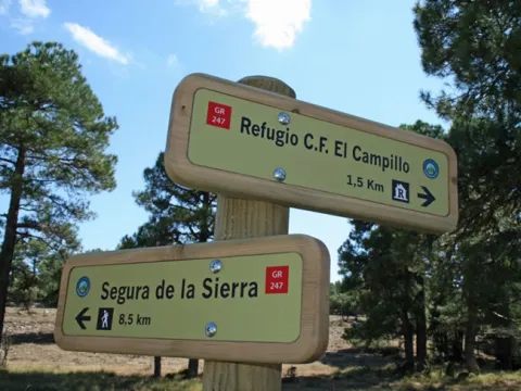
STAGE 02: Segura de la Sierra - Forestrand House Refuge El Campillo

Submitted by brandcode_deweloper on
Id
2155339
Breve descripción

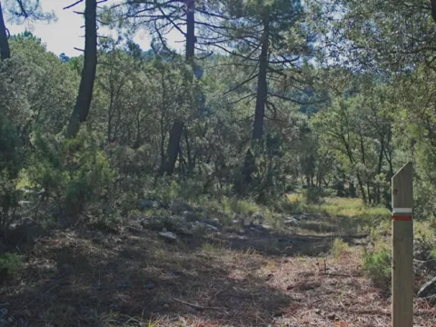
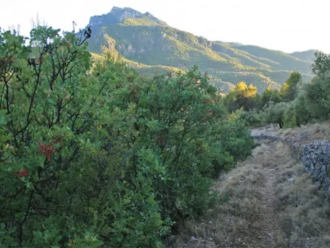
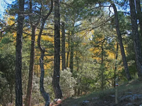
This short stage, which is mostly followed by old traditional paths, allows to enjoy the transition between the humanized landscapes of the low mountain and the closed forest masses of the high areas, knowing the three types of pine trees that occur in the natural park as we gain altitude: those of carrasco, black and laricio or salgareño.

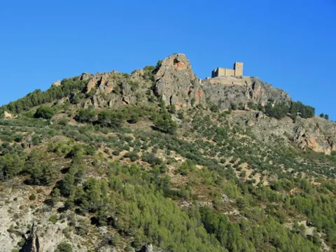
The route from Segura de la Sierra, a small white town hanging on the mountain, whose restored Arab castle attests that this town was the historic head of the Sierra de Segura region. It comes down between pine trees and oak trees to the Abeno Valle del Trujala and the village of the same name, with a scattered population, where they are harmoniously combined pine, rosejo, mountain olive trees, orchards and small cortijos.

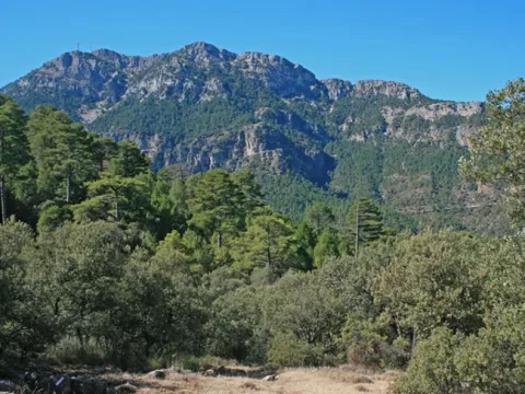
After passing very close to the Moro Bridge and the Roman bridge of Romilán, we will ascend to the Dehesa de la Carnicera, changing the atmosphere and entering a valuable and welcoming pine larix forest with plenty of oak, complaints and juniors. The stage ends in the Forest House of El Campillo, in the middle of the forest of larice pine trees. From it we have several options, all by signposted routes: continue to Hornos de Segura on the path GR 247 Southern Forests; climb to the summit of El Yelmo or go down to the charming valley of the river Madera.

This stage offers you the connection to the variant GR 247.1. If you choose the variant you can connect with the stages 19 and 20 and following. So you can make a circuit less than the main, with the stages of the north of the path.
Latitud
38.3547
Longitud
-2.6487
Distrito
Ubicación en el mapa
POINT (-2.6487 38.3547)
imagen
Image
852967248dd3e6cb3942a1fe6af42945_12_XL.jpg
Imagen principal
Activado
imagen
Image
852967248dd3e6cb3942a1fe6af42945_11_XL.jpg
Imagen principal
Desactivado
imagen
Image
852967248dd3e6cb3942a1fe6af42945_10_XL.jpg
Imagen principal
Desactivado
imagen
Image
852967248dd3e6cb3942a1fe6af42945_13_XL.jpg
Imagen principal
Desactivado
imagen
Image
852967248dd3e6cb3942a1fe6af42945_14_XL.jpg
Imagen principal
Desactivado
imagen
Image
852967248dd3e6cb3942a1fe6af42945_15_XL.jpg
Imagen principal
Desactivado
imagen
Image
852967248dd3e6cb3942a1fe6af42945_2_XL.jpg
Imagen principal
Desactivado
imagen
Image
852967248dd3e6cb3942a1fe6af42945_3_XL.jpg
Imagen principal
Desactivado
imagen
Image
852967248dd3e6cb3942a1fe6af42945_4_XL.jpg
Imagen principal
Desactivado
imagen
Image
852967248dd3e6cb3942a1fe6af42945_5_XL.jpg
Imagen principal
Desactivado
imagen
Image
852967248dd3e6cb3942a1fe6af42945_6_XL.jpg
Imagen principal
Desactivado
imagen
Image
852967248dd3e6cb3942a1fe6af42945_7_XL.jpg
Imagen principal
Desactivado
imagen
Image
852967248dd3e6cb3942a1fe6af42945_9_XL.jpg
Imagen principal
Desactivado
imagen
Image
852967248dd3e6cb3942a1fe6af42945_8_XL.jpg
Imagen principal
Desactivado
imagen
Image
852967248dd3e6cb3942a1fe6af42945_XL.jpg
Imagen principal
Desactivado
4 h

Nature

icon-intereses-naturaleza

Friends

icon-intereses-amigos

Adventure

icon-intereses-aventura

Culture

icon-intereses-cultura

Sport

icon-intereses-deporte

Eco-friendly

icon-intereses-eco-friendly

For couples

icon-intereses-en-pareja

Family

icon-intereses-familia

Gastronomy

icon-intereses-gastronomia

Municipality

icon-intereses-municipio

Low-cost tourism

icon-intereses-turismo-low-cost

Solo travel

icon-intereses-viajar-solo
Medium
Segura de la Sierra - Refugio CF El Campillo
9,95 km
674m
698m
334m
2
1
2
3
On foot
All year round
Activado
Almost all the stage runs along the path, with rocky points and short sections with strong slope
Segura de la Sierra, Trujala, Fuente del Avellanar

On the path: Segura de la Sierra
Near the path: Orcera and New Cortijos

In the final: Casa Forestal El Campillo

The five doors of Segura de la Sierra

The entrance porch to Segura de la Sierra for most visitors, who arrive by road, is the splendid New Gate, which seems to be dating from the 16th century and which replaced a previous one from which only the left turret remains. But today, by regaining the use of the old roads, we go back to the doors already almost forgotten, made to defend the people in times when there were no hiking or equestrian tourists, but walkers and riders. Or, simply, villagers who went down to their hidden hostels to donkey loins.

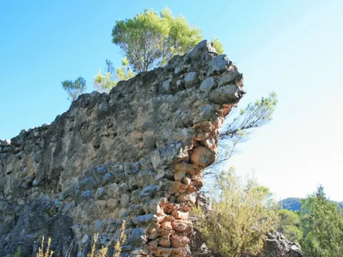
Thus, the Southern Forest path passes through two of its doors. If we come from stage 1 we enter through the Orcera Gate, which was part of the ancient Arab wall and today calls for a restoration. If we leave the other end of the village to make stage 2 towards the Trujala and El Campillo valley, we will pass through the Catena Gate, which was partially restored in 1972 and which retains the true appearance of a Muslim medieval door. It is included in a very little visited turret, within which, with a little imagination, we can evoke the similar corners that still exist today in many people of the Maghreb.

From the Gate of Gontar, which at the time controlled the entrance from the saw, there is only one tower that is not recognizable, enabled as a kit of the bullring, on the road that goes up to the castle. And from the Herrada Gate there's barely a part of the foundation. Thus, in the times of the Muslims, for whom the importance of the medinas was related to the number of their doors, Segura de la Sierra had five, a not negligible number.

Sierra insurance

Refugio CF El Campillo

Coordenadas / Huso 30S
According to Projection UTM Datum ETRS89
Tramo de asfalto o cemento
18.19%
Tramo de pista o camino forestal
6.03%
Tramo de vía pecuaria
0
Tramo de senda
75.78%

Route card

Km 0

Segura de la Sierra


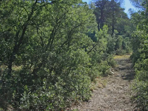
Partimos de Segura de la Sierra desde la Puerta de Catena, a unos metros de los Baños Árabes. Estas dos construcciones crean un ambiente que evoca nítidamente el de los pueblos del norte del Magreb. Las vistas hacia montes y olivares son amplísimas. Bajamos 50 metros hasta la carretera, por la que caminamos unos 200 metros y continuamos a la izquierda por el camino que baja al Valle del Trujala. Se trata de una deliciosa senda tradicional que transita por denso bosque mediterráneo salpicado de pequeños olivares.

Km 1,9

Valle del Trujala


Llegamos al estrecho Valle del Trujala, que es un afluente del Guadalimar. En este lugar finaliza la carreterita que vemos a nuestra derecha, que recorre el valle y sus pequeñas aldeas, como Puente Moro, El Batán, El Porche, Don Lope, El Soto, etc. Con su poblamiento disperso, sus blancas cortijadas y su vegetación de ribera, el Valle del Trujala es una de las zonas de esta parte del parque natural donde mejor se conserva el ambiente tradicional. Además, la zona en la que nuestra ruta cruza el Valle del Trujala tiene una notable relevancia arqueológica, porque en ella está el llamado Puente Moro, cerca del sendero. Se trata de un ancho puente de origen medieval, muy cerca del cual hay otro más pequeño, al que se atribuye origen romano, llamado Puente de Romillán.

Km 2,5

Arroyo de Los Yeros


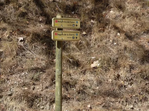
Cruzamos el Arroyo de Los Yeros –afluente del Trujala– y pasamos a caminar por una senda, que en algunos de sus primeros tramos es rocosa. Enseguida llegamos a un cruce con señales direccionales a las que hay que estar atentos.

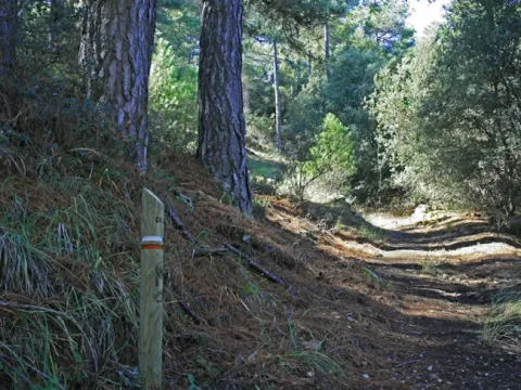
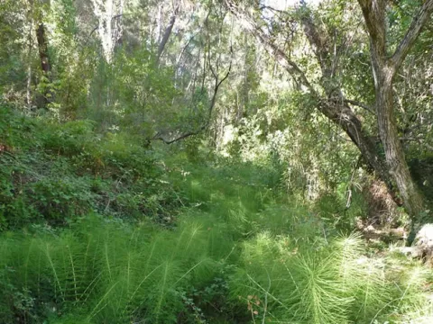
Nuestra senda se va elevando y se interna en un pinar de pino carrasco con abundancia de romero y sabina mora. Abajo veremos el Cortijo de Romillán. A nuestra espalda, hacia la izquierda, aparece el castillo de Segura de la Sierra, y después, a la derecha, El Yelmo. Más adelante nuestro camino se ensancha, mientras a la izquierda se abren hermosas panorámicas hacia el calar de Navalperal. Pronto el sotobosque se irá haciendo más umbrío y frondoso, con encinas, madroños, enebros y cornicabras. En el kilómetro 3,8 llegamos a un calvero del bosque con algunas junqueras que hay que atravesar fijándose en las balizas de señalización. Aproximadamente en el kilómetro 4,8 habremos pasado ya al estrato del pino negral y el sotobosque sigue siendo muy cerrado.

Km 5,2

Cruce con pista forestal


Cruzamos una ancha pista forestal que viene desde la Casa Forestal de Navalcaballo y baja hasta la aldea de El Robledo. Observamos que ahora hay más encinas. Poco más arriba, si volvemos la mirada, disfrutaremos de grandes vistas sobre las tierras bajas del Valle del Guadalimar, cubiertas de olivares, y de Segura de la Sierra. Tras cruzar un arroyo, el sendero gana altura zigzagueando durante un trecho con notable pendiente. Entramos ya en el dominio de los pinos salgareños, rectos y de gran tamaño, y el suelo se vuelve más herboso.

Km 6,4

Chorreón de la Cañada de la Fresnadilla


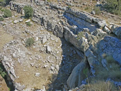
A nuestra izquierda, abajo, aparece un amplio anfiteatro rocoso y escalonado, bajo el cual hay una toba por la que cae el agua en cascada, llamado Chorreón de la Cañada de la Fresnadilla. Con frecuencia se seca, pero si tenemos la suerte de verla con agua y cuando la temperatura ambiente es propicia, es un lugar excelente para darse una improvisada ducha montañera. Después llaneamos por una chopera de suelo muy herboso, bellísima en otoño.

Km 7,1

Cruce con carretera


Cruzamos la carretera JF-7016. Nuestra ruta asciende por la Cañada del Borriquillo donde, al ser vía pecuaria, la senda no está muy definida, pero las marcas y balizas no dejan lugar a dudas. En el kilómetro 7,5 nuestra ruta se separa del GR 147, con el que ha coincidido hasta ahora. Llegaremos a un calvero, que es un amplio collado. Desde él se abren sorprendentes vistas hacia el este, concretamente hacia el Cerro del Toril y la Loma del Mirandante. Abajo está el valle de río Madera. Nosotros continuamos, viendo al frente la mole de El Yelmo, y después llaneamos por los pastizales de El Campillejo, siguiendo las marcas y balizas, hasta llegar de nuevo a la carretera.

Km 8,5

Cruce con carretera


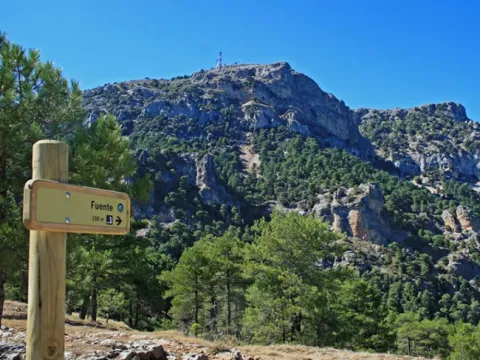
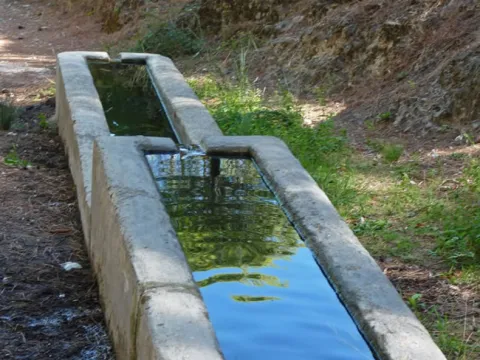
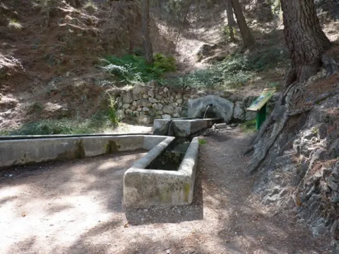
Durante el último kilómetro y medio de nuestra etapa caminaremos por la estrecha carretera JF-7016, sin pendiente, flanqueados por El Yelmo y los amplios pastizales de El Campillejo, y en medio de un paisaje abierto y magnífico. En los kilómetros 9 y 9,4 veremos señalizados dos caminos a la derecha que convergen en la Fuente del Avellanar. Es importante abastecerse en ella de agua, porque el refugio donde finaliza la etapa no dispone de fuente. El primero de esos caminos tiene 150 metros de longitud y el segundo 300 metros.

Km 10

Refugio Casa Forestal El Campillo


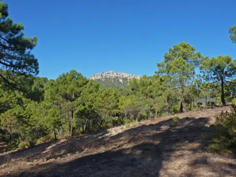
La etapa termina en la casa forestal de El Campillo, situada en la base suroriental de El Yelmo. La antigua casa donde vivía el guarda forestal está en ruinas, pero su tamaño y la existencia de varias construcciones auxiliares dan idea de la importancia que tuvo en su momento, lo que es lógico dada la tradicional relevancia forestal de toda la zona. En una de esas dependencias está el refugio en él podemos pernoctar. El punto de agua más cercano es la fuente del Avellanar. Para llegar a ella debemos ir por la carretera –dirección Segura de la Sierra– y a unos 600 metros tomar el camino señalizado que antes hemos comentado, y que ahora encontraremos a la izquierda. Desde ahí, la fuente está a 300 metros.

El Campillo no es solo un lugar de gran belleza, sino también un punto estratégico para iniciar varias rutas senderistas. Podemos, obviamente, continuar por el GR 247 haciendo la etapa 3, que llega a Hornos de Segura. Pero también se puede optar por subir a la Cumbre de El Yelmo –uno de los mejores miradores de la zona norte del parque– por el PR-A 194, señalizado y que también forma parte del sendero Bosques del Sur como derivación 2. O bien se puede bajar al valle de río Madera por el camino que parte al otro lado de la carretera, justo enfrente del refugio. Este camino está recuperado y señalizado por la Confederación Hidrográfica del Segura. Tiene una longitud de 4,8 km y un desnivel total negativo de 230 metros. Discurre por hermosos bosques y, al final, pasa junto a la aldea de Arroyo Canales (río Madera), donde podemos enlazar con la variante GR 247.1 del sendero Bosques del Sur. Aunque esta variante no enlaza aquí con esta parte del sendero, un pequeño desplazamiento te permitiría una ruta alternativa, usando la variante para regresar a Segura de la Sierra por otro camino, o conectar directamente con las etapas del interior de la Sierra de Segura.
STAGE 01: Recreational Area Peña del Olivar - Segura de la Sierra

Submitted by brandcode_deweloper on
Id
2085333
Breve descripción

This stage of the Southern Forest trail allows you to enjoy the wide variety of landscapes of the low mountain of the natural park, in which the pine trees are alternated with Mediterranean sotoforest, olive groves and small villages and villages.

In the surroundings of Siles we will see a beautiful mosaic of pineapples and olive groves and we will enter one of the best pineapples of carrasco pine in the natural park, in which you can see and touch two gigantic examples of carrasco pine included in the Inventory of Singular Trees of Andalusia.

We can approach the remains of the small castle of Puentehonda, half hidden in the thickness of the forest and walk a delicious horseshoe road that part of the recreational area of Los Straits, from which you can see the Hispanic Muslim torreons of Santa Catalina and the wavy olive groves of the Trujala valley.

The day will not end better, because the stage ends in Segura de la Sierra, a small town declared a Historical-Artistic Set, in which it is enjoyed its spectacular location, its castle - of indispensable visit - and its popular architecture.

Latitud
38.1547
Longitud
-2.5612
Distrito
Municipio
Ubicación en el mapa
POINT (-2.5612 38.1547)
imagen
Image
deb45d333d0414ba3de42155789fdb4a_XL.jpg
Imagen principal
Activado
imagen
Image
deb45d333d0414ba3de42155789fdb4a_10_XL.jpg
Imagen principal
Desactivado
imagen
Image
deb45d333d0414ba3de42155789fdb4a_11_XL.jpg
Imagen principal
Desactivado
imagen
Image
deb45d333d0414ba3de42155789fdb4a_12_XL.jpg
Imagen principal
Desactivado
imagen
Image
deb45d333d0414ba3de42155789fdb4a_13_XL.jpg
Imagen principal
Desactivado
imagen
Image
deb45d333d0414ba3de42155789fdb4a_14_XL.jpg
Imagen principal
Desactivado
imagen
Image
deb45d333d0414ba3de42155789fdb4a_15_XL.jpg
Imagen principal
Desactivado
imagen
Image
deb45d333d0414ba3de42155789fdb4a_16_XL.jpg
Imagen principal
Desactivado
imagen
Image
deb45d333d0414ba3de42155789fdb4a_17_XL.jpg
Imagen principal
Desactivado
imagen
Image
deb45d333d0414ba3de42155789fdb4a_18_XL.jpg
Imagen principal
Desactivado
imagen
Image
deb45d333d0414ba3de42155789fdb4a_20_XL.jpg
Imagen principal
Desactivado
imagen
Image
deb45d333d0414ba3de42155789fdb4a_19_XL.jpg
Imagen principal
Desactivado
imagen
Image
deb45d333d0414ba3de42155789fdb4a_21_XL.jpg
Imagen principal
Desactivado
imagen
Image
deb45d333d0414ba3de42155789fdb4a_2_XL.jpg
Imagen principal
Desactivado
imagen
Image
deb45d333d0414ba3de42155789fdb4a_3_XL.jpg
Imagen principal
Desactivado
imagen
Image
deb45d333d0414ba3de42155789fdb4a_4_XL.jpg
Imagen principal
Desactivado
imagen
Image
deb45d333d0414ba3de42155789fdb4a_5_XL.jpg
Imagen principal
Desactivado
imagen
Image
deb45d333d0414ba3de42155789fdb4a_6_XL.jpg
Imagen principal
Desactivado
imagen
Image
deb45d333d0414ba3de42155789fdb4a_7_XL.jpg
Imagen principal
Desactivado
imagen
Image
deb45d333d0414ba3de42155789fdb4a_8_XL.jpg
Imagen principal
Desactivado
imagen
Image
deb45d333d0414ba3de42155789fdb4a_9_XL.jpg
Imagen principal
Desactivado
6 h 45 min

Friends

icon-intereses-amigos

Nature

icon-intereses-naturaleza

Solo travel

icon-intereses-viajar-solo

Gastronomy

icon-intereses-gastronomia

For couples

icon-intereses-en-pareja

Family

icon-intereses-familia

Adventure

icon-intereses-aventura

Culture

icon-intereses-cultura

Sport

icon-intereses-deporte

Municipality

icon-intereses-municipio

Low-cost tourism

icon-intereses-turismo-low-cost

Eco-friendly

icon-intereses-eco-friendly
Medium
AR Peña del Olivar - Segura de la Sierra
19,54 km
331m
890m
562m
2
1
2
3
On foot
All year round
Activado
Strong and rocky soils in short sections of the Segura de la Sierra access path.
Peña del Olivar Recreative Area, Noguerón Fountain, Honda Bridge Recreative Area, Pilarillo Forest House Source, Straits Recreative Area, Sierra Segura.

On the path: Segura de la Sierra
Near the path: Siles, Benatae and Orcera

The Segura Common and its Earth

Orcera, a town very close to the journey of this stage and that is seen when it rises to Segura de la Sierra, was the stage in the 16th century of an event that is still considered emblematic in the history of the Sierra de Segura. This is the preparation of the ordinances of the Segura Common and its Earth, signed in 1580 by the representatives of the following councils in the Franciscan convent of Santa María de la Peña.

Once Granada was conquered by Christians in 1492, the Sierra de Segura, which for centuries had been a land of border and struggle between Christians and Muslims, is living a stage of stability, prosperity and population growth. Most of the territory was occupied by the mountains and pastures, the pine wood being the main wealth, because already at that time the woods were circulating through the rivers supplying the entire kingdom.

The inhabitants themselves were aware that the external greed over their wealth posed a danger to the survival of their economy, so the Ordinances were made in 1580, whose aim was to ensure that the wealth generated in the region reverted to its own inhabitants. The Ordinances, based on the Fuero de Cuenca, were the regulatory norm of the coexistence of the serrans and of the economic activities that were the sustenance of the region, especially the wood and the pastures. It also regulated the collection of fruits and seeds, hunting, fishing and the conservation of roads, sources and caves as common goods.

They had an enormous significance for two centuries as a regulatory instrument for trade and the use of natural resources, creating a framework of ecological rationality that was appropriate to the criteria, needs and knowledge of the time. When the walker satisfied his thirst in some source, remember what more than four centuries ago prescribed article 50 of the Ordinances:

"Item we order and command that because the sources are clean and their births for the drinking of the people and their service and use that no person abreve or wash in them other filth with the penalty of six hundred maravedis (...) and they restrain clean (...) two rods of measuring around the so-called penalty because it is in the public good."

AR Peña del Olivar

Sierra insurance

Coordenadas / Huso 30S
According to Projection UTM Datum ETRS89
Tramo de asfalto o cemento
0.31%
Tramo de pista o camino forestal
52.2%
Tramo de vía pecuaria
0
Tramo de senda
47.49%

Route card

Km 0

Área Recreativa Peña del Olivar


La ruta comienza en el Área Recreativa de la Peña del Olivar, situada a escasos 2 kilómetros de la población de Siles en la carretera de Las Acebeas. Se trata de uno de los equipamientos de uso público mejor dotados del parque que cuenta con mesas, fuente, juegos infantiles, bar, terraza, etc., y en verano incluso con una excepcional zona natural de baño. Es recomendable visitar también su Colección Botánica, en la que se pueden ver muchas de las especies más representativas de la flora del parque natural. El sendero arranca bajo un gran panel con un croquis de carreteras pintado sobre un muro de piedra. Por la pista forestal que sale hacia la derecha, en sus primeros kilómetros contemplaremos un mosaico de terrenos de olivar mezclados con pinares.

Km 1

Fuente del Noguerón


Apenas a 1 kilómetro del inicio encontramos a nuestra izquierda la Fuente del Noguerón. El terreno calizo filtra de manera lenta y continua el agua que cae durante los meses húmedos como si se tratara de una gran esponja rocosa, dándole salida a través de fuentes como esta cuando el agua se encuentra con una capa de terreno impermeable.

A pocos metros de la fuente dejamos a nuestra izquierda el sendero PR-A 175 Circular de la Peña del Olivar y la etapa 21 del propio sendero Bosques del Sur, que nos llevaría hasta el refugio de la Era del Fustal. Nosotros continuaremos por la pista al frente, inmersos en uno de los mejores pinares de carrasco del parque natural, bajo el cual crece un cerrado sotobosque con encinas, madroños y durillos (Viburnum tinus).

Km 2,4

Bifurcación


Llegamos a una bifurcación de pistas y debemos de ir por la de la derecha que va en suave descenso hacia el valle del río Morles. El bosque cada vez es más auténtico y prueba de ello es que a 2 kilómetros de la citada bifurcación vamos a encontrar a nuestra derecha, a pie de pista, dos gigantescos y venerables ejemplares de pino carrasco. Ambos están incluidos en el Inventario de Árboles Singulares de Andalucía con los nombres de Pino de los Barrancos de Puentehonda y Pino del Cerro Bucentaina respectivamente. Este último tiene 32 metros de altura y 4,5 metros de diámetro en su base.

Un poco más adelante dejamos a nuestra izquierda una pequeña senda, no muy bien conservada, que se corresponde con el PR-A 79, en dirección a las ruinas del Castillo de Puente Honda. No obstante, si no queremos desviarnos, lo podremos contemplar un poco más adelante, a nuestra izquierda y en la parte alta entre los pinares. Se trata de un pequeño puesto de atalaya medieval en la ladera del Cerro Bucentaina, compuesto por dos torres construidas sobre dos rocas gemelas y unidas por un muro.

Km 5,1

Cruce de Puentehonda


Llegamos a un cruce con una pista forestal bastante más ancha que la que hemos transitado. Hacia la izquierda conduce a la encantadora aldea de La Hueta, pero nuestra ruta gira hacia la derecha para transitar por esta pista apenas 200 metros y girar de nuevo hacia la izquierda por otra pista, llegando enseguida a la aldea de Puentehonda, que ya habremos observado cuando bajábamos hacia el valle y que está al otro lado del pequeño río Morles. Junto a la aldea hay una agradable área recreativa dotada de fuente. En esta zona el paisaje ya ha sido más transformado por el ser humano y existen pequeñas parcelas de olivar que se mezclan en algunos casos con nogales, frutales y pequeños huertos.

Nuestra ruta continúa por una pista forestal que está un poco antes de llegar al área recreativa. Es más estrecha y empinada que la anterior, y nos vuelve a adentrar en el bosque de pinar. El bosque de pino carrasco da paso al de pino negral, más adaptado a estas altitudes, salpicado con algunas encinas y robles (quejigos). A nuestra izquierda, en lo alto, se contempla el Calar de Navalperal y a nuestra derecha, encaramada sobre la roca, la caseta de vigilancia de Peñalta.

Km 9,5

Puerto de Siles


La subida culmina en el Puerto de Siles, muy próximo a los 1100 metros de altitud. En este punto podremos desviarno de nuestra ruta para recorrer el PR-A 180, que también forma parte del sendero Bosques del Sur y que nos llevará a Peñalta, cumbre de 1400 metros que es un espléndido mirador natural sobre los Valles del Guadalimar y del Trujala. La subida a Peñalta es la derivación 1 de este GR. Más información en la página 281.

Continuando hacia Segura de la Sierra desde el Puerto de Siles, comenzamos un descenso por senda hacia la casa forestal El Pilarillo que encontramos apenas 600 metros más abajo. Hay una fuente, justo donde se sitúan las casas, al pie de la carretera. A nuestra izquierda y en paralelo discurre una pista forestal asfaltada que más tarde cruzaremos. Después, nuestra senda cruza una ancha pista de tierra, atajando para finalmente volver a ella.

Km 12

Área Recreativa de los Estrechos


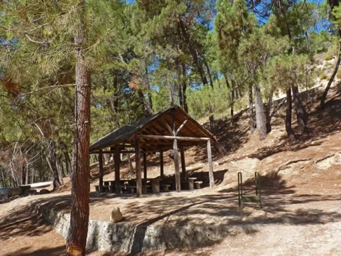
Llegamos al Área Recreativa de Los Estrechos que nos encontraremos a nuestra izquierda. Cuenta con un techado de madera con mesas para comer, además de una magnífica fuente y sombras. Si continuáramos por la pista que traemos llegaríamos muy pronto a la gran piscina municipal de Amurjo, a 1,2 kilómetros, de excepcionales dimensiones y rodeada de pinares y roquedos. Después de otros 0,8 kilómetros alcanzaríamos Orcera entrando por su encantador casco viejo.

Para continuar nuestra etapa desde Los Estrechos tomamos un delicioso camino de herradura. Caminando bajo los pinos carrascos, con muy poco desnivel, iremos viendo el monte Peñalta, hasta que la perspectiva se abre hacia Orcera, los torreones hispano-musulmanes de Santa Catalina y los ondulados olivares del valle del Trujala.

Más adelante, tras pasar por un olivar, ganamos altura por el camino tradicional que durante siglos fue transitado por las gentes que circulaban entre los pueblos de Orcera y Segura de la Sierra, y que es muy panorámico en algunos tramos. Aparece ante nuestra vista la inconfundible mole de El Yelmo, la montaña más emblemática de esta zona del parque natural, y más al sur, la línea de cumbres de la Sierra de Las Villas.

Km 19,6

Segura de la Sierra


La etapa finaliza en Segura de la Sierra, un pequeño pueblo declarado Conjunto Histórico-Artístico, cuya vista ya enamora desde que empezamos a divisarlo desde el sendero Bosques del Sur, con sus casitas blancas ciñéndose al perfil del monte coronado por un castillo de origen musulmán, que alberga el Espacio Temático del Territorio de Frontera. Pasear sin prisa por sus calles estrechas, descubrir los detalles y rincones de su arquitectura popular y extasiarse con las panorámicas que se abren en todas las direcciones es una de las experiencias más gratificantes que depara el sendero Bosques del Sur. Visitar el pueblo llegando en vehículo es agradable para todo el mundo, pero llegar a él caminando nos permitirá sentir con más autenticidad su esencia, ya que el origen histórico de su emplazamiento fue defensivo, y por tanto la altitud y la dificultad de acceso constituyen el sentido original de Segura de la Sierra.

En esta misma población, cerca del acceso al castillo y a la carretera de salida hacia Siles-Pontones (Ctra. de La Cumbre), el GR te ofrece una alternativa al trazado principal: la variante GR 247.1 (más información en la página 231), que en dos jornadas conecta directamente con las etapas 19 y 20, pudiendo cerrar un circuito completo con las etapas del norte del GR 247.

Live a unique gastronomic experience in the Sierra de Segura with Silvestres Laboratorio Gastronómico

Submitted by brandcode_deweloper on
Id
13487044
Descripción
Descripción larga
From their laboratory in Pontones, on the banks of the Segura River, the participants will know the surroundings of the surrounding saw, participate in a workshop where they will learn different culinary techniques and culminate the experience by savoring the result of their work, accompanied by some of the seasonal elaborations of Silvestres. The products of this land will be the protagonists: wild fruits and roots, aromatic herbs or seasonal mushrooms, this will depend on the time when participants are encouraged to enjoy. Various processes that will transform the product into something unique will be used to allow participants to live a culinary experience where innovation and tradition intertwine. Each experience will be different, created to surprise the participants with the unexpected and connect their senses to the soul of the saw, as they learn, enjoy and marvel at what nature and science can achieve together.
Telecomunicaciones
Teléfono
623 911 904
Ubicación
Latitud
38.118878
Longitud
-2.670939
Dirección
Plaza Príncipe de España, 8. Pontones
Ubicación en el mapa
POINT (-2.670939 38.118878)
Imágenes
imagen
Image
_mg_6695-jpg
Imagen principal
Activado
Horario de apertura
All year round
Precio
75.00€
Idiomas
Loading map
Preparing points of interest and routes...
Duración
4 h
Que incluye
Each participant shall carry its processed product.
A tener en cuenta
Self-vehicle.
Enlace reserva
www.bysilvestres.com
Aforo
A maximum of 15 people are established to carry out the activity.

Enjoy a stay with a unique fishing day experience at Casa Josefa

Submitted by brandcode_deweloper on
Id
13470480
Descripción
Descripción larga
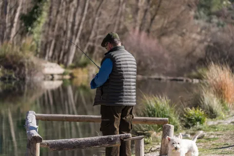
Casa Josefa is an accommodation located in Pozo Alcón, where you can enjoy the life of the village and meet its neighbors. Fully equipped with fireplace for use in winter, it offers a weekend stay with an experience that will not leave you indifferent. The trade of fishing is one of the oldest and helps to feed from an ancient time. At the hand of a specialist guide and with the necessary equipment the participants will move to the River Peralta to the Intensive Fishing Cote, where fishing is allowed. Located on the river bank, along the course of the activity you will be given the necessary recommendations so that you can enjoy the art of fishing and get some trout that you can take to the accommodation to cook with the traditional recipes that Casa Josefa will provide. There will also be a circular route along the peralta river that begins in the Forest of the Higueras, a natural environment surrounded by vegetation and water streams where it can be refreshed when it is hot, as well as enjoy the shade. At the end, you can enjoy the recreational area and take a snack. Not including: • Only accommodation. • Specialist guide on fishing. • Material.
Telecomunicaciones
Teléfono
645 936 519
Ubicación
Latitud
37.878499
Longitud
-2.901674
Dirección
C/ Tosa, 5
Municipio
Ubicación en el mapa
POINT (-2.901674 37.878499)
Imágenes
imagen
Image
dsc09805-jpg
Imagen principal
Activado
Horario de apertura
March to October
Precio
470.00€
Idiomas
Loading map
Preparing points of interest and routes...
Duración
Minimum stay: 2 nights
A tener en cuenta
Self-vehicle.
Enlace reserva
www.casasruralescazorlapozoalcon.com
Aforo
A minimum of 6 persons and a maximum of 8 persons are established to develop the activity.

Experience the sunset with the flavor of our land at Aleuri Olympo

Submitted by brandcode_deweloper on
Id
13467841
Descripción
Descripción larga
The Aleuri Olympo Restaurant, located in La Iruela, with wonderful views of the Sierra de Cazorla from where you can see the legacy of olive trees characteristic of these landscapes and enjoy a unique sunset, accompanied by a gastronomic experience with products from the area, prioritizing the local and seasonal nature park of the Serras de Cazorla, Segura and Las Villas. The journey begins at the moment when the sun begins to fall, at the tables of its window, combining the traditional cuisine, the product of proximity, and all under the look of innovation and music. The experience consists of an oil tasting Aleuri 70 / 30 of its own micro plot, followed by a rin ran appetizer, a typical dish of the area made with its traditional recipe. It is completed with a consummation, where it is recommended to enjoy the wines of proximity of Campoameno Syrah Barrica of the Sierra Sur de Jaén. The proposal varies according to the season, highlighting local products, and is designed for vegans, vegetarians and people with gluten or lactose intolerances. Undoubtedly, an integral experience in a unique environment.
Telecomunicaciones
Teléfono
623 152 125
Ubicación
Latitud
37.922614
Longitud
-2.994011
Dirección
Carretera de Burunchel, 3
Municipio
Ubicación en el mapa
POINT (-2.994011 37.922614)
Imágenes
imagen
Image
_mg_3821-3-jpg
Imagen principal
Activado
Horario de apertura
All year round
Precio
9.90€
Idiomas
Loading map
Preparing points of interest and routes...
Duración
2 h
Que incluye
Dinner.
A tener en cuenta
At the time of booking it is necessary to warn of food allergies and intolerances. Self-vehicle.
Enlace reserva
https://www.instagram.com/aleuriolympo/

Visit and craft beer tasting at Cervezas La Yedra

Submitted by brandcode_deweloper on
Id
13191489
Descripción
Descripción larga
Guided tour of an authentic independent artisan beer factory located in the heart of the Natural Park Sierras de Cazorla, Segura and Las Villas Discover the fascinating world of artisan beer and be surprised by the unique flavors of its original beers, through a guided tour of its small factory, where you will know the process of making. After the visit you will enjoy a tasting of 3 different styles of your artisan beers accompanied by a small snack with typical Cazorla products.
Telecomunicaciones
Teléfono
644 194 423
Ubicación
Latitud
37.918209
Longitud
-3.022187
Dirección
C/ Levante, 50B. Pol. Ind. Cerro del Cabezuelo
Municipio
Ubicación en el mapa
POINT (-3.022187 37.918209)
Imágenes
imagen
Image
cervezas-la-yedra-_cca3853-jpg
Imagen principal
Activado
Horario de apertura
All year on request
Precio
13.00€
Loading map
Preparing points of interest and routes...
Duración
2 h
Tipo de experiencia
Que incluye
Deustation of 3 types of beers accompanied by a small appetizer made with typical products from Cazorla from local producers
A tener en cuenta
Book in advance via the web or by phone 644194423 / 634059732.
Enlace reserva
https://www.cervezaslayedra.es/
Aforo
Maximum 10 people

Visit Villanueva del Arzobispo through the eyes of its most famous characters with its Tourist Information Point

Submitted by brandcode_deweloper on
Id
13485200
Descripción
Descripción larga
Villanueva del Archbishop, located at the entrance of the Natural Park of the Sierras de Cazorla, Segura and Las Villas, stands out for his historical and architectural legacy, reflected in his master houses. During this guided tour, you will go through the narrow streets of the historic centre, beginning at the Parish of San Andrés, a temple of great magnitude. The route continues through the convent of Santa Ana and the City Hall, a recently restored solarium house. The Plaza Mayor is visited, where the Casa de los Arcos is located, which has been awarded the prize for provincial beautification for its façade and its interior, and also its courtyard reminds those of the Nazari era. The tour follows to the Casino or Círculo Mercantile, a building designed by Manuel López Ramírez. The visit culminates in the Church of the Vera Cruz, home to the image of the Christ of the Vera Cruz, pattern of the town, work of Mariano Benlliure. Along the itinerary, there will be known prominent characters in the history of Villanueva del Archbishop, whose influence continues in the culture and traditions of the municipality. Reservations via phone 607184628.
Telecomunicaciones
Teléfono
607 184 628
Ubicación
Latitud
38.169581
Longitud
-3.010126
Dirección
Av. de la Constitución, 5
Ubicación en el mapa
POINT (-3.010126 38.169581)
Imágenes
imagen
Image
_mg_5156-jpg
Imagen principal
Activado
Horario de apertura
All year from Wednesday to Sunday.
Precio
0.00€
Idiomas
Loading map
Preparing points of interest and routes...
Duración
2 h 30 min
Que incluye
Guided tour.
A tener en cuenta
Comfortable footwear.
Enlace reserva
www.villanuevadelarzobispo.es/turismo
Aforo
A maximum of 60 people are established to develop the activity.

Interpretive visit to Cortijo La Vicaría cheese dairy with tasting

Submitted by brandcode_deweloper on
Id
13205404
Descripción
Descripción larga
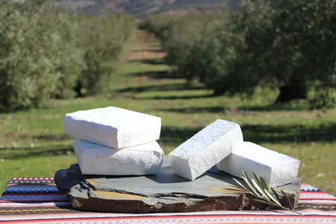
Guided visit to our cheese shop where you will learn the process of making the different varieties of cheese from frescoes to cures. After the visit you will enjoy a guided tasting of 7 varieties of our cheeses accompanied by other artisanal products of the Sierras such as honey or AOVE with D.O Sierra de Cazorla.
Telecomunicaciones
Teléfono
635 564 592
Ubicación
Latitud
38.348919
Longitud
-2.811021
Dirección
Pol. Ind. La Vicaría. Paseo de la Vicaría, s/n. Puente de Génave
Distrito
Municipio
Ubicación en el mapa
POINT (-2.811021 38.348919)
Imágenes
imagen
Image
img_4605-jpg
Imagen principal
Activado
Horario de apertura
All year round (prior reservation)
Precio
5.00€
Idiomas
Loading map
Preparing points of interest and routes...
Duración
1 h 30 min
Tipo de experiencia
Que incluye
Possibility to buy in store the tasted cheeses
A tener en cuenta
Book with previous appointment on phone / WhatsApp: + 34 635 564 592
Enlace reserva
https://www.queserialavicaria.com
Aforo
Minimum 15 - maximum 30 persons

Visit to the oil mill, tasting and/or millers breakfast

Submitted by brandcode_deweloper on
Id
13208527
Descripción
Descripción larga
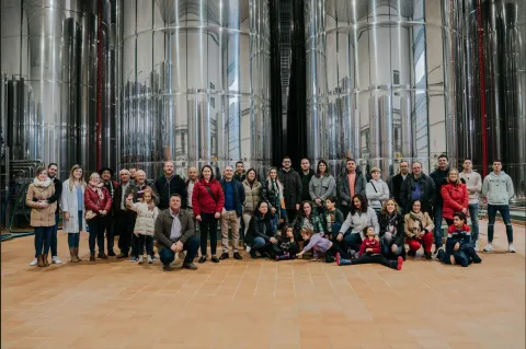
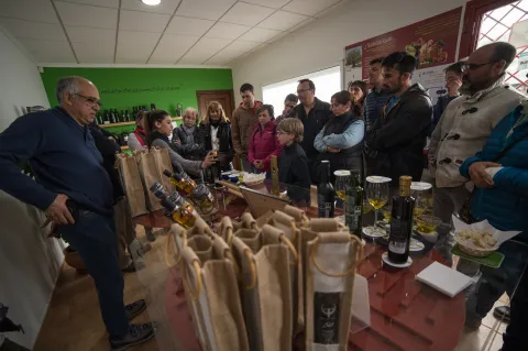
We invite you to embark on a sensory and gastronomic journey through a unique natural environment. In our visits you will know the process of making the AOVE and the centenary gastronomic tradition that has forged the personality and culture of Mogón and our people throughout many generations. We will start the day with a breakfast mill, enjoying a tasting of the different types of olive oil accompanied by local products.
Telecomunicaciones
Teléfono
661 552 126
Ubicación
Latitud
38.062581
Longitud
-3.042785
Dirección
Carretera, Km. 9,2. Mogón
Municipio
Ubicación en el mapa
POINT (-3.042785 38.062581)
Imágenes
imagen
Image
bodega_puertadelasvillas-jpg
Imagen principal
Activado
Horario de apertura
All year (necessary prior reservation)
Precio
15.00€
Idiomas
Loading map
Preparing points of interest and routes...
Duración
1 h 30 min
Tipo de experiencia
Que incluye
Tasting AOVES Puerta de Las Villas and / or breakfast mill
A tener en cuenta
To book: 48 hours in advance, on our website, by phone or WhatsApp 661 552 126 or commercial email @ puertadelasvillas.com
Enlace reserva
https://www.puertadelasvillas.com/oleoturismo/
Aforo
Minimum 4 people, maximum 20 (for larger groups consult availability)

Visit to the Oleofer oil mill and tasting

Submitted by brandcode_deweloper on
Id
13203214
Descripción
Descripción larga
Immerse yourself in the culture of extra virgin olive oil and enjoy a fantastic experience learning all the secrets of our liquid gold in a wonderful setting of the Natural Park Sierras de Cazorla, Segura and Las Villas You can see first hand what the AOVE process is like from the time the olive reaches our factory until it is packaged and put on sale. You will know the different types of olive trees, collection methods, olive varieties and much more, and you will end up tasting our Tavara Lands oils.
Telecomunicaciones
Teléfono
697 224 745
Ubicación
Latitud
38.361455
Longitud
-2.786601
Dirección
Carretera La Puerta de Segura-El Puente
Distrito
Ubicación en el mapa
POINT (-2.786601 38.361455)
Imágenes
imagen
Image
cata_oleofer-jpg
Imagen principal
Activado
Horario de apertura
All year round (prior reservation)
Precio
10.00€
Idiomas
Loading map
Preparing points of interest and routes...
Duración
1 h 30 min
Tipo de experiencia
Que incluye
Visit to Almazara Debustion of AOVES Tavara Lands
A tener en cuenta
To book: At least one day in advance by phone at 697 22 47 45 or by email contact @ oleofer.com
Enlace reserva
https://www.miaceiteadomicilio.com/oleoturismo/reservar-visita/
Aforo
Minimum 2 people - maximum 25-30 people