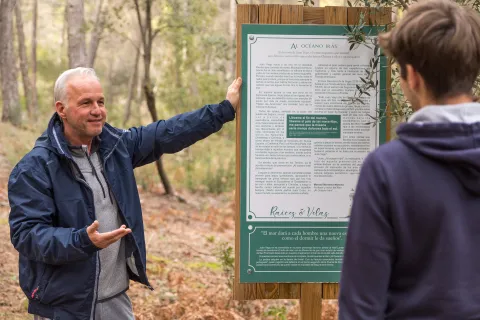
Enjoy a stay at Cortijo de Ramón between "Roots and Candles"
Day 1.
Arrived at the accommodation.
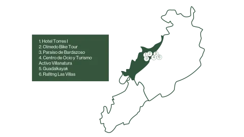
Defeat the liquid gold of Jaén from the hand of the Hotel Torres I.
Duration of experience: Minimum stay of 1 night.
Price: 125 €/ adult.
Day 2.
Discover the Sierra de Las Villas by bike or by taking a route.
Option A.
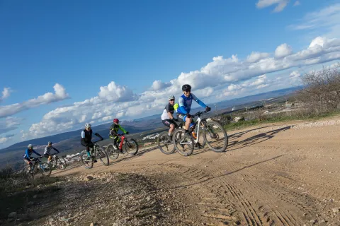
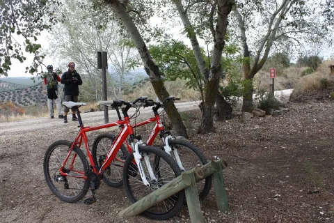
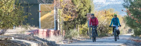
Explore the Natural Park of the saws of Cazorla, Segura and Las Villas by bicycle with Olmedo Bike Tour.
Duration of experience: 6 to 7 hours.
Price: 50 €/ group.
Option B.
Taste and adventure: Route and tasting gourmet in Paradise of Bardazoso.
Duration of experience: 5 hours.
Price: 50 €/ person.
Option C.
Change of accommodation.
Rural House and Active Tourism and Leisure Center Villanatura. Enjoy a day in a mountain olive grove.
Duration of experience: 5 hours.
Minimum stay of 1 night.
Price: 50 €/ person.
Day 3.
Adventure activities.
Option A.
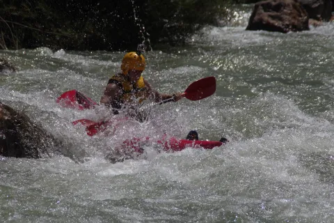
Rafting by the Guadalquivir River with Guadalkayak.
Duration of experience: 1 hour.
Price: adult 40 €/ person and children (under 14 years): 30 €/ person.
Option B.
Kayak waters by the Guadalquivir River with Guadalkayak.
Duration of experience: 3 hours.
Price: 50 €/ person.
Day 4
Initiation to the Via Ferrata El Rayo with Rafting Las Villas.
Duration of experience: 2 and a half hours.
Price: 35 €/ person.
(*) Prices may be subject to change.
A circuit designed for those who want to immerse themselves in the natural and cultural beauty of the Sierra de Las Villas. Various experiences of oleoturism are offered, where travelers will discover the process of making extra virgin olive oil, a real local treasure. On many occasions you can combine it with the rich gastronomy of the area, which offers local and quality products, highlighting its authentic flavors.
For nature and sport lovers, you can make bike routes or explore the river by practicing kayak or rafting, ideal for enjoying the landscapes of the saw from different perspectives.
A circuit that combines culture, sport and the pleasure of gastronomy, allowing to discover the Sierra de Las Villas in a unique and sustainable way.
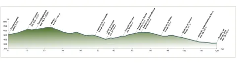
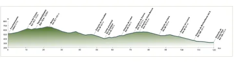
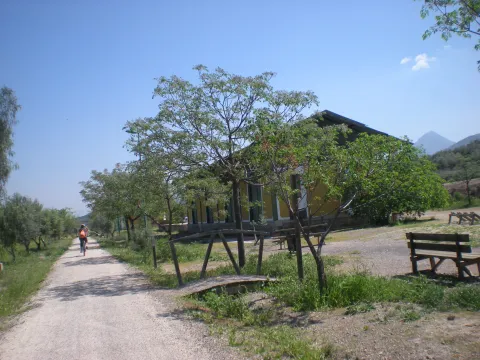
The tour begins at the edge of the city centre of Jaén, next to the municipal sports complex Las Fuentezuelas. The first 2 km, used by hiking and cycling, have several rest areas. From here on, we will cross, on a service road, the north-west circumvalation of Jaén to resume the trail to the town of Torredelcamp. After passing through a new alternative road that saves the A-316 motorway, we arrive at the Torredelcampo station (km. 11,100) located in this urban nucleus.
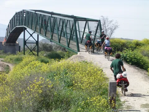
After two tunnels (the first lit 333 meters long), two viaducts and the rest area of the Quebradas, we will reach the nearby town of Torredonjimeno. From Torredonjimeno Station (Km. 1,600) we will continue in the direction of Martos, for which we will have to cross two long metal walkways that allow the crossing with the road A-316. La Via Verde crosses the city centre of Martos and offers the possibility to make interesting visits to the city.
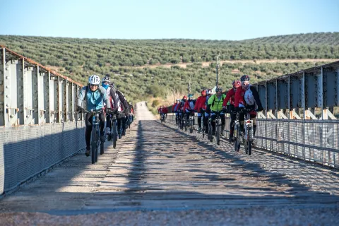
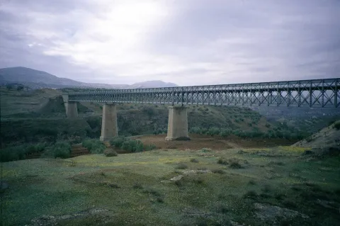
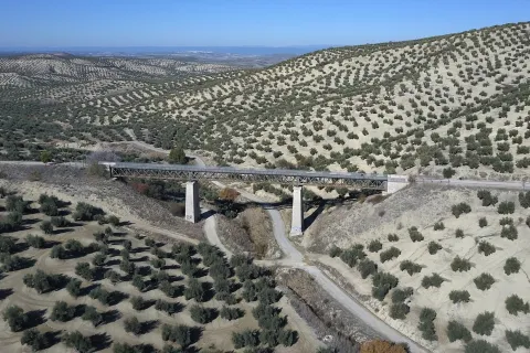
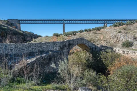
We left Martos, in a southwestern direction, towards the border with the province of Córdoba. New intersections with the national road are resolved by installing a lower step and a new gateway. In Km. 33, coinciding with the proximity of the Salado stream, the landscape changes and becomes more abrupt and serrano, already in the foothills of the Sierra Sur massif. The railway crosses rivers and streams in the middle of impressive ravines, through metal viaducts with lengths between 70 m and 224 m. These complex engineering works, which were designed by the French Alessandre and Delapierre, date back to the end of the 19th century, magnificent examples of oblonted architecture, and which constitute extraordinary views on the rural landscapes of the province of Jaén.
The rest area of the isolated station of Vado-Jaén is located at km 37. The old railway platform continues its course in the direction of the Alcaudete Station, passing the impressive viaduct on the Víboras River (224 m long and 80 m high), the remains of an abandoned balast quarry, called La Muela, and some sections of lush Mediterranean vegetation in which they stand out oak, retama and majajelos, as well as old almonds.
Leaving the Alcaudete station behind, at 48,400 km, we will reach a crossing with the A-316 road, saved by a high gateway.
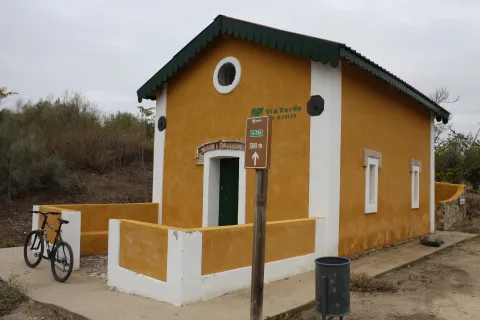
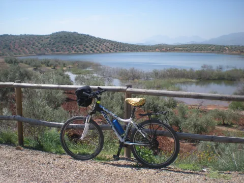
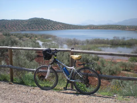
After passing through the building for the railway houses, the Green Way of Oil connects with the Biking Routes of Sierra Sur de Jaén (signposted), which enter the cycloturist in the heart of the massif of the same name, and runs right next to the Laguna Honda Natural Reserve (Km. 50,500); at this point you can see the abundant and rich avifauna that dwells in this 65 Has. wetland of extension: evil, real anade, squid or small zampullin.
On the right bank of the Green Way, a road leads to another natural space protected from the environment: the Natural Reserve of Laguna del Chinche, of 6.5 Has. of extension and with an interesting perilagunar vegetation. The last miles pass through a very eroded site where deep ravines are frequent, in whose slopes the thyme and the spartum occupy a land, not suitable for the olive tree, which sometimes offer excellent panoramic views of the Vadomojón reservoir. The jiennese part of the Green Way of Oil concludes on the great iron bridge over the Guadaljoz River, right in the tail of the reservoir, 199 m long.
From this point the green track connects with that of the Cordobese Subbetic.
6, from Jaén (The Fuentezuelas' polysports complex) and from each of the five stations.
Users: cyclists, walkers and wheelchair people.
Regardless of the way you decide to travel this route, it is recommended to use comfortable clothes and footwear and adapted to the time of the year. Although it is not convenient to do so in the middle of summer due to the heat. You must not forget to wear enough water and, if you go on a bike, it is always recommended to wear a helmet.
For more information visit:http: / / www.viasverdes.com
Cultural heritage: Monumental set of Jaén. The medieval castle of Alcaudete. Medieval Bridge of the Vipers. Archaeological route of the Torreones. Urban assemblies of Luque, Zuheros, Doña Mencía, Cabra and Lucena. Cueva de los Murcielagos en Zuheros.
Ramal a Baena: Urban complex of Luque and Baena, archaeological park of Torreparedones, the Historical and Archaeological Museum of Baena, church of the ancient Convent of the Agustinos Descalzo in Luque.
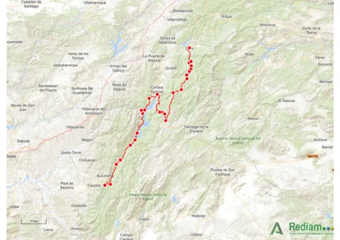
The starting point is located in the village of Vadillo-Castril. The latter is followed by the A-319 road that links the towns of Peal de Becerro and Hornos de Segura. We must take the detour located at the kilometer 31.7 and continue for 5 km by the JF-7091 until the entrance detour to Vadillo-Castril and the Training and Forest Experiment Centre.
The route has been broken down in stages, assuming that it will be of interest to cycloturists, although it could be carried out by car as it travels on roads open to traffic.
Coordinates 38.39197, -2,58255
Siles is a village of 2200 inhabitants located on the north end of the Natural Park. There is an old artificial pineapple sequero, which has been musealized and transformed into the current Centre for Interpretation and Reception of Visitors of the Sierra de Segura. It is located in the street Carretera de Hellín no. 21, and has several exhibition spaces that report on the natural values of the Sierra de Segura, the history of the human population in the territory, the serrano trades and, in an outstanding way, on the sequero itself, from which the original machinery is preserved.
This stage is part of Mount Navahondona, one of the areas of the Natural Park with the highest concentration of elements of the forest legacy, mainly because here the mountain engineer don Enrique Mackay worked during the first quarter of the 20th century. After descending through the Guadalquivir valley, following the route of the woods, it reaches the reservoir of the Tranco, where we can see a very unique artifact.
The route runs within a natural protected space rich in flora and fauna, which can be damaged by incivious and unenvironmentally friendly behaviour. The regulations of the Natural Park prohibit both the collection of plants and the capture of animals. You can't light fire either. Along the course, there are different accommodation and restoration options.
Elements of the Forest Legacy Catalogue to be visited: Sheet number 1, 6, 9, 12.17, 32 and 44.
The starting point is located in the village of Vadillo-Castril. The latter is followed by the A-319 road that links the towns of Peal de Becerro and Hornos de Segura. We must take the detour located at the kilometer 31.7 and continue for 5 km by the JF-7091 until the entrance detour to Vadillo-Castril and the Training and Forest Experiment Centre.
The route has been broken down in stages, assuming that it will be of interest to cycloturists, although it could be carried out by car as it travels on roads open to traffic.
Shortly after the fifth bridge, it is recommended to continue to the left, where it is already incorporated into a wider road, right next to a rural house called "Nace el Río." If you go ahead, there are two ways to return, or on a road to the left that goes down to the same point of departure, or you can follow the right by a road called "Paseo del Solar," which when you reach the village allows you to go down to the Plaza de Santa María again.
The first option would be about an hour, the second option would be half an hour more, but it is worth the beautiful views we have from the viewpoints. Both routes are very simple so they are perfect for those trails who want to go for a walk or families with children. But they are also ideal to discover the most beautiful corners of the area without making an intense effort, being able to enjoy the road to the maximum.
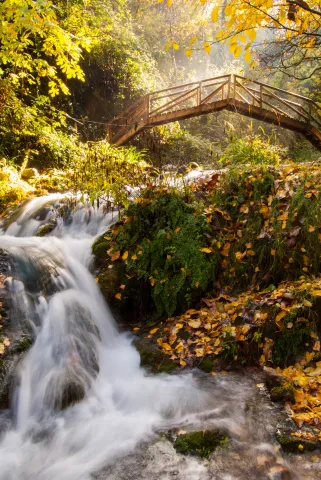
In the direction of the Castle of the Yedra we run into a small square where to the right it is moving towards the Castle, and to the left it is already marked the beginning of this circular route, which will enter into a space closed by large chopos that, in combination with the crystal waters of the river forming pozas, will make our journey an unparalleled environment to enjoy nature. Using the various wooden bridges, you can cross the river to continue this magnificent expedition.
Wear adequate clothing and footwear.
About 200 m behind the ruins of Santa Maria.
The tour begins at the edge of the city centre of Jaén, next to the municipal sports complex Las Fuentezuelas. The first 2 km, used by hiking and cycling, have several rest areas. From here on, we will cross, on a service road, the north-west circumvalation of Jaén to resume the trail to the town of Torredelcamp. After passing through a new alternative road that saves the A-316 motorway, we arrive at the Torredelcampo station (km. 11,100) located in this urban nucleus.
After two tunnels (the first lit 333 meters long), two viaducts and the rest area of the Quebradas, we will reach the nearby town of Torredonjimeno. From Torredonjimeno Station (Km. 1,600) we will continue in the direction of Martos, for which we will have to cross two long metal walkways that allow the crossing with the road A-316. La Via Verde crosses the city centre of Martos and offers the possibility to make interesting visits to the city.
We left Martos, in a southwestern direction, towards the border with the province of Córdoba. New intersections with the national road are resolved by installing a lower step and a new gateway. In Km. 33, coinciding with the proximity of the Salado stream, the landscape changes and becomes more abrupt and serrano, already in the foothills of the Sierra Sur massif. The railway crosses rivers and streams in the middle of impressive ravines, through metal viaducts with lengths between 70 m and 224 m. These complex engineering works, which were designed by the French Alessandre and Delapierre, date back to the end of the 19th century, magnificent examples of oblonted architecture, and which constitute extraordinary views on the rural landscapes of the province of Jaén.
The rest area of the isolated station of Vado-Jaén is located at km 37. The old railway platform continues its course in the direction of the Alcaudete Station, passing the impressive viaduct on the Víboras River (224 m long and 80 m high), the remains of an abandoned balast quarry, called La Muela, and some sections of lush Mediterranean vegetation in which they stand out oak, retama and majajelos, as well as old almonds.
Leaving the Alcaudete station behind, at 48,400 km, we will reach a crossing with the A-316 road, saved by a high gateway.
After passing through the building for the railway houses, the Green Way of Oil connects with the Biking Routes of Sierra Sur de Jaén (signposted), which enter the cycloturist in the heart of the massif of the same name, and runs right next to the Laguna Honda Natural Reserve (Km. 50,500); at this point you can see the abundant and rich avifauna that dwells in this 65 Has. wetland of extension: evil, real anade, squid or small zampullin.
On the right bank of the Green Way, a road leads to another natural space protected from the environment: the Natural Reserve of Laguna del Chinche, of 6.5 Has. of extension and with an interesting perilagunar vegetation. The last miles pass through a very eroded site where deep ravines are frequent, in whose slopes the thyme and the spartum occupy a land, not suitable for the olive tree, which sometimes offer excellent panoramic views of the Vadomojón reservoir. The jiennese part of the Green Way of Oil concludes on the great iron bridge over the Guadaljoz River, right in the tail of the reservoir, 199 m long.
From this point the green track connects with that of the Cordobese Subbetic.
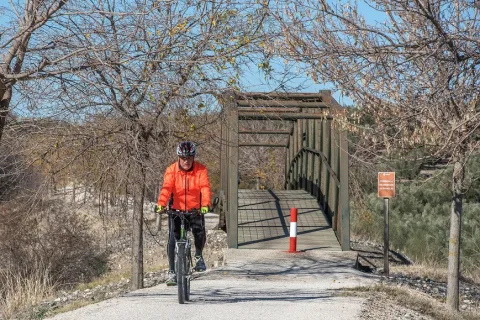
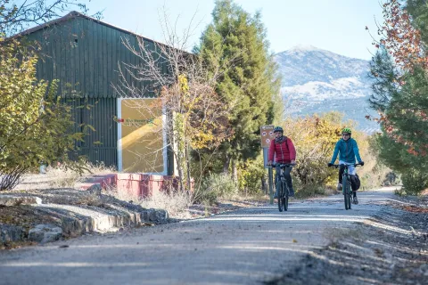
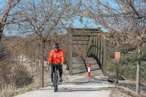
The Green Way of Oil is presented as a new and attractive offer of interior tourism based on the development and recovery of the infrastructure of the old abandoned railway Jaén-Campo Real (Córdoba) as a green corridor, for the practice of cycling, hiking and other sports in direct contact with nature.
Built between 1882 and 1893, this railway belonged to the line Linares- Puente Genil, which was dedicated throughout much of the 20th century to the transport of different metals from the linarian mines and, especially, from the abundant olive oil to the port of Málaga and the markets of the southern Peninsula, so it was popularly called the Oil Train. Technical and commercial reasons motivated their abandonment in 1971, and the transport of passengers and goods was finally closed on 1 January 1985.
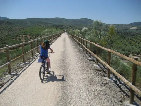
All of its layout, from Jaén to the provincial limit, runs by sepentating olive-countryside grounds that make up a landscape of authentic olive-sea splattered by typical Andalusian cortijos. The presence of the Serras de Jabalcuz, la Grana, la Caracolera and del Achillos, located very close to the South and the East of the Via Verde, provide diversity to the relief and the landscape.
6, from Jaén (The Fuentezuelas' polysports complex) and from each of the five stations.
Users: cyclists, walkers and wheelchair people.
Regardless of the way you decide to travel this route, it is recommended to use comfortable clothes and footwear and adapted to the time of the year. Although it is not convenient to do so in the middle of summer due to the heat. You must not forget to wear enough water and, if you go on a bike, it is always recommended to wear a helmet.
For more information visit:http: / / www.viasverdes.com
Cultural heritage: Monumental set of Jaén. The medieval castle of Alcaudete. Medieval Bridge of the Vipers. Archaeological route of the Torreones. Urban assemblies of Luque, Zuheros, Doña Mencía, Cabra and Lucena. Cueva de los Murcielagos en Zuheros.
Ramal a Baena: Urban complex of Luque and Baena, archaeological park of Torreparedones, the Historical and Archaeological Museum of Baena, church of the ancient Convent of the Agustinos Descalzo in Luque.