Saltar al contenido principal

Greenwaand (Vía Verde) de Segura

Submitted by brandcode_deweloper on
Id
6591286
Descripción larga

Km 114.5

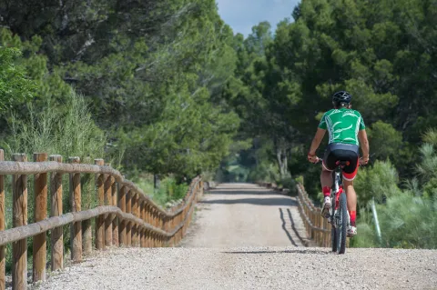
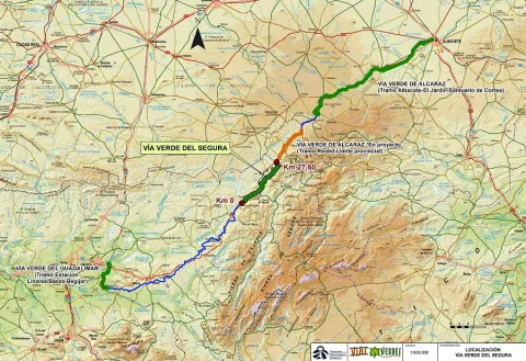
The Segura Natural Trail–Greenway, promoted by the Provincial Council of Jaén and developed by the Ministry of Agriculture, Fisheries and Food in 2015, is a truly unspoilt route surrounded by nature and landscapes. Visitors should be aware that the nearby towns, and therefore opportunities to obtain supplies, are located some distance from the route. It begins beside the kilometre 217 marker on the Bailén–Albacete national road (N-322), two kilometres from Arroyo del Ojanco and one kilometre from its abandoned railway station. There is no designated car park on the left-hand side of the road when travelling towards Albacete, although there is sufficient space to park several vehicles. Information panels and signs indicate the starting point.

The first kilometre descends towards the Guadalimar River viaduct, a monumental concrete structure with a 175-metre-long deck supported by five wide arches. The viaduct also provides an exceptional viewpoint overlooking the river’s gallery forest. The Guadalimar River is the lowest point on the route.

After crossing the Guadalimar River, the route of the former railway has been occupied for 1.5 km by the access road to a biogas plant. The alternative is a parallel path which, in order to negotiate the overpasses, includes several ascending and descending slopes.

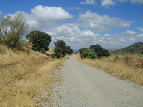
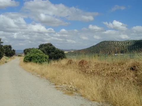
When the asphalt road branches away at km 118, the route once again takes over the former railway platform. The Segura Greenway regains the advantages of the original railway route and begins a long journey through a landscape of rolling hills, dominated by orderly rows of olive trees and alternating areas of uncultivated land covered with Spanish broom, dotted with isolated trees and small patches of pine forest. In the distance, high mountains rise on both sides, their olive groves extending upwards until they meet the dense pine forests crowning the summits.

Across such difficult terrain, the railway was able to maintain long straight sections thanks to its most characteristic engineering structures. High embankments built over stream valleys alternate with cuttings through raised terrain and cut-and-cover tunnels in places where the earthy walls of the cuttings were too unstable.

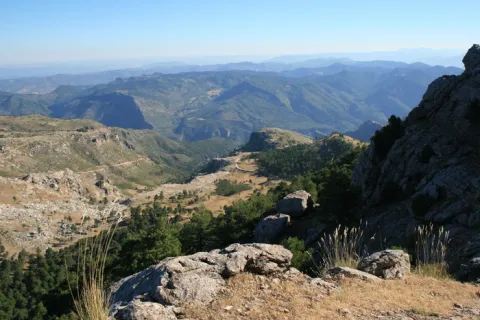
From km 122 onwards, it becomes easier to see a deep gorge opening in the mountain range that closes off the southern horizon on the right. The Guadalimar River has carved a passage through the Sierra de Segura, where the town of La Puerta de Segura occupies a strategic location. In the distance, beyond the gorge and perched on a hill, the castle and village of Segura de la Sierra can be seen overlooking the boundaries of the Sierras de Cazorla, Segura y Las Villas Natural Park.

Within sight of the hamlet of La Agracea, at km 124.5, there is another important point on the route. A shooting range stands to one side, and its bar is the only place near the greenway where visitors can obtain supplies. 

Km 125

At km 125, the original route of the Baeza–Utiel railway has been severed by the N-322 road. The gravel path ends at the intersecting JV-7001 road. As the former railway alignment has disappeared, the alternative is to share the lightly trafficked road with other vehicles. Turning right, the road rises over an overpass and crosses above the N-322 in the direction of La Puerta de Segura, located 6 km from the greenway. This interruption, which is clearly signposted, is marked by an old steamroller raised on an unusual pedestal: a former railway track overpass.
Around 200 metres further on, a gravel track on the left descends to rejoin the original railway alignment and allows vehicles to reach the car park provided beside the first station on the route.
 
The former Puente de Génave station, at km 125.3, follows the same architectural design as the other stations. It consists of a main passenger building and a goods warehouse, each with its respective platform. Here, however, there is also a livestock loading platform, which is not present at the other stations, alongside which a rest area has been provided.
 
It is worth mentioning that there is a new 5 km cycle lane between the town of Puente de Génave and La Puerta de Segura. This provides an excellent opportunity to reach this beautiful town and the heart of the Natural Park safely.
 
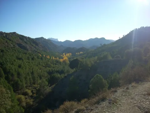
Beyond the station, the railway route winds around the courses of the Gavilán and Moral streams. The alignment curves around deep valleys with steep slopes. In this unspoilt environment, pine forest begins to spread towards the route, first reaching it through the intermittent ravines crossed by high embankments and eventually becoming the dominant feature. The pine trees enhance the route between the hamlet of Bonache, at km 126.7, shortly before crossing into the Natural Park, and the cutting at km 129. This section includes a rest area at km 128.2, an idyllic place to stop, where the greenery and shade of the pine trees create an oasis.

As the route crosses the Sierras de Cazorla, Segura y Las Villas Natural Park, the dominant landscape of olive groves and uncultivated land returns. The vegetation changes, but the surrounding stream valleys continue to shape the route. The Segura Greenway then enters a large cutting with high rocky walls that curves to the left, rises over two high embankments providing views across the deep valley and finally passes underground. The Génave Tunnel, at km 132, is the longest on the route and consists of a straight, 277-metre gallery in excellent condition. However, it has no lighting, so visitors are advised to bring a torch or bicycle lights.

Km 133.5

A long straight section through uncultivated land leads to Génave station, at km 133.5, where there is a rest area, a car park and access from the Génave road, the JV-7053.

Beyond Génave station, the rolling landscape returns. The former railway platform once again follows long straight sections between olive groves and uncultivated fields. The surroundings are similar, although the panoramic views are different. On the left-hand side, towards the north, Sierra Morena gradually descends and the landscape opens up. The view extends across the boundaries of the province of Jaén and may even reach the Campos de Montiel region in Ciudad Real. 

Km 137

The section through the Natural Park comes to an end beside an overpass near the Santa María farmhouse. The ruined buildings and rugged surroundings create a strong sense of isolation. From this farmhouse onwards, the landscape changes radically. Olive groves are no longer ever-present. They continue to dominate the distant mountains, but along the edges of the route they alternate with fields of herbaceous crops and uncultivated land covered with Spanish broom and holm oaks. The latter even form a small woodland extending for around one hundred metres.
 
Villarrodrigo station, at km 140, has a rest area and an access point. Beyond the station lies the final section of the route: a gentle 1.5 km descent through flat cereal fields. The Segura Greenway ends at the provincial boundary with Albacete, at km 141.5. However, the journey can continue for another 19.5 km along the Sierra de Alcaraz Greenway, or even as far as the city of Albacete, although a further 16 km section beyond Reolid station and towards the town of Alcaraz has not yet been restored. 

Facilities
Information and evacuation panels, direction signs, railings, bollards and replanted vegetation along the edges of the route. Rest areas with tables, benches, litter bins and bicycle parking facilities. Access points at the stations.
 
The beginning of the Segura Greenway is marked as km 114.5 with a view to its future integration with other already signposted sections in both Jaén and Albacete. At km 131.5, there is an original series of railway markers bearing the initials B-U, standing for Baeza–Utiel. These belonged to the former Baeza–Utiel railway, whose starting point, km 0, was located in Linares. 

Breve descripción

The route of the old Baeza railway - Use its steps in the province of Jaén in the region of the Sierra de Segura. On the way to the province of Albacete, it unfolds between a landscape of lomas and hills dominated by the olive grove. And one of its sections goes through the Natural Park Sierras de Cazorla, Segura and Las Villas.

This Natural Road - Via Verde has been implemented under the Natural Walking Programme of the Ministry of Agriculture, Food and the Environment.

Latitud
37.7796
Longitud
-3.7849
Distrito
Municipio
Ubicación en el mapa
POINT (-3.7849 37.7796)
imagen
Image
PA200236%20-%20copia.jpg
Imagen principal
Activado
imagen
Image
PA200223%20-%20copia.jpg
Imagen principal
Desactivado
imagen
Image
Foto%201_RAF1305.jpg
Imagen principal
Desactivado
imagen
Image
Foto%202_RAF1230.jpg
Imagen principal
Desactivado
imagen
Image
Foto%203_RAF1232.jpg
Imagen principal
Desactivado
imagen
Image
Foto%204-203237.png
Imagen principal
Desactivado
imagen
Image
Foto%205_RAF1295.jpg
Imagen principal
Desactivado
imagen
Image
Foto%207_RAF1315.jpg
Imagen principal
Desactivado
imagen
Image
PA200215%20-%20copia.jpg
Imagen principal
Desactivado
imagen
Image
PA200280%20-%20copia.jpg
Imagen principal
Desactivado
imagen
Image
DGJK5601.jpg
Imagen principal
Desactivado
imagen
Image
thumb.png
Imagen principal
Desactivado
imagen
Image
PA200265%20-%20copia.jpg
Imagen principal
Desactivado

Friends

icon-intereses-amigos

Nature

icon-intereses-naturaleza

Solo travel

icon-intereses-viajar-solo

Gastronomy

icon-intereses-gastronomia

For couples

icon-intereses-en-pareja

Family

icon-intereses-familia

Adventure

icon-intereses-aventura

Culture

icon-intereses-cultura

Sport

icon-intereses-deporte

Municipality

icon-intereses-municipio

Low-cost tourism

icon-intereses-turismo-low-cost

Eco-friendly

icon-intereses-eco-friendly
Medium
Image
d3c1c77a-e613-630f-1a91-091aa05883f1?t=1604419293738
Vía Verde de Segura
27 km
Suitable though difficult between the km. 116.2 and 117.7.
All year round
Desactivado
Image
1bce61fa-87f2-0deb-4b00-f9ee11d10e13?t=1607013708900

Between the km 217 of the N-322 road (municipal term of Arroyo del Ojanco) and the provincial limit Jaén-Albacete (T.M. de Villarrodrigo).
Tramo de asfalto o cemento
 
Tramo de pista o camino forestal
 
Tramo de vía pecuaria
 
Tramo de senda
 

Greenwaand (Vía Verde) de Vadollano

Submitted by brandcode_deweloper on
Id
6585625
Descripción larga

This Green Way has 2 protected natural spaces located within a radius of less than 5 km: ZIC of the Guadalimar River (Red Natura 2000) and the El Pibat Natural Monument. In addition, it is possible to learn more about these natural spaces protected by the Laguna Grande Information Point.

ZIC of the Guadalimar River:In this natural space, red clays and sands are common. This area is part of the medium mountain serranies of the Sierras de Cazorla and Segura, predominating the landscape of mountain-standing countryside (Cuenca del Guadalimar). The final section is characterized by the landscape of the Vega del Guadalquivir. The river is important for species such as calandino, the Boga del Tajo and the Boga del Guadiana.

The Pat Natural Monument:This Natural Monument, located in the area of contact between the countryside and the foothills of Sierra Morena, houses a stretch of the river Guarrizas of extraordinary landscape and natural value. In the higher areas the landscape is rough and the river is attached to the huge granite blocks. The channel has to save a number of levels by producing two small waterfalls. Below, the arms of the river are reunited in a deep remnant. The riverside vegetation is in good condition of conservation, highlight species like the strawberry, with examples of a remarkable size. Among the fauna are the birds, among which is the black millano.

Breve descripción

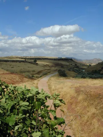
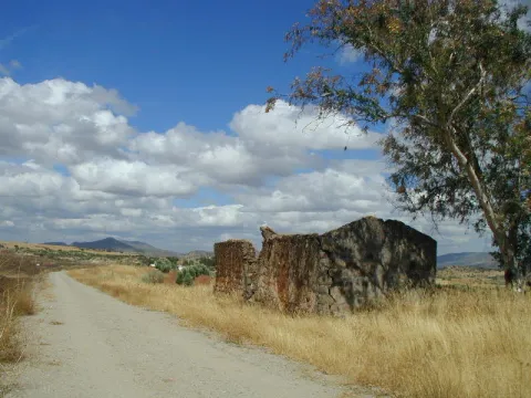
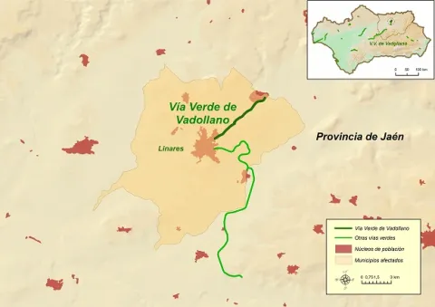
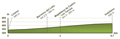
The Vadollano Green Way runs through the old route of the Linares- Vadollano railway road, from the old Santana factory to the access doors of the Army Station Headquarters in Vadollano, from which rail and naughty remains can be observed, which over the years have been covered with vegetation and are virtually unpassable.

Latitud
37.7796
Longitud
-3.7849
Distrito
Municipio
Ubicación en el mapa
POINT (-3.7849 37.7796)
imagen
Image
Vadollano00.jpg
Imagen principal
Activado
imagen
Image
Vadollano04.jpg
Imagen principal
Desactivado
imagen
Image
Vadollano01.jpg
Imagen principal
Desactivado
imagen
Image
Vadollano03.jpg
Imagen principal
Desactivado
imagen
Image
Vadollano05.jpg
Imagen principal
Desactivado
imagen
Image
Vadollano02.jpg
Imagen principal
Desactivado

Nature

icon-intereses-naturaleza

Friends

icon-intereses-amigos

Adventure

icon-intereses-aventura

Culture

icon-intereses-cultura

Sport

icon-intereses-deporte

Eco-friendly

icon-intereses-eco-friendly

For couples

icon-intereses-en-pareja

Family

icon-intereses-familia

Gastronomy

icon-intereses-gastronomia

Municipality

icon-intereses-municipio

Low-cost tourism

icon-intereses-turismo-low-cost

Solo travel

icon-intereses-viajar-solo
Medium
Image
cf9c3d89-f6e2-4cbc-ef01-e6d4338688df?t=1604420899217
Vía Verde de Vadollano
6,7 km
Can be taken by foot, mountain bike and horse
All year round
Desactivado
Image
76052e72-0bfc-a949-04c2-bb067efc28ba?t=1607013534423
1

1 rest area

Regardless of the way you decide to travel this route, it is recommended to use comfortable clothes and footwear and adapted to the time of the year. Although it is not convenient to do so in the middle of summer due to the heat. You must not forget to wear enough water and, if you go on a bike, it is always recommended to wear a helmet.

For more information visit:http: / / www.viasverdes.com

Monumental set of Linares, mining and industrial heritage, ruins of the Ibero-Roman city of Catulo and centres of interpretation of the Landscape Minero and Metallurgy.

By car we recommend you access the Via Verde for the following access:

  • Access No 1: Linares, in the vicinity of the Factory of Santa Ana. GPS coordinates (decimal format): 38.105551 °, -3.620675 °.
  • Access No 2: Vadollano area, access from road A-312. GPS coordinates (decimal format): 38.139634 °, -3.570731 °.

By train:

  • Liners: Medium Distance, Madrid-Jaén Line and Long Distance of Renfe

Connections:

  • Jaén: 30 km to Linares.

GR-247 Bosques del Sur

Submitted by brandcode_deweloper on
Id
6480311
Breve descripción

The GR247is the largest hiking route in the largest natural space in Spain. The GR247 Forest of the South path offers you 478 km marked, along 21 main stages and 11 derivations to places of interest. The GR also has 3 variants, composed of two sections each, that will help you subdivide the layout, and make a version adapted to your interests and time available. You decide how to do it! Its tour will take you to the births of the Guadalquivir and Segura rivers, it will enter you by the mosaic of landscapes of this mountain: high mountain peaks, castles, forests, rivers and waterfalls, traditional roads, altiplanicies, villages and villages still inhabited, historical sets, olive groves and orchards. A great way to discover the flight of the broken bones, the cleanest waters, the conversation with the transhuman pastors, the way to live in the mountain villages..., a collection of experiences and the authenticity of the most extensive saws of Andalusia, await you on the verge of this road. Most of the stages start and end in places with basic services - sources, villages or villages, campsites and other accommodation, camping areas or near carts. Other sections have only emergency shelters, without services, built to provide these areas of the GR. It well plans your journey because some stages go through very remote places, without telephone coverage, often subject to high mountain conditions that can leave you isolated (snow, wind and low-zero temperatures in winter, or lack of water and permanent insolation in summer), so you must be informed of the conditions before you start the route; in addition to having enough of your breath. You decide where to start the road, how many steps you will make on this visit to the park, how to divide the walk or, if you prefer, dedicate all your holidays to the full tour. Never leave the route, always follow the rules of use of the GR and the shelters as well as the instructions of the natural park staff. It respects all the rules of protected space as you walk the path and use its equipment. Landscapes full of memory await the steps and the complicit look of the walker, in one of the most interesting natural spaces in southern Europe.

Latitud
38.1547
Longitud
-2.5612
Distrito
Municipio
Ubicación en el mapa
POINT (-2.5612 38.1547)
imagen
Image
image_162532.jpeg
Imagen principal
Activado

Nature

icon-intereses-naturaleza

Friends

icon-intereses-amigos
Image
GR-247 Bosques del Sur
478 km
Desactivado

Recommendedalways long pants (even in summer), boots or non-slip shoes, hat or cap, drinking water and some kind of food and clothing adaptable to variable weather. It is also advisable to carry protection cream for the sun and air, to be provided with a mobile phone and to carry a small medicine with disinfectant, tirite, gauze, some bandage, anti-inflammatory and against bites. In rainy days or where there are sources or rivers it is also recommended to wear a complete mute of clothes.
You can't forget the photo camera!

Circular Route Peña del Olivar

Submitted by brandcode_deweloper on
Id
5973466
Breve descripción

Northern area of the Natural Park, municipality of Siles.

Latitud
38.3883
Longitud
-2.5817
Distrito
Municipio
Ubicación en el mapa
POINT (-2.5817 38.3883)
imagen
Image
1.jpg
Imagen principal
Activado
imagen
Image
Ruta%20Circular%20Pe%C3%B1a%20del%20Olivar.jpg
Imagen principal
Desactivado

Nature

icon-intereses-naturaleza

Friends

icon-intereses-amigos

Adventure

icon-intereses-aventura

Culture

icon-intereses-cultura

Sport

icon-intereses-deporte

Eco-friendly

icon-intereses-eco-friendly

For couples

icon-intereses-en-pareja

Family

icon-intereses-familia

Gastronomy

icon-intereses-gastronomia

Municipality

icon-intereses-municipio

Low-cost tourism

icon-intereses-turismo-low-cost

Solo travel

icon-intereses-viajar-solo
Medium
Document
Document
Ruta Circular Peña del Olivar
1,3 km
4480m
All year round
Desactivado

In the recreational area of La Peña del Olivardis it puts the fountain, tables, bathing area and a kiosk that usually opens during the holiday period. There is also water in the Nogueron Fountain (Km 1),

From Siles: on the JF-7012 road, marked "The Way of the Azeas."

Recreative area of the Peña del Olivar, in the Km 2 of the said road, next to the ceramic panel.

Circular Route Navalespino

Submitted by brandcode_deweloper on
Id
5972751
Descripción larga

From Segura de la Sierra we take the Sierra road (JV-7032), and at 8.3 km we find a crossing called La Era del Fustal, where we turn right, towards Santiago de la Sword. About 400? m later we took to the left a long forest track that flows into the Albaceteña village of Parolís. It is a wide track and in good condition, at the beginning of which there are signs of speed and weight limitation.

From Siles we take the road called the Road of the Azebeas (JF-7012). At 14 Km we arrive at the crossing that goes to Segura de la Sierra on the right (The Era del Fustal). We ignore it and continue to face it by finding about 400? m to the left the forest track mentioned above.

Latitud
38.276424
Longitud
-2.543725
Distrito
Municipio
Ubicación en el mapa
POINT (-2.543725 38.276424)
imagen
Image
2.jpg
Imagen principal
Activado
imagen
Image
turismoActivo9.jpg
Imagen principal
Desactivado
2 h 30 min

Nature

icon-intereses-naturaleza

Friends

icon-intereses-amigos

Adventure

icon-intereses-aventura

Culture

icon-intereses-cultura

Sport

icon-intereses-deporte

Eco-friendly

icon-intereses-eco-friendly

For couples

icon-intereses-en-pareja

Family

icon-intereses-familia

Gastronomy

icon-intereses-gastronomia

Municipality

icon-intereses-municipio

Low-cost tourism

icon-intereses-turismo-low-cost

Solo travel

icon-intereses-viajar-solo
Medium
Ruta Circular Navalespino
7,7 km
250m
All year round
Desactivado

The only point of water is the Fountain of the Hoya del Trigo at 2,2? Km from the beginning. It can dry in summer.

Type of Signals:Beacons with white arrows and mojones. From the km 1.3 and to the top we will also find white and yellow signs of international signage such as the Path of Small Tour (PR) of the PR-A 178.

At 6.9 Km from the start of the track, and as we go down to the stream of the Fountain of the Tejo, just before reaching it, a track to the stream of the Fountain of the Tejo, just before reaching it, a track to the right, which in 1.6 Km will place us next to the front of the path. There are wooden rails that delimit the parking area.

Coordenadas / Huso 30S
539909 mE / 4236584 mN
Tramo de asfalto o cemento
 
Tramo de pista o camino forestal
 
Tramo de vía pecuaria
 
Tramo de senda
 

Route Source of the River Segura – Viewpoint Juan León

Submitted by brandcode_deweloper on
Id
5971858
Descripción larga

Attention to snow in winter and contrast of temperatures between day and night in summer.

Breve descripción

After contemplating at the beginning the great poza where the Segura river is born, the route ascends between pinars, pastures, small vaguadas and very broken hills by the karmic action.

The route ends in an impressive cut from which we discover the most panoramic. To the left, the rope of the Banderillas and the Sierra de Cazorla. To the right stands the summit of the Yelmo and the Alcaraz Albaceteña saw.

The most immediate thing is the abandoned village of Los Centenares. After that, the summit curtain of the Sierra de Mirabuenos and the Sierra de las Villas, among which the Guadalquivir valley and the Tranco reservoir are hidden. Beyond, the view is lost in the plains of Castilla-La Mancha. The area is continuously overflown by leonate vultures and the muflon is very abundant.

Latitud
38.0001
Longitud
-2.7503
Distrito
Municipio
Ubicación en el mapa
POINT (-2.7503 38.0001)
imagen
Image
2.jpg
Imagen principal
Activado
imagen
Image
Ruta%20Nacimiento%20del%20R%C3%ADo%20Segura%20%E2%80%93%20Mirador%20de%20Juan%20Le%C3%B3n.jpg
Imagen principal
Desactivado
1 h 45 min (solo ida)

Nature

icon-intereses-naturaleza

Friends

icon-intereses-amigos

Adventure

icon-intereses-aventura

Culture

icon-intereses-cultura

Sport

icon-intereses-deporte

Eco-friendly

icon-intereses-eco-friendly

For couples

icon-intereses-en-pareja

Family

icon-intereses-familia

Gastronomy

icon-intereses-gastronomia

Municipality

icon-intereses-municipio

Low-cost tourism

icon-intereses-turismo-low-cost

Solo travel

icon-intereses-viajar-solo
Medium
Ruta Nacimiento del Río Segura – Mirador de Juan León
5,6 km (solo ida)
317m
All year round
Desactivado

Pontones has various services and at the birth of the Segura there is a recreational area with banks and tables. There are no sources on the tour.

Recreative area of the Birth of the Segura, located at the end of the above mentioned road, which is 4.7 km long

On the road JF-7047, which leaves 0.5 km from Pontones (Pontón Bajo) towards Santiago de la Sword, to the right, with the indication "Fuente Segura."

Recreative area of the Birth of the Segura, located at the end of the above mentioned road, which is 4.7 km long.

Circular Route el Yelmo Chico

Submitted by brandcode_deweloper on
Id
5970388
Breve descripción

Between the Garganta de Hornos and the El Yelmo peak, near the village of La Capellanía in the municipality of Hornos de Segura.

In the village of the Capellania, right at the entrance, as the first building is passed to our right, the path starts. There is an indicative arrow and the corresponding start panel.

Latitud
38.212083
Longitud
-2.686295
Distrito
Municipio
Ubicación en el mapa
POINT (-2.686295 38.212083)
imagen
Image
1.jpg
Imagen principal
Activado
imagen
Image
Ruta%20Circular%20el%20Yelmo%20Chico%20%281%29.jpg
Imagen principal
Desactivado
4 h

Nature

icon-intereses-naturaleza

Friends

icon-intereses-amigos

Adventure

icon-intereses-aventura

Culture

icon-intereses-cultura

Sport

icon-intereses-deporte

Eco-friendly

icon-intereses-eco-friendly

For couples

icon-intereses-en-pareja

Family

icon-intereses-familia

Gastronomy

icon-intereses-gastronomia

Municipality

icon-intereses-municipio

Low-cost tourism

icon-intereses-turismo-low-cost

Solo travel

icon-intereses-viajar-solo
Medium
Document
Document
Ruta Circular el Yelmo Chico
14,8 km
580m
All year round
Desactivado

Along the route we will find several places suitable for refreshment and rest, two of them, on foot of the route, are corresponding to cattle forks. But we recommend to visit the area of La Fuente de los Ganados just 5 minutes from our route, a very suitable place for the rest where we will find an old forest house.

To reach this path you have to go to the village of the Capellanía, which is accessed by a short signposted detour from the road of Hornos de Segura to Rio Madera A-317, old road to Pontones.

Coordenadas / Huso 30S
527463 mE / 4229393Nm
Tramo de asfalto o cemento
 
Tramo de pista o camino forestal
 
Tramo de vía pecuaria
 
Tramo de senda
 

Route siles-Villarrodrigo

Submitted by brandcode_deweloper on
Id
5931433
Descripción larga

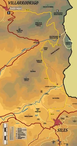
This one that we take care of, runs along the dirt track that leaves to the right of the ceramic panel and, little by little, is gaining height until we reach the Fountain of the Sabina or the Noguerón; from here, we will continue along this same track until we reach a firewall, where we will see the arrow that marks a detour and the path by which we must continue.
This zigzaguea path between pines and madroños, gently ascending until we link to the middle track, we will turn a few meters to the left and when we get back to the firewall we will see on a stone wall the continuation of this path. This stretch, with a similar route to the previous one, will take us to the top track, again by the firewall, where we will have a rewarding view of the Puntal.

On this track we will walk about 100 meters and see a stone that marks the continuation of the path, already softer, until we reach a mold where we can rest. If we move along the track a few meters we will see a splendid view of the Morles River Valley, the village of La Hueta and the hill of Peñalta.
Then our path will come down gently, until we reach the sign that indicates the ascension to the Hole Stone. If we decide to go up to it, we will have to take certain precautions, as the path is narrow and may be dangerous.
We will continue to descend until we reach the Fresnedilla and then we will walk along sections of path and lane alternatively until we reach the old schools of this village. We will cross the road and through a narrow path that runs between rocks and oaks we will get back to the road where we will walk in a banana way until we reach the starting point: the Peña del Olivar.

Breve descripción

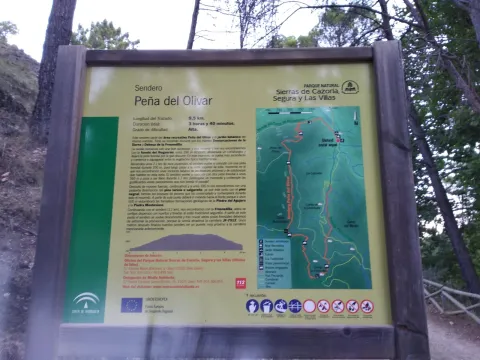
La Peña del Olivar is a good place for leisure and rest, and from here several hiking routes start.

Latitud
38.4522
Longitud
-2.6578
Distrito
Municipio
Ubicación en el mapa
POINT (-2.6578 38.4522)
imagen
Image
Ruta%20siles-Villarrodrigo.jpeg
Imagen principal
Activado
imagen
Image
Ruta%20siles-Villarrodrigo1.jpeg
Imagen principal
Desactivado
7 h 30 min

Nature

icon-intereses-naturaleza

Friends

icon-intereses-amigos

Adventure

icon-intereses-aventura

Culture

icon-intereses-cultura

Sport

icon-intereses-deporte

Eco-friendly

icon-intereses-eco-friendly

For couples

icon-intereses-en-pareja

Family

icon-intereses-familia

Gastronomy

icon-intereses-gastronomia

Municipality

icon-intereses-municipio

Low-cost tourism

icon-intereses-turismo-low-cost

Solo travel

icon-intereses-viajar-solo
Medium
Document
Document
Document
Ruta siles-Villarrodrigo
26,4 km
1350m
All year round
Desactivado

Area R. de la Peña del Olivar. The route starts to the right of the start panel.

Route Waterfalls of Hueta

Submitted by brandcode_deweloper on
Id
5931004
Descripción larga

From Siles we take the national road A-310 direction to the Gate of Segura, as we cross the Emilio del Arroyo bridge river of the Molinos, a lane to the villages of Puente Onda and La Hueta is left; this will be the detour we must follow.

We follow the forest track for 2.8 Km towards Puente Honda, once we reach the crossing where you see the Puente Honda Village we will take the detour that comes to the right direction the Hueta.

Next that forest track we will pass through the Mill of the Moors and we will have to go straight for 2 Km until we reach the pastry of La Hueta.

Unrecommended route for children and older persons, as there are large ravines and steep areas that are dangerous.

Breve descripción

In the Natural Park of the Sierra de Segura in the village of La Hueta belonging to the term Orcera.

Latitud
38.336322
Longitud
-2.609489
Distrito
Municipio
Ubicación en el mapa
POINT (-2.609489 38.336322)
imagen
Image
3%20%281%29.jpg
Imagen principal
Activado
imagen
Image
turismoActivo14.jpg
Imagen principal
Desactivado
1 h

Nature

icon-intereses-naturaleza

Friends

icon-intereses-amigos

Adventure

icon-intereses-aventura

Culture

icon-intereses-cultura

Sport

icon-intereses-deporte

Eco-friendly

icon-intereses-eco-friendly

For couples

icon-intereses-en-pareja

Family

icon-intereses-familia

Gastronomy

icon-intereses-gastronomia

Municipality

icon-intereses-municipio

Low-cost tourism

icon-intereses-turismo-low-cost

Solo travel

icon-intereses-viajar-solo
Alta
Ruta Cascadas de la Hueta
1,2 km
172m
All year round
Desactivado

In the village of the Hueta at the beginning of the route we can find a source of drinking water.

La Hueta village.

Coordenadas / Huso 30S
38.336322 / -2.609489
Tramo de asfalto o cemento
 
Tramo de pista o camino forestal
 
Tramo de vía pecuaria
 
Tramo de senda
 

Route Miradores Félix Rodríguez de la Fuente

Submitted by brandcode_deweloper on
Id
5729462
Descripción larga

This route begins at the LINAREJOS VIEWPOINT, from where you can enjoy an excellent panoramic view of much of the Sierra de Cazorla, one of the mountain ranges that make up the Natural Park. The renowned naturalist and great admirer of these landscapes filmed countless scenes very close to this location. During the winter months, you can hear the sound of the water plunging down the nearby Linarejos Stream waterfall. In addition to the “Félix Rodríguez de la Fuente Viewpoints” Route, there are other equally interesting routes nearby that allow visitors to discover more of this magnificent Natural Park, such as Cerrada de Utrero and the Linarejos Viewpoint Route.

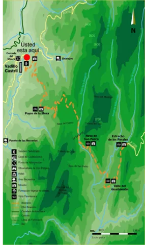
The second VIEWPOINT included on this route is POYOS DE LA MESA, which offers one of the most spectacular panoramic views in the Sierras de Cazorla, Segura y Las Villas Natural Park: the Poyos de la Mesa plateau, which reaches an altitude of 1,635 metres. Should you decide to climb it, you will enjoy breathtaking views of the Guadalquivir Valley, Vadillo-Castril and the El Adelantado Parador, among other places. It is a geological formation highly characteristic of these mountains: a unique high plateau that ends in a steep descending slope. Among the pine forests near this point stands the Pino Abuelo, or Grandfather Pine, one of the oldest trees in the area.

Coordinates: 37.906835,-2.913155

The third VIEWPOINT on the route is NAVA DE SAN PEDRO, where the meadows were once converted into vegetable gardens and cultivated fields. It provides an insight into living conditions at a time when timber was one of the main resources extracted from the mountains and the inhabitants used the relatively scarce open spaces for livestock farming and agriculture. On many occasions, the forest rangers themselves established forest houses in suitable locations such as this one, where vegetable gardens and small-scale livestock farming supplemented both their diet and their income. From this viewpoint, you can enjoy impressive views and learn about the return of the bearded vulture to Andalusia.

The landscape before you was the last Andalusian refuge of an animal as little known as it is spectacular: the bearded vulture. This Iberian vulture disappeared from the mountains you are now looking at in the late 1980s, resulting in its extinction in Andalusia.

Shortly afterwards, work began on the programme to reintroduce the bearded vulture to Andalusia, promoted by the Regional Ministry of the Environment. The species’ most remarkable characteristic is its scavenging diet, as it is the only bird on the planet that feeds almost exclusively on bones. To do so, it has developed an ingenious behaviour from which it takes its name: it drops bones from great heights so that they break against the ground in places known as bone-breaking sites. This allows it to consume large, hard bones. Although the bird is harmless, all the threats faced by bearded vultures are associated with human beings and their activities.

Their populations declined and became locally extinct as a result of direct persecution, collecting, collisions and electrocution involving power lines, and the illegal use of poisoned bait.

Today, they are also affected by disturbance around nesting sites caused by nearby recreational activities such as climbing and paragliding, as well as by reduced food availability and the decline of extensive livestock farming.

To achieve the return of the bearded vulture to Andalusia, feasibility studies were carried out to identify the most suitable areas for the species. A captive-breeding programme was established to provide chicks for reintroduction, together with a release and monitoring plan and a public-awareness programme aimed at informing the sectors involved in its conservation.

The fourth stop has been named the BARRANCO DEL GUADALENTÍN VIEWPOINT, where you can clearly observe the course followed by the river on its way towards the nearby La Bolera Reservoir. Over the centuries, the Guadalentín River has carved an impressive valley through the hard rock, which later narrows into secluded gorges known locally as “cerradas”. From here, the Sierra del Pozo rises majestically, containing some of the highest peaks in the Natural Park, including Pico Cabañas, which stands at over 2,000 metres and dominates the mountain landscape. At the foot of the viewpoint lies the path of the “Félix Rodríguez de la Fuente Viewpoints” Route, which climbs continuously until reaching the end of this magnificent route at the Estrecho de los Perales.

The fifth stop is the ESTRECHO DE LOS PERALES VIEWPOINT, a remarkable gorge distinguished by the beauty of its unusual rock formations. Below, the Valdetrillo Stream tumbles through lively rapids, providing a pleasant natural soundtrack. In this area, you may see agile mouflons and male Iberian ibex climbing the vertical rock faces, or enjoy the majestic flight of a golden eagle, griffon vulture or booted eagle. Behind the viewpoint stands Cerro de los Trancos, which offers views of some of the highest mountains in this protected natural area, including El Cabañas.

“We must do everything within our power; we must fight together, united and tenaciously, so that a vast, round rock does not die: a rock with a heart of iron and basalt, a rock with a skin of water and clouds, a rock whose voice is the singing of birds and the whisper of the breeze, now increasingly overwhelmed by the roar of the machines invented by humankind; a rock travelling through space, carrying the human species and every living animal; a rock that I like to call the blue planet.”

Félix Rodríguez de la Fuente in El Hombre y la Tierra.

Breve descripción

This route is located in Puente de la Cerrada del Utrero. Nearby you will find the INITIO sign of path where it explains that we will travel through the forest track that is headed to the fields of Hernán Perea. It is a free road for road traffic so we must take precautions to walk on a path.

Along the itinerary several viewpoints will help us to interpret the landscape by delights us with the views that these saws offer us.

Among the most striking points are the Cerrada de Utrero and Linarejos, where the waters of the Guadalquivir River have excavated a deep throat, the Poyos de la Mesa, a striking geological formation in which the strong rocky, the Spora de San Pedro, a kárstic planicie surrounded by mountains, The Guadaltir Valley, which leads the waters of this river to the reservoir of La Bolera, and the Strait of Perales, pronounced throat where the rock is the main protagonist of the environment.

You will also pass by the poyos of the Carilong, where he lived the last broken bones of Andalusia. At present this rapture is once again spreading the natural park skies thanks to the reintroduction.

Latitud
37.9202
Longitud
-2.9804
Municipio
Ubicación en el mapa
POINT (-2.9804 37.9202)
imagen
Image
735_img.png
Imagen principal
Activado
imagen
Image
curva.jpg
Imagen principal
Activado
imagen
Image
shutterstock_1060474277.jpg
Imagen principal
Desactivado
4 h 30 min

Nature

icon-intereses-naturaleza

Friends

icon-intereses-amigos

Adventure

icon-intereses-aventura

Culture

icon-intereses-cultura

Sport

icon-intereses-deporte

Eco-friendly

icon-intereses-eco-friendly

For couples

icon-intereses-en-pareja

Family

icon-intereses-familia

Gastronomy

icon-intereses-gastronomia

Municipality

icon-intereses-municipio

Low-cost tourism

icon-intereses-turismo-low-cost

Solo travel

icon-intereses-viajar-solo
Medium
Image
86984fd3-de31-e1f9-58a1-23a33abfa6c7?t=1607016107801
Ruta Miradores Félix Rodríguez de la Fuente
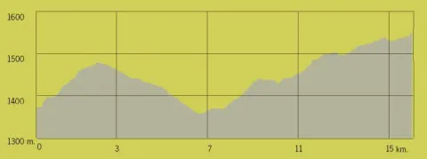
15,2 km
All year round
Desactivado
Image
b16b97bd-2592-e87e-e751-4d81489e51d0?t=1607016265852