
Saltar al contenido principal

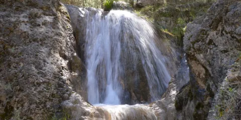
Route Waterfalls of Hueta

Submitted by brandcode_deweloper on
Id
5931004
Descripción larga

From Siles we take the national road A-310 direction to the Gate of Segura, as we cross the Emilio del Arroyo bridge river of the Molinos, a lane to the villages of Puente Onda and La Hueta is left; this will be the detour we must follow.

We follow the forest track for 2.8 Km towards Puente Honda, once we reach the crossing where you see the Puente Honda Village we will take the detour that comes to the right direction the Hueta.

Next that forest track we will pass through the Mill of the Moors and we will have to go straight for 2 Km until we reach the pastry of La Hueta.

Unrecommended route for children and older persons, as there are large ravines and steep areas that are dangerous.

Breve descripción

In the Natural Park of the Sierra de Segura in the village of La Hueta belonging to the term Orcera.

Latitud
38.336322
Longitud
-2.609489
Distrito
Municipio
Ubicación en el mapa
POINT (-2.609489 38.336322)
imagen
Image
3%20%281%29.jpg
Imagen principal
Activado
imagen
Image
turismoActivo14.jpg
Imagen principal
Desactivado
1 h

Nature

icon-intereses-naturaleza

Friends

icon-intereses-amigos

Adventure

icon-intereses-aventura

Culture

icon-intereses-cultura

Sport

icon-intereses-deporte

Eco-friendly

icon-intereses-eco-friendly

For couples

icon-intereses-en-pareja

Family

icon-intereses-familia

Gastronomy

icon-intereses-gastronomia

Municipality

icon-intereses-municipio

Low-cost tourism

icon-intereses-turismo-low-cost

Solo travel

icon-intereses-viajar-solo
Alta
Ruta Cascadas de la Hueta
1,2 km
172m
All year round
Desactivado

In the village of the Hueta at the beginning of the route we can find a source of drinking water.

La Hueta village.

Coordenadas / Huso 30S
38.336322 / -2.609489
Tramo de asfalto o cemento
 
Tramo de pista o camino forestal
 
Tramo de vía pecuaria
 
Tramo de senda
