Saltar al contenido principal

The Chaplaincy

Submitted by brandcode_deweloper on
Id
659644
Descripción
Descripción larga

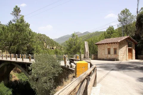
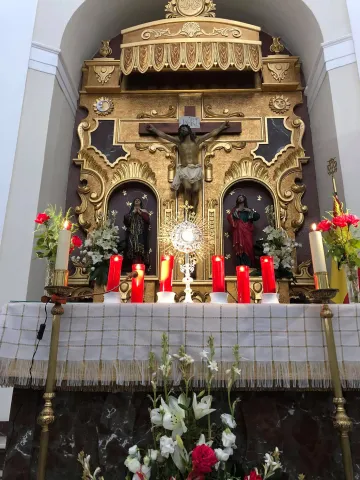
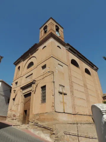
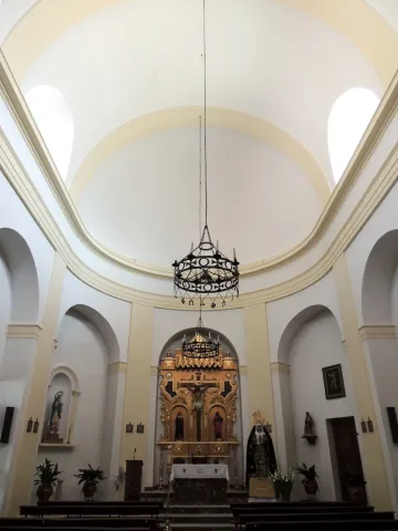
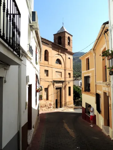
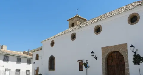
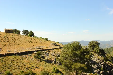
A small hermitage, which at the time made the school, brings to our head memories of past times. Its position allows it to have a privileged view over the nearby mountains, which you can know more in depth if you do the circular path of the Yelmo Chico, the PR-A 150 that part of the Capellania.

Breve descripción

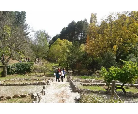
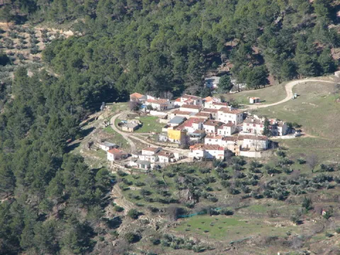
Jars, rosemary and pines accompany the road leading to the Capellania. Small gardens between the pine trees and some olive trees lead to the area where the village is located. It has an immense central meadow with several roads that lead to the different houses.

Ubicación
Latitud
37.913575
Longitud
-3.011814
Municipio
Ubicación en el mapa
POINT (-3.011814 37.913575)
Tipos de punto de interés
Imágenes carrusel
imagen
Image
6%20%281%29.jpg
Imagen principal
Desactivado
imagen
Image
b4b8d505ab9cd1db1bf562f9e4900a0b40f1d770.jpeg
Imagen principal
Desactivado
Imágenes cabecera
imagen
Image
Cazorla_%2814277828194%29.jpg
Imagen principal
Activado
Loading map
Preparing points of interest and routes...
Marcas de calidad
La Ballestera y Montalvo

Submitted by brandcode_deweloper on
Id
659617
Descripción
Descripción larga

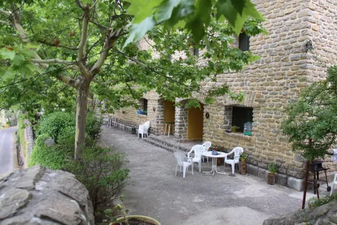
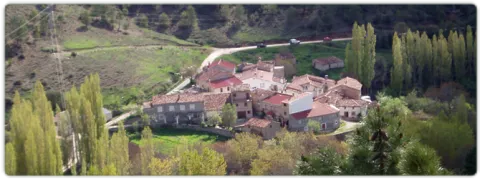
The crossbow is made up of two cores of houses separated by an old laundry room that awaits the arrival of people in laundry clothes. During the winter it has only four neighbors. It surprises the cleaning of the village and the freshness of the water that runs next to it. If you close your eyes you can discover that the silence is broken only by the rooster singing, the cat's maullido or the water running.

Next to the Ballestera we find Montalvo with a completely different landscape. It dominates an elevation that is accessed by a road that zigzaguea to the village and offers us impressive views over the valley. You can see narrow streets, narrow walls, houses recovered from ruin, all surrounded by privileged views of the valley.

Breve descripción

A very narrow road surrounded by trees leads us to the Ballestera. You will pass through a bread oven and an old haystack, witnesses from another time, from the self-sufficient past of this village. The gardens are intermingled with the pines and some olive trees, the result of the need to get oil before.

Ubicación
Latitud
38.148202
Longitud
-2.693707
Ubicación en el mapa
POINT (-2.693707 38.148202)
Tipos de punto de interés
Imágenes carrusel
imagen
Image
596_img.png
Imagen principal
Desactivado
imagen
Image
IMG_7633.JPG
Imagen principal
Desactivado
Imágenes cabecera
imagen
Image
ballesteraMontalvo%20%281%29.jpg
Imagen principal
Activado
Loading map
Preparing points of interest and routes...
Marcas de calidad

Karst of Pinar Negro

Submitted by brandcode_deweloper on
Id
876621
Descripción
Descripción larga

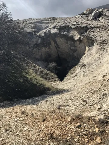
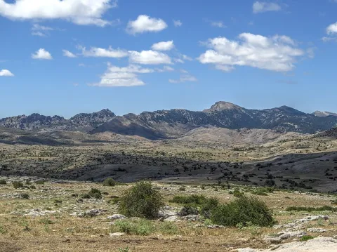
In the eastern part of the Sierra de Segura there is a spectacular karmic landscape, characterized by the presence of an exokarst of exceptional beauty with an immense field of dolins and uvalas, splashed with sims, of different scale. This karmic relief is controlled litologically and structurally, and conditioned by a high mountain climate, with level periods that accentuate the dissolution in karmic cavities. In this area, a carbonated altiplanicie that includes from the fields of Hernán Perea to those of the Black Pinar, stands out a series of simas, within dolinas and uvalas, among which stand out the one of the Campo del Espino, the one of the Hunzón, the one of the Cortijo, and mainly the very one of the Black Pinar.

The morphology of these cavities, with frequent balance chimneys, uses and some subhorizontal galleries, with clear structural control, reflects the importance of dissolution in the geomorphological evolution of them, with few examples of tectonic simas such. The most important of its development is that of the Black Pinar which is the sink of a large dolina of 105 x 130 m. In the area around the mouth a small channel runs through which a water course temporarily circulates that penetrates the cavity as a ponor. It has a large mouth (8 x 2 m.) that communicates with a large initial well of 10 x 16 m that descends to 104 m., where a second well of 40 m is started; reaching the bottom of the main track of the sima. Fifteen meters above the second well is the side track of smaller dimensions, but it reaches more depth, reaching more than 100 m.

Source: Inventory of Georresources of Andalusia. Environmental Council. Junta de Andalusia.

Breve descripción

Karst of Black Pinar

Ubicación
Latitud
38.298857
Longitud
-2.651877
Distrito
Ubicación en el mapa
POINT (-2.651877 38.298857)
Tipos de punto de interés
Imágenes carrusel
imagen
Image
10379407Master.jpg
Imagen principal
Desactivado
Imágenes cabecera
imagen
Image
800px-Campos_de_Hern%C3%A1n_Perea_24J_01.jpg
Imagen principal
Activado
Loading map
Preparing points of interest and routes...

Confluence of Miller

Submitted by brandcode_deweloper on
Id
913153
Descripción
Descripción larga

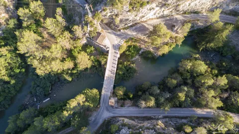
Here was born in the 1950s a village with the same name: Miller's Boards. This core was created to house the personnel employed in the construction of Miller's hydraulic power plant. To supply water to this plant the reservoirs of the Anchuricas (Segura River) and the Old River (Zumeta River) were built. The water jumps are 185 and 195 meters high respectively.

A magnificent view of Las Juntas is from the place known as the Loma del Paerón. To get to this point we recommend you make the route "Loma del Paerón" which is identified as PR-A 108. From here a natural lookout is opened before you to contemplate the valleys of the Zumeta and Segura rivers, and the union of both.

In front of the Loma are the Cañás de la Muela, where there is a large colony of leonado vulture, as well as the Iberian village of the Peñón de los Almendros, the village of Góntar... You're in a magical area worth discovering.

We suggest...

  • If you get to Miller's Boards after you have made a good route, where you have known villages like Miller, the Coke's Calar or the Eguijones' Cave, you certainly need to get a good dip (only in summer, of course...).
  • To know and remember the history of the following pineers who, until the 1950s of the 20th century, carried wood through the rivers, helped with hooks and shooting beasts.
  • There is a great book for hiking in the area: Valleys of the Segura River and Zumeta. It describes with precision and deep knowledge a series of routes that you will certainly love.

It is reached through the road JF-7038 from the town of Santiago de la Espada after 22 km. From Segura de la Sierra we can also reach the road in the direction of Rio Madera - La Toba - Miller's Boards. This way the distance is 54 km. and a time of about 1 hour.

Breve descripción

With this suggestive name we know the union of two important rivers of the Sierra de Segura: the Zumeta and the Segura. Together they say goodbye to Jaén - this peaceful and beautiful parachute - to enter the province of Albacete. From the bridge it is easy to imagine the ancient "pineros" preparing the logs that arrived from the two rivers and that would take them, after a fabulous journey, to the Mediterranean, with no tool other than a double-pointed hazelnut stick hook.

Ubicación
Latitud
38.298857
Longitud
-2.651877
Distrito
Ubicación en el mapa
POINT (-2.651877 38.298857)
Tipos de punto de interés
Imágenes carrusel
imagen
Image
19250548_143367852884610_5379292057515744177_o.jpg
Imagen principal
Desactivado
imagen
Image
17%20Las%20Juntas%20de%20Miller.jpg
Imagen principal
Desactivado
imagen
Image
6%20Juntas%20de%20Miller.JPG
Imagen principal
Desactivado
Imágenes cabecera
imagen
Image
43310356724_616217becc_b.jpg
Imagen principal
Activado
Loading map
Preparing points of interest and routes...

Torre del Vinagre Botanical Garden

Submitted by brandcode_deweloper on
Id
920758
Descripción
Descripción larga

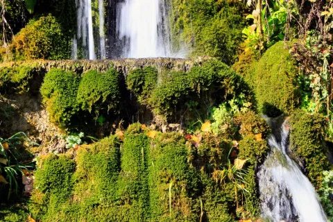
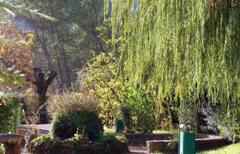
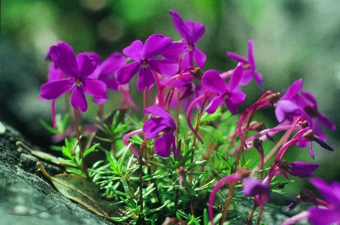
In the Garden are the different plant formations that, depending on the height and humidity, we can find naturally in the Park, such as the high mountain, the larix pineapples, the deciduous bosquets or the riverside forests. There is a space dedicated to the exclusive species of the Park (endemisms), such as the Cazorla violet.

We suggest...

  • Any season is good for visiting the Garden, but in autumn the deciduous trees are dressed in yellow and in spring you can see the flowers of some endemic plants.
  • Attention should be paid to the activities organized by the Garden, such as photography workshops, medicinal plants or plant dyes. There are also activities for children. They are free and have a remarkable quality. You can call or subscribe to your mailing list.
  • Torre del Vinagre is one of the most strategic places in the Park, which has two Visitors' Centres and the beginning of the emblematic route of the Borosa. It can be worth using a whole day.
Breve descripción

This large Botanical Garden has a wide and careful selection of plants from the Natural Park, from small herbaceas to large trees. It is a perfect place to observe and learn to distinguish them or simply to take a pleasant walk between lush vegetation. Your visit will help you understand that the extraordinary botanical wealth of these saws is one of the main reasons for them to be declared as Protected Space. The entrance is free.

    Ubicación
    Latitud
    38.014000
    Longitud
    -2.872970
    Ubicación en el mapa
    POINT (-2.87297 38.014)
    Tipos de punto de interés
    Imágenes carrusel
    imagen
    Image
    jardin2.jpg
    Imagen principal
    Desactivado
    imagen
    Image
    24vinagre_ribera.jpg
    Imagen principal
    Desactivado
    imagen
    Image
    646_JB_01.jpg
    Imagen principal
    Desactivado
    imagen
    Image
    Natu210%20%281%29.jpg
    Imagen principal
    Desactivado
    Imágenes cabecera
    imagen
    Image
    506_img.png
    Imagen principal
    Activado
    Loading map
    Preparing points of interest and routes...

    Botanical Garden el Hornico

    Submitted by brandcode_deweloper on
    Id
    920700
    Descripción
    Descripción larga

    The Arroyo del Vidrio divides the Garden into two, and passing through a wooden bridge with eastern air, we reach a natural area where we can know the plants integrated into their natural habitat, some of them in danger of extinction. This part has a circular path around the channel, where, in addition to vegetables, more than forty species of birds can be observed, as well as squirrels and amphibians. This ravine is the ideal framework to begin to contemplate in situ the particular contrast of the area, from a lookout located at the highest part of the tour.

    The slope of the right margin, in umbria, is occupied by a pineapple pineapple (Pinus nigra ssp. salzmanii). In front, in the dolomitic herring where the parking is located, the black pine (Pinus pinaster) is the only tree able to overcome the presence of magnesium on the ground. Next, in the rocky carasol, the carrasco pine (Pinus halepensis), the most characteristic Mediterranean pinacea of arid areas, dwells on very permeable substrates, where drought becomes extreme. The fact that the three native pine species of this Natural Park naturally coexist in such a small space, deletes the special ecological characteristics of this area.

    We suggest...

    • The Botanical Garden of El Hornico, marked as the Collection of Autotonous Plants in the public-use organization chart of the Natural Park, is currently managed by the municipality of Pozo Alcón and is only open to the public in times of maximum tourist influx. For an organized and scheduled visit it is best to contact the municipal tourist information point (Tfno. 953 739 005)
    • Next to the botanist is the El Hornico Nature Hall, which develops environmental education activities within the garden and in its nearby environment. It is an ideal place to organize school and group activities.

    The Botanical Garden of the Hornico is 9 km from Pozo Alcón and 17 km from Hinojares. From Pozo Alcón you have to take the A-326, up the Avenida de la Bolera, direction to Castril. By passing the campsite de la Bolera and the km 7, we take a detour that comes to our left and that borders the Forest House of la Bolera (it is marked as an entrance to El Hornico). On an unasphalt road, 2 km later, we take another turn to the left, after passing a bridge, which leads us to the park of the Garden a few meters later.

    Breve descripción

    The diversity and contrast in the landscape, essential characteristics of the southern end of the Natural Park, are manifested, above all, in the composition and structure of the plant formations that cover the territory. With a short and pleasant walk through the Botanical Garden of El Hornico we will know the forest ecosystems present in the protected natural space and the plants that make up them, from the subdesert dungeons of the Guadiana Menor, to the piornal and pine trees of the high mountain of the mountain, passing through the different forests present along the length and width of its surface. In these facilities, reaching the summits from the basal area, it only costs effort and a few minutes.

    Ubicación
    Latitud
    37.774490
    Longitud
    -2.923710
    Municipio
    Ubicación en el mapa
    POINT (-2.92371 37.77449)
    Imágenes carrusel
    imagen
    Image
    jardin-botanico-el-hornico.jpg
    Imagen principal
    Desactivado
    imagen
    Image
    jardin-botanico-el-hornico%20%282%29.jpg
    Imagen principal
    Desactivado
    Imágenes cabecera
    imagen
    Image
    jardin-botanico-el-hornico.png
    Imagen principal
    Activado
    Loading map
    Preparing points of interest and routes...

    Parish Church of Santa Águeda

    Submitted by brandcode_deweloper on
    Id
    4905213
    Descripción
    Breve descripción

    It is Renaissance in simple and simple forms and is under the title of the Patroness of the town, Santa Águeda.It began construction in 1571, on ruins of another existing temple.The plant is a drawer, that is, it consists of a unique ship, covered with a wooden armor, according to the Mudejar tradition. TheMajor chapelis of rectangular base, it is accessed by a step and through a large arch of half point. Another part that has particular interest is theTower of the bell tower, design by Andrés de Vandelvira. It is structured in three bodies, separated by cornels, and that of the bells covered with half orange domes. The factory in the whole building is a shillery. It also highlights themagnificent imaginationThe size of Saint Agueda from the 16th century and a size of Jesus Crucified from the same time stand out.

    Telecomunicaciones
    Sitio web
    www.redjaen.es/francis/?m=c&o=17967&letra=&ord=&id=91365
    Teléfono de contacto
    953 430 027
    Ubicación
    Código Postal
    23270
    Latitud
    38.240170
    Longitud
    -3.054240
    Dirección
    C/ Reyes Católicos, 1
    Distrito
    Ubicación en el mapa
    POINT (-3.05424 38.24017)
    Tipos de punto de interés
    Imágenes carrusel
    imagen
    Image
    iglesiadesantaaguedaa_1906x600_q75_middle.jpg
    Imagen principal
    Desactivado
    imagen
    Image
    Mon271.jpg
    Imagen principal
    Desactivado
    Imágenes cabecera
    imagen
    Image
    00044354.jpg
    Imagen principal
    Activado
    Loading map
    Preparing points of interest and routes...

    Parish Church of San Mateo

    Submitted by brandcode_deweloper on
    Id
    5709379
    Descripción
    Descripción larga

    The church, in spite of its generous dimensions, was organized from a single ship, divided into two sections, with a half-barrel vault cover that is discharged on fajon arches. On the outside there is a neo-classicist air. The main cover is of a bartender. The tower, with a chute look, was later added.

    Breve descripción

    The parish church of San Mateo was drawn in 1817 by Sebastian de Azcuaga. It was a project that would replace the old medieval temple, for which it should save the irregularities of the land and significantly expand its space, as the number of parishioners increased considerably.

    Telecomunicaciones
    Sitio web
    https://www.facebook.com/parroquialapuertadesegura/
    Ubicación
    Código Postal
    23360
    Latitud
    38.348830
    Longitud
    -2.738260
    Dirección
    C/ de la Iglesia, 6
    Distrito
    Ubicación en el mapa
    POINT (-2.73826 38.34883)
    Tipos de punto de interés
    Imágenes carrusel
    imagen
    Image
    3.jpg
    Imagen principal
    Desactivado
    imagen
    Image
    Iglesia%20Parroquial%20de%20San%20Mateo2.JPG
    Imagen principal
    Desactivado
    imagen
    Image
    Iglesia%20Parroquial%20de%20San%20Mateo3.JPG
    Imagen principal
    Desactivado
    Imágenes cabecera
    imagen
    Image
    Iglesia%20Parroquial%20de%20San%20Mateo.JPG
    Imagen principal
    Activado
    Horario
    Monday to Sunday: 08: 00 - 18: 00.
    Loading map
    Preparing points of interest and routes...

    Parish Church of Nuestra Señora de la Paz

    Submitted by brandcode_deweloper on
    Id
    8088298
    Descripción
    Descripción larga

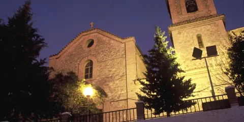
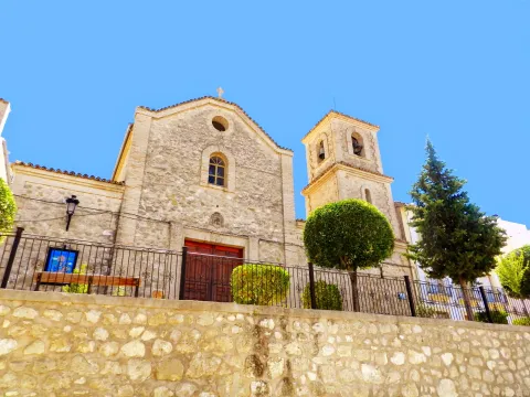
    Its cover that coincides with the central ship is raised vertically with an intellized door that is preceded by a few steps, and, on it, on the same axis, a stylized window with a half-point arch. It also presents another circular window also highlighted with respect to the wall, and, closing on top of the main facade, a small stone cross, which marks the central axis. It is above the tower, with a square base, located on the right of our view, with three bodies separated by two strands and reinforced corners, and in the bell tower, large gaps with half-point arches and four-water tiles. To visit: time of worship.

    Breve descripción

    The current church was completely rebuilt in the 1970s. The old one was ordered to be built by Cardinal Lorenzana, Archbishop of Toledo in 1787, and from it are preserved the shield on the outside, which shows the imposition of the casulla to San Ildefonso (remember the religious affinity with Toledo, a city to which this saint is linked) and which comes from the hermitage of "Chillúevar Vieja"; the baptismal pile, dated in the 18th century, and the ancient crown of the Virgin.

    Telecomunicaciones
    Sitio web
    www.chilluevar.es
    Teléfono de contacto
    953 717 712
    Ubicación
    Código Postal
    23477
    Latitud
    38.003627
    Longitud
    -3.030800
    Dirección
    Av. de Andalucía, 50
    Municipio
    Ubicación en el mapa
    POINT (-3.0308 38.003627)
    Imágenes carrusel
    imagen
    Image
    Iglesia%20Parroquial%20de%20Nuestra%20Se%C3%B1ora%20de%20la%20Paz2.jpg
    Imagen principal
    Desactivado
    Imágenes cabecera
    imagen
    Image
    Iglesia%20Parroquial%20de%20Nuestra%20Se%C3%B1ora%20de%20la%20Paz.JPG
    Imagen principal
    Activado
    Loading map
    Preparing points of interest and routes...

    Parish Church of Nuestra Señora de la Cabeza

    Submitted by brandcode_deweloper on
    Id
    4535554
    Descripción
    Breve descripción

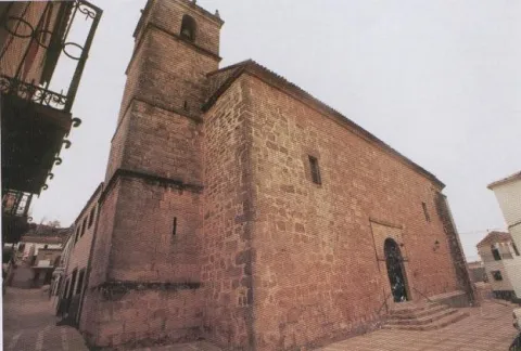
    This Church was ordered to be built by the Archbishop of Toledo Don Francisco Antonio de Lorenzana and Buitron in 1778. Its most characteristic element is its tower, which is a visual reference point for the entire population and the only vestige of the 18th century, although like the church, it has been restored in different times. The square-based tower has a bell body with four holes covered with half-point arch and four-water roof.

    Telecomunicaciones
    Sitio web
    www.huesa.es/el-municipio/patrimonio-historico.html
    Teléfono de contacto
    953 715 542
    Ubicación
    Código Postal
    23487
    Latitud
    37.765520
    Longitud
    -3.075180
    Dirección
    C/ Ramón y Cajal, 9
    Municipio
    Ubicación en el mapa
    POINT (-3.07518 37.76552)
    Tipos de punto de interés
    Imágenes carrusel
    imagen
    Image
    Nuestra%20Se%C3%B1ora%20de%20la%20Cabeza%20en%20Huesa.JPG
    Imagen principal
    Desactivado
    imagen
    Image
    Nuestra%20Se%C3%B1ora%20de%20la%20Cabeza%20en%20Huesa2.jpg
    Imagen principal
    Desactivado
    Imágenes cabecera
    imagen
    Image
    DSCN0271.JPG
    Imagen principal
    Activado
    Loading map
    Preparing points of interest and routes...