Saltar al contenido principal

Holm Oak and Juniper Forests

Submitted by brandcode_deweloper on
Id
920671
Descripción
Descripción larga

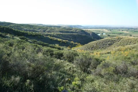
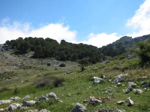
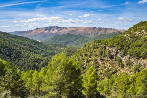
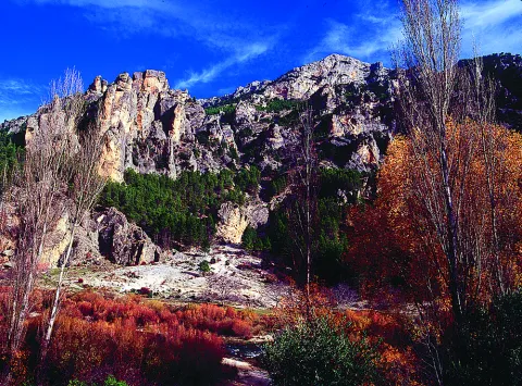
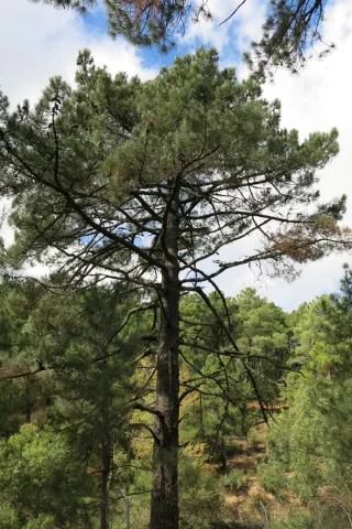
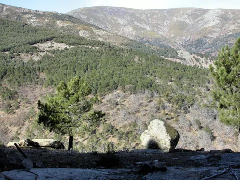
They are found on the stony and slope slopes, forming clear forests in which they coexist with some pine of several species (Pinus nigra salzmannii, Pinus pinaster and Pinus halepensis), according to the altitude and orientation of the slope, as well as cornicabra (Pistacia terebinthus), ruscos (Ruscus aculeatus) and a herbaceous entourage such as charts, rompesacos and cerveres (Poa bulbosa, Cynosurus echinatus, Aegilops, and the acrachacellus (Arrachacus), and the acellus (Arrachatus), and the other (Arrachus).

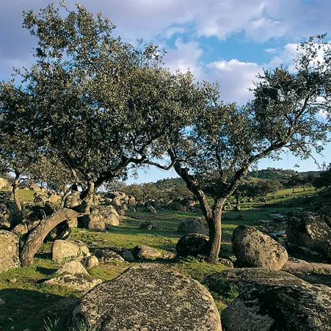
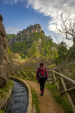
From the Recreative Area of Linarejos, we walk along the track that goes up the hill. We will go through a quarry and a barrier, these are two indicators that confirm that we are on the right track. At 3 km from the Recreative Area we will see a detour to our left, a track that enters us into a rock maze. It is a torque, in which this formation of oaks and juniper is extended. Two leads are coming out to our left, one after the other, and they both get us into this torcal. If we do not want to go too far, because it is a difficult ground to go through, from the main track we see this plant formation in the same way.

Breve descripción

The Navillas, Peña Gallinera

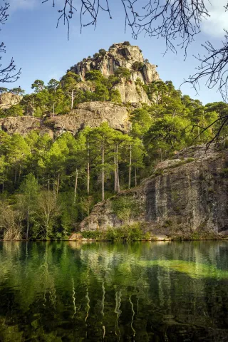
The oak (Quercus ilex ballota) and juniperus oxicedrus (Juniperus oxicedrus) are a unique feature of these limestone saws. It is difficult to see a formation of these pure characteristics, since it is normal to see them intermingled in enclosures, pine trees and in slices of Mediterranean forests, but in a few places, like this, we can see them with their characteristic elements.

Ubicación
Latitud
37.912893
Longitud
-3.003887
Municipio
Ubicación en el mapa
POINT (-3.003887 37.912893)
Imágenes carrusel
imagen
Image
encinares_enebrales.png
Imagen principal
Desactivado
imagen
Image
ales%20%281%29.jpg
Imagen principal
Desactivado
Imágenes cabecera
imagen
Image
4eladera%20del%20espinar%2C%20barranco%20de%20la%20pinada%2C%20barranco%20de%20las%20esparragueras%2C%20barranco%20de%20las%20liebres.jpg
Imagen principal
Activado
Loading map
Preparing points of interest and routes...

Holm Oak Forest

Submitted by brandcode_deweloper on
Id
880004
Descripción
Descripción larga

Our goal is to see one of the most spectacular oak trees in the Park, where we will see large, very large oak trees and a forest of tale. Give the place where we left the car, we continue on foot on the track about 6 km. The rise is easy and uncomplicated.

We'll get to a crossroads, we'll follow right. A little higher, a source is intuited under an oak. For that place, to the right of the track and above the source we will find large copies of oak, although in reality we have been walking through a magnificent oak for a long time. The crossing of the track is where the old forest house of the Fountain del Roble was. This is where the burning reaches all its magnificence.

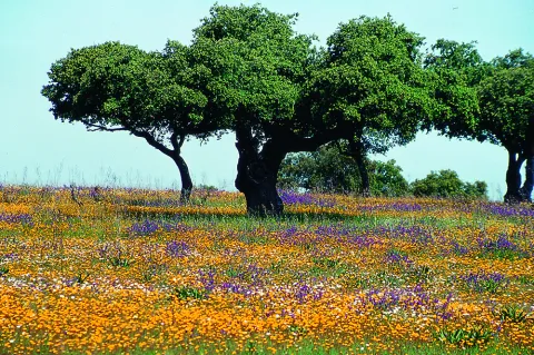
In this forest dominated by the oak we find some other complaint (Quercus faginea), serbals (Sorbus domestica), pespejones (Sorbus torinlis), majuelos (Crataegus monogina), skirmishes (Rosa spp.), laureolas (Daphne laureola), thorns (Berberis vulgaris australis), torvizcos (Daphne gidium), peonies or mountain roses (Paeonia broteroi), orchids (Orchis, the dominant, Chiphiphipis, and the contiguera (Ophanacteria), and the domineas.

In our saws we can see many oak forests. For example, on the rise to Santiago de la Sword from Tobos, on the Esperilla, before Fuente Steel, or on the access track to the Pegueras. The name of engraving has meant Mediterranean forest, but the matter is not so simple.
Rather, we should say that burning is a phase of the Mediterranean forest. The lauroid forest, which we discussed elsewhere, is also Mediterranean forest. In any case, the engraving does exist as such, in addition to the fact that its main component, the encin (Quercus ilex ballota), is in almost all the plant formations of the Park, with the exception of the summits and the cold deciduous forests, of the high mountain.

LOCATION

From Coto Ríos we take the road A-319 towards the Tranco and less than a kilometer away to the right towards the campsite of the Llanos de Arance. We overcome it and follow it (the road becomes a forest track), until it reaches the control of Aguamula. As we pass it we follow the track to the left, discarding another one to the right, from here we will travel the right margin of the Tranco reservoir. We take the first detour to be presented to our right at 2.1 km from the above control. It is a great crossing where the track is widened and where we must turn to our right making a closed curve that places us almost 180º to the sense of our march. This is the track that goes up to Majalalto, passing through the Fountain del Roble. In that place we left the vehicle, as the track is closed to traffic with a chain.

Breve descripción

Our goal is to see one of the most spectacular oak trees in the Park, where we will see large, very large oak trees and a forest of tale. Give the place where we left the car, we continue on foot on the track about 6 km. The rise is easy and uncomplicated.

We'll get to a crossroads, we'll follow right. A little higher, a source is intuited under an oak. For that place, to the right of the track and above the source we will find large copies of oak, although in reality we have been walking through a magnificent oak for a long time. The crossing of the track is where the old forest house of the Fountain del Roble was. This is where the burning reaches all its magnificence.

In this forest dominated by the oak we find some other complaint (Quercus faginea), serbals (Sorbus domestica), pespejones (Sorbus torinlis), majuelos (Crataegus monogina), skirmishes (Rosa spp.), laureolas (Daphne laureola), thorns (Berberis vulgaris australis), torvizcos (Daphne gidium), peonies or mountain roses (Paeonia broteroi), orchids (Orchis, the dominant, Chiphiphipis, and the contiguera (Ophanacteria), and the domineas.

In our saws we can see many oak forests. For example, on the rise to Santiago de la Sword from Tobos, on the Esperilla, before Fuente Steel, or on the access track to the Pegueras. The name of engraving has meant Mediterranean forest, but the matter is not so simple.

Rather, we should say that burning is a phase of the Mediterranean forest. The lauroid forest, which we discussed elsewhere, is also Mediterranean forest. In any case, the engraving does exist as such, in addition to the fact that its main component, the encin (Quercus ilex ballota), is in almost all the plant formations of the Park, with the exception of the summits and the cold deciduous forests, of the high mountain.

LOCATION

From Coto Ríos we take the road A-319 towards the Tranco and less than a kilometer away to the right towards the campsite of the Llanos de Arance. We overcome it and follow it (the road becomes a forest track), until it reaches the control of Aguamula. As we pass it we follow the track to the left, discarding another one to the right, from here we will travel the right margin of the Tranco reservoir. We take the first detour to be presented to our right at 2.1 km from the above control. It is a great crossing where the track is widened and where we must turn to our right making a closed curve that places us almost 180º to the sense of our march. This is the track that goes up to Majalalto, passing through the Fountain del Roble. In that place we left the vehicle, as the track is closed to traffic with a chain.

Ubicación
Latitud
37.912893
Longitud
-3.003887
Municipio
Ubicación en el mapa
POINT (-3.003887 37.912893)
Tipos de punto de interés
Imágenes carrusel
imagen
Image
Natu021.jpg
Imagen principal
Desactivado
imagen
Image
IMG_0815._Encinar.jpg
Imagen principal
Desactivado
Imágenes cabecera
imagen
Image
encinar.png
Imagen principal
Activado
Loading map
Preparing points of interest and routes...

Tranco Reservoir

Submitted by brandcode_deweloper on
Id
912713
Descripción
Descripción larga

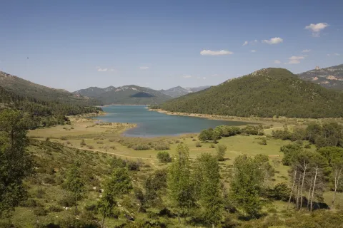
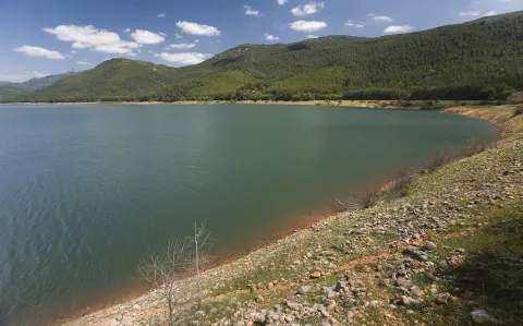
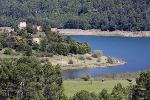
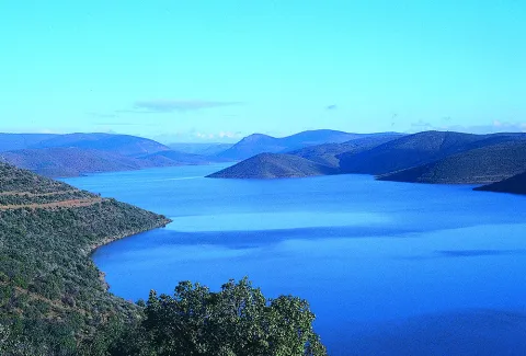
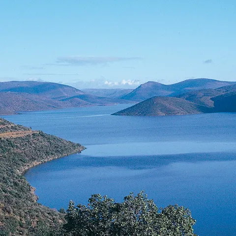
The reservoir is mainly nourished by the waters of the Guadalquivir, it has almost 500 cubic meters of capacity and 1500 hectares of surface. Much of it was previously occupied by the beautiful Vega de Hornos and the Guadalquivir valley.

We suggest...

The Tranco road is usually quite busy on dates of greater tourist influx, so, if you really want to enjoy the landscape, do not agree to look at it from the car and stop for a while at the dam or at some viewpoint, as usual. Our advice is: walk. On the right bank, you have several forest tracks, as well as the circular signposted path PR-A 149, which begins very close to the village of Fuente la Higuera. On the left, there are two signposted paths: the PR-A 193, which starts 1.1 km from the Tranco dam to the north, and a stretch of the GR-144, which is taken halfway between the Hornos de Segura and Cañada Morales, in a pronounced curve. In addition, in the environment of the reservoir you will not find many earrings.

Breve descripción

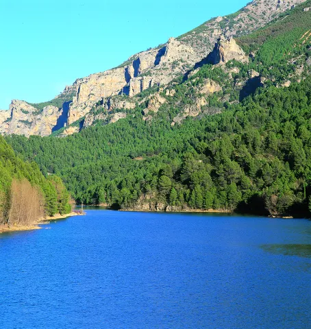
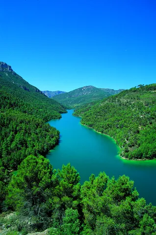
It is one of the largest reservoirs in Spain and is a first-class landscape resource in the Natural Park, so its entire environment is especially protected as the Bujaraiza Reserve Area. The left bank is on the A-319 road, and has various viewpoints, recreational areas, signposted trails and accommodation and restoration services, as well as water sports facilities. The right margin is mostly passed through forest tracks and roads. In its beginning (southern part) has several views of the Félix Rodríguez de la Fuente route.

Ubicación
Latitud
37.772886
Longitud
-3.788329
Distrito
Municipio
Ubicación en el mapa
POINT (-3.788329 37.772886)
Imágenes carrusel
imagen
Image
_mg_3284-jpg
Imagen principal
Desactivado
imagen
Image
_mg_0792-jpg
Imagen principal
Desactivado
imagen
Image
_mg_3280-jpg
Imagen principal
Desactivado
imagen
Image
img_0526-copia-jpg
Imagen principal
Desactivado
imagen
Image
img_0528-copia-jpg
Imagen principal
Desactivado
Imágenes cabecera
imagen
Image
_mg_0793-jpg
Imagen principal
Activado
Loading map
Preparing points of interest and routes...

Siles Reservoir

Submitted by brandcode_deweloper on
Id
873003
Descripción
Descripción larga

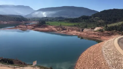
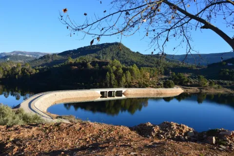
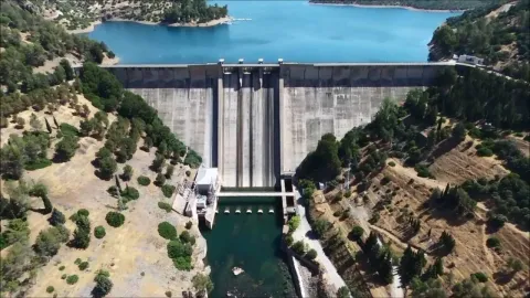
The Siles dam, which was completed in 2015, receives its water from the Gualimar River and the Carrizas River.
It is a reservoir that receives its water from the Guadalimar River and the Carrizas River, located close to its head and belonging to the Guadalquivir Hydrographic Confederation.

The reservoir is almost entirely the municipal term of Siles (Jaén), although it enters approximately 500 meters in the term of Villaverde de de Guadalimar. It is named after Dam de Siles, when the dam is found in the municipality of the same nomenclature.

The reservoir has an extension of 21.1 ha, with a capacity to store 30 hm ³ of water. The type of dam is from Arc Gravity and was completed in 2015.

Breve descripción

Siles packaging

Ubicación
Latitud
38.387861
Longitud
-2.582637
Distrito
Municipio
Ubicación en el mapa
POINT (-2.582637 38.387861)
Imágenes carrusel
imagen
Image
presasiles.jpg
Imagen principal
Desactivado
Imágenes cabecera
imagen
Image
2%20%281%29.jpg
Imagen principal
Activado
Loading map
Preparing points of interest and routes...

La Bolera Reservoir

Submitted by brandcode_deweloper on
Id
872785
Descripción
Descripción larga

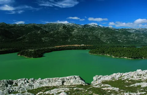
With its 53 hectares of capacity and 265 hectares of surface, it is the second largest in the park. It began to be exploited for irrigation and supply in 1972. The maximum water level is 966 m in altitude and the height of the dam on the channel is 43 m.

Breve descripción

Bread.

Ubicación
Latitud
37.789256
Longitud
-2.937727
Municipio
Ubicación en el mapa
POINT (-2.937727 37.789256)
Imágenes carrusel
imagen
Image
pantano-bolera-Sierra-Cazorla-900x603.jpg
Imagen principal
Desactivado
imagen
Image
Natu005.jpg
Imagen principal
Desactivado
Loading map
Preparing points of interest and routes...

Guadalmena Reservoir

Submitted by brandcode_deweloper on
Id
872881
Descripción
Descripción larga

Located on the outside of the Park, this large reservoir has a storage capacity of 346.5 hm ³ and occupies an area of 1250 ha. It began operating in 1969, with supply for human consumption being the main use of unpackaged water, and irrigation and electricity production being secondary uses.

Its turbines have a production capacity of 15.2 MW / hour. The maximum water level is 594.6 m in altitude and the height of the dam on the channel is 85 m.

Breve descripción

Embalse del Guadalmena

Ubicación
Latitud
38.349338
Longitud
-2.990036
Distrito
Municipio
Ubicación en el mapa
POINT (-2.990036 38.349338)
Imágenes carrusel
imagen
Image
maxresdefault%20%287%29.jpg
Imagen principal
Desactivado
imagen
Image
Natu084.jpg
Imagen principal
Desactivado
Imágenes cabecera
imagen
Image
guadalmena.png
Imagen principal
Activado
Loading map
Preparing points of interest and routes...

Anchuricas Reservoir

Submitted by brandcode_deweloper on
Id
873053
Descripción
Descripción larga

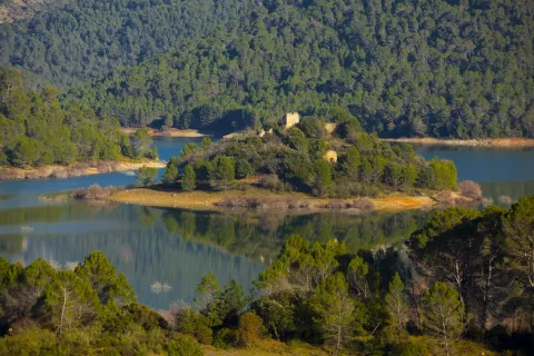
Under these waters is the old Casicas house; the dam that created this reservoir to store water for the Miller hydropower plant was completed in 1957, and once the water of the Segura River began to pour into the house it became the home only of the trout and barbs that were born in the new reservoir.

Testimony of the continuity of the house is its church, a simple rectangular structure very damaged by the passage of time but still serenely rises from the reservoir on a mound, surrounded by oaks, pans and pans.

Leonate vultures are a common view of the reservoir; the surrounding mountains offer an ideal shelter for these rapacious birds and also provide spectacular viewpoints from which to enjoy their views. The views from Puntal de la Misa, Umbria de los Eguijones and the peak of the Mahalon are possibly the most impressive in this area.

We recommend...

  • In summer it is difficult to resist the temptation to leave the vehicle in one of the accesses to the reservoir and enjoy a bath in a true mountain lake. It is also an excellent place to practice piragüism.
  • A circular route part of the church of Las Casicas and surrounds the entire reservoir, crossing several villages with beautiful views of Anchuricas. The route is marked PR-A 128.

UBICATION

The reservoir of Anchuricas can be reached from Segura de la Sierra or Santiago de la Espada. From Segura de la Sierra, follow the provincial road JF-7038 to Rio Madera and continue towards La Toba. After passing the detour that leads to the village of La Toba, you will see the reservoir on the right. The same path leads to Miller's Boards and ascends to Santiago de la Sword.

Breve descripción

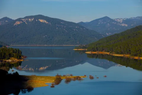
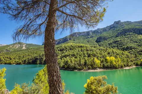
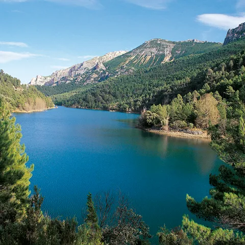
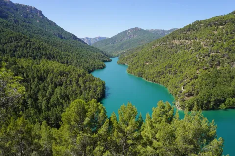
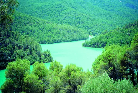
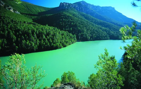
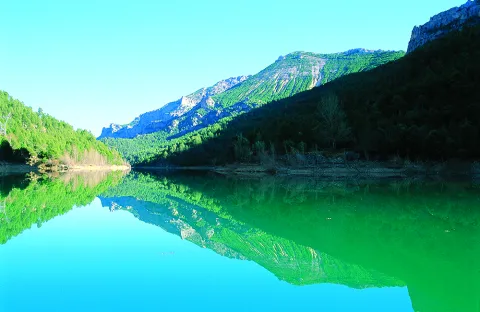
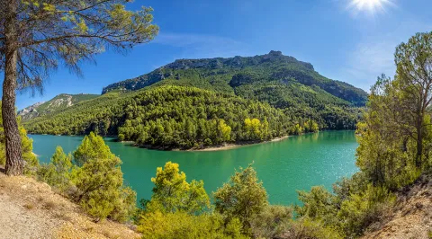
This small reservoir, attached between dense pine trees and high mountains, is a pleasant surprise for visitors because the water level is usually high and actually looks like a narrow lake. The water enters from the Segura River, once it leaves La Toba, and continues from 4 to 5 kilometres to the dam. Depending on the amount of sunlight present, the water in the tank can acquire a variety of different aspects, from an intense blue to an emerald green, which only adds to the mysteries that are already hidden under its surface.

Ubicación
Latitud
37.772886
Longitud
-3.788329
Ubicación en el mapa
POINT (-3.788329 37.772886)
Imágenes carrusel
imagen
Image
Cazorla%20anchuricas%202.jpg
Imagen principal
Desactivado
imagen
Image
Cazorla%20parque%20natural.jpg
Imagen principal
Desactivado
imagen
Image
anchuricas.png
Imagen principal
Desactivado
imagen
Image
26221616Master.jpg
Imagen principal
Desactivado
imagen
Image
Natu079.jpg
Imagen principal
Desactivado
imagen
Image
Natu080.jpg
Imagen principal
Desactivado
imagen
Image
Natu092.jpg
Imagen principal
Desactivado
imagen
Image
Natu057.jpg
Imagen principal
Desactivado
imagen
Image
Natu112.jpg
Imagen principal
Desactivado
imagen
Image
Natu380.jpg
Imagen principal
Desactivado
imagen
Image
Natu127.jpg
Imagen principal
Desactivado
imagen
Image
Natu230.jpg
Imagen principal
Desactivado
imagen
Image
Natu252.jpg
Imagen principal
Desactivado
imagen
Image
Natu253.jpg
Imagen principal
Desactivado
imagen
Image
Natu269.jpg
Imagen principal
Desactivado
Imágenes cabecera
imagen
Image
Cazorla%20anchuricas%201.jpg
Imagen principal
Activado
Loading map
Preparing points of interest and routes...

Aguas Negras Reservoir

Submitted by brandcode_deweloper on
Id
872954
Descripción
Descripción larga

In a spectacular high mountain area, right on the edge of our region with that of Cazorla, the Borosa River has a hydroelectric use composed of the tiny reservoir of Black Waters, of 0.07 hm ³, and the Electric Central of Los Organos, with a production capacity of 1.9 MW / hour. The maximum water level is 1250 m high.

Breve descripción

Black Water Embalse

Ubicación
Latitud
37.912893
Longitud
-3.003887
Municipio
Ubicación en el mapa
POINT (-3.003887 37.912893)
Imágenes carrusel
imagen
Image
3%20%281%29.jpg
Imagen principal
Desactivado
imagen
Image
1.jpg
Imagen principal
Desactivado
imagen
Image
2%20%281%29.jpg
Imagen principal
Desactivado
Imágenes cabecera
imagen
Image
Natu068.jpg
Imagen principal
Activado
Loading map
Preparing points of interest and routes...

Aguas Negras Reservoir and Valdeazores Lagoon

Submitted by brandcode_deweloper on
Id
912573
Descripción
Descripción larga

By coming down from Collado Bermejo you will first find the Lagoon of Valdeazores, a natural stagnation of the stream of the same name that has been repressed with a wall at its bottom. The lagoon is an intense turquoise blue, surrounded by nozzles, strawberries, complaints and maples.

About 800 meters later you will find the reservoir of Aguas Negras, another paradoxical place where a dam was built years ago for the hydroelectric use of the Borosa River.

Crossing the dam and walking a few hundred meters you can reach the birth of Aguas Negras - or the birth of Boros- an emergency that helped by the Arroyo del Inferno gives rise to some of the most important tributaries of Guadalquivir in its high stretch.

We suggest:

  • From the Interpretation Centre of the Borosa River (next to the farm), a well-known route to the reservoirs, passing through the Cerrada de Elias and the leap of the Organs. If you have time, give a day to this spectacular route.
  • Visit the San Pedro Navy by the way we had brought to the hill of Fuente Bermejo.

In Cazorla take the Sierra road (A-319) until the crossing known as the Empalme del Valle. Turn right on the JF-7092 road and after passing the bridge over the Guadalquivir River (4 km from the Empalme) follow the left track (JF-7091). We go through the Nava del Espino, the Nava de San Pedro, the Nava Ciazo and follow in the direction of the Campos, but before we reach them, on the Collado de la Fuente Bermejo a road to the left takes us to the lagoons.

Breve descripción

The natural wealth and beauty of these two sites have made them visited by an infinite number of hikers in recent decades; but this pressure has not prevented the lagoons from remaining unique and beautiful. You are in one of the areas of maximum protection of the Park, an extremely delicate ecosystem that has favored this explosion of biodiversity: real anades, seals and petirrodes find an ideal shelter in these "ponds" and in the vegetation surrounding them.

Ubicación
Nombre
Embalse Aguas Negras
Latitud
37.912893
Longitud
-3.003887
Municipio
Ubicación en el mapa
POINT (-3.003887 37.912893)
Tipos de punto de interés
Imágenes carrusel
imagen
Image
lagunas-de-aguas-negras-cazorla-2-jpg
Imagen principal
Desactivado
imagen
Image
lagunas-de-aguas-negras-cazorla-1-jpg
Imagen principal
Desactivado
Imágenes cabecera
imagen
Image
lagunas-de-aguas-negras-cazorla-3-jpg
Imagen principal
Activado
Loading map
Preparing points of interest and routes...

Negral or Resinero Pine Forest

Submitted by brandcode_deweloper on
Id
881318
Descripción
Descripción larga

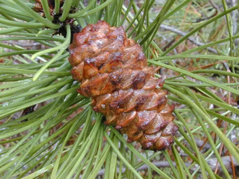
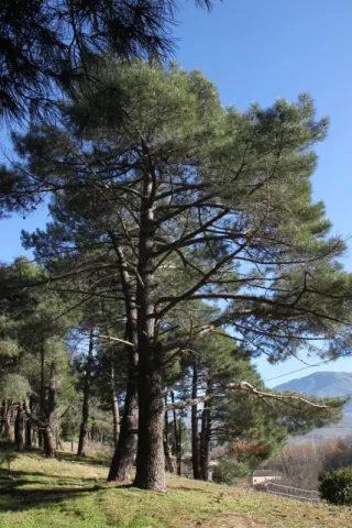
El Chorro is on a platform at 1350 m of altitude, flanked to the west by the large cuts that raise the foothills of the saw on the jiennese countryside, and to the east by Mount Gilillo (1847 m). In the skirt that forms this platform is extended an extensive black pine pinar, which is what is called in the area to the Pinus pinaster.

The orientation of this hillside we walk through is west and northwest, making sunsets a great added value to the enjoyment of the pine. In this area, an observatory of rapacious birds has been installed, especially of lethal vultures.

This black pine saw its area of natural presence expanded by serving as a raw material in the extraction of the essence of trementine (avocado), the main product that is obtained from the resin. In the early 20th century many slopes of these saws were populated with this pine.

The pineapple that we visit is barely sotoscala at first, but then it is enriched with endrines (Prunus spinosa), majuelos (Crataegus monogina), skirmishes (Rosa spp.). As we reach the stream of the Chorro, this little forest is thick and on the front side that has a north orientation is enriched with madreselvas (Lonicera peryclimenum hispanica), with mountain roses (Paeonia broteroi), and numerous orchids (Orchis cazorlensis, Orchis tenera, Neotinea maculata,...).

LOCATION

We access the road that leaves La Iruela in the direction of Riogazas and the Chorro. About 10 km away we reach an old forest house on our left and on the shore of the road. From this point we follow the track already walking, not more than 2 km., through a thick forest of black pines (Pinus pinaster).

Breve descripción

El Chorro

Ubicación
Latitud
37.920351
Longitud
-2.994140
Municipio
Ubicación en el mapa
POINT (-2.99414 37.920351)
Tipos de punto de interés
Imágenes carrusel
imagen
Image
Pinus_pinaster.jpg
Imagen principal
Desactivado
imagen
Image
62-Pinus-pinaster-porte-PH-IMG_0142-427x640.jpg
Imagen principal
Desactivado
imagen
Image
el-pino-laricio-pinus-nigra-el-pino-carrasco-pinus-halepensis-y-el-pino-resinero-pinus-pinaster-son-las-especies-resineras-por-excelencia-fundamentalmente-la-c3baltima.jpg
Imagen principal
Desactivado
Imágenes cabecera
imagen
Image
DSCN3318.jpg
Imagen principal
Activado
Loading map
Preparing points of interest and routes...