Saltar al contenido principal

Fountain Taza de Pozo Alcón

Submitted by brandcode_deweloper on
Id
8109717
Descripción
Descripción larga

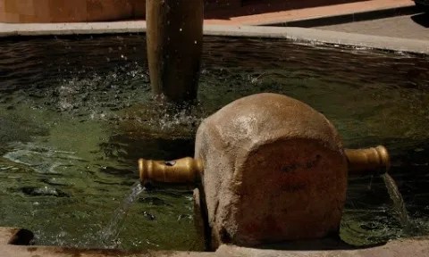
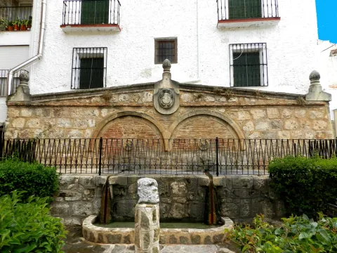
Located on a side of the Church of the Incarnation. Decorative source of vertical pipe type cup that spills to an octagonal pillar. It has two side pipes on the perimeter of the pillar that they used to serve to fill the cantars.

Breve descripción

Dodecagonal source with a single pipe on one side

Telecomunicaciones
Teléfono de contacto
953 738 041
Correo electrónico
ayuntamiento@pozoalcon.es
Ubicación
Código Postal
23485
Latitud
37.705600
Longitud
-2.933550
Dirección
C/ Monje, 2. Pozo Alcón
Municipio
Ubicación en el mapa
POINT (-2.93355 37.7056)
Tipos de punto de interés
Imágenes carrusel
imagen
Image
Fuente%20Taza2%20%281%29.jpg
Imagen principal
Desactivado
imagen
Image
Fuente%20Taza3%20%281%29.jpg
Imagen principal
Desactivado
Imágenes cabecera
imagen
Image
Fuente%20Taza%20%281%29.jpg
Imagen principal
Activado
Loading map
Preparing points of interest and routes...
Fountain of los Chorros

Submitted by brandcode_deweloper on
Id
4672111
Descripción
Breve descripción

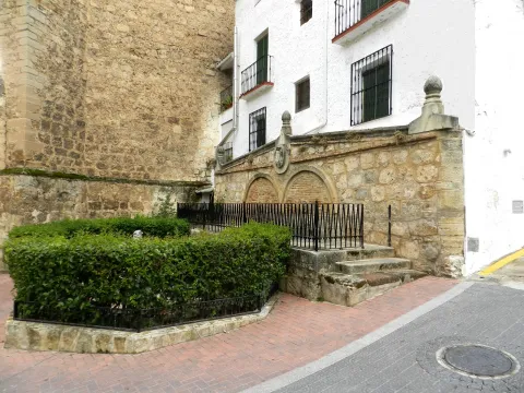
It dates back to the late 18th century, although its construction date is not well known. It's made of masonry and landscape structure. It is made up of a frontis with two half-point arches and a triangular fronton that in its center hosts a shield of the Bourbons.

Ubicación
Código Postal
23370
Latitud
38.317760
Longitud
-2.658810
Distrito
Municipio
Ubicación en el mapa
POINT (-2.65881 38.31776)
Tipos de punto de interés
Imágenes carrusel
imagen
Image
fuente%20los%20chorros.JPG
Imagen principal
Desactivado
Imágenes cabecera
imagen
Image
DSCN1418.jpg
Imagen principal
Activado
Horario
10: 00 - 14: 00 and 17: 00 - 21: 00.
Loading map
Preparing points of interest and routes...
Fountain of the Corregidora

Submitted by brandcode_deweloper on
Id
4696970
Descripción
Descripción larga

The fountain of La Corregidora is less than 1 km from the urban centre of Sabiote, in the
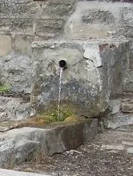
place known as the Corridor. To access it, you have to go down by an unusual cut through those areas of La Loma, and it gradually opens up by discovering a beautiful view in which you can see the entire province, passing through Villacarillo and Iznatoraf (or Torafe as they call it through those areas and the Sierra de Segura). It is a dark and very humid area, as the sun never comes. It has a 4-year-old fountain, which in the past and now serves to give the cattle and the people to drink. The stream that forms, called the corridor, as its source, flows into the Guadalimar basin. In the surroundings there are only heras, olive trees and fruit crops, such as cherry and almonds.

Breve descripción

One of the most important natural sites we own in the region of the Loma and the Villas, is this stream that forms a waterfall in the vicinity of Sabiote, a place that for its freshness and for having around it the stone that has made great the monuments of this villa.

Telecomunicaciones
Sitio web
www.sabiote.com
Teléfono de contacto
953 773 002
Ubicación
Código Postal
23410
Latitud
38.068423
Longitud
-3.291115
Municipio
Ubicación en el mapa
POINT (-3.291115 38.068423)
Tipos de punto de interés
Imágenes carrusel
imagen
Image
Fuente%20de%20la%20Corregidora.jpg
Imagen principal
Desactivado
Imágenes cabecera
imagen
Image
img_0227.jpg
Imagen principal
Activado
Loading map
Preparing points of interest and routes...
Fountain of the Almoteja

Submitted by brandcode_deweloper on
Id
880909
Descripción
Descripción larga

In the fountain we can see the catacamosque (Pinguicola vallisneriifolia), small carnivora plant endemic to the Park, which feeds on insects. In this place a signposted path of 1 '5 km is started, which ascends on a hillside from which you can see very good panorama of the Bucentaina and the Stone of the Hole.

SITUATION

In the km 2.2 of the Siles to Las Azeas road (JF-7012), it starts a forest track that leads to the Area after 1.5 km.

Breve descripción

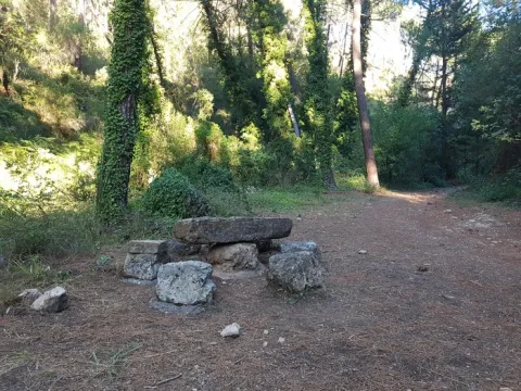
This Recreative Area is in a cool and pleasant place next to the Arroyo del Barranco de los Tejos and has tables and fountain. Although it has a small parking lot, we recommend walking to enjoy the river vegetation of the stream, with abundant willows.

Ubicación
Latitud
38.359810
Longitud
-2.569110
Dirección
km 2,2 de la carretera de Siles a Las Acebeas
Distrito
Municipio
Ubicación en el mapa
POINT (-2.56911 38.35981)
Tipos de punto de interés
Imágenes carrusel
imagen
Image
Fuente%20Almoteja.jpg
Imagen principal
Desactivado
Imágenes cabecera
imagen
Image
fuente-almoteja.jpg
Imagen principal
Activado
Loading map
Preparing points of interest and routes...

Fault of Tíscar

Submitted by brandcode_deweloper on
Id
876119
Descripción
Descripción larga

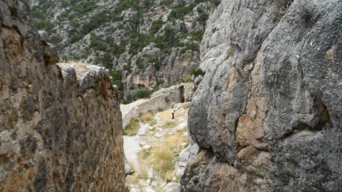
The Tiscar Falla is a sinistra tear fracture that borders the Quesada saw by the E, running always close to the Quesada- well Alcón road. The fracture plane is almost vertical. The failure has cut the southern end of the Sierra de Cazorla, moving the southern fragment to the NW about 8 km.

At the proposed point the failure plane can be observed, with associated failure rocks, as well as some horizontal strands that show the movement of this fracture.

Source: Inventory of Georresources of Andalusia. Environmental Council. Junta de Andalusia.

Breve descripción

Tiscar failure

Ubicación
Latitud
37.912893
Longitud
-3.003887
Municipio
Ubicación en el mapa
POINT (-3.003887 37.912893)
Tipos de punto de interés
Imágenes carrusel
imagen
Image
falla-tiscar.jpg
Imagen principal
Desactivado
imagen
Image
piedras.jpg
Imagen principal
Desactivado
imagen
Image
Natu215.jpg
Imagen principal
Desactivado
Imágenes cabecera
imagen
Image
tiscar.jpg
Imagen principal
Activado
Loading map
Preparing points of interest and routes...
Los Perales Strait

Submitted by brandcode_deweloper on
Id
913048
Descripción
Descripción larga

There are two places to enjoy the Strait of Perals:

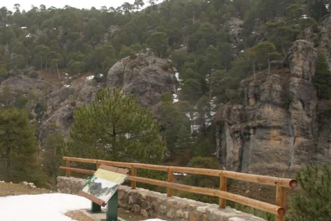
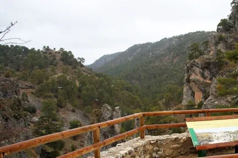
  • Undoubtedly a good place to observe the beauty of this Strait is the lookout that appears on the left side of the Navas road. It's not signposted, so you have to pay attention, though it has no loss.
  • In the valley of Valdetrillos in the ascending direction there is a track that can be seen from the lookout. To get to it you have to turn back on the runway of the Navas and take the road cut by a chain that goes to the right. We have to cross the bridge over the Rambla stream. After a period of half an hour walking we view the basin of the Valdetrillos stream from where the Strait of the Perals and the lookout that has been referred to above are observed.

In Cazorla take the Sierra road (A-319) until the crossing known as the Empalme del Valle. Turn right on the JF-7092 road and after passing the bridge over the Guadalquivir River (4 km from the Empalme) follow the left track (JF-7091). Between the km 27 and 28 of the road signs is the lookout with views of the Strait of the Perales.

Breve descripción

Singular throat that stands out for the aesthetics of its curious rock formations. At the bottom the stream of Valdetrillos breaks into fast joys that put the sound note. In this area it is easy to see how the agile muflons, the montane males, and even the majestic flight of the royal eagle, the leonate vulture or the drifted eagle climb through vertical walls. At the end of the valley the Calarillas provides perspectives of the highest mountains of this natural space.

Ubicación
Latitud
37.912893
Longitud
-3.003887
Municipio
Ubicación en el mapa
POINT (-3.003887 37.912893)
Tipos de punto de interés
Imágenes carrusel
imagen
Image
perales.jpg
Imagen principal
Desactivado
Imágenes cabecera
imagen
Image
1515_MI_01.jpg
Imagen principal
Activado
Loading map
Preparing points of interest and routes...
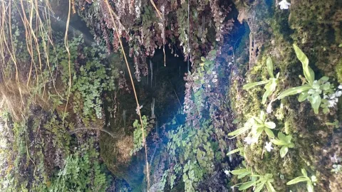
El Yelmo Free Flight Station

Submitted by brandcode_deweloper on
Id
1921810
Descripción
Descripción larga

INTERNATIONAL AIR FESTIVAL -The Yelmo is the most important festival in Spain on flight issues. A very original festival that allows you to enjoy the projection of films linked to air and air sports, and a fair with the best products for the practice of free flight, as well as acrobatic exhibitions, concerts and cultural activities.

Breve descripción

The Yelmo is the most emblematic mountain in the Sierra de Segura. With a height of 1.807 meters above sea level, it is a privileged lookout over the Jienese province and the borders. The great attraction of the place, located in the heart of Natural Park, is joined by its exceptional conditions. The west-facing flight is about 1,000 meters high and specialists consider it one of the best in Spain. The poniente breeze allows to fly all year round, except for adverse weather conditions.

Telecomunicaciones
Teléfono de contacto
953 482 131 / 650 116 801
Ubicación
Nombre
Club de Parapente “El Yelmo”
Código Postal
23293
Latitud
38.253746
Longitud
-2.660571
Dirección
C/ Andalucía, 164 F 1º
Distrito
Ubicación en el mapa
POINT (-2.660571 38.253746)
Loading map
Preparing points of interest and routes...
Huesa Station

Submitted by brandcode_deweloper on
Id
4535653
Descripción
Breve descripción

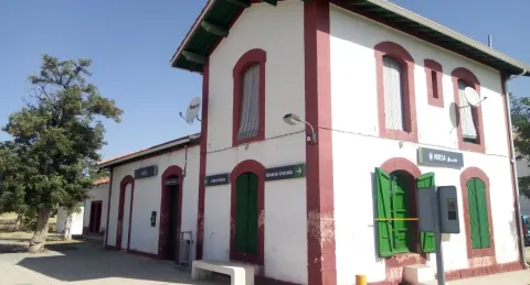
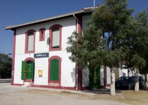
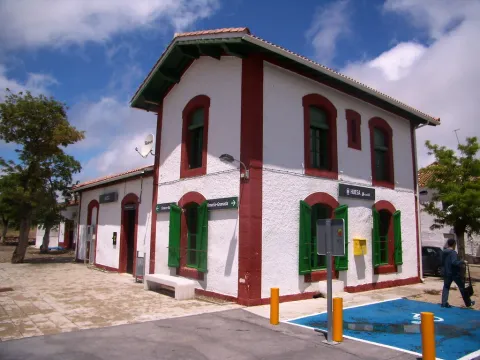
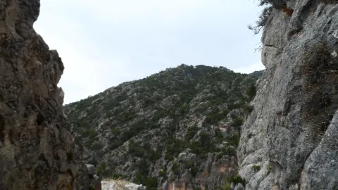
Huesa belongs to the region of Alto Guadalquivir, extending from the center of the region to the south of it, just on the provincial border with Granada. It gives the capital 137 Km. The station is located at point 82.7 of the railway line of Iberian width Linares Baeza-Almería, between the stations of Larva and Cabra del Santo Cristo- Alicún.

Telecomunicaciones
Teléfono de contacto
902 432 343
Ubicación
Código Postal
23487
Latitud
37.717060
Longitud
-3.186950
Dirección
Estación, s/n
Municipio
Ubicación en el mapa
POINT (-3.18695 37.71706)
Tipos de punto de interés
Imágenes carrusel
imagen
Image
Estaci%C3%B3n%20de%20Huesa%202.jpg
Imagen principal
Desactivado
imagen
Image
Estaci%C3%B3n%20de%20Huesa.jpg
Imagen principal
Desactivado
Imágenes cabecera
imagen
Image
5699259710_896b12e639_b.jpg
Imagen principal
Activado
Loading map
Preparing points of interest and routes...
Hermitage of the Cristo de la Vera Cruz

Submitted by brandcode_deweloper on
Id
4585075
Descripción
Breve descripción

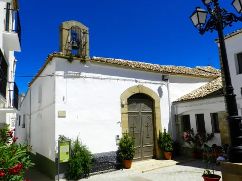
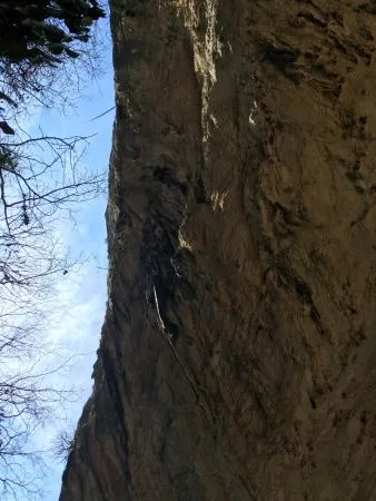
It dates from the XVII@-@ XVIII centuries. It houses the image of the pattern, the Most Holy Christ of Veracruz, in a baroque style shrimp whose decoration is due to the painter Ginés Navarro. The outer cover dates from the reconstruction of the temple that was made to the neo-Gothic taste by the neighbors in the first half of the 19th century.

Telecomunicaciones
Sitio web
www.redjaen.es/francis/?m=c&o=8079
Ubicación
Código Postal
23338
Latitud
38.159280
Longitud
-3.031710
Dirección
C/ Veracruz
Municipio
Ubicación en el mapa
POINT (-3.03171 38.15928)
Tipos de punto de interés
Imágenes carrusel
imagen
Image
Ermita%20del%20Cristo%20de%20la%20Vera%20Cruz%202.jpg
Imagen principal
Desactivado
Imágenes cabecera
imagen
Image
DSCN4255.JPG
Imagen principal
Activado
Loading map
Preparing points of interest and routes...
Hermitage of Santa Quiteria

Submitted by brandcode_deweloper on
Id
4909238
Descripción
Breve descripción

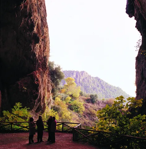
The old construction, already in 1,511, is cited among the hermitage of Iznatoraf, a municipality from which it gained independence. She is the co-patron of Sorihuela and is located three kilometres from the town centre, in the area called "Cerrico Pelón." It has a single ship and lacks architectural value due to the numerous reforms it has undergone.

Ubicación
Código Postal
23270
Latitud
38.216680
Longitud
-3.038390
Distrito
Ubicación en el mapa
POINT (-3.03839 38.21668)
Tipos de punto de interés
Imágenes carrusel
imagen
Image
Ermita%20de%20Santa%20Quiteria%20%281%29.jpg
Imagen principal
Desactivado
imagen
Image
Ermita%20de%20Santa%20Quiteria.jpg
Imagen principal
Desactivado
Imágenes cabecera
imagen
Image
Ermita%20de%20Santa%20Quiteria%20OK.jpg
Imagen principal
Activado
Loading map
Preparing points of interest and routes...