Saltar al contenido principal

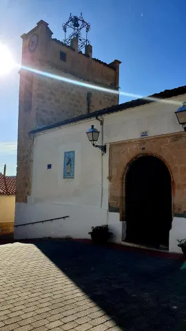
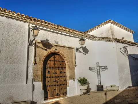
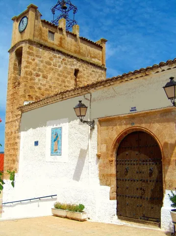
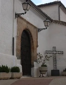
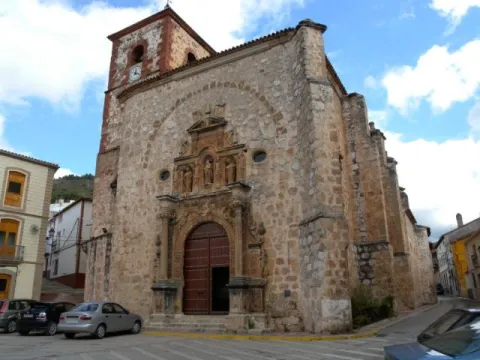
Church of Nuestra Señora de la Asunción

Submitted by brandcode_deweloper on
Id
918675
Descripción
Descripción larga

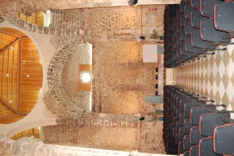
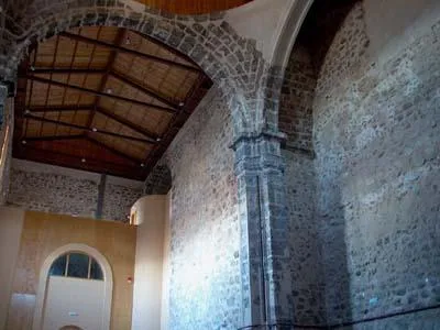
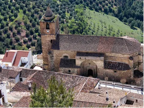
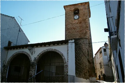
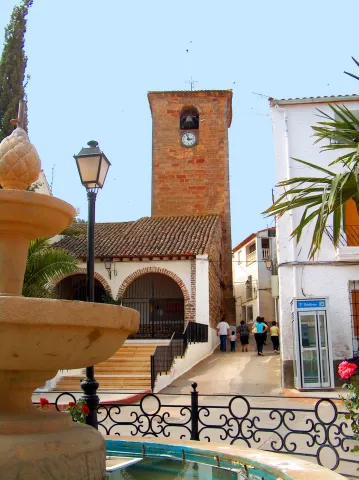
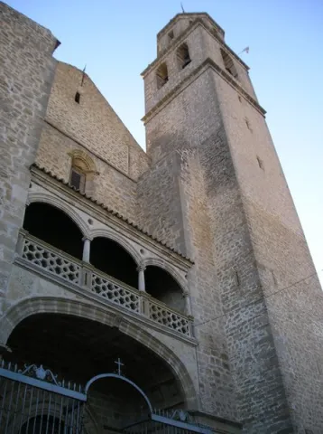
The church, beginning in 1534, is the first great church built by Vandelvira and from here he left two years later to Ubeda where Francis of the Cobos had commissioned him to perform the Sacred Chapel of El Salvador. The church was completed during the 18th century although the shrimp of the Christ of the Veracruz dates from the 18th century.

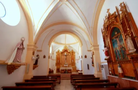
In the lightness of the domes and in their composition, elements are intuited that will be present in their most representative architectural element, the vanish dome. The paintings that cover the domes of the central ship date from 1575, the work of Pedro Raxis representing scenes of the Old Testament and the Passion of Christ.

We can imagine Vandelvira and his assistants during the first years of the construction of this church, large wooden scaffolding, the noise of the quarries, piles of stone to be turned into armchairs and the caleros selling lime for the argamase. Without a doubt, the most curious image should be the perplexity of the elderly, seeing such thin pillars on the sides of a great central ship, nothing to do with the churches of the area, or the recite Sanctuary of the Virgin of Fuensanta, in the nearby Villanueva of the Archbishop.

Breve descripción

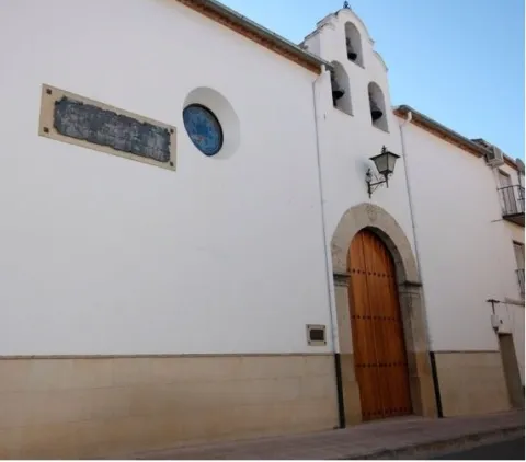
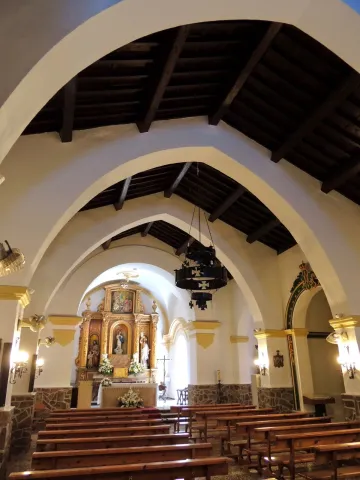
The church of Nuestra Señora de la Asunción sits on the site that occupied the castle of the place known as the Tower of Mingo Pliego. On the floor, Andrés de Vandelvira draws a new temple and during his stay in Villacarillo will meet Luisa de Luna, with whom he married and had seven children. In the church of the Assumption we see some elements that are typical of the buildings projected by the architect, such as its basilical plant of three ships separated by high and slender pillars that complete the sense of monumental of the whole. There are still some tarootic elements in the building, which is a sample of that time of changes that represent the first decades of the 16th.

Ubicación
Latitud
38.114995
Longitud
-3.086348
Dirección
Plaza Juan XXIII
Municipio
Ubicación en el mapa
POINT (-3.086348 38.114995)
Tipos de punto de interés
Imágenes carrusel
imagen
Image
asun2.jpeg
Imagen principal
Desactivado
imagen
Image
asun3.jpeg
Imagen principal
Desactivado
imagen
Image
asun4.jpeg
Imagen principal
Desactivado
Imágenes cabecera
imagen
Image
asun1.jpeg
Imagen principal
Activado
Loading map
Preparing points of interest and routes...

Church of Nuestra Señora de la Asunción

Submitted by brandcode_deweloper on
Id
5630906
Descripción
Breve descripción

It's the most important of Benatae's buildings. The temple responds to the sacred Levine architecture, which could be due to the fact that, during the period of configuration of its factory, it belonged to the kingdom of Murcia, a situation that lasted until the suppression of the Military Order of Santiago.Constructionstarted in the 15th centuryand ends in the XVII, which causes architectural elements of the Gothic, Renaissance and Baroque styles to exist.The cover, next to the epistle, isof sillery,with a half-point arcwith convexa molding through the intrados. It is framed in a potter that rests on Gothic moldings.The towerof irregular silery has a characteristic form: it is quadrangular andthree times longer than widewith holes at the ends for the bells. The plant is ofa central shipin the form of a rectangle divided into three sections. The presbyterium appears behind a pointed chest arc.The altarpieceIn the wood, it is organized in three streets and in the central one is found the image of the Immaculate in a furnace.

Telecomunicaciones
Sitio web
www.andalucia.org/es/benatae-turismo-cultural-iglesia-parroquial-de-nuestra-senora-de-la-asuncion/
Teléfono de contacto
953 482 096
Ubicación
Código Postal
23390
Latitud
38.353620
Longitud
-2.650780
Dirección
C/ Reyes Católicos, 1
Distrito
Municipio
Ubicación en el mapa
POINT (-2.65078 38.35362)
Tipos de punto de interés
Imágenes carrusel
imagen
Image
Iglesia%20de%20Nuestra%20Se%C3%B1ora%20de%20la%20Asunci%C3%B3n_Benatae.jpg
Imagen principal
Desactivado
imagen
Image
benatae2%20%281%29.jpg
Imagen principal
Desactivado
imagen
Image
Iglesia%20de%20Nuestra%20Se%C3%B1ora%20de%20la%20Asunci%C3%B3n%20benatae.%202.jpg
Imagen principal
Desactivado
Imágenes cabecera
imagen
Image
Iglesia%20de%20Nuestra%20Se%C3%B1ora%20de%20la%20Asunci%C3%B3n%20benatae%20ret%20%281%29.jpg
Imagen principal
Activado
Loading map
Preparing points of interest and routes...

Church of los Jesuitas

Submitted by brandcode_deweloper on
Id
918621
Descripción
Descripción larga

Thanks to this father's work, we know many things about the College of the Society of Jesus in Segura de la Sierra. The buildings that are preserved today in Segura de la Sierra are the result of one of its neighbours' efforts to make a religious foundation. His name was Cristóbal Rodríguez de Moya and, in the face of his wife's death, he understood that he would have a problem with his heritage of not marrying one of his three daughters. By choosing his daughters for religious life, he founded a College.

To observe the interior of the Church of the Jesuits is not to do so in the key of the history of art or to analyze the restoration that the building has suffered, it is to have a vision of society from the end of the 16th century to approach its fears and a religiosity that permeated all aspects of life, of fear of the devil or to die in sin. An approach to daily life in a small mountain community, with the poor of solemnity to which the Society of Jesus attended with its pastoral missions.

In short, it is about knowing one more episode of the history of the end of the 16th century in Segura, the plague of 1596, the famine of 1605, the charity, the fears and poverty of a large part of the population and the collective sadness of the death of Francisca de Avilés, the last daughter of Cristóbal Rodríguez de Moya. To mentally recite the passage of this woman's death puts the hairs at the top, with a mass attended by all the people and even the Franciscans of Santa María de la Peña, of Orcera, to give the last farewell to the foundress.

Breve descripción

Let's imagine for a moment an afternoon of 1606. A priest named Manuel de Arceo is finishing writing the last chapter of the history of the foundation of the College of Segura. He does not want to take the lead, nor to go into history, but only fulfils the orders he has received from Rome to record the Jesuits foundations and to prevent their process from falling into oblivion. A few days later, Father Arceo received a new assignment, to go to New Granada to take over the new Jesuit province.

Ubicación
Latitud
38.298550
Longitud
-2.652490
Distrito
Ubicación en el mapa
POINT (-2.65249 38.29855)
Imágenes carrusel
imagen
Image
segura-de-la-sierra-iglesia-2-jpg
Imagen principal
Desactivado
imagen
Image
jesuitas.jpg
Imagen principal
Desactivado
Imágenes cabecera
imagen
Image
Iglesia%20de%20los%20Jesuitas%20%28Segura%20de%20la%20Sierra%29-1%20%283%29.jpg
Imagen principal
Activado
Loading map
Preparing points of interest and routes...
Marcas de calidad

Church of the Vera Cruz

Submitted by brandcode_deweloper on
Id
4639987
Descripción
Breve descripción

The Church of the Vera Cruz was built annexed to the old hospital of the Vera Cruz between 1575 and 1605, in the late 16th and early 17th century. The facade is sober, adorned with a half-point bow on the main door and a bell-like swordsman. A single-ship plant, divided into two sections covered with an arista vault and two chapels in each section. It houses the sculptural jewel of Villanueva del Archbishop, The Christ of the Vera Cruz, the patron of the town, the work of the sculptor Mariano Benlliure, and the Virgin of the Incarnation of the imaginary Domingo Sánchez Mesa.

Telecomunicaciones
Sitio web
www.andalucia.org/es/villanueva-del-arzobispo-turismo-cultural-iglesia-de-la-vera-cruz
Teléfono de contacto
953 450 848
Ubicación
Código Postal
23330
Latitud
38.170400
Longitud
-3.007320
Dirección
C/ Vera Cruz, 7
Ubicación en el mapa
POINT (-3.00732 38.1704)
Tipos de punto de interés
Imágenes carrusel
imagen
Image
Iglesia%20de%20la%20Vera%20Cruz%20en%20Villanueva%20del%20arzobispo.jpeg
Imagen principal
Desactivado
Imágenes cabecera
imagen
Image
Iglesia-vera-cruz.jpg
Imagen principal
Activado
Loading map
Preparing points of interest and routes...

Church of the Inmaculada Concepción

Submitted by brandcode_deweloper on
Id
4536746
Descripción
Descripción larga

It began in the 13th century with the semantic of the Gothic, in the following centuries the majority of the factory was configured according to the artistic lexicography of the Renaissance and finished the works in the 18th century in Baroque style.

Its ship is rectangular, structured in five sections that separate hard arches pointed over semi-pillars, and is covered with a pair and row wood roof in two waters. The right side has four chapels covered with half a barrel.

The one that welcomes the patron, the Virgin of the Field - the sculptural group that form Mary and the Child is from the 20th century - has its access through a half-point arch on pillars with pilasters curved with capitals with ovens and darts. On the left side there is a capilla-hornina with a half-point arc.

The presbyterium has flat tester, is covered with a half-barrel with lunetes and is accessed through a half-point spinal arch on pillars with artefacts. At the foot of the temple are the tower, the choir high and the door. The tower is Renaissance, built with silery, with a square base, has bell holes and is covered in four waters.

They also deserve to stand out their two Renaissance covers, one, the most valuable, on the side of the Gospel, and the other at their feet. Its porch, of very later construction, is significant as it involves the insertion of an element of popular architecture.

Breve descripción

The most significant of Génave's cultural properties is the parish church of the Immaculate Conception.

Telecomunicaciones
Sitio web
www.genave.es/el-municipio/patrimonio-historico.html
Teléfono de contacto
953 615 054
Ubicación
Código Postal
23210
Latitud
38.429490
Longitud
-2.732900
Dirección
C/ Iglesia, 14
Distrito
Municipio
Ubicación en el mapa
POINT (-2.7329 38.42949)
Tipos de punto de interés
Imágenes carrusel
imagen
Image
2.JPG
Imagen principal
Desactivado
imagen
Image
4.jpg
Imagen principal
Desactivado
Imágenes cabecera
imagen
Image
1.jpg
Imagen principal
Activado
Loading map
Preparing points of interest and routes...

Church of the Encarnación

Submitted by brandcode_deweloper on
Id
4540597
Descripción
Descripción larga

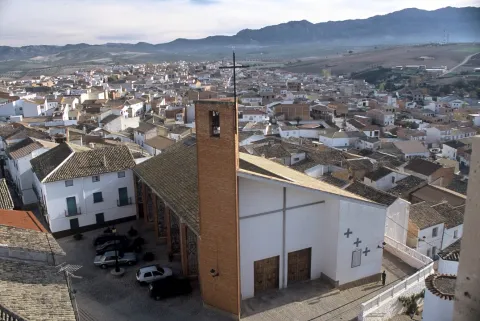
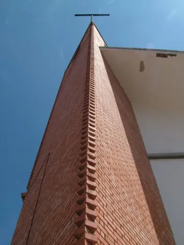
The novelty of the temple lies in the fact that the sides of the rectangle of its plant are broken in the form of a saw tip on its sides - with iconographic windows with human and holy figures - while on the front they alternate the straight lines with the circular lines and at the entrance a triangle is formed for the tower to stand on it.

The floor is of terraced; the altar is of granite; the tower is of brick seen; the wood has a presence in the roof; and a large cross presides over the main facade.

Breve descripción

To complete the medieval aspect given to Peal de Becerro its mocha and watch towers, the remains of the walls of the fence and the historical center of organic urbanism, with cobbled streets and single-family two-storey and asymmetric holes with pots and flowers, it would have been desirable for its original temple to be preserved. But it disappeared and the parish church of the Incarnation was built in 1969 with a project designed and directed by Francisco Gutiérrez de Cabiedes.

Telecomunicaciones
Sitio web
http://parroquiapealdebecerro.blogspot.com/
Teléfono de contacto
953 730 433
Ubicación
Código Postal
23460
Latitud
37.912120
Longitud
-3.126830
Dirección
C/ Poeta Miguel Hernández, 18
Municipio
Ubicación en el mapa
POINT (-3.12683 37.91212)
Tipos de punto de interés
Imágenes carrusel
imagen
Image
iglesia-de-la-encarnacion-y-ciudad-peal-de-becerro-jpg
Imagen principal
Desactivado
Imágenes cabecera
imagen
Image
Monumentos5IglesiadelaEncarnacixnTorre.jpg
Imagen principal
Activado
Loading map
Preparing points of interest and routes...

Church of the Asunción

Submitted by brandcode_deweloper on
Id
913640
Descripción
Descripción larga

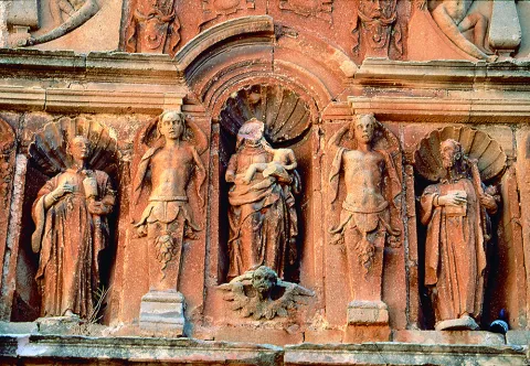
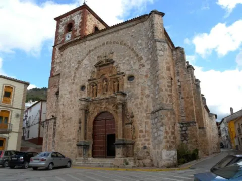
The works had to begin shortly after, and when on January 26, 1537 a visit was made by the visitors of the Order of Santiago, in the inspection of the accounts there was an expense that linked Andrés de Vandelvira to the project of the new factory next to the cantero Juan de Mojica; the church butler justified a total of 30,000 maravedis paid to these teachers "(...) for the quenta of the work of the yglesia that is being avened from haçer in the plaça (...)."

The trail of the new church was set up in Francisco de Luna, a master of canteria of recognized prestige at the service of the Order of Santiago, which in turn would be the one that encouraged Vandelvira and Mojica to keep the work at first. However, a certain documentary vacuum has generated confusion in the constructive process of this church, since if at first it is clear the commission to Mojica and Vandelvira, months later as it appears from another letter from the king - of 12 October 1537 - the factory was rekilled by the cantero Juan Martínez, although at the foot of the work was left Juan de Mojica for many years. De Vandelvira and Francisco de Luna do not know any more data related to the church of Orcera, but they must have influenced Juan de Mojica, a bartender at the end and after all professionally related to them. Perhaps Vandelvira also influenced the intervention made in the church by the singers Martín López de Alcaraz and his father Anton Sánchez, active in the city of Ubeda, in the years 1567 and 1568.

In the church, finally built throughout the 16th and 17th centuries, once again the Gothic-Renaissance duality is maintained in the approach of its unique ship, divided into three sections covered with tercelette vaults plus a quarter or major chapel with a starved vault. The arches perpiaños of the sections are half-point and the parietal - slightly pointed - are placed in semi-columns raised on bases of more classical composition. The classicism is more forceful on the outside: windows, side cover, cornels and vases that crown the contrasts. At the beginning of the 20th century, a monumental and proud 16th-century cover came from the late Franciscan convent of Santa María de la Peña, in which a beautiful Gothic image was venerated with this advocation, now preserved in the parish temple of Santa María del Collado de Segura de la Sierra.

Lost almost all of its movable goods in 1936, they are worthy to describe within the imagination a Crucified Christ of Manierist inspiration - preserved in the sacristy - which presents the particularity of which it was made in wood paste, and an Ecce Homo, a baroque size venerated in the town under the advocation of El Señor de la Caña, located at the entrance of the chapel of the Sagrarian. The major altarpiece, in gold bread, was built in the post-war and occupies most of the header's tester.

Breve descripción

Monument opened on 8 February 1983. In Orcera, in the area of Segura de la Sierra, although with its own council, there was, according to the visit of 1525, a small church dedicated to San Mateo on the outskirts. The increase in population and greater economic capacity determined the construction of a new temple in the public square; as it was mandatory the request was requested to the Council of the Order of Santiago and King Charles I as the supreme master of it. Carlos I in a letter, dated February 8, 1535 in Madrid, ordered that appropriate steps be taken on whether or not such works were appropriate, teachers' expenses, etc. On 28 February the licence was granted.

Telecomunicaciones
Teléfono de contacto
953 480 080
Ubicación
Código Postal
23370
Latitud
38.317650
Longitud
-2.659190
Dirección
Plaza España, 1 Camino de Navalcán C/ 18 de Julio, 6
Distrito
Municipio
Ubicación en el mapa
POINT (-2.65919 38.31765)
Tipos de punto de interés
Imágenes carrusel
imagen
Image
Mon444.jpg
Imagen principal
Desactivado
imagen
Image
175419-iglesia-de-orcera%20%281%29.jpg
Imagen principal
Desactivado
Imágenes cabecera
imagen
Image
175419-iglesia-de-orcera.jpg
Imagen principal
Activado
Loading map
Preparing points of interest and routes...

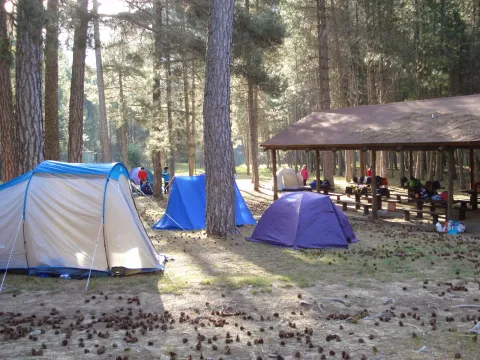
Huerta Vieja (Camping Area ontrolada)

Submitted by brandcode_deweloper on
Id
880967
Descripción
Descripción larga

Tranco road A-319, in the surroundings of the Tranco reservoir.

Breve descripción

Large area surrounded by lush vegetation, with fountain and wooden dining area, crossed by a stream. When you are not occupied by a camp, it is an excellent place to eat and rest. Very close is also the delicious place where the village of Bujaraiza was, abandoned since the construction of the Tranco reservoir.

Ubicación
Latitud
38.117830
Longitud
-2.806540
Dirección
Carretera del Tranco A-319
Distrito
Municipio
Ubicación en el mapa
POINT (-2.80654 38.11783)
Imágenes carrusel
imagen
Image
Huerta%20Vieja%202.jpg
Imagen principal
Desactivado
imagen
Image
Huerta%20Vieja%201.jpg
Imagen principal
Desactivado
Imágenes cabecera
imagen
Image
huerta-vieja.jpg
Imagen principal
Activado
Loading map
Preparing points of interest and routes...

Granites of La Puerta de Segura

Submitted by brandcode_deweloper on
Id
876209
Descripción
Descripción larga

Aflation of paleozoic granite surrounded by prebetic (triasic) materials with which it has a relationship of inconformity. Part of the village is built on the granite, which force a meandro in the Guadalimar River.

These are pink-coloured granules in afloor, in which large quartz and feldspar crystals are distinguished, in general unmeteorized. They are part of a recently exhumed paleorelieve after the erosion of the triastic clays and herring that cover them regionally. This is the granitic outcrop of the Central Iberian Zone of the southernmost Iberian Massif and further into the Betic Externs.

Source: Inventory of Georresources of Andalusia. Environmental Council. Junta de Andalusia.

Breve descripción

Granites of The Safe Gate

Ubicación
Latitud
38.079566
Longitud
-4.164839
Distrito
Municipio
Ubicación en el mapa
POINT (-4.164839 38.079566)
Tipos de punto de interés
Imágenes carrusel
imagen
Image
puerta-segura%20%281%29.jpg
Imagen principal
Desactivado
Imágenes cabecera
imagen
Image
la_puerta_segura_1.jpg
Imagen principal
Activado
Loading map
Preparing points of interest and routes...

Gorge of Hornos

Submitted by brandcode_deweloper on
Id
913080
Descripción
Descripción larga

Half a mile from Hornos, on the right, you will find the look at Las Celadillas. Later on, do not stop visiting the charming village of La Capellanía, whose crossing is well marked to the left. From there you can walk along the signposted path PR-A 150, which is close to the steep slopes of the Yelmo Chico and allows you to contemplate a wide range of views. The A-317a road itself lends itself to the walk, as it has very little traffic since the new A-317 road was built from Hornos to Santiago de la Espada.

Breve descripción

It is a long and deep valley all along the winding road A-317a, which rises at first between olive groves and then between closed pine trees, which are of carrasco pine in the lower area, black pine in the middle altitude strip and larix pine in the higher parts. Mixed with them, the oak trees and other species of the Mediterranean forest abound, forming a landscape of remarkable longitude.

Ubicación
Latitud
38.210827
Longitud
-2.685734
Distrito
Municipio
Ubicación en el mapa
POINT (-2.685734 38.210827)
Tipos de punto de interés
Imágenes carrusel
imagen
Image
Aldea%20de%20La%20Capellan%C3%ADa%20y%20valle%20de%20La%20Garganta%20-%20copia.jpg
Imagen principal
Desactivado
Imágenes cabecera
imagen
Image
hornos1.jpg
Imagen principal
Activado
Loading map
Preparing points of interest and routes...