Saltar al contenido principal

La Bolera Gorge

Submitted by brandcode_deweloper on
Id
912227
Descripción
Descripción larga

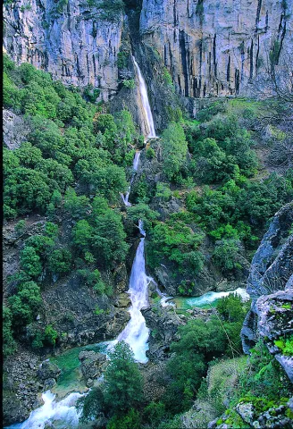
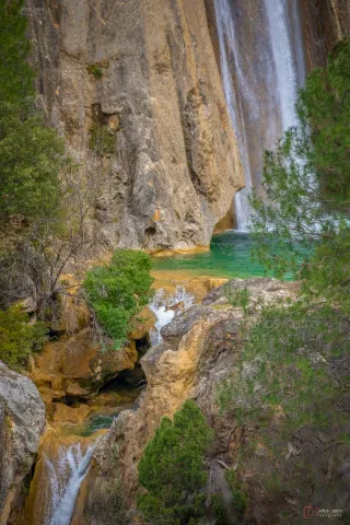
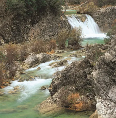
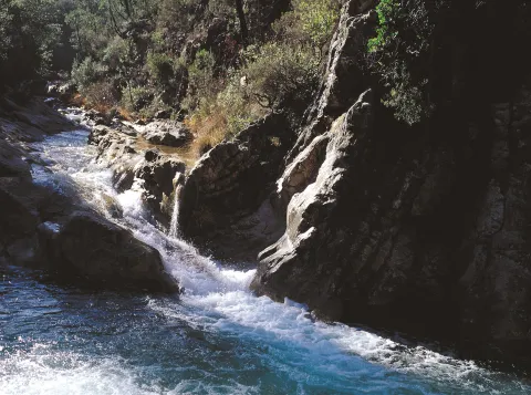
When that happens, the old Ituri Canal, already without use, loads its bed of crystalline liquid and discharges it to the riverbed, forming several waterfalls and chorreaderos of fine rain. At that time, neither the gallid waters, nor the technical difficulties that the current may pose, prevent the visitor from enjoying a unique show. Not in vain, this is one of the canyons preferred by the fans of this adventure sport of our country.

We suggest...

  • To practice barranquism within the Natural Park it is necessary to have permission from the Environmental Council.
  • It is possible that the vents of the reservoir will relieve water. To be sure we are not surprised by an avenue inside the canyon, it is recommended to request information on this matter from the administration of the reservoir (Tfno. 953 738 251)
  • Under normal conditions, there is no need for large physical powers or advanced knowledge to carry out the activity with a specialized guide. Several multiadventure companies offer this service in the area.

To go to the Bolera Clock there would be two options. The first is to go to the Bolera reservoir, as the dam is raised on the beginning of the canyon. A highly recommended option to observe the parade is the visit of the Peña de la Alcantarilla. To get to this place, in Pozo Alcón we take the road A-326 towards Castril. Just as we enter the Natural Park (there is a large panel indicating it as we pass a bridge after a long straight, past the km 6), we leave the main road turning left, passing through one of the entrances of Campsite La Bolera, we follow a narrow road to a parking lot located 30 meters from where the asphalt ends, 1 km later.

Breve descripción

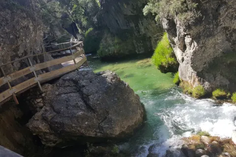
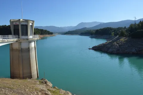
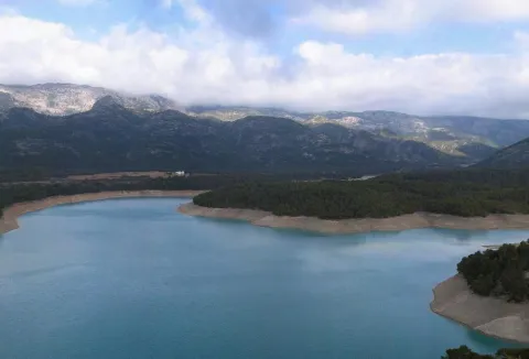
The Cerrada de la Bolera is one of the most spectacular and beautiful cannons in the Natural Park. From above, from the dam of the reservoir of the same name, from the bridge on which the road A-326 saves the parade or from the view of the Peña de la Alcantarilla, the view impresses. However, the most beautiful surprises are kept in their insides, in a territory reserved exclusively for barranquists. The shedding does not always carry water, as the leaks cause, in the driest times, the flow flow in a lower section, sometimes leaving the canyon dry. And yet, it is worth going through, because the forms that have modeled the river are very attractive. If on the contrary the level of the reservoir is high, those same leaks turn the journey into a dream.
Ubicación
Latitud
37.702695
Longitud
-2.935057
Municipio
Ubicación en el mapa
POINT (-2.935057 37.702695)
Tipos de punto de interés
Imágenes carrusel
imagen
Image
Pantano_de_la_Bolera_%28Pozo_Alc%C3%B3n%29.jpg
Imagen principal
Desactivado
Imágenes cabecera
imagen
Image
JDCANO_PANTANO_BOLERA.jpg
Imagen principal
Activado
Loading map
Preparing points of interest and routes...

Cerrada de Utrero - Linarejos Waterfall

Submitted by brandcode_deweloper on
Id
874733
Descripción
Descripción larga

The sector of the Cerrada de Utroo-Lancar de Linarejos is located in materials of the Prebetic of the Betic Cordillera. In particular, in the Cerrada de Utrero, the Guadalquivir River fits into limestone of the Superior Jurassic often dolomitised that develop constructive and destructive karmic forms at different scales.

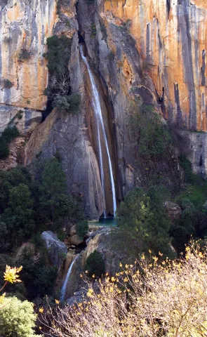
The narrow river-karctic valley was carved during the quaternary along the axis of a synchronous N40E direction. The karctic canyon of the closed is one km long and has a profile scaled by the development of travertines and pozas. The walls of the valley are pulled by minor karmic forms of great beauty and spectacular lapiaces The setting of the Guadalquivir River has left the stream of Linarejos hanging producing an impressive waterfall, known as the Cascade of Linarejos. This water jump of several tens of meters develops a travertine mass with "horse tail" morphology and cascade facies. The Lanchar de Linarejos is located on the SE flank of the synclinal and features a sequence of lapiaces and structural alleys controlled by conjugated diaclases.

Source: Inventory of Georresources of Andalusia. Environmental Council. Junta de Andalusia.

Breve descripción

Closed from Utrero, Linarejos

Ubicación
Latitud
37.920351
Longitud
-2.994140
Municipio
Ubicación en el mapa
POINT (-2.99414 37.920351)
Tipos de punto de interés
Imágenes carrusel
imagen
Image
Natu091.jpg
Imagen principal
Desactivado
imagen
Image
cascada-linarejos-cazorla.jpg
Imagen principal
Desactivado
Imágenes cabecera
imagen
Image
cascada_de_linarejos_g.jpg
Imagen principal
Activado
Loading map
Preparing points of interest and routes...

Elías Gorge

Submitted by brandcode_deweloper on
Id
874689
Descripción
Descripción larga

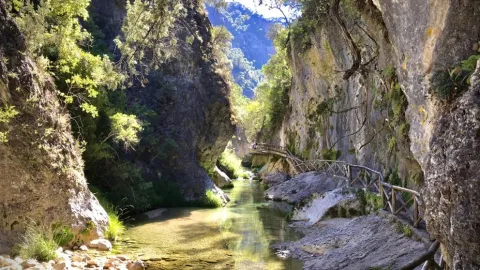
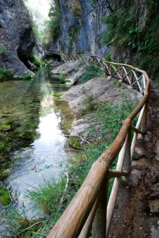
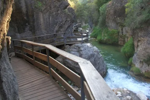
The river incision of the Borosa River in the Cretaceous limestone of Urgonian faces produces the strong fitting of the channel in this area, generating a narrow karmic valley with vertical walls more than 10 m in height and about 400 m in length.

This spectacular throat known as the Cerrada de Elias can be crossed over a pendant walkway several meters above the river, which is suspended on the vertical walls of the Cerrada.

Source: Inventory of Georresources of Andalusia. Environmental Council. Junta de Andalusia.

Breve descripción

Closed of Elijah

Ubicación
Latitud
37.920351
Longitud
-2.994140
Municipio
Ubicación en el mapa
POINT (-2.99414 37.920351)
Tipos de punto de interés
Imágenes carrusel
imagen
Image
img_tayala_20201019-104833_imagenes_lv_terceros_cerrada_de_elias-198-kHfF-U484165980244z1B-992x558%40LaVanguardia-Web%20%281%29.jpg
Imagen principal
Desactivado
imagen
Image
687_ss_03-jpg
Imagen principal
Desactivado
imagen
Image
CR09-e1515518982814%20%281%29.jpg
Imagen principal
Desactivado
Imágenes cabecera
imagen
Image
687_ss_01-jpg
Imagen principal
Activado
Loading map
Preparing points of interest and routes...

Threatened Species Thematic Center

Submitted by brandcode_deweloper on
Id
924314
Descripción
Descripción larga

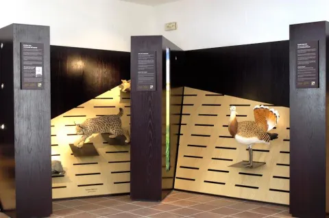
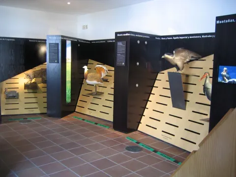
In it you can travel the most representative ecosystems of Andalusia understanding why we are taking certain species to the limit of their disappearance. You will know some local recovery projects such as the one of the broken bones, the alimoche or the lizard of Valverde. The centre is in turn the headquarters of the Gipaetus Foundation, a non-profit organization dedicated to the awareness and protection of Andalusian biodiversity, in particular of broken bones (Gipaetus barbatus).

In this Thematic Center you will find a permanent interactive exhibition on threatened Andalusian fauna. It also has an interesting library based on the areas of ecology, biology and heritage conservation.

The building - in which the carnage of the city was formerly located - is located next to the balcony down the river Cerezuelo, and open to the well-known square of Santa María. It is a splendid place to start a visit to this square and to the old town of Cazorla.

We suggest:

  • Visit in the same square of Santa María the Thematic Center "Frondosa Nature," where the biological and environmental wealth of the entire Park is explained
Breve descripción

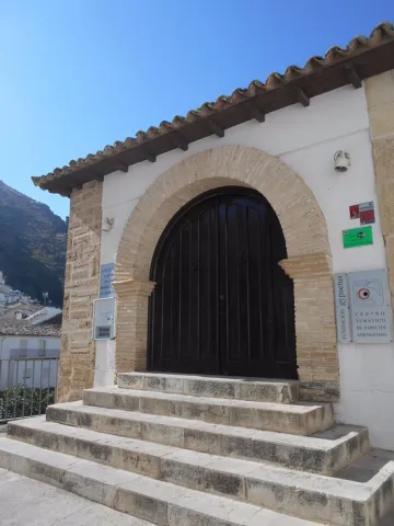
The Thematic Centre for Threatened Species is located in the historic centre of Cazorla, is an old building used as butchers and which has been given to the Gyapetus Foundation by the City Council of Cazorla, as Founder and Patron.

Telecomunicaciones
Sitio web
www.gypaetus.org
Teléfono de contacto
953 720 923
Ubicación
Código Postal
23470
Latitud
37.909575
Longitud
-3.000356
Dirección
Plaza de Santa María, 2
Municipio
Ubicación en el mapa
POINT (-3.000356 37.909575)
Tipos de punto de interés
Imágenes carrusel
imagen
Image
Centro%20Tem%C3%A1tico%20de%20Especies%20Amenazadas%20%28ant.%20Carnicer%C3%ADas%20Rea.JPG
Imagen principal
Desactivado
imagen
Image
main_image_44368%20%281%29.jpeg
Imagen principal
Desactivado
imagen
Image
06.jpg
Imagen principal
Desactivado
Imágenes cabecera
imagen
Image
entrada.jpg
Imagen principal
Activado
Horario
Oct - may: Tuesday to Sunday, mornings 10: 30 - 13: 30 (oct - may) or 12: 00 - 14: 00 (jun - sept). Late: oct - sea 16: 00 - 19: 00, abr - may 17: 30 - 20: 30, jun - sept 19: 00 - 21: 00. Monday and Tuesday closed.
Loading map
Preparing points of interest and routes...

Visitor Centre Río Borosa

Submitted by brandcode_deweloper on
Id
9307225
Descripción
Descripción larga

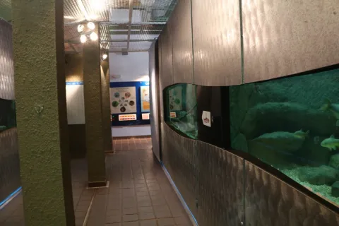
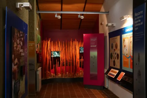
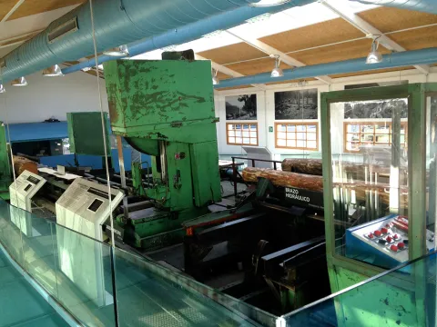
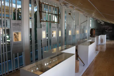
For its development, a journey along the river is proposed, as an argumental thread, by the way of a sculptural riverbank. A cucaveral scene approaches the visitor to the river bank. Through a space equipped with an ambimentation of the interior of a river it is immersed in the water in the company of its rich ictiofauna, like the European eel. The common trout and rainbow, barbs and bogas are the food for a wide variety of small mammals and fishing birds living in this environment. They all form an immense network that is also present on the tour of the visitor center.

As a colophone, the importance of properly exploiting the two main natural resources of these saws is shown: water and forests. To leave with a good taste of mouth, nothing better than to taste some of the home specialities in your cafe with garden views, accompanied by the singing of birds in a privileged environment.

Breve descripción

The visitors center Rio Borosa is located in one of the most emblematic areas of the Natural Park Sierras de Cazorla, Segura and Las Villas, specifically next to the river from which it is named and which is the first great tributary of the Guadalquivir. Next to it is a farmhouse and the path of the Borosa River, which runs this interesting route and completes the visit to the surroundings. The interpretative exhibition aims to show the importance of the hydrographic network as it is the real responsible for life in the natural park, starting the exhibition with a topographic model of the Borosa river basin and a graphic recreation of the entire river network of the park.

Telecomunicaciones
Teléfono de contacto
953 820 483
Ubicación
Código Postal
23311
Latitud
37.969254
Longitud
-3.063701
Dirección
Carretera Tranco A-319, desvío km. 48, Carretera Loma Mari Ángeles
Municipio
Ubicación en el mapa
POINT (-3.063701 37.969254)
Tipos de punto de interés
Imágenes carrusel
imagen
Image
Acuarios%20CV%20R%C3%ADo%20Borosa.jpg
Imagen principal
Desactivado
imagen
Image
Natu181.jpg
Imagen principal
Desactivado
imagen
Image
Natu184.jpg
Imagen principal
Desactivado
imagen
Image
Natu249.jpg
Imagen principal
Desactivado
Imágenes cabecera
imagen
Image
Exposici%C3%B3n%20CV%20R%C3%ADo%20Borosa.jpg
Imagen principal
Activado
Horario
Winter: Wednesday to Sunday 10: 00 - 16: 00. Summer: Tuesday to Sunday 10: 00 - 14: 00 and 16: 30 - 19: 00. July and August: every day.
Loading map
Preparing points of interest and routes...

Villa de Beas Interpretation Center, the 16th Century and Mysticism

Submitted by brandcode_deweloper on
Id
924230
Descripción
Descripción larga
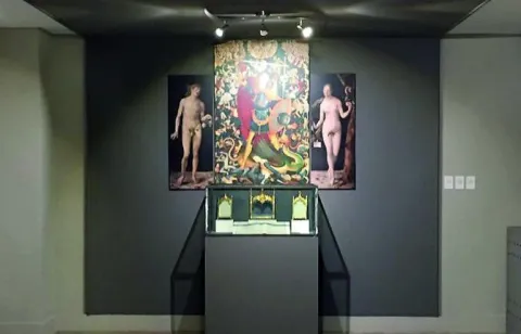
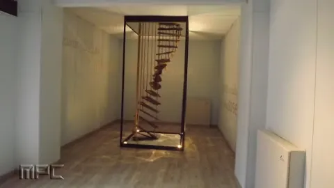
San Juan de la Cruz attended as a confessor for about four months. There, in the Convent of monks of El Calvario, he would write part of his spiritual Canticle. These historical facts are the basis of this Thematic Space, where the foundations of the mystique of both characters are interpreted. The Space also brings the visitor closer to other aspects related to Beas de Segura, such as its history, the symbology of the bull and the folklore of the town. In the Mystical area, the Santa Teresa de Jesús y San Juan de la Cruz figures are the basis of this thematic space where the origin of the Beasense foundation, convent life, with an exhibition of original pieces from the monastery are explained, and you can visit the hall of the mansions and the mystical scale, in addition to having an allegory of the mystical garden, among other elements of interest.
Breve descripción
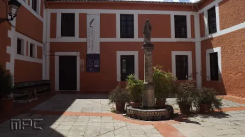
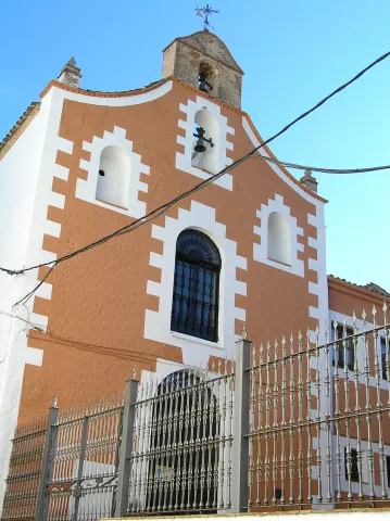
In 1575, Santa Teresa de Jesús founded the convent of the Discalced Carmelites in Beas de Segura where, three years later.
Ubicación
Código Postal
23280
Latitud
38.250500
Longitud
-2.885750
Dirección
C/ La Villa, 64
Distrito
Municipio
Ubicación en el mapa
POINT (-2.88575 38.2505)
Tipos de punto de interés
Imágenes carrusel
imagen
Image
image_content_12885183_20170810104547%20%282%29.jpg
Imagen principal
Desactivado
imagen
Image
unnamed%20%281%29.jpg
Imagen principal
Desactivado
imagen
Image
unnamed%20%282%29.jpg
Imagen principal
Desactivado
Imágenes cabecera
imagen
Image
Ermita_de_la_Villa.jpeg
Imagen principal
Activado
Loading map
Preparing points of interest and routes...

Interpretation Centre Los Oficios del Bosque-El Sequero

Submitted by brandcode_deweloper on
Id
924147
Descripción
Descripción larga

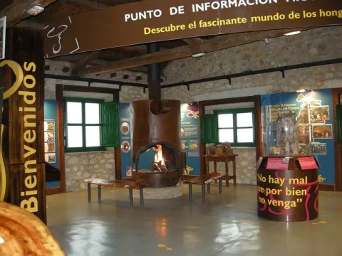
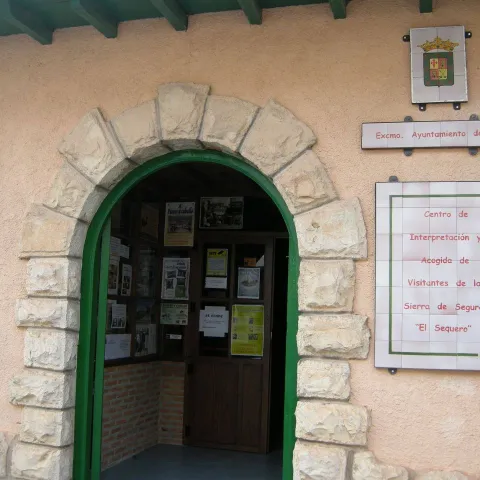
The Sequero de Siles is the Centre for the Interpretation and Reception of Visitors of the Sierra de Segura. Its name is because the building where it is located is an old "dryer" or pineapple dryer.

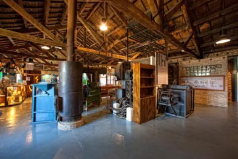
The old sequero was owned by the Icona, dedicated to the extraction of pineapples from the pineapples, which were later stored in glass containers for better conservation. It was abandoned in the late 1970s, and in the late 1990s, the City Council obtained the property, beginning its restoration and value. The museum was officially opened on 19 January 2003. In the center is also integrated the Mycological Information Point of Siles.

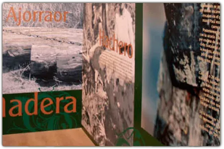
It has a thematic space dedicated to forest trades. Its name is because the building where it is located is an old "dry" or pineapple dryer in which the pineapples were removed and stored in glass vessels for storage and transport.

In its rooms you can approach the world of the ancient offices of the mountain, the fungi, the ethnography, the history and the biodiversity of the Sierra de Segura region. The building itself, recently restored, is worth looking at in detail. Its original use was the preparation of the pineapples used as seeds in the repopulations of these saws and other areas of Spain, activity remained alive during the decades of the 50 to the 70's last century. A part of the curious machinery with which the complex process of extraction, selection and drying of the pineapples was carried out is currently exposed.

We suggest...

  • Use the Sequero's excellent information service to ask all you need.
  • Enjoy the views of the environment of Siles from the terrace of the Centre.
  • Stop you in the theme space "Los Oficios del Bosque," for the quality of your information and visual resources.
  • Take advantage of the Mycological Information Point to learn more about the fascinating world of mushrooms and mushrooms.

Breve descripción

The Sequero de Siles is a new building that houses several interpretation facilities and a visitor information service, as well as a small product shop from the Natural Park and a space for the projection of audiovisual.

Telecomunicaciones
Sitio web
www.patrimoniosierradesegura.com
Teléfono de contacto
953 491 143
Ubicación
Código Postal
23380
Latitud
38.391667
Longitud
-2.582904
Dirección
Carretera de Hellín, 21
Distrito
Municipio
Ubicación en el mapa
POINT (-2.582904 38.391667)
Tipos de punto de interés
Imágenes carrusel
imagen
Image
image_262950.jpeg
Imagen principal
Desactivado
imagen
Image
Sequero%204.jpg
Imagen principal
Desactivado
imagen
Image
Sequero%202.jpg
Imagen principal
Desactivado
imagen
Image
Centro%20de%20Interpretaci%C3%B3n%20Los%20Oficios%20del%20Bosque-El%20Sequero.png
Imagen principal
Desactivado
Imágenes cabecera
imagen
Image
Sequero%203.jpg
Imagen principal
Activado
Horario
Mages: Tuesday to Sunday 11: 00 - 14: 00. Afternoon: spring - summer 18: 00 - 21: 00, autumn - winter 17: 00 - 20: 00.
Loading map
Preparing points of interest and routes...

Interpretation Centre of the Patrimonio Arqueológico de Quesada (CIPAQ)

Submitted by brandcode_deweloper on
Id
2343406
Descripción
Descripción larga

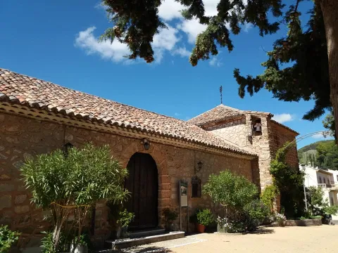
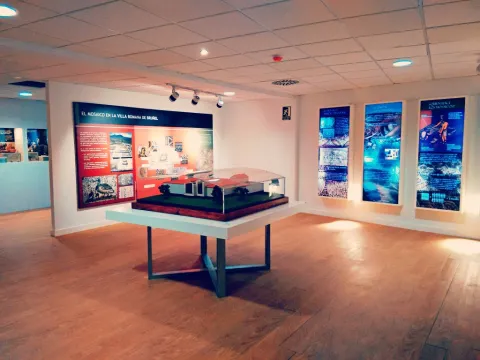
Thus, the first floor is dedicated to one of the most important sets of rock, eulin and schematic art in the province of Jaén, declared World Heritage by Unesco in 1998. On the ground floor the theme revolves around the Roman villa of Bruñel, with an amazing group of mosaics in excellent conservation. The tour is set with the exhibition of interesting objects, recreations, audiovisual, interactive and a teaching classroom for small visitors to learn by playing.

Breve descripción

The objective of the CIPAQ is to show the extraordinary legacy, prehistoric and Roman, which treasures Quesada.

Telecomunicaciones
Teléfono de contacto
953 714 011
Correo electrónico
oficinadeturismodequesada@gmail.com
Ubicación
Código Postal
23480
Latitud
37.846000
Longitud
-3.067317
Dirección
Plaza de la Coronación, 1
Municipio
Ubicación en el mapa
POINT (-3.067317 37.846)
Tipos de punto de interés
Imágenes carrusel
imagen
Image
cipaq.jpg
Imagen principal
Desactivado
Imágenes cabecera
imagen
Image
Patrimonio_Arquolxgico_Quesada.jpg
Imagen principal
Activado
Horario
Tuesday to Sunday: 10: 00 - 14: 00 and 16: 00 - 19: 00.
Loading map
Preparing points of interest and routes...

Interpretation Centre of the Olivar Ecológico

Submitted by brandcode_deweloper on
Id
2343490
Descripción
Descripción larga

The ecological olive tree, which has been the only one that has existed since the emergence of olive cultivation until the middle of the 20th century, has again been reborn today, finding in Sierra de Segura an ideal place to redelight us with this humanized ecosystem, a refuge of flora and fauna, which has served the sustainable development of the Mediterranean peoples for more than 5000 years. This Ecological Olivar Interpretation Center is located in the Sierra de Génave Almazara, which tells us its history, lived in one of the most extensive protected areas in Europe, the Sierras Natural Park of Cazorla, Segura and Las Villas.

The itinerary begins in the main building and is a tour of the culture of the organic olive tree. From the reception we see an Andalusian courtyard, where the History Room of the last 10,000 years of olive-growing is located. The Itinerary continues to the upper floor. A mural on the ecological olive tree of the Sierra de Segura is with us in the background in the Olivar Agrosystem Hall, which highlights the importance of practicing sustainable agricultural systems, such as the organic olive tree.

The next room introduces us to the various uses of the olive tree, which are varied and very rooted in Mediterranean culture. Finally, you can access the Art and Olivo Exhibition Room, with reproductions of works related to the olive tree and where videos are projected on the olive tree.

Breve descripción

Centro de Interpreción del Olivar Ecológico is located in the Jiennense town of Génave, part of the Natural Park of the Serras de Cazorla, Segura and Las Villas.

Telecomunicaciones
Sitio web
www.oleotourjaen.es
Teléfono de contacto
953 493 153 / 649 834 835
Correo electrónico
cooperativa@sierradegenave.com
Ubicación
Código Postal
23392
Latitud
38.431220
Longitud
-2.734110
Dirección
Av. de la Estación, 33-9
Distrito
Municipio
Ubicación en el mapa
POINT (-2.73411 38.43122)
Tipos de punto de interés
Imágenes carrusel
imagen
Image
image_254820.jpeg
Imagen principal
Desactivado
imagen
Image
image_254815.jpeg
Imagen principal
Desactivado
imagen
Image
image_254816.jpeg
Imagen principal
Desactivado
Imágenes cabecera
imagen
Image
CI_Olivar_Ecolxgico.jpg
Imagen principal
Activado
Horario
Concert visit.
Loading map
Preparing points of interest and routes...

Interpretation Centre of the Culture de la Madera (ciCUM)

Submitted by brandcode_deweloper on
Id
2344150
Descripción
Descripción larga

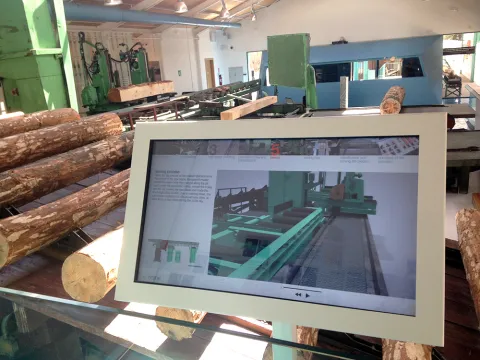
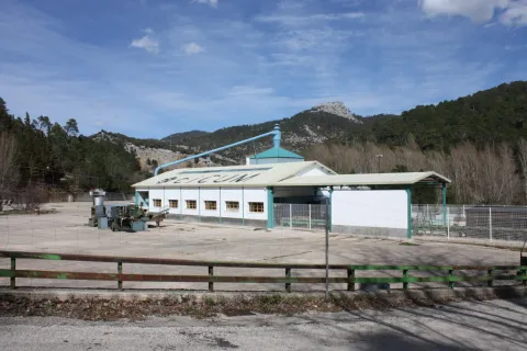
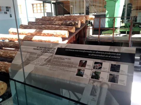
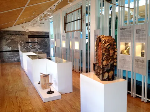
CICUM is a equipment that acts as a view that offers the visitor a wide view of the forest culture in the mountains of Cazorla Segura and the Villas. It seeks to give visibility to the cultural and ecological legacy as a heritage in the natural park. But CICUM is not only the sawmill of Vadillo Castril and its exhibition, it is also the signposted village around it, the items interpreted through the Forest Heritage Route. CICUM will carry out a set of activities such as teaching workshops through new technologies, guided forest routes, conferences or demonstrations.

Breve descripción

CICUM is a equipment that acts as a view that offers the visitor a wide view of the forest culture in the mountains of Cazorla Segura and the Villas.

Telecomunicaciones
Sitio web
http://www.cicumcazorla.es/
Teléfono de contacto
953 721 330 / 689 193 666
Correo electrónico
info@almagaia.es
Ubicación
Código Postal
23479
Latitud
37.921030
Longitud
-2.929950
Municipio
Ubicación en el mapa
POINT (-2.92995 37.92103)
Tipos de punto de interés
Imágenes carrusel
imagen
Image
5%20%281%29.jpg
Imagen principal
Desactivado
imagen
Image
ciCUM
Imagen principal
Desactivado
imagen
Image
ciCUM
Imagen principal
Desactivado
imagen
Image
ciCUM
Imagen principal
Desactivado
imagen
Image
ciCUM
Imagen principal
Desactivado
Imágenes cabecera
imagen
Image
Cicum.JPG
Imagen principal
Activado
Horario
Weekends all year. From 1 jul to 15 sept and Easter, every day. Winter: 10: 30 - 13: 30 and 16: 00 - 19: 00. Summer: 10: 30 - 13: 30 and 17: 30 - 20: 30.
Loading map
Preparing points of interest and routes...