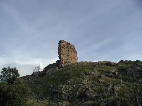
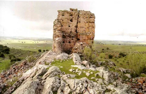
Saltar al contenido principal

Interpretation Centre Cultura Romana

Submitted by brandcode_deweloper on
Id
889103
Descripción
Descripción larga

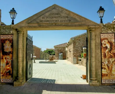
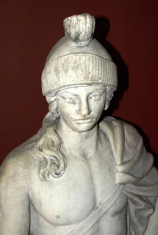
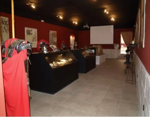
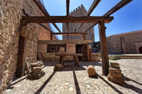
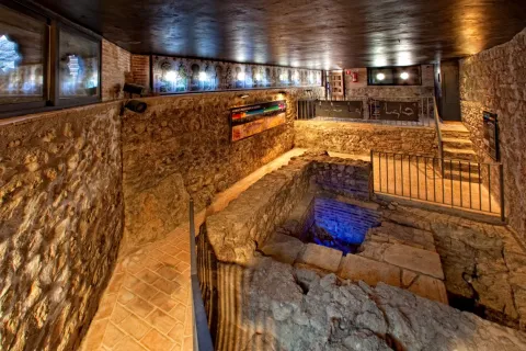
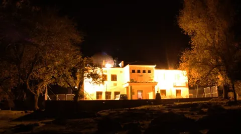
It aims to illustrate the visitor during his tour of the Roman cultural heritage and to value the archaeological site of the Roman villa of Los Baños, located in the vicinity of this town. In the outer space, which serves as a stage for representations, you can see a reproduction of an archaeological excavation, a sun watch with Roman numbering, a bajorrelief, a fountain, etc. In the interior there are reproductions of archeology pieces, panels with texts allusive to the Roman era, period costumes and a video summarizing the theme. There is also an area that imitates the asueto rooms, which could very well serve as a dining room, decorated with divans, mosaics, ropajes, vases, etc.

Breve descripción

The Interpreting Centre has the function of making the Roman culture of the municipality known. It has two rooms and a central courtyard where through reproductions, panels and projections.

Telecomunicaciones
Sitio web
www.arroyodelojanco.es
Teléfono de contacto
695 992 481
Correo electrónico
culturaromana.arroyo@gmail.com
Ubicación
Código Postal
23340
Latitud
38.321930
Longitud
-2.894070
Dirección
C/ Bolea
Distrito
Municipio
Ubicación en el mapa
POINT (-2.89407 38.32193)
Tipos de punto de interés
Imágenes carrusel
imagen
Image
P9120643%20%28Copiar%29.JPG
Imagen principal
Desactivado
imagen
Image
image_106251.jpeg
Imagen principal
Desactivado
Imágenes cabecera
imagen
Image
unnamed%20%281%29.jpg
Imagen principal
Activado
Horario
Wednesday to Sunday: 11: 00 - 13: 00 and 16: 00 - 18: 00.
Loading map
Preparing points of interest and routes...

Segura de la Sierra Castle Interpretation Center

Submitted by brandcode_deweloper on
Id
2343598
Descripción
Descripción larga
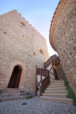
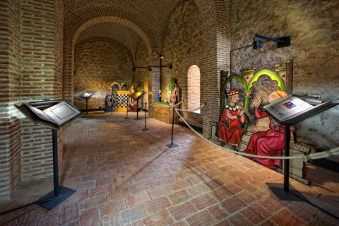
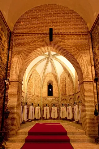
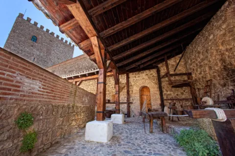
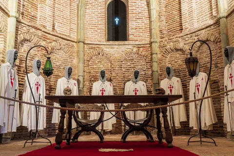
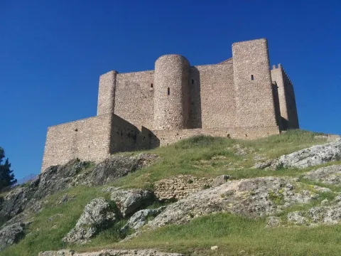
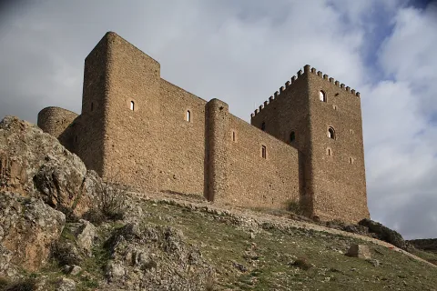
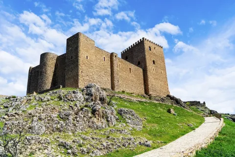
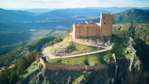
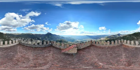
In the Islamic period the town was fortified and provided with a triple enclosure of walls. This fortification was accessed through four gates: Catena, which is the best preserved, Gontar, Mediodia or Orcera and the New Gate, which was rebuilt in the 16th century. It was declared a Picturesque Landscape and Historic-Artistic Site along with the town. Currently, it is home to an interpretation center called Segura de la Sierra. Border Territory in which you can delve into the Middle Ages, during which Segura de la Sierra was a relevant enclave. This interpretive space consists of several exhibition sets from the family environment of the warrior poet, ranging from sound elements that recreate the conversation that Jorge Manrique has with his father, Don Rodrigo, on the stage of the Coplas on the death of his father, as well as other interpretive speeches more linked to the author's poetic work. After visiting Jorge Manrique's interpretive space, it is possible to climb the battlements of the Torre del Homenaje and shudder with the spectacular views it offers: El Yelmo, with its more than 1,800 meters of altitude and symbol of the Sierra de Segura; Segura La Vieja (Iberian town), the Cerro de Góntar, the Peñalta viewpoint and so on countless landmarks that, together with a relaxed reading of Manriqueña poetry, will offer the visitor an emotion that will connect them forever with Segura de la Sierra.
Breve descripción
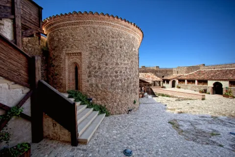
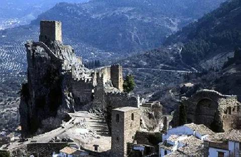
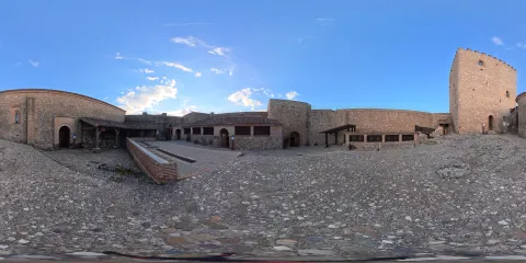
Of Muslim origin, its factory denotes an evident Christian remodeling, dating mostly to the second half of the 13th century. Inside we can find the Parade Ground, the Capilla de Santa Ana y la Torre del Homenaje with three floors. It was besieged during the French invasion and later restored.
Ubicación
Nombre
Castillo de Segura de la Sierra
Código Postal
23379
Latitud
38.299220
Longitud
-2.649790
Distrito
Ubicación en el mapa
POINT (-2.64979 38.29922)
Tipos de punto de interés
Imágenes carrusel
imagen
Image
IMG_4369.jpg
Imagen principal
Desactivado
imagen
Image
IMG_4372.jpg
Imagen principal
Desactivado
imagen
Image
IMG_4384.jpg
Imagen principal
Desactivado
imagen
Image
IMG_4387.jpg
Imagen principal
Desactivado
imagen
Image
IMG_4404.jpg
Imagen principal
Desactivado
imagen
Image
IMG_4420.jpg
Imagen principal
Desactivado
imagen
Image
IMG_4425.jpg
Imagen principal
Desactivado
Imágenes cabecera
imagen
Image
Segura%20de%20la%20Sierra18.jpg
Imagen principal
Activado
Horario
May 1 - Oct 31: Tuesday to Sunday 10:30 - 14:00 and 17:00 - 20:30. Nov 1 - Apr 30: Tuesday to Sunday 10:00 - 14:00 and 16:00 - 18:30.
Loading map
Preparing points of interest and routes...
Marcas de calidad

Interpretation Centre Castle of La Iruela

Submitted by brandcode_deweloper on
Id
2343586
Descripción
Breve descripción

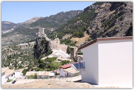
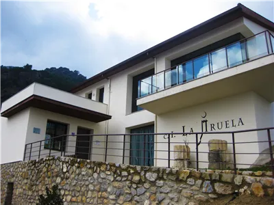
This centre is born of the need to have a space where the visitor can know and interpret the history of La Iruela, making a journey from its origins to the present and can enjoy in a didactic way and through technological means of the historical, heritage, cultural, natural and ethnic heritage of the place. It is located in the Historical Set composed of the Castle of La Iruela and the Church of Santo Domingo de Silos, monumental symbols of the town, declared an artistic Historical Set in 1985.

Telecomunicaciones
Teléfono de contacto
953 720 712 / 691 782 295
Ubicación
Código Postal
23476
Latitud
37.920900
Longitud
-2.990120
Dirección
Esperilla Alta, s/n
Municipio
Ubicación en el mapa
POINT (-2.99012 37.9209)
Tipos de punto de interés
Imágenes carrusel
imagen
Image
image_104333.jpeg
Imagen principal
Desactivado
imagen
Image
725_img.png
Imagen principal
Desactivado
Imágenes cabecera
imagen
Image
thb_g_1.jpg
Imagen principal
Activado
Horario
Wednesday to Sunday: 10: 30 - 13: 30 and 16: 00 - 18: 30 (October to April).
Loading map
Preparing points of interest and routes...
Marcas de calidad

Fresnedilla Astronomical Outreach Center

Submitted by brandcode_deweloper on
Id
886028
Descripción
Descripción larga

Spaces and equipment

The design and forecasting of the space of the observatory is based on the different services it offers to the visitor, based on a modest and functional conception. It has three different spaces:

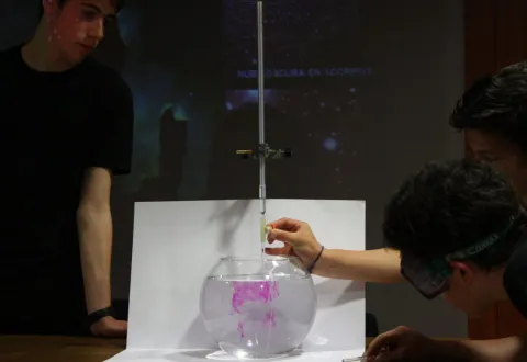
Multi-use room. Exhibition of audiovisual of own production with the aim of introducing visitors to the topics of most interest and scientific news. It offers us a space in which to conduct courses, congresses, talks and conferences, development of workshops, exhibitions, introduction to the use of planispheres, of web tools in the world of astronomy and astrophysics.

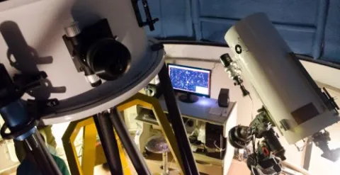
Main Observatory. It is the heart of the center, under a dome of 5 m, is the most pointed equipment in the field of astronomical observation, including the main telescope of 460 mm of fully computerized aperture and a 300 mm Dark-Kirkham of excellent optical quality dedicated exclusively to astronomical photography. The equipment is completed with high-sensitivity CCD cameras for capture of deep and planetary sky images, filters and wheel with computerized filters, self-guidance systems and an automated weather station that controls all systems autonomously...

This complete equipment allows us to introduce the visitor into the magic of observation under dome by doing live observations or through monitor by receiving on closed circuit the images of both the telescope and the video or the computer. In turn your remote control program will soon allow us to make use of the On-line installation. Its advanced equipment allows its use by research and teaching teams.

Solarium. Located in the open air on the terrace, it allows natural planetarium sessions with green laser pointer, observations with prismatic different calibre and telescopes of different design and function (some of them self-making).

The aim is to introduce the visitor to the various techniques and means of observation according to the object to be studied. For this we will use plateaus and stellar cards. We also have five secondary teams with instruments for initiation, advanced and assisted navigation.

Activities

The Fresnedilla Observatory offers the user high quality experiences, exclusive and programmed and supervised by professionals with extensive experience in teaching and dissemination.

Our entity has been planning a series of activities that have been consolidated over the years, in our annual plan of activities: annual outreach days, open-door days, training monitors and initiation courses, astrophotography courses, observation sessions, workshops, guided tours, lectures in educational centres and participation in cultural weeks in them, support for congresses, visits of professionals to our centres, exhibitions, training courses for dynamic and scientific dissemination...

The methodology that guides the staging of each proposal allows the manipulation, observation and research by the participants, making use of various teaching instruments and the latest technologies, both audiovisual and instrumentation. At the same time, classic channels are used, close to the visitor, from murals, work guides to Tales and theatrical. In short, we are committed to an active, varied, original and quality methodology.

The complete equipment, the natural environment in which it is located and the quality of the sky, makes this area a reference in our community, offering the visitor the opportunity to make observations and activities in an observatory with professional benefits, providing a new alternative offer of leisure and cultural to the visitor of the Natural Park and affecting the tourist development of the area with an attractive, quality and respectful activity.

Breve descripción

In 2009, the Astronomical Outreach Centre of Fresnedilla opened its doors. Developed in collaboration with the City Council of Villacarillo, the Tourism, Trade and Sport Council of the Junta de Andalucía and the collaboration of the Parque de las Ciencias Consortium of Granada, this centre arises from the need to develop specific activities of dissemination and astronomical research in a dark sky of excellent quality, with a stable and permanent infrastructure of easy access to the general public.

The Fresneilla Observatory is located in the heart of the most extensive Natural Park in South Europe, the P.N. de Cazorla, Segura and the Villas, a unique natural attraction, which attracts more than 200,000 visitors each year. In the surroundings of the observatory we can visit places with a special charm: Navazalto, cascade of Chorrogil, around Aguascebas, Peñacorba, which are incorporated into the activity that the observatory develops through guided didactic routes, night hiking and orientation techniques and observation sessions in emblematic areas.

Telecomunicaciones
Teléfono de contacto
659 473 549
Ubicación
Código Postal
23300
Latitud
38.061000
Longitud
-2.944330
Municipio
Ubicación en el mapa
POINT (-2.94433 38.061)
Tipos de punto de interés
Imágenes carrusel
imagen
Image
DSC6654_p-500x257.jpg
Imagen principal
Desactivado
imagen
Image
IMG_7437-1024x705.jpg
Imagen principal
Desactivado
Imágenes cabecera
imagen
Image
IMG_0916-1024x569.jpg
Imagen principal
Activado
Loading map
Preparing points of interest and routes...

Castle of Yedra

Submitted by brandcode_deweloper on
Id
4979201
Descripción
Breve descripción

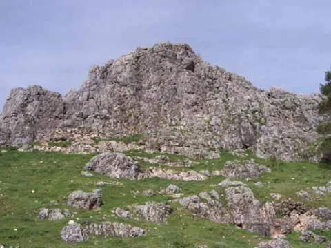
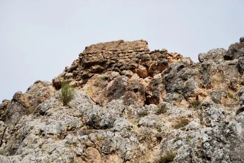
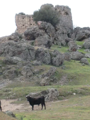
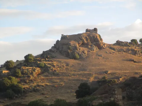
Theprimitive locationof Torres de Albanchez was in a nearby mound, defended by the castle of Yedra, already melted, but from which some remains are preserved: remains of masonry walls, defensive structures and aljibes, excavated on the same rock. It is estimated that its origins may be in a Visigoda Hispanic community among thecenturies V and VIIwho, after leaving the vegas of the Guadalimar, settled in this strategic enclave. It was conquered by the troops ofFernando III the Holy in 1235, who granted it to the Military Order of Santiago, which promoted the construction of a new settlement in the present less abrupt place. The castle of Yedra was declared Good of Cultural Interest in 1985.

Telecomunicaciones
Sitio web
www.torresdealbanchez.es
Correo electrónico
torresalbanchez@yahoo.es
Ubicación
Nombre
Torres de Albánchez
Código Postal
23391
Latitud
38.424570
Longitud
-2.677260
Distrito
Ubicación en el mapa
POINT (-2.67726 38.42457)
Tipos de punto de interés
Imágenes carrusel
imagen
Image
Castillo%20de%20Yedra.jpg
Imagen principal
Desactivado
Imágenes cabecera
imagen
Image
30876542136_e45e9f2f83_b.jpg
Imagen principal
Activado
Horario
24 h.
Loading map
Preparing points of interest and routes...

Castle of Segura de la Sierra

Submitted by brandcode_deweloper on
Id
6250036
Descripción
Descripción larga

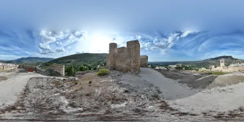
El recinto exterior abarca una gran superficie, en la que se distinguen muros que pertenecerían a construcciones características de un castillo y dos grande aljibes excavados en la roca, destinados a recoger y almacenar agua.

La barbacana, muy restaurada, está formada por un antemuro que protegía el lado oeste, más accesible, y una puerta con dos tramos de escalera en codo, lo que dificultaba la entrada a los posibles atacantes y que sería el acceso original.

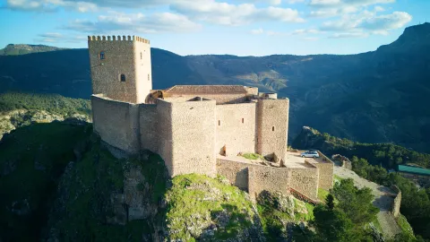
El alcázar, de forma trapezoidal, tiene cuatro torres esquineras y dos más pequeñas en los lienzos sur y sureste, esta última semicircular. La entrada, también en codo, pero con una subida en rampa, se sitúa en la torre noroeste, mientras que la torre del Homenaje, situada en el sector este, con 18,43 m de altura, se estructuraba en tres plantas y terraza comunicadas por una escalera empotrada en el grueso de los muros. Las torres están comunicadas por un adarve que recorre todo el recinto.

En el interior del recinto se conserva una capilla erigida en el siglo XIII por la Orden de Santiago, de estilo mudéjar, con una nave rectangular y ábside semicircular. Frente a ella hay una gran sala o refectorio con arcos apuntados, en la que, probablemente, el techo original fuese más alto que el actual, pudiendo haber sido reutilizada como polvorín durante la Guerra de la Independencia (1808-1814). El aljibe existente en el centro del patio de armas se construyó para el aprovisionamiento de los defensores del castillo en caso de que los atacantes hubiesen conquistado el recinto exterior. Durante las excavaciones arqueológicas realizadas en 2001 salieron a la luz restos de otras construcciones de diversas cronologías: una vivienda del siglo X, lienzos de la muralla de tapial del siglo XII y de una torre almohade o un baño. El baño debió estar decorado con cierta suntuosidad, como muestran los restos de elementos decorativos recuperados, lo que correspondería a residencia de un importante señor.

Un segundo recinto de mampostería trabada con argamasa se extiende por la ladera oeste, de sur a nordeste. En él se distinguen restos de hasta siete torreones, mientras que en su interior son visibles restos de otras estructuras. 

Al nordeste, a la misma altitud de la villa, se conservan restos de un pequeño recinto con una gran torre de tapial, conocida como la “Torre de las Eras” de, al menos, cuatro niveles, horadada por numerosas saeteras de la que tan sólo quedan en pie dos de sus lados. Unos metros al este se observan los restos de una torre esquinera de menor tamaño, y de unas caballerizas y un silo excavados en la roca, situados entre ambas.

En la ladera sur del cerro sobre el que se asienta el castillo se encuentra la Torre del Agua, construcción almohade de planta rectangular y realizada en un tapial muy duro (tabiyya). Formada por tres muros, tiene como cierre trasero la roca natural. Originalmente carecía de entrada u otros vanos, pues su función parece haber sido la protección de un manantial al que se accedería desde la parte superior. 

La ocupación del cerro en el que se asienta Segura de la Sierra es anterior a la construcción de la fortaleza y de los grandes recintos de murallas hoy visibles en la población, erigidos probablemente como resultado de las transformaciones sociopolíticas que sufrió al-Andalus a partir del siglo XI. Los restos más antiguos documentados durante las investigaciones arqueológicas corresponden a una vivienda del siglo IX bajo el castillo.

La desmembración del Califato de Córdoba, a principios del siglo XI, causó un continuo cambio de manos de Segura, que, tras pertenecer a la taifa de Murcia, llegó a ser reino independiente entre 1043 y 1044, antes de caer bajo el control de la Taifa de Denia. La conquista de esta última por el rey de Zaragoza propició un nuevo período de independencia entre 1076 y 1079, pasando finalmente a formar parte del reino de Sevilla, hasta la ocupación de Segura por los almorávides en 1091.

Durante la crisis del movimiento almorávide Ibrahim ibn Hamusk se sublevó en Sócovos de Yeste, apoderándose de Segura en 1147, aliándose con el reino creado en Levante y Murcia por ibn Sai ibn Mardanis. Esta alianza propició que ibn Hamusk se apoderase de un gran territorio, tomando Jaén, Baeza y Úbeda. Estos territorios que formaron parte de un reino independiente pasaron a manos almohades en 1169, quedando ibn Hamusk como gobernador de sus territorios en Jaén. 

En ese momento Saqura se describe ya como una fortaleza (hisn) comparable a una ciudad (medina) por la importancia de su población. Entre los siglos XI y XIII se produjo una amplia fortificación en la Sierra de Segura.

Tras la conquista castellana de la comarca, entre 1226 y 1239, Fernando III reparte paulatinamente los territorios a la Orden de Santiago, concediéndole Segura el 21 de agosto de 1242, localidad a la que la Orden trasladará la Encomienda Mayor de Castilla desde Uclés. En 1243 tenía Concejo y recibió el fuero de Cuenca. 

El castillo de Segura sirvió como bastión durante las luchas nobiliarias de los siglos XIV y XV, bajo la autoridad de la familia Manrique, y como lugar desde el que partieron numerosos ataques al reino nazarí de Granada, teniendo como uno de sus principales protagonistas a Rodrigo Manrique, Maestre de la Orden de Santiago y padre del poeta Jorge Manrique.

Permaneció como sede de la Encomienda y cabeza del señorío santiaguista durante toda la Edad Moderna. 

En 1748 se constituye la Provincia Marítima de Segura de la Sierra, por el aprovisionamiento de madera para la política naval del reinado de Fernando VI, lo que produjo la degradación forestal de la comarca.

En 1810 fue nuevamente escenario de un conflicto bélico, con el enfrentamiento con las tropas napoleónicas, que arrasaron y quemaron tanto la villa como el castillo, que permaneció en ruinas hasta una serie de restauraciones llevadas a cabo en el castillo y las murallas de la localidad durante los años 60 y 70 del siglo XX. En 2001 la Universidad de Jaén acometió la primera intervención arqueológica en el castillo y en 2021 en parte de la muralla de la villa, en la zona de la puerta de Góntar.

La villa de Segura de la Sierra y su castillo están declarados Conjunto Histórico Artístico y Paisaje Pintoresco.

LEYENDAS
Leyenda del ajedrez del rey de Segura. Mudarra, sobrino del rey de Córdoba, ganó una partida de ajedrez al rey de Segura siendo huésped de su castillo. El monarca indignado le llamó “hijo de nadie”, ante lo que Mudarra le asesinó golpeándole iracundo con el tablero en la cabeza. Huyó a Córdoba donde su madre le relató la historia de su padre, Gonzalo Gustioz, a cuyos hijos, los 7 infantes de Salas, decapitaron por orden de su tío Ruy Velázquez, como venganza por una grave afrenta a la familia de su esposa durante las celebraciones de su boda. 

Mudarra partió a Castilla en busca de Ruy Velázquez, al que dio muerte cerca de Burgos, completando su venganza quemando viva a doña Lambra, esposa de su tío e instigadora del asesinato de los infantes.

 

Breve descripción

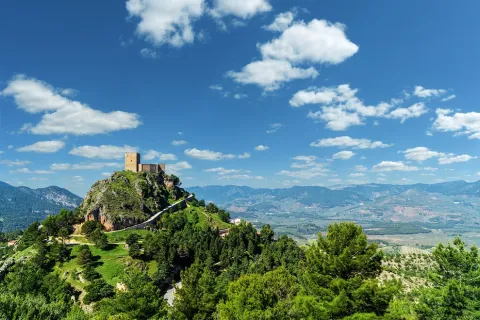
The castle of Segura de la Sierra is made up of an outer enclosure of tapial and an alcázar protected by a barbacana, made in masonry, a Christian work built between the 13th and 14th centuries, although taking advantage of the remains of the previous Muslim fortification. Many defensive elements extend along the hill side on which it sits, while inside the castle a chapel, a capitular room, a bathroom and other structures are preserved from different chronological moments. The walls embrace the villa, in which samples of typical serrana architecture and monumental buildings are alternated.
The dismemberment of the Califate of Cordoba, in the early 11th century, caused a continuous change of hands of Segura, becoming the center of the independent kingdom of ibn Hamusk in the 12th century. After the Spanish conquest of the region, in 1242 Fernando III granted Segura to the Order of Santiago, which would make it the major envoys of Castile. From it, numerous attacks took place on the Nazari kingdom of Granada and served as a bastion during the nobility struggles of the 14th and 15th centuries, under the authority of the Manrique family. In 1810 it was the scene of the confrontation with the Napoleonic troops, which destroyed and burned both the village and the castle.
After several restorations, the village of Segura de la Sierra and its castle are declared an Artistic Historical Set and Pintoresque Landscape.

Telecomunicaciones
Sitio web
www.claritasturismo.com/experiencias-segura-de-la-sierra/
Teléfono de contacto
682 834 293
Correo electrónico
info@castilloseguradelasierra.com
Ubicación
Código Postal
23379
Latitud
38.299210
Longitud
-2.649790
Dirección
C/ Castillo
Distrito
Ubicación en el mapa
POINT (-2.64979 38.29921)
Tipos de punto de interés
Imágenes carrusel
imagen
Image
img-20160526-184330-largejpg.jpg
Imagen principal
Desactivado
imagen
Image
_MG_0250%20%281%29.jpg
Imagen principal
Desactivado
imagen
Image
Segura de la Sierra
Imagen principal
Desactivado
imagen
Image
Segura de la Sierra
Imagen principal
Desactivado
Imágenes cabecera
imagen
Image
CYB_Segura_Sierra_01
Imagen principal
Desactivado
imagen
Image
CYB_Segura_Sierra_02
Imagen principal
Desactivado
Horario
1 may - 31 oct: tuesday to sunday 10: 30 - 14: 00 and 17: 00 - 20: 30. 1 nov - 30 abr: tuesday to sunday 10: 00 - 14: 00 and 16: 00 - 18: 30.
Experiencia 360
Image
cyb_segura_sierra_360_02
Image
cyb_segura_sierra_360_02
Loading map
Preparing points of interest and routes...
Marcas de calidad

Castle of Santo Tomé

Submitted by brandcode_deweloper on
Id
4869549
Descripción
Breve descripción

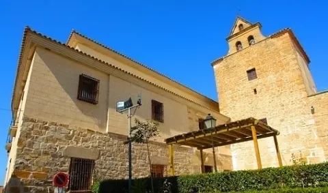
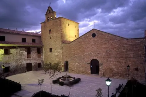
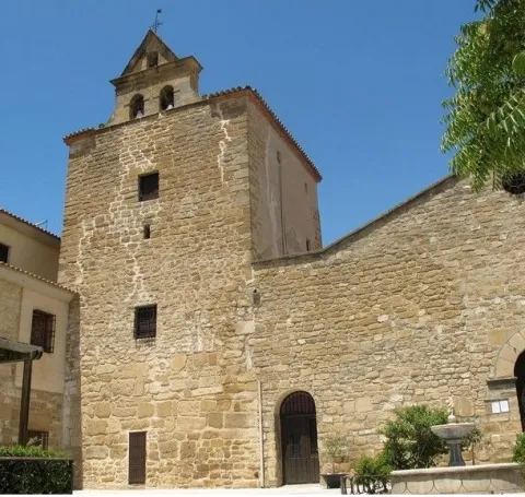
During the Middle Ages, Sao Tomé was linked to the archbishop of Toledo and was part of the territory of theCazorla advance. To meet the defensive objectives, in the14th century a castle roseof which only is preservedthe tower of tributewith a rectangular base, almost square and a single floor, which was preserved as a bell tower on the left side of the church. The tower, which retains its Gothic features, is of masonry and regular yarn on its ground floor and of armchair on the upper area, and is covered by a roof. As the original military function was changed to the religious function, aSwordsmanwith two holes for the bells, cornice and triangular front that hosts another bell. It was declaredGood of Cultural Interestin 1985.

Telecomunicaciones
Sitio web
www.santotome.es/el-municipio/patrimonio-historico.html
Teléfono de contacto
953 736 200
Correo electrónico
aytostotome@gmail.com
Ubicación
Código Postal
23311
Latitud
38.028480
Longitud
-3.101980
Dirección
Plaza Montemar
Municipio
Ubicación en el mapa
POINT (-3.10198 38.02848)
Tipos de punto de interés
Imágenes carrusel
imagen
Image
Castillo%20de%20Santo%20Tom%C3%A9.jpg
Imagen principal
Desactivado
imagen
Image
Castillo%20de%20Santo%20Tom%C3%A9%202.jpeg
Imagen principal
Desactivado
Imágenes cabecera
imagen
Image
Castillo-de-santo-tomas-1%20%281%29.jpg
Imagen principal
Activado
Loading map
Preparing points of interest and routes...

Castle of Navas de Tolosa

Submitted by brandcode_deweloper on
Id
320510
Descripción
Descripción larga

The castle of the Navas de Tolosa is made up of a trapeze-shaped walled enclosure and a hexagonal plant tower located at its northeastern angle. Possibly there was a second external enclosure to which some visible canvas would belong in the surroundings of the castle.

The site of the fortification, very destroyed, was possibly built in a tapial of argamase on a base of masonry, adapts to the rocky plateau on which it sits, using it as a foundation and as part of its defense. Inside it are distinguished some sections of walls that would belong to internal dependencies and a possible aljibe.

Two accesses are kept inside the fortress, the main door was located on its west side, protected by a narrow wall that supports a natural rock skid. On the eastern flank, next to the tower, a narrow posterna is opened partially hidden by a rock that gives it visual protection and creates a narrow corridor to reach it.

The tower, built in a very compact tapial with its high lime content, retains about 14 m from the outside and only two from the inside. In the outer plucido of the tower there are still some lines that would be part of some type of decoration or simulation of large armchairs, a technique known as false parting, especially in the area of the posterna.

Inside there is a rectangular space that occupies much of the stay, leaving a narrow corridor around it. It is possible to be an aljibe to collect and store the rain water, whose cover would hold the ground on the first floor of the tower.

To the north-east of the fortress there are traces of a rectangular building with internal divisions, perhaps the hermitage that was erected shortly after the Christian conquest. Other walls that are distinguished in their surroundings could be evidence of the existence of a small plateau.

The area of Despeñacolos has attracted inhabitants since Prehistory for its steep orography, in which caves and coats proliferate, as well as for its natural sites conducive to sacralization.

But it was its strategic value with respect to the natural steps that pass through Sierra Morena, so fortifications were erected during the Middle Ages, and even in previous periods, with the aim of controlling the communication routes between the Plateau and al- Ándalus.

Although the small plateau could be inhabited already in the Bronze Age and in Roman times, the Castle of Navas de Tolosa, it would be built between the XI- XII centuries by Muslims to control the natural steps of Despeñacolos. Years later, they would strengthen their defensive role in an attempt to stop the progress of Christian troops. This fortress became one of the "doors" of the passage of the Muradal, along with Castro Ferral, which made it a goal to beat. After the battle of the Navas de Tolosa will definitely be in the power of Castile.

The fortress was part of the stage of one of the most prominent milestones in the medieval history of the Peninsular, because of its significance in the advance of the Christian kingdoms over al- Ándalus, the battle of the Saves of Tolosa, fought on July 16, 1212. Conceived as a crusade, it was a contest in which the routes and steps to the Plateau played a fundamental role. A coalition of Christian kings, Alfonso VIII of Castile, Peter II of Aragon and Sancho VII of Navarra, supported by Pope Innocent III, faced against the Almohad Caliph of Muhammad al-Nasir, in whose army fighters from the Maghreb, from sub-Saharan territories and from Turkish contingents were integrated.

On 12 July 1212, troops under the command of Don Diego López de Haro took over the Puerto del Muradal. Two days later, after being blocked in the passage of the Slayer, Christians camp in the place known as the King's Table, from where they went to battle, defeating the Almohad army.

After the victory of the Christian armies, the fortification of the Navas would remain important on the route of the Muradal throughout the 13th century, becoming one of the strategic points for control of the passage of troops during the conquest of Alto Guadalquivir. In 1217 the archbishop of Toledo was awarded the castles of the region, with the consent of Pope Honorio III, who confirmed them as the limits of the Toledo archdiocese.

According to the written sources, this space was repopulated by Spanish contingents throughout the 13th century, and its castle was demolished in 1473 under the mandate of the City of Baeza.

Breve descripción

The castle of Navas de Tolosa is a small fortification in height that takes advantage of the defensive possibilities offered by the rock formation on which it is based, a hoss of a certain magnitude, capable of hosting a small military garrison. It is made up of a walled enclosure and a hexagonal tower, and may have had a second enclosure to protect them. Because of the presence in its surroundings of numerous vestiges of construction it may have been surrounded by a small population that would find refuge among its walls in case of danger.
The castle of the Navas de Tolosa or the Collados or the Eagles was one of the fortresses that were built to protect the Puerto del Muradal, one of the main mountain steps that communicated al- Andalus with the Plateau. The transcendental battle of the Navas de Tolosa marked its history, as it would be taken by the Castilians in the context of the confrontation between the Christian and Muslim sides, in July 1212. During the 13th century, it would have the role of protecting and monitoring the passage of troops and supplies for the campaigns carried out by Christian armies in the conquest of al- Andalus.

Telecomunicaciones
Sitio web
www.lacarolina.innovasur.es
Teléfono de contacto
953 660 600 / 953 661 251
Correo electrónico
info@lacarolina.es
Ubicación
Código Postal
23212
Latitud
38.299530
Longitud
-3.597440
Dirección
En las proximidades de la A-IV, pasado el kilómetro 265, entre Santa Elena y La Carolina.
Distrito
Municipio
Ubicación en el mapa
POINT (-3.59744 38.29953)
Tipos de punto de interés
Imágenes carrusel
imagen
Image
castillo navas
Imagen principal
Desactivado
Imágenes cabecera
imagen
Image
6672445Master.jpg
Imagen principal
Activado
Horario
Visit after contact with managers. Private property.
Experiencia 360
Image
CyB_La_Guardia
Image
CyB_La_Guardia
Loading map
Preparing points of interest and routes...

Castle of Las Fuentes

Submitted by brandcode_deweloper on
Id
6623566
Descripción
Breve descripción

This small atalaya or surveillance post is located on the top of a hill, dominating part of the Guadalimar River Valley. The construction material is masonry, malripated and covered with tapial.
It is currently in a state of progressive ruin.

Telecomunicaciones
Sitio web
www.benatae.es
Teléfono de contacto
953 480 378
Correo electrónico
benatae@promojaen.es
Ubicación
Código Postal
23390
Latitud
38.352650
Longitud
-2.654430
Dirección
Los Lagartos dirección Siles, 1.5 km
Distrito
Municipio
Ubicación en el mapa
POINT (-2.65443 38.35265)
Tipos de punto de interés
Imágenes carrusel
imagen
Image
2.jpg
Imagen principal
Desactivado
imagen
Image
3.jpg
Imagen principal
Desactivado
Imágenes cabecera
imagen
Image
1.jpg
Imagen principal
Activado
Loading map
Preparing points of interest and routes...

Castle of la Laguna

Submitted by brandcode_deweloper on
Id
4537002
Descripción
Descripción larga

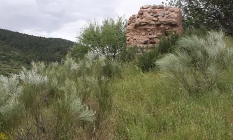
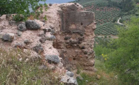
During the Islamic period it was a fundamental enclave in the advanced position strategy both to emit signs of fires and fumes, and to house a garrison that could prevent troop movements and protect nearby villages from Christian attacks.

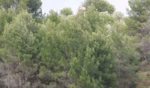
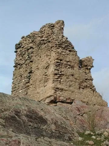
Before time irreversibly deteriorated this tower was an effective defensive element for the severity of its construction and the strength of its stones. With rectangular floor, it was built in argamase tapial. The remains of other walls that could be part of the wall surrounding this tower can still be seen nearby. Its constructive structure and technique is very similar to many other strengths of the Sierra de Segura. In 1985 this property was declared Good of Cultural Interest.
Breve descripción

The Laguna tower, called by others from Zarracotín, is located to the north, three kilometres from Génave, towards Sierra Morena and Ciudad Real.

Ubicación
Latitud
38.464960
Longitud
-2.737910
Dirección
Camino de La Laguna
Distrito
Municipio
Ubicación en el mapa
POINT (-2.73791 38.46496)
Tipos de punto de interés
Imágenes carrusel
imagen
Image
Castillo%20de%20la%20Laguna%202.jpg
Imagen principal
Desactivado
imagen
Image
Castillo%20de%20la%20Laguna.jpg
Imagen principal
Desactivado
Imágenes cabecera
imagen
Image
torre%20laguna%20genave.jpg
Imagen principal
Activado
Loading map
Preparing points of interest and routes...