Saltar al contenido principal

Castle of Hornos de Segura

Submitted by brandcode_deweloper on
Id
4651566
Descripción
Descripción larga

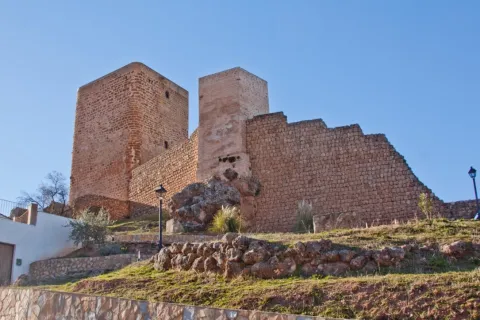
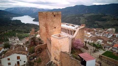
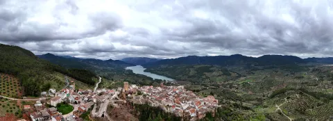
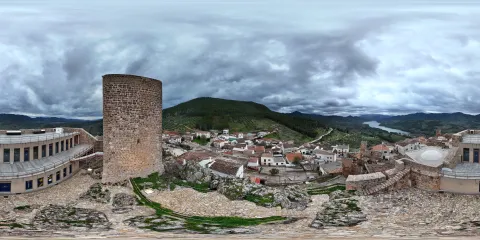
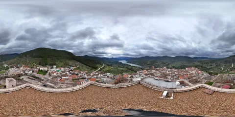
Written sources refer to Hornos as Hisn, meaning a fortified place. The enclosure that survives today dates from the Late Medieval Castilian period, although it retains, blended in, some Islamic elements. It has a slightly trapezoidal shape, with a large keep on its widest side and a smaller one, both on the south-eastern wall of the enclosure. Inside the enclosure, between the two towers, stands the main cistern, of Islamic origin.

On its southern side, the rocky configuration of the promontory was put to use, with defensive walls built along the more vulnerable stretches, while the rock itself served as a natural defence elsewhere.

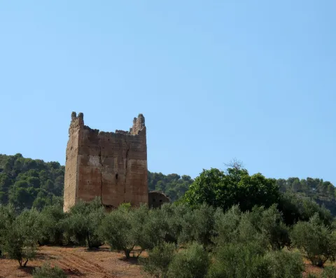
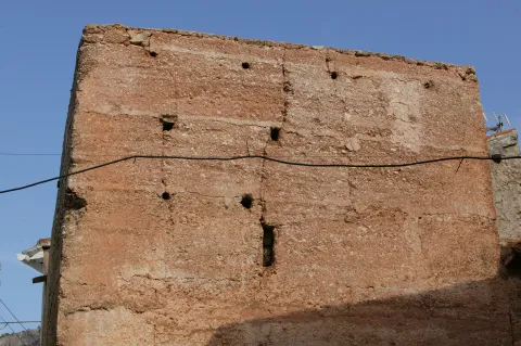
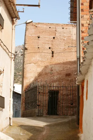
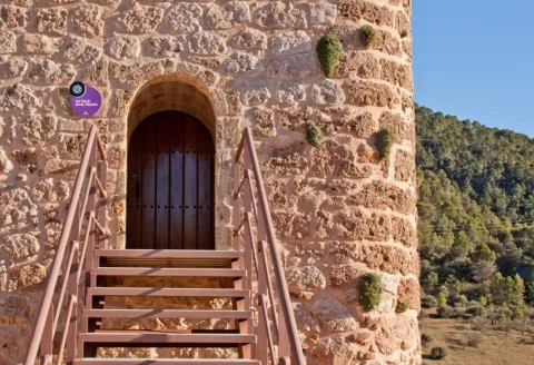
The keep has a square floor plan and is built in masonry, with rounded corners, and is divided internally into three levels.

The lower part has a rocky base housing a cistern, accessed from the first floor. On this floor is the entrance to the tower, several metres above ground level. From this second level, a staircase built into the wall leads up to a third, both floors having rooms covered with barrel vaults. 

This tower and part of the castle enclosure have been restored, but in the unrepaired sections of the walls and in the smaller towers, the original construction can still be seen: irregular, bonded masonry covered with mortar. 

The castle wall extended to form an enclosure surrounding the town centre. Two square-plan towers survive today, one of them incorporated into a present-day building. Also surviving is the so-called Puerta de la Villa, an angled entrance set within a two-storey masonry tower, topped by a continuous parapet pierced with a few arrow slits, which formed part of the enclosure of Almohad origin.

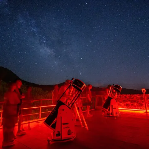
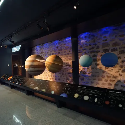
The castle underwent extensive restoration in 1973. The town was declared a Historic-Artistic Site in 1985. The castle now houses the Cosmolarium, an Astronomy interpretation centre and a planetarium for full-dome film screenings.

Some prehistoric settlements have been identified within the Sierra, but between the end of the Bronze Age and the Roman period, settlements are found only in the valleys and more open areas. 

During the Roman period, occupation of these valleys was organised through small, scattered settlements, but between the 2nd and 3rd centuries a process of land concentration seems to have taken place. From the 6th century onwards, peasant populations fled the large estates under pressure from landowners, taking refuge for several centuries in inaccessible spots within the mountains, as must have happened, among others, with the large settlement of Segura La Vieja. 

Between the 8th and 10th centuries, a return to the valleys of Segura probably took place, a region now controlled by muladíes (Muslim converts of Iberian origin). The choice of these sites was driven by their strategic position and by the abundance of water in the surrounding area. Hornos was probably founded in this context, around the 10th century, as was Segura de la Sierra, though it does not appear in Arab sources before the 12th century, or already during the Castilian conquest. Its position above the valley allowed Hornos, together with Segura and Catena (La Espinareda), to exercise complete control over a territory where significant irrigated agriculture developed. Referred to in the sources as Hisn Fornus, it would originally have been a hamlet defended by its steep location and by a walled enclosure, forming part of the territories controlled by the rebel muladí Ibn al-Saliya during the fitna (Civil War) of the late 9th century.

Between the 11th and 13th centuries, very few settlements of note existed in the area, although Segura and Hornos are clearly mentioned in Arab sources. During this period they grew in importance, especially Segura, for which abundant records survive. Hornos is also mentioned repeatedly, but its development and defensive capacity appear to have been more limited.

Shortly after the arrival of the Castilians, it appears deserted, indicating that at that time it must have been a settlement of little significance, although it would later be resettled and gradually develop. Following its conquest in 1239 by Don Pedro Pérez Pelayo Correa, Master of the Order of Santiago, it received the title of villa and was granted by Ferdinand III the Saint to the Order, which would build the castle upon the remains of the Muslim fortress. 
Hornos, together with Segura de la Sierra, was one of the sites where the political ambitions of the Manrique family played out in the 15th century, in conflict with the monarchs John II and Henry IV. The Manriques controlled a large part of the resources of the Order of Santiago, thanks to which Rodrigo Manrique, Commander of Segura, proclaimed himself Grand Master of the Order, resisting and defeating the troops of John II and Don Álvaro de Luna at Hornos. 
It remained part of the Santiaguista lordship of Segura de la Sierra throughout the Early Modern period, belonging to the Kingdom of Murcia between 1507 and 1748.

Breve descripción

The castle of Hornos is located on a 890 m high limestone promontory on the Vega of the Hornos River, in the wide valley that separates the saws of Segura and Las Villas. The fortress we see today was built by the Order of Santiago in the 13th century on a Muslim fortification from which remains of three square-floor turreons and a aljibe are preserved. The Christian castle is made up of a trapezoidal enclosure, with a large tower of tribute on its wider side and a smaller turret. There are also remains of the enclosure surrounding the urban core, including its original door, known as La Puerta de la Villa, a tower built in two-storey masonry that contains access in "L." The castle currently houses the Cosmolarium, an interpretation center of Astronomy.
The foundation of Furnaces probably occurred in the 10th century, as did that of Segura de la Sierra. Its location over the valley would allow it to exercise complete control of the territory next to Segura and Catena (La Espinareda). Known as Hisn Fornus, between the 11th and 13th centuries it must have had a certain development and defensive capacity, being one of the few localities that highlighted in the area. After the Spanish conquest in 1239 it was given by King Fernando III to the Order of Santiago, who will raise the castle on the remains of the Muslim fortress. He obtained the title of a villa in the first half of the 13th century.
 

Ubicación
Latitud
38.216450
Longitud
-2.718530
Distrito
Municipio
Ubicación en el mapa
POINT (-2.71853 38.21645)
Tipos de punto de interés
Imágenes carrusel
imagen
Image
42.jpg
Imagen principal
Desactivado
imagen
Image
40.jpg
Imagen principal
Desactivado
imagen
Image
Observación Nocturna
Imagen principal
Desactivado
imagen
Image
cosmolarium-interior-jpg
Imagen principal
Desactivado
Imágenes cabecera
imagen
Image
CYB_Hornos_castillo_01
Imagen principal
Desactivado
imagen
Image
CYB_Hornos_castillo_02
Imagen principal
Desactivado
Experiencia 360
Image
cyb_HORNOS_castillo_360
Image
cyb_HORNOS_castillo_360
Loading map
Preparing points of interest and routes...

Castle of Cardete

Submitted by brandcode_deweloper on
Id
5630671
Descripción
Breve descripción

The fortress of Cardete was built by the Arabs, and at that time Benatae was to be one of the villages dependent on the fortress. However, it had to be occupied between 1226 and 1242, at the same time as most of the Sierra de Segura. The enclosure has a trapezoidal shape and the tower of tribute is 14 meters high. The construction rules are being passed, and this tower is projected to the inside of the walled enclosure.

Telecomunicaciones
Sitio web
www.benatae.jaenescondido.es/castillo-de-cardete.html
Teléfono de contacto
953 480 378
Correo electrónico
benatae@promojaen.es
Ubicación
Código Postal
23390
Latitud
38.346260
Longitud
-2.705750
Dirección
A-310
Distrito
Municipio
Ubicación en el mapa
POINT (-2.70575 38.34626)
Tipos de punto de interés
Imágenes carrusel
imagen
Image
Castillo%20de%20Cardete.jpg
Imagen principal
Desactivado
imagen
Image
castillo_de_cardete_copy.jpg
Imagen principal
Desactivado
imagen
Image
Castillo%20de%20Cardete%203.jpg
Imagen principal
Desactivado
Imágenes cabecera
imagen
Image
Castillo%20de%20Cardete%202.jpg
Imagen principal
Activado
Loading map
Preparing points of interest and routes...

Castle of Bujaraiza

Submitted by brandcode_deweloper on
Id
918389
Descripción
Descripción larga

They highlight the remains of the tower of tribute located in the courtyard of arms. It is worth taking advantage of the low levels of the reservoir to walk to the castle from the above-mentioned viewpoint.

Breve descripción

Small Arab fortress built on a hill that today becomes an island when the level of the reservoir rises, which gives it a special charm despite its deteriorating appearance. It can be seen from the viewpoint of Félix Rodríguez de la Fuente, in the km 60.5.

Ubicación
Latitud
37.912893
Longitud
-3.003887
Municipio
Ubicación en el mapa
POINT (-3.003887 37.912893)
Tipos de punto de interés
Imágenes carrusel
imagen
Image
1%20%282%29.jpg
Imagen principal
Desactivado
imagen
Image
2%20%283%29.jpg
Imagen principal
Desactivado
imagen
Image
Natu067.jpg
Imagen principal
Desactivado
imagen
Image
Natu074.jpg
Imagen principal
Desactivado
Imágenes cabecera
imagen
Image
experiencia-bujaraiza.jpg
Imagen principal
Activado
Loading map
Preparing points of interest and routes...

Castle of Bujalamé

Submitted by brandcode_deweloper on
Id
5709512
Descripción
Breve descripción

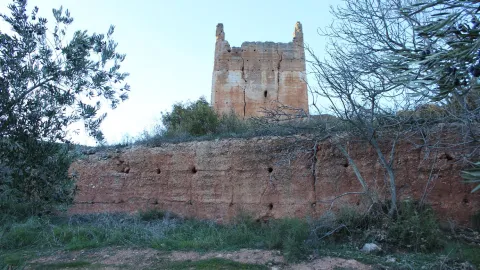
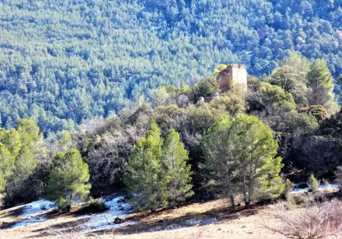
It belongs to the Almohad period, so it dates from the last third of the 11th century and the first half of the XII. During the Middle Ages the municipality performed strategic functions of interest, as the Guadalimar was fundamental on the Levante route. The Muslims valued the importance of the castle, along with the dam and the adjacent bridge, for the control of this path. However, the castle deteriorated and its stones were used by its neighbours for new constructions. Thus, only the remains of an old turret of the outer defensive belt, of a square floor and made of tapial, are preserved from the medieval fortress. He served as a prison for years and there was a church inside.

Telecomunicaciones
Sitio web
www.lapuertadesegura.jaenescondido.es/castillo-de-bujalame.html
Correo electrónico
lapuerta@promojaen.es
Ubicación
Código Postal
23360
Latitud
38.349170
Longitud
-2.737380
Dirección
C/ Castillo, 11
Distrito
Ubicación en el mapa
POINT (-2.73738 38.34917)
Tipos de punto de interés
Imágenes carrusel
imagen
Image
torreon-jpg
Imagen principal
Desactivado
Imágenes cabecera
imagen
Image
torreon-del-viejo-castillo-jpg
Imagen principal
Activado
Loading map
Preparing points of interest and routes...

Town Centre of Orcera

Submitted by brandcode_deweloper on
Id
4672158
Descripción
Breve descripción

In an urban reticulation that is faithful to its origins, in the skirt of Mount Peñalta, on an abrupt topography, through narrow and irregular alleys, adarves and improvised squares, houses of clear serrana and vernacular identity, of ripada and slimmed masonry, capricious volumes, empty asymmetric, low height, original chimneys and Arab tiles are raised. It is the medieval neighborhood, which resists the avatars of the centuries.

Telecomunicaciones
Sitio web
www.orcera.es
Ubicación
Código Postal
23370
Latitud
38.317760
Longitud
-2.659330
Distrito
Municipio
Ubicación en el mapa
POINT (-2.65933 38.31776)
Tipos de punto de interés
Imágenes carrusel
imagen
Image
2283_Fill_800_800.jpg
Imagen principal
Desactivado
Imágenes cabecera
imagen
Image
Monumentos4Arquitecturapopular.jpg
Imagen principal
Activado
Loading map
Preparing points of interest and routes...

Town Centre of Hinojares

Submitted by brandcode_deweloper on
Id
8090596
Descripción
Descripción larga

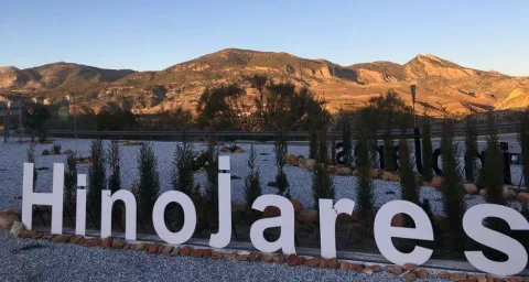
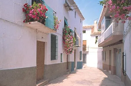
It is a small set of traditional houses that are whitened and covered in two waters by Arab tiles, with small verticalized holes to alleviate the rigors of winter, adapted to the simple habits of its inhabitants, dedicated to hunting, pastures and agriculture; and, in more peripheral positions, houses with a floor structure, with a maximum of four heights and roofed to four waters. The buildings are stacked and morphologically split like the chips of a game of domino, almost lost in an open landscape of wide horizons, differentiating ravines and green spaces, only on the next contour to the municipality.

Breve descripción

Urbanistically, this municipality has not been formed as a result of previous planning; it does not have a rational and hierarchical structure; it does not show regularity in the layout of its streets or an orderly design in the distribution of housing and services.

Telecomunicaciones
Sitio web
www.hinojares.es/el-municipio/patrimonio-historico.html
Correo electrónico
hinojares@promojaen.es
Ubicación
Código Postal
23486
Latitud
37.715500
Longitud
-2.999240
Municipio
Ubicación en el mapa
POINT (-2.99924 37.7155)
Imágenes carrusel
imagen
Image
hinojares2%20%281%29.jpg
Imagen principal
Desactivado
imagen
Image
hinojares5.jpeg
Imagen principal
Desactivado
Imágenes cabecera
imagen
Image
hinojares.jpg
Imagen principal
Activado
Loading map
Preparing points of interest and routes...

Waterfall Bridge Nevada

Submitted by brandcode_deweloper on
Id
8088114
Descripción
Descripción larga

Like the other municipalities of the region, it is located between the mountain and the Guadalquivir valley. Its fundamental economy is the olive tree, although it has an incipient tourist development

Breve descripción

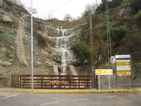
Chilluevar is a municipality in the province of Jaén, in Andalusia, Spain. It belongs to the Sierra de Cazorla region. This town is located at 738 meters of altitude and is located in one of the least known parts of the Natural Park, the Sierra de las Villas.

Telecomunicaciones
Sitio web
www.promojaen.es/pit/fmt.asp?i=&m=28&op=1
Teléfono de contacto
953 717 300
Ubicación
Código Postal
23477
Latitud
38.001440
Longitud
-3.031300
Municipio
Ubicación en el mapa
POINT (-3.0313 38.00144)
Imágenes carrusel
imagen
Image
cascada%20Chillu%C3%A9var2%20%281%29.jpg
Imagen principal
Desactivado
Imágenes cabecera
imagen
Image
cascada%20Chillu%C3%A9var%20%281%29.jpg
Imagen principal
Activado
Loading map
Preparing points of interest and routes...

Waterfall la Escaruela

Submitted by brandcode_deweloper on
Id
912020
Descripción
Descripción larga

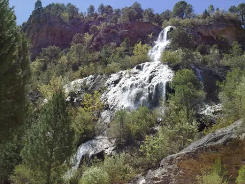
The waterfall is located next to the Falcones (1448 m), mountain always visible from any street of Cazorla, and a natural stone wall "Los Castellones" (1,820 m), elevation as a fortress from where it is named. To appreciate the water leaps it will be necessary to climb up a narrow path that runs next to the slope of the stream where you will be accompanied by the cornicabra (Pistacia terebinthus), a very abundant species on this path. By moving along the path you will appreciate the impressive fall of water as soon as the limestone walls serve as slides.

We suggest:

  • Next to the bridge from where the waterfall is seen, a right-hand road leads us to the control of Riogazas. It is a pleasant walk in which you will find a fountain called "The River" and another beautiful waterfall, that of the Magdalena. From here goes down a road to Cazorla.

In the Iruela you have to reach the square of the City Hall from where the road ascends towards the hotel Riogazas. 5 km from the Iruela and after two lookouts with meringeros there is a bridge. To the left we can see the Cascade of the Escaleruela.

Breve descripción

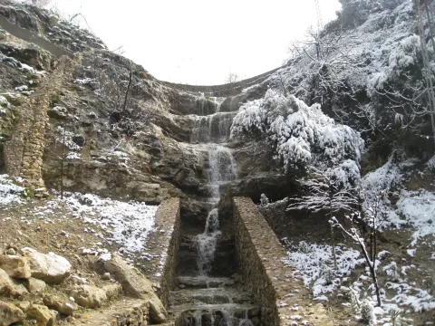
When you look at the waterfall you discover a stream covered in vegetation that barely lets the water see. Your look continues to ascend among limestone walls to discover how a stream with numerous water leaps is unraveling, only visible in periods of abundant rain and ice. Although we are very close to the localities of Cazorla and the Iruela wild nature begins to manifest in this spectacular leap of water, premonition of what we will find later.

Ubicación
Latitud
37.912893
Longitud
-3.003887
Municipio
Ubicación en el mapa
POINT (-3.003887 37.912893)
Tipos de punto de interés
Imágenes carrusel
imagen
Image
escaruela.jpg
Imagen principal
Desactivado
Imágenes cabecera
imagen
Image
unnamed%20%283%29.jpg
Imagen principal
Activado
Loading map
Preparing points of interest and routes...

Waterfall El Saltador

Submitted by brandcode_deweloper on
Id
5929475
Descripción
Descripción larga

Information and Observations

  • We will have to leave the vehicle at the entrance of the lane because there is a barrier to avoid the passage of vehicles.
  • The property through which the lane passes is private so it is not allowed to enter the lane with vehicle.
Breve descripción

The Saltador is a natural waterfall in the Arroyo del Tejuelo; this stream receives the waters of the Arroyo de Andrés and the Sierra del Agua, then joins the Arroyo de la Fuente del Tejo and forms the flow of the Tu River.

Ubicación
Latitud
38.388680
Longitud
-2.581360
Distrito
Municipio
Ubicación en el mapa
POINT (-2.58136 38.38868)
Imágenes carrusel
imagen
Image
Natu150.jpg
Imagen principal
Desactivado
Imágenes cabecera
imagen
Image
5.jpg
Imagen principal
Activado
Loading map
Preparing points of interest and routes...

Waterfall of Chorro Gil

Submitted by brandcode_deweloper on
Id
878082
Descripción
Descripción larga

The upper part of the Borosa River, has a scalated profile for the development of pozas and waterfalls in which travertine terraces are formed with spectacular botroidal calcite morphologies that were precipitated during the most humid and warm periods of the Quaternary.

Although travertine appear throughout the river, the highest concentration is located in the sector between the organ jump and the electric power plant. Its formation is due to the precipitation of calcite caused by the tear-up of the river waters produced by the turbulent regime of the water leaps in the areas with the greatest slope. This precipitation occurs in areas of dense vegetation receding elements of plants and producing subvertical sheets known as cascade facies.

Breve descripción

Travertines and cascade of Chorro Gil

Ubicación
Latitud
37.912893
Longitud
-3.003887
Dirección
Cascada de Chorro Gil
Municipio
Ubicación en el mapa
POINT (-3.003887 37.912893)
Tipos de punto de interés
Imágenes carrusel
imagen
Image
salto-de-los-organos-jpg
Imagen principal
Desactivado
Imágenes cabecera
imagen
Image
Natu069%20%281%29.jpg
Imagen principal
Activado
Loading map
Preparing points of interest and routes...