Saltar al contenido principal

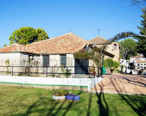
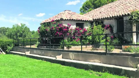
Tercia House

Submitted by brandcode_deweloper on
Id
4868987
Descripción
Breve descripción

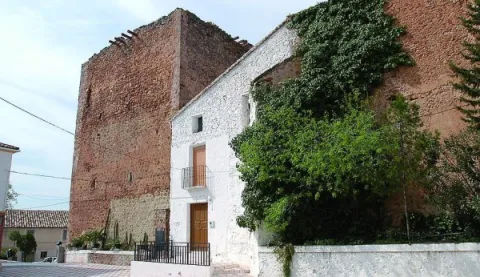
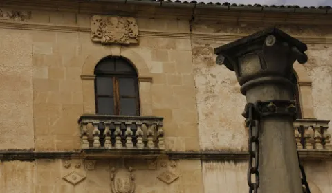
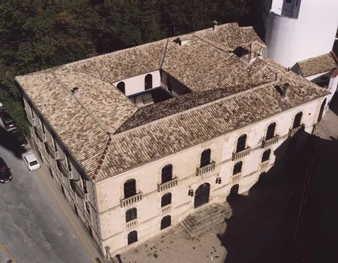
Built in the 15th century between the two towers with which the fortress had. It was the house where the tithe collectors settled. Here lived the master of Santiago, Don Rodrigo Manrique, father of Jorge Manrique, whom the poet cried to in "Coplas to the death of my father."

Telecomunicaciones
Sitio web
www.siles.es/historia-y-patrimonio-de-siles/
Ubicación
Código Postal
23380
Latitud
38.386420
Longitud
-2.581550
Dirección
Av. de San Roque, s/n
Distrito
Municipio
Ubicación en el mapa
POINT (-2.58155 38.38642)
Tipos de punto de interés
Imágenes carrusel
imagen
Image
1.jpg
Imagen principal
Desactivado
Imágenes cabecera
imagen
Image
image_content_12765402_20170521112419.jpg
Imagen principal
Activado
Loading map
Preparing points of interest and routes...

Large House

Submitted by brandcode_deweloper on
Id
4869608
Descripción
Breve descripción

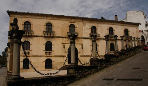
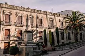
It is located in the church square and belongs tothe first half of the 18th century.It consists of two bodies. On the lower floor it has a decentralized and intellized cover, with spillage dovens, silvery jambas and wooden doors with swollen nails. On the cover is shown anobiliary shieldof the people, the Sanchez of Quesada.

Telecomunicaciones
Teléfono de contacto
953 736 333
Ubicación
Código Postal
23311
Latitud
38.028600
Longitud
-3.101960
Dirección
Plaza Montemar, 3
Municipio
Ubicación en el mapa
POINT (-3.10196 38.0286)
Tipos de punto de interés
Imágenes carrusel
imagen
Image
casa%20grande%20santo%20tome.jpg
Imagen principal
Desactivado
Imágenes cabecera
imagen
Image
casa-grande-2jpg__940x620_q83_370x279_q75_middle.jpg
Imagen principal
Activado
Loading map
Preparing points of interest and routes...

Mayorazgo House

Submitted by brandcode_deweloper on
Id
4979398
Descripción
Breve descripción

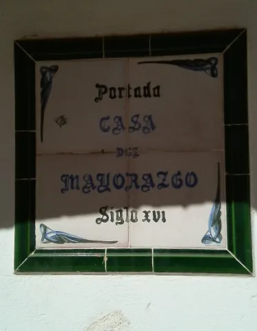
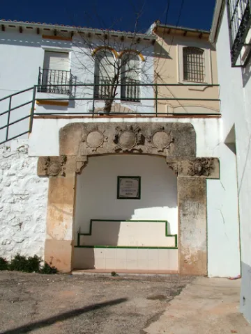
In Torres de Albánchez, there have been a loss of lordial mansions of interest, such as this so-called House of Mayor.With Renaissance cover and characteristic hardware of the second half of the16th century.Inside it had a cave with canyon vault for shelter in times of danger. The cover was intellized, provided with zapatas in mends surrounded in the intrados. There is a new cultural equipment in the town, theEidades de la Sierra interpretation centrein which the geological history of the Sierra de Segura is represented, including the phases of human occupation.

Telecomunicaciones
Sitio web
www.redjaen.es/francis/?m=c&o=21681
Correo electrónico
torresalbanchez@yahoo.es
Ubicación
Código Postal
23391
Latitud
38.415368
Longitud
-2.676730
Dirección
Plaza de la Iglesia
Distrito
Ubicación en el mapa
POINT (-2.67673 38.415368)
Tipos de punto de interés
Imágenes carrusel
imagen
Image
Casa%20del%20Mayorazgo%2C%20Torres%20de%20Alb%C3%A1nchez%203.jpg
Imagen principal
Desactivado
imagen
Image
Casa%20del%20Mayorazgo%2C%20Torres%20de%20Alb%C3%A1nchez.jpg
Imagen principal
Desactivado
Imágenes cabecera
imagen
Image
image_content_12585531_20170118114340.jpg
Imagen principal
Activado
Loading map
Preparing points of interest and routes...

House of the Chains

Submitted by brandcode_deweloper on
Id
656022
Descripción
Descripción larga

In Beas de Segura we find different examples of this type on Feria Street. In Orcera we find some interesting houses on San José Street or in Genaro de la Parra. In the Gate of Segura and in Siles there are also examples of this architecture called generally regionalist, but what they are looking for at the bottom is to incorporate elements from other times in the design of the houses.

Elements of Muslim architecture will give rise to the ne- mudejar and so during different times as the rebirth or the baroque. Its owners intended to legitimize their situation of being able to recover elements of the medieval or Renaissance past, as an element that would serve to connect with the nobility and thus justify their situation of power. To talk about this type of construction, is to make it from the 19th century, a century of great transformations, a time in which the saws that make up the Natural Park know the province of Jaén and the establishment of mechanism and forms of government totally different from those that exist with the advance of Cazorla and the envination of Segura. It is the century in which great fortunes are formed and at the same time the number of poor families is growing exponentially, all of which are framed in a constitutional regime that is completely unknown to most of the inhabitants.

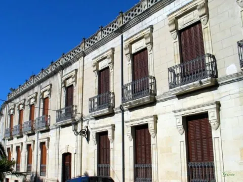
The House of the Chains is a three-storey construction that offers a compact and solid image highlighting Renaissance elements such as the half-point arches. A large entrance arch contains the shield of the Godoy family, the first owners to be recorded.

Breve descripción

The House of the Cadenas stands on the floor that occupied the house of the Marquis of Camarasa and still retains a stone plate belonging to the old building. This construction serves to understand all that architecture present in our villages and which is made up of large master houses that have little to do with the rest. During the 19th century there are a number of large owners who become owners of large areas of land from the disamortization and sale of public property.

Ubicación
Latitud
37.913400
Longitud
-3.002850
Dirección
C/ Cantarranas, 8
Municipio
Ubicación en el mapa
POINT (-3.00285 37.9134)
Imágenes carrusel
imagen
Image
Casa%20de%20las%20Cadenas1.png
Imagen principal
Desactivado
imagen
Image
casa-cadenas-2.jpg
Imagen principal
Desactivado
Imágenes cabecera
imagen
Image
casa-cadenas.jpeg
Imagen principal
Activado
Loading map
Preparing points of interest and routes...

House of the Inquisition

Submitted by brandcode_deweloper on
Id
4635969
Descripción
Breve descripción

The house of the Inquisition is a historic building located in the old town. It is a three-storey building whose interior is completely modified from the original structure. It must have been built between the 16th and 17th centuries. Its facade is preserved, including the grating, and the rise of stairs, decorated by several shields of the Holy Office of the Inquisition and a pontored cross. In the absence of torture and dismayed between its walls, the house hosted the meetings and debates of the Villacarillo court and, perhaps, the execution of the lighter sentences imposed by the provincial courts.

Telecomunicaciones
Sitio web
www.villacarrillo.es/ciudad/conoce-la-ciudad-villacarrillo/patrimonio-historico-2/
Teléfono de contacto
953 440 000
Correo electrónico
villacarrillo@villacarrillo.es
Ubicación
Código Postal
23300
Latitud
38.115370
Longitud
-3.087180
Municipio
Ubicación en el mapa
POINT (-3.08718 38.11537)
Tipos de punto de interés
Imágenes carrusel
imagen
Image
c.%20inquisicion%20villacarrillo.jpg
Imagen principal
Desactivado
Imágenes cabecera
imagen
Image
01115142.jpg
Imagen principal
Activado
Loading map
Preparing points of interest and routes...

A-316 Road, Torreperogil-Villacarrillo-Villanueva del Arzobispo Section

Submitted by brandcode_deweloper on
Id
7468197
Descripción
Descripción larga

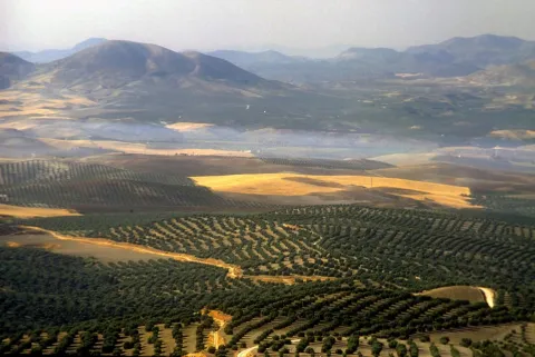
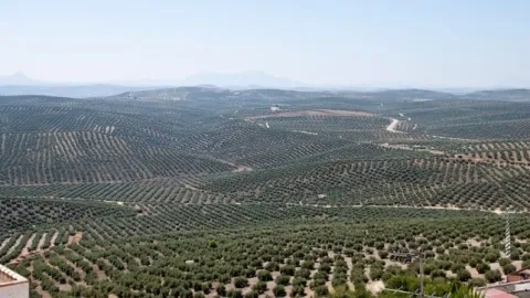
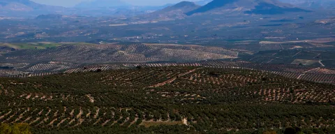
In particular this stretch of road runs almost air in the interflude of the valleys of the Guadalimar and the Guadalquivir. From this area you can see thousands of hectares of olive trees in a single look, framed by the horizons of Sierra Morena on one side, and Sierra de Segura and Sierra de Las Villas on the other.

Breve descripción

It is just an example of the great olive groves that can be seen when travelling through the province of Jaén.

Ubicación
Latitud
37.772886
Longitud
-3.788329
Municipio
Ubicación en el mapa
POINT (-3.788329 37.772886)
Tipos de punto de interés
Imágenes carrusel
imagen
Image
272ca59b7f36e64b14d2565ff1caba3a.jpg
Imagen principal
Desactivado
imagen
Image
olivos%20%281%29.jpg
Imagen principal
Desactivado
Imágenes cabecera
imagen
Image
miradores.png
Imagen principal
Activado
Loading map
Preparing points of interest and routes...

Carbonates of the Sector de Cabañas

Submitted by brandcode_deweloper on
Id
874642
Descripción
Descripción larga

The stratigraphic section of Cabañas is a mandatory reference of the Jurassic to Cretaceous transit in the Prebetic Zone. The materials that apflorate are essentially carbonates, in which the tidal levels stand out with marked cyclicity and magnificent examples of surfaces with drying cracks.

Reef faces, levels of accumulation of ferruginous oils, and limestones with spectacular sedimentary structures caused by traction currents are also observed. In addition to the section itself, the panorama contains an example of angular discord between the Jurassic materials and various Cretaceous terms of high paleogeographic interest.

Source: Inventory of Georresources of Andalusia. Environmental Council. Junta de Andalusia.

Breve descripción

Carbonates of the Cabins sector

Ubicación
Latitud
37.842982
Longitud
-3.066921
Municipio
Ubicación en el mapa
POINT (-3.066921 37.842982)
Tipos de punto de interés
Imágenes carrusel
imagen
Image
IMG_7746.JPG
Imagen principal
Desactivado
imagen
Image
100_3241.jpg
Imagen principal
Desactivado
Imágenes cabecera
imagen
Image
Natu004%20%281%29.png
Imagen principal
Activado
Loading map
Preparing points of interest and routes...

Guadalentín River Canyon

Submitted by brandcode_deweloper on
Id
874522
Descripción
Descripción larga

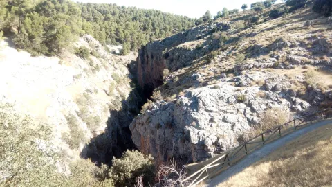
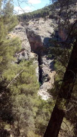
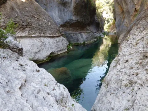
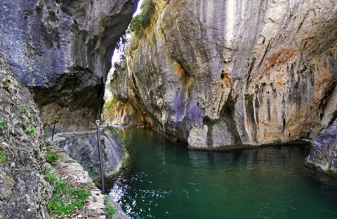
The canyon of the Guadalanimín River is a river form generated by the fitting of the Guadalanimin River in the dolomies of the upper Cretaceous of the Sierra del Pozo. This river also takes advantage of a fracture of medium direction N-S. The formation of this morphology has therefore involved river, karctic and tectonic processes.

Source: Inventory of Georresources of Andalusia. Environmental Council. Junta de Andalusia.

Breve descripción

Guadalentín River Canyon

Ubicación
Latitud
37.912893
Longitud
-3.003887
Municipio
Ubicación en el mapa
POINT (-3.003887 37.912893)
Tipos de punto de interés
Imágenes carrusel
imagen
Image
6341791Master.jpg
Imagen principal
Desactivado
imagen
Image
6341846Master.jpg
Imagen principal
Desactivado
imagen
Image
cerrada-de-la-canaliega-rio-guadalentin-senda-de-los-pescadores-56367-xl.jpg
Imagen principal
Desactivado
Imágenes cabecera
imagen
Image
Pil%C3%B3n%20del%20Ciervo.jpg
Imagen principal
Activado
Loading map
Preparing points of interest and routes...

Campos Hernán Perea

Submitted by brandcode_deweloper on
Id
911990
Descripción
Descripción larga

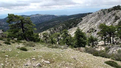
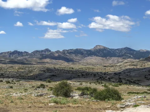
Its landscape is an exponent of karmic modeling. No one can say that he knows the Park in depth if he has not traveled the overwhelming plains of the Campos. The high mountain grazing is here the real protagonist; an activity that has, for centuries, allowed life in these remote territories, the homeland of the Segurean sheep.

They say that in Los Campos solitude is felt. There are no fewer people here than in the wooded areas of the Park, because it is common to find some shepherd. What happens is that the clear breadth that our eyes perceive makes us more aware of our small than in dense forest areas.

The real beginning of the Hernán Perea Campos is about 11 km from Don Domingo, after having passed the Cañada Hermosa shelter, first of the three shelters that support the mountaineers on this route. They were built by the ICONA in the 1970s and are located next to the main road, which is surrounded by light depressions, dolins and sour rocky cords of limestone origin.

The harsh weather conditions have created a very adapted vegetation of piorns, albar thorn and common juniper (rake). We will also find some sown pieces of cereal, and of course many herbaceous plants from which the livestock is fed.

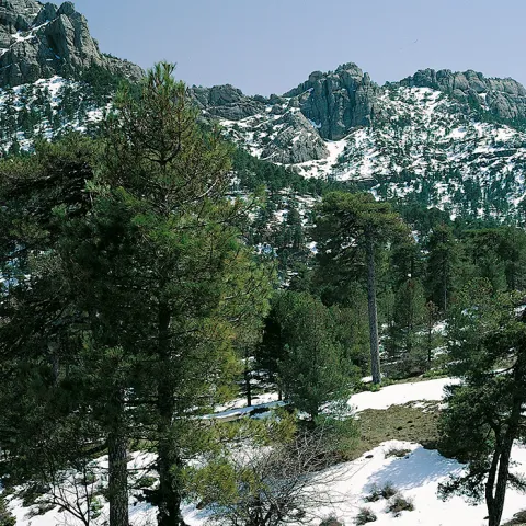
If we make the way in winter, with the snow covering its unique orography, we have the feeling of crossing an Arctic landscape. We must be very well informed of the weather, because a strong snow can put us in serious trouble. Spring is the best time to visit the Campos, when conditions are less demanding, although a good advice for any time is not to abandon at any time the main road that crosses the altiplanicie from north to south.

We suggest:

  • About 3.5 km from Don Domingo is the famous Pino Galapán, a 39-metre-high larix pine specimen in the area. A respectful visit to this "giant" in the Segura saw is required.
  • Rapist birds fly this place majestically throughout the year. The prismatics will be of great use to you to try to distinguish the royal eagle, the leonate vulture or... maybe the broken bones? The muflons are very abundant.
  • We must not forget that the beauty and grandiosity of the Campos is a major danger in certain times of the year. Winter, which here covers almost all autumn and part of spring, can be surprised by huge snowfalls that may eventually catch visitors, or leave them without the few visual references in the altiplanicie. In any case, in order to travel through these sites, you always have to use all-terrain vehicles, at least two cars, to provide support, as there is no telephone coverage. It is not advisable to stay in the winter months or in the twilight or night hours, and always to let third parties know that the tour begins.

From Santiago de la Espada we take the A-317 towards La Puebla de Don Fadrique. At 2.1 km, on the right, we find the JF-7091 road to La Matea. We take this road and follow it to the village of Don Domingo. The forest track towards Rambla Seca leads us to the fields of Hernán Perea.


Breve descripción

The fields of Hernán Pelea - or Perea, as is often called in the many mapas - make up the most extensive altiplanicie in Spain: they have an average altitude of 1600-1700 meters and an extension of more than 5,000 hectares. This vast altiplano represents one of the largest and most original landscapes of the Natural Park, quite different from all others.

Ubicación
Latitud
38.298857
Longitud
-2.651877
Distrito
Ubicación en el mapa
POINT (-2.651877 38.298857)
Tipos de punto de interés
Imágenes carrusel
imagen
Image
perea.jpg
Imagen principal
Desactivado
Loading map
Preparing points of interest and routes...

Sponge Limestones of the Camino del Chorro

Submitted by brandcode_deweloper on
Id
874613
Descripción
Descripción larga

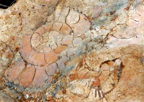
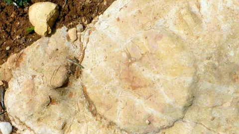
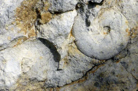
In the westernmost part of the Cazorla saw, tectonic scales of Cazorla and del Chorro, the Oxfordiense is also represented by nodular and rhythmic margoso- calcareas, by sponge and stromatolite bioconstructions, some of which perfectly retain the depository morphology, giving reliefs in the form of mounds ("mounds") made up of sponges and, most of them, of which are stromatolites. The spongiaries, siliceous sponges epigenized to calcite, appear mainly in the lower part of the bioherm, at first disorganized and fragmented and then adapted to different surfaces.

The stromatolites, on the other hand, constitute the majority of the bioconstructed body, and begin to be planar and then move to centrimetric columnar forms that together give cupolas of almost half a metre in diameter. Some of these depository morphologies can be observed on the slope of the road that from Cazorla leads to the Chorro, where this point of geological interest is located. These deposits culminate the depository sequence of the Oxfordiense in the saw of Cazorla, which is a sequence of deepening, in response to the oxfordiense transgression that caused the disappearance of the platform of the Lïas-Dogger, whose deposits are crowned by a "hardground" on which the Oxfordiense sequence is available. This sequence, in turn, is overtaken by another of lower Kimmeridgian age with which again the somerization that will culminate the Jurassic cycle begins.

Source: Inventory of Georresources of Andalusia. Environmental Council. Junta de Andalusia.

Breve descripción

Sponge limestone of the Chorro Road

Ubicación
Latitud
37.912893
Longitud
-3.003887
Municipio
Ubicación en el mapa
POINT (-3.003887 37.912893)
Tipos de punto de interés
Imágenes carrusel
imagen
Image
2%20%281%29.jpg
Imagen principal
Desactivado
imagen
Image
1%20%282%29.png
Imagen principal
Desactivado
imagen
Image
1.jpg
Imagen principal
Desactivado
imagen
Image
3%20%281%29.jpg
Imagen principal
Desactivado
Imágenes cabecera
imagen
Image
caliza.jpg
Imagen principal
Activado
Loading map
Preparing points of interest and routes...