Saltar al contenido principal

Guadalentín Headwaters via Fuente Acero

Submitted by brandcode_deweloper on
Id
911838
Descripción
Descripción larga

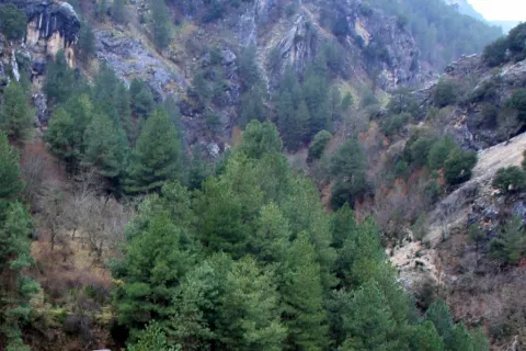
A road to the right is about 400 metres from the forest house of the source of Steel that will take us to the top of the Guadaltiín River.

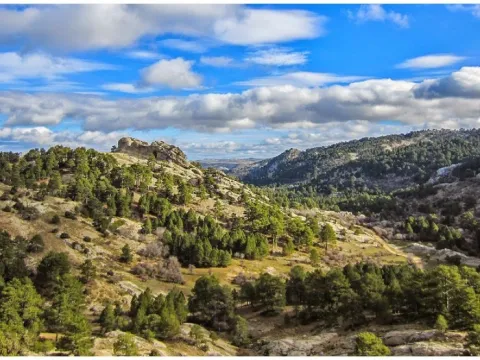
From the Fuente de los Chorros, which can be considered its birth, to Vado Carretas, the Guadalanimin is watched by a high wall, the Cabrilla saw, which rises almost 1000 meters above its waters, and is shown in a succession of poyos and cliffs. In this Sierra there are some of the highest peaks of the Natural Park, such as the Cerro de los Tornajos, the Pico las Covachas or the Empanadas, which exceed 2,000 m. This saw is also the limit with the province of Granada.

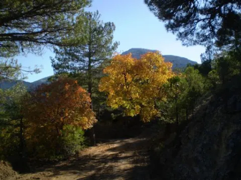
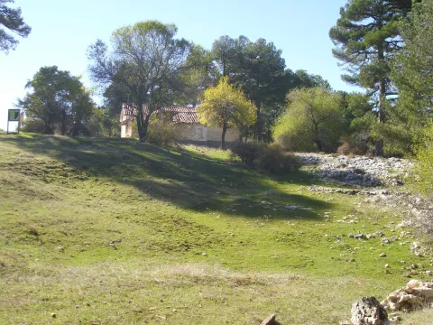
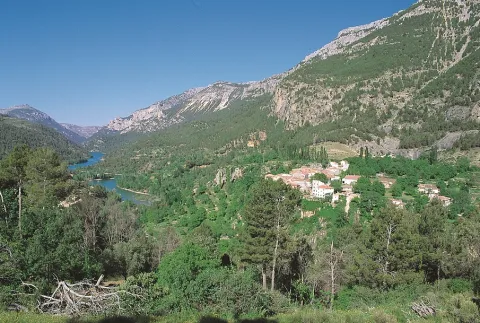
The river is surrounded by beautiful pastures, cortijos and fields of abandoned crops, and with them great nogueras and other fruit trees that show us life in other times. Some of these corijos are in places that are remnants of peace and invite us to make a stop and enjoy the landscape.

We suggest...

  • Make the route from Fuente Steel to the Vado de las Carretas in order to admire these landscapes as a whole.
  • Stop you in the forest of complaints you'll find on the way.

In Cazorla take the Sierra road (A-319) until the crossing known as the Empalme del Valle. Turn right on the JF-7092 road and after passing the bridge over the Guadalquivir River (4 km from the Empalme) follow the left track (JF-7091). Passing the Sail of San Pedro and the Strait of the Perals we find on the right the ruins of the forest house of Fuente Econo.

Breve descripción

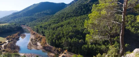
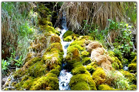
The Guadaltiín River in its journey has cultivated a valley of great beauty. Its shores are covered by lush vegetation: maples, strawberries, chopos, and complaints accompany it on its way. It stops in remnants of crystalline waters where the otter and the Iberian crab live; and sometimes the slopes narrow and form closed that accelerate the passage of the water. This is an essential excursion for anyone who wants to know this Natural Park.
Ubicación
Latitud
37.912893
Longitud
-3.003887
Municipio
Ubicación en el mapa
POINT (-3.003887 37.912893)
Imágenes carrusel
imagen
Image
1.png
Imagen principal
Desactivado
imagen
Image
3%20%281%29.jpg
Imagen principal
Desactivado
imagen
Image
4%20%281%29.jpg
Imagen principal
Desactivado
Imágenes cabecera
imagen
Image
9673418Master.jpg
Imagen principal
Activado
Loading map
Preparing points of interest and routes...

Burunchel

Submitted by brandcode_deweloper on
Id
659395
Descripción
Descripción larga

Since 2003, it has held a cattle fair in August, which had historically been one of the largest in the province of Jaén.

Breve descripción

Burunchel is settled on a hillside and still today you can perceive his past as an ancient dehesa. It is one of the entrances to the Natural Park and it is worth being approached by the hermitage of San Julián, from the 15th century and its facade.

Ubicación
Latitud
37.946090
Longitud
-2.954070
Municipio
Ubicación en el mapa
POINT (-2.95407 37.94609)
Tipos de punto de interés
Imágenes carrusel
imagen
Image
593_img.png
Imagen principal
Desactivado
imagen
Image
burunchel.jpg
Imagen principal
Desactivado
Imágenes cabecera
imagen
Image
burunchel%20%281%29.jpg
Imagen principal
Activado
Loading map
Preparing points of interest and routes...
Marcas de calidad

River Vault of Cerezuelo

Submitted by brandcode_deweloper on
Id
9346072
Descripción
Descripción larga

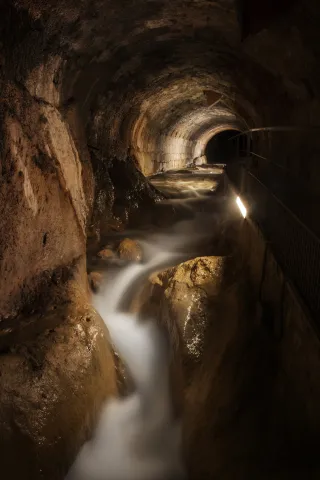
When he received the assignment, the Albacetean architect found it very difficult not to have a space of the size that Francisco de los Cobos asked for, so he solved it by building a vault on the River Cerezuelo; above the vault, the square of Santa Maria and on the square, the church, disproportionate by its enormous size, as they only lived a thousand inhabitants in the town, and yet almost cathedralicia. The project dated from 1535 and was a major engineering challenge for the media of the time.

It is said to be the only church in the world built on a river, and it is today, without a doubt, along with the vault on which it rises, the great tourist attraction in the city of Cazorla.

Breve descripción

The vault covering the Cerezuelo River was designed by Andrés de Vandelvira to be able to carry out the commission of Francisco de los Cobos, secretary of Charles V, as advance of Cazorla, of the construction of the church of Santa María. It is half-canyon, very compact, and adapts to the river's riverlevels throughout the plaza de Santa María, extending from the beginning of the plaza to the temple's header wall. The length of the tour is approximately 120 meters long.

Telecomunicaciones
Sitio web
www.turismoencazorla.com/dondeiryquever/monumentosycentros/bovedariocerezuelo.php
Teléfono de contacto
953 710 102
Correo electrónico
turismo@cazorla.es
Ubicación
Código Postal
23470
Latitud
37.909143
Longitud
-3.001215
Dirección
Plaza Sta. María
Municipio
Ubicación en el mapa
POINT (-3.001215 37.909143)
Tipos de punto de interés
Imágenes carrusel
imagen
Image
B%C3%B3veda%20r%C3%ADo%20Cerezuelo%202.jpg
Imagen principal
Desactivado
Imágenes cabecera
imagen
Image
B%C3%B3veda%20r%C3%ADo%20Cerezuelo%201.jpg
Imagen principal
Activado
Horario
Tuesday to Sunday: 10: 00 - 13: 00 and 16: 00 - 20: 00. Non-festive Monday closed. Guided tours every 30 minutes from 10: 00.
Loading map
Preparing points of interest and routes...

Gallery Forests

Submitted by brandcode_deweloper on
Id
879400
Descripción
Descripción larga

Many are the places where we can see a good forest in the gallery, both in the Segura River Valley and in the Guadalquivir Valley. The one we have chosen is on the upper stretch of the Segura River, in its way through the charming village of La Toba.

This defines the forests that accompany the rivers. Its components change along the river, from its birth to its mouth. The section we will see in the mountain areas of the Park corresponds to the sections of the high basin.

The forest we visit is made up of choperas (Populus nigra and Populus x canadensis), strawberries (Fraxinus angustifolia), saucedas formed by several willows (Salix eleagnos angustifolia, S. purpurea, S. atrcinerea and S. fragilis), zarzales (Rubus ulmifolius), and herbaceous formations of junches, molinies and cardics (Scripus holoschoenu, Juncus inflexius, Molinia caulea and Carpenex). We can also observe orchids such as daztilorrizas (Daztilorhiza elata) among these junkals.

Any time of the year is good for walking through this forest, with the most recommended autumn for its colors and the advanced spring for the great green nuance it presents and for the flowering of the orchids that populate it.

LOCATION

In the short detour that goes to the village of La Toba, as we pass the bridge over the Segura River, we park and we can enjoy directly a splendid riverside forest.

Breve descripción

Rio Segura, La Toba

Ubicación
Latitud
37.772886
Longitud
-3.788329
Ubicación en el mapa
POINT (-3.788329 37.772886)
Tipos de punto de interés
Imágenes carrusel
imagen
Image
La%20Toba%20%28Alonso%20Torrente%29.jpg
Imagen principal
Desactivado
imagen
Image
679_SS_09.jpg
Imagen principal
Desactivado
Imágenes cabecera
imagen
Image
_MG_3298.jpg
Imagen principal
Activado
Loading map
Preparing points of interest and routes...

Valley Floor Deciduous Forests

Submitted by brandcode_deweloper on
Id
920264
Descripción
Descripción larga

In the area of Tejina we have a splendid deciduous forest made up of complaints (Quercus faginea) that have leaves that are larger and more lustrous than those of high mountains, mapes of Montpelier (Acer monspessulanum), serbales (domestic Sorbus), pespejones (Sorbus tormentinalis) and pyruetans or wild perals (Pyrus bourgeana).

They are accompanied by shrubs such as majuelos (Crataegus monogina), endrines (Prunus spinosa), skirmishes or tapasses (Rosa spp.) and species of the Mediterranean forest, such as madroños (Arbutus unedo), agracejos or lebiernagos (Phylirea latifolia), wild jazmines (Jazminum fruticans), hedras (Hedera helix). In wet areas there are zarzas (Rubus ulmifolius), and in the forest and stony areas there are splits (Lavandula latifolia).

Among the herbaceous plants are grasses such as Brachypodium phoenocoids, Holcus lanatus, other species such as orchids (Ophrys lutea, O. apifera, O. tenthredinifera), trees (Trifolium campestre, T. strellatum), violets (Viola odorata) and others such as Bupleurum rigidum, Bellis perennis, etc.

We suggest:

  • When you are in places like this, very few, remember that these deciduous forests are authentic ecological shelters for fauna, because the fruits of many of its plant species mature in winter, which makes many birds survive when food is scarce in all other places. In turn, these birds help in the dispersion of the seeds. The human transformation of these areas threatens the stability of this ecosystem and involves serious biodiversity losses. Today many of the plant components of this forest are protected by law in Andalusia. We cannot afford to lose the most precious natural treasures, our forests.

Valle del Guadalquivir, on the road A-319 (km 42), a little below the Puente del Hacha, in the area known as Tejina.

Breve descripción

At the bottom of some valleys, deep and fertile soil coexist with thermal investment processes. These particular conditions of soil and climate make it possible to establish deciduous forests. These forests are very restricted to small enclaves in the Guadalquivir valley, as their ancient domains have been strongly transformed by human beings over the centuries.

Ubicación
Latitud
37.921120
Longitud
-2.991910
Municipio
Ubicación en el mapa
POINT (-2.99191 37.92112)
Imágenes carrusel
imagen
Image
valle.jpg
Imagen principal
Desactivado
Imágenes cabecera
imagen
Image
_fotodeeduardoviuales_6d80611f.jpg
Imagen principal
Activado
Loading map
Preparing points of interest and routes...

High Mountain Deciduous Forests

Submitted by brandcode_deweloper on
Id
879671
Descripción
Descripción larga

The site is really special for the great variety of species we found. In it we can walk and enjoy one of the few high mountain deciduous forests that have left in the Natural Park.
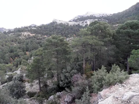
Today we can no longer define as forests the few remaining stains, even though in past times they spread across large areas of the high mountain of these saws, wearing the valleys and vessels of lush forests. At present their presence is limited to small holes, rails and rails in which deep and fertile soil is accumulated.

These beautiful bosquets are made up of maple (Acer granatense), mustard (Sorbus aria), cereal (Prunus mahaleb) and whine (Quercus faginea), accompanied by a shrub of spiners with majuelos (Crataegus monogina), rars (Berberis vulgaris australis), skirmishes (Rosa spp.), madreselvas (Lonicera spladada, L. etrusca), sanjuaneros (Lonicera arborea) and spinos (Cratagulata).

We suggest:

  • Later there is Nava Noguera and the control of Rambla Seca, which marks the entrance to the Campos de Hernán Pelea, one of the most original and overwhelming landscapes of the Park.
  • There are other very accessible places where we can enjoy these exceptional bosquets, such as the surroundings of the Collado del Ventano in the Calar de Navalespino and the Barranco del Guadalentín.
  • Don't miss these sketches in the fall.

LOCATION

We access the road that goes from Vadillo Castril to Santiago de la Espada, which becomes a ground track from Los Collados, but the firm is good and we can reach the destination point without great problems. Once we have ascended to the Saves of San Pedro, we are already on the line, we arrive at the junction of the Laguna of Valdeazores, which is about 9 km from the Navy. We look at the extraordinary landscape, as we take the Guadalanimin ravine to our right. As we pass through the Collado de la Zarca (where there is a track to our right, cut to traffic with a chain), we lose sight of the Barranco del Guadalentín and enter a few rails. Less than a kilometre after a few curves are presented to our right, in the sense of the march, a few holes full of trees.

Breve descripción

Necklace of the Beer

Ubicación
Latitud
37.702695
Longitud
-2.935057
Municipio
Ubicación en el mapa
POINT (-2.935057 37.702695)
Imágenes carrusel
imagen
Image
613_img.png
Imagen principal
Desactivado
imagen
Image
bosque.jpg
Imagen principal
Desactivado
Imágenes cabecera
imagen
Image
caduci.jpg
Imagen principal
Activado
Loading map
Preparing points of interest and routes...

Forest Lauroide Mediterráneo

Submitted by brandcode_deweloper on
Id
879507
Descripción
Descripción larga

This type of forest can be the purest and best preserved that we find in the low mountain of the Park, refugee in unaltered ravines and slopes, where a fertile and deep soil is accumulated. There are some delays of this first formation, and one of the places where we can see it is in the lower basin of the Borosa River. On its slopes is an impressive lauroid forest of madroños, gracegos and doves. The highest point of this forest in our tour is the entrance to the closed of Elias, where a plant vault of madroños and agracejo covers us during a good stretch.

But what is a lauroid forest?

In Mediterranean forests we find several types of vegetation, determined by their conservation status, and the presence of more or less deep fertile soil. In the enclaves with better soil, deep and rich in organic matter, the lauroid forests, made up of shrubs and perennial, lustrous and always green leaves, grow.

The main components of this forest are the madroño (Arbutus unedo), the agracejo or labiérnago (Phillyrea latifolia), the pedillo or barbadija (Viburnum tinus), and climbers such as madreselvas (Lonicera implexa) and the zarzaparilla (Smilax aspera). These shrubs are sometimes accompanied by trees such as complaints and oaks (Quercus faginea and Quercus ilex ballota), although in closed formations of madroños and agracejo, it does not develop under them anything but their own seedlings, due to the dense shadow they form. These lauroid forests are the richest phase of plant succession in the low mountain of the Park.

These forests come from the vegetation that dominated southern Europe before the quaternary glaciations. After them the lauroid forests, which had more elements (trees such as the laurel, hence its name), had no choice but to adapt to a drier and colder climate, lost elements and took refuge on the middle slopes of the mountains and valleys where they found soil and softer climate with subhumid namoclima. Other plant elements that arrived with the northern latitudes glaciations found in these forests a suitable habitat, such as the complaints (Quercus faginea), the maple of Montpelier (Acer monspessulanum) and the pespejon (Sorbus tormentinalis).

LOCATION

We'll access the Borosa for the A-319. At the height of the Visitor Reception Center Torre del Vinagre, we turn right to the farm, where we park and remount the river upstream. Soon, at the Shipyard's source, we began to see that Mediterranean formation of lauroid species. We can reach the end of the Cerrada de Elias, where we end our walk through the lauroid forests.

Breve descripción

Rio Borosa

Ubicación
Latitud
37.912893
Longitud
-3.003887
Municipio
Ubicación en el mapa
POINT (-3.003887 37.912893)
Tipos de punto de interés
Imágenes carrusel
imagen
Image
612_img.png
Imagen principal
Desactivado
imagen
Image
bosque-mediterraneo.JPG
Imagen principal
Desactivado
Imágenes cabecera
imagen
Image
borosa.jpg
Imagen principal
Activado
Loading map
Preparing points of interest and routes...

Bojedas

Submitted by brandcode_deweloper on
Id
879115
Descripción
Descripción larga

One of the most surprising plant formations in the Park is the nozzles. Their presence is extraordinary for several reasons: for more to the south of the Iberian Peninsula they no longer exist, for they find refuge in many northern species, because the boj (Buxus sempervirens) has created a culture of home utensils and because they keep the ground in channels and slopes.

There are many places where we can see a nozzle. In many streams and ravines it is almost impenetrable, but we can also see it on the slopes of the Banderillas colonizing to the same top. There are also nozzles in any ravine of the Las Villas saw, in the closed of Elias, in the Borosa river, by the stream of the Molinos in Siles, etc. All these are easily accessible by vehicle, but we are going to set ourselves in a place a little more apart from the traditional tourist circuits, although perfectly accessible: a ravine called La Bojeda.

In La Bojeda there is a formation of boj accompanied by deciduous species such as cures (Acer granatense), maple de Montpelier (Acer monspessulanun), mustards (Sorbus aria), pespejones (Sorbus tormentinalis) and complaints (Quercus faginea). In the inside of the bowl, vegetation is not thriving because of the lack of light and the high humidity that is maintained, so the appearance of a bowl is of a continuous, always green tapestry. Only when winters are very cold, the whole bowl takes a tone between dark green and reddish brown. This is a cold defense mechanism. Other species are stripped of their leaves, but the boj, which is of perennial leaf so they are ingested in this way.

LOCATION

To access the port of Tiscar, on the road from Quesada to Pozo Alcón, if our direction is in that sense. When we get to the port we must follow a mile or so, until we reach a crossing of a forest track that leaves us to the left. We can park and follow it walking, it will take a little more than 3 km, which will make us very short, as the panoramic view we will see throughout the tour is spectacular.

Breve descripción

La Bojeda, Puerto de Tícar

Ubicación
Latitud
37.842982
Longitud
-3.066921
Municipio
Ubicación en el mapa
POINT (-3.066921 37.842982)
Tipos de punto de interés
Imágenes carrusel
imagen
Image
609_img.png
Imagen principal
Desactivado
imagen
Image
bojeda%20%281%29.jpg
Imagen principal
Desactivado
Imágenes cabecera
imagen
Image
bojeda.jpg
Imagen principal
Activado
Loading map
Preparing points of interest and routes...

Belerda y Don Pedro

Submitted by brandcode_deweloper on
Id
911650
Descripción
Descripción larga

Despite the strong emigration suffered over the last half century, both villages are still populated and with some vitality, still keeping their environment calm. The same fate has not been achieved by another village that is located downstream, Arroyo Molinos, which has been completely depopulated.

Although it does not appear on the maps, there is no sign of it, nor is there any separation that can be observed clearly, there are two Belerdas: the high and the low, so it is common to hear the village in plural. Many popular customs are still preserved, even the old public laundry is still used. The inhabitants are farmers and farmers, although there are some services (bakery, shop, bar, etc.).

We suggest...

  • Visit the Larguillo Picón, a natural monument to the balance and geological whim.
  • Between Belerda and Don Pedro is the Blue Pilon, a natural pool between rocks, which has traditionally been used for the bathroom by the locals. The waters are cold, but the experience revitalizes.

The village closest to Belerda is Huesa, 5 Km., from which part a road, very narrow and with curves, that goes directly to the village (JA-7200) and that links 3 km later with the road of Tícar (JA-6206). On this last road, Quesada is 18 km away. (the crossing to Belerda at 15), Hinojares at 15 (the crossing at 12) and Pozo Alcon at 20 km.

Breve descripción

Belerda, or Las Belerdas, is very close to the Casillas of Don Pedro, a core with which he is linked a close social and historical relationship. Under the monumental, historical, natural and sacro set of Tiscar are the Casillas of Don Pedro, with the Larguillo Picón, challenging the balance and welcoming the traveller. This group of houses, with a charming urban disorder motivated by the difficult orography of the land and the social conditions of its inhabitants, receives this name in honor of the infant Don Pedro, uncle of Alfonso XI, who in 1319 took over the Norm Fortress of Tícar and its 4,500 inhabitants, the Arab Reyezuelo Mohamed Adon. At the bottom of Vallejo, on both sides of the Tíscar stream, is Belerda, protected by a natural wall where vultures and mountain goats live, at the foot of the Caballo hills, fully integrated into a wild and apparently hostile environment.

Ubicación
Latitud
37.844710
Longitud
-3.067440
Municipio
Ubicación en el mapa
POINT (-3.06744 37.84471)
Tipos de punto de interés
Imágenes carrusel
imagen
Image
belerda1.jpg
Imagen principal
Desactivado
Imágenes cabecera
imagen
Image
santuario-tiscar.jpg
Imagen principal
Activado
Loading map
Preparing points of interest and routes...

Ravine of the Garbanzal y los Picones de Fique

Submitted by brandcode_deweloper on
Id
911413
Descripción
Descripción larga

The name of the Forest Pass has a source that is worth knowing. The current wide road was formerly a cavalry path that communicated the Garbanzal forest house, with the area of Tícar and that more than thirty years ago became a forest track to allow access to vehicles in the event of emergencies, thanks to the theson and imagination of a forest guard, Alfonso Bosques. The track, in the first section, had to save the obstacle of a vertical wall (Picones de Fique), so the work was craved impossible for the superior of the agent, who denied the attempt.

Forests was in charge of a maintenance crew, to clean the gutters and fix the forest tracks. Taking advantage of the main guard's vacation, he got to work, almost without means. Based on masonry and hard work, in just twenty days he managed to widen the lane, allowing the movement of all-terrain vehicles, which facilitated rapid access to an area to which, in the event of a forest fire, he could only access on foot or give a rodeo of almost 40 km. Even to make a blow on the rock he used fair rockets, the only explosive he had within his reach. Since then, the locals have known the place with the last name of the guard.

We suggest...

  • At the beginning of the walk, next to the chain, there is a natural lookout in one of the promontories of the Picones, with excellent views.
  • Another highly recommended option is to make a small route that goes above the Fique Picones and that reaches the head of the Extreme Barrio, to a place known as La Bujea, which is under the Glove Picón. To this end, leaving the vehicle in the place indicated above, we continue on the main track, which ascends by the lack of the Rayal Picon, to enter, by the pine, to a clear through which a stream circulates. Meters above the forest track, following the course of the water, we found the birth of it. This small channel is known as the Bujea stream and disappears in the middle of the ravine. However, this is the true birth of the Extreme Arroyo, since the waters below are actually the same as those of the Bujea, which appear after a stretch of underground circulation.

By reference to the Port of Tícar, 500 metres from the highest point of the road, in the direction of Pozo Alcón, there is a forest track to our left, in a wide entrance where we can leave the vehicle. The firm is good, so we can drive in another 800 meters, up to a wide curve (with a pine in the interior vertex) with space to park. A few meters later (either on foot or on a bike) of the main lane part another track that ascends the slope, to enter between the rocks (there is a chain). Following that lead we reached the Picones de Fique and the Barrio del Garbanzal. If we continue later, already in the next ravine, we arrive at the birth of the Extreme Arroyo.

Breve descripción

The road is simply spectacular. After passing through the Forest Pass, under the capricious pious forms of the Picones de Fique, along the two slopes of the Barranco del Garbanzal, we reached the ruins of the forest house, of which there is only a majane of stones. So far we'll have gone about 2 km from the chain. If we follow the forest track, we enter the next ravine, much wider and more open, than as the stream that runs through it, it bears the name of Extremera. Some 1,200 m later we reached the crystalline water channel, waded by the forest track. If we keep running up the vaguade we get to a spring, considered the birth of the stream.

Ubicación
Latitud
37.842982
Longitud
-3.066921
Municipio
Ubicación en el mapa
POINT (-3.066921 37.842982)
Tipos de punto de interés
Imágenes carrusel
imagen
Image
barranco.jpg
Imagen principal
Desactivado
Imágenes cabecera
imagen
Image
22485037.jpg
Imagen principal
Activado
Loading map
Preparing points of interest and routes...